Summer time in Greece, especially in the southern regions of the country can be rather hot. Therefore climbing near the seaside can be a very nice experience and at the same time bearable with the high temperatures.
In the past year, we have climbed a lot in the Ermionida region and we established several Trad Climbing routes, especially nearby Dardiza Bay.
Dardiza bay (3.5 kms from Ermioni) is a pebble shingle beach where many local and visiting Greeks go. Situated alongside the main road, it has a small mobile cantina during high season offering cold drinks and hot snacks.
- Check out Dardiza Bayby 1 V- UIAA 30 m. route
- Check out Dardiza Bayby 2 IV UIAA 30 m. route
- Check out Dardiza Bayby 3 IV UIAA 20 m. route
- Check out Dardiza Bayby 4 IV UIAA 20 m. route
- Check out Dardiza Bayby 5 IV+ UIAA 20 m. route
The beach offers stunning views towards the islands of Hydra and Dokos and is close to some of the most important tourist spots in Ermioni, like Kranidi, Kilada, or Porto Heli, which remain unspoilt and beautiful.
First Ascent
In mountaineering, a first ascent (abbreviated to FA in guidebooks) is the first successful, documented attainment of the top of a mountain or the first to follow a particular climbing route. First mountain ascents are notable because they entail genuine exploration, with greater risks, challenges and recognition than climbing a route pioneered by others. The person who performs the first ascent is called the first ascensionist.
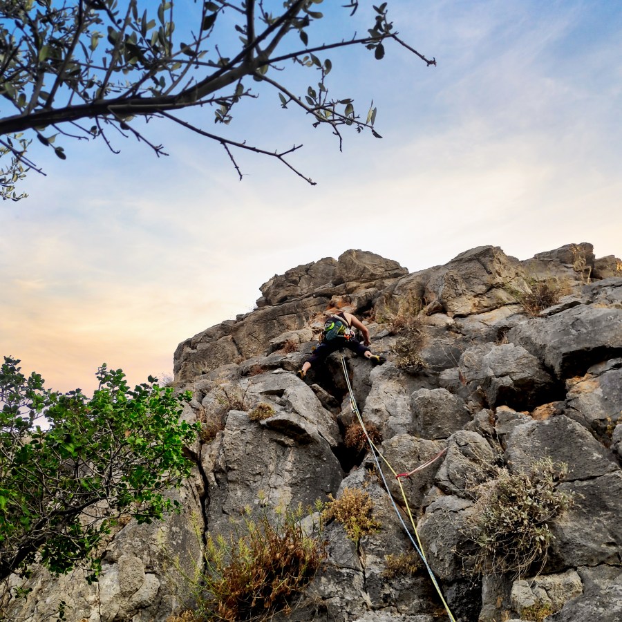
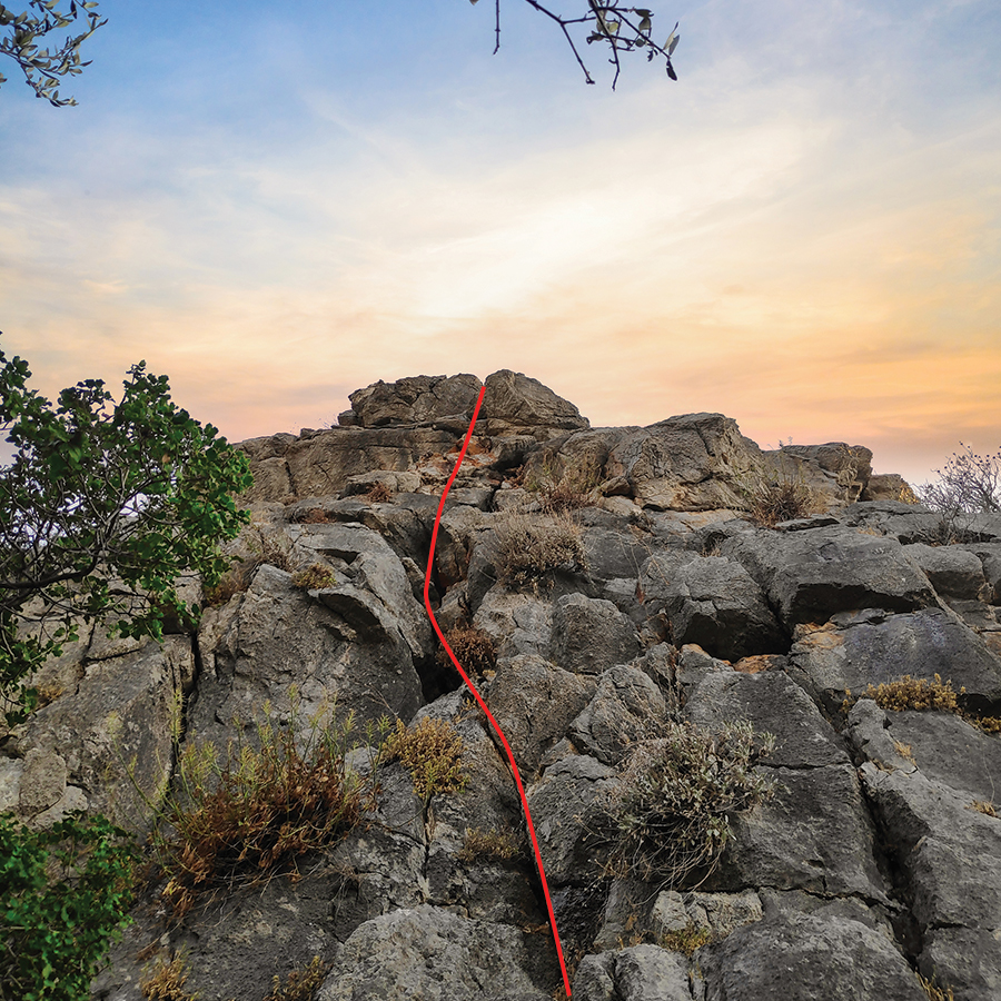
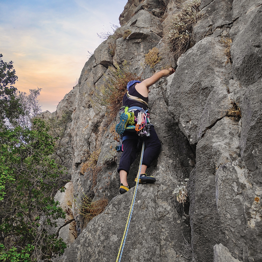
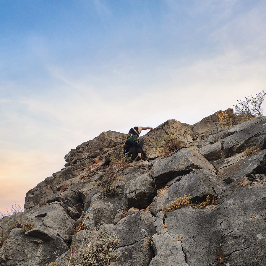
Dardiza Bayby Shitter V- UIAA 20 m | Climbing in Dardiza Bay
“Dardiza Bayby Shitter” (V-, 20 m.) first ascent was claimed on 08/07/2022 by V. Christopoulos, Olympus Mountaineering and C. Toutoutzis. The route is situated in the north face of the rock formation which is located north-west from Dardiza Bay, just few kilometers far from Ermioni.
The route can be described as an “introduction” to traditional climbing with a single pitch length and of maximum grade V- UIAA.
Support the journey — buy me a coffee
I share these articles and the climbing guidebooks because I love the outdoors, and they’ll always be free. If they’ve helped you, help me keep them coming. Click the button to support my work.

Download for free the complete route description and Topo map
- Download the complete Interactive Guidebook in PDF spreads (best for Tablets/Laptops/Desktops)
- Download the complete Interactive Guidebook in PDF single pages (best for Phones)

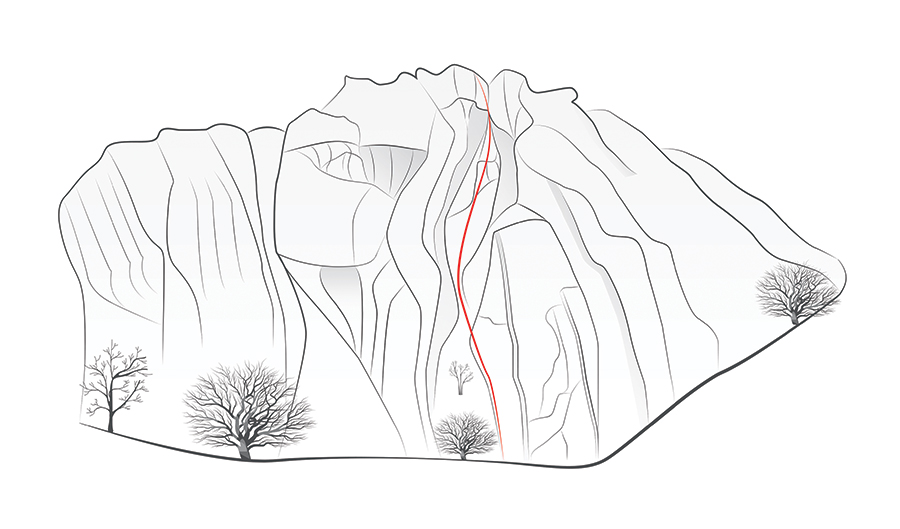
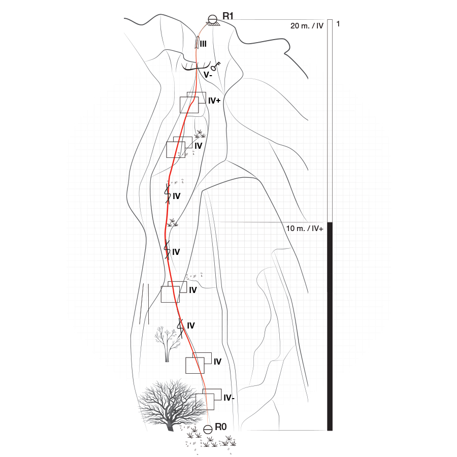
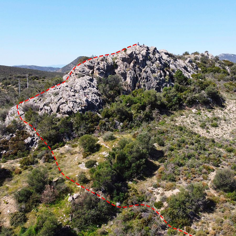
Dardiza Bayby Shitter V- UIAA 20 m | Topographic Map
If you are going to climb alpine rock faces, you will need the most detailed information possible about the rock and the route. All this can be found on a topographic map: This is a graphic representation of a climbing route and can usually be found in a guidebook or on certain websites. The lead climber should always have the topographic map at hand when on the rock face.
Like any map, a topographic map uses symbols to represent information about the rock. Climbers can orient themselves on the basis of these standardised Symbols. Illustrations indicate the climbing direction, the length of each pitch and the number and type of belay points. Further indicators that can help with orientation include a logical route, the rock quality as well notable features on the rock.
Bellow a topo of the route Dardiza Bayby Shitter V- UIAA 20 m
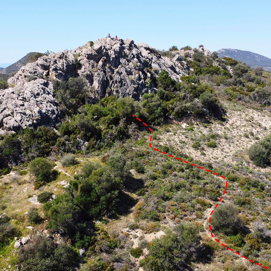
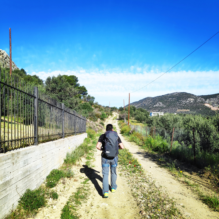
Approach
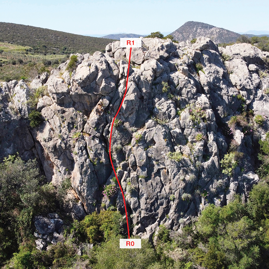
The route is located in the rock formation north west of Dardiza Bay, municipality of Ermionida, Argolis – Greece.
Its orientation is north. Approaching R0 requires 5 minutes of hiking on an easy trail.
- Parking spot: 37.403527, 23.256539
- Beginning of the route: 37.403620, 23.255125

Check out more FREE Guidebooks
Download now for free! Explore breathtaking landscapes and conquer thrilling heights with our collection of guidebooks and topos.
Don’t miss out on this opportunity to elevate your outdoor adventures. Click, download, and let the exploration begin!
Route description
R0 – R1 | V- UIAA – 20 m.
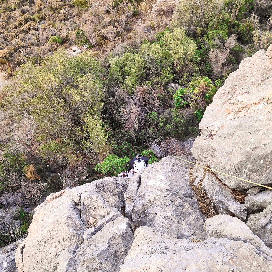
Dardiza Bayby Shitter is a single pitch (20 m.) and starts right from the base of the north side of the rock (37.403620, 23.255125).
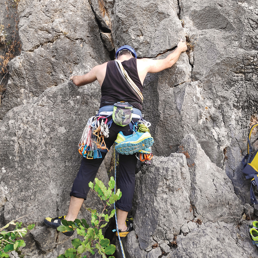
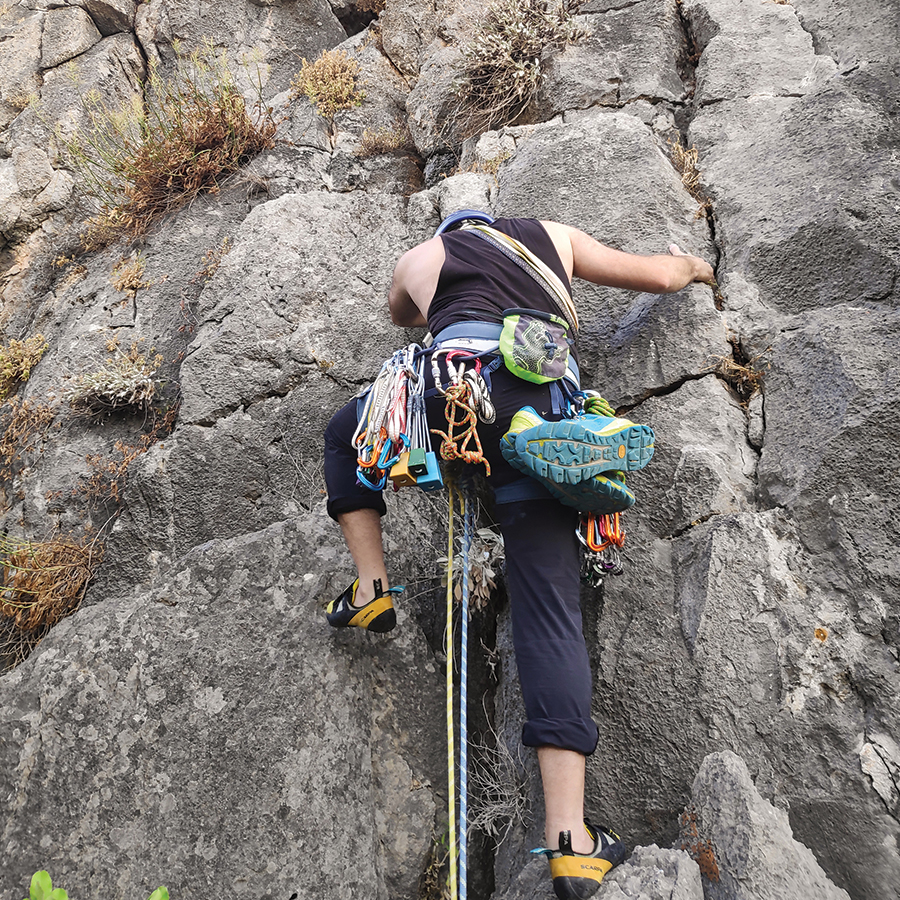
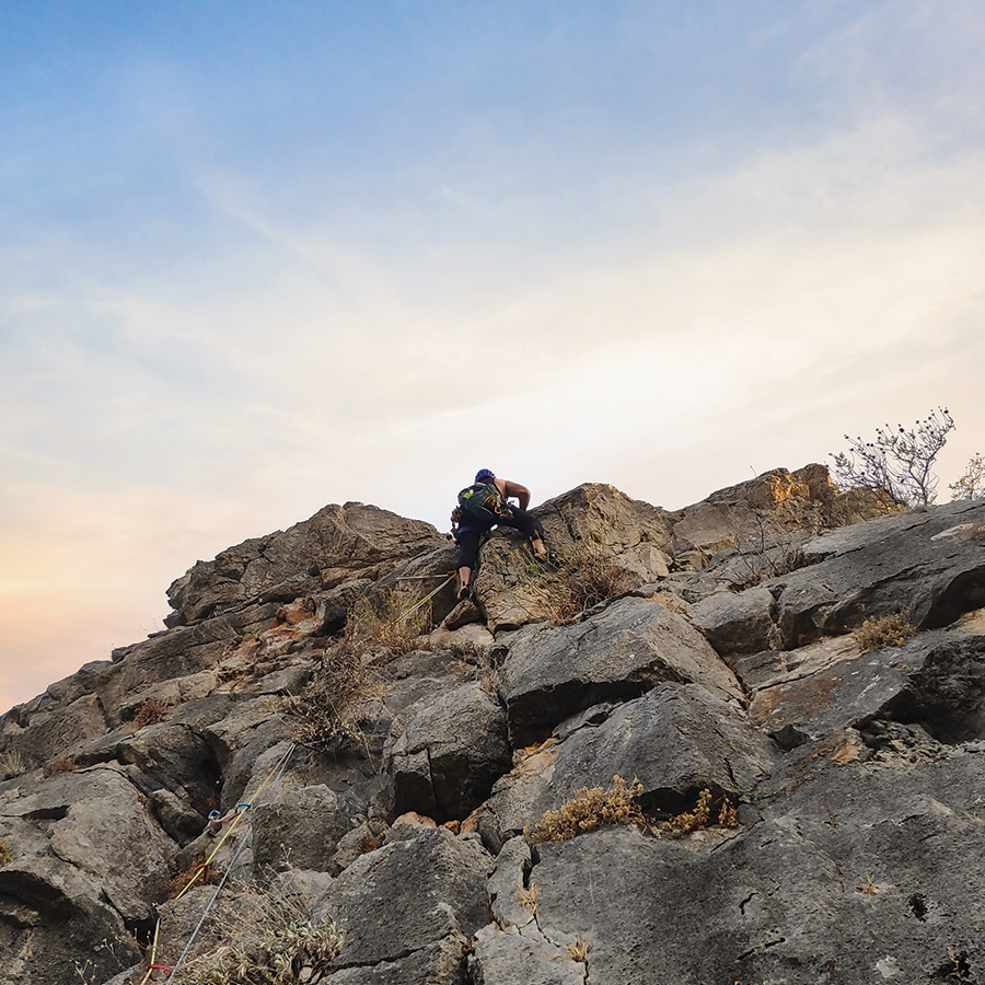
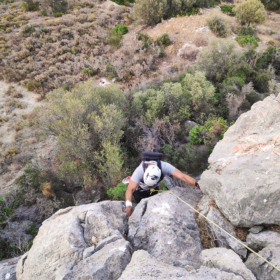
Dardiza Bayby Shitter starts on the left side from the route Dardiza Bayby 3. The first part of this pitch is an easy slab UIAA IV-. As soon as you start to climb, you have to move towards the left and find a good position where you can place the first protection (nut or friend). The slab continues up to an obvious crack. As soon as we reach the crack UIAA IV we place a second protection and then we continue to climb on another slab with a maximum degree of UIAA IV.
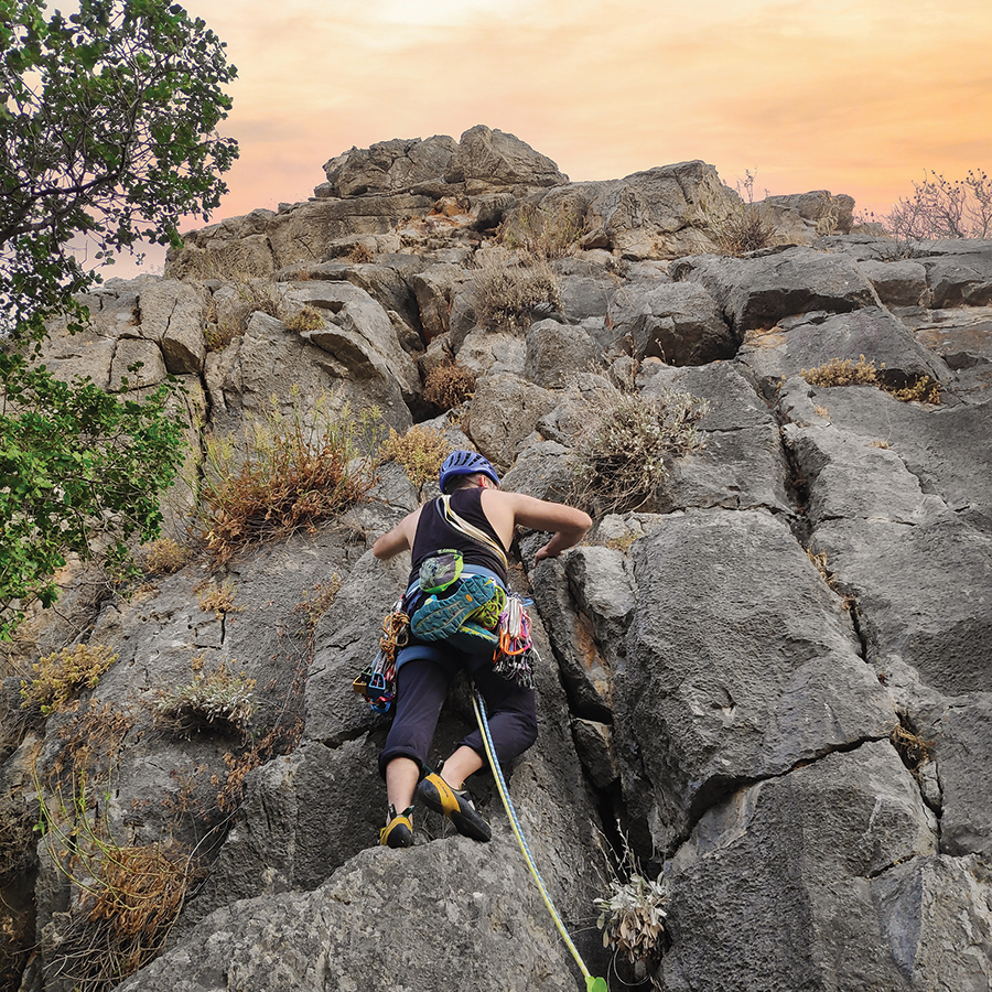
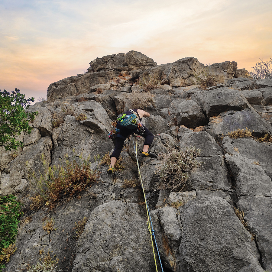
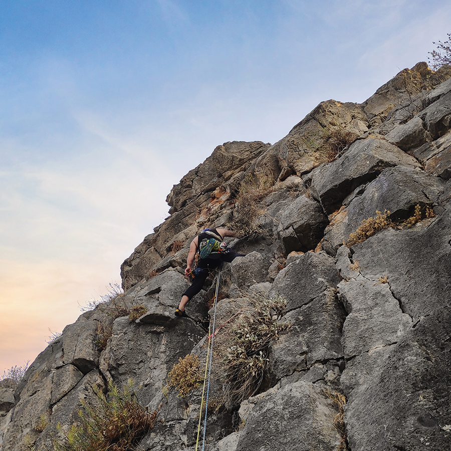
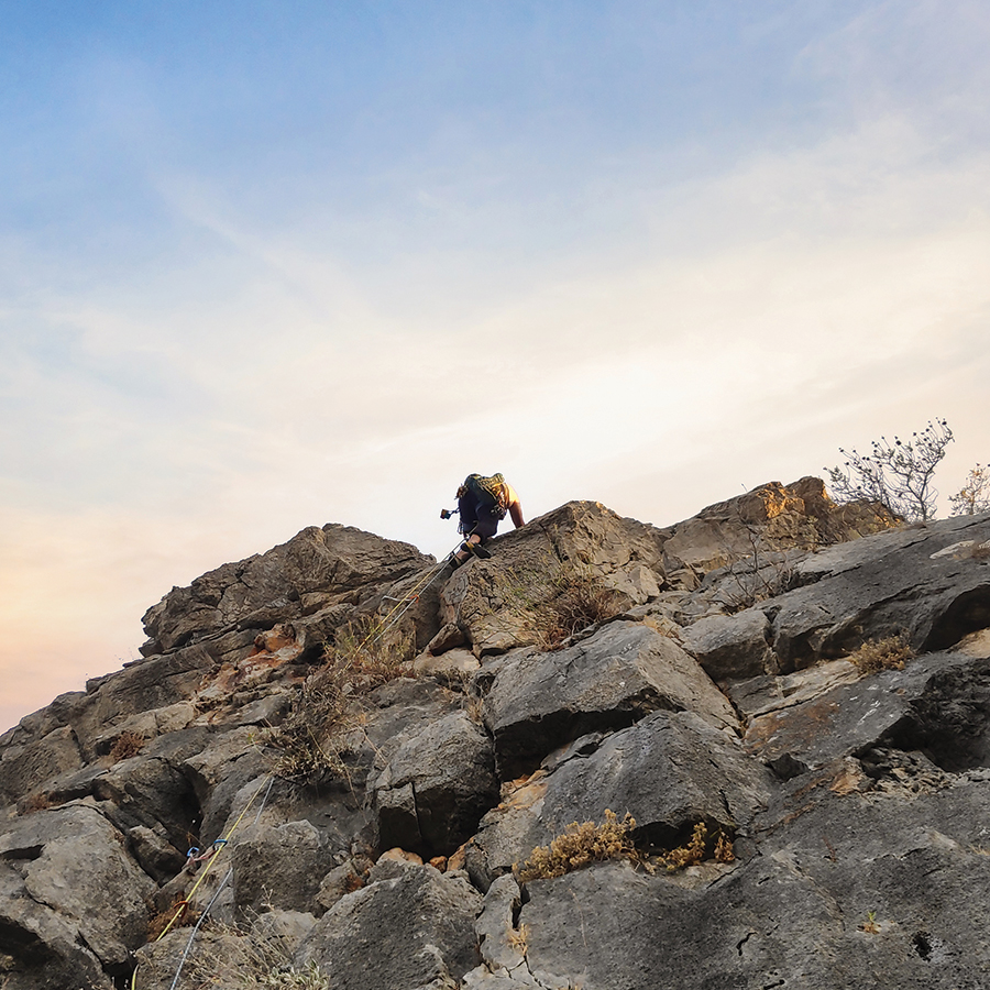
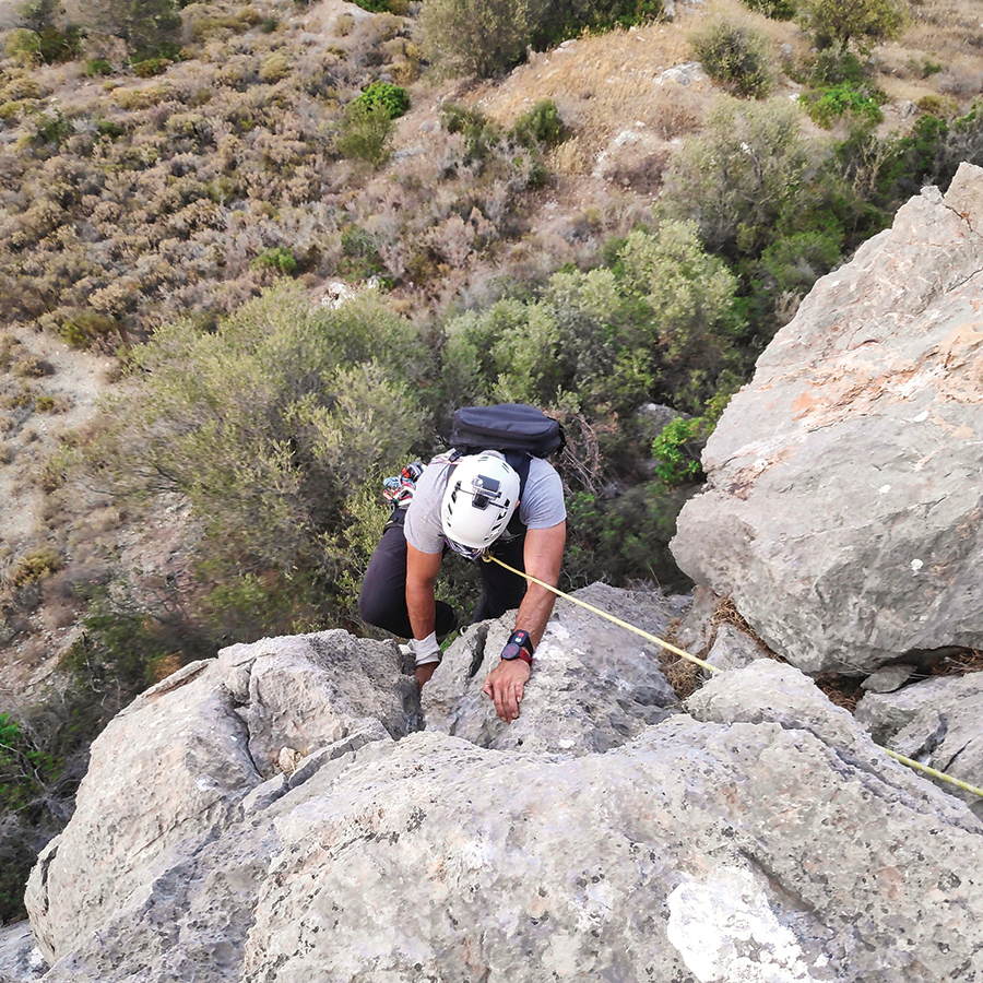
On the point, we might find some loose rocks, therefore we have to pay attention, mainly in order to protect the belayer. We continue to climb on a slab and just before we reach the crux, there is a passage of a maximum degree of UIAA IV+. Having passed this slab, we reach the crux which is a small overhang. The overhang might intimidate newcomers in trad climbing, but there are good holds and can be climbed easily. In addition, this part of the climb can be well protected with gear. Once we climb over the overhand, we follow the ridge UIAA III for about 3-4 meters and we look for one of the large boulders in order to establish the anchor point.
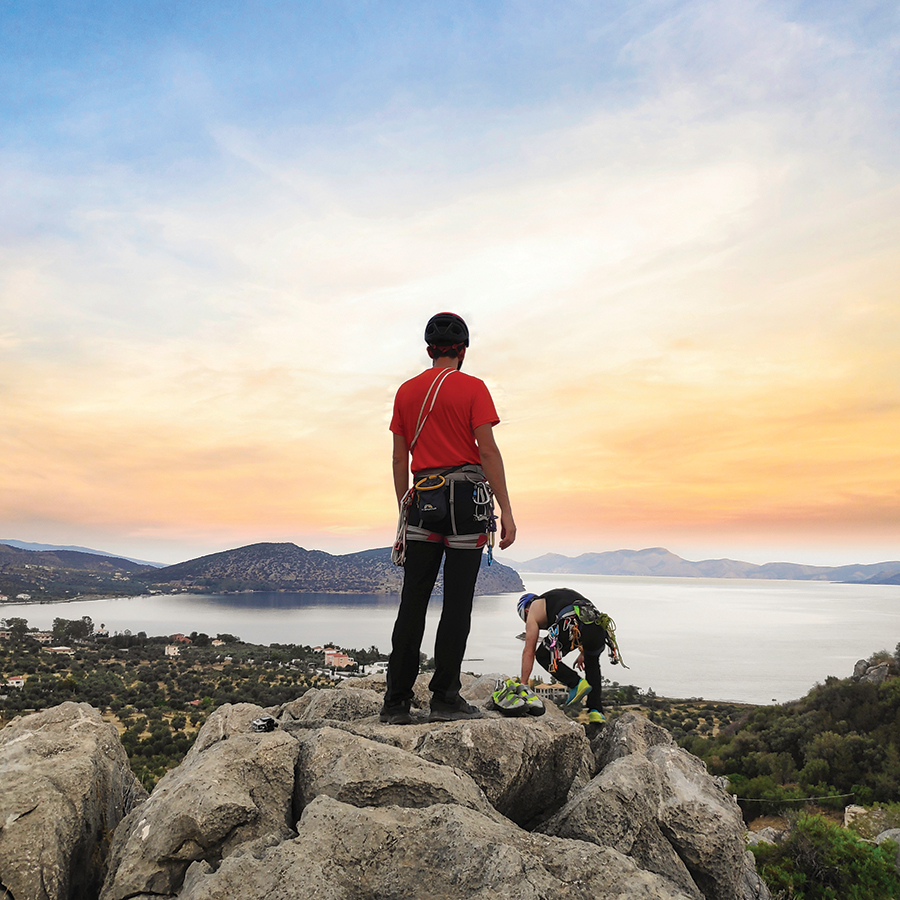
Make a belay with a large sling or kevlar cordelette and an additional nut or friend on one of the obvious boulders. The belay position is very good and comfortable and with a unique view towards the islands of Hydra and Dokos.
Climbing as Second & Third and reaching the top of the Rock
From R1, we can also clearly see the following areas of climbing interest:
- Katafyki Gorge
- Pillars of the Wind
- Mount Didimo
- “Monsters of the Wind” Mount Ortholithi
- “The long run” Mount Ortholithi
- Castle Thermisia
- Dardiza Crag
- Dardiza Bayby 1
- Dardiza Bayby 2
- Dardiza Bayby 3
- Dardiza Bayby 4
- Dardiza Bayby 5
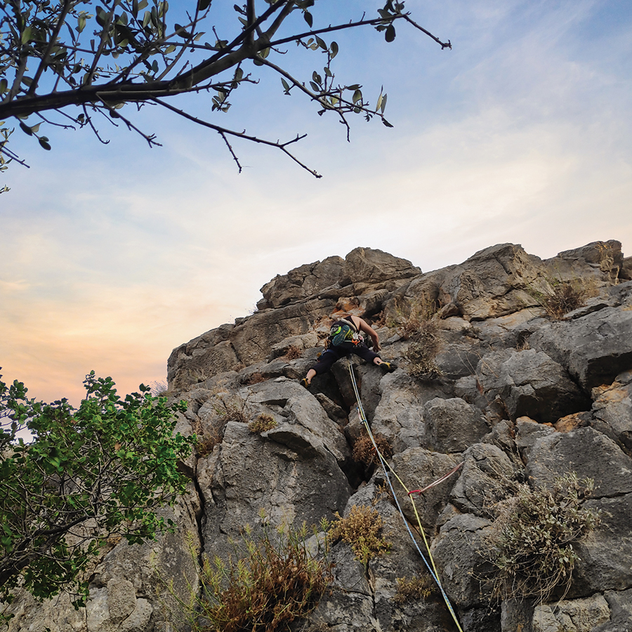
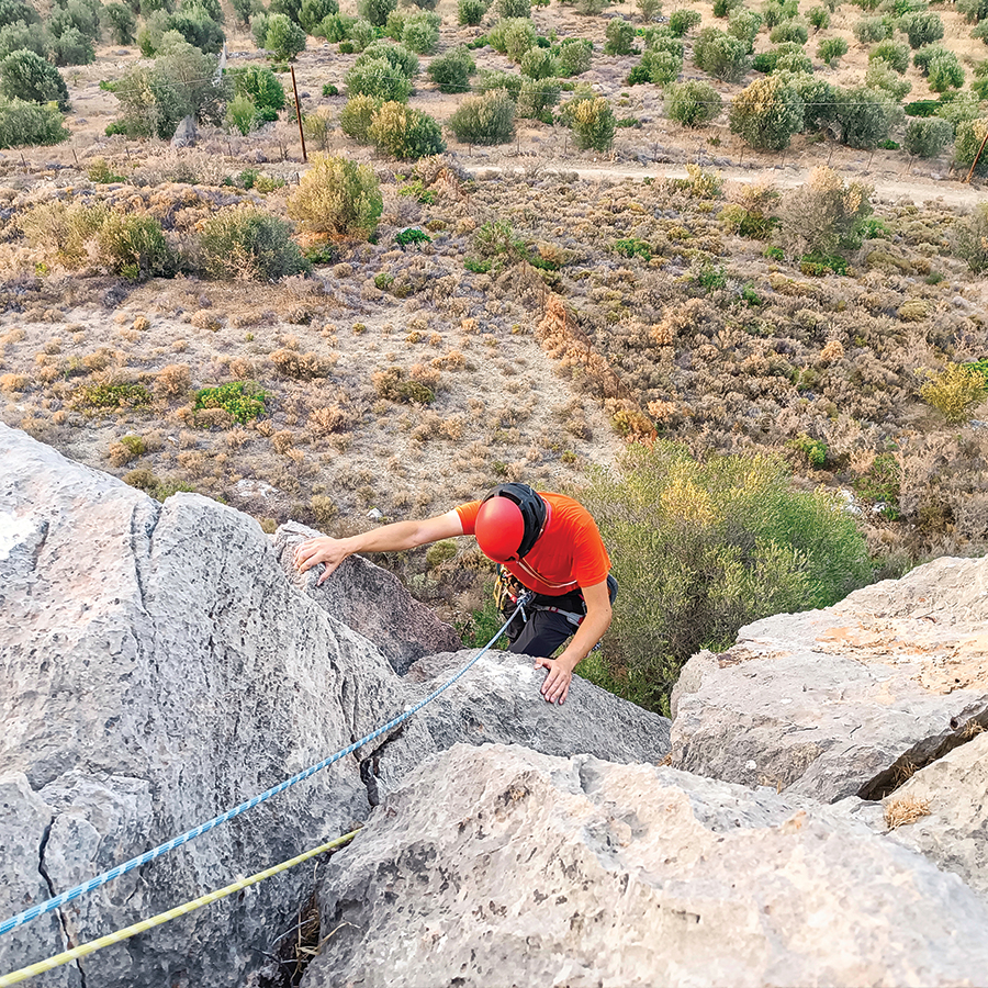
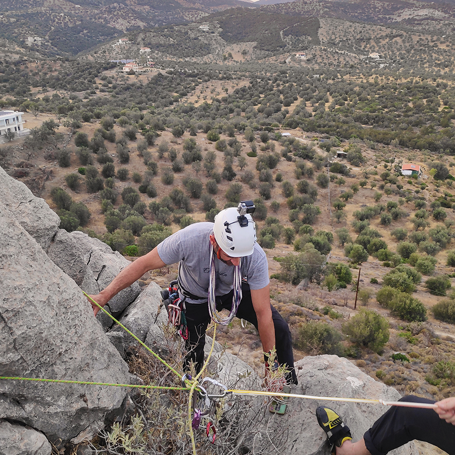
View from the Top
Once we have reached the top of the rock, we came across the stunning view towards Hydra island, and the overall region of Ermionida. From the top, we could clearly see Mount Didimo, Pillars of the Wind and Mount Ortholithi.

Subscribe & Stay Informed
Enter your email address to follow this blog and receive notifications of new posts by email
Return
Our return route starts from the top of the route. We initially go south and we follow the ridge towards the east. We have to downclimb some boulders. The descent is obvious and easy to identify.
The descent takes about 5 minutes.
Recommended Gear
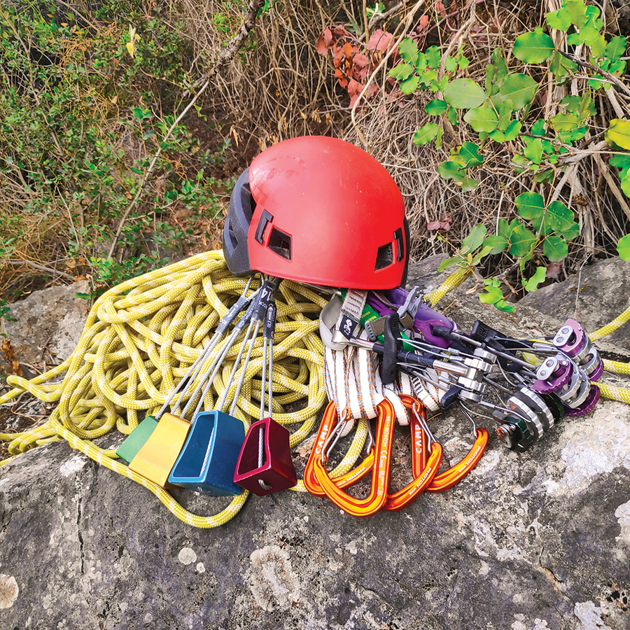
For this trad climb, I used the following gear:
- Mammut Wall Rider Helmet
- 5 lanyards 60 cm
- 1 lanyard 120 cm
- 4 locking carabiners
- 1 HMS carabiner
- Mammut Ophir Harness
- Simond Climbing shoes
- BD HotWire Quickdraws
- Alpine Quickdraws
- Cordelette for prusik
- 2 x 60 m. rope
- 4 carabiners
- Reverso
- 0.5 lt of Water
- 1 energy bar
- Friends / Camalots
- Rock Nuts
Details of the Climb
- Location: Dardiza Bay
- Starting Point: Dardiza Bay
- Ending Point: Dardiza Bay
- Trail Signs: No
- Difficulty: Medium
- When to Climb: Late Autumn, Winter, Early Spring
- Water Features: None
Support the journey — buy me a coffee
I share these articles and the climbing guidebooks because I love the outdoors, and they’ll always be free. If they’ve helped you, help me keep them coming. Click the button to support my work.
Download for free the complete route description and Topo map
- Download the complete Interactive Guidebook in PDF spreads (best for Tablets/Laptops/Desktops)
- Download the complete Interactive Guidebook in PDF single pages (best for Phones)
Before you leave this blog check out the following map
Below: This map marks all the mountaineering adventures that have been featured on Olympus Mountaineering so far, including several Sport climbing crags – Select full screen to expand, zoom in for more detail, or click on a marker for a link to the post.

What a sky!! Beautiful view from the summit. Maggie
LikeLiked by 1 person
Thank you for your comment Maggie.
In order to not have issues with the heat, we went for evening climb and the view from the top was really charming!
LikeLike
Holy smokes, this looks hardcore! I wish I was more into climbing than I was. I used to climb at a gym and have only climbed outdoors once. It seems like it would be an awesome hobby – I just do too much already! I always love seeing climbers, though. Total mad lads!
LikeLiked by 1 person
Thank you for your kind comment, much appreciated!
Also, it is great to know that you also like to climb -although mostly indoors- and I would highly suggest you go more often to the outdoors.
The feeling of being out in the nature in combination with climbing is unique, especially if you go for trad climbing routes. It doesn’t need to be difficult routes. Just the fact of being outdoors and doing your sport is already enough!
Again, thank you for your kind comment.
LikeLiked by 1 person
Yeah, I think that’s why I didn’t end up liking climbing – I did it mostly in gyms! I love being outdoors to hike and ski, and it would be far better to climb outdoors than indoors! I’ll need to find some friends who can take me outdoors!
LikeLiked by 1 person
To get in touch with more experienced climbers is a great starting point. Then, they will be able to lead and help you out.
LikeLiked by 1 person
Wow. That view IS magnificent! We absolutely can’t wait to explore Greece – hopefully not too far into the future. What’s the weather like at this time of year? I imagine it’s probably too hot for us!
LikeLike
Greece, besides the world class destination like Kalymnos, offers many more options for climbing (sport, Trad, mountaineering).
Should you decide to come, feel free to drop a message.
Though, as you guessed, now is pretty hot for quality climbing, but great if you want to combine it with the sea side.
LikeLike
Of course! We really love discovering the more ‘off the beaten track’ places. Places like Kalymnos are popular for a reason but that doesn’t mean that’s the only place in Greece that’s great for climbing!
We will definitely drop you a message when we are planning to come – it would be great to get some local recommendations!
LikeLiked by 1 person
Great!! Beautiful views from the top!! Lovely captures!!!
LikeLike
Indeed, the views from the top were lovely!
Thank you for reading this post and of course for your comment too.
LikeLiked by 1 person
Pingback: Climbing in Ermionida, Argolis (Greece) Guidebook Edition 2022 – Olympus Mountaineering
Pingback: Ek Tou Anasfalous VI UIAA 90 m. | Trad Climbing in Karathona beach – Nafplio – Olympus Mountaineering
Pingback: The Ultimate Guide of Trad Climbing in Ermionida, Argolis – Greece – Olympus Mountaineering
Pingback: Climbing in Ermionida, Argolis (Greece) Guidebook Edition 2023 – Olympus Mountaineering
Pingback: Climbing in Pleides Crag – Katafyki Ravine – Ermioni – Olympus Mountaineering
Pingback: Climbing in Charamos Crag – Kandia – Argolis, Greece (Update 2023) – Olympus Mountaineering
Pingback: Electra VI UIAA 4 Pitches – 145 m. | Trad Multi Pitch Climbing in Pleiades Crag – Katafyki Ravine – Ermioni – Olympus Mountaineering
Pingback: Climbing in Pleiades Crag – Katafyki Ravine – Ermioni – 2025 Edition – Olympus Mountaineering
Pingback: Climbing in Ermionida, Argolis (Greece) Guidebook Edition 2025 – Olympus Mountaineering