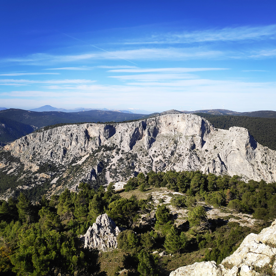
Regularly, I make it a point to explore some of my favorite outdoor spots in Greece, with Mt. Parnitha topping the list. This stunning mountain is conveniently just 30 minutes away from the heart of Athens. Situated in the Attiki province, approximately 25km north of Athens, Mt. Parnitha is part of the quartet of mountains—Immitos, Penteli, and Poikilo—encircling the plain upon which the city is built. Among these peaks, Mt. Parnitha stands as the tallest and most awe-inspiring.
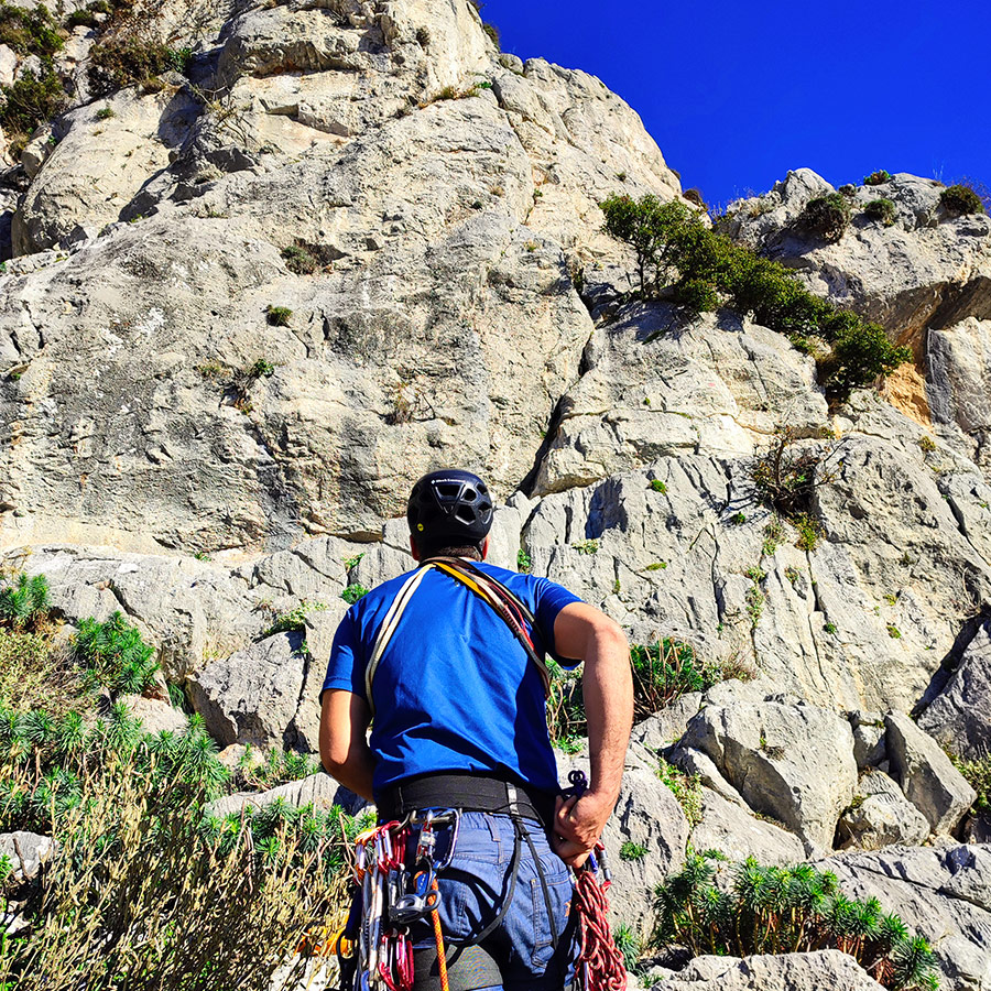
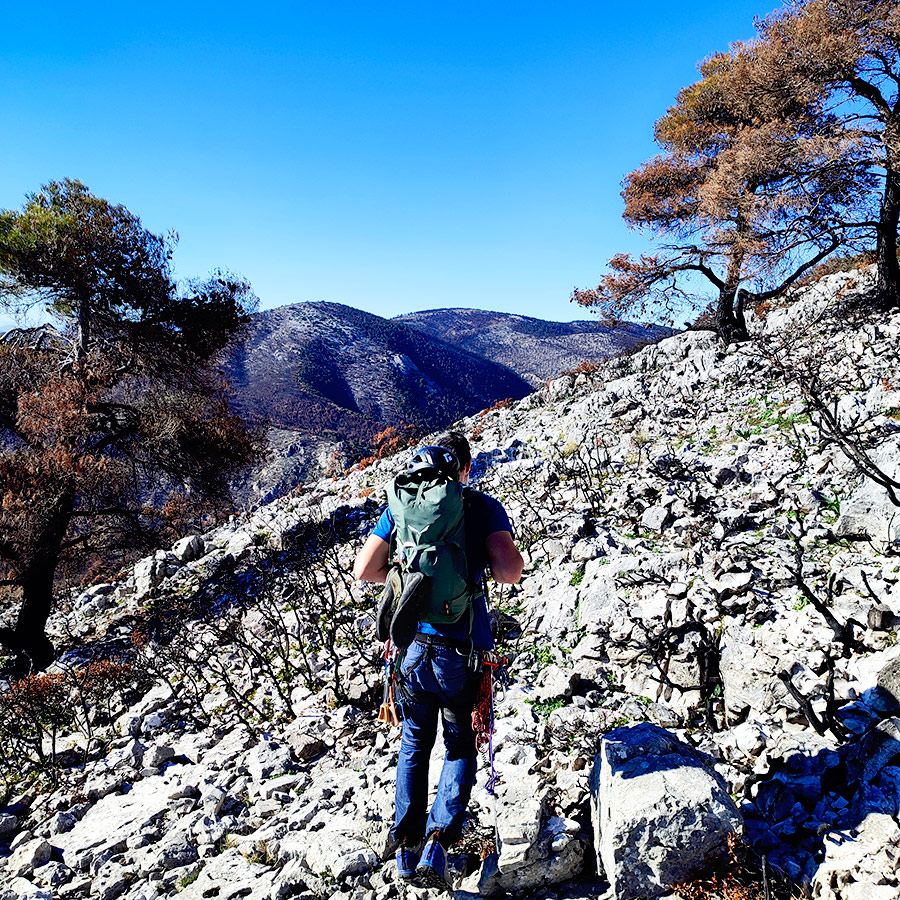
In my past visits to Parnitha, I’ve had the pleasure of climbing in the Flabouri area. However, this time around, my sights are set on exploring and climbing a second route in the captivating region of Arma.
About a year ago, before the devastating wildfires of the summer of 2023, I had the pleasure of fully enjoying the first route in the Arma area—Skytali.
About Arma
Have you ever wondered about a great location for Traditional rock climbing in Athens, Greece?
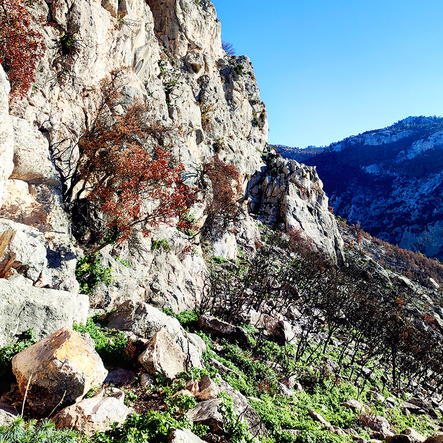
Arma, located just a stone’s throw away from the charming village of Fyli, also known as Chasia. Situated in the southwestern area of Parnitha, this region has become a hotspot for climbers, thanks to its numerous cliffs that have captivated the Greek climbing community.
Among these cliffs, Arma takes center stage, playing a pivotal role in the rock climbing history of the region. It’s not just a climbing destination; it’s a canvas where the exploratory spirit of the first Greek rock climbers came to life. Arma unfolds its beauty through four distinct areas:
- Notio Arma (South Arma): A haven for climbers seeking a southern thrill, with challenging routes and breathtaking views.
- Kentriko Arma (Central Arma): A diverse playground offering routes for climbers of all skill levels, from novices to seasoned adventurers.
- Vorios Tichos (North Wall): A historic wall echoing the footsteps of the first Greek rock climbers, showcasing the region’s limestone in all its glory.
- Spilia Sarri (Sarri’s Cave): A unique experience tucked away in a cave, blending shelter with the excitement of climbing.
The rock quality throughout Arma is impressive, ranging from good to excellent in some areas, providing a solid foundation for a memorable climbing experience.
For those eager to delve deeper into Arma and the broader climbing scene in Attica, the “Attica Rock” guidebook is your go-to resource. It unveils the secrets of routes, difficulty levels, and the overall climbing experience in the region.
But the story doesn’t end there. Thanks to the dedication of a small group of local climbers, led by K. Lafogiannis and A. Papandreou, the old routes established many years ago have been revived. Their hard work and passion have breathed new life into Arma, preserving its rich history and offering contemporary climbers a chance to connect with the roots of this vibrant community.
For a closer look at their efforts and to connect with fellow climbers, check out the dedicated Facebook Group.
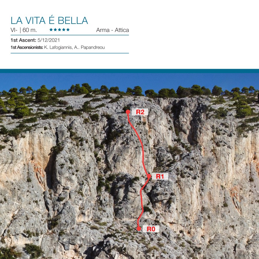
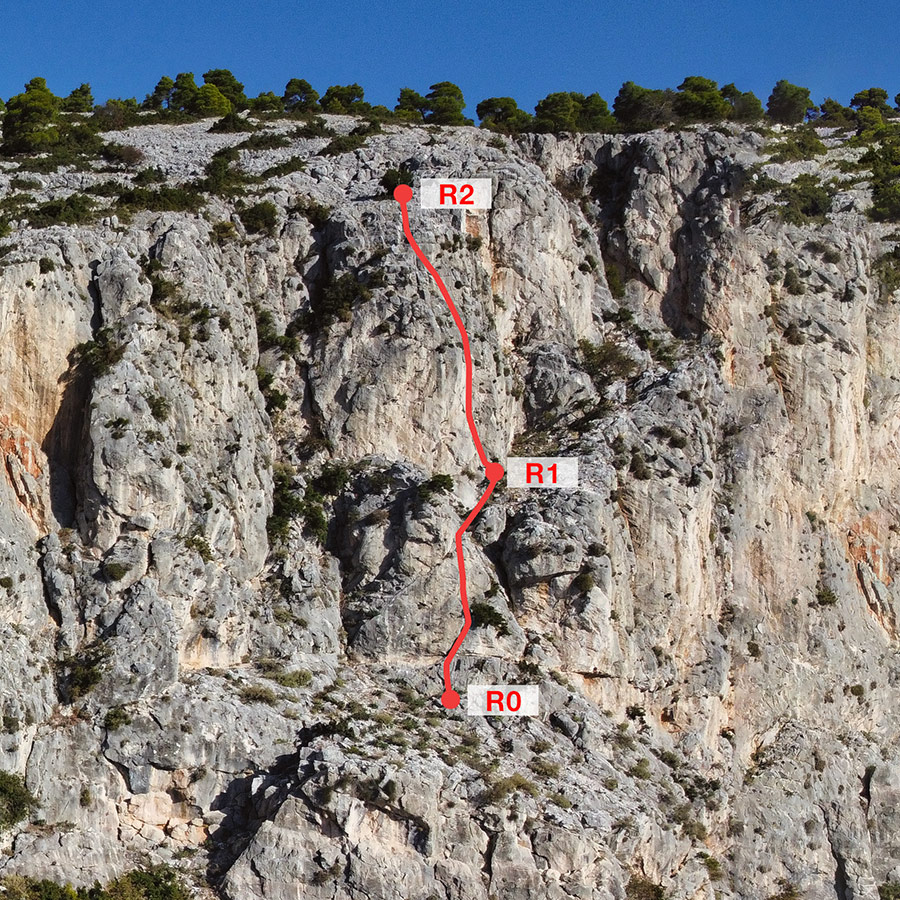
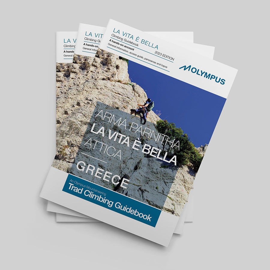
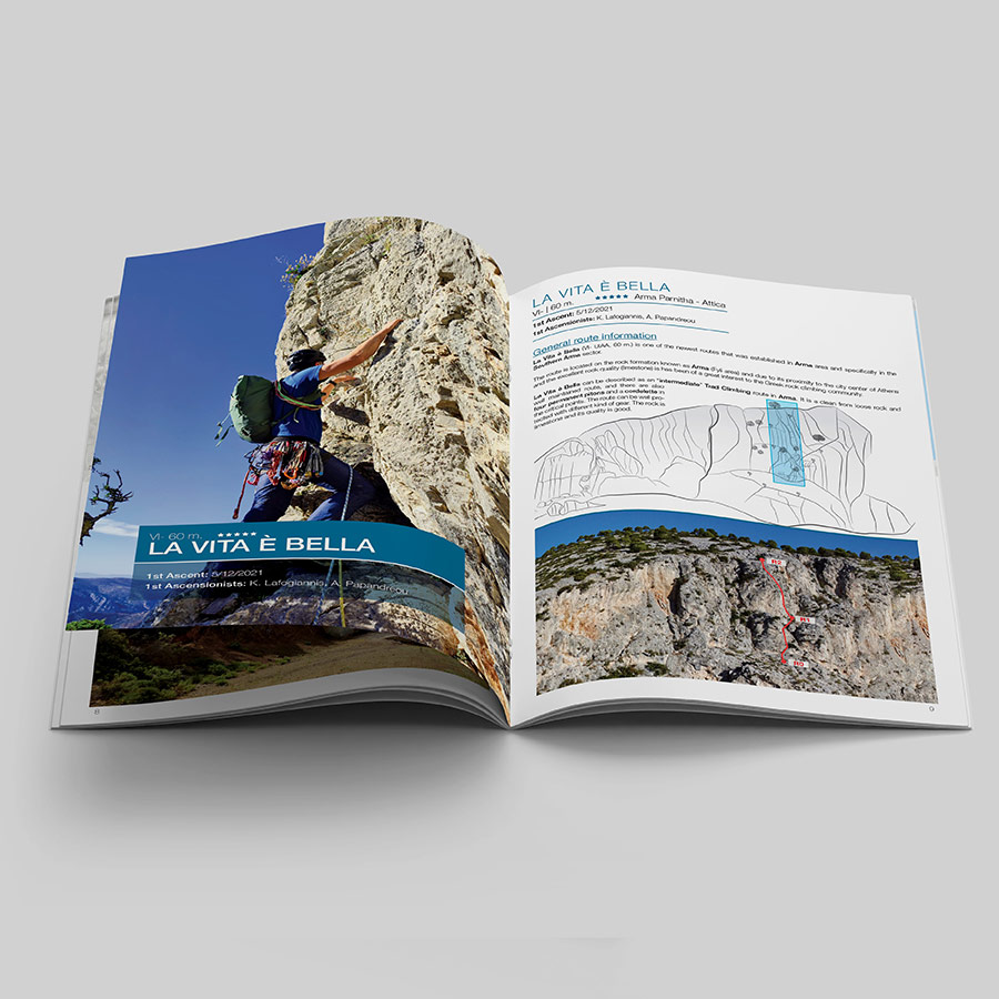
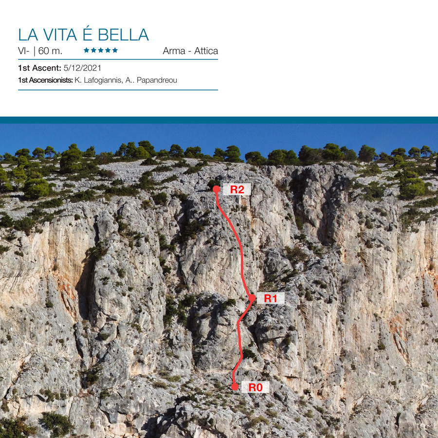
La Vita è Bella VI- UIAA, 2 Pitches, 60 m. – Trad Climbing in Arma, Parnitha
La Vita è Bella (VI- UIAA, 60 m.) is one of the newest routes that was established in Arma area and specifically in the Southern Arma sector.
La Vita è Bella (VI- UIAA, 60 m.) first ascent was claimed on 5/12/2021 by K. Lafogiannis and A. Papandreou.
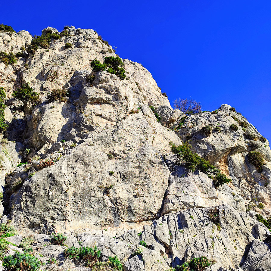
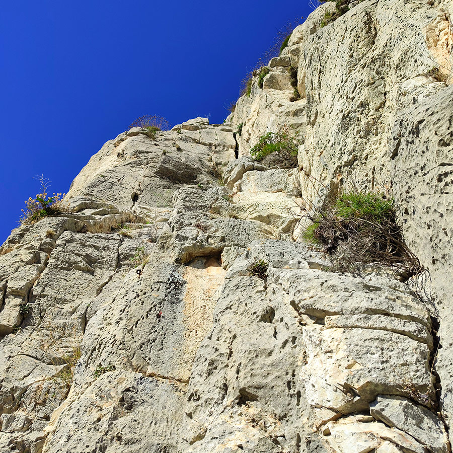
The route is located on the rock formation known as Arma (Fyli area) and due to its proximity to the city center of Athens and the excellent rock quality (limestone) is has been of a great interest to the Greek rock climbing community.
La Vita è Bella can be described as an “intermediate” Trad Climbing route in Arma. It is a clean from loose rock and well maintained route, and there are also four permanent pitons and a cordelette in the critical points. The route can be well protected with different kind of gear. The rock is limestone and its quality is good.
Support the journey — buy me a coffee
I share these articles and the climbing guidebooks because I love the outdoors, and they’ll always be free. If they’ve helped you, help me keep them coming. Click the button to support my work.

Download for free the complete route description and Topo map
- Download the complete Interactive Guidebook in PDF spreads (best for Tablets/Laptops/Desktops)
- Download the complete Interactive Guidebook in PDF single pages (best for Phones)

Check out more FREE Guidebooks
Download now for free! Explore breathtaking landscapes and conquer thrilling heights with our collection of guidebooks and topos.
Don’t miss out on this opportunity to elevate your outdoor adventures. Click, download, and let the exploration begin!
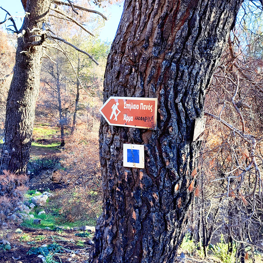
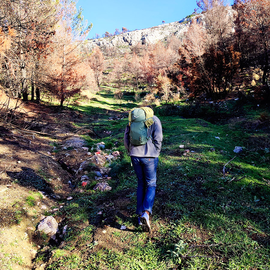
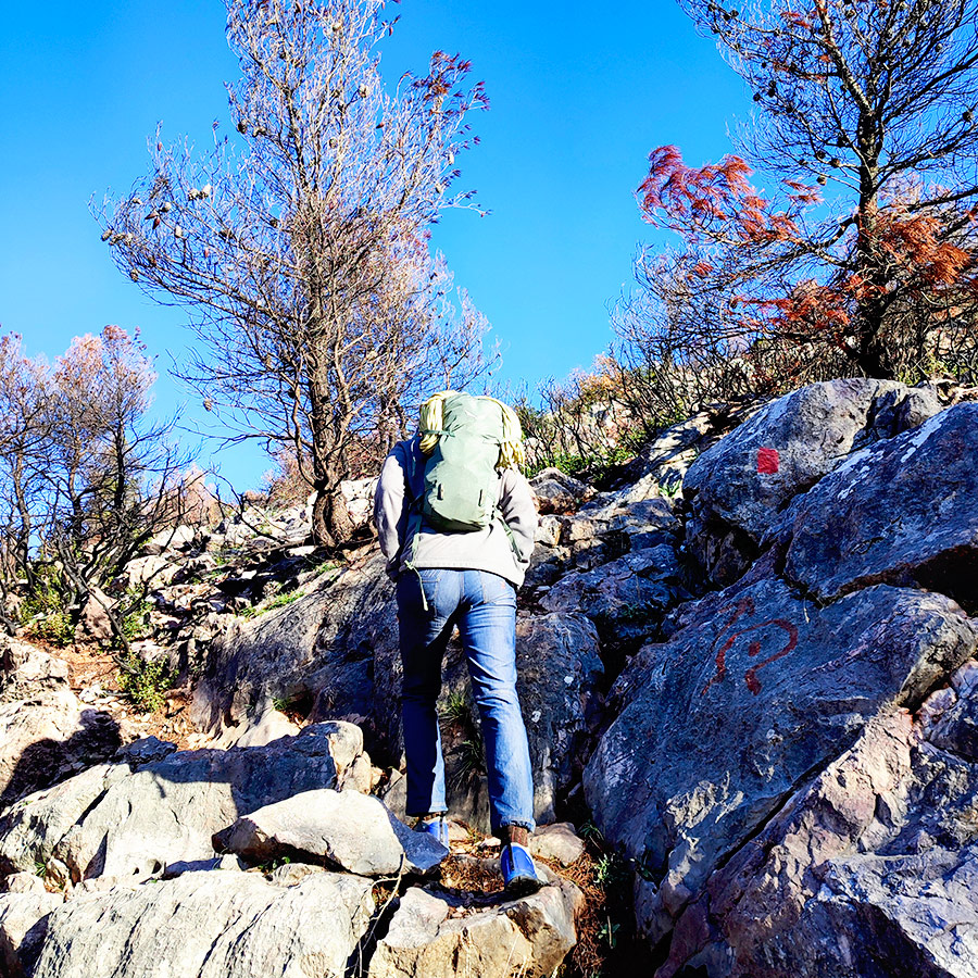
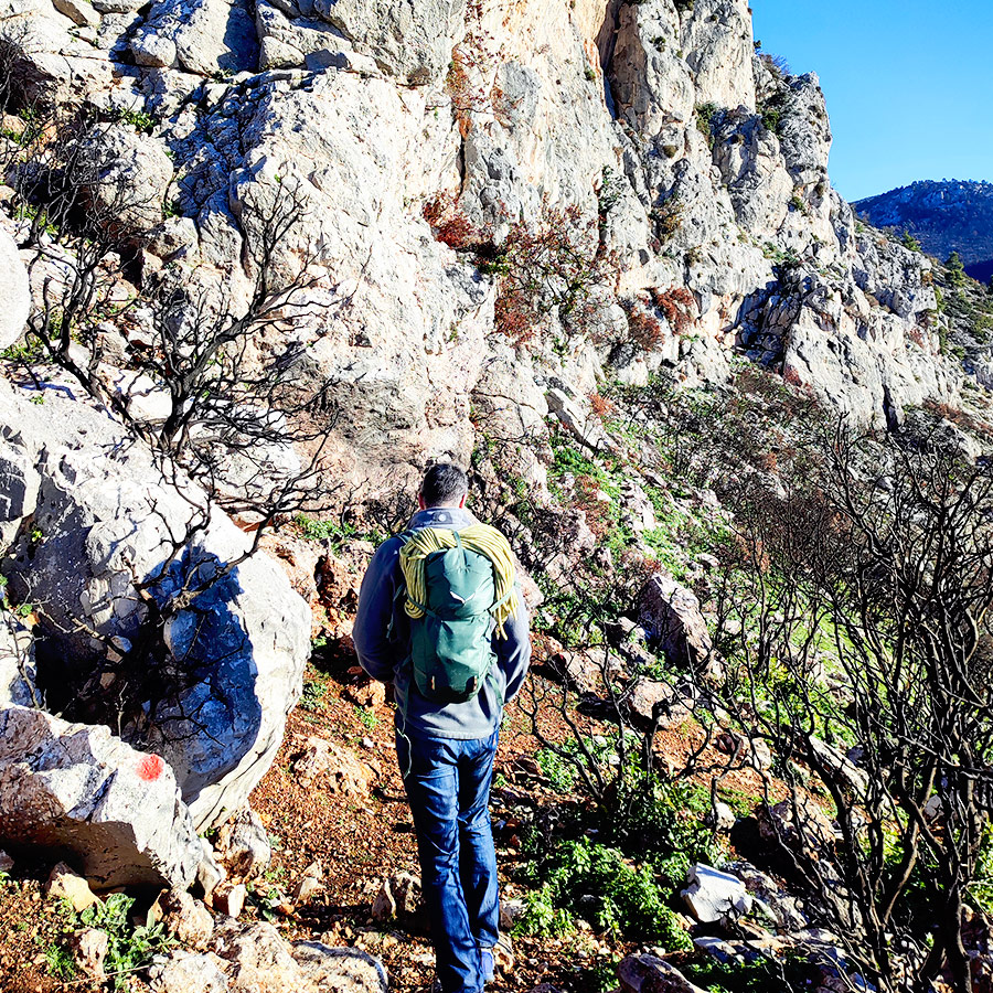
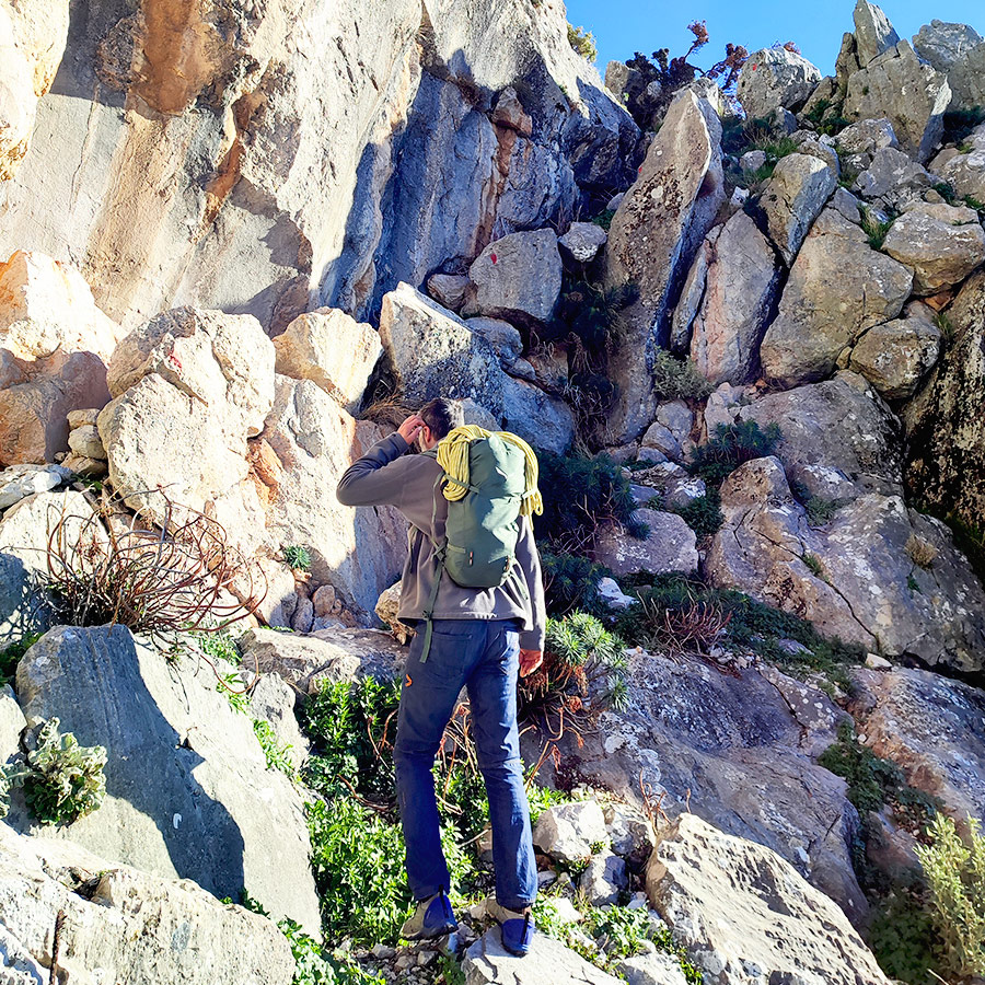
Approach
From Attiki Odos Exit #6, follow Fylis Avenue towards Fyli/Chasia (north/west). Follow the road for 500m until big roundabout. Take the third exit and continue on Fylis Avenue. 3,1 km after the roundabout you will see a golden-domed church on your right hand (Panagia Kanala) and a football pitch on your left. Continue and go further than the Fyli village and follow the direction towards Monastery Kliston. You will drive further on from Monastery Kliston till the following location 38.133639, 23.650956 .
As soon as you park, follow the red signs which they lead to the Via Ferrata and the beginning of the route is located here: 38.135403, 23.655060
- Parking spot: 38.133639, 23.650956
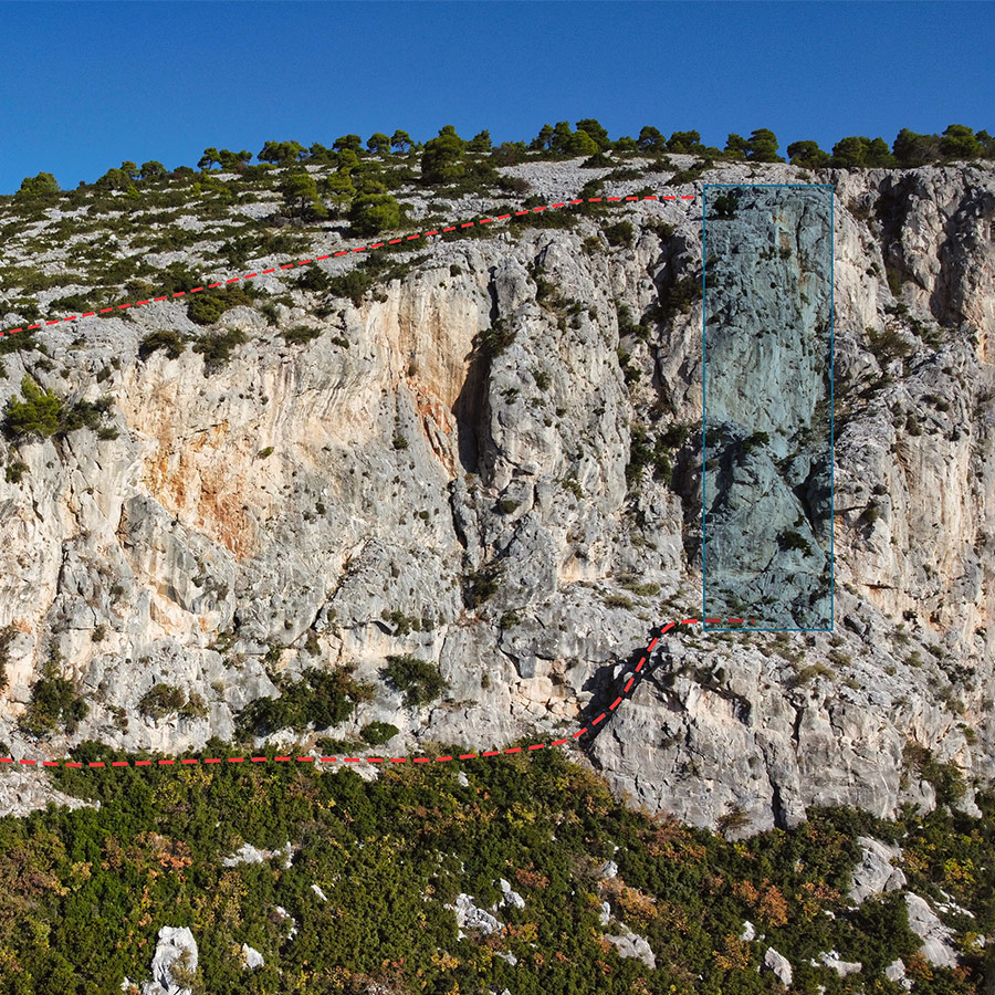
Route description
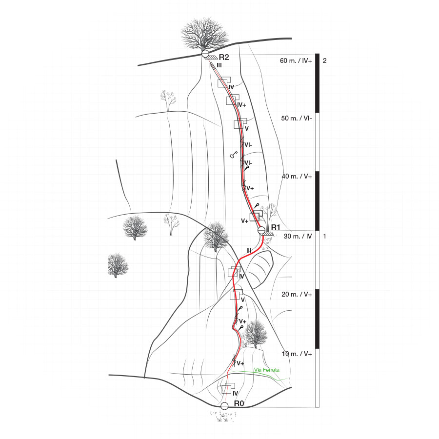
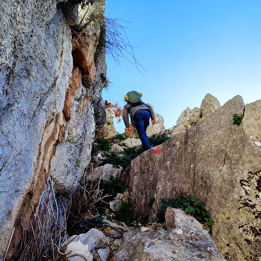
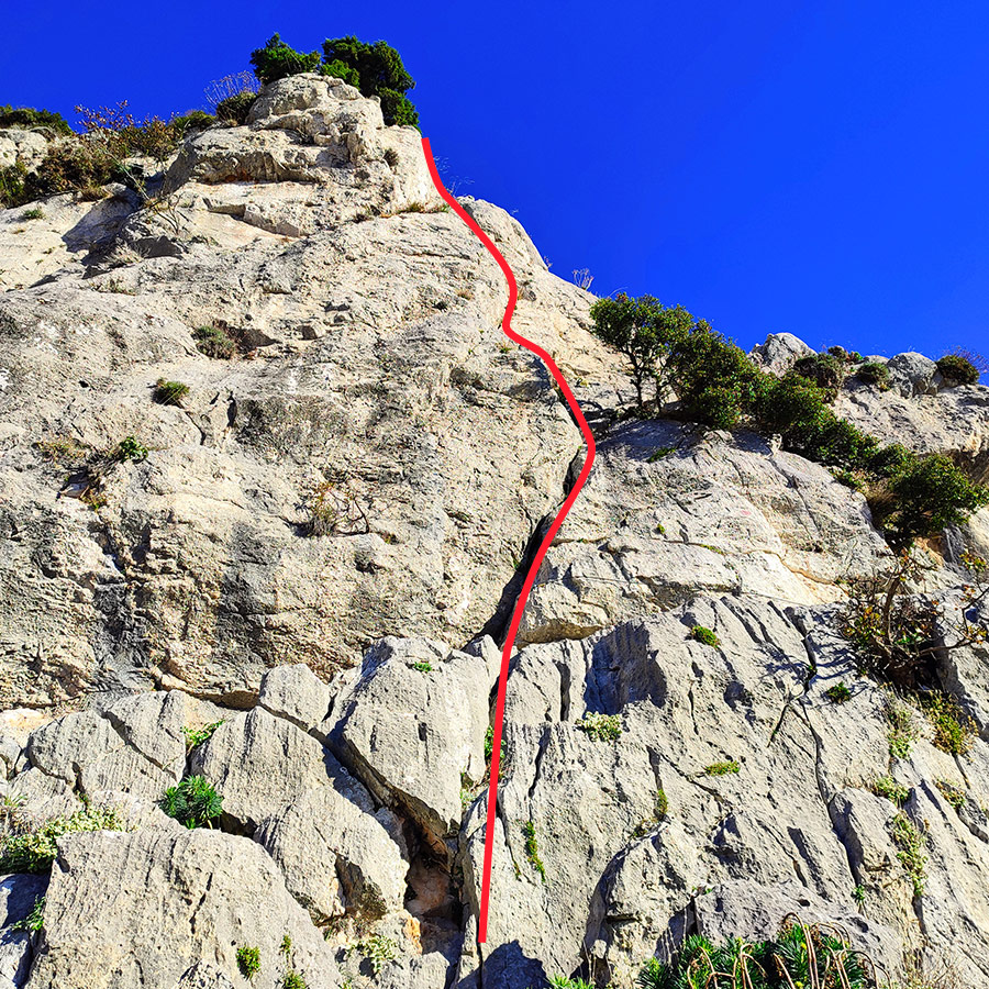
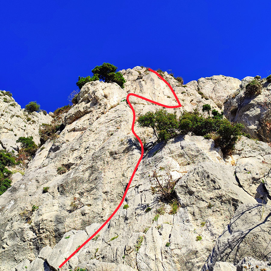
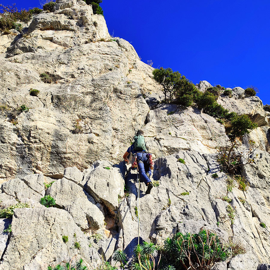
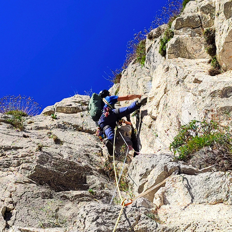
R0 – R1 | V+ UIAA – 30 m.
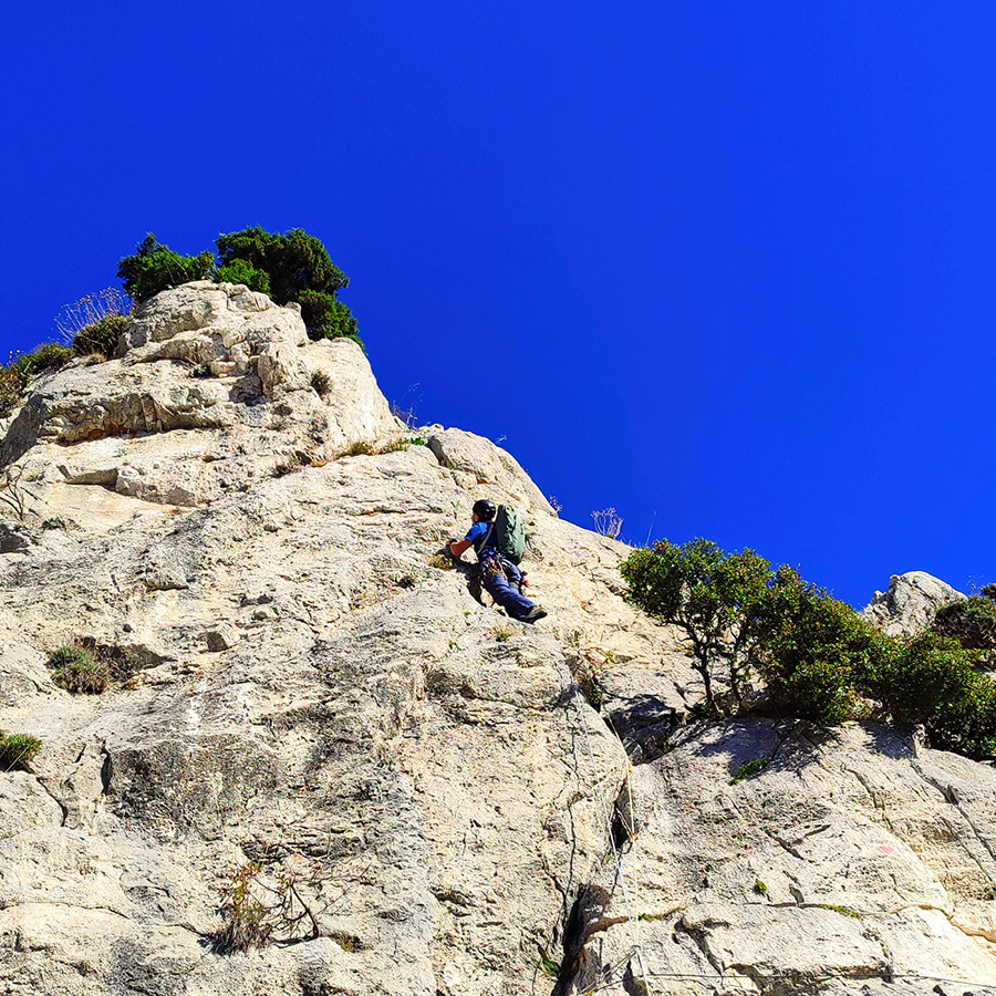
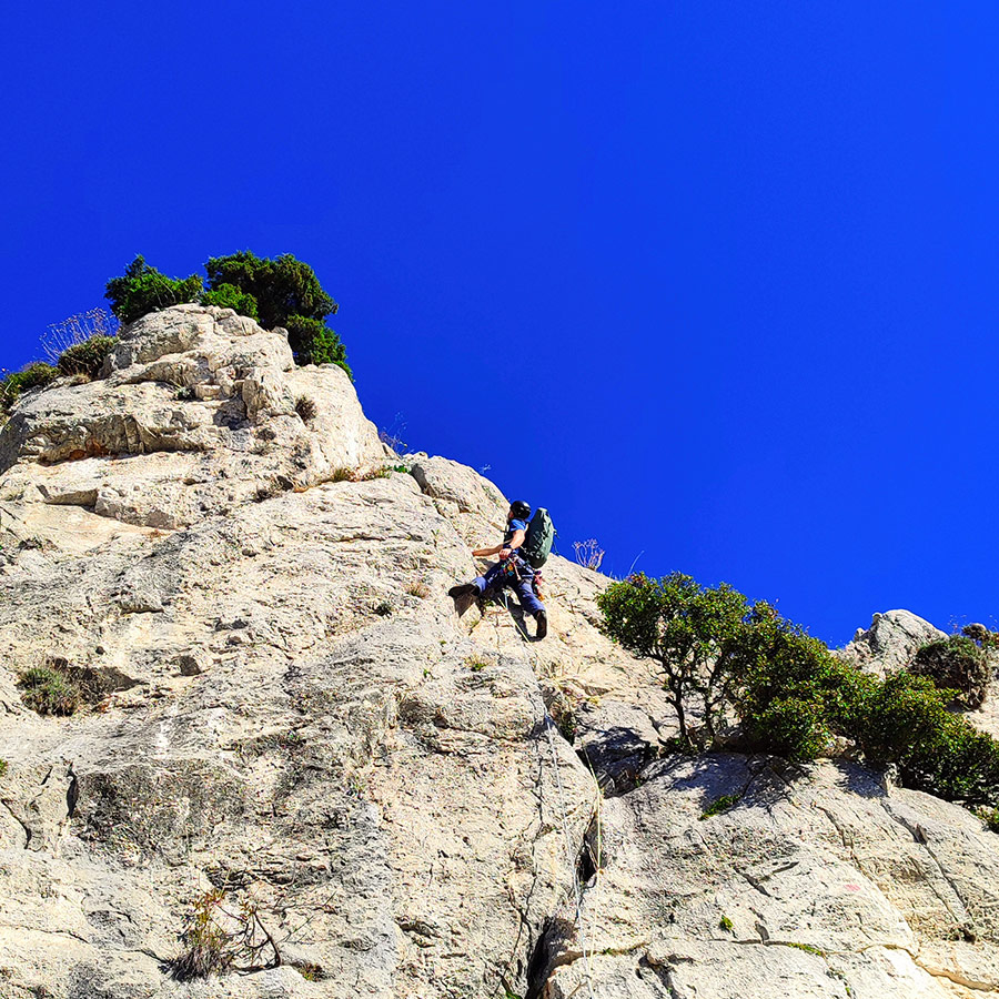
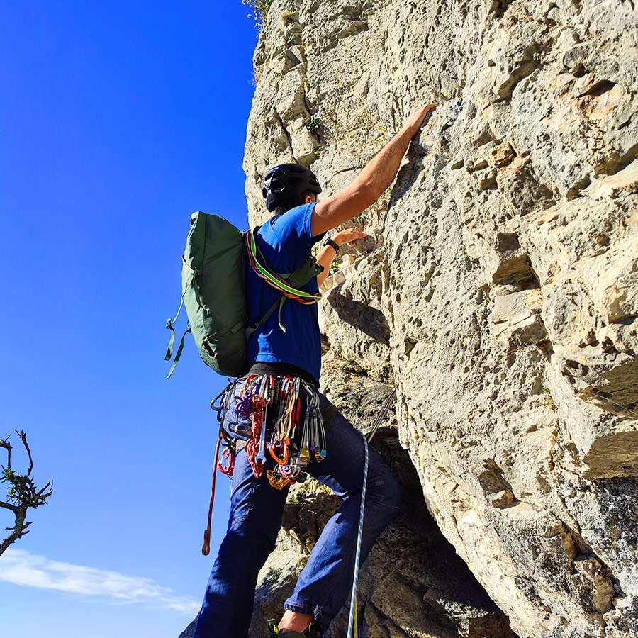
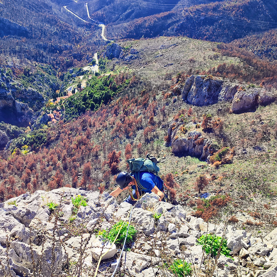
The established commencement point of the Arma Via Ferrata marks the inception of the original route. However, we have identified a more practical alternative, commencing the ascent approximately 5 meters below. At this juncture, a spacious ledge affords increased convenience, facilitating the orderly deployment and management of ropes.The initial segment of the ascent entails navigating a straightforward IV UIAA-rated slab for approximately 5 meters. This section concludes upon reaching the Via Ferrata cable and encountering the initial crack in the route.
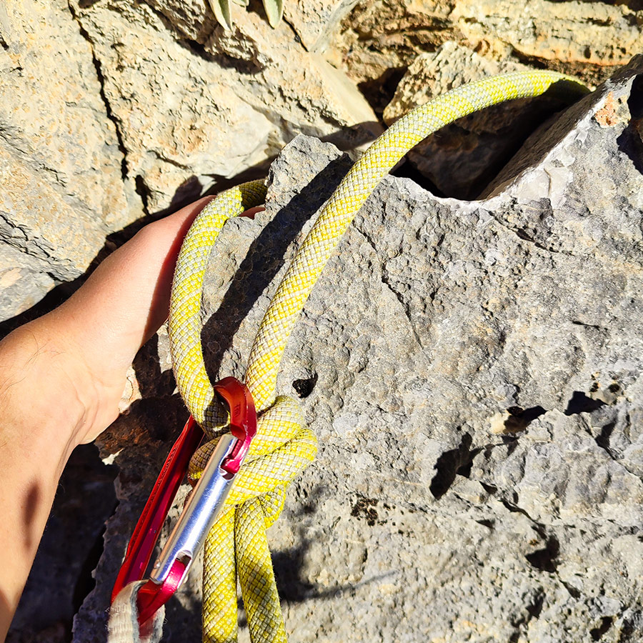
Securing the crack with appropriate gear becomes essential as we ascend to surmount a V+ UIAA rated. Progressing onto a small ledge housing a tree, we encounter a strategic vantage point. At this juncture, a visible cordelette offers an opportunity to employ a quickdraw, ensuring a reliable and secure gear placement.
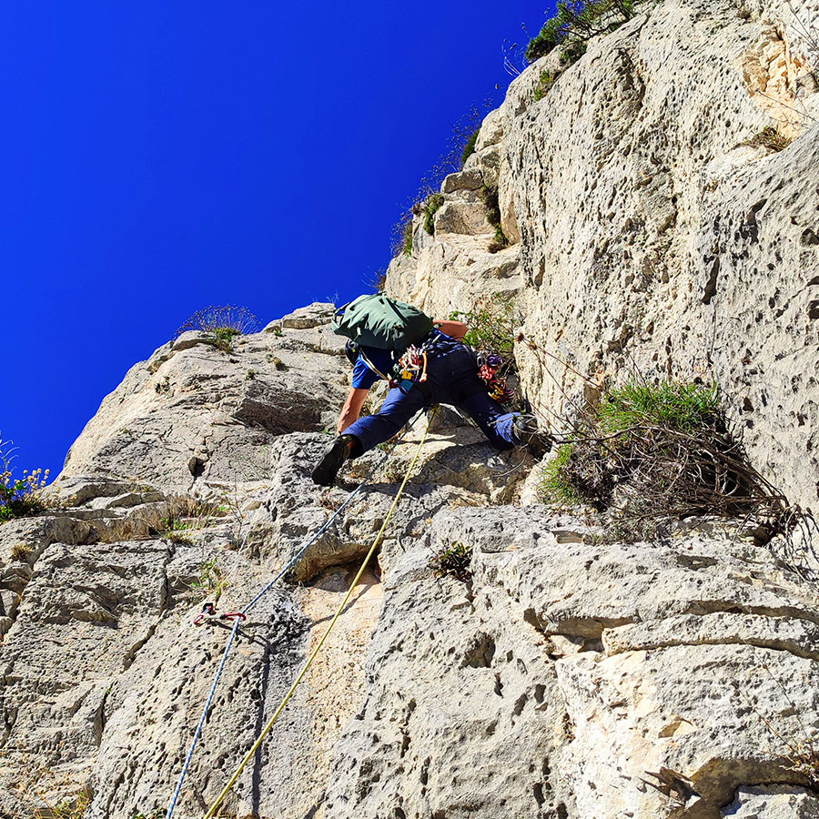
Subsequently, we adhere to the inherent trajectory of the ascent, encountering a gradual increase in difficulty. Notably, post the cordelette, two strategically positioned pitons come into view on the rock. This juncture serves as the crux of the initial pitch, with a V+ UIAA grade, demanding a cautious and deliberate approach for safe navigation.
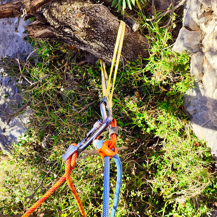
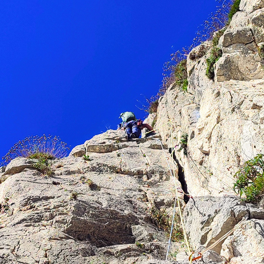
Upon surmounting the crux of the initial pitch, the terrain progressively mellows, transitioning into sections of IV UIAA. This ease continues until reaching the summit of the rock. However, prior topping up, a recommended maneuver involves traversing to the right. This positions us strategically to access a conspicuous tree, ideal for establishing our first anchor, denoted as R1.
The belay position is very comfortable.
Important: While the traverse itself presents as straightforward, caution is paramount owing to the presence of scree in the gully. Exercise heightened care throughout the traverse to mitigate potential risks associated with the loose debris.
Explore all outdoor activities in a convenient list view here
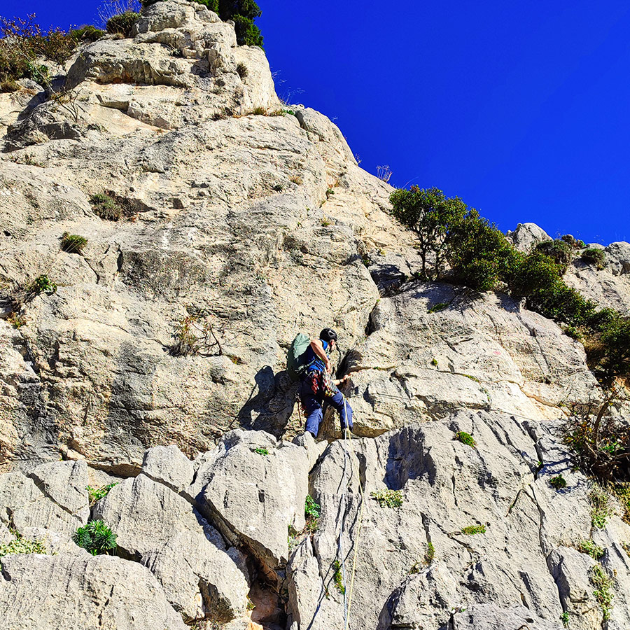
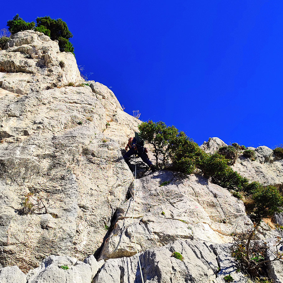
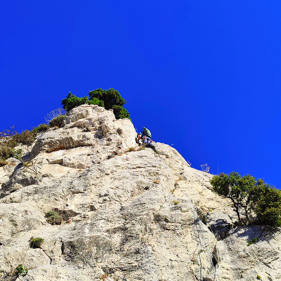
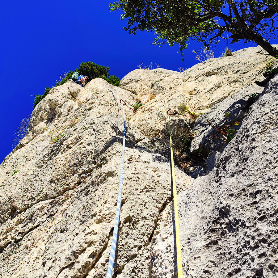
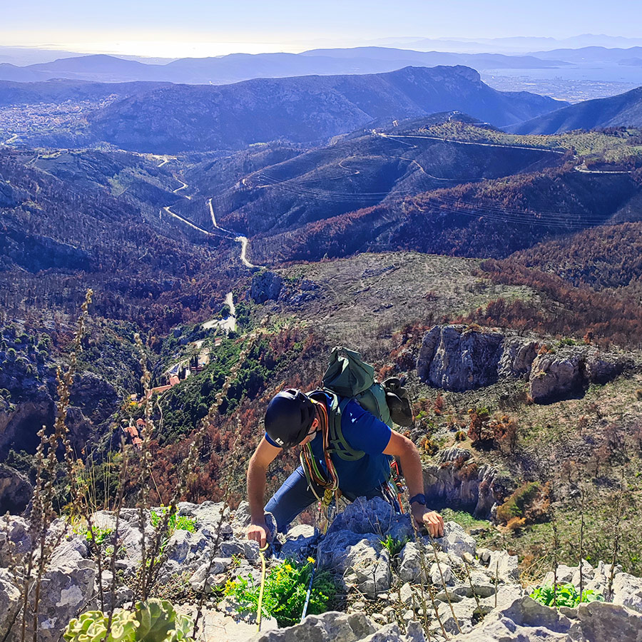
R1 – R2 | VI- UIAA – 30 m.
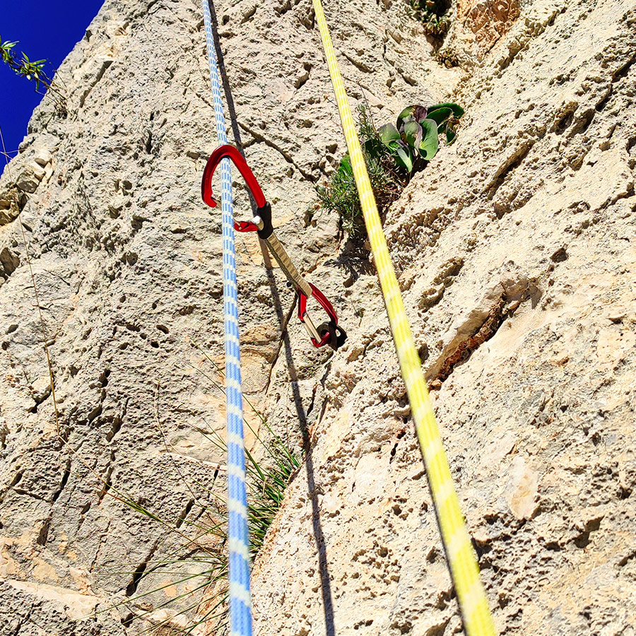
The second pitch, notably more challenging, commences slightly to the left of the tree serving as the anchor point. From this anchor point, a visible permanent piton not only offers a critical location for secure protection but also provides a clue to the route ahead.
The initial segment of Pitch 2 is graded at approximately V+ UIAA, with the difficulty gradually escalating. Progressing beyond this section, we encounter a visually appealing yet challenging crack, roughly the size of a closed fist. In proximity to the route’s pivotal crux, there is another strategically positioned piton. The crux itself, rated at about VI- UIAA, demands a significant level of skill and precision to climb it securely.
For safeguarding this particular section, the first ascensionists advise employing two size 11 Hex nuts, a gear option we regrettably lacked. Nonetheless, this segment provides an exceptional climbing experience, demanding not only proficient climbing skills but also a resilient mental approach.
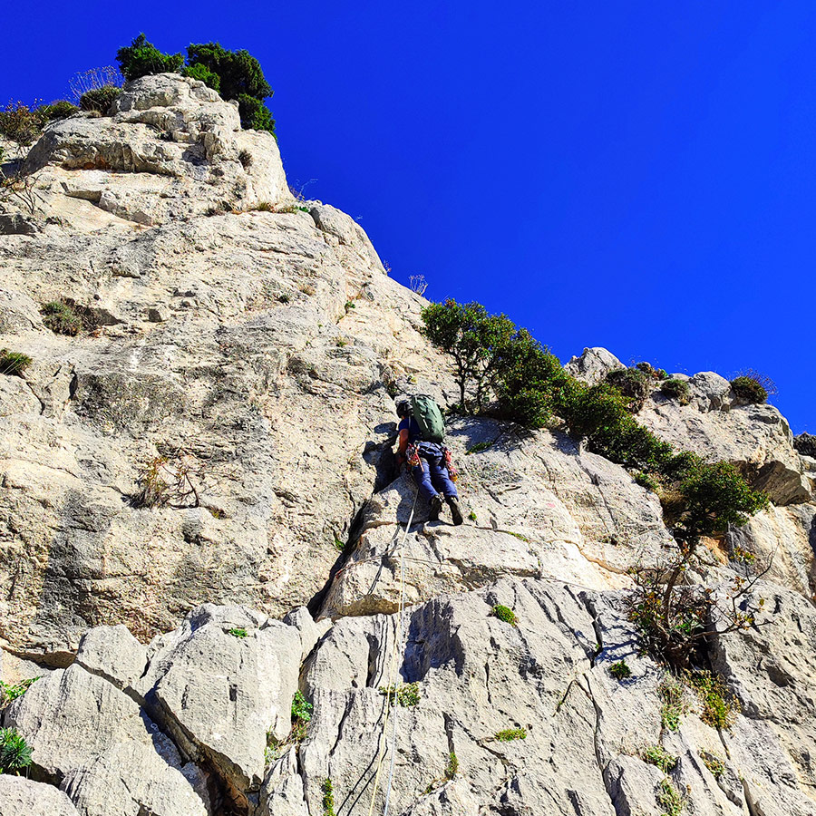
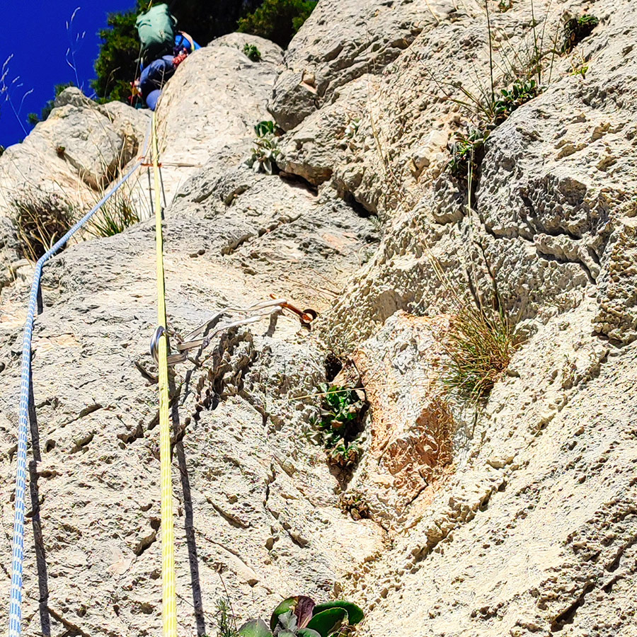
Having climbed the challenging crux of the route, the ascent transitions into a more manageable phase, with the grade descending gradually from VI- UIAA to V UIAA. The concluding section transforms into an easy scramble of III UIAA.
Upon reaching the summit, a conspicuous tree comes into view, serving as an optimal anchor point for establishing R2.
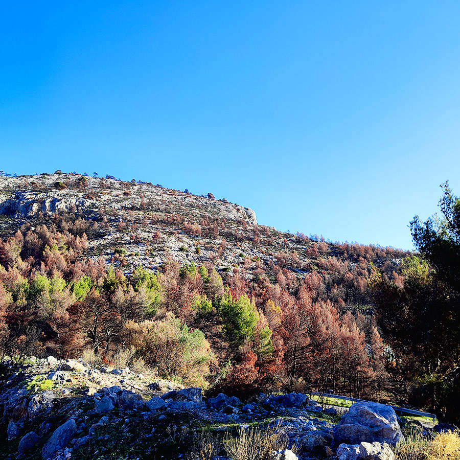
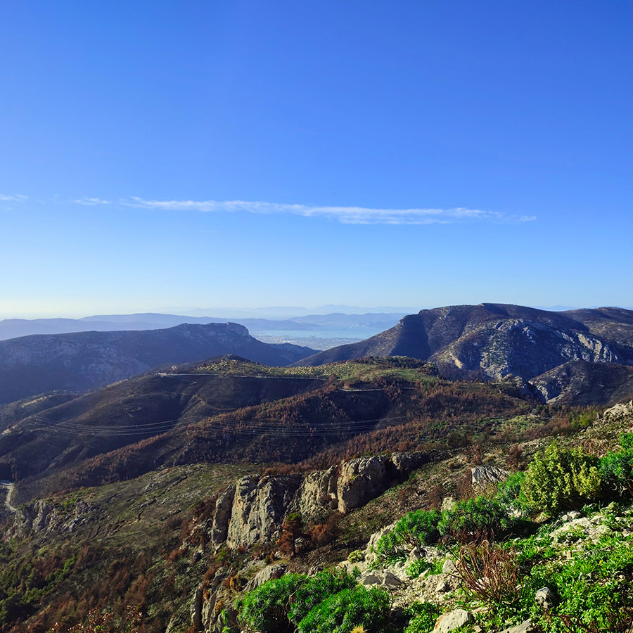
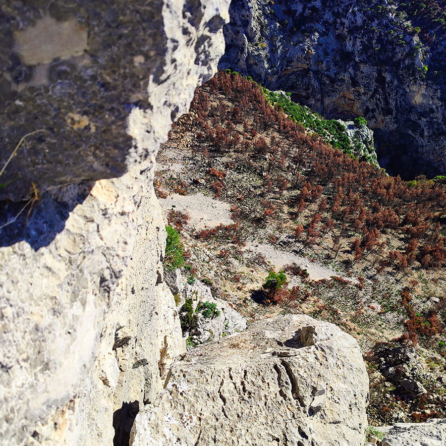
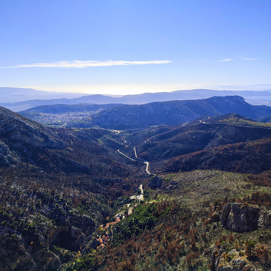
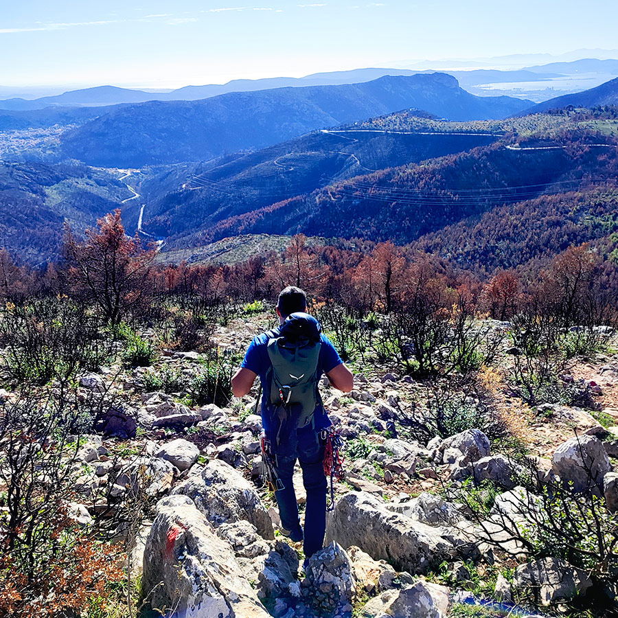
The vista from the summit remains quite impressive, although the forest below bears the scars of the wildfires that occurred during the summer of 2023.


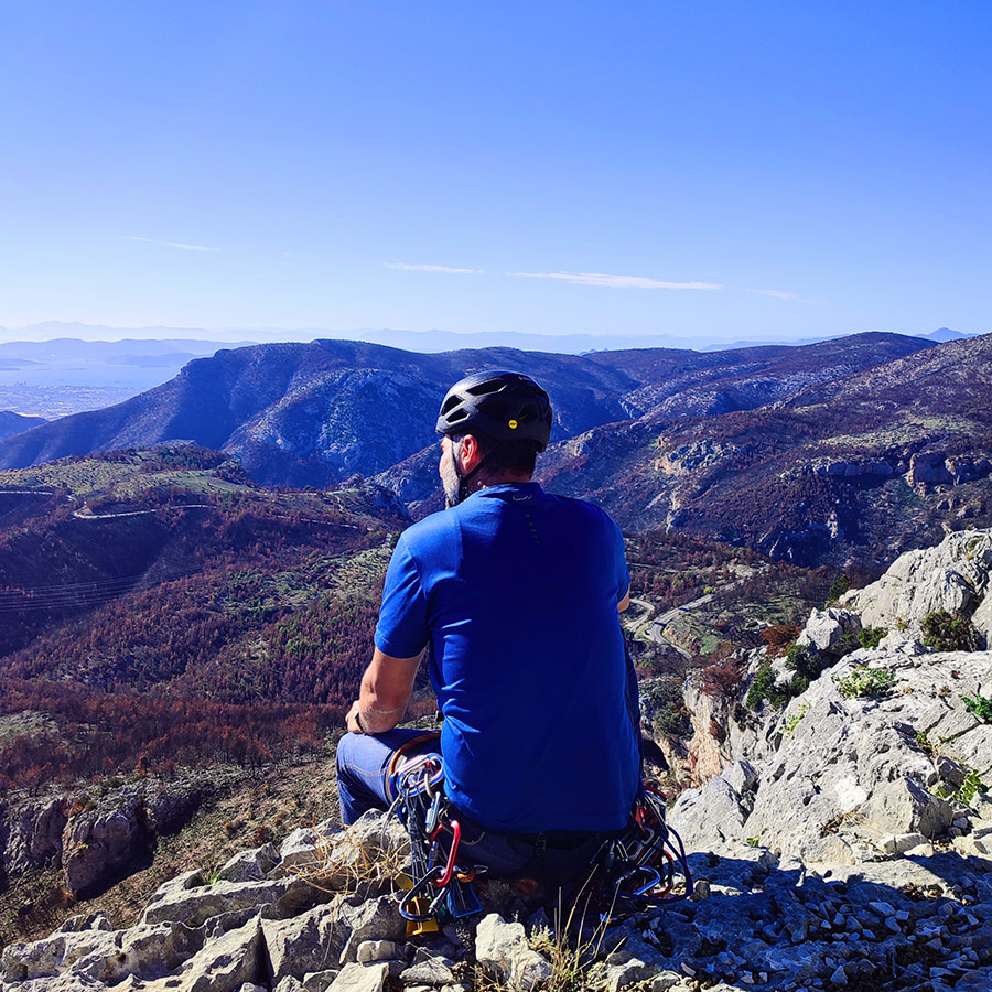
View from the Top
Standing triumphantly atop South Arma is a sensory feast for any climber’s soul. As you conquer the heights, a panorama of unparalleled beauty unfolds before you. To the southeast, the sprawling cityscape of Athens stretches as far as the eye can see. Gaze westward, and the views extend over the historic landscapes of Elefsina and Aspropyrgos, each layering the horizon with tales of ancient and modern Greek history. The vantage point from South Arma not only rewards the physical effort of the climb but also offers a visual symphony, harmonizing the natural wonders of the region with the urban tapestry of Athens.
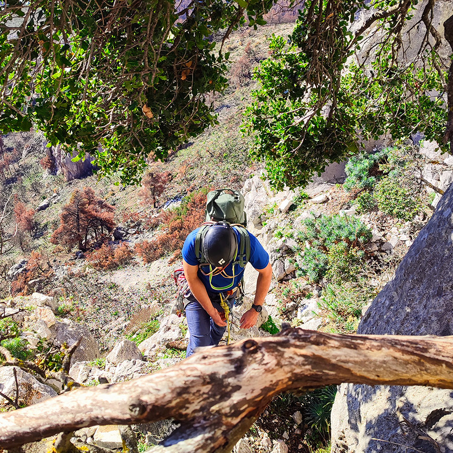
Return
From the top of the rock, we have two options. The first is to abseil down from the route Loxi (Λοξή) (make sure to have 2×60 meters half ropes) or to follow the trail which leads to the beginning of the via Ferrata trail.
Recommended Gear

For this trad climb, I used the following gear:
- Mammut Wall Rider Helmet
- 5 lanyards 60 cm
- 1 lanyard 120 cm
- 4 locking carabiners
- 1 HMS carabiner
- The North Face Verto 27 Backpack
- Petzl Hirundos Harness
- La Sportiva Katana Climbing shoes
- Alpine Quickdraws
- Cordelette for prusik
- 2 x 60 m. rope
- 4 carabiners
- Reverso
- 1 lt of Water
- 1 energy bar
- Friends / Camalots
- Rock Nuts
- Hex Nuts Size 11 x 2 items
Details of the Climb
- Location: Mt. Parnitha – Arma
- Difficulty: VI- UIAA
- Length: 60 meters
- Pitches: 2
- When to Climb: Late Autumn – Early Spring
- Water Features: None
Subscribe & Stay Informed
Enter your email address to follow this blog and receive notifications of new posts by email
Download for free the complete route description and Topo map
- Download the complete Interactive Guidebook in PDF spreads (best for Tablets/Laptops/Desktops)
- Download the complete Interactive Guidebook in PDF single pages (best for Phones)
Support the journey — buy me a coffee
I share these articles and the climbing guidebooks because I love the outdoors, and they’ll always be free. If they’ve helped you, help me keep them coming. Click the button to support my work.
See other outdoor activities in Parnitha:
- Trad Climbing in Arma – Skytali
- Trad Climbing in Kato Flabouri – Klassiki
- Hiking in West Parnitha – Kliston Monastery – Pan’s Cave – Arma
- Training on Mount Parnitha
- Winter Hike on Mount Parnitha
- Climbing in Korakofolia – Parnitha
- Hiking in West Parnitha – Ag. Kiprianos – Koromilia – Alogopetra
- Climbing in Epos Fylis – Parnitha
- Dry Tooling in Rizos’ Cave – Parnitha
- Via Ferrata Arma – Parnitha
- Scrambling and Climbing the Flabouri Ridge
Before you leave this blog check out the following map
Below: This map marks all the mountaineering adventures that have been featured on Olympus Mountaineering so far, including several Sport climbing crags – Select full screen to expand, zoom in for more detail, or click on a marker for a link to the post.

Excellent and well written article thanks!!
LikeLike
Thank you for your kind comment and pleased to know you enjoyed reading the article.
LikeLike