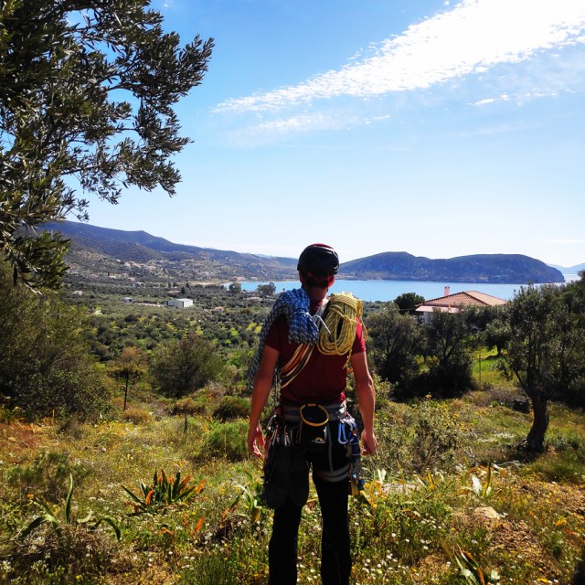
Spring is here, winter mountaineering activities in Greece are almost at the end of the season, and for this reason we decide to return to an area where in the past we have been exploring various climbing possibilities. In fact, last December we climbed two new routes at Dardiza Bay and we had spotted one more rock formation that we wanted to explore.
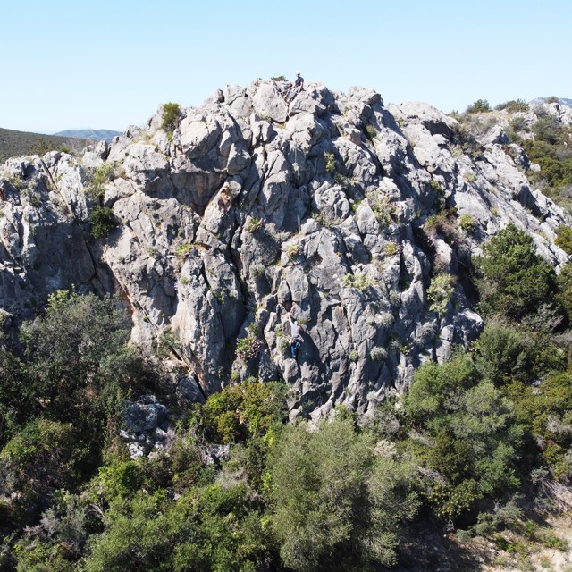
This time, we wanted to explore if we could climb the north face of a rock formation that is located north-west from Dardiza Bay.
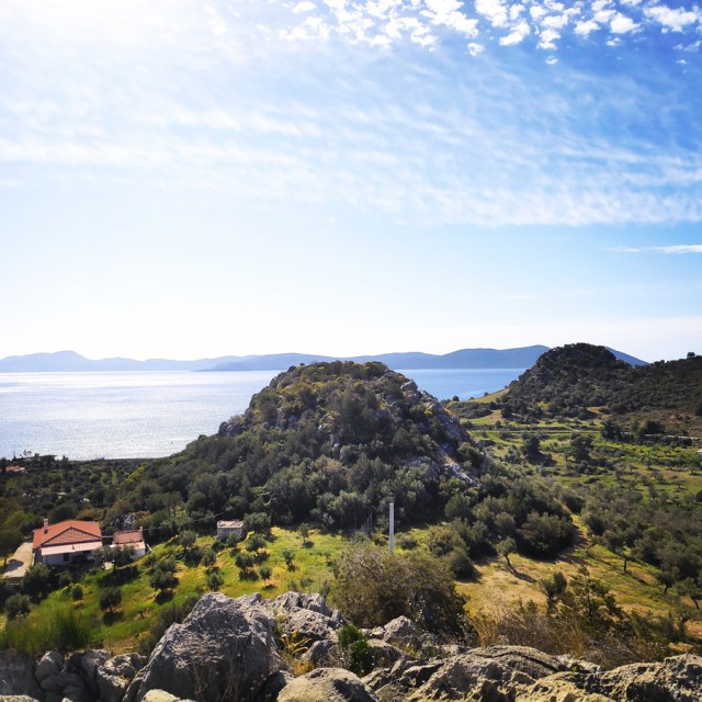
Dardiza bay (3.5 kms from Ermioni) is a pebble shingle beach where many local and visiting Greeks go. Situated alongside the main road, it has a small mobile cantina during high season offering cold drinks and hot snacks.
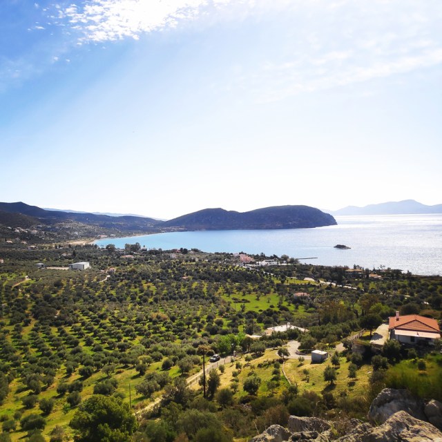
The beach offers stunning views towards the islands of Hydra and Dokos and is close to some of the most important tourist spots in Ermioni, like Kranidi, Kilada, or Porto Heli, which remain unspoilt and beautiful.
First Ascent
In mountaineering, a first ascent (abbreviated to FA in guidebooks) is the first successful, documented attainment of the top of a mountain or the first to follow a particular climbing route. First mountain ascents are notable because they entail genuine exploration, with greater risks, challenges and recognition than climbing a route pioneered by others. The person who performs the first ascent is called the first ascensionist.
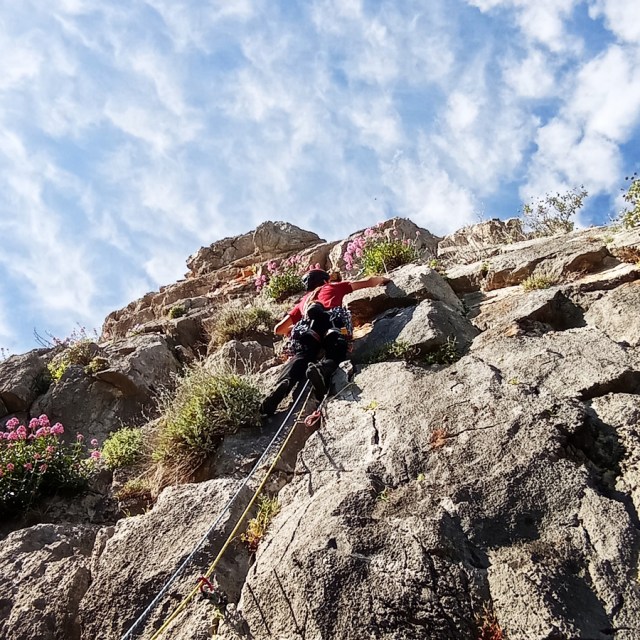
Dardiza Bayby 3 IV UIAA 20 m | Climbing in Dardiza Bay
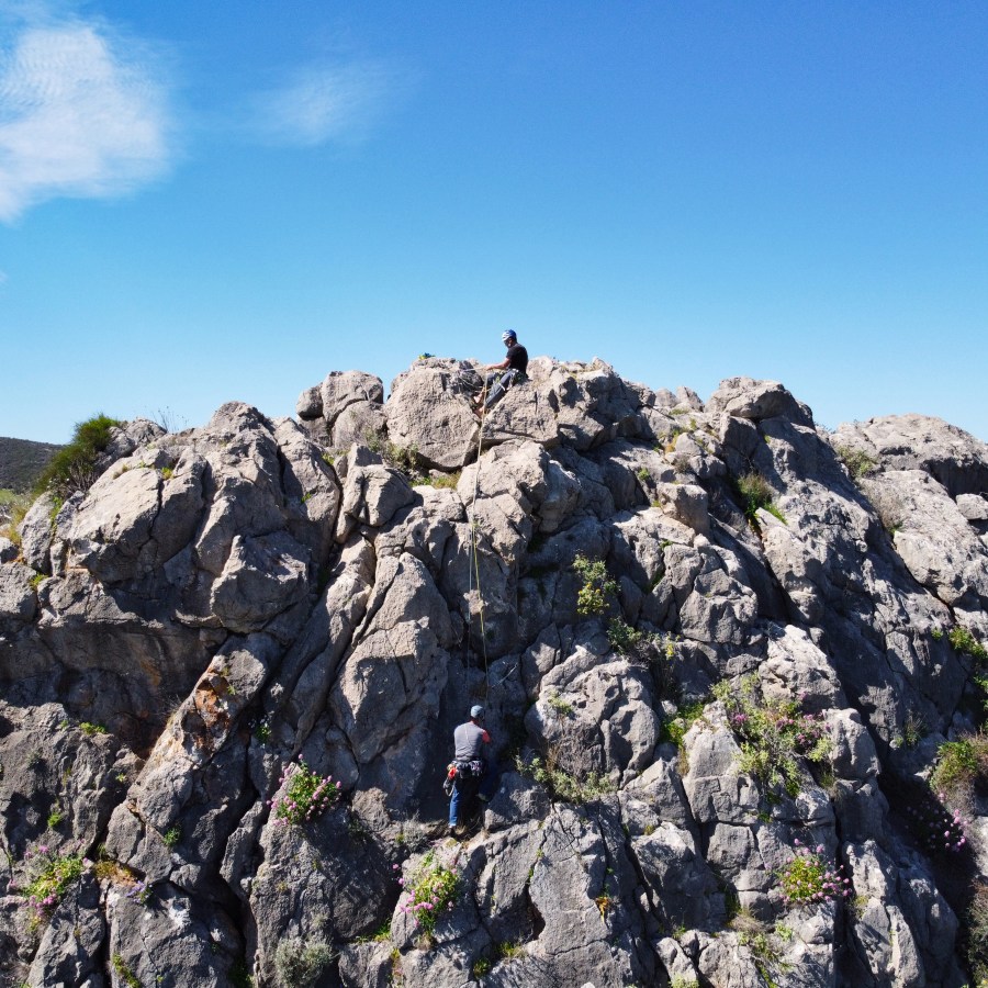
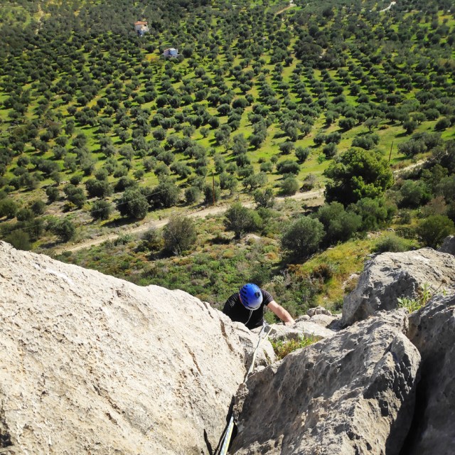
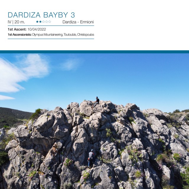
“Dardiza Bayby 3” (IV, 30 m.) first ascent was made on 10/04/2022 by Olympus Mountaineering, C. Toutoutzis and V. Christopoulos. The route is situated in the north face of the rock formation which is located north-west from Dardiza Bay, just few kilometers far from Ermioni. The route can be described as an “introduction” to traditional climbing with a single pitch length and of maximum grade IV UIAA.

Download for free the complete route description and Topo map
- Download the complete Interactive Guidebook in PDF spreads (best for Tablets/Laptops/Desktops)
- Download the complete Interactive Guidebook in PDF single pages (best for Phones)


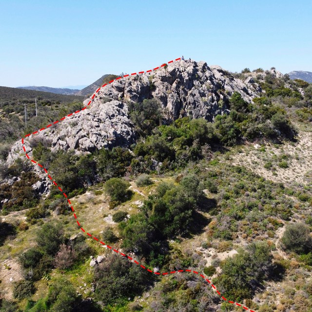
Dardiza Bayby 3 IV UIAA 20 m | Topographic Map
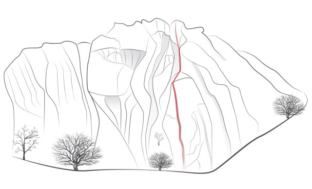
If you are going to climb alpine rock faces, you will need the most detailed information possible about the rock and the route. All this can be found on a topographic map: This is a graphic representation of a climbing route and can usually be found in a guidebook or on certain websites. The lead climber should always have the topographic map at hand when on the rock face.
Like any map, a topographic map uses symbols to represent information about the rock. Climbers can orient themselves on the basis of these standardised Symbols. Illustrations indicate the climbing direction, the length of each pitch and the number and type of belay points. Further indicators that can help with orientation include a logical route, the rock quality as well notable features on the rock.
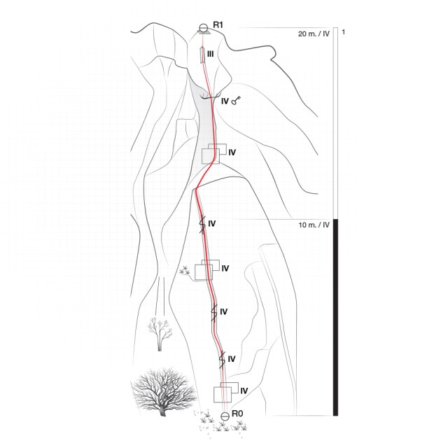
Bellow a topo of the route Dardiza Bayby 3 IV 20 m.
General route information
“Dardiza Bayby 3” (IV, 30 m.) first ascent was made on 10/04/2022 by Olympus Mountaineering, C. Toutoutzis and V. Christopoulos. The route is situated in the north face of the rock formation which is located north-west from Dardiza Bay, just few kilometers far from Ermioni. The route can be described as an “introduction” to traditional climbing with a single pitch length and of maximum grade IV UIAA.
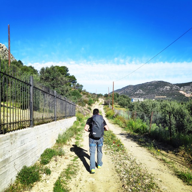
Approach
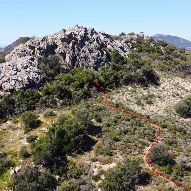
The route is located in the rock formation north west of Dardiza Bay, municipality of Ermionida, Argolis – Greece.
Its orientation is north. Approaching R0 requires 5 minutes of hiking on an easy trail.
- Parking spot: 37.403527, 23.256539
- Beginning of the route: 37.403620, 23.255125


Route description
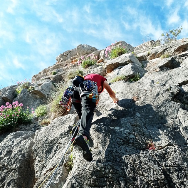
R0 – R1 | IV UIAA – 20 m.
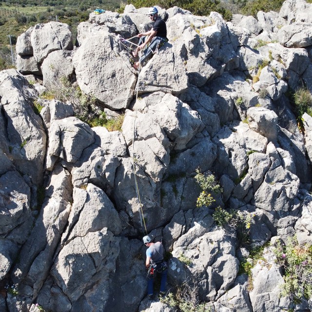
Dardiza Bayby 3 is a single pitch (20 m.) and starts right from the base of the north side of the rock (37.403620, 23.255125).
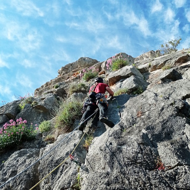
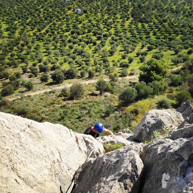
The first part of this pitch is an easy slab UIAA IV. After few moves we reach the crack and for about 5 meters we follow the crack of a maximum difficulty of UIAA IV. This part of the climb can be protected well with nuts, friends or slings. As soon we exit from the crack, we reach a ledge and right above us is a small overhang and this is the crux of Dardiza Bayby 3.
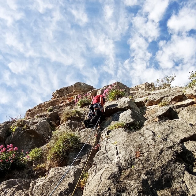
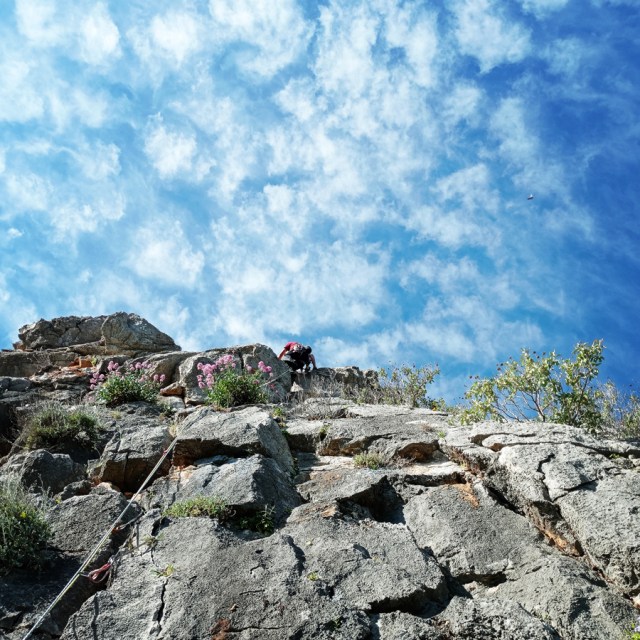
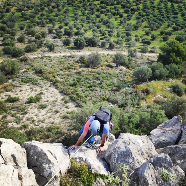
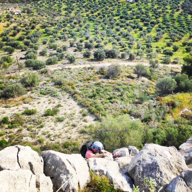
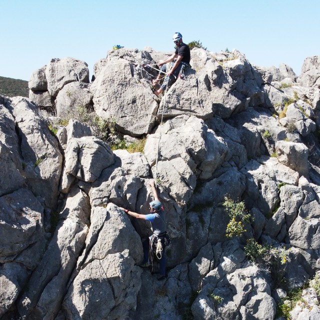
The crux can be well protected and although the overhang might intimidate newcomers in trad climbing, there are good holds and can be climbed easily. Once we climb over the overhand, we follow the ridge UIAA III for about 3-4 meters and we look for one of the large boulders in order to establish the ancor point.
Make a belay with a large sling or kevlar cordelette and an additional nut or friend on one of the obvious boulders. The belay position is very good and comfortable and with a unique view towards the islands of Hydra and Dokos.

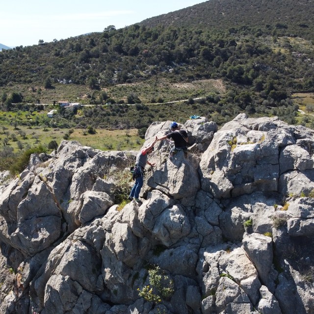
Climbing as Second and reaching the top of the Rock


From R1, we can also clearly see the following areas of climbing interest:
- Katafyki Gorge
- Pillars of the Wind
- Mount Didimo
- “Monsters of the Wind” Mount Ortholithi
- “The long run” Mount Ortholithi
- Castle Thermisia
- Dardiza Crag
- Dardiza Bayby 1
- Dardiza Bayby 2
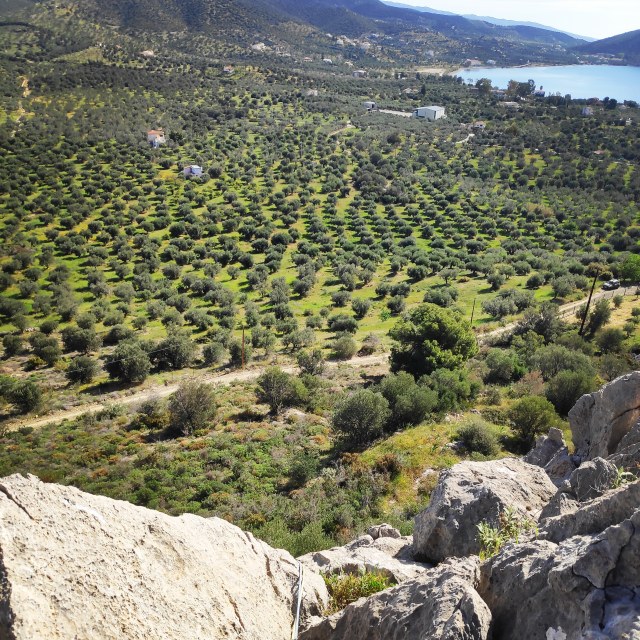
View from the Top
Once we have reached the top of the rock, we came across the stunning view towards Hydra island, and the overall region of Ermionida. From the top, we could clearly see Mount Didimo, Pillars of the Wind and Mount Ortholithi.

Return
Our return route starts from the top of the route. We initially go south and we follow the ridge towards the east. We have to downclimb some boulders. The descent is obvious and easy to identify.
The descent takes about 5 minutes.
Recommended Gear
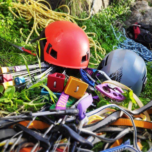
For this trad climb, I used the following gear:
- Mammut Wall Rider Helmet
- Simond Alpinism 22 l backpack
- 5 lanyards 60 cm
- 1 lanyard 120 cm
- 4 locking carabiners
- 1 HMS carabiner
- Mammut Ophir Harness
- Simond Climbing shoes
- BD HotWire Quickdraws
- Alpine Quickdraws
- Cordelette for prusik
- 2 x 60 m. rope
- 4 carabiners
- Reverso
- 1.5 lt of Water
- 1 energy bar
- Friends / Camalots
- Rock Nuts
Details of the Climb
- Location: Dardiza Bay
- Starting Point: Dardiza Bay
- Ending Point: Dardiza Bay
- Trail Signs: No
- Difficulty: Medium
- When to Climb: Late Autumn, Winter, Early Spring
- Water Features: None
Download for free the complete route description and Topo map
- Download the complete Interactive Guidebook in PDF spreads (best for Tablets/Laptops/Desktops)
- Download the complete Interactive Guidebook in PDF single pages (best for Phones)
Before you leave this blog check out the following map
Below: This map marks all the mountaineering adventures that have been featured on Olympus Mountaineering so far, including several Sport climbing crags – Select full screen to expand, zoom in for more detail, or click on a marker for a link to the post.

Pingback: Dardiza Bayby 4 V- UIAA 20 m. | Trad Climbing in Dardiza Bay – Ermioni – Olympus Mountaineering
Pingback: Dardiza Bayby 5 IV+ UIAA 20 m. | Trad Climbing in Dardiza Bay – Ermioni – Olympus Mountaineering
Pingback: Dardiza Bayby Shitter V- UIAA 20 m. | Trad Climbing in Dardiza Bay – Ermioni – Olympus Mountaineering
Pingback: Climbing in Ermionida, Argolis (Greece) Guidebook Edition 2022 – Olympus Mountaineering
Pingback: The Ultimate Guide of Trad Climbing in Ermionida, Argolis – Greece – Olympus Mountaineering
Pingback: Climbing in Ermionida, Argolis (Greece) Guidebook Edition 2023 – Olympus Mountaineering
Pingback: Climbing in Pleides Crag – Katafyki Ravine – Ermioni – Olympus Mountaineering
Pingback: Climbing in Charamos Crag – Kandia – Argolis, Greece (Update 2023) – Olympus Mountaineering
Pingback: Climbing in Pleiades Crag – Katafyki Ravine – Ermioni – 2025 Edition – Olympus Mountaineering
Pingback: Climbing in Ermionida, Argolis (Greece) Guidebook Edition 2025 – Olympus Mountaineering