Ever since I started my outdoor adventures, and especially climbing, I was always excited to repeat famous climbing routes that were first ascended by legendary greek and not only climbers.
All these years, I have been on several mountain peaks and lakes, I have climbed traditional routes, I’ve pushed my limits in sport climbing, I trained in Dry Tooling and of course I have done my favourite -of all- activity, winter mountaineering.
Having acquired all the knowledge (via dedicated mountaineering and climbing schools) and extensive experience (via the expeditions I have participated), it was about time to have a first ascent too.

In mountaineering, a first ascent (abbreviated to FA in guidebooks) is the first successful, documented attainment of the top of a mountain or the first to follow a particular climbing route. First mountain ascents are notable because they entail genuine exploration, with greater risks, challenges and recognition than climbing a route pioneered by others. The person who performs the first ascent is called the first ascensionist.
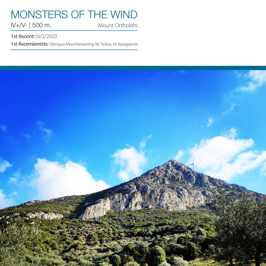
Monsters of the Wind IV+/V- UIAA 500 m. – First Ascent of the South-West Ridge of Mount Ortholithi
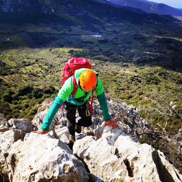
On February 16, 2020, me a.k.a. Olympus Mountaineering, together with M. Tsokas and M. Karagiannis we have climbed the entire South-West ridge of Mount Ortholithi.
Download for free the complete route description and Topo map
- See first publication here: South-West ridge of Mount Ortholithi
- Download the complete route description and Topo map in PDF (english)
- Κατέβασε το αρχείο με όλη την περιγραφή και το σχεδιάγραμμα της διαδρομής σε PDF (ελληνικά)

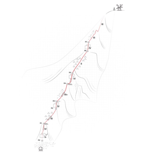
Monsters of the Wind IV+/V- UIAA 500 m. | Topographic map
If you are going to climb alpine rock faces, you will need the most detailed information possible about the rock and the route. All this can be found on a topographic map: This is a graphic representation of a climbing route and can usually be found in a guidebook or on certain websites. The lead climber should always have the topographic map at hand when on the rock face.
Like any map, a topographic map uses symbols to represent information about the rock. Climbers can orient themselves on the basis of these standardised Symbols. Illustrations indicate the climbing direction, the length of each pitch and the number and type of belay points. Further indicators that can help with orientation include a logical route, the rock quality as well notable features on the rock.
Bellow a topo of the route Monsters of the Wind IV+/V- 500 m.
General route information
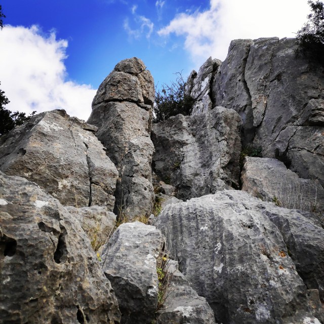
“Monsters of the Wind” (IV+/V-, 500 m.) follows the south-western ridge of Mount Ortholithi, offering an atmospheric climb overlooking the Saronic Gulf and Ermionida. The route can be described as an “adventure route” with great potential for free route selection. The route also does not present any difficulties in terms of safety with the use of temporary protection.
Approach
From Athens one needs to drive towards Epidavros and from there should follow the road to Ermionida. Just after Trachia village, should follow the road to Karatzas village and from there to Choriza.
Total distance from Athens: 150 km
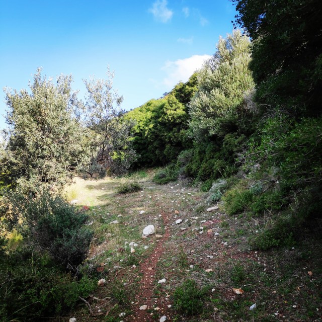
About 2 km before arriving in Choriza ( 37.520145, 23.233478 ), there is a dirt road where we can leave the car and start the approach hike.
The approach hike is an easy hike of about 10 minutes.


Route description
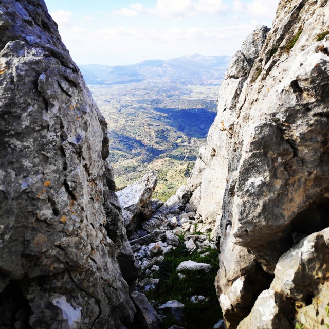
R0 – R1
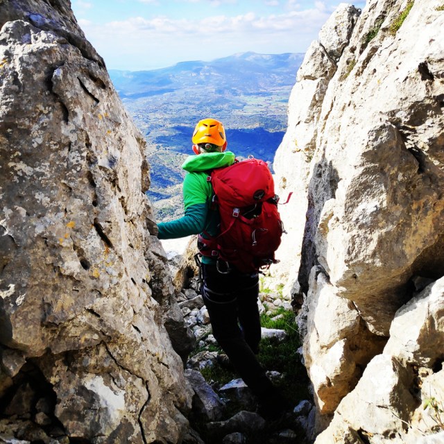
The route starts with the first pitch (35 m.) exactly at the base of the south-west ridge (37.525356, 23.234392) of a well-secured IV slab. Shortly before the slab is climbed, and as we enter a couloir, there are 3 meters of climb with grade IV + / V- and with a large loose boulder (attention!). The couloir is a bit shabby with loose rocks and the difficulty is IV UIAA. Having completed the couloir, we exit onto a ledge with rocks and make a belay with a large sling or a kevlar cordelette.


R1 – R2
From R1 to R2, the degree of difficulty is significantly reduced and until we find a characteristic slab of IV we can proceed without any rope protection.

R2 – R3
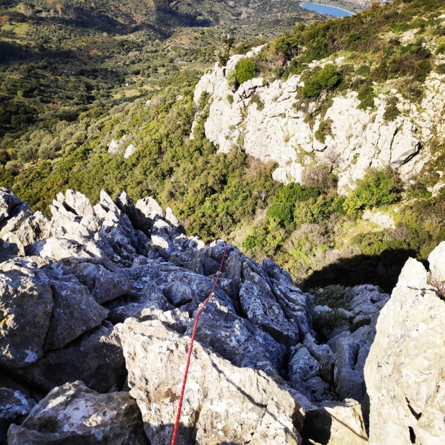
From R2 to R3, there is a IV UIAA grade passage on a slab about 4-5 meters tall. This passage is not very exposed and with a little care we reach a grassed slope. At this point, the view towards the Argosaronic sea begins to become unique.

R3 – R4
From R3 to R4, we follow (without being roped) the aesthetic ridge with stunning view to the Argosaronikos (east) mainly with scrambling of III+ grade. This part is almost 150 meters up to an obvious ledge, and it has a fairly low degree of danger and difficulty.

R4 – R5
From R4 to R5, there is another IV grade pass that starts as a dihedral (the first 3 m.) and ends to a rock wall/slab of about 4-5 meters. This passage can be well secured and protected.


R5 – R6
From R5 to R6, the terrain becomes very easy with a slope of up to 40 °, and is essentially a fairly uphill walk (with minimal scrambling).
R6 – R7
From R6 to R7, we’ll find a short slab (3m.) of IV degree difficulty that can eventually be climbed unroped (for experiences limbers), because it only has 2 IV degree movements.


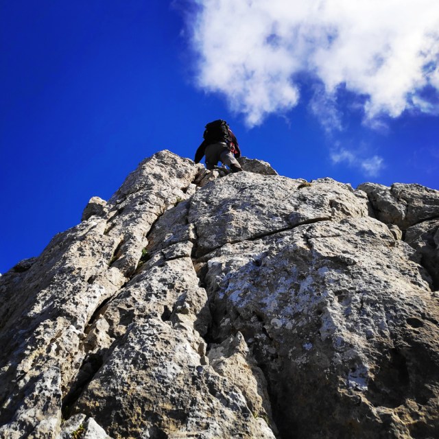
R7 – Peak
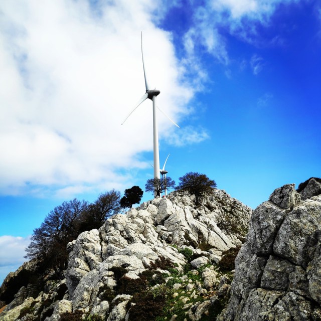
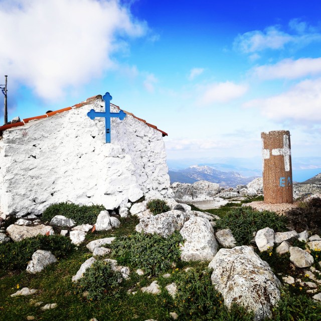
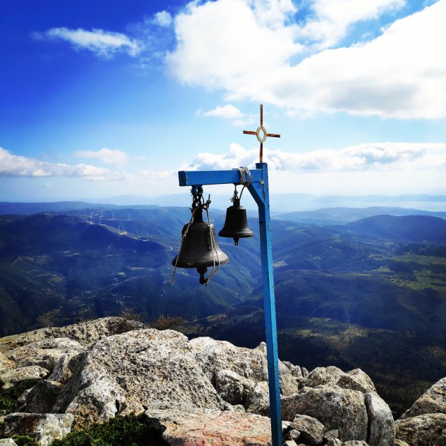
Having reached R7, essentially the route is complete and we have about 90 m of hiking and scrambling of maximum III degree. At the top, we will find the old church of Profitis Elias, but also the “Monsters of the Wind” (wind turbines)
Return
The return starts from the peak and aims to descend to the village of Chora.
We start with an eastern course for about 450 m. and at point 37.527323, 23.247323, we turn right and descend to the couloir that leads us to low vegetation up to the goat trails. From there, we follow the goat trails that lead us to Chora village.
The descent takes about 75 minutes.
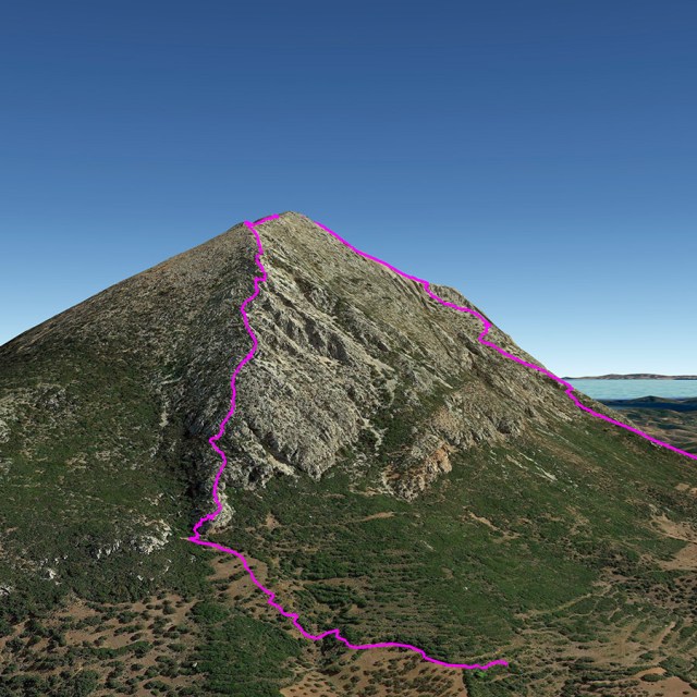
Bellow you can see the route we have followed on a map and 3D:


Recommended Gear
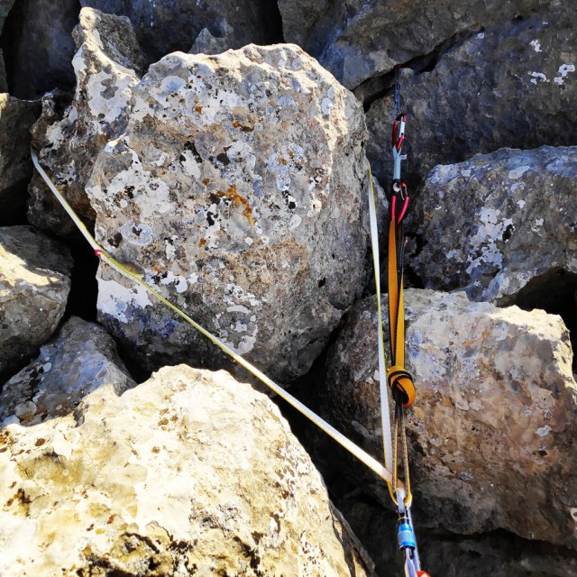
For this multi-pitch climb, I used the following gear:
- Mammut Wall Rider Helmet
- Simond 22 lt. Back pack
- 5 lanyards 60 cm
- 1 lanyard 120 cm
- 4 locking carabiners
- 1 HMS carabiner
- Petzl Altitude Harness
- Simond Climbing shoes
- 6 Quickdraws
- Cordelette for prusik
- 60 m. rope
- 4 carabiners
- Reverso
- 1.5 lt of Water
- 1 energy bar
- Rock Nuts
Details of the Climb
- Location: Ortholithi Mountain
- Starting Point: Choriza
- Ending Point: Choriza
- Trail Signs: No
- Minimum Elevation: 528 m
- Maximum Elevation: 1.105 m.
- Total Distance: 3.5 km
- Difficulty: Medium
- When to Hike: Autumn, Winter, Spring
- Water Features: None
Download for free the complete route description and Topo map
- See first publication here: South-West ridge of Mount Ortholithi
- Download the complete route description and Topo map in PDF (english)
- Κατέβασε το αρχείο με όλη την περιγραφή και το σχεδιάγραμμα της διαδρομής σε PDF (ελληνικά)

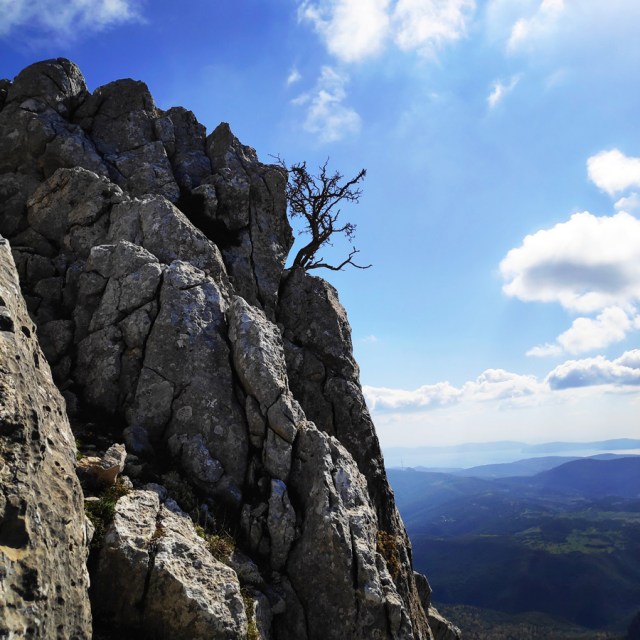
Congratulations on achieving a first ascent! I love the name, “monsters of the wind’ after the wind turbines. We have a bunch of turbines in southern Alberta and I now have a cool new name for them! Your route looks like it was super fun and is described really well. I love the pic of the lone tree on the cliff in R5-R6. Thanks so much for sharing!
LikeLike
Thank you very much for the nice comment and I am pleased to know you like the name and the route too.
It is indeed a fun and not difficult route that offers really nice views.
LikeLike
Pingback: Diaberis Pothos | Trad Climbing at the top of Profitis Elias – Asini – Olympus Mountaineering
Pingback: The Ultimate Guide of Climbing in Argolis, Greece – Olympus Mountaineering
Pingback: Simond Alpinism 22 Backpack – Long Term Review – Olympus Mountaineering
Excellent route descriptions, pictures, and general information. The rock looks fun and quite sharp in places. I can feel the enthusiasm for rock climbing and outdoor appreciation through your words. If you keep providing articles, I will keep treading them. Rock on!
LikeLike
Thank you for your kind comment and for reading through the Olympus Mountaineering blog.
It was indeed fun to climb this rock and stay tuned for upcoming posts.
Again thank you for your kind comment.
LikeLiked by 1 person
Pingback: Climbing in Dardiza – Ermioni – Argolis | Greece – Olympus Mountaineering
Pingback: The Ultimate Guide of Climbing in Ermionida, Argolis – Greece – Olympus Mountaineering
Pingback: Camp Mach Express Dyneema Quickdraw Review – Olympus Mountaineering
Pingback: The Long Run IV+/V- UIAA 900 m.| Climbing the South-East Ridge of Mount Ortholithi – Olympus Mountaineering
Pingback: Souzaki Mouzaki V- UIAA 50 m. | Climbing in Kouverta Beach – Ermioni – Olympus Mountaineering
Pingback: Dardiza Bayby 1 V- UIAA 30 m. | Trad Climbing in Dardiza Bay – Ermioni – Olympus Mountaineering
Pingback: Dardiza Bayby 2 IV UIAA 30 m. | Trad Climbing in Dardiza Bay – Ermioni – Olympus Mountaineering
Pingback: Monsters of the Wind – A Mixed Climbing Attempt of the South-West Ridge – Mount Ortholithi – Olympus Mountaineering
Pingback: Dardiza Bayby 3 IV UIAA 20 m. | Trad Climbing in Dardiza Bay – Ermioni – Olympus Mountaineering
Pingback: Dardiza Bayby 4 V- UIAA 20 m. | Trad Climbing in Dardiza Bay – Ermioni – Olympus Mountaineering
Pingback: Dardiza Bayby 5 IV+ UIAA 20 m. | Trad Climbing in Dardiza Bay – Ermioni – Olympus Mountaineering
Pingback: Dardiza Bayby Shitter V- UIAA 20 m. | Trad Climbing in Dardiza Bay – Ermioni – Olympus Mountaineering