The first time I visited mount Ortholithi was in 2015 and I was really fascinated by this mountain. Although, in that first ascent I hiked up to the chapel of Saint Elias, I particularly liked to be on the top of mount Ortholithi. Since then, I have been a couple of more times either hiking or climbing. Last year, February 2020, just before the first lockdown in Greece (covid-19), I had the chance to go and first ascent the South-West ridge via a route that I named as “Monsters of the Wind“.
A year later, once again, mount Ortholithi “invited” me again, but this time, I climbed to the top via the South-East ridge, via a route that was firstly ascent by Jim Titt and Hans Weninger.

In mountaineering, a first ascent (abbreviated to FA in guidebooks) is the first successful, documented attainment of the top of a mountain or the first to follow a particular climbing route. First mountain ascents are notable because they entail genuine exploration, with greater risks, challenges and recognition than climbing a route pioneered by others. The person who performs the first ascent is called the first ascensionist.
The Long Run IV+/V- UIAA 900 m. – Climbing of the South-East Ridge of Mount Ortholithi
Most probably in, 2001, Jim Titt and Hans Weninger climbed the entire South-East ridge of Mount Ortholithi, though, besides a mention on the climbing guide of J. Titt and a mention on the climbing guide of H. Weninger, we do not have any further info.
Therefore, I have decided to provide a full description with photos and a topo of this great ridge.
Download for free the complete route description and Topo map
- Download the complete route description and Topo map in PDF (english)
- Κατέβασε το αρχείο με όλη την περιγραφή και το σχεδιάγραμμα της διαδρομής σε PDF (ελληνικά)

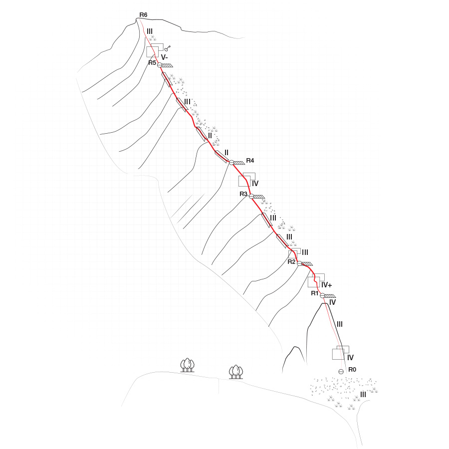
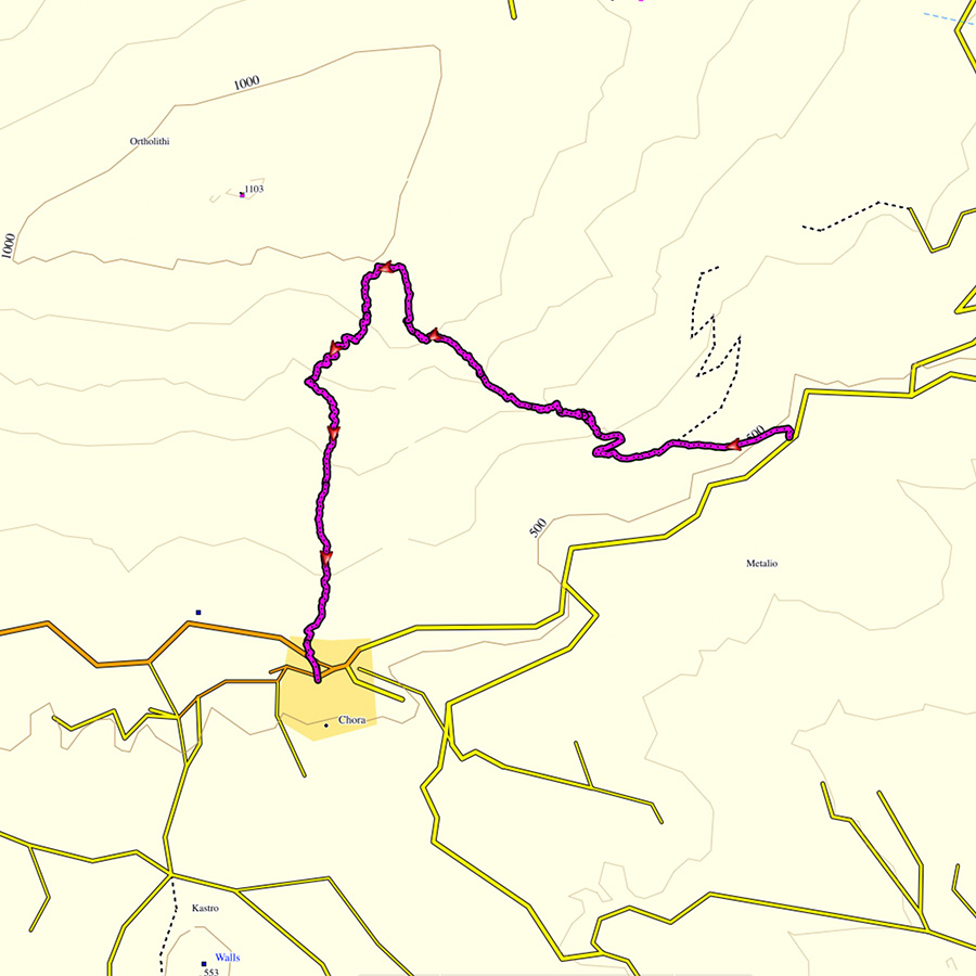
The Long Run IV+/V- UIAA 900 m. | Topographic map
If you are going to climb alpine rock faces, you will need the most detailed information possible about the rock and the route. All this can be found on a topographic map: This is a graphic representation of a climbing route and can usually be found in a guidebook or on certain websites. The lead climber should always have the topographic map at hand when on the rock face.
Like any map, a topographic map uses symbols to represent information about the rock. Climbers can orient themselves on the basis of these standardised Symbols. Illustrations indicate the climbing direction, the length of each pitch and the number and type of belay points. Further indicators that can help with orientation include a logical route, the rock quality as well notable features on the rock.
Bellow a topo of the route The Long Run IV+/V- 900 m.
General route information
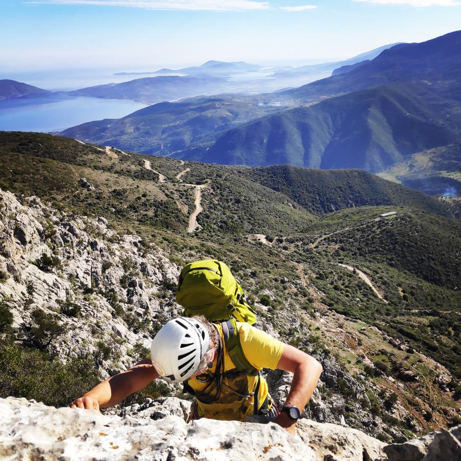
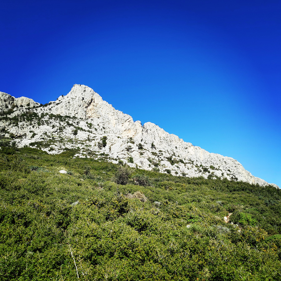
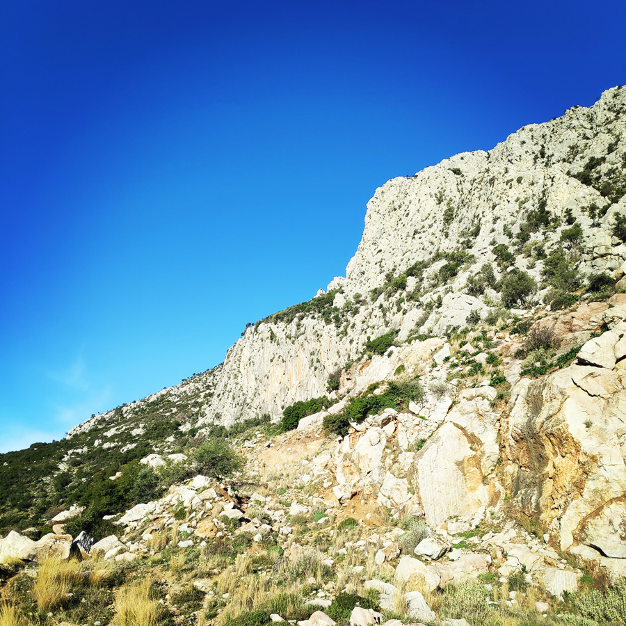
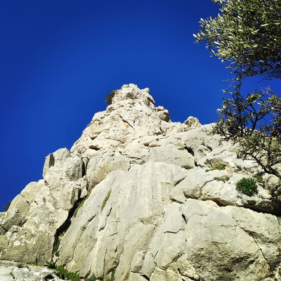
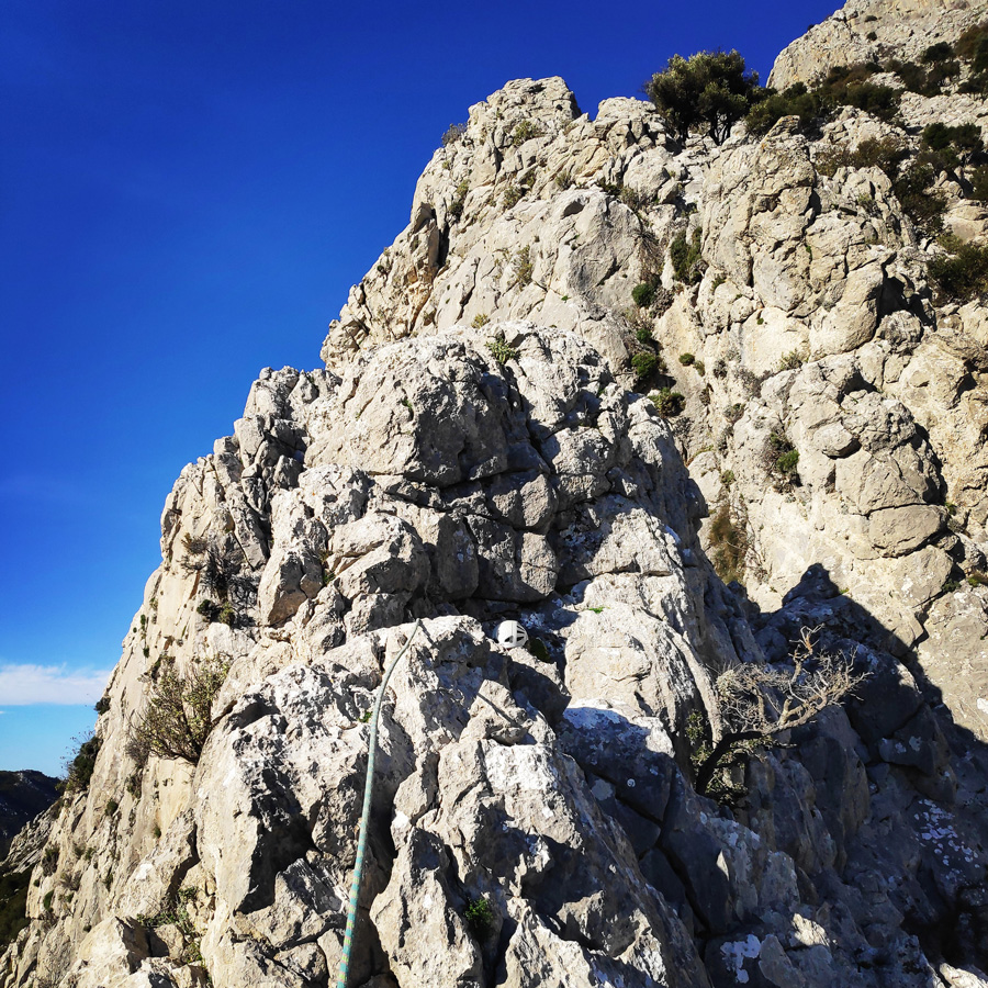
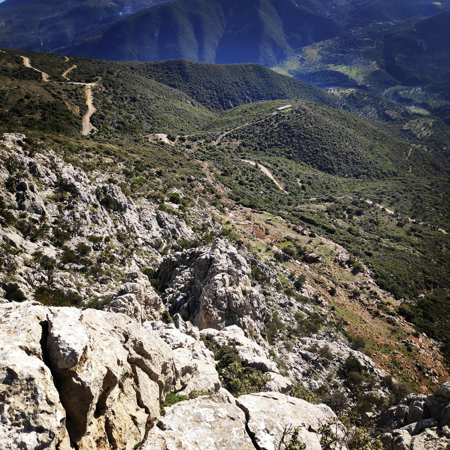
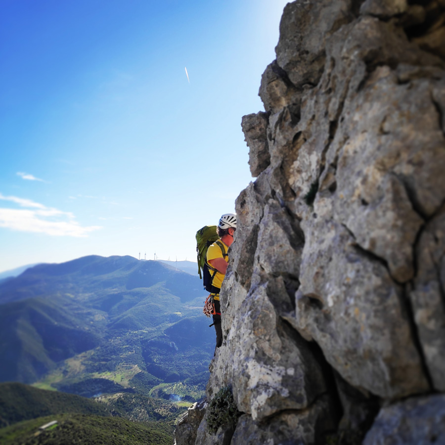
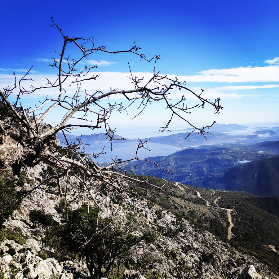
“The Long Run” (IV+/V-, 900 m.) first ascent was most probably in 2001 by legendary climbers Jim Titt and Hans Weninger. The route follows the south-eastern ridge of Mount Ortholithi, offering an atmospheric climb overlooking the Saronic Gulf and Ermionida. The route can be described as an “adventure route” with great potential for free route selection and does not present any real climbing difficulties, with the exception of several parts of loose rocks.
Approach
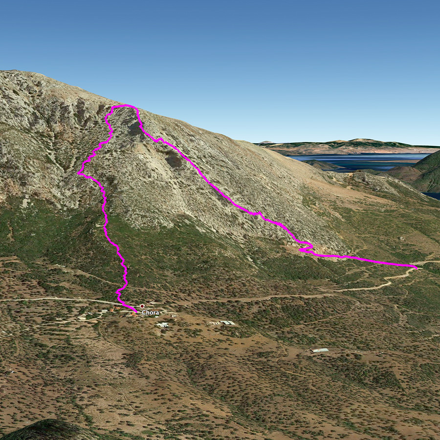
From Athens one needs to drive towards Epidavros and from there should follow the road to Ermionida. Just after Trachia village, should follow the road to Karatzas village and from there to Choriza.
Total distance from Athens: 150 km
About 1,2 km after arriving in Choriza ( 37.523801, 23.258523 ), we can leave the car and start the approach hike.
The approach hike is an easy hike of about 10 minutes.


Support the journey — buy me a coffee
I share these articles and the climbing guidebooks because I love the outdoors, and they’ll always be free. If they’ve helped you, help me keep them coming. Click the button to support my work.

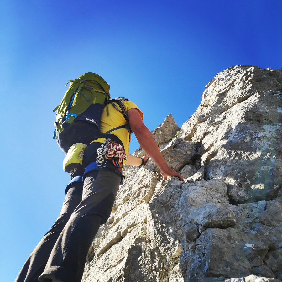
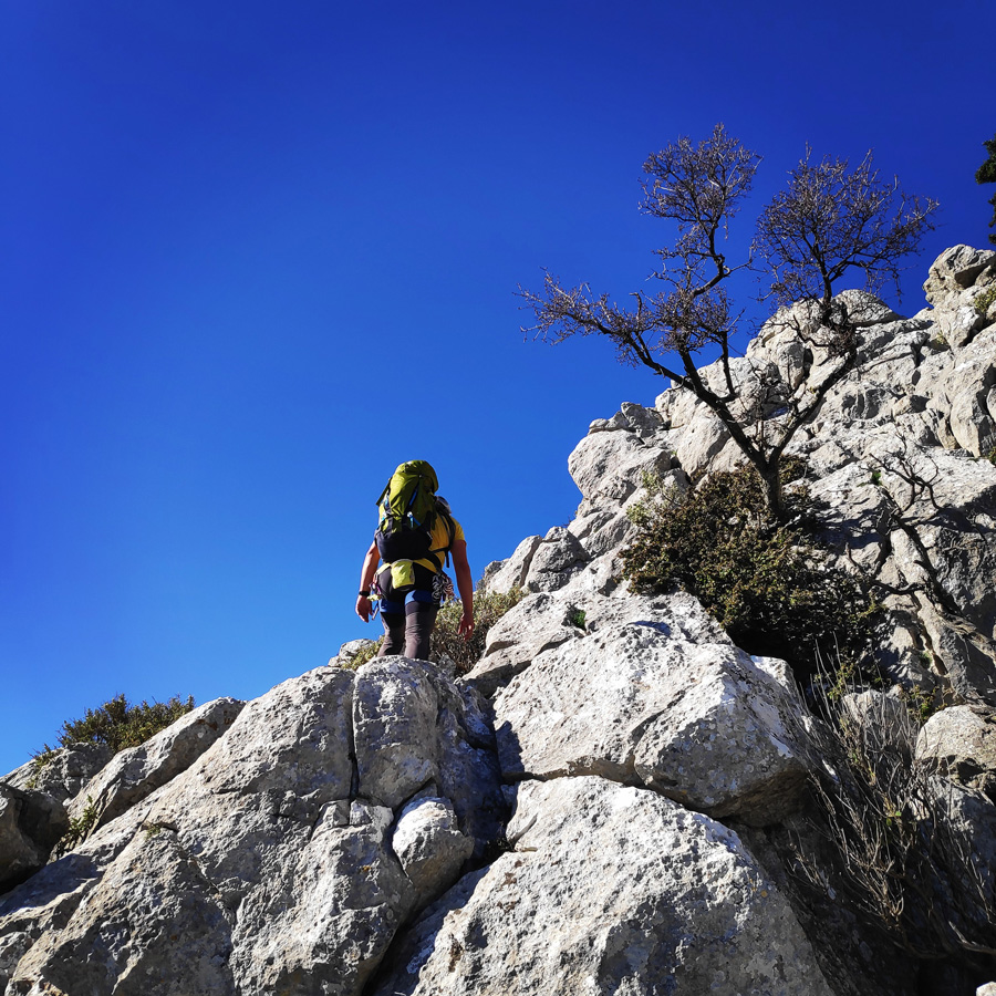
Route description
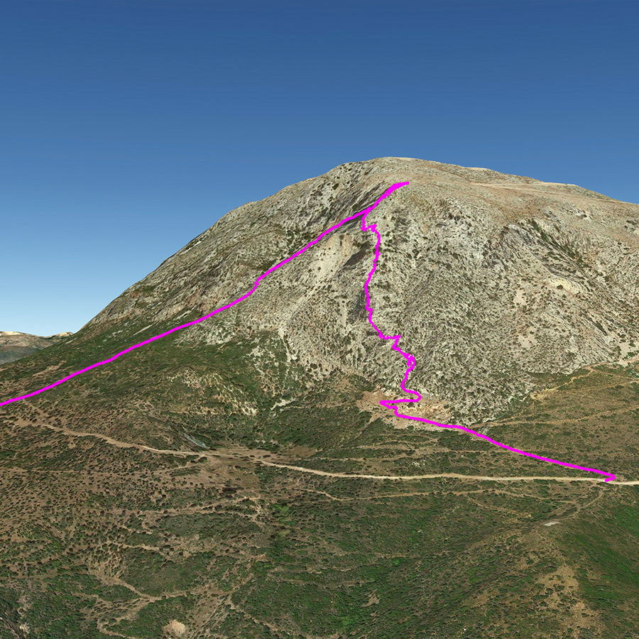
R0 – R1
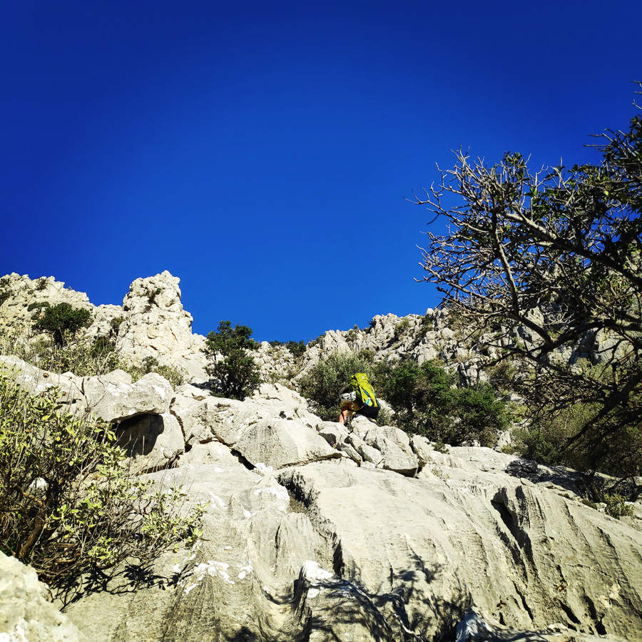
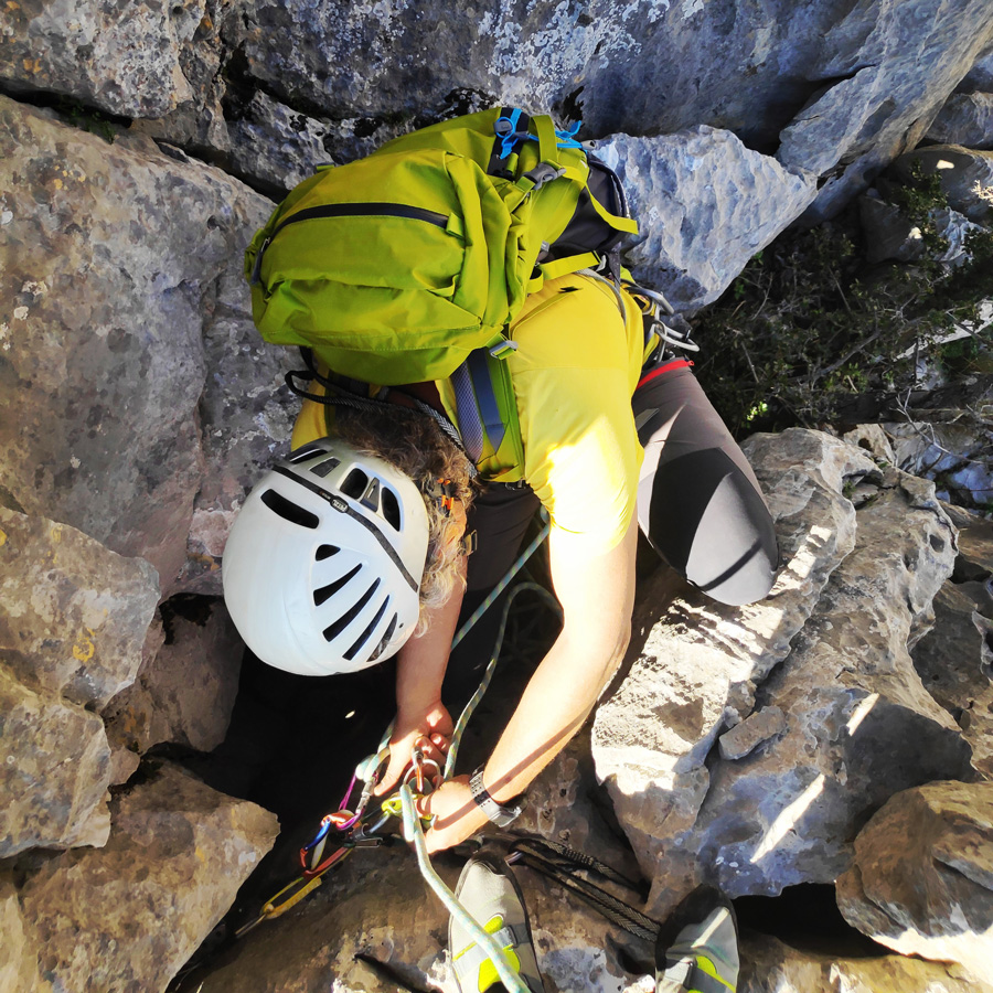
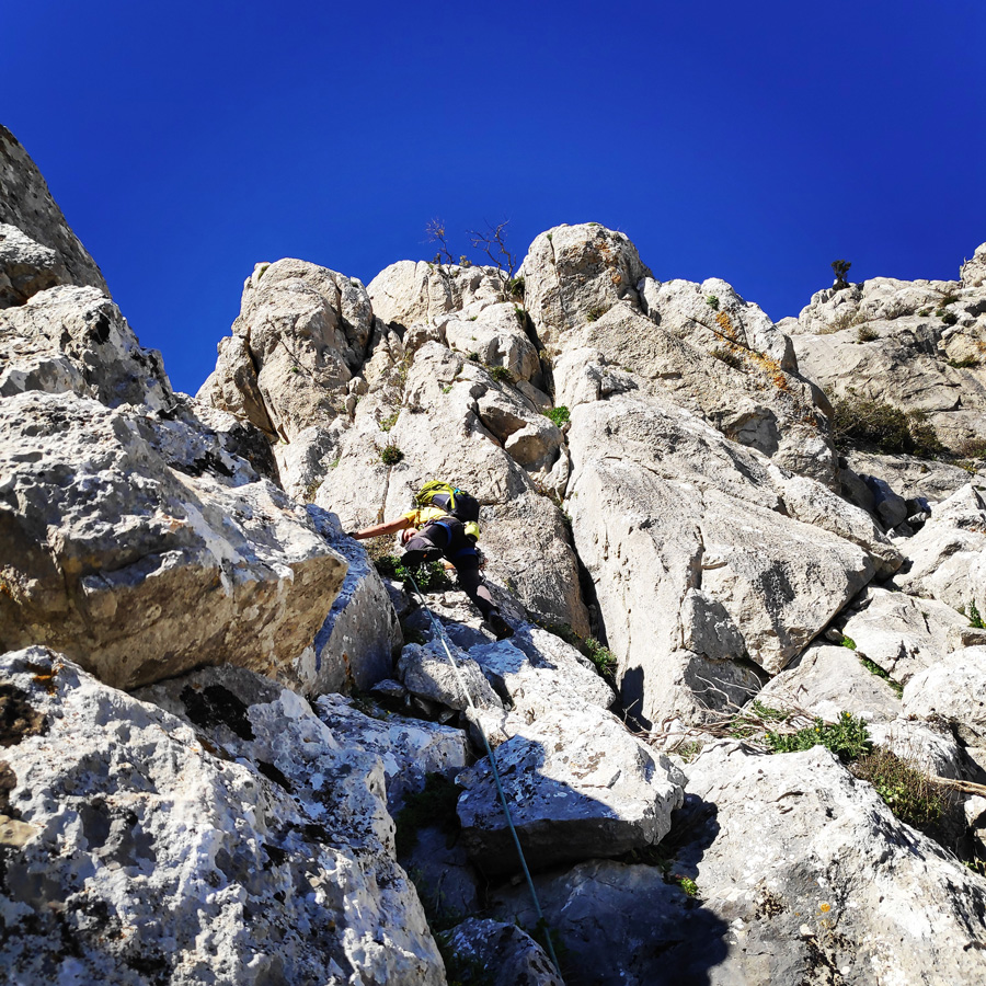
The route starts with the first pitch (30 m.) exactly at the base of the south-east ridge (37.523737, 23.253851) on a IV UIAA slab that although is easy to protect we have to pay attention to the various loose blocks that are handing above us. Once we pass the first buttress, we continue on top of the ridge III UIAA and on our right we find a ledge, but we continue onto the ridge and specifically we pass a characteristic IV UIAA boulder.
Having passed through the characteristic boulder, we reach a ledge with rubbles and we create a belay with a large sling or a kevlar cordelette.

R1 – R2
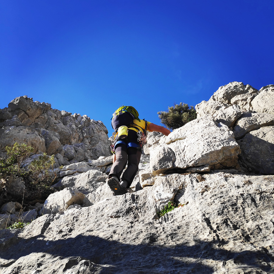
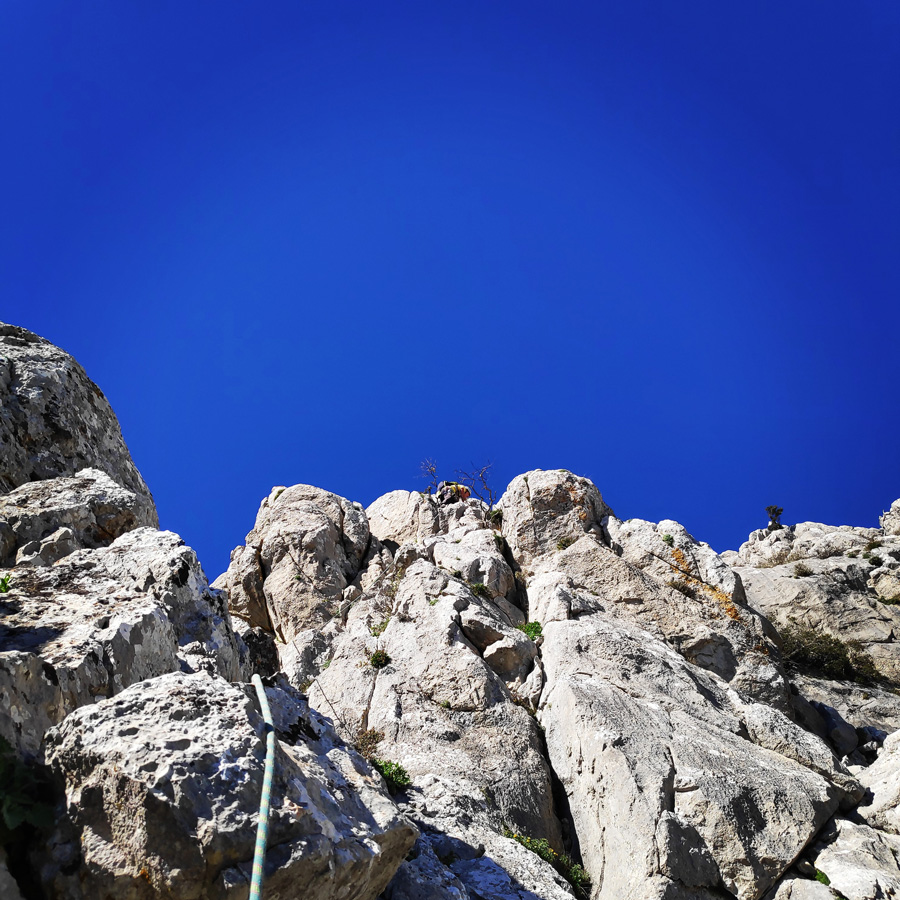
From R1 to R2, we climb on a slab IV + UIAA for about 10 meters. Once we pass this slab, we continue on the ridge. At this point the ridge is about III UIAA and does not present any particular difficulty. At about 50 m. we belay in a characteristic lower point of the ridge.


Explore all outdoor activities in a convenient list view here
R2 – R3
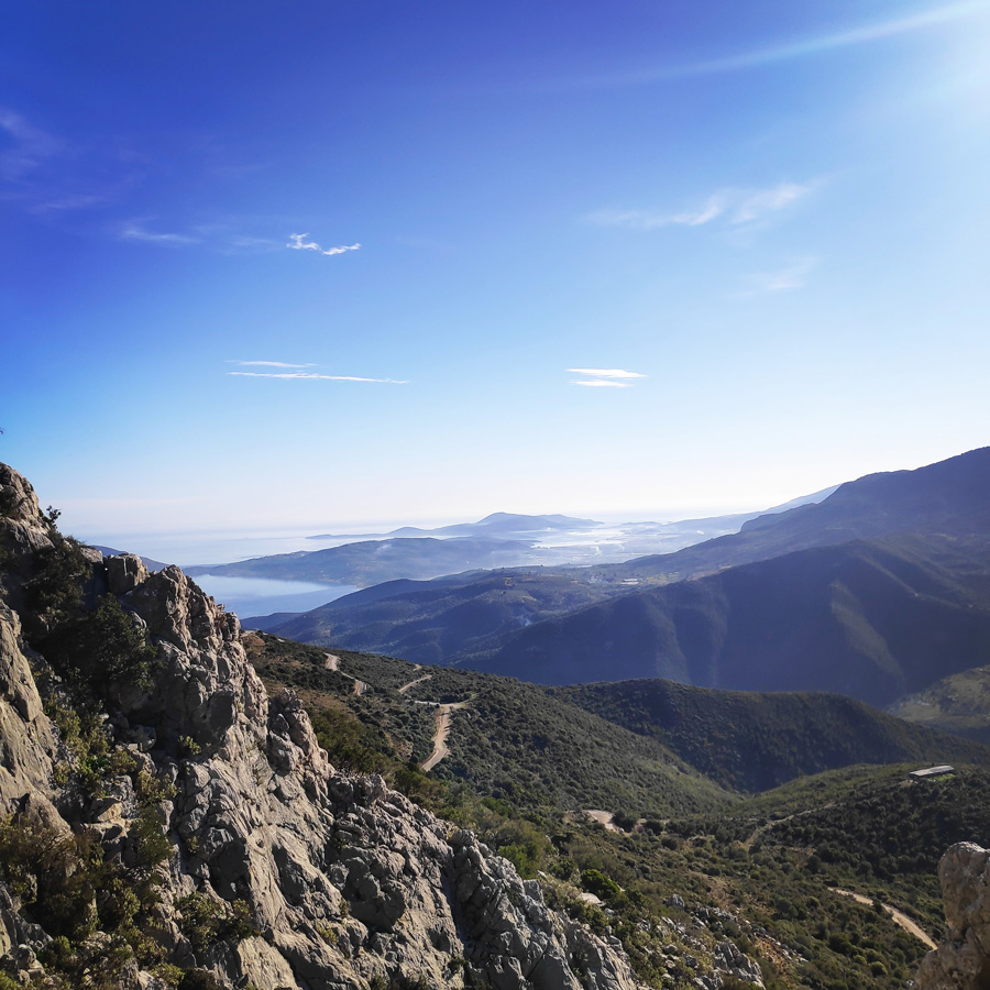
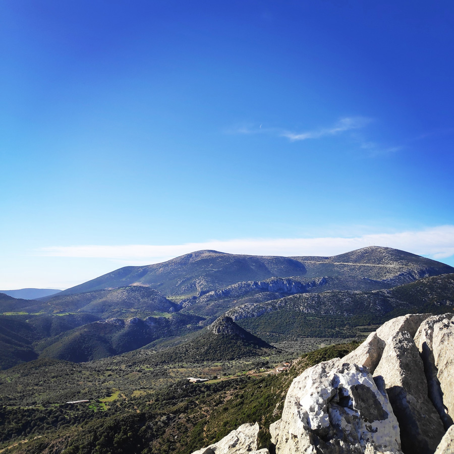
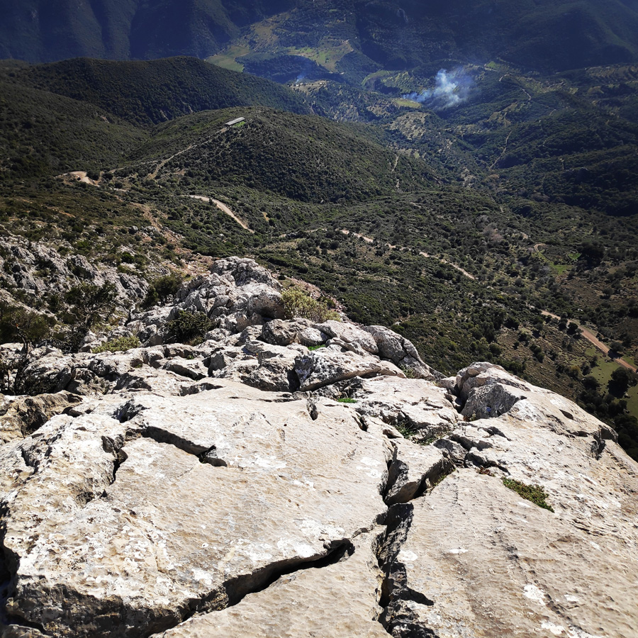
From R2 to R3, we follow the ridge (without protection or being on a rope) with scrambling III UIAA. This pitch is about 150 meters until we reach an obvious ledge. At this point, the view towards the Argosaronic sea is becoming unique.

R3 – R4
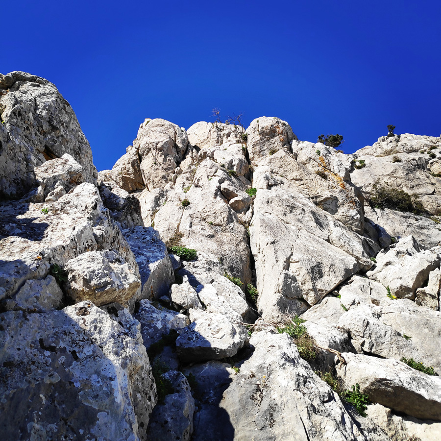
From R3 to R4, there is another passage of IV UIAA degree about 4 m. which ends again on the ridge. This passage can be well secured, but the lead climber should be extra careful due to eventual loose rocks.

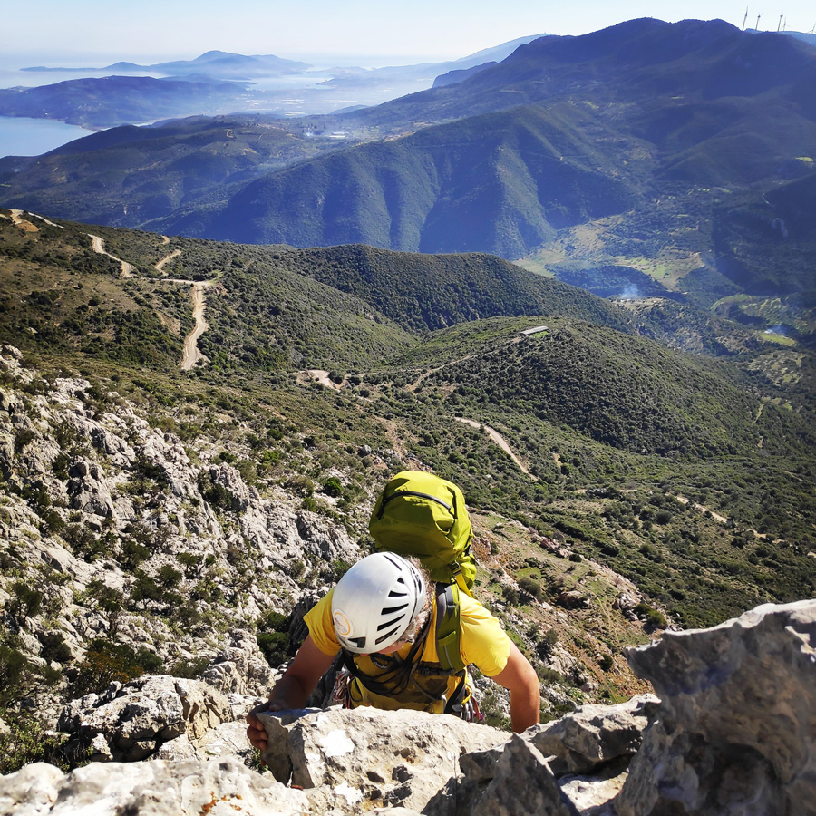
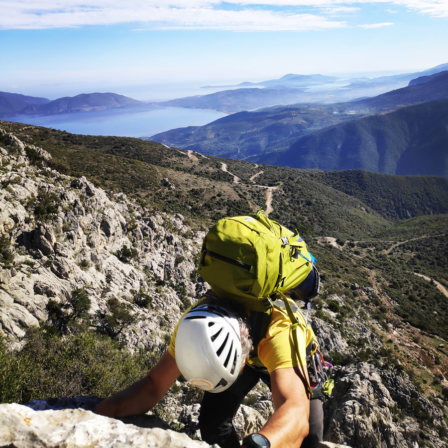

R4 – R5
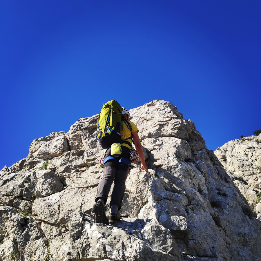
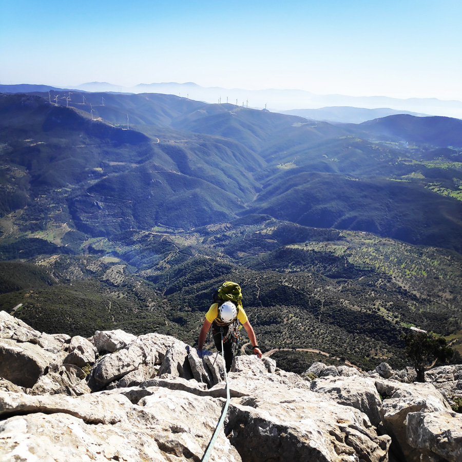
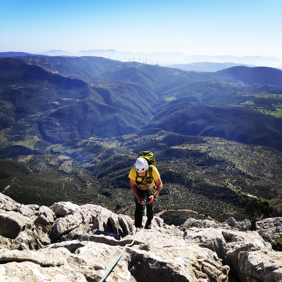
From R4 to R5, the terrain becomes very easy with a slope of up to 40 °, and is essentially a fairly uphill walk (with minimal scrambling). We go uphill up to the point where we see the last pitch, basically a vertical slab. Before the slab, we belay so we can climb the last pitch.


R5 – R6
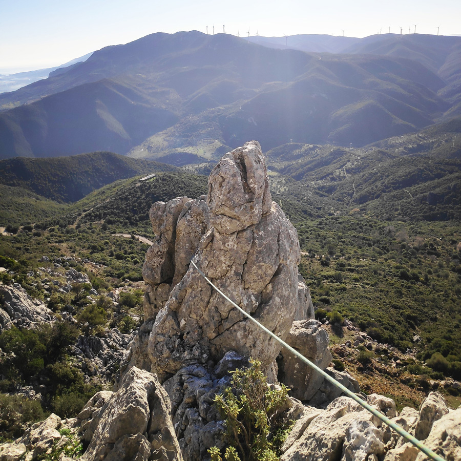
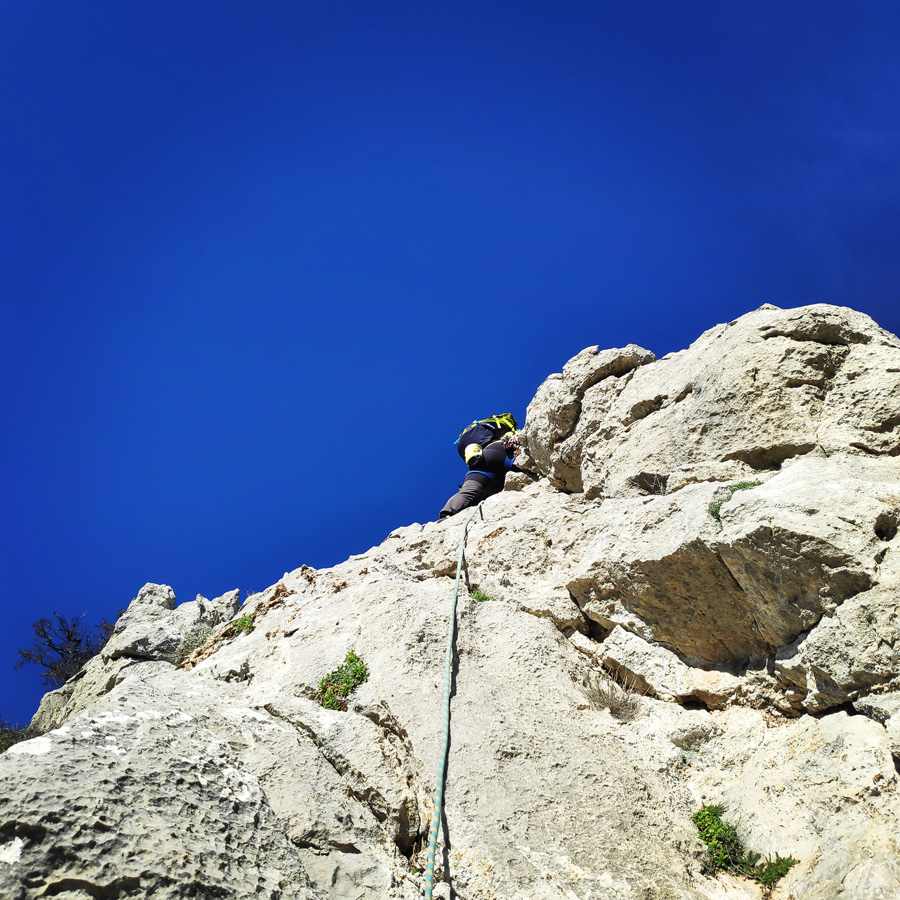
From R5 to R6, we have the last part of the ridge, where the crux of the route is located. Just after the relay, we have two small slabs of IV UIAA and we go towards the edge of the ridge. At that point, we place good protection (nuts or friends) and make the necessary moves to climb a pass of about 8 m and a degree of difficulty V-UIAA.
This particular passage is not difficult to climb, but due to the exposure, the movements of the lead climber should be careful. Once we complete this passage, the route is practically completed and we have a few meters of walking and scrambling of maximum III UIAA.


Check out more FREE Guidebooks
Download now for free! Explore breathtaking landscapes and conquer thrilling heights with our collection of guidebooks and topos.
Don’t miss out on this opportunity to elevate your outdoor adventures. Click, download, and let the exploration begin!
Return
The return starts from the peak and aims to descend to the village of Chora.
We start with an northern course for about 80-100 m. and at point 37.527323, 23.247323, and descend to the couloir that leads us to low vegetation up to the goat trails. From there, we follow the goat trails that lead us to Chora village.
The descent takes about 65 minutes.
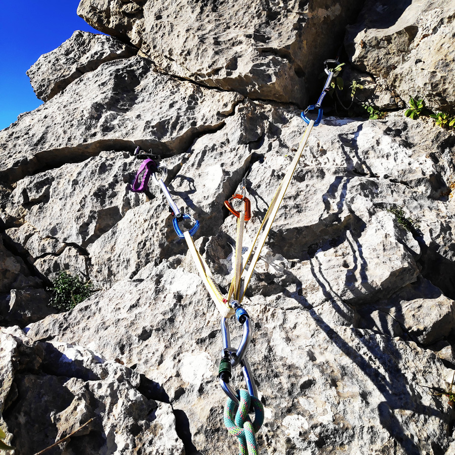
Recommended Gear
For this multi-pitch climb, I used the following gear:
- Mammut Wall Rider Helmet
- The North Face Vert 27 lt. Back pack
- 5 lanyards 60 cm
- 1 lanyard 120 cm
- 4 locking carabiners
- 1 HMS carabiner
- Mammut Ophir Harness
- Simond Climbing shoes
- 6 Quickdraws
- Cordelette for prusik
- 60 m. rope
- 4 carabiners
- Reverso
- 1.5 lt of Water
- 1 energy bar
- Rock Nuts
Details of the Climb
- Location: Ortholithi Mountain
- Starting Point: Choriza
- Ending Point: Choriza
- Trail Signs: No
- Minimum Elevation: 500 m
- Maximum Elevation: 1.105 m.
- Total Distance: 2.9 km
- Difficulty: Medium
- When to Hike: Autumn, Winter, Spring
- Water Features: None
Support the journey — buy me a coffee
I share these articles and the climbing guidebooks because I love the outdoors, and they’ll always be free. If they’ve helped you, help me keep them coming. Click the button to support my work.
Download for free the complete route description and Topo map
- Download the complete route description and Topo map in PDF (english)
- Κατέβασε το αρχείο με όλη την περιγραφή και το σχεδιάγραμμα της διαδρομής σε PDF (ελληνικά)
Subscribe & Stay Informed
Enter your email address to follow this blog and receive notifications of new posts by email
Suggestion
If you plan to spend more time in the area, I would highly suggest you also check out the South-West Ridge of Mount Ortholithi, and specifically the route, “Monsters of the Wind“.
Below: This map marks all the mountaineering adventures that have been featured on Olympus Mountaineering so far, including several Sport climbing crags – Select full screen to expand, zoom in for more detail, or click on a marker for a link to the post.

Wow, talk about gorgeous views. My heart was racing from looking at some of these pictures. You must feel such a strong sense of accomplishment after completing a climb like that. It looks beautiful, but also very challenging.
LikeLiked by 1 person
Thank you for the nice comment and indeed the view from that ridge and from the top of Ortholithi mountain is great.
It always feels very nice when you complete any type of climb, and especially, if you are back from the mountain sound and safe.
Technically speaking, was not a difficult climb (max V- UIAA), but the loose rocks and the exposure of the climb made it very interesting/challenging.
Thank you again for your kind comment.
LikeLiked by 2 people
Again a great article to read. And thanks for highlighting the path on the pictures. I’m always asking myself how on earth could soneone possibly get up there and where exactly. 😊
LikeLiked by 1 person
Thanks for reading through this post and glad to know you enjoyed it.
Climbing a mountain, or in this case a ridge of a mountain, requires some climbing experience and knowledge of multipitch climbing techniques.
As soon you have such skills, then the most “difficult” part is to identify and avoid any loose rocks.
Thank you for your comment.
LikeLike
I am always amazed at the level of dedication to your craft, from descriptions to maps to really stellar photos. It’s always a pleasure to read and motivates me to seize any opportunity I can to embrace the outdoors, especially in the times of Covid. Thank you for the great read!
LikeLike
Thank you for your very kind comment and is really nice to know people appreciate the time and effort I put in order to present as accurate as possible the routes I have been.
Much appreciated your comment. Thank you.
LikeLike
It must have been a great experience! Enjoyed reading it! Wonderful pictures. Thanks for sharing!
LikeLike
Indeed, such kind of climbing routes are very pleasant.
Thank you for your comment and if you would like to see/read similar posts check the two following ones:
LikeLiked by 1 person
Pingback: Climbing in Charamos Crag – Kandia – Argolis, Greece – Olympus Mountaineering
Pingback: Souzaki Mouzaki V- UIAA 50 m. | Climbing in Kouverta Beach – Ermioni – Olympus Mountaineering
Pingback: Climbing in Ermionida, Argolis (Greece) Guidebook – Olympus Mountaineering
Pingback: Dardiza Bayby 1 V- UIAA 30 m. | Trad Climbing in Dardiza Bay – Ermioni – Olympus Mountaineering
Pingback: Dardiza Bayby 2 IV UIAA 30 m. | Trad Climbing in Dardiza Bay – Ermioni – Olympus Mountaineering
Pingback: Monsters of the Wind – A Mixed Climbing Attempt of the South-West Ridge – Mount Ortholithi – Olympus Mountaineering
Pingback: Climbing in Petrogerakas Crag – Ermionida – Argolis – Greece – Olympus Mountaineering
Pingback: Dardiza Bayby 3 IV UIAA 20 m. | Trad Climbing in Dardiza Bay – Ermioni – Olympus Mountaineering
Pingback: Dardiza Bayby 4 V- UIAA 20 m. | Trad Climbing in Dardiza Bay – Ermioni – Olympus Mountaineering
Pingback: Dardiza Bayby 5 IV+ UIAA 20 m. | Trad Climbing in Dardiza Bay – Ermioni – Olympus Mountaineering
Pingback: Dardiza Bayby Shitter V- UIAA 20 m. | Trad Climbing in Dardiza Bay – Ermioni – Olympus Mountaineering
Pingback: Climbing in Ermionida, Argolis (Greece) Guidebook Edition 2022 – Olympus Mountaineering
Pingback: The Ultimate Guide of Trad Climbing in Ermionida, Argolis – Greece – Olympus Mountaineering
Pingback: Climbing in Ermionida, Argolis (Greece) Guidebook Edition 2023 – Olympus Mountaineering
Pingback: Climbing in Pleides Crag – Katafyki Ravine – Ermioni – Olympus Mountaineering
Pingback: Climbing in Charamos Crag – Kandia – Argolis, Greece (Update 2023) – Olympus Mountaineering
Pingback: Climbing in Pleiades Crag – Katafyki Ravine – Ermioni – 2025 Edition – Olympus Mountaineering
Pingback: Climbing in Ermionida, Argolis (Greece) Guidebook Edition 2025 – Olympus Mountaineering