
For my hiking and mountaineering expeditions I needed a handheld GPS device that will provide me all necessary trail information and safety when weather conditions become really nasty up on the snowy mountains. My goal was to purchase a not very large or heavy device that would run on AA batteries and would have touch screen too. Garmin makes the most of the Dakota 20’s smaller screen (2.6 inches diagonal, compared with the Oregon’s 3 inches diagonal) by providing a large-font mode for the trip odometer that displays speed and moving time in a large, bold font easily visible when the unit is mounted on a bike handlebar.
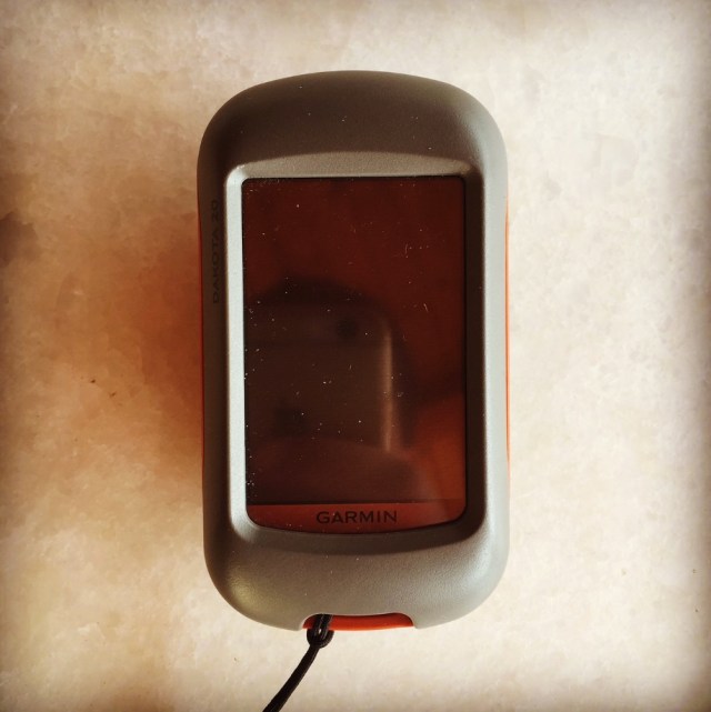
The screen is customisable to the Dakota 20’s multiple modes, and for the most part the controls were intuitive and easy to use. I found screen brightness and sharpness to be just fair. This means that I am not entirely happy with the quality of the screen, especially if I compare it with mobile phone devices such as an iPhone 6. Having said that, the Dakota 20 will provide you enough screen space in order to locate yourself and the next “waypoint”.
The interface is basically the same as that of the Garmin Oregon, with a main menu of 24 items spread across four screens. It’s pretty intuitive and easy to use, but it gets much better if you take the time to customize it. The user can change profile and can re-arrange the menu. The keypad is not very easy to use, due to the smaller screen, but I found that I quickly got used to this and it did not result in a significant increase in errors.
he Dakota 20 has the same excellent route, track and waypoint management tools. These include:
- Waypoints – The ability to project a waypoint, and to reposition one at your current location.
- Tracks – You can choose to hide or show a track on the map and give it a custom color (17 colors are available). The image at the right shows the View Track preview option.
- Routes – You can view a map of the entire route, edit the route, reverse it and view an elevation plot.
Plan Your Next Trip
One of the best features Garmin provides, is that you can plan your next trip right from your computer. Take charge of your next adventure with BaseCamp™, software that lets you view and organize maps, waypoints, routes, and tracks. This free trip-planning software even allows you to create Garmin Adventures that you can share with friends, family or fellow explorers. BaseCamp displays topographic map data in 2-D or 3-D on your computer screen, including contour lines and elevation profiles. It also can transfer an unlimited amount of satellite images to your device when paired with a BirdsEye Satellite Imagery subscription.


Garmin Dakota 20 pros
- Compact and light weight
- Tri-axial compass
- Barometric altimeter
- Great touch screen interface
- Slightly better sunlight visibility than Oregon series
- Ability to customize display and menus using profiles
- Excellent track management tools
- Paperless geocaching support
- Availability of free maps
- Accepts Garmin custom raster maps with v 3.22 beta
- Good battery life
Garmin Dakota 20 cons
- Poor sunlight visibility than eTrex and GPSMAP color units
- Small screen limits map area that can be seen
Physical & Performance |
|
| Physical dimensions | 2.2″ x 3.9″ x 1.3″ (5.5 x 10 x 3.3 cm) |
|---|---|
| Display size, WxH | 1.43″ x 2.15″ (3.6 x 5.5 cm); 2.6″ diag (6.6 cm) |
| Display resolution, WxH | 160 x 240 pixels |
| Display type | transflective color TFT touchscreen |
| Touchscreen | Yes |
| Weight | 5.25 oz (148.8 g) with batteries |
| Battery | 2 AA batteries (not included); NiMH or Lithium recommended |
| Battery life | 20 hours |
| Water rating | IPX7 |
| High-sensitivity receiver | Yes |
| Interface | USB |
| Barometric altimeter | Yes |
| Electronic compass | Yes (tilt-compensated 3-axis) |
| Unit-to-unit transfer (shares data wirelessly with similar units) | |
Maps & Memory |
|
| Basemap | Yes |
|---|---|
| Ability to add maps | Yes |
| Built-in memory | 850 MB |
| Accepts data cards | microSD™ card (not included) |
| Custom POIs (ability to add additional points of interest) | Yes |
| Waypoints/favorites/locations | 1000 |
| Routes | 50 |
| Track log | 10,000 points, 200 saved tracks |
Outdoor Features |
|
| Automatic routing (turn by turn routing on roads) | Yes (with optional mapping for detailed roads) |
|---|---|
| Geocaching-friendly | Yes (Paperless) |
| Custom maps compatible | Yes |
| Hunt/fish calendar | Yes |
| Sun and moon information | Yes |
| Tide tables | Yes |
| Area calculation | Yes |

Pingback: Dirfi Mountain Winter Climb via Couloir – Olympus Mountaineering
Pingback: Aroania (Chelmos) Winter Mountaineering Ascent – Olympus Mountaineering
Pingback: KALENJI Trail Running Bag/Vest 10L Review – Olympus Mountaineering
Pingback: Hiking in South Pindos – Lakmos Mountain Pt.01 | Anthochori – Tsoukarela Peak – Verliga Alpine Lake – Olympus Mountaineering
Pingback: Hiking in South Pindos – Lakmos Mountain Pt.02 | Verliga Alpine Lake – Megas Trapos – Baros – Kallarites – Olympus Mountaineering
Pingback: Taygetus Mountain Crossing Pentadaktylos (Five Fingers) – Anavriti – Tsarkos – Spanakaki – Sidirokastro – Athanati Rachi – Profitis Elias – EOS Refuge – Olympus Mountaineering
Pingback: Hiking on Mount Mainalo – Tzelati Peak – Olympus Mountaineering
Pingback: Hiking on Mount Mainalo – Traversing Ostrakina to Mavri Korifi (Black Peak) – Olympus Mountaineering
Pingback: Winter hike and mountaineering climb on Gardiki Peak (Arête of Chelmos/Aroania) – Olympus Mountaineering
Pingback: Winter Mountaineering Climb in Strogoula via Agrofylakas Couloir (Tzoumerka-Athamanika) – Olympus Mountaineering
Pingback: Alpine Climb on Parnassos Mountain – Gerontovrachos and Touborachi – Olympus Mountaineering
Pingback: Mountain Leader Seminar on Mount Parnassos – Olympus Mountaineering
Pingback: Hiking in Parnonas – Sitaina – Russa Petra – Megali Tourla – Profitis Elias – Sitaina – Olympus Mountaineering
Pingback: The North Face Verto 27 Summit Series Backpack Review – Olympus Mountaineering
Pingback: Hiking and Wild Camping on Mount Giona (Mt. Aselinon) – Olympus Mountaineering
Pingback: Hiking in West Parnitha – Agios Kiprianos – Koromilia peak – Tamilthi peak – Alogopetra peak – Agios Kiprianos – Olympus Mountaineering
Loved rreading this thank you
LikeLike