It’s been almost 6 months since my last visit to the area of Mt. Tzoumerka (Athamanika) and this time I wanted to explore an area of the mountains that I have never been before. The overall plan was to visit and explore the Central and Eastern Tzoumerka and specifically the hiking opportunities around Theodoriana village.
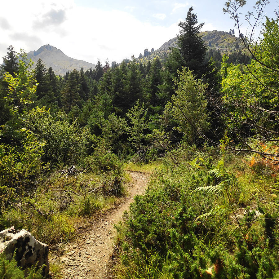
The trail to Marks area leads us to the heart of Elatia, the largest and pristine forest of Theodoriana, and a wonderful stream with lakes and waterfalls.
About Theodoriana
Theodoriana is a village and former community in the Arta regional unit, Epirus, Greece. Northeast is the Trikala regional unit. The Pindos and the Athamanian mountains cross the northeastern part. The Acheloos river flows by the village along the regional road the connects Arta to Trikala.
The entire area of Theodoriana are mountains and pine trees along with forests dominate the whole municipality except for the upper parts and the valley areas where farmlands are located. Some of its residents live only during the summer months and leave during the winter months.
See more hiking/mountaineering routes around this area:
- Hiking in Tzoumerka (Athamanika) – Katarraktis Waterfalls – Katarraktis Refuge – Faneromeni
- Winter Climb in Strogoula via Agrofylakas Couloir
- Hiking in Tzoumerka – Skala Stamati – Katafidi
- Hiking in Kefalovriso Waterfalls
- Syrrako – Kallarites
- Hiking in Tzoumerka (Athamanika) – Pramanta Refuge – Kefalovriso Waterfall – Melissourgoi Refuge
- Winter Mountaineering Climb in Strogoula
Theodoriana was founded in 250 BC as Theodoria by Theodorus of Athamania. Theodorus of Athamania was king of the Athamanians in south-eastern Epirus. He is known otherwise only from the Delian temple inventories: his daughter Phila made dedications there before 225 BC. In 250 BC, King Theodorus founded the city of Theodoria, nowadays Theodoriana.
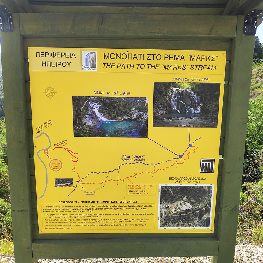
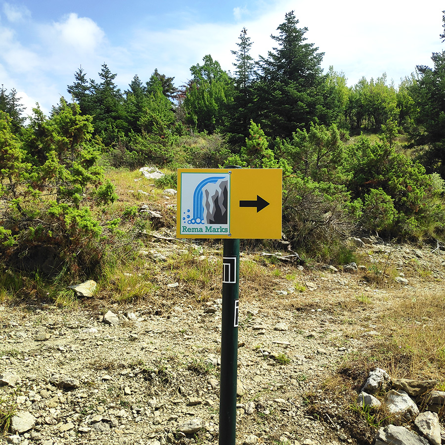
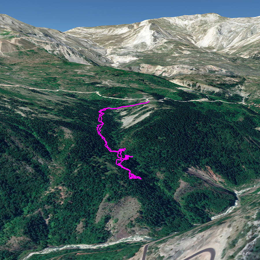
How to reach Marks Stream – Rema Marks
Marks Stream – Rema Marks
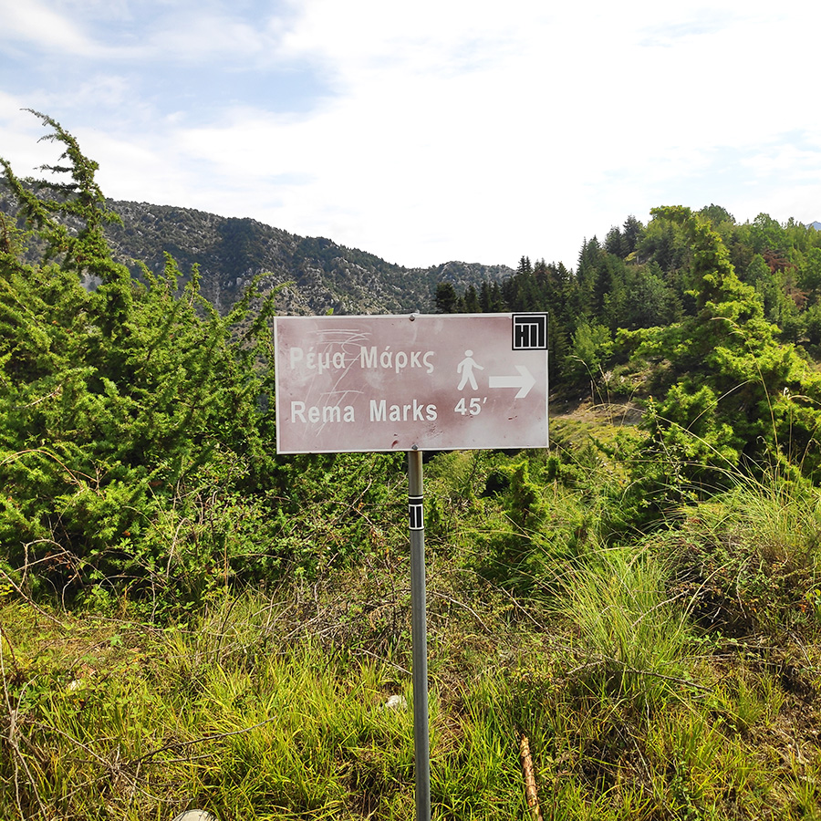
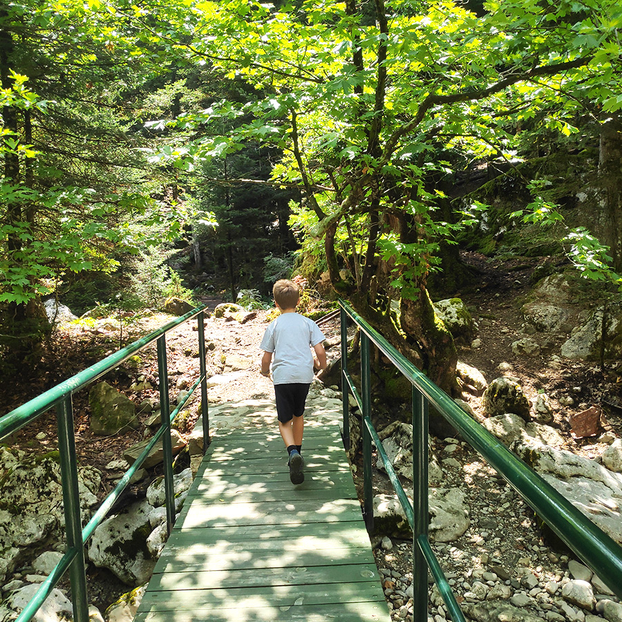
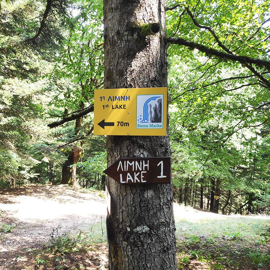
The trail to the beautiful Marks Stream starts about 2.5 km from the village square on the way to Arta. Passing the junction at the water bottling plant, coming out of the road with the fir trees, one comes across, a sign that leads left to a forest road and to the beginning of the path.
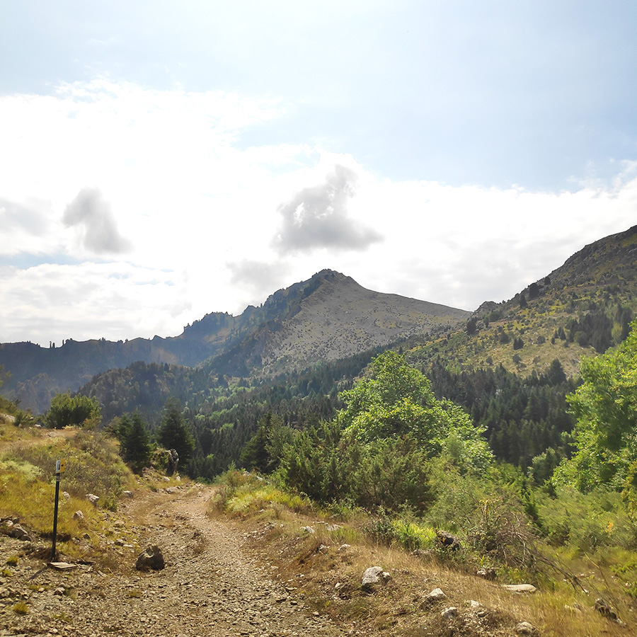
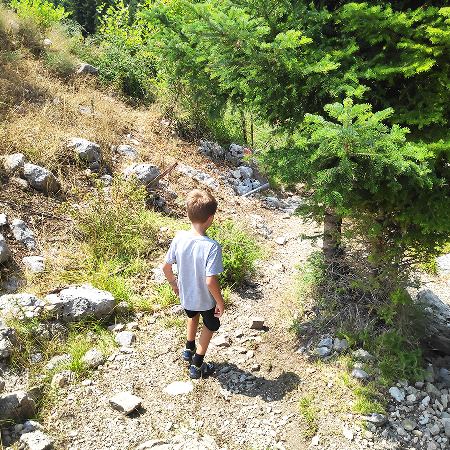
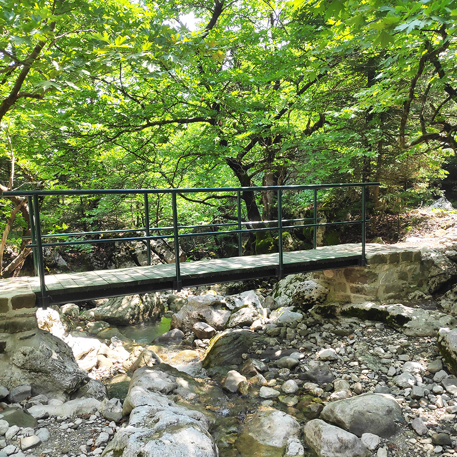
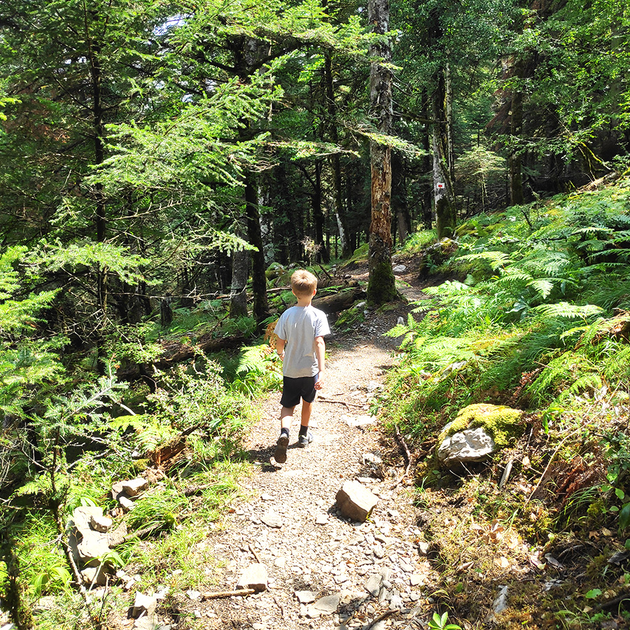
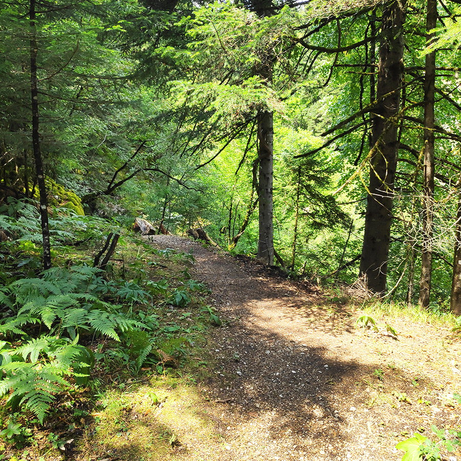
The trail starts from the tarmac road and descends on a path into a wonderful fir forest, in the footsteps of the old path which led to “Elatia”. after few minutes we reach a bridge where we cross it and from that point and on, the entire trail is under the shade of the trees.
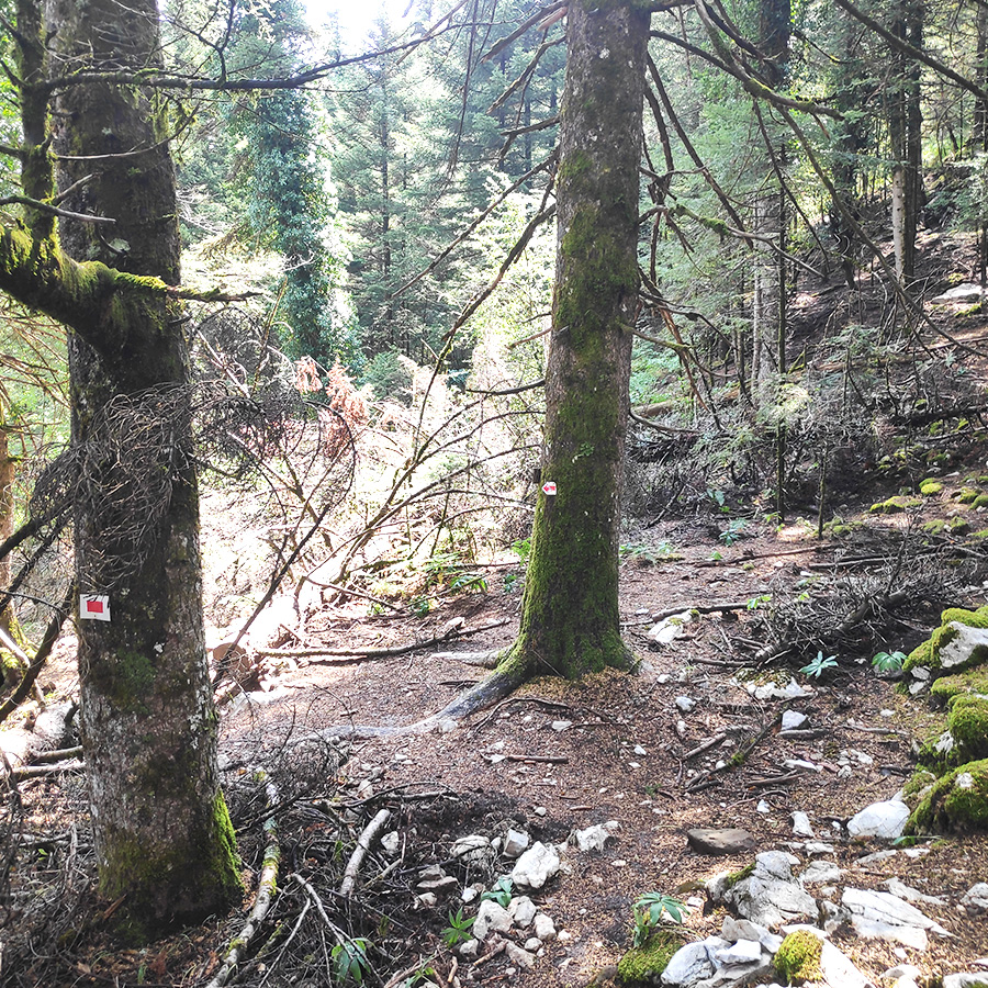
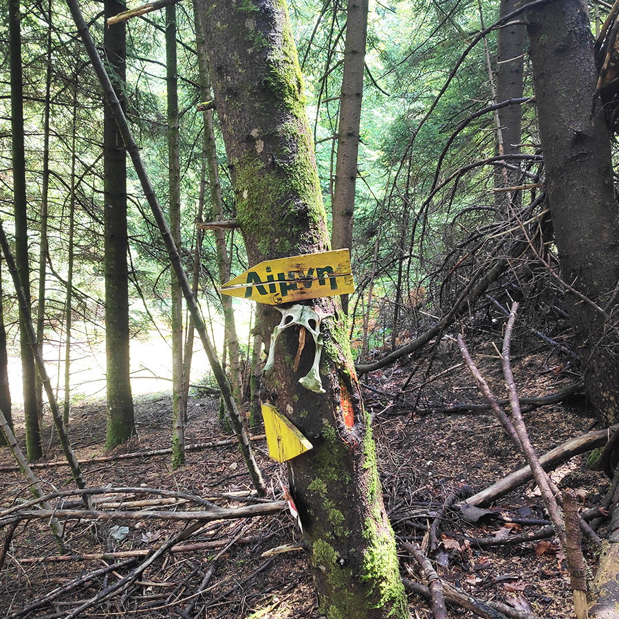
The trail is well signed, with older and newer signs and I could also say very easy to hike and very family friendly.
Support the journey — buy me a coffee
I share these articles and the climbing guidebooks because I love the outdoors, and they’ll always be free. If they’ve helped you, help me keep them coming. Click the button to support my work.


Check out more FREE Guidebooks
Download now for free! Explore breathtaking landscapes and conquer thrilling heights with our collection of guidebooks and topos.
Don’t miss out on this opportunity to elevate your outdoor adventures. Click, download, and let the exploration begin!
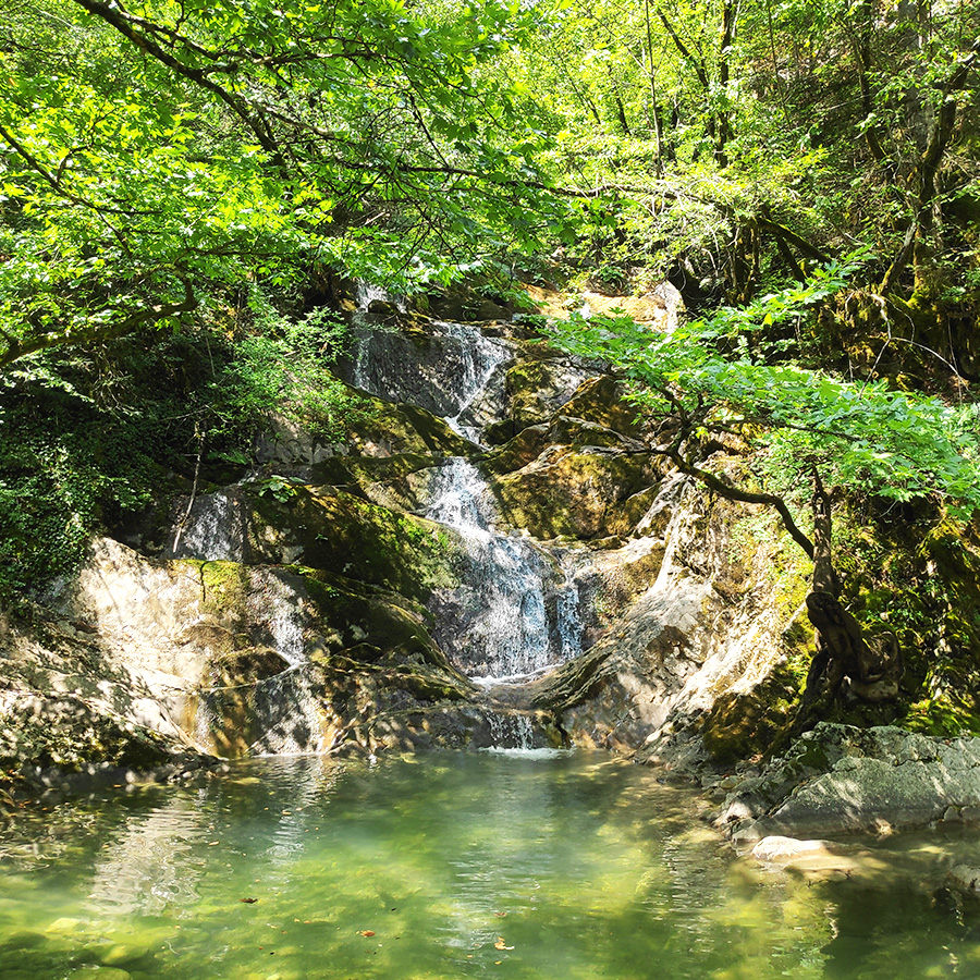
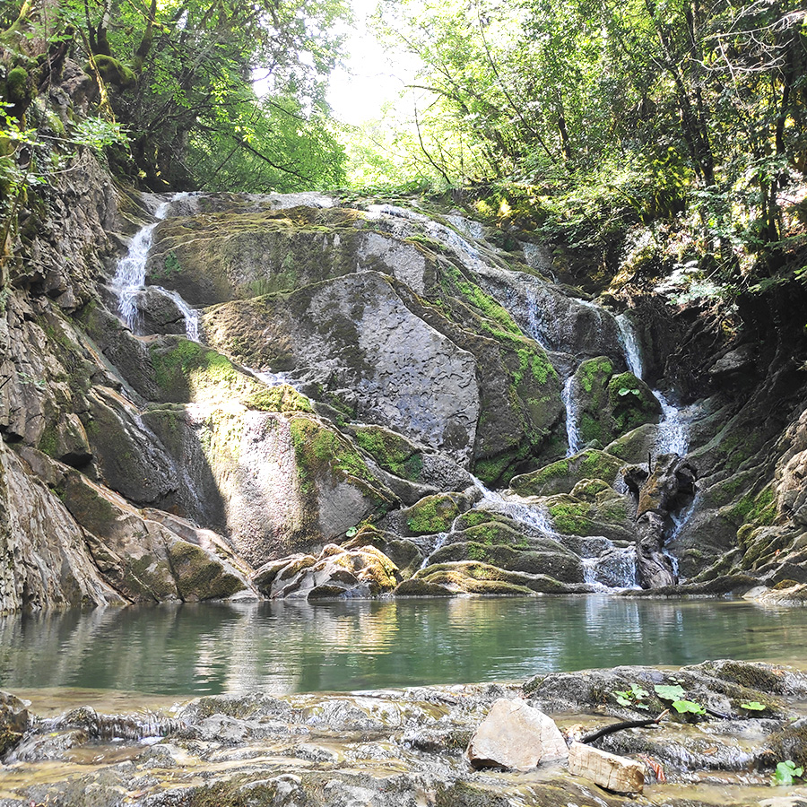
1st Lake – Marks Stream (Rema Marks)
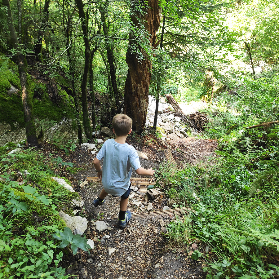
Following the trail next to the stream, into the forest we hear the water rushing out of huge rocks, forming continuous waterfalls and green lakes. The sunlight barely penetrates the dense plane trees that cover them. about 20-25 minutes into the trail, we come across a crossroad of signages, which indicate the direction for the 1st lake and the direction to the 2nd lake and the rest of the trail.
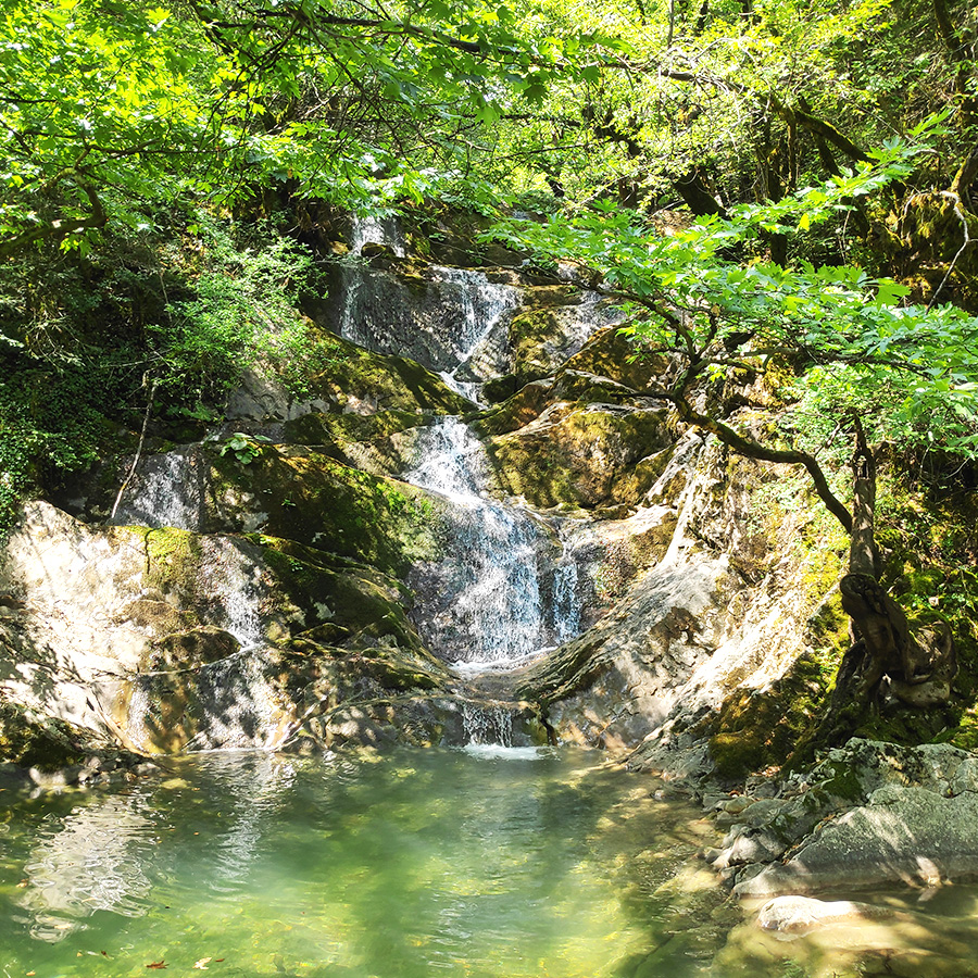
At the point, we turned left and in about 70 meters, and after some stairs that we had to downhill we came across the beautiful 1st lake with the really nice small waterfall.

Explore all outdoor activities in a convenient list view here
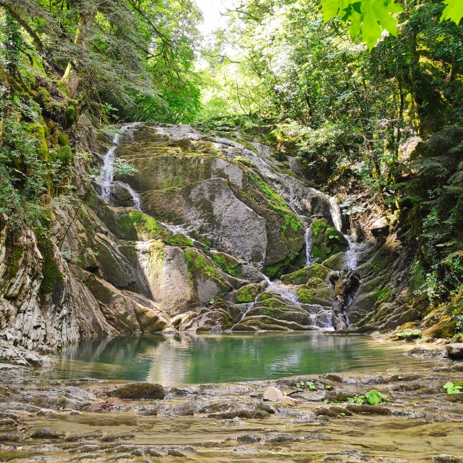
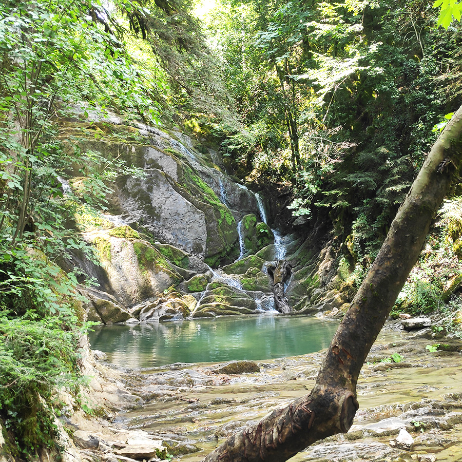
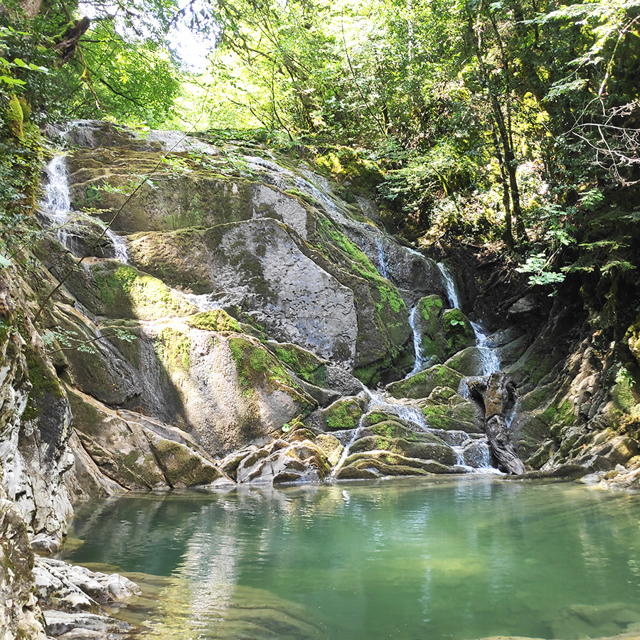
2nd Lake – Marks Stream (Rema Marks)
Having visited and enjoyed the short stop at the first lake, it was time to continue our exploration at Marks Stream and visit the second and one of the most fabulous locations I have ever visited in Tzoumerka (Athamanika) mountains.
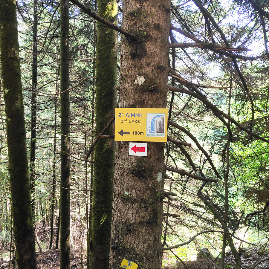
In order to visit the second lake, we need to return towards the crossroad and from there we need to follow the signs that indicates the trail to the second lake. In order to reach this stunning location, we need to hike downhill in an easy terrain for about 180 meters.
As soon we see this second pond full of water we can easily understand that the whole effort was worthwhile. The stream that comes from the first lake, not forms multiple smaller waterfalls, that all end up to the 2nd lake. The view is simply wonderful, like in a fairytale.

Support the journey — buy me a coffee
I share these articles and the climbing guidebooks because I love the outdoors, and they’ll always be free. If they’ve helped you, help me keep them coming. Click the button to support my work.
Details of the Hike:
- Location: Rema Marks Theodoriana
- Trail Signs: Signed path
- Maximum Elevation: 987 m.
- Minimum Elevation: 802 m
- Total Distance: 3 km
- Hiking time: 2 hours (with easy pace – including the breaks)
- Difficulty: Easy
- When to Hike: Any time of the year
Subscribe & Stay Informed
Enter your email address to follow this blog and receive notifications of new posts by email
See more hiking/mountaineering routes around this area:
- Hiking in Tzoumerka (Athamanika) – Katarraktis Waterfalls – Katarraktis Refuge – Faneromeni
- Winter Climb in Strogoula via Agrofylakas Couloir
- Hiking in Tzoumerka – Skala Stamati – Katafidi
- Hiking in Kefalovriso Waterfalls
- Syrrako – Kallarites
- Hiking in Tzoumerka (Athamanika) – Pramanta Refuge – Kefalovriso Waterfall – Melissourgoi Refuge
- Winter Mountaineering Climb in Strogoula
Before you leave this blog check out the following map
Below: This map marks all the mountaineering adventures that have been featured on Olympus Mountaineering so far, including several Sport climbing crags – Select full screen to expand, zoom in for more detail, or click on a marker for a link to the post.

What a beautiful area. The second lake looks amazing with the cascade running into it
LikeLiked by 1 person
It’s a really nice area and I’m very happy I have finally visited and explored all hiking possibilities there.
Highly recommended!
Thanks for your comment.
LikeLike
This looks utterly delightful. Beautiful pools, and a lovely forest walk. Perfect!
LikeLiked by 1 person
Thank you for your kind comment!
LikeLiked by 1 person
Oh, what lovely lakes and waterfalls. So gorgeous and cool on a hot day. I like how you ‘prove’ it’s kid friendly by bringing a kid. Well done 🙂
LikeLiked by 1 person
During summer time, one of the nicest ways to enjoy Greece is to hike bellow the alpine level, under the shadow of the trees. Now, if you combine this with pools, waterfalls and streams, it can only be better.
An indeed, this kind of hikes are easy and family friendly.
LikeLike
Yes, I imagine shade is at a premium in Greece in the summer. Stay cool, my friend.
LikeLiked by 1 person
Pingback: Souda Twin Waterfalls – Theodoriana – Hiking in Tzoumerka (family friendly) – Olympus Mountaineering
Pingback: Hiking in Tzoumerka (Athamanika) – Pramanta Refuge – Kefalovriso Waterfall – Melissourgoi Refuge – Pramanta Refuge (family friendly) – Olympus Mountaineering
Pingback: A Family Adventure in Greece: Top 10 Hiking Routes for Nature-Loving Families – Olympus Mountaineering
Pingback: Hiking in Tzoumerka (Athamanika) – Melissourgoi – Kryoneri Waterfall – Melissourgoi (family friendly) – Olympus Mountaineering
Pingback: Hiking in Captain’s Baths (Λουτρά Καπετάνιου) – Vourgareli – South Tzoumerka (family friendly) – Olympus Mountaineering