
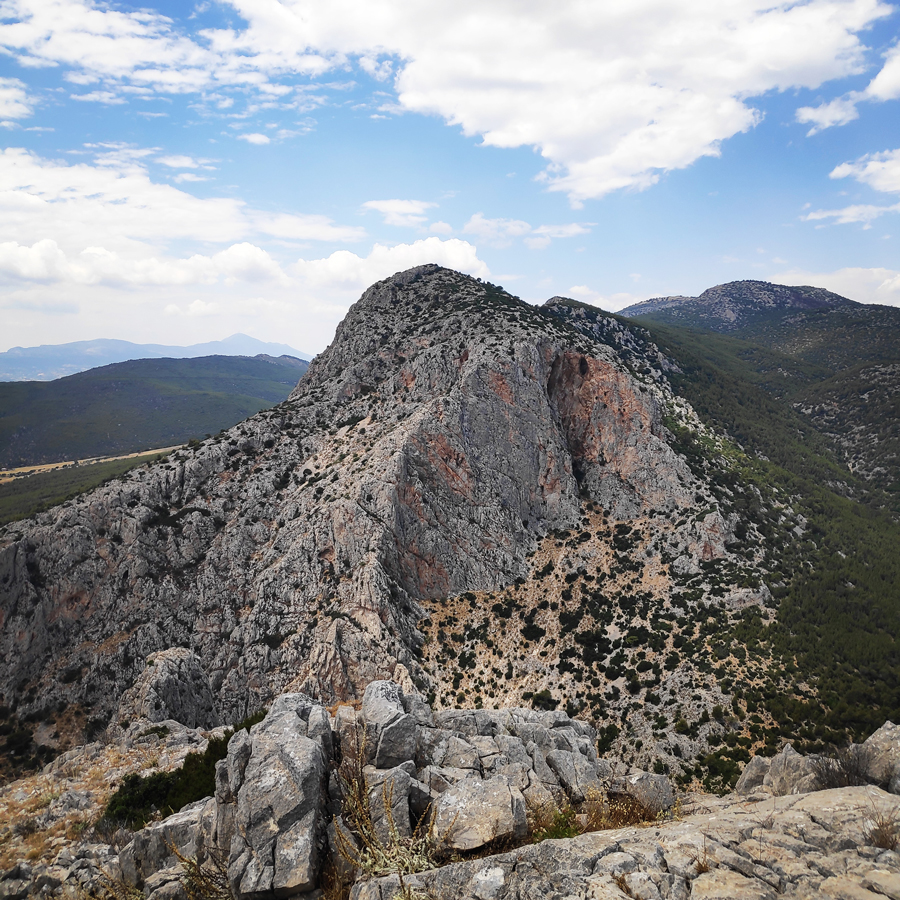
It has been almost two years ago since my last visit in the area of Mt. Pateras and specifically in Kantili location. During my previous visit, I had climbed the Horned Owl ridge but while climbing that ridge it struck my attention a rock formation which is located in the opposite from the main peak of Kantili.
After some research, I had noticed that there were a couple of routes and together with a climbing buddy, we decided to pay a visit to the area and give a try to a route named Fantastic 4.
Pateras is a mountain of West Attica, Greece, with an elevation of 1,131 meters. Its highest peak is named Leontari. It is situated between the plain of Eleusis and the plain of Megara, and stretches between the Gulf of Corinth at Aigosthena and the Saronic Gulf near Eleusis.
It is separated from its northern neighbour Cithaeron by the plain of Vilia. The mountain is covered with woods with Aleppo pine and Mediterranean maquis. In the tops of the mountain, that belong to a CORINE biotope, there are firs, of species Abies cephalonica.
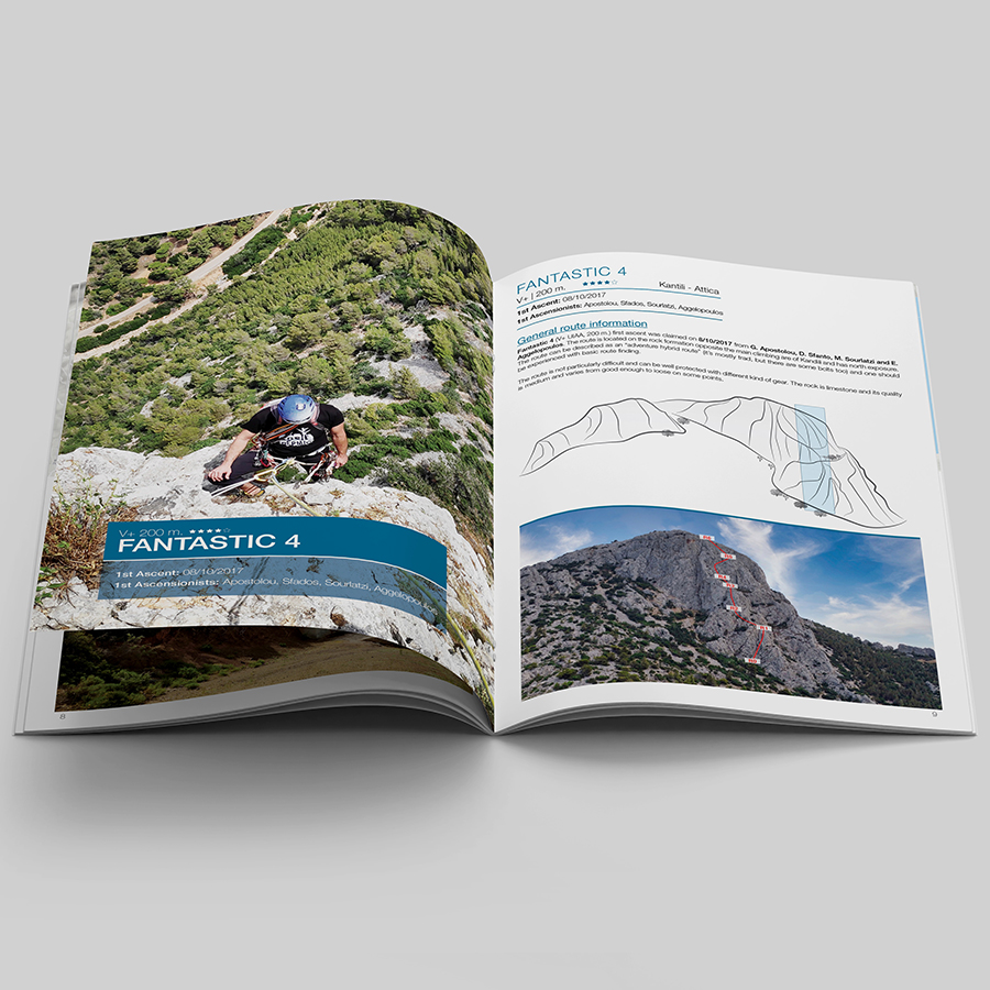
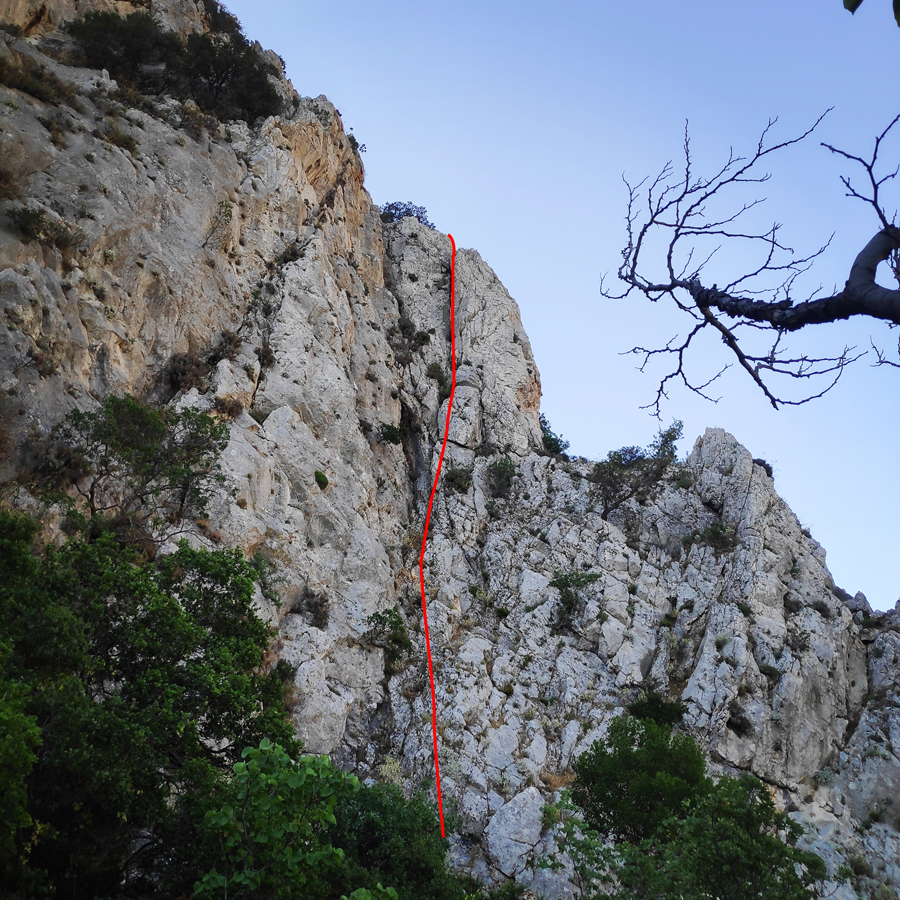
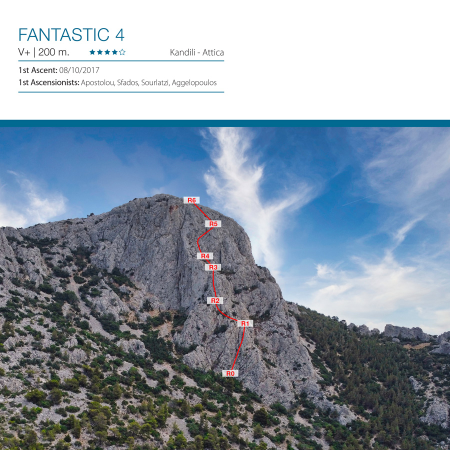
Fantastic 4 V+ UIAA 200 m. | Trad Climbing in Kantili
Fantastic 4 (V+ UIAA, 200 m.) first ascent was claimed on 8/10/2017 from G. Apostolou, D. Sfanto, M. Sourlatzi and E. Aggelopoulo.
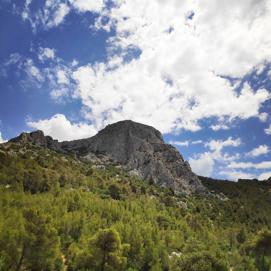
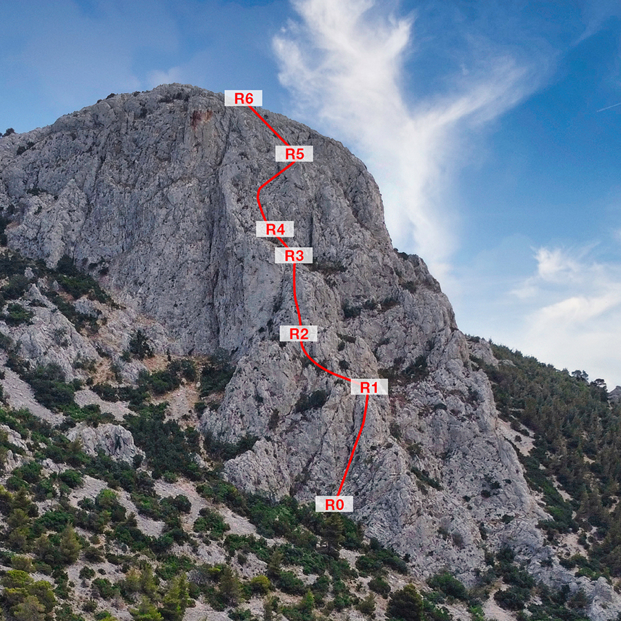
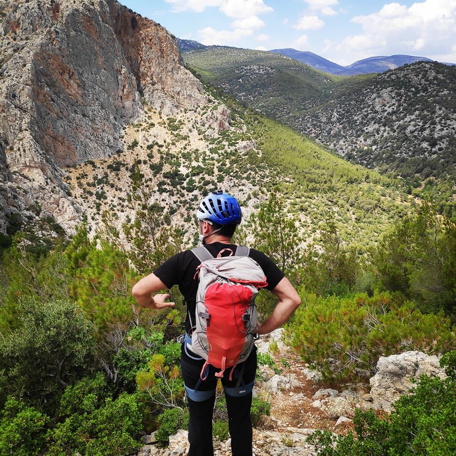
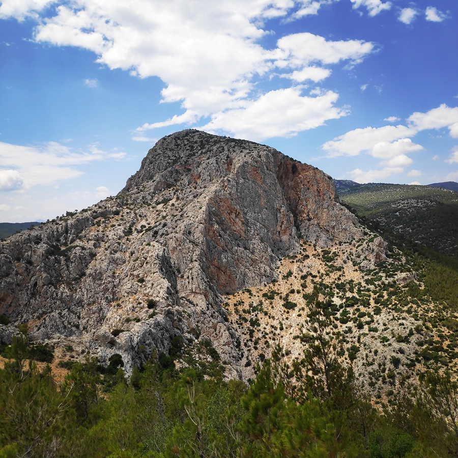
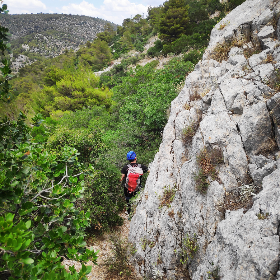
The route is located on the rock formation opposite the main climbing are of Kantili and has north exposure. The route can be described as an “adventure hybrid route” (it’s mostly trad, but there are some bolts too) and one should be experienced with basic route finding. The route is not particularly difficult and can be well protected with different kind of gear. The rock is limestone and its quality is medium and varies from good enough to loose on some points.
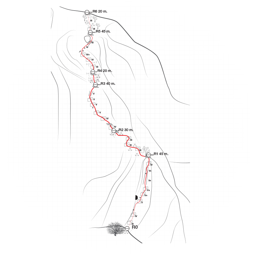
The route is 200 meters long, divided in 6 pitches and with a maximum difficulty of V+ UIAA.
Support the journey — buy me a coffee
I share these articles and the climbing guidebooks because I love the outdoors, and they’ll always be free. If they’ve helped you, help me keep them coming. Click the button to support my work.

Download for free the complete route description and Topo map
- Download the complete Interactive Guidebook in PDF spreads (best for Tablets/Laptops/Desktops)
- Download the complete Interactive Guidebook in PDF single pages (best for Phones)
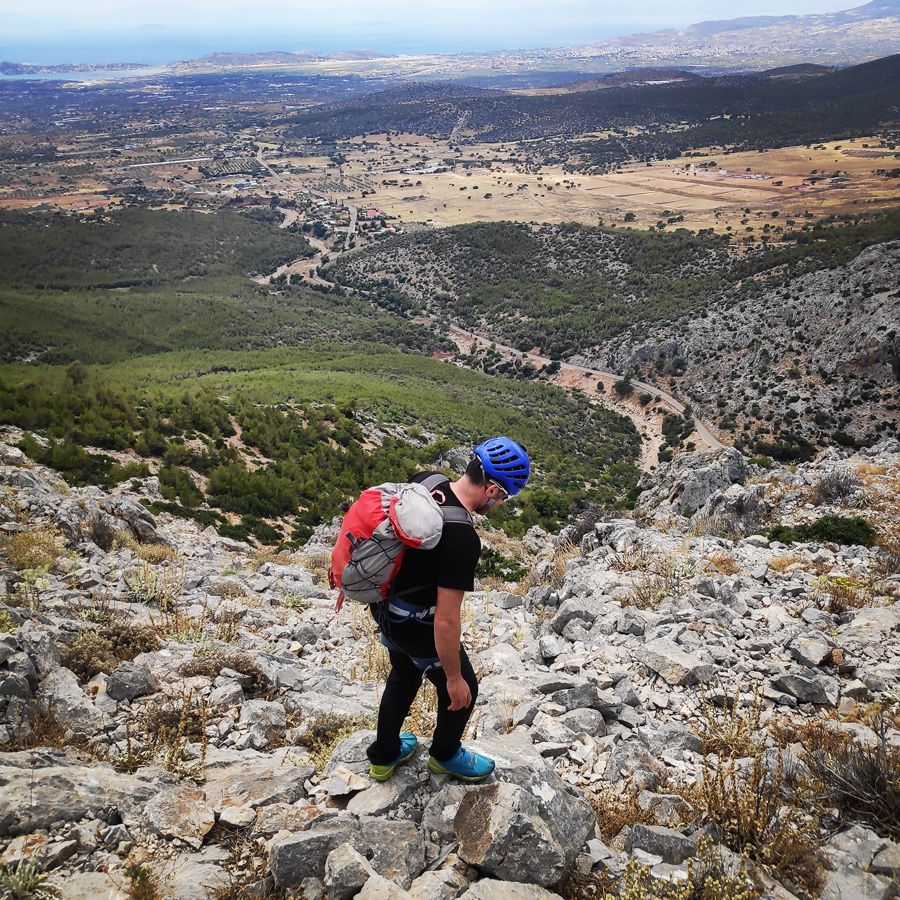
Approach
From Athens one needs to drive towards Eleusis and from there should follow the road to Kantili. You can park your car in this location: 38.058263, 23.411412
Total distance from Athens: 48 km
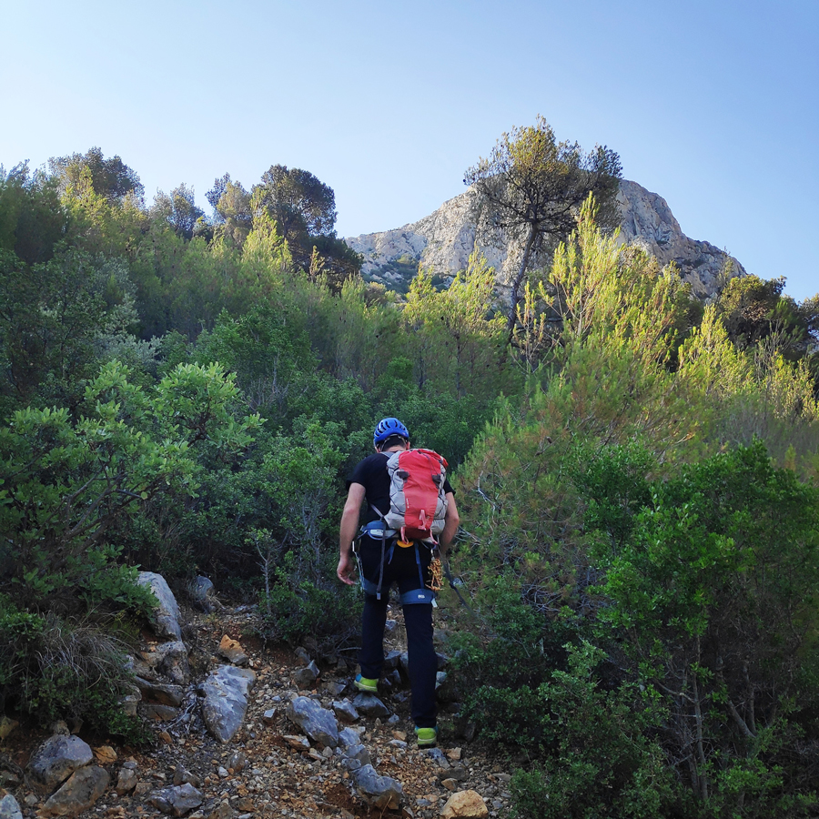
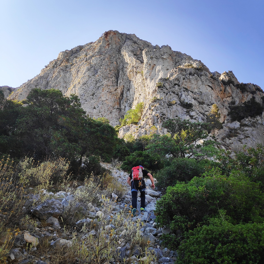
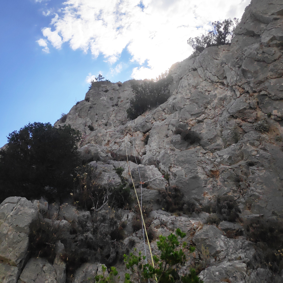
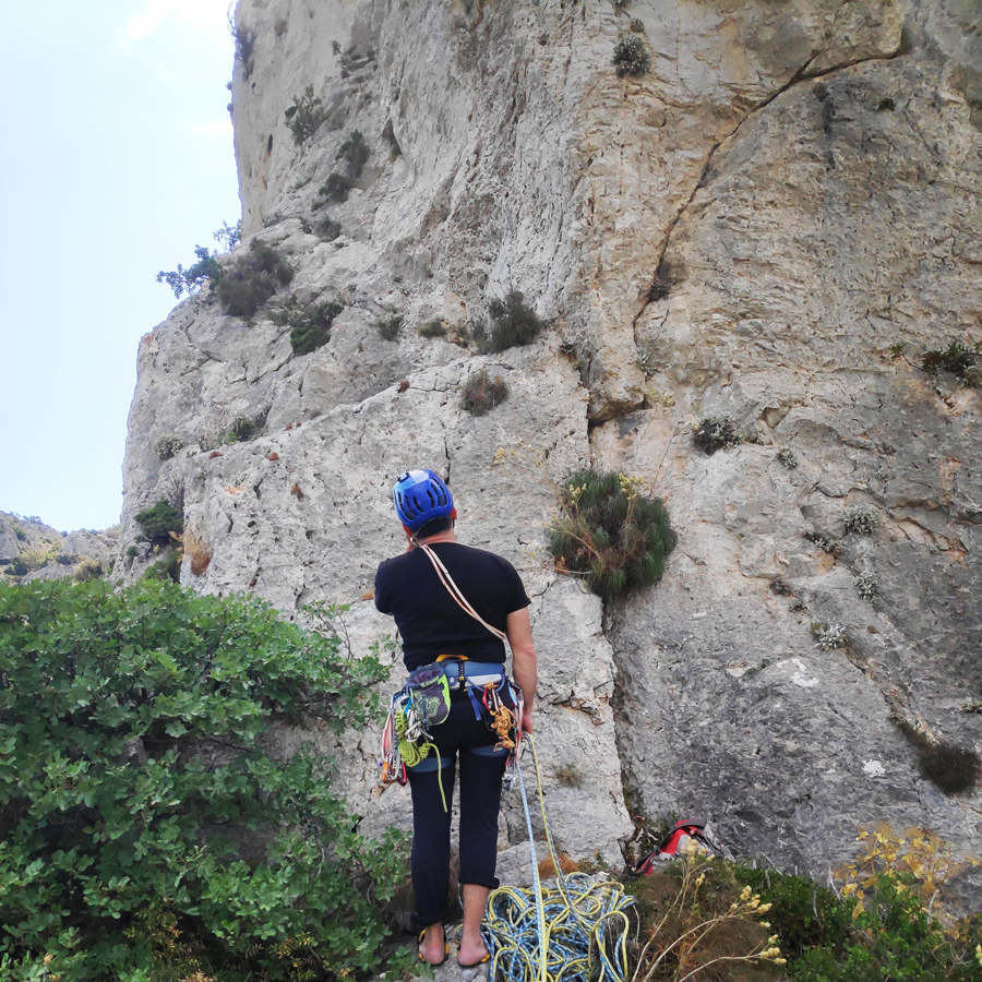
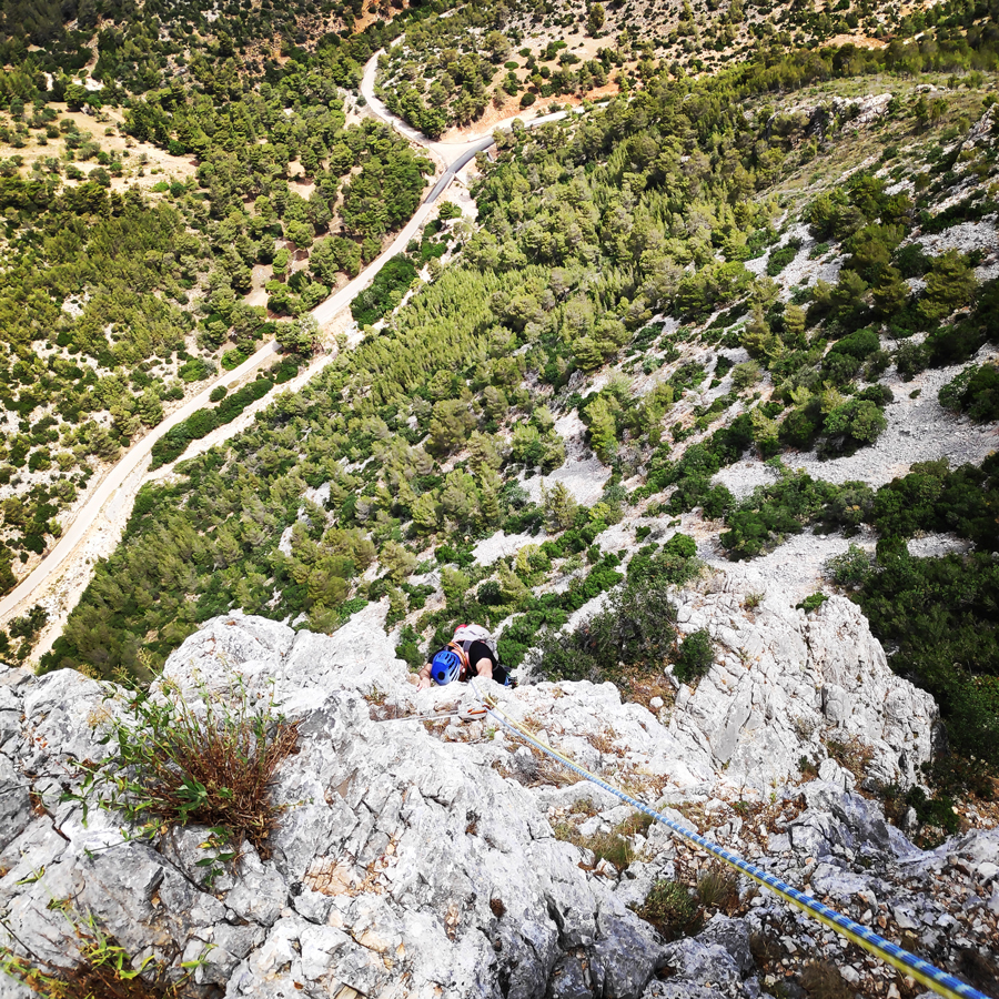
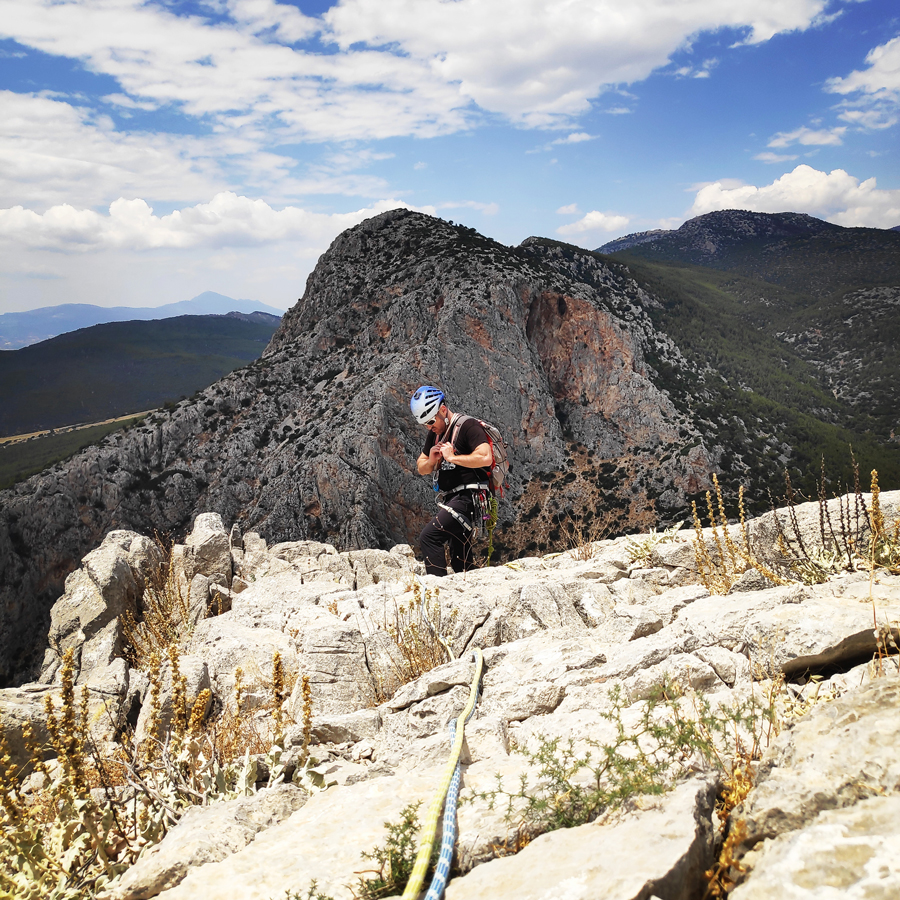
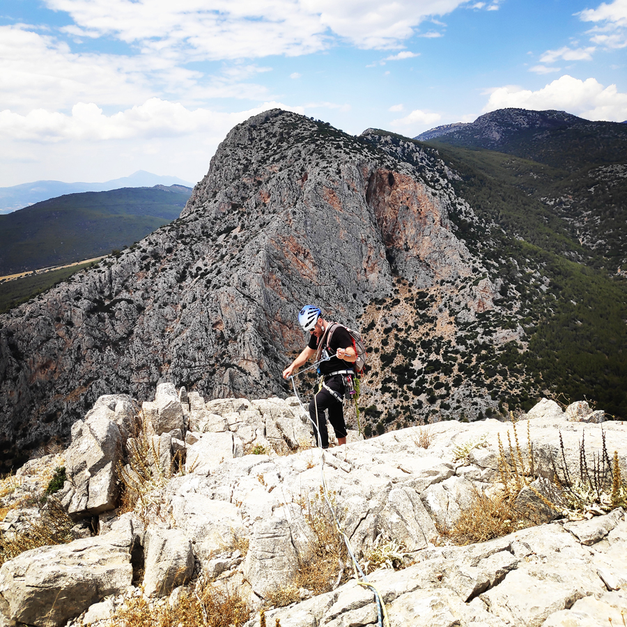
For the access you need about 20 minutes of uphill hike through low vegetation and while approaching the two characteristic pillars of the rock formation, “Fantastic 4” is on the left pillar. The route starts straight up from the ledge and there is rock cairn at the base of the route.
Explore all outdoor activities in a convenient list view here
Route description
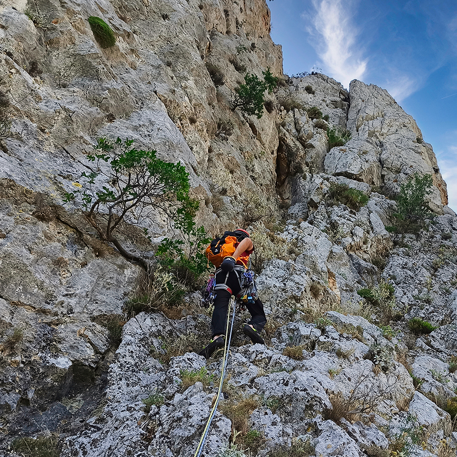
R0 – R1 | V+ UIAA – 45 m.
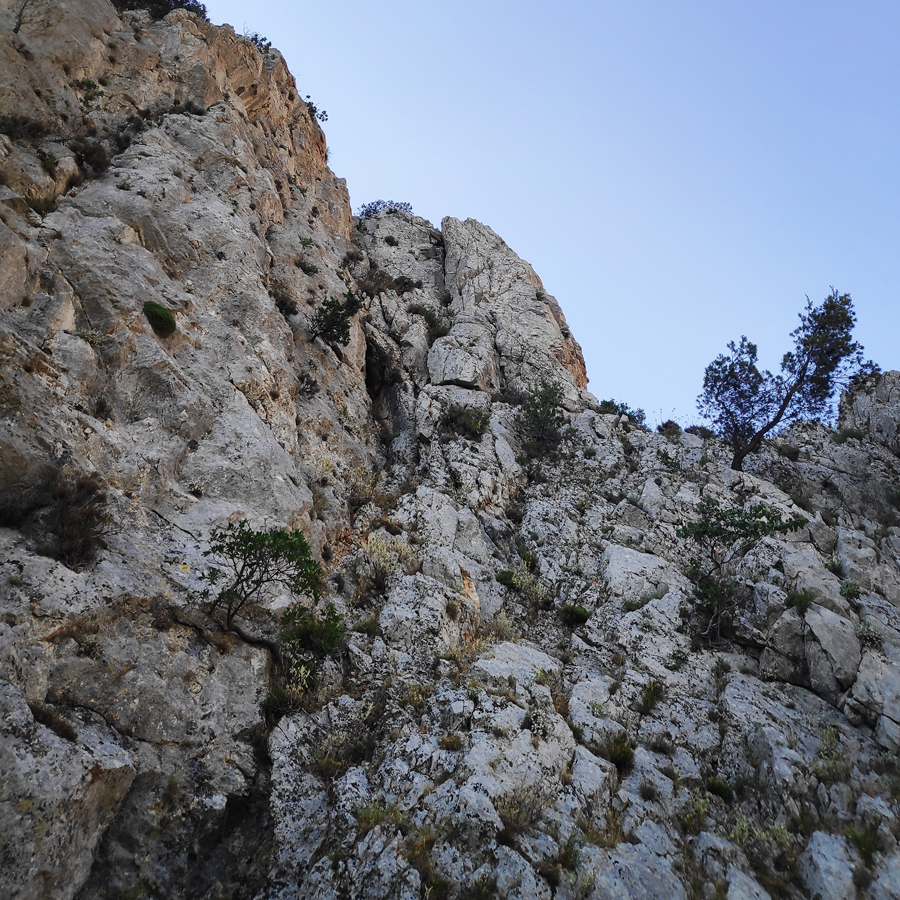
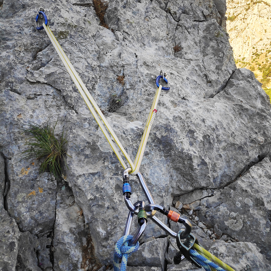
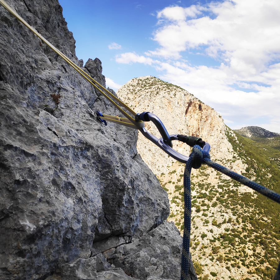
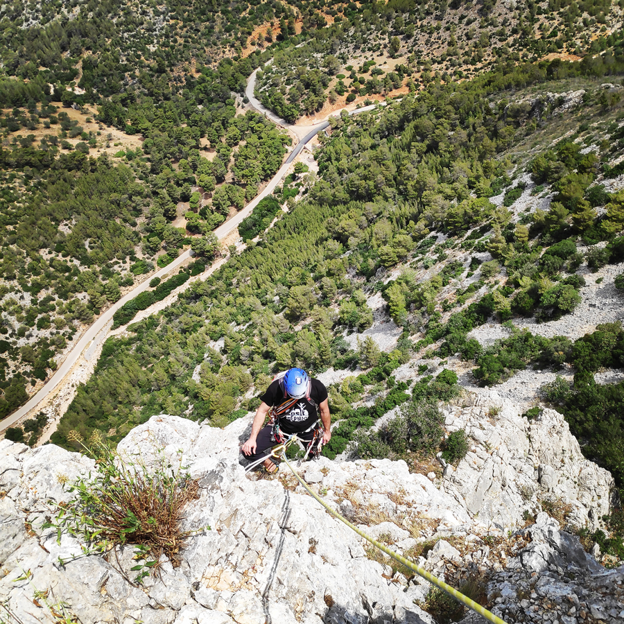
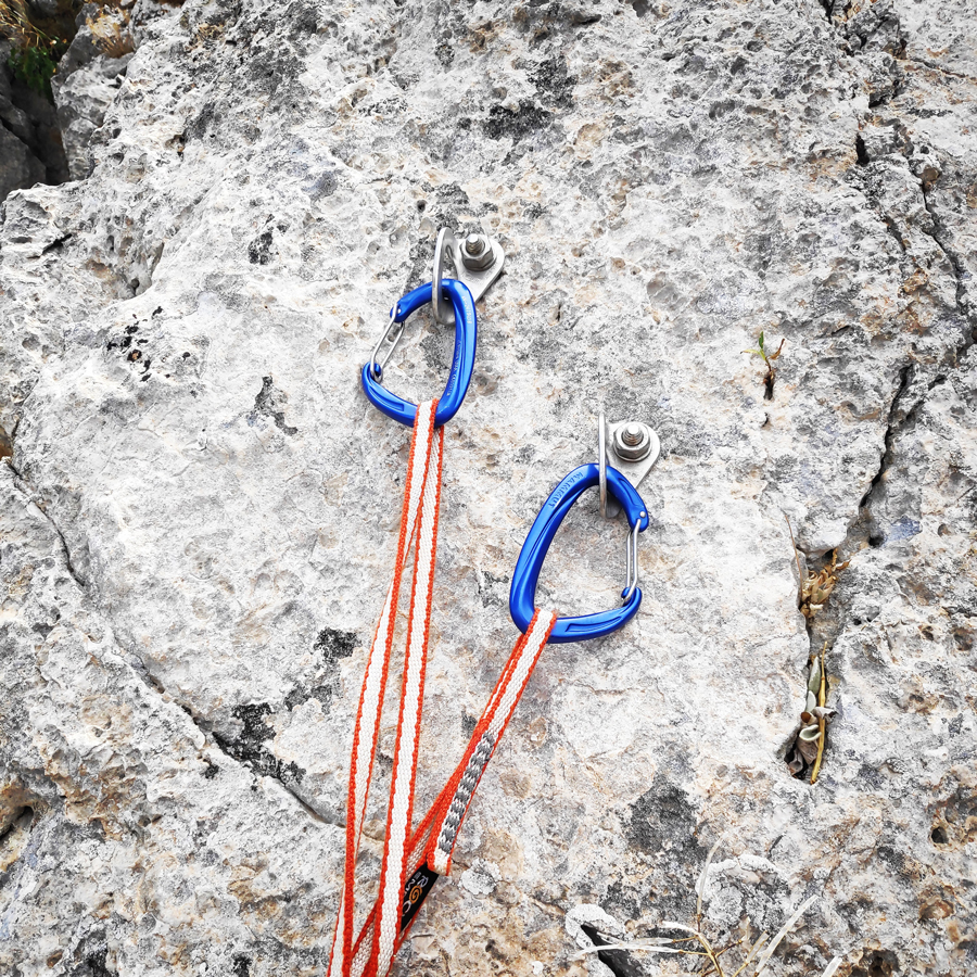
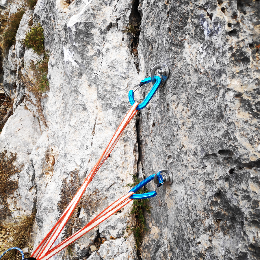
The route starts with the first pitch of 45 m. from the base of the pillar. We start to scramble straight up in easy terrain of III UIAA up to the point we have a cave on our left. At that point there we start the actual climb on a slab of a IV UIAA. Just before the cave there is a bolt placed on the left wall. As soon we overcome the cave the inclination starts to become steeper and we have to climb again on a slab of about V UIAA. We continue to climb up to the point we reach a small ledge, just bellow a dihedral. This dihedral is the crux of the first pitch and actually of the entire route. At the mid section of the dihedral, there is another bolt that can be handy. As soon we climb on top of the dihedral and behind a tree we will see two bolts and there is where we can establish our first belay. We belay with a double size sling (120 cm) and the location for belay is comfortable.
R1-R2 | III UIAA 30 m.
The second pitch of 30 m. starts with an easy climb on a slab and we follow the direction of and old wild olive tree where we pass it from the left. Once we reach the top of that section, we move to the left where we will be uphill walking until we see the second belay.
We belay with a single size sling (60 cm) and the location for belay is comfortable.

Check out more FREE Guidebooks
Download now for free! Explore breathtaking landscapes and conquer thrilling heights with our collection of guidebooks and topos.
Don’t miss out on this opportunity to elevate your outdoor adventures. Click, download, and let the exploration begin!
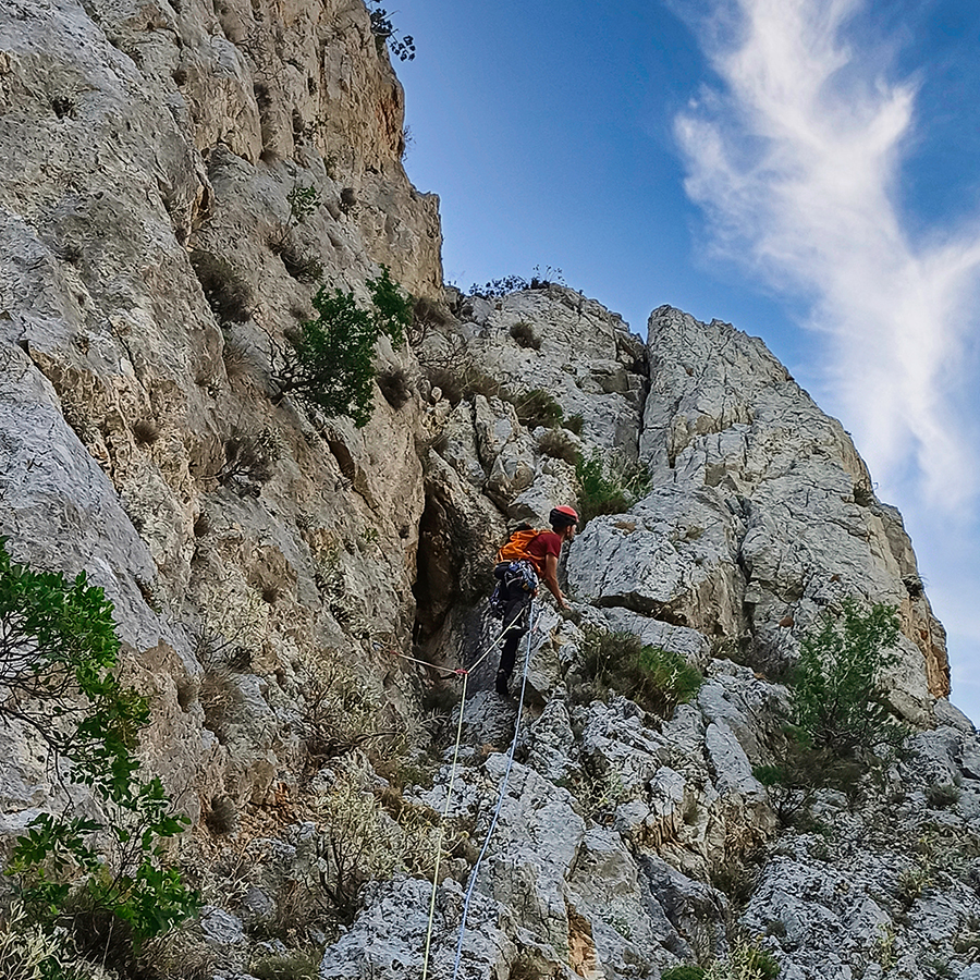
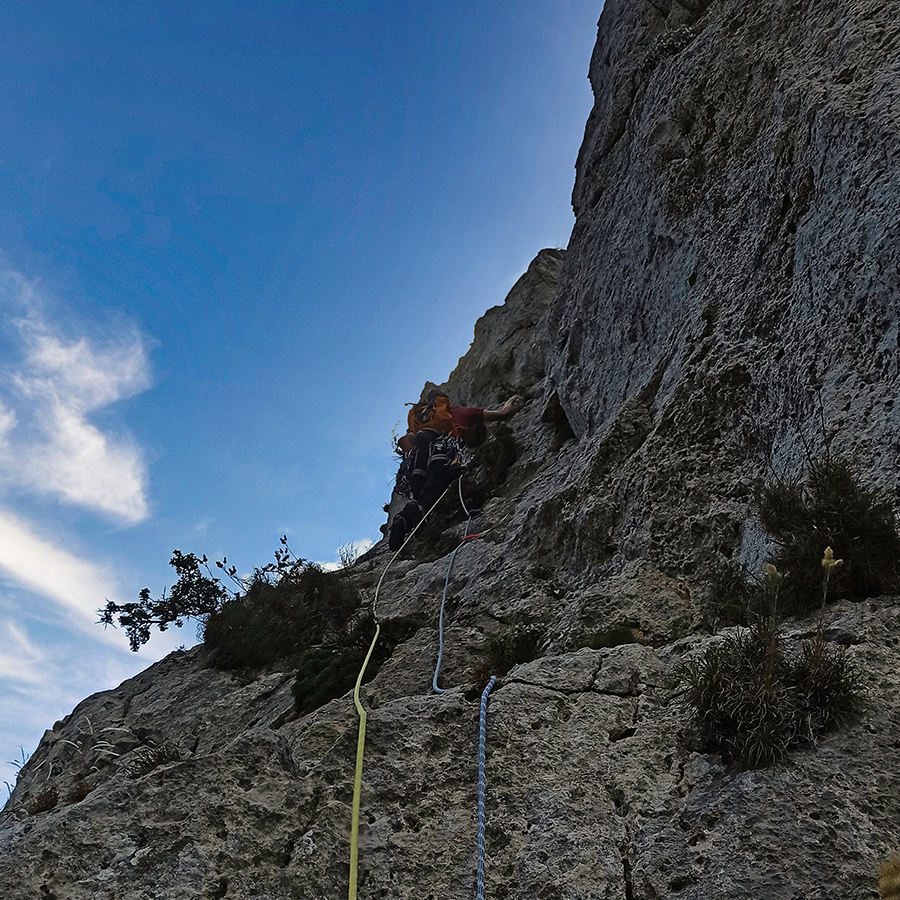
R2-R3 | V UIAA 40 m.
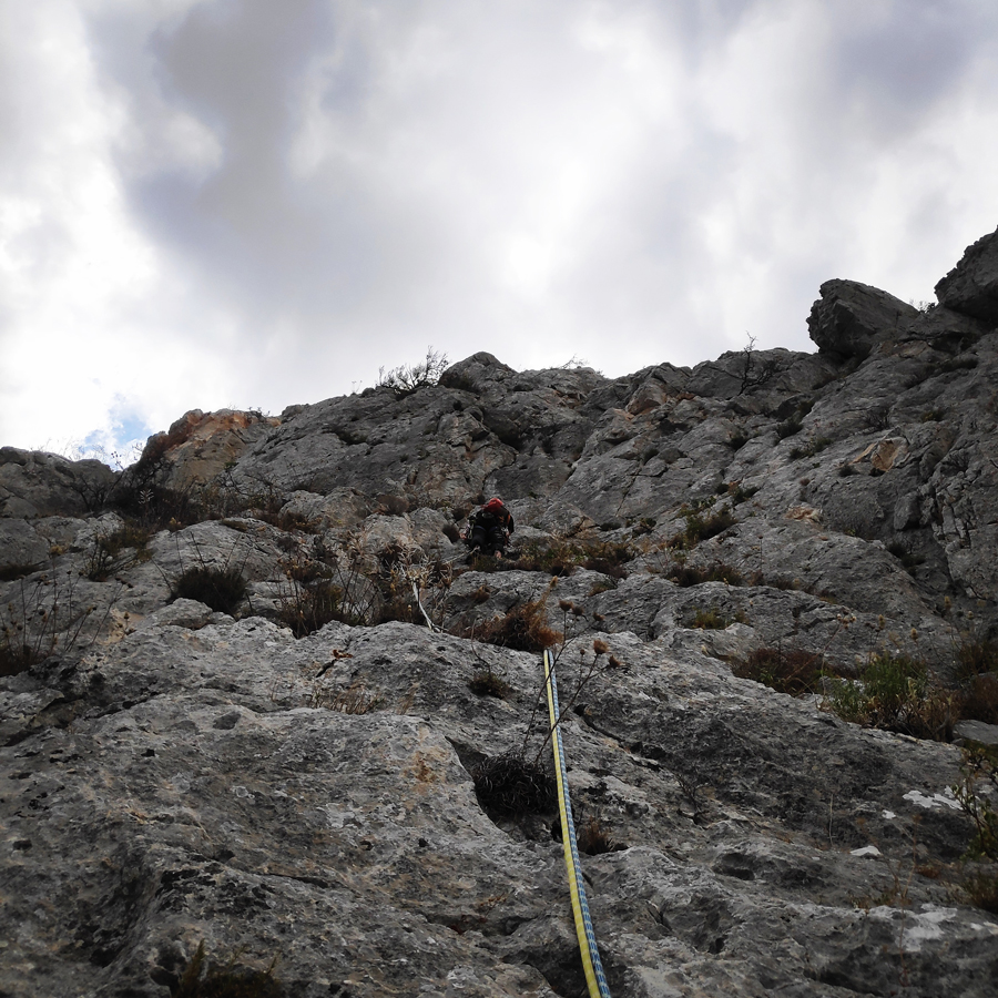
For the third pitch we start to climb straight up from the belay on a slab of IV UIAA. After only two moves we reach a small ledge and on that point we have to make sure to place some good protection. We continue to climb straight up on a slightly exposed slab of IV UIAA where there is also one bolt placed.
As soon we pass the bolt and by turning to the right we enter and climb a rather steep dihedral of maximum difficulty V UIAA. This dihedral might be a bit exposed, but there are enough holds.
As soon we climb up the dihedral, we turn left where we have to scramble on top of a small boulder of maximum III UIAA and we reach the belay.
R3-R4 | 20 m.
The fourth pitch is the easiest of all as there is no actual climbing, but rather a short uphill hike of about 20 meters. Though, one should be extra careful because there are loose rocks.
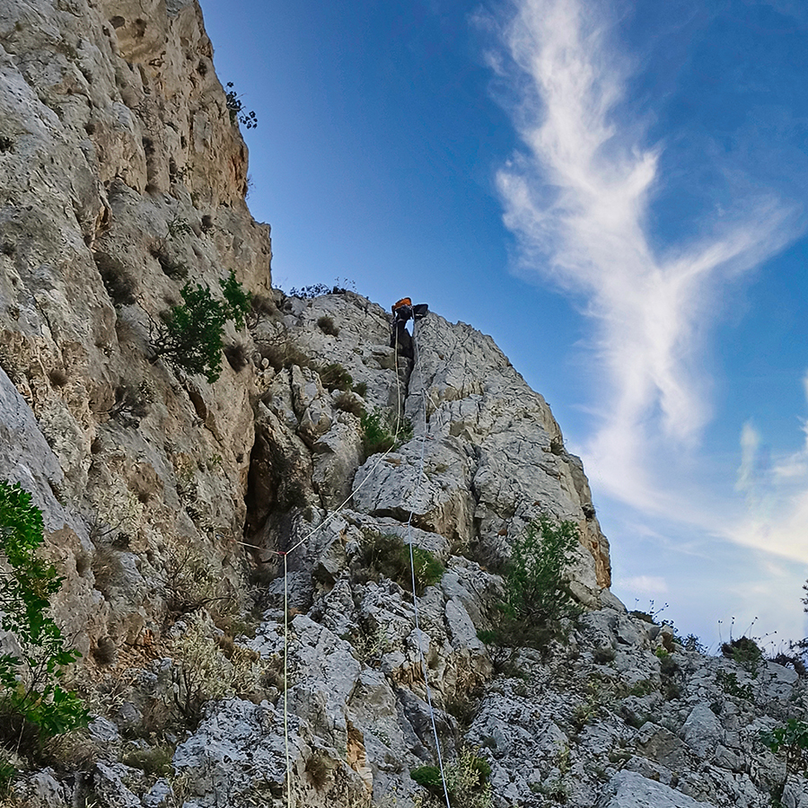
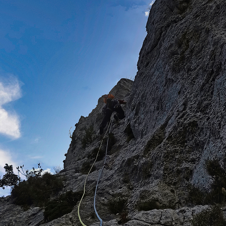
R4-R5 | IV+ UIAA 45 m.
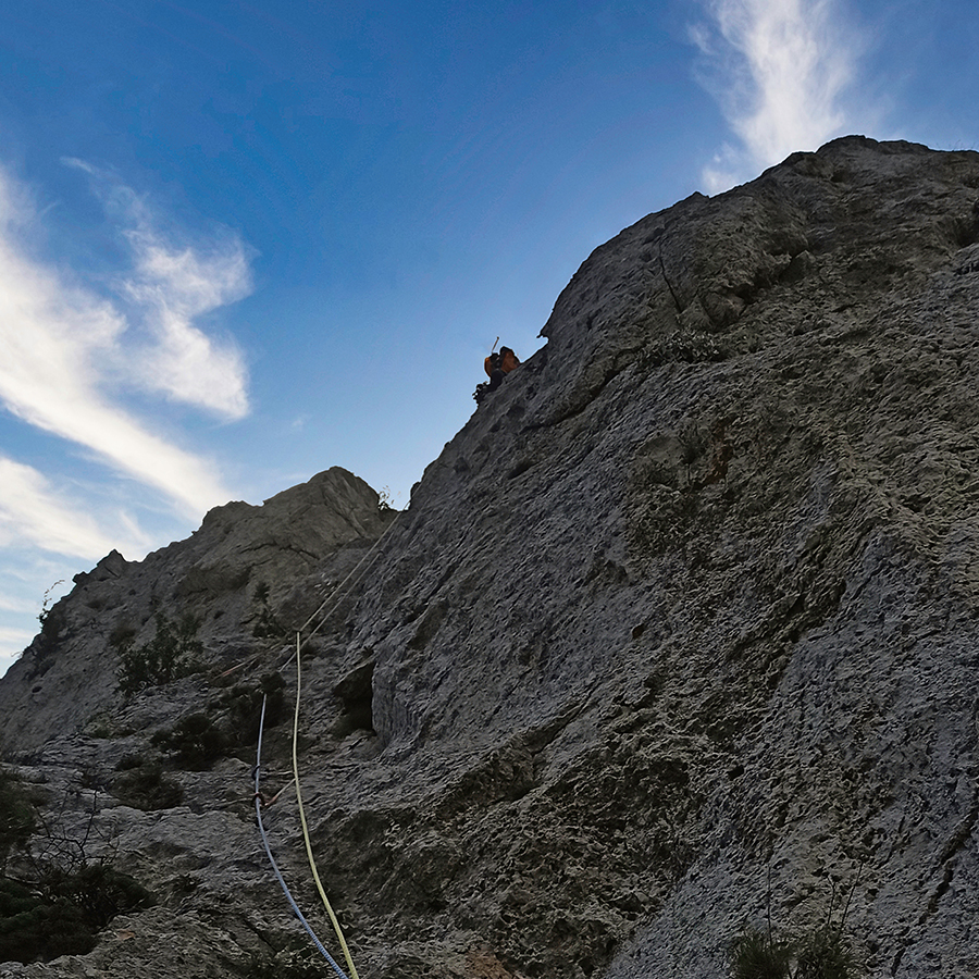
The fifth pitch starts with some scrambling of III UIAA and continues to move straight up with some slabs of IV and IV+ UIAA until we see the first of the two drilled bolts. As soon we see the bolt, we traverse to the right and within 4-5 meters there is a second bold placed. We continue and we climb a ramp. As soon the ramp ends, we turn to the left and we see the belay.
On that point the view is really unique!
R5-R6 | III UIAA 20 m.
For the 6th and last pitch we start to climb to the right side from the belay. We have to climb a up a small boulder and up to the top there is an easy scramble of III UIAA (or perhaps IV UIAA).
Return
From the top of the rock, we turn right and we downhill towards south. Most of the downhill is steep and there is not a clear trail so make sure to be extra careful. From the top of the rock up to the parking spot we need about 30-45 minutes.
Subscribe & Stay Informed
Enter your email address to follow this blog and receive notifications of new posts by email
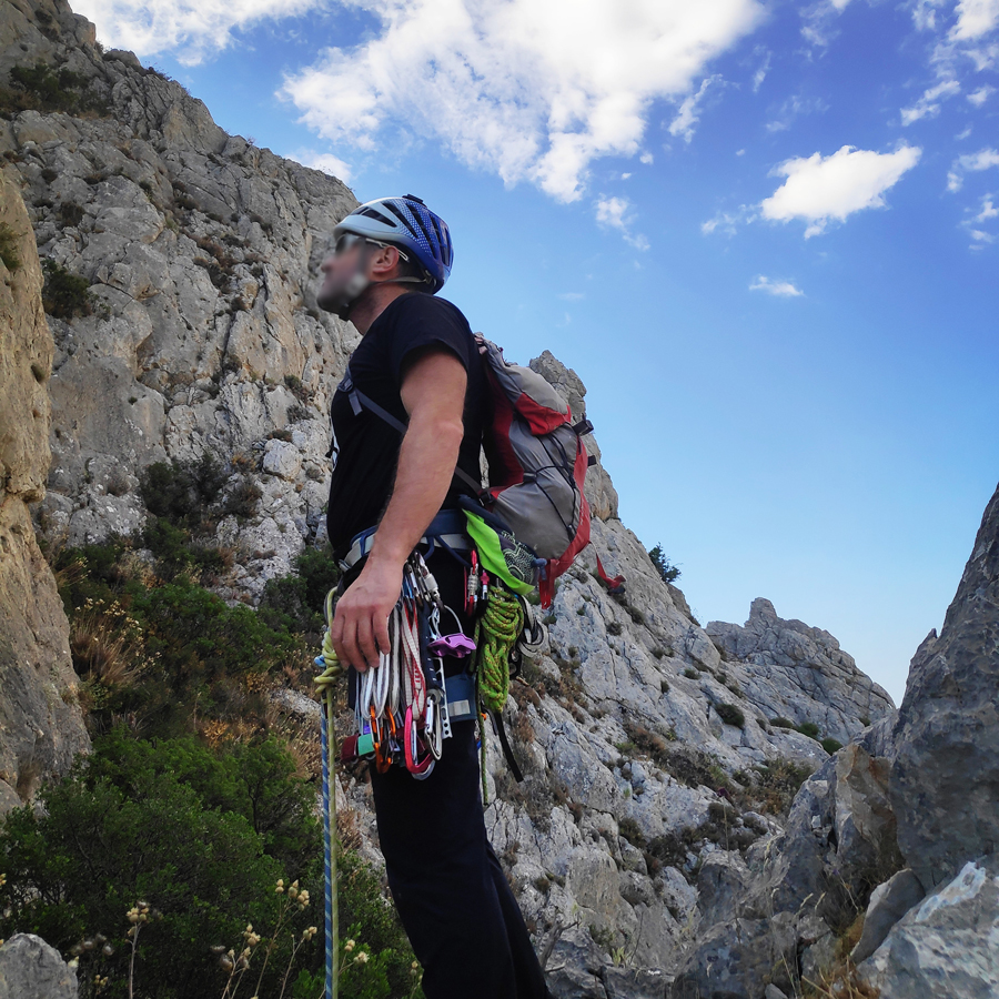
Recommended Gear
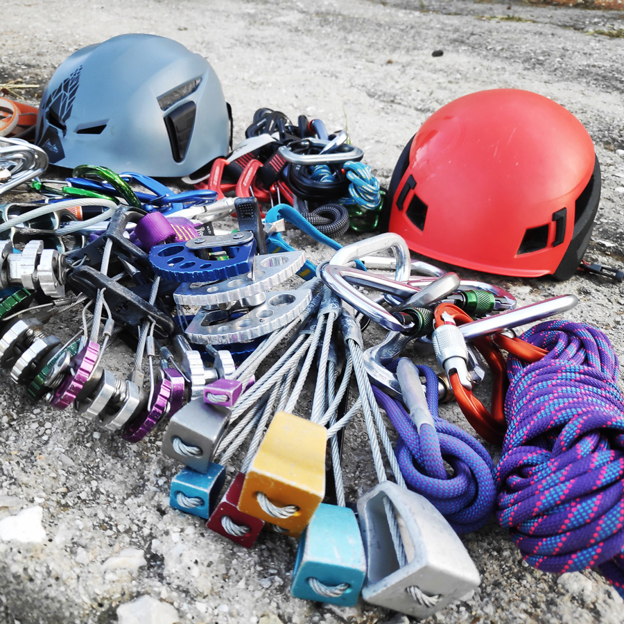
For this trad climb, I used the following gear:
- Mammut Wall Rider Helmet
- 5 lanyards 60 cm
- 1 lanyard 120 cm
- 4 locking carabiners
- 1 HMS carabiner
- The North Face Verto 27 Backpack
- Mammut Ophir Harness
- Simond Climbing shoes
- Alpine Quickdraws
- Cordelette for prusik
- 2 x 60 m. rope
- 4 carabiners
- Reverso
- 0.5 lt of Water
- 1 energy bar
- Friends / Camalots
- Rock Nuts
Details of the Climb
- Location: Mt. Patera – Kantili
- Starting Point: Kantili
- Ending Point: Kantili
- Trail Signs: No
- Difficulty: Medium
- When to Climb: Late Autumn – Early Summer
- Water Features: None
Support the journey — buy me a coffee
I share these articles and the climbing guidebooks because I love the outdoors, and they’ll always be free. If they’ve helped you, help me keep them coming. Click the button to support my work.
Download for free the complete route description and Topo map
- Download the complete Interactive Guidebook in PDF spreads (best for Tablets/Laptops/Desktops)
- Download the complete Interactive Guidebook in PDF single pages (best for Phones)
Before you leave this blog check out the following map
Below: This map marks all the mountaineering adventures that have been featured on Olympus Mountaineering so far, including several Sport climbing crags – Select full screen to expand, zoom in for more detail, or click on a marker for a link to the post.

Pingback: Ek Tou Anasfalous VI UIAA 90 m. | Trad Climbing in Karathona beach – Nafplio – Olympus Mountaineering
Pingback: Electra VI UIAA 4 Pitches – 145 m. | Trad Multi Pitch Climbing in Pleiades Crag – Katafyki Ravine – Ermioni – Olympus Mountaineering