
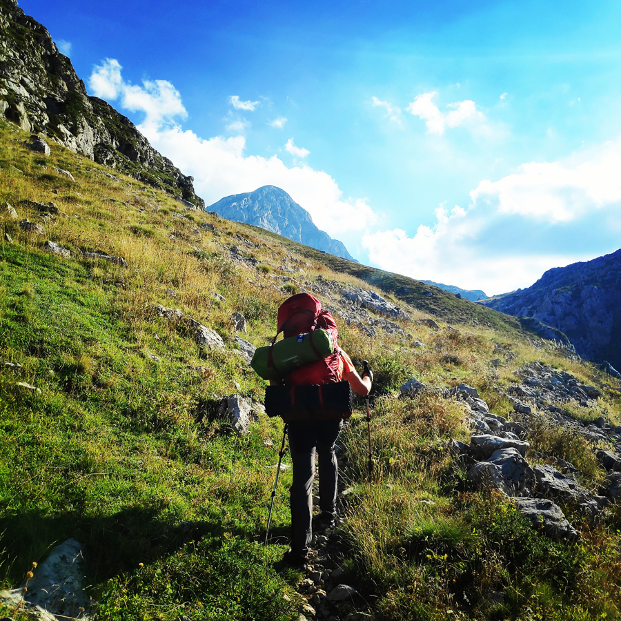
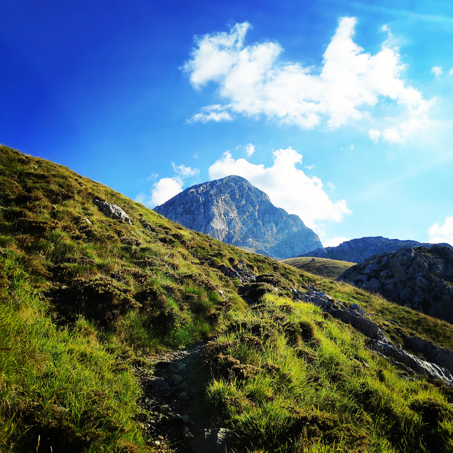
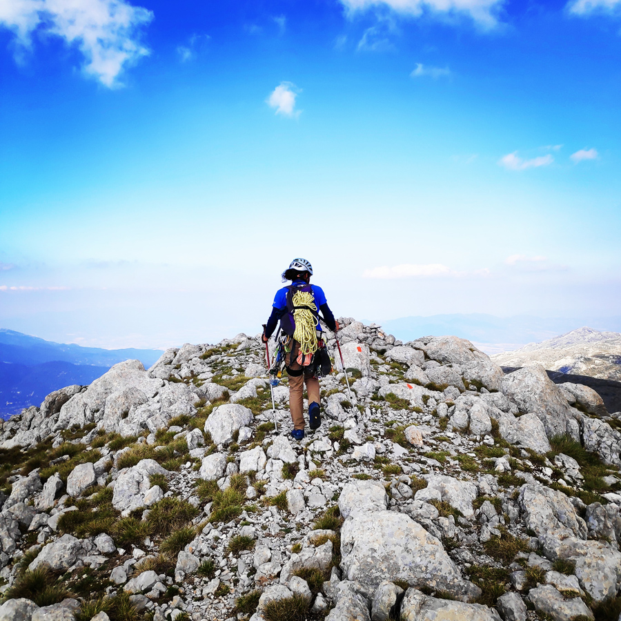
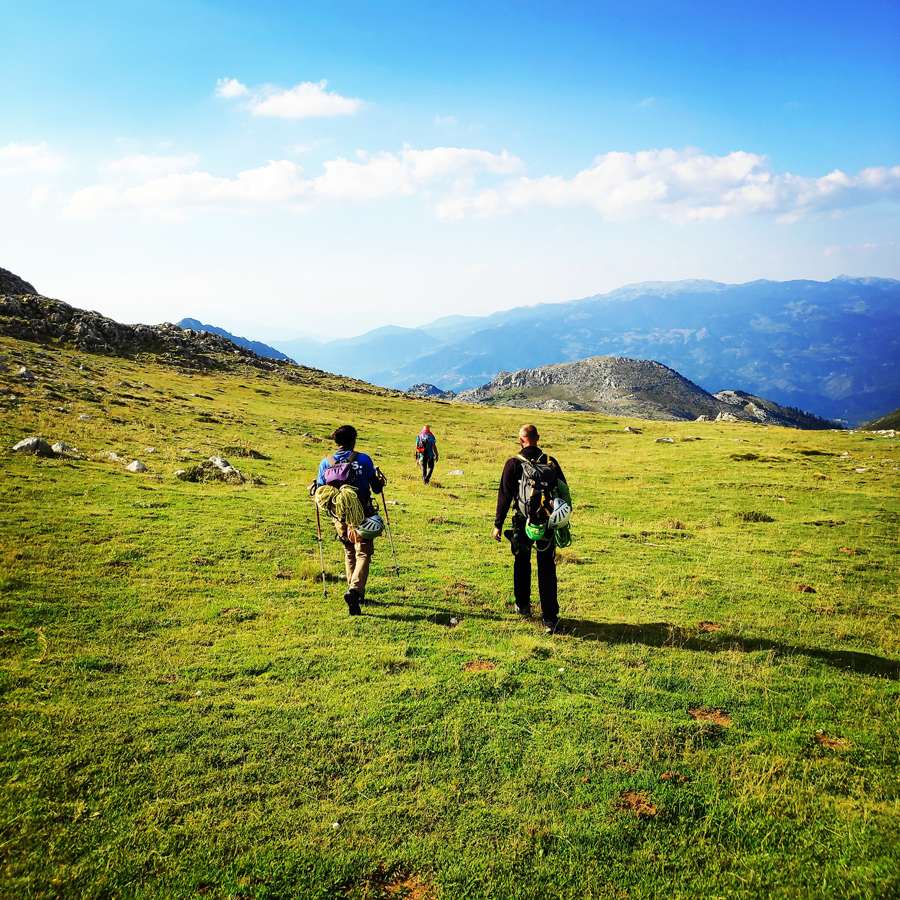
It has been almost three years ago since my last visit on Mount Giona. Also, this is the third time I reach the Pyramida peak, 2.510 m. and each time I have reached the top from different routes.
The first time I visited Giona I hiked towards the top from Kaloskopi. The second time, via Karagiannis’ path and this time I reached the top of mount Giona via the famous mountaineering route, Alpina V UIAA 300 m.
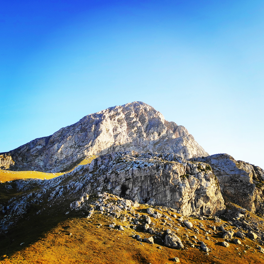
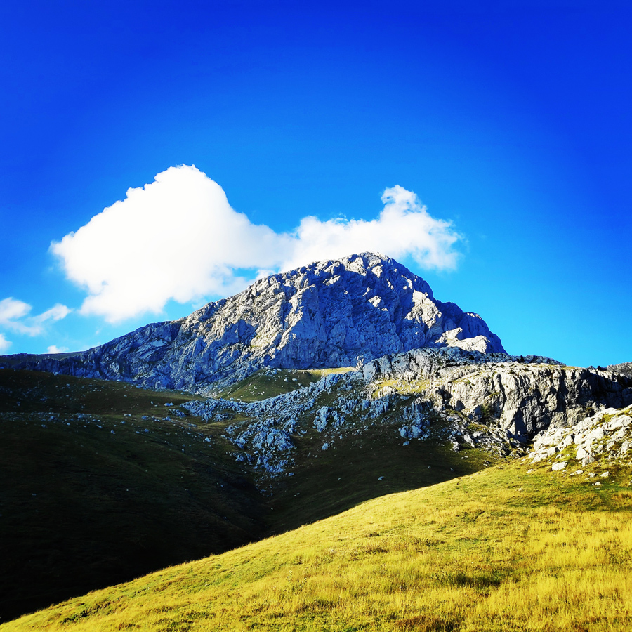
Mount Aselinon (Giona) is a mountain in Phocis, Central Greece. It is located between the mountains of Parnassus to the east, Vardousia to the west, and Oeta to the north. Known in classical antiquity as the Aselinon Oros (moonless mountain), it is the highest mountain south of Olympus and the fifth overall in Greece. Pyramida is its highest peak at 2,510 metres (8,235 ft).
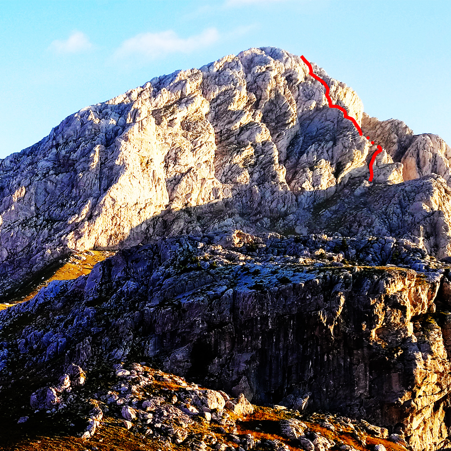
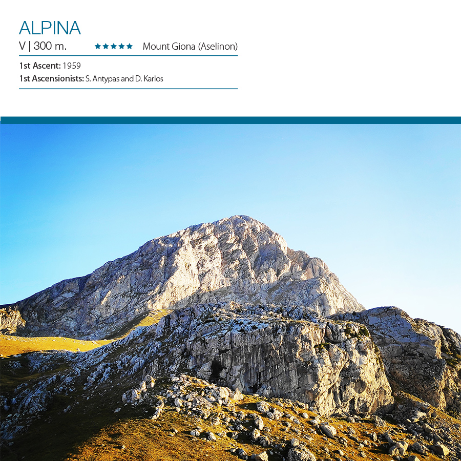
Alpina V UIAA – 300 m.
“Alpina” (V, 300 m.) first ascent was made in 1959 by S. Antypas and D. Karlos. The route follows the North-West ridge which is located on the north face of the pyramid of Mount Giona.
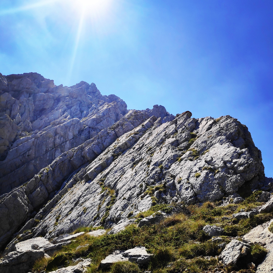
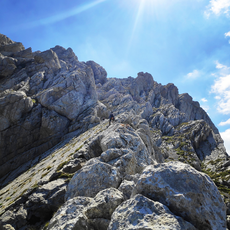
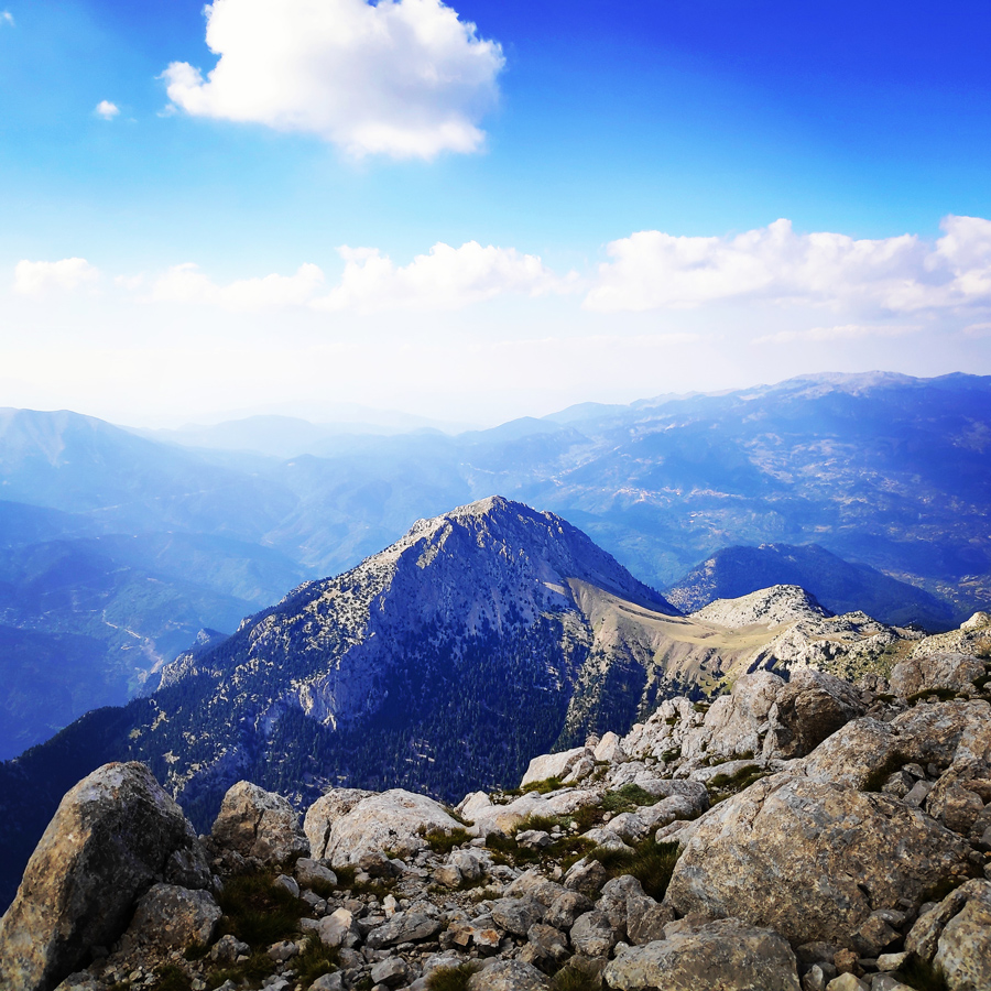
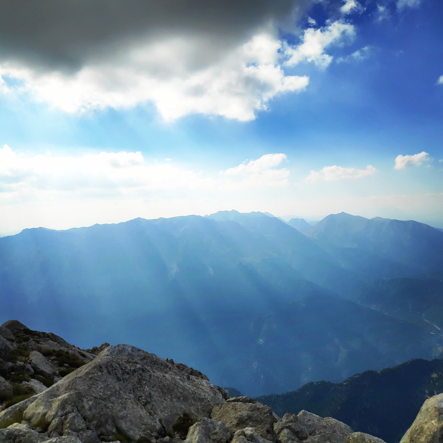
This is a very atmospheric route with great views towards Lazorema and Vathia Laka with plenty of variety in the climbing style, from slab to dehydral and some scrambling too. Alpina is also a great route for winter mountaineering ascents.
Support the journey — buy me a coffee
I share these articles and the climbing guidebooks because I love the outdoors, and they’ll always be free. If they’ve helped you, help me keep them coming. Click the button to support my work.

Download for free the complete route description and Topo map
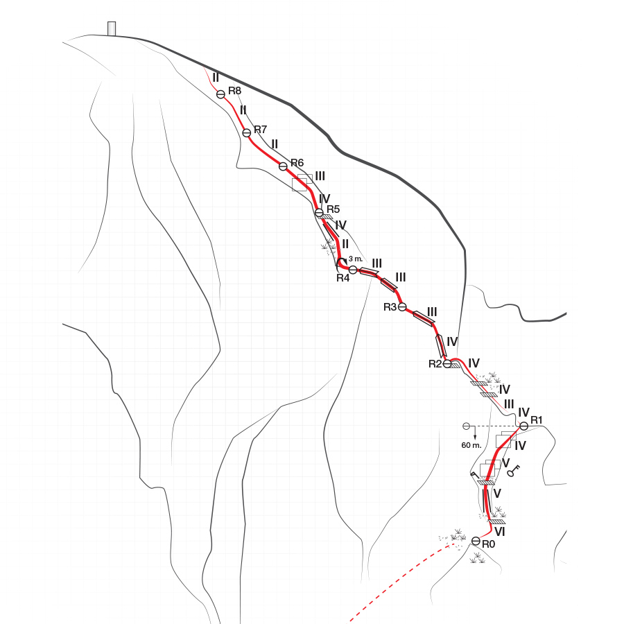
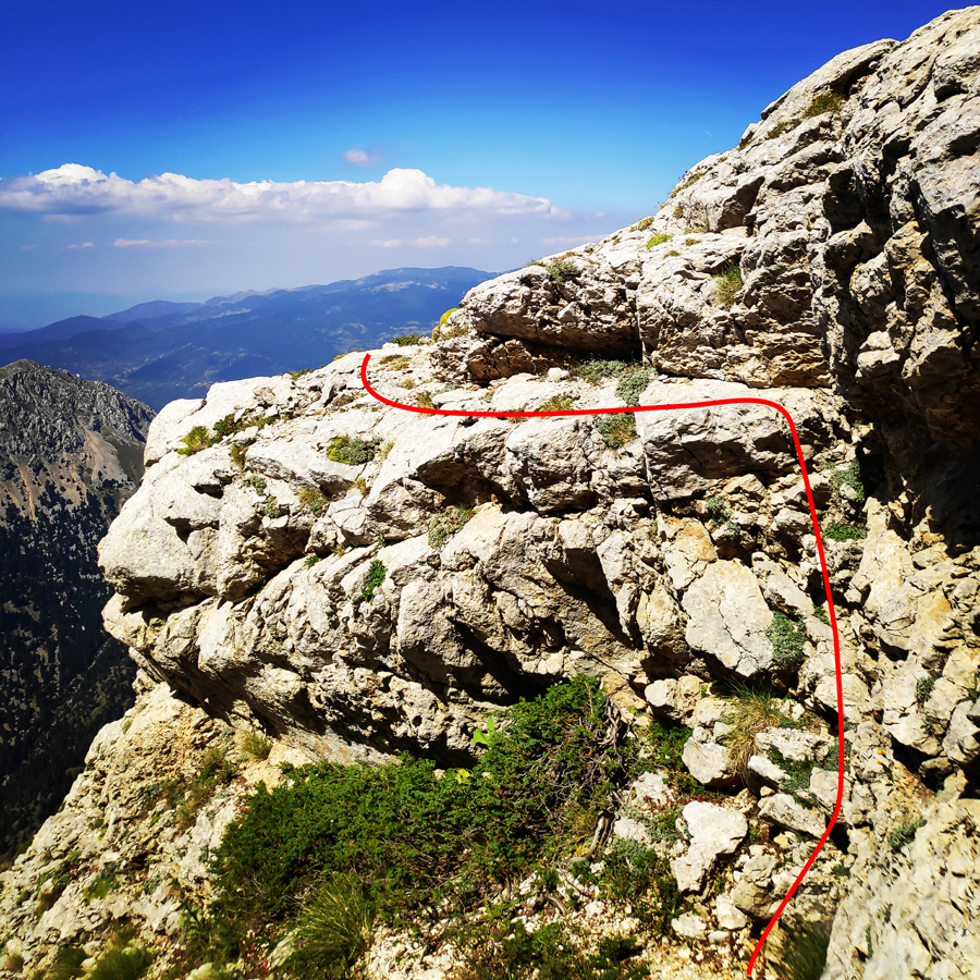
Topographic map
If you are going to climb alpine rock faces, you will need the most detailed information possible about the rock and the route. All this can be found on a topographic map: This is a graphic representation of a climbing route and can usually be found in a guidebook or on certain websites. The lead climber should always have the topographic map at hand when on the rock face.
Like any map, a topographic map uses symbols to represent information about the rock. Climbers can orient themselves on the basis of these standardised Symbols. Illustrations indicate the climbing direction, the length of each pitch and the number and type of belay points. Further indicators that can help with orientation include a logical route, the rock quality as well notable features on the rock.
Bellow a topo of the route Alpina V UIAA – 300 m.
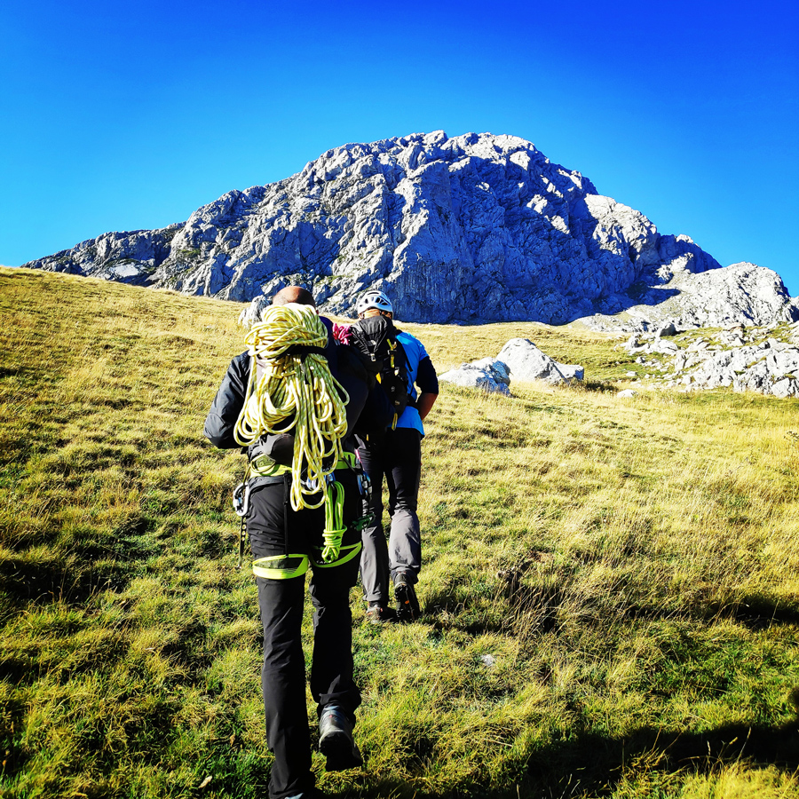
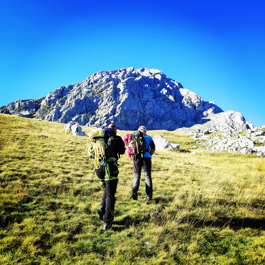
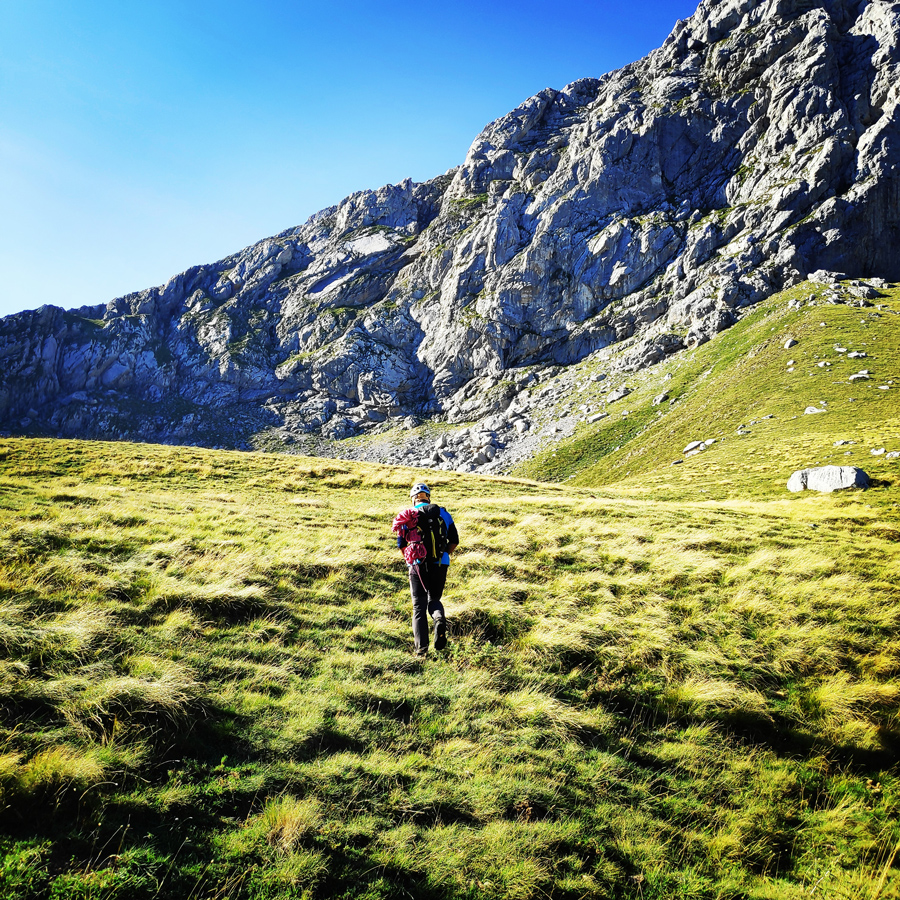
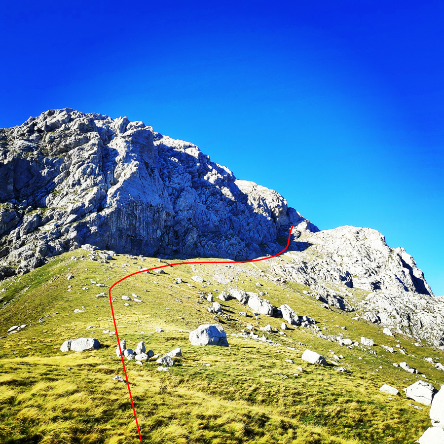
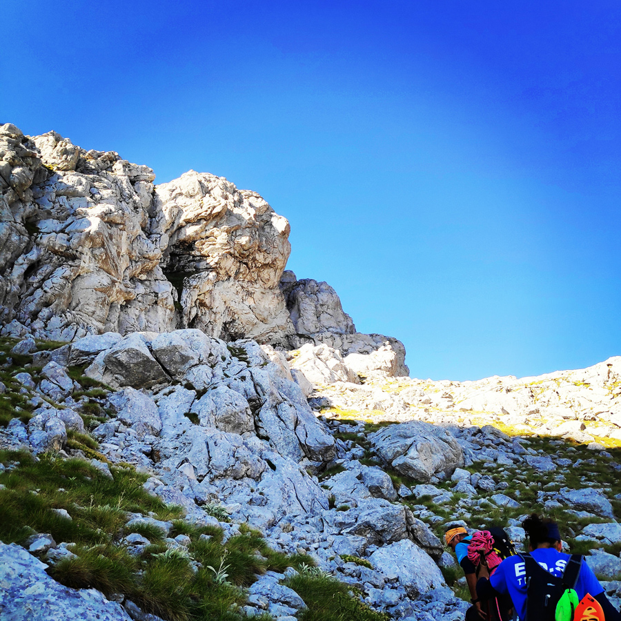
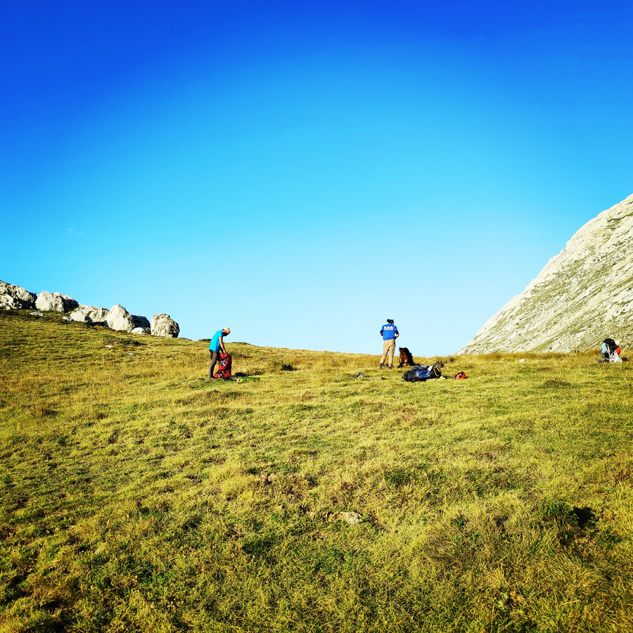
Approach
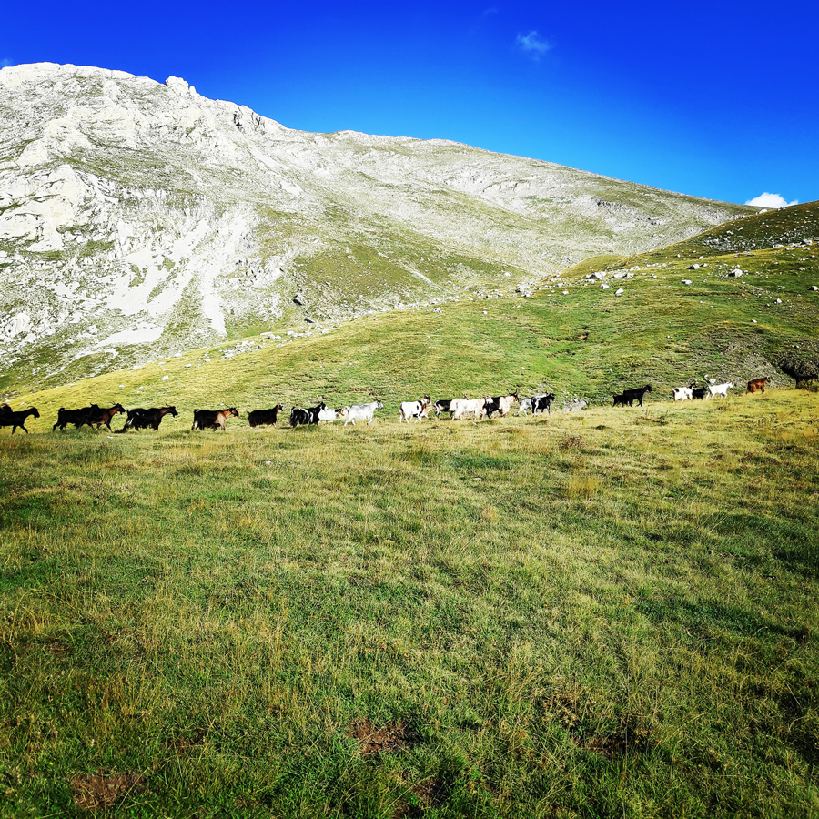
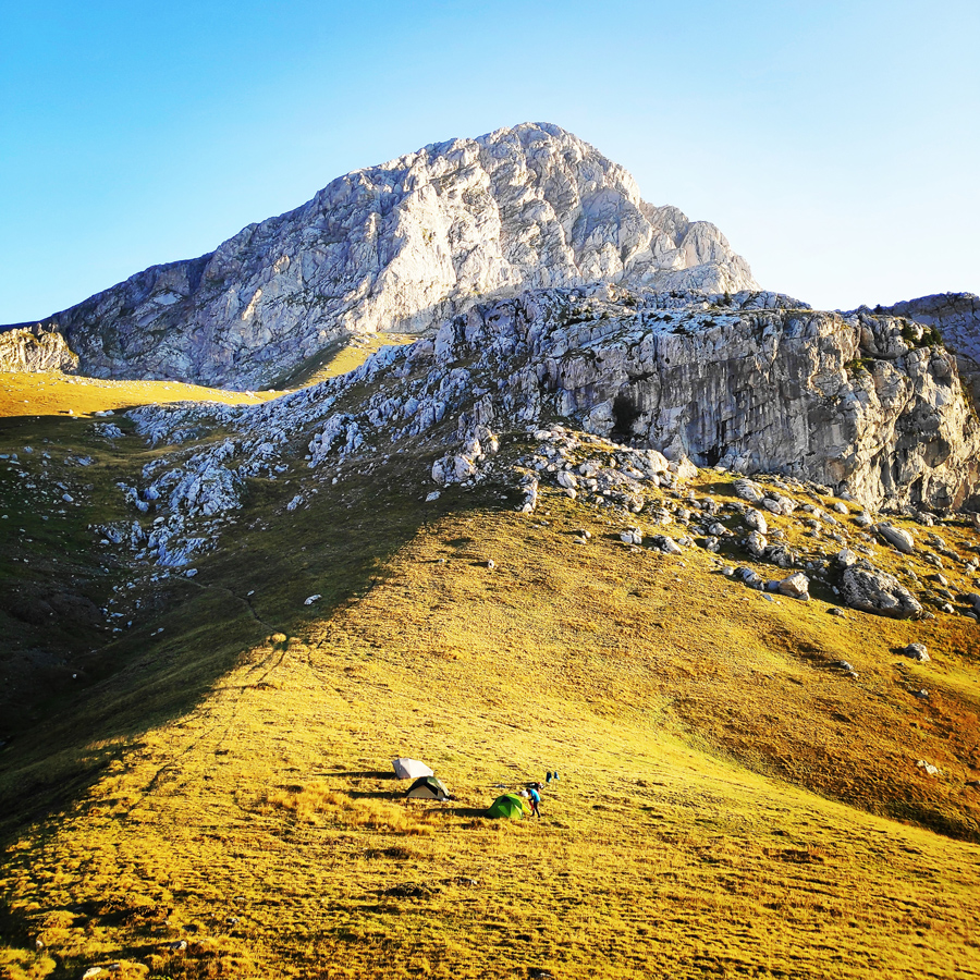
The route is located in Pyramida of Mount Giona and specifically on the north face of the mountain. Its orientation is north. Approaching the R0 requires 1 hour and 15 minutes of hiking from the camp site. Hiking to the camp site is about 1 hour from the parking lot.
- Parking lot coordinates: 38°39’54.07″, 22°16’11.85″
- Beginning of the route: 38°39’2.03″, 22°15’13.26″

Check out more FREE Guidebooks
Download now for free! Explore breathtaking landscapes and conquer thrilling heights with our collection of guidebooks and topos.
Don’t miss out on this opportunity to elevate your outdoor adventures. Click, download, and let the exploration begin!
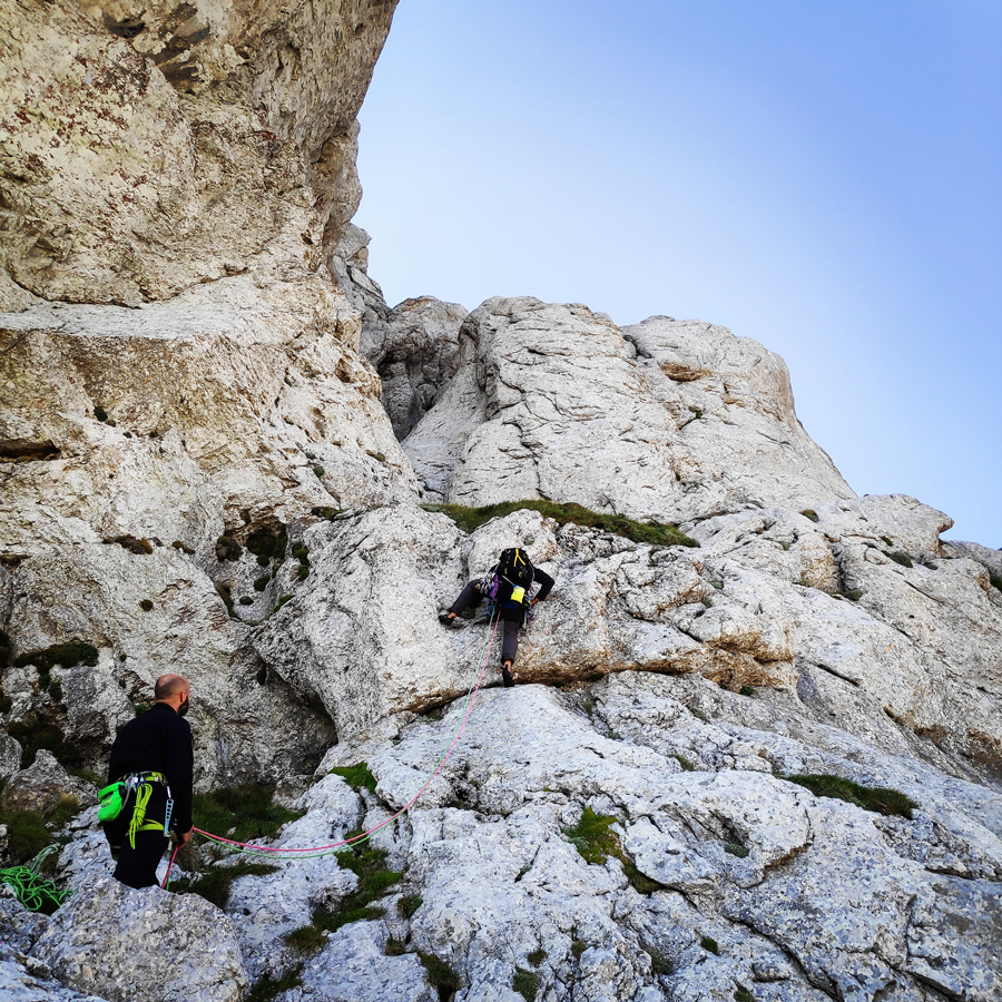
Route Description
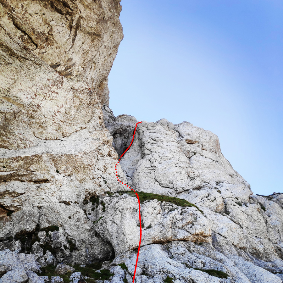
R0 – R1
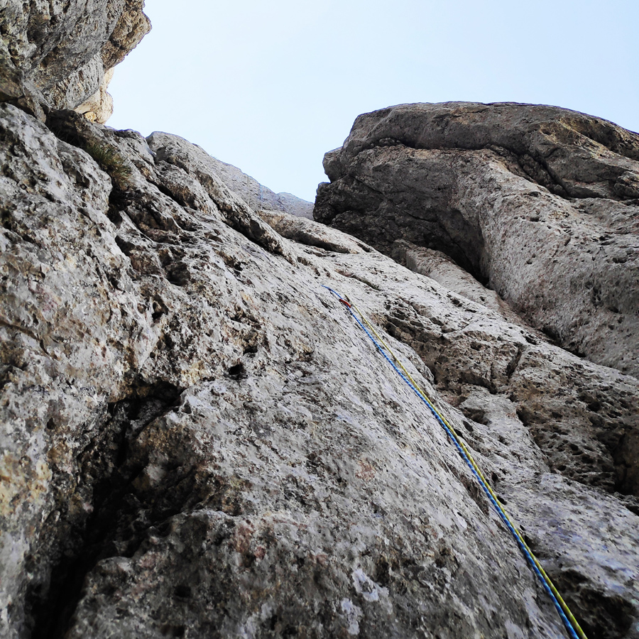
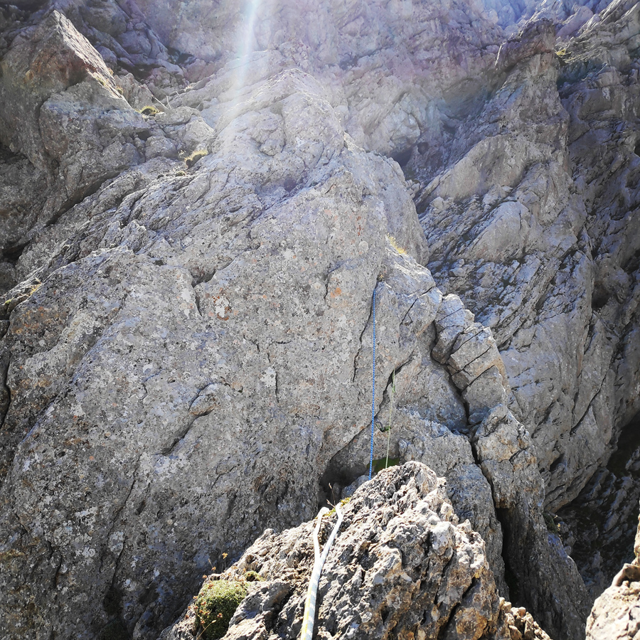
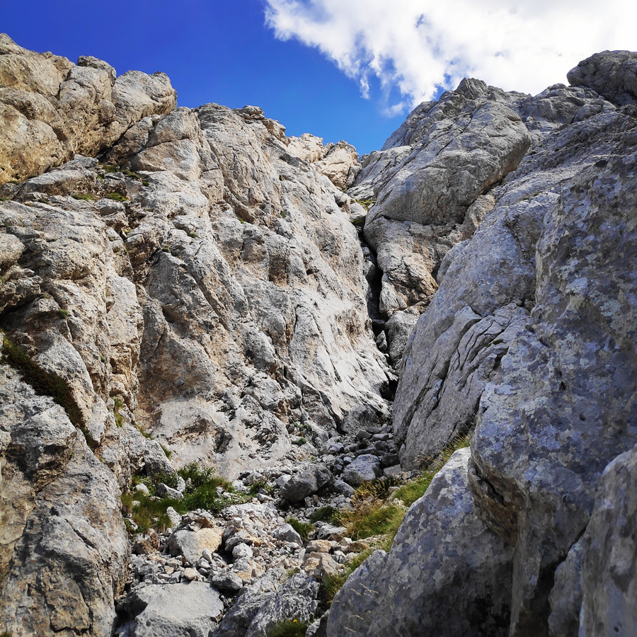
The route starts with the first pitch (60 m.) exactly at the base of the north-west ridge ( 38°39’2.03″, 22°15’13.26″) via the obvious couloir.
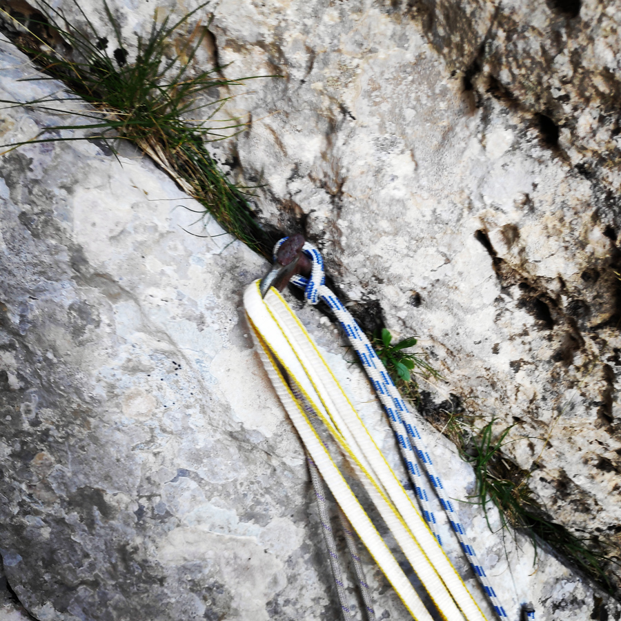
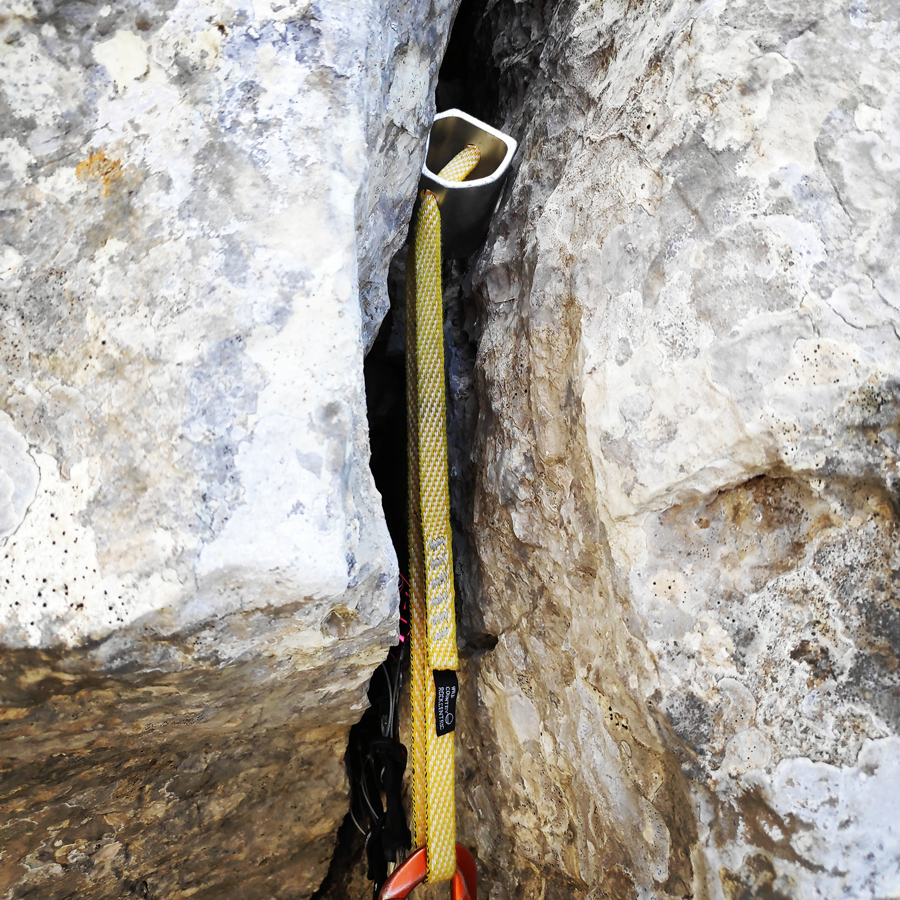
We climb IV UIAA on top of a ledge where there is grass and rubbles and we continue scrambling (attention to the loose rocks) towards the couloir. Entering the couloir we climb a slab of V UIAA and then we go on a ledge where we can find an old peg. We continue on a slab of V UIAA and we move towards the east (right) where we see an old cordelette.
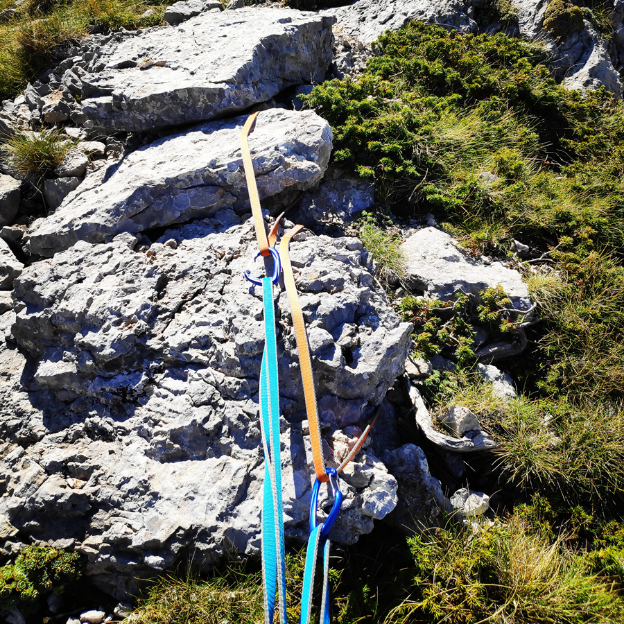
We climb IV UIAA up to the obvious belay where there are few old cordelettes. From the belay we can enjoy the magnificent ridge, but also great views towards Lazorema and Vathia Laka.

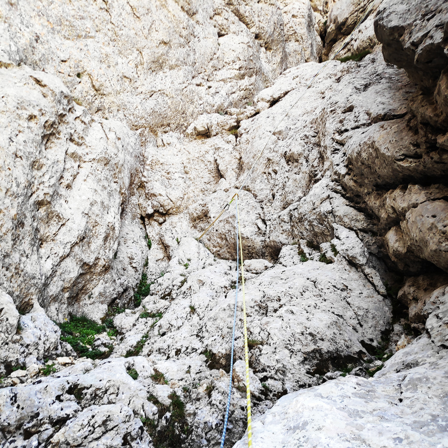
R1 – R2
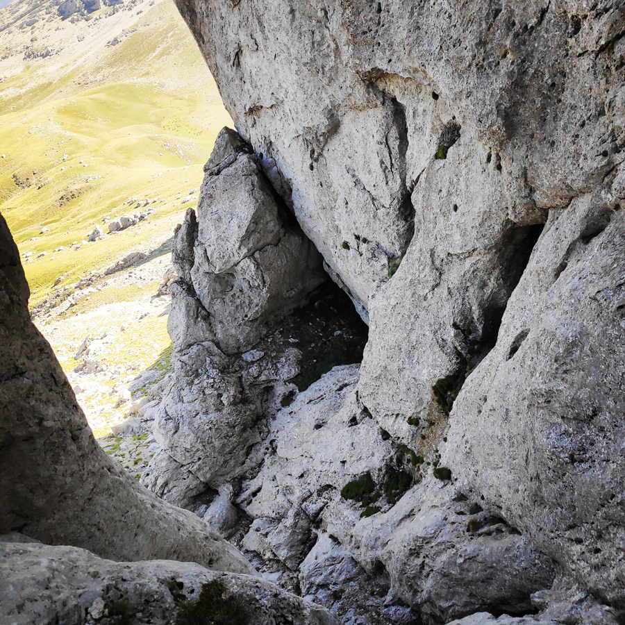
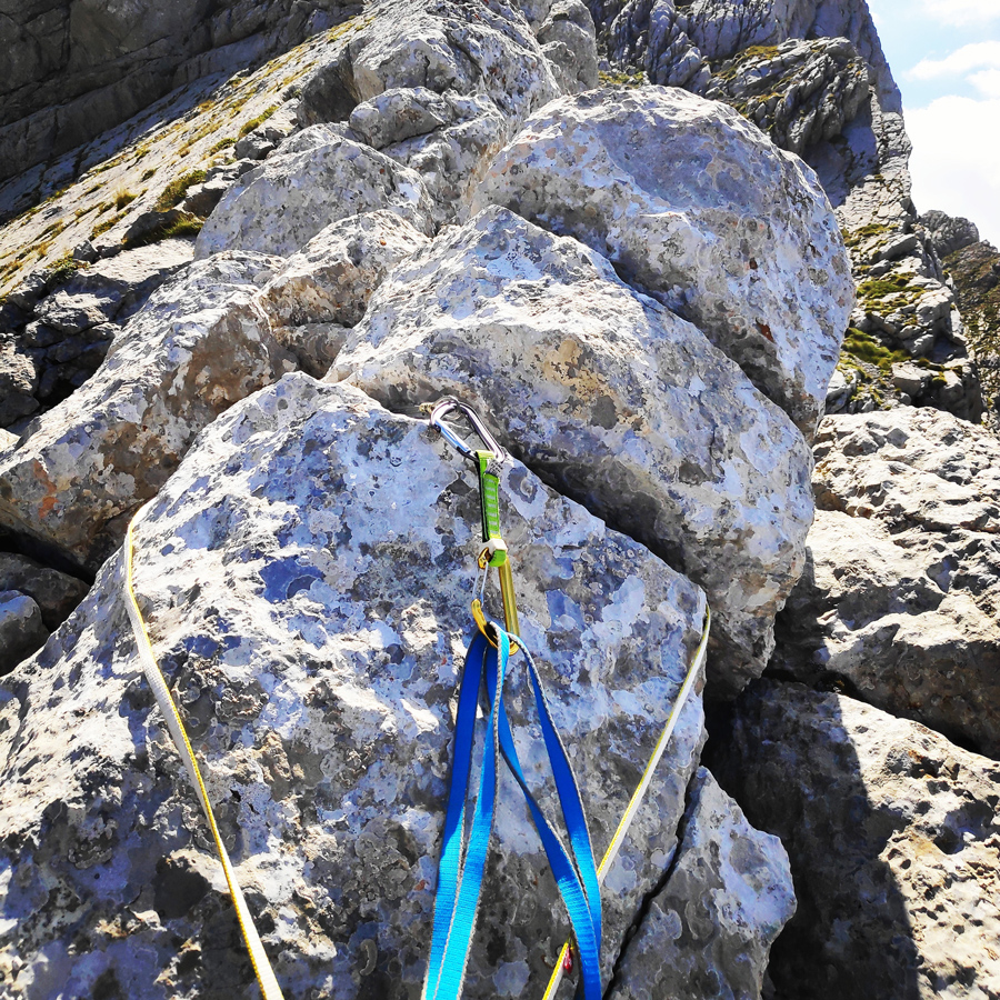
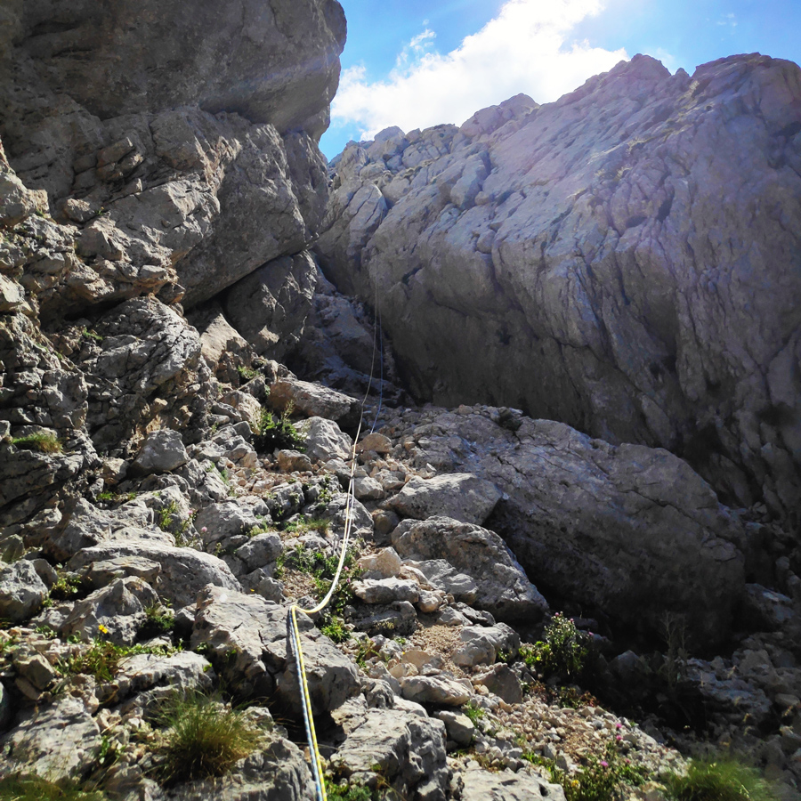
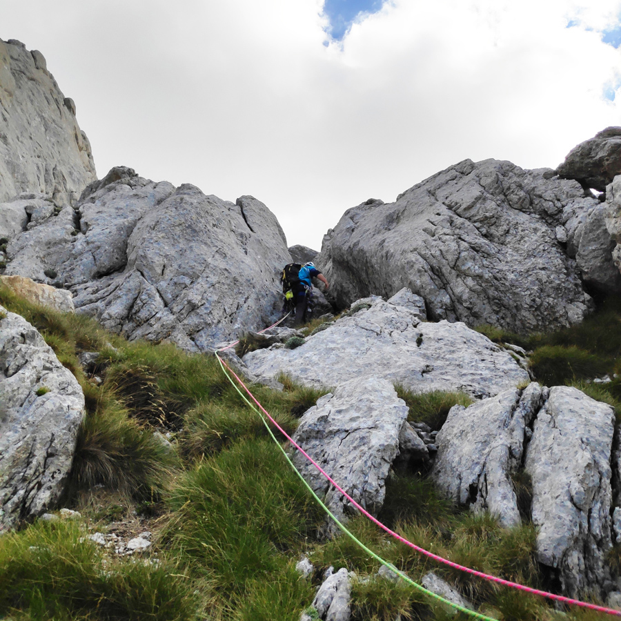
From R1 to R2, we first need to pass from the right side of an obelisk shaped rock. This passage is a IV UIAA but quite exposed and in combination with the loose rocks it becomes quite demanding.
Having passed the obelisk, the terrain becomes easier (III UIAA) and upon that, we climb IV UIAA consecutive ledges with some rubbles until we reach the beginning of the beautiful ridge. Belay is a solid spot with good view of the ridge.
Explore all outdoor activities in a convenient list view here
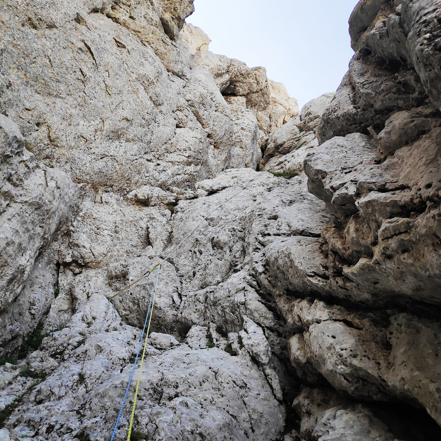
R2 – R3
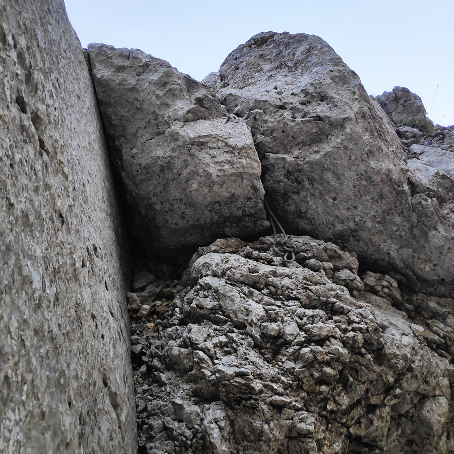
From R2 to R3, there is a IV UIAA grade passage on the ridge and soon after the difficulty is max III UIAA.
Though at that point the ridge becomes really narrow, the typical knife edge ridge. We then climb a III UIAA passage and we belay on a good spot right in the middle of the ridge.
R3 – R4
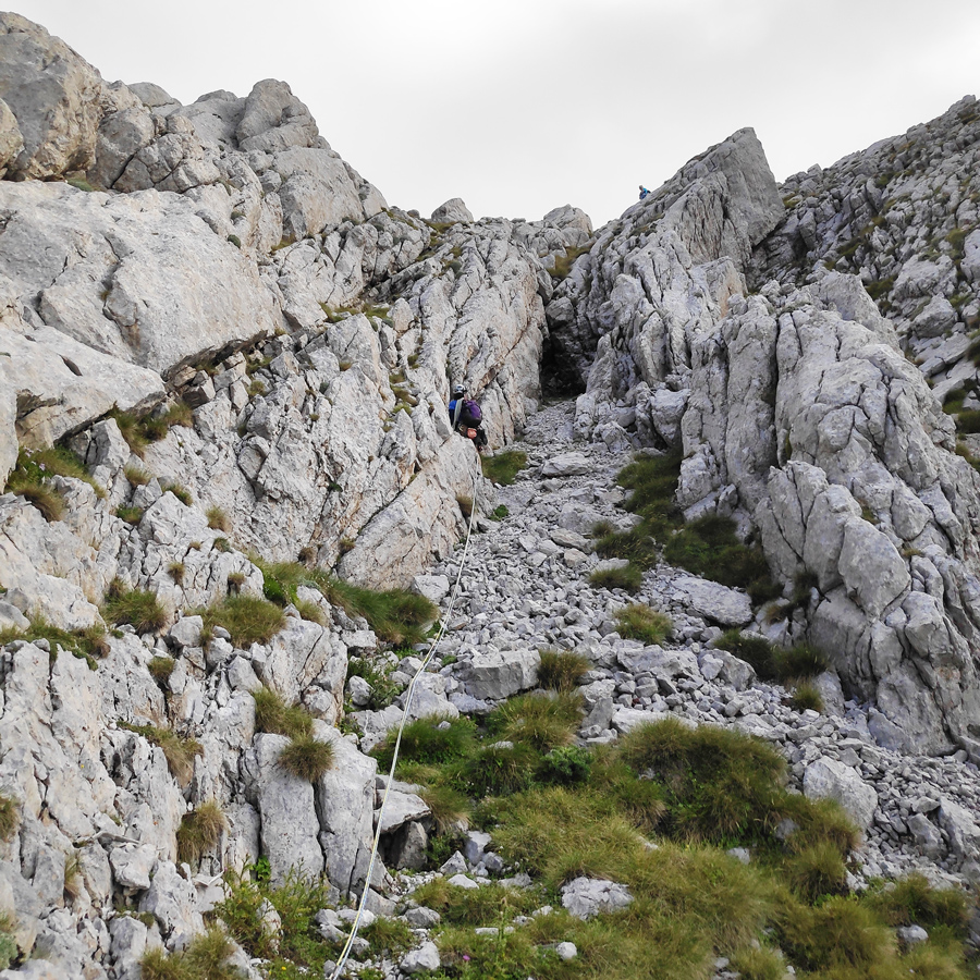
From R3 to R4, we continue to follow the ridge with stunning view to the east mainly with scrambling of III grade. This pitch is less exposed and easier compared to the previous pitch.
R4 – R5
From R4 to R5, we first need to downclimb about 3 meters and then to follow (II UIAA) the couloir that leads to R5.
Prior of reaching R5 we need to climb a short passage of IV UIAA. This pitch is not difficult though from this point and on we always need to be very careful with loose rocks.
R5 – R6
From R5 to R6, the pitch starts with a IV UIAA passage and then the terrain becomes easier of a maximum III UIAA grade.
R6 – R7 – R8 – Peak
From R6 till the end of the route, we need to follow the obvious path.
These pitches are relatively easy, though it is very important to pay attention to the loose rocks and rubbles.
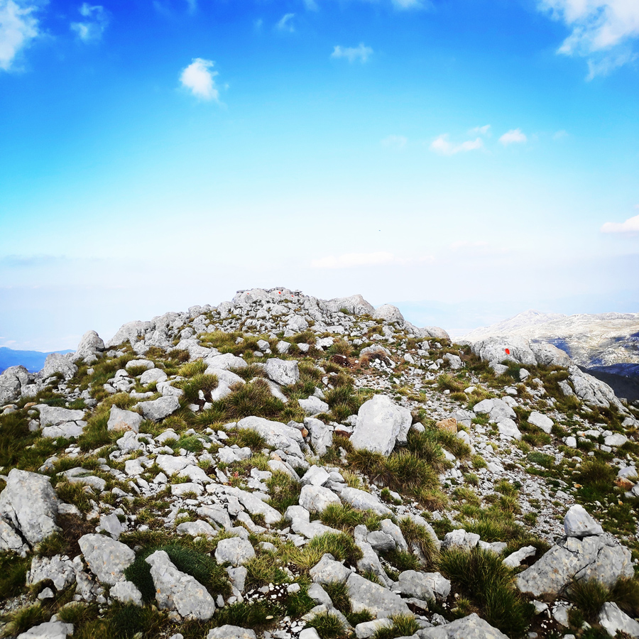
Once we exit the route, we have to go towards the east (left) and within a minute we reach the highest peak of mount Giona, 2.510 meters.

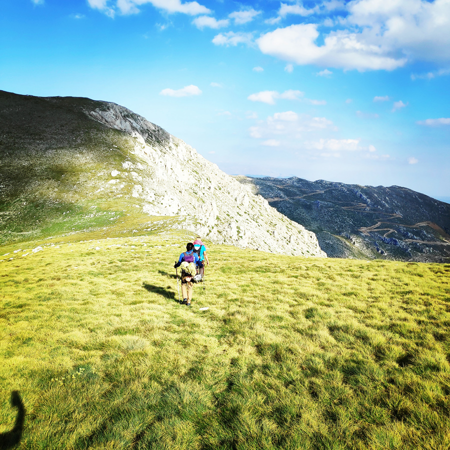
Return
The return starts from the peak of Giona and there is a signed trail towards Vathia Laka and from there towards the parking lot.
The descent till the parking lot takes about 2 hours and 15 minutes.
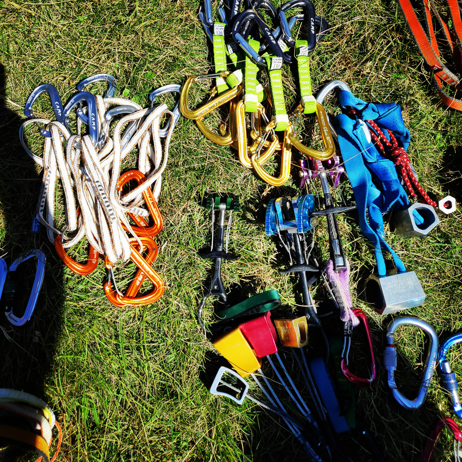
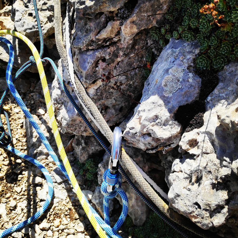
Recommended Gear
For this multi-pitch climb, I used the following gear:
- Mammut Wall Rider Helmet
- The North Face Verto 27 Back pack
- 5 lanyards 60 cm
- 2 lanyards 120 cm
- 4 locking carabiners
- 2 HMS carabiner
- Mammut Ophir Speedfit Harness
- Simond Climbing shoes
- Camp Mach Alpine Quickdraws
- Cordelette for prusik
- 2 x 60 m. 1/2 ropes
- 5 wire gate carabiners
- Reverso
- 1.5 lt of Water
- 1 energy bar
- Rock Nuts
- Sunscreen
Subscribe & Stay Informed
Enter your email address to follow this blog and receive notifications of new posts by email
Details of the Climb
- Location: Aselinon Mountain/Mount Giona
- Starting Point: Mnimata
- Ending Point: Pyramida Peak
- Trail Signs: Yes
- Maximum Elevation: 2.510 m.
- Difficulty: V UIAA 300 m.
- When to Climb: Summer and Autumn
- Water Features: Yes
Below: This map marks all the mountaineering adventures that have been featured on Olympus Mountaineering so far, including several Sport climbing crags – Select full screen to expand, zoom in for more detail, or click on a marker for a link to the post.

Awesome trip report! That route looks so much fun!
LikeLike
It’s a really nice route indeed and due to the loose rocks and rubbles, quite demanding too.
LikeLike
Beautiful photos and excellent organization of the report, love the attention to detail and passion y’all bring to the mountains!
LikeLike
Thank you for your kind comment and I’m Very pleased to know you liked this post and you understand -through this post- my passion about the mountains.
Thanks again for your positive comment.
LikeLike
Pingback: Hiking and Wild Camping on Mount Giona (Mt. Aselinon) – Olympus Mountaineering
Pingback: Camp Mach Express Dyneema Quickdraw Review – Olympus Mountaineering
Pingback: Immerse in Greek Mountain Beauty: 10 Hiking Routes That Ignite the Spirit of Adventure – Olympus Mountaineering