Tzoumerka (or Athamanika), characterised by the mountains, the rugged landscape and the dense greenery, have the water element omnipresent in order to offer its freshness and balance through its everlasting movement! Thus, on the one hand there is the Acheloos river with its unique beaches, and on the other the Theodoriana village and its unique, twin waterfalls of Souda.
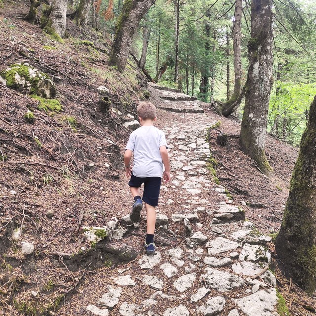
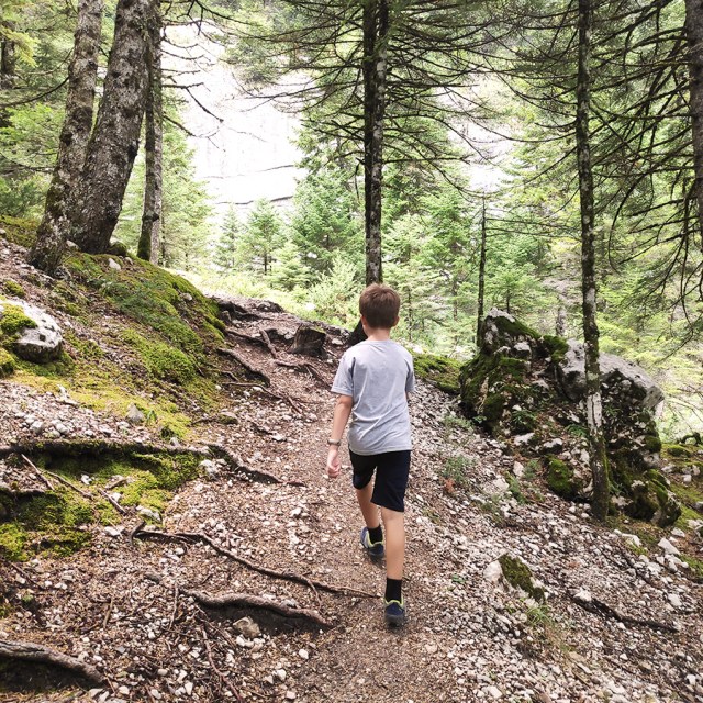
Having visited the wonderful “Marks Stream“, we decided to continue our exploration in the area by visiting the twin waterfalls of Souda. This is a very easy hike and suitable for non-experienced hikers and/or families with kids.
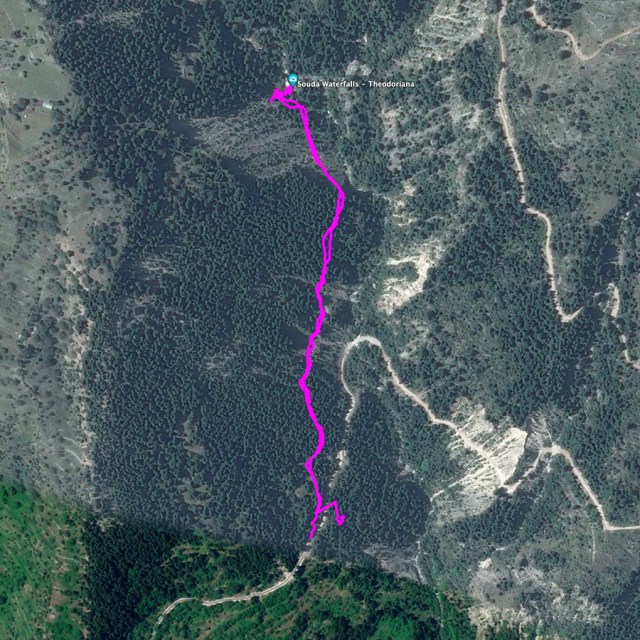
In order to reach the twin waterfalls of Souda you can do it in two ways:
- to start the hike from Theodoriana village or
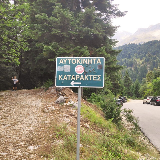
- drive up to the dedicated parking lot and start the hike from there.
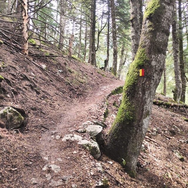
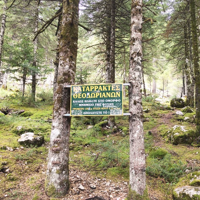
Due to the fact we had limited amount of time, and wanted to explore further the area, we decided to drive up to the parking lot and start our hike from there. The trail starts right from the parking spot (there is a dedicated signage) and the overall hike is very easy with minimum elevation gain.
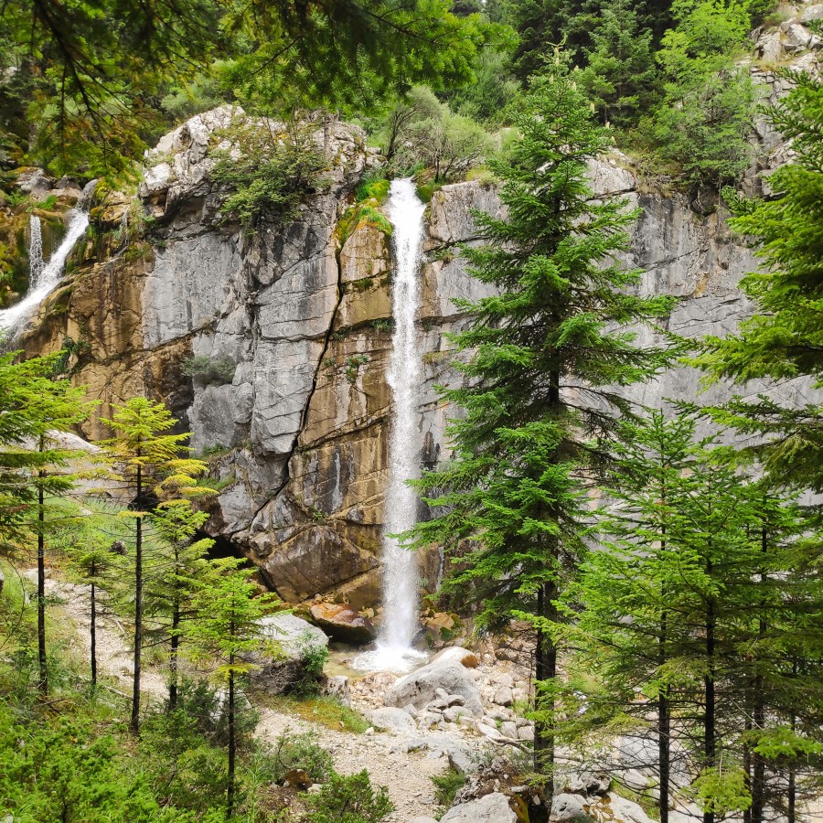
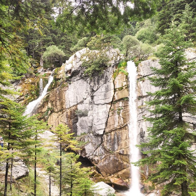
The Twin Waterfalls of Souda
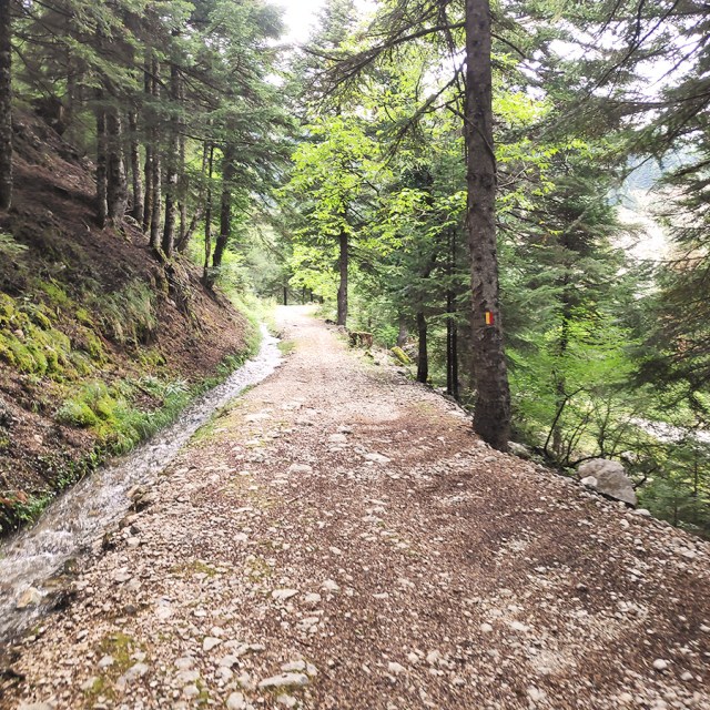
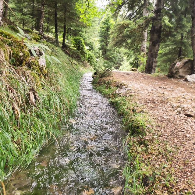
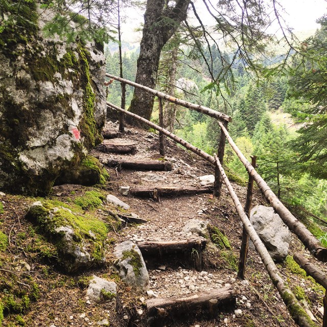
In order to reach the twin waterfalls of Souda, you need to hike about 1km and this only takes between 15 to 20 minutes. The trail is singed and the path is very easy to follow. While you hike towards the waterfalls, you have a refreshing water stream on your left and stunning views on the right.
See more hiking/mountaineering routes around this area:
- Hiking in Tzoumerka – Theodoriana – Marks Stream (Rema Marks)
- Hiking in Tzoumerka (Athamanika) – Katarraktis Waterfalls – Katarraktis Refuge – Faneromeni
- Winter Climb in Strogoula via Agrofylakas Couloir
- Hiking in Tzoumerka – Skala Stamati – Katafidi
- Hiking in Kefalovriso Waterfalls
- Syrrako – Kallarites
- Hiking in Tzoumerka (Athamanika) – Pramanta Refuge – Kefalovriso Waterfall – Melissourgoi Refuge
- Hiking in Kouiassa waterfall
- Winter Mountaineering Climb in Strogoula
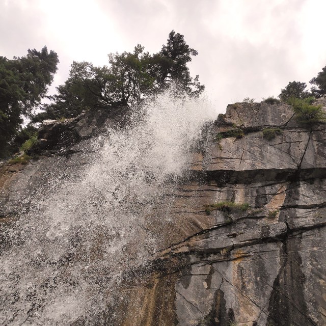
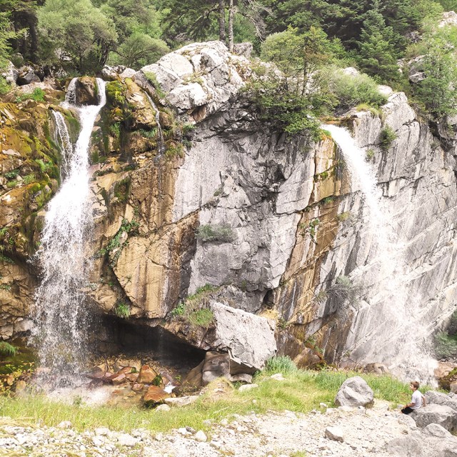
As soon you reach the viewpoint, you see two waterfalls falling over a cliff. The water falls from 25-meters high and 800 cubic meters per hour, making the Souda one of the most impressive, Greek waterfalls.


About Athamanika Mountains (Tzoumerka)
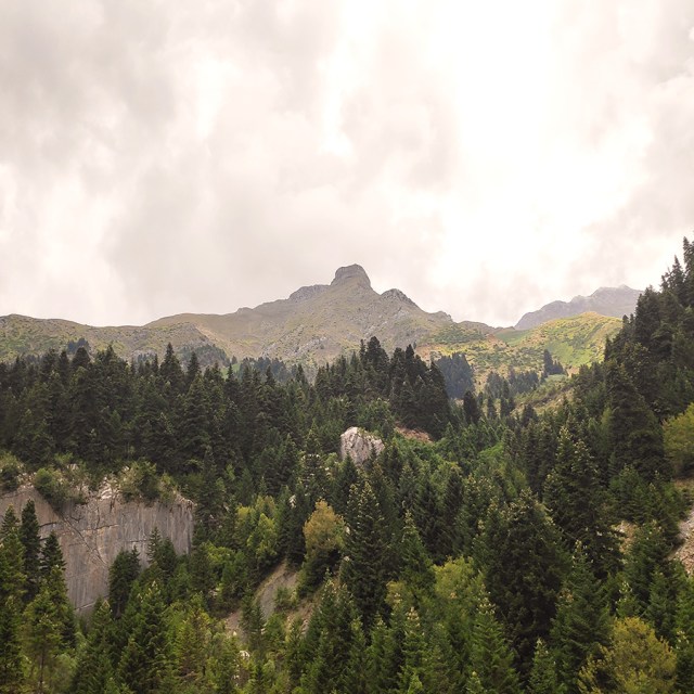
Athamanika mountains rise in-between the boundaries of the counties of Arta, Ioannina and Trikala. At the West the mountains are bounded by Aracthos river and at the East by Acheloos river. Geomorphologically, the region is divided into 2 sections: the northern section, belongs to Ioannina prefecture and hosts the highest peak (2469 meters) and the southern part belongs mainly to the prefecture of Arta.
Geologically, Athamanika Mountains are consisted mainly of limestones and flysch formations. This alternation of rocks combined with intense rainfall has resulted the development of an extensive groundwater with a presence of springs in many places. The most famous water spring is “Agathi“, near the village of Melisourgoi. Also, a nice natural attraction is the waterfall of Kefalovriso.
About Theodoriana
Theodoriana is a village and former community in the Arta regional unit, Epirus, Greece. Northeast is the Trikala regional unit. The Pindos and the Athamanian mountains cross the northeastern part. The Acheloos river flows by the village along the regional road the connects Arta to Trikala.
The entire area of Theodoriana are mountains and pine trees along with forests dominate the whole municipality except for the upper parts and the valley areas where farmlands are located. Some of its residents live only during the summer months and leave during the winter months.
Theodoriana was founded in 250 BC as Theodoria by Theodorus of Athamania. Theodorus of Athamania was king of the Athamanians in south-eastern Epirus. He is known otherwise only from the Delian temple inventories: his daughter Phila made dedications there before 225 BC. In 250 BC, King Theodorus founded the city of Theodoria, nowadays Theodoriana.
Details of the Hike:
- Location: Souda Waterfalls Theodoriana
- Trail Signs: Signed path
- Maximum Elevation: 987 m.
- Minimum Elevation: 802 m
- Total Distance: 2 km (with the return)
- Hiking time: 30-45 min (with the return)
- Difficulty: Easy
- When to Hike: Any time of the year
Before you leave this blog check out the following map
Below: This map marks all the mountaineering adventures that have been featured on Olympus Mountaineering so far, including several Sport climbing crags – Select full screen to expand, zoom in for more detail, or click on a marker for a link to the post.

Wow! Absolutely beautiful!!
LikeLiked by 1 person
Got to love a beautiful waterfall! Also found ‘the view while hiking’ calling to me. Thanks. –Curt
LikeLiked by 1 person
Thank you for your kind comment Curt!
LikeLike
Pingback: Hiking in Tzoumerka (Athamanika) – Pramanta Refuge – Kefalovriso Waterfall – Melissourgoi Refuge – Pramanta Refuge (family friendly) – Olympus Mountaineering
Pingback: Hiking in Tzoumerka (Athamanika) – Melissourgoi – Kryoneri Waterfall – Melissourgoi (family friendly) – Olympus Mountaineering
Pingback: Hiking in Captain’s Baths (Λουτρά Καπετάνιου) – Vourgareli – South Tzoumerka (family friendly) – Olympus Mountaineering