After a rather demanding climb in Strogoula via the “Agrofylakas” couloir, it was time for an easy hike in order to enjoy the beautiful landscape of Athamanika (Tzoumerka) mountains.
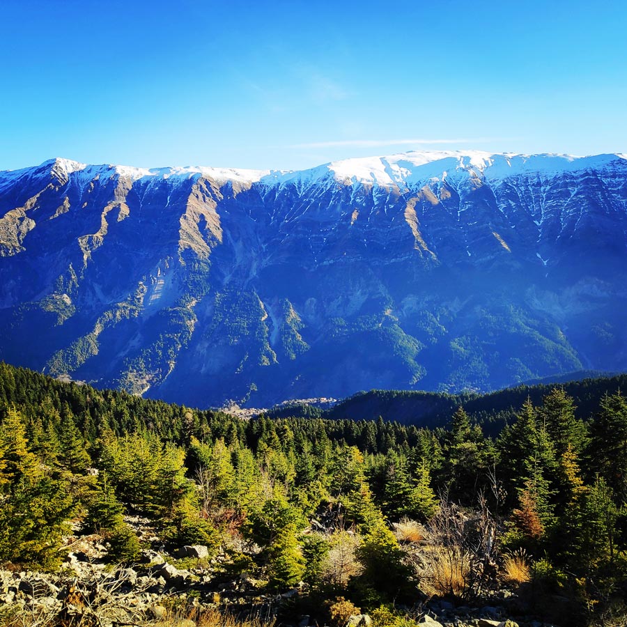
The cycle of seasons at Tzoumerka (Athamanika) follows its own calm rhythms. Words such as awe and admiration are not enough to describe the splendor of the nature.
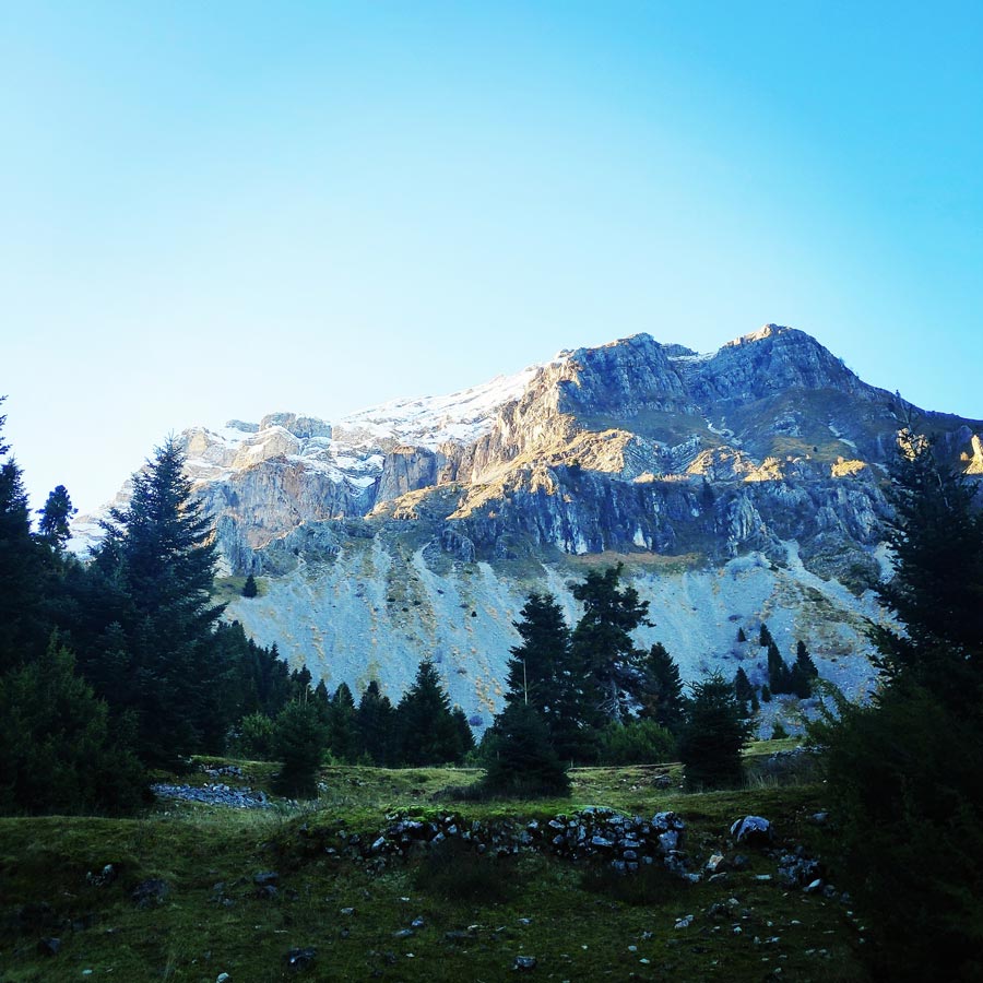
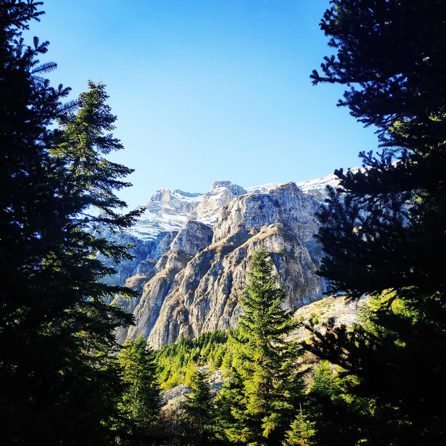
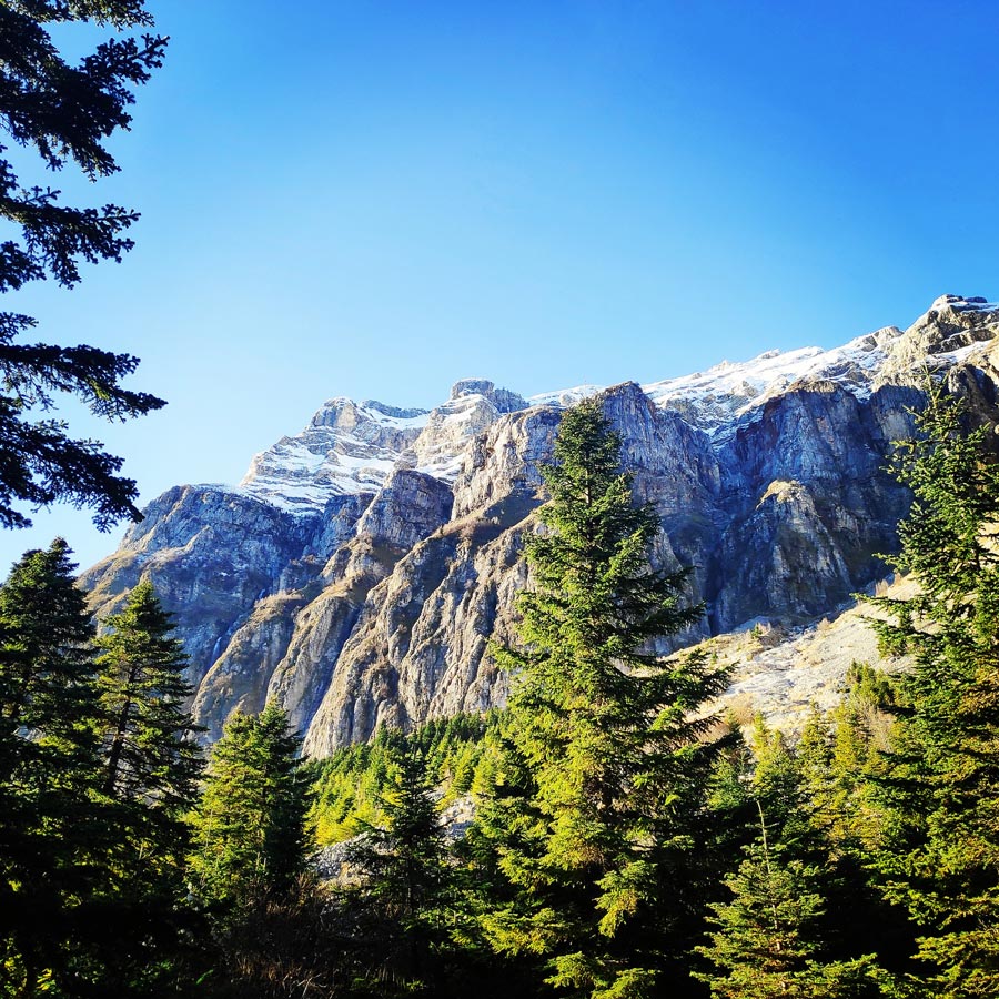
Here, time seems to hang still over the gorges, the vertical cliffs of the ravines and the snow-covered firs that climb the rocks up to the naked alpine zone. The abundant running water and impressive waterfalls justify the omnipresent dense flora and satisfy both the physical thirst as well as that of the sense of sight.
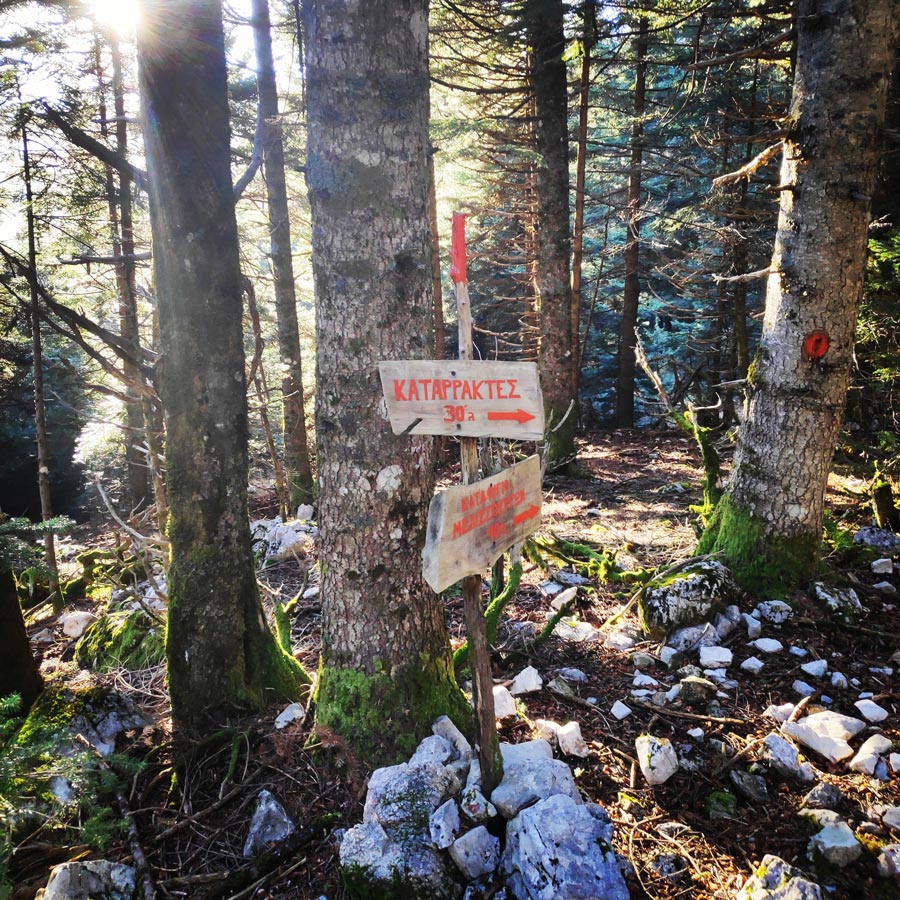
There are a lot of mapped hiking routes at Tzoumerka, with special markings, both for advanced and beginners in hiking. A very easy hike is the one that starts from the Pramanta Mountain Refuge and end in the Waterfall.
About Tzoumerka (Athamanika) Mountains
Tzoumerka together with the mountains Kakarditsa and Lakmos are the most important mountains of the region. Its peak, Katafidi, reaches at an altitude of 2393 meters. The steep slopes are its main characteristic that cover the biggest part of the western side. Its eastern side is mild and easier for hiking in winter. Like in the rest of Pindos, in Tzoumerka there are some of the biggest and most rare mammals of Greece.
If you are lucky you might see bears, wolves, elks and other smaller species. The mountain is full of oak and pinon trees while at some points there are cercis siliquastrum, wild cherry trees and plane trees.
See more hiking/mountaineering routes around this area:
- Winter Climb in Strogoula via Agrofylakas Couloir
- Winter Mountaineering Lakmos/Peristeri
- Verliga Alpine Lake
- Alpine Dragon Lake
- Astraka Peak
- Gamila Peak
- Syrrako – Kallarites
Support the journey — buy me a coffee
I share these articles and the climbing guidebooks because I love the outdoors, and they’ll always be free. If they’ve helped you, help me keep them coming. Click the button to support my work.

Athamanika mountains rise in-between the boundaries of the counties of Arta, Ioannina and Trikala. At the West the mountains are bounded by Aracthos river and at the East by Acheloos river. Geomorphologically, the region is divided into 2 sections: the northern section, belongs to Ioannina prefecture and hosts the highest peak (2469 meters) and the southern part belongs mainly to the prefecture of Arta.
Geologically, Athamanika Mountains are consisted mainly of limestones and flysch formations. This alternation of rocks combined with intense rainfall has resulted the development of an extensive groundwater with a presence of springs in many places. The most famous water spring is “Agathi“, near the village of Melisourgoi.
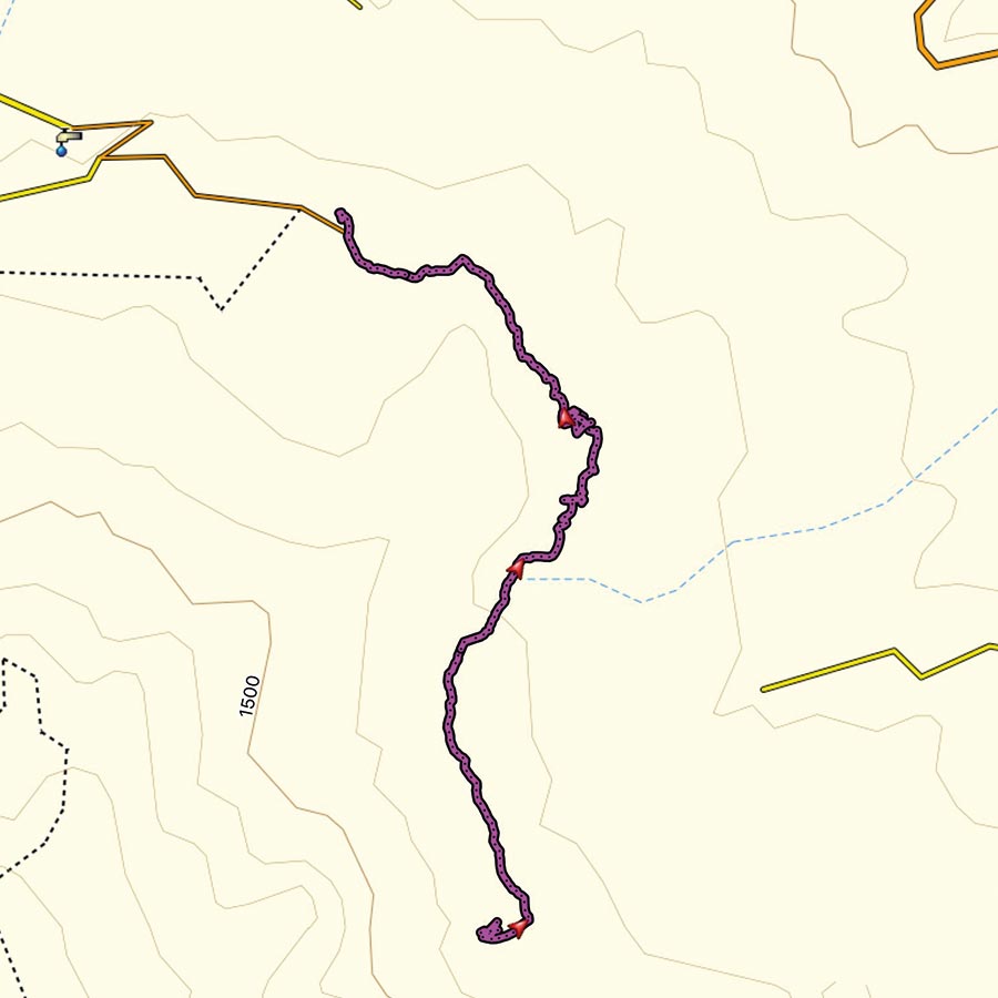
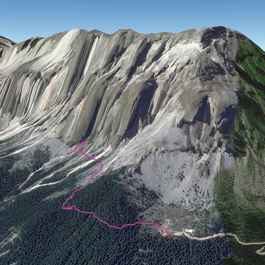
Pramanta Mountain Refuge – Waterfall
The route starts at an altitude of 1.300 m (4.265 ft), in the “Isioma” plateau on the slopes of Tzoumerka Mountain. The Pramanta Mountain Refuge restarted its operation on 28 October 2006 under new administration! Babis and Pola, together with their two wonderful and kind kids, provided us excellent service and great company during our stay there.
There are two 8-bed rooms and one 10-bed room, totalling 26 beds, a fully functional kitchen, dining tables, a living room and a fireplace. It operates round the year, every day, should no emergencies occur (we’re humans!). The whole “Isioma” plateau is there for games, camping, football, excursions even a little theatre! (mountain theatre).
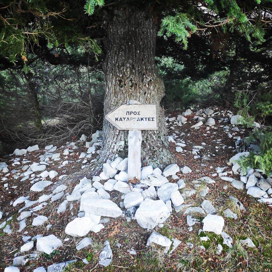
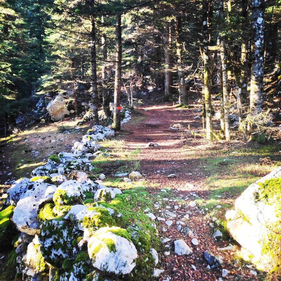
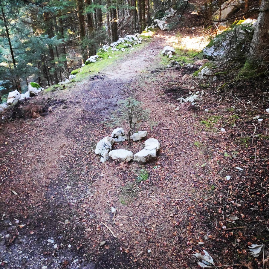
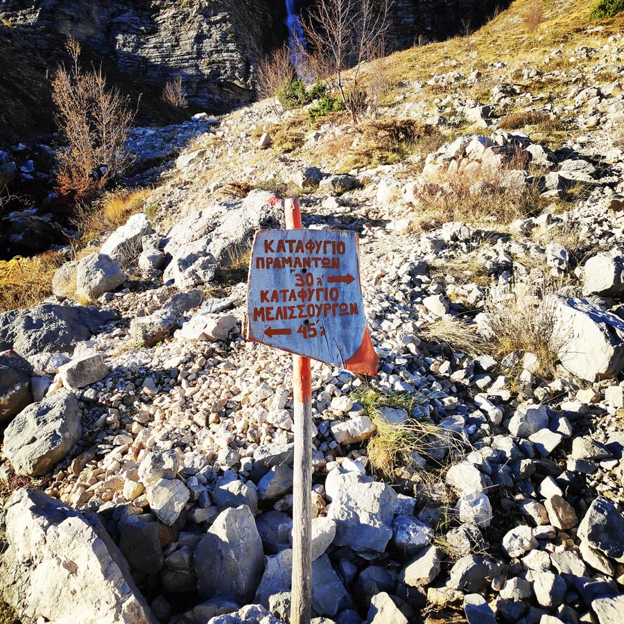
A 100 meters away from the refuge there is a clear sign that indicates the trail to the magnificent waterfall. The trail is very easy to identify and to follow and there is not any single difficulty. In fact, is an ideal hike for beginners but also for families with kids.
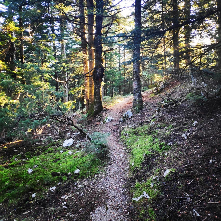
Although the official estimated time from Pramanta Mountain Refuge to the waterfall is about 45 minutes, with a good pace, I reached the Kefalovriso waterfall within 20 minutes. I was still hiking and not running, but due to the fact there is not much elevation gain and/or loss, the waterfall can be reached very fast.
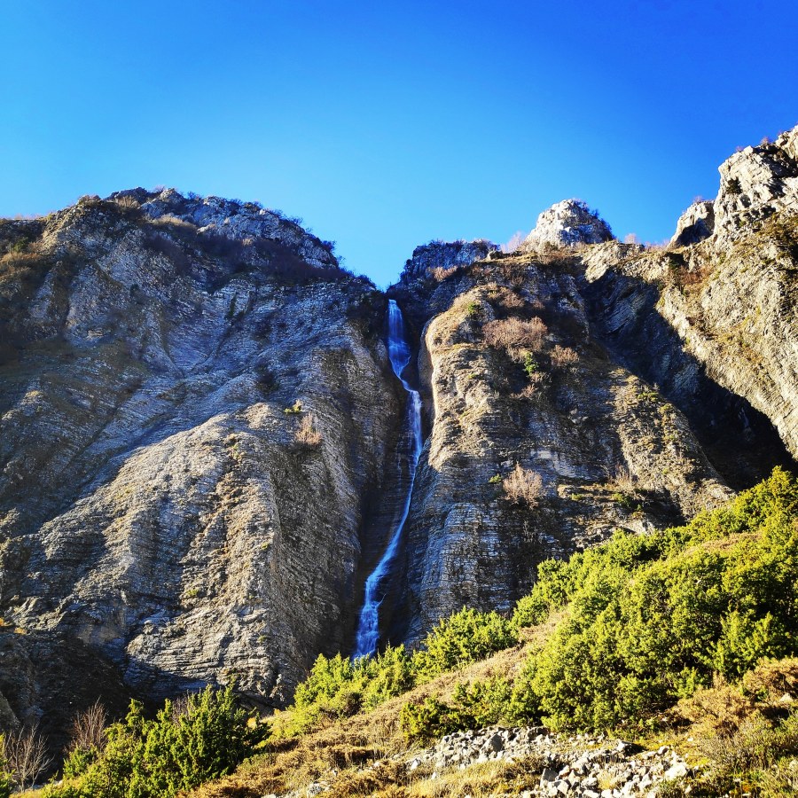
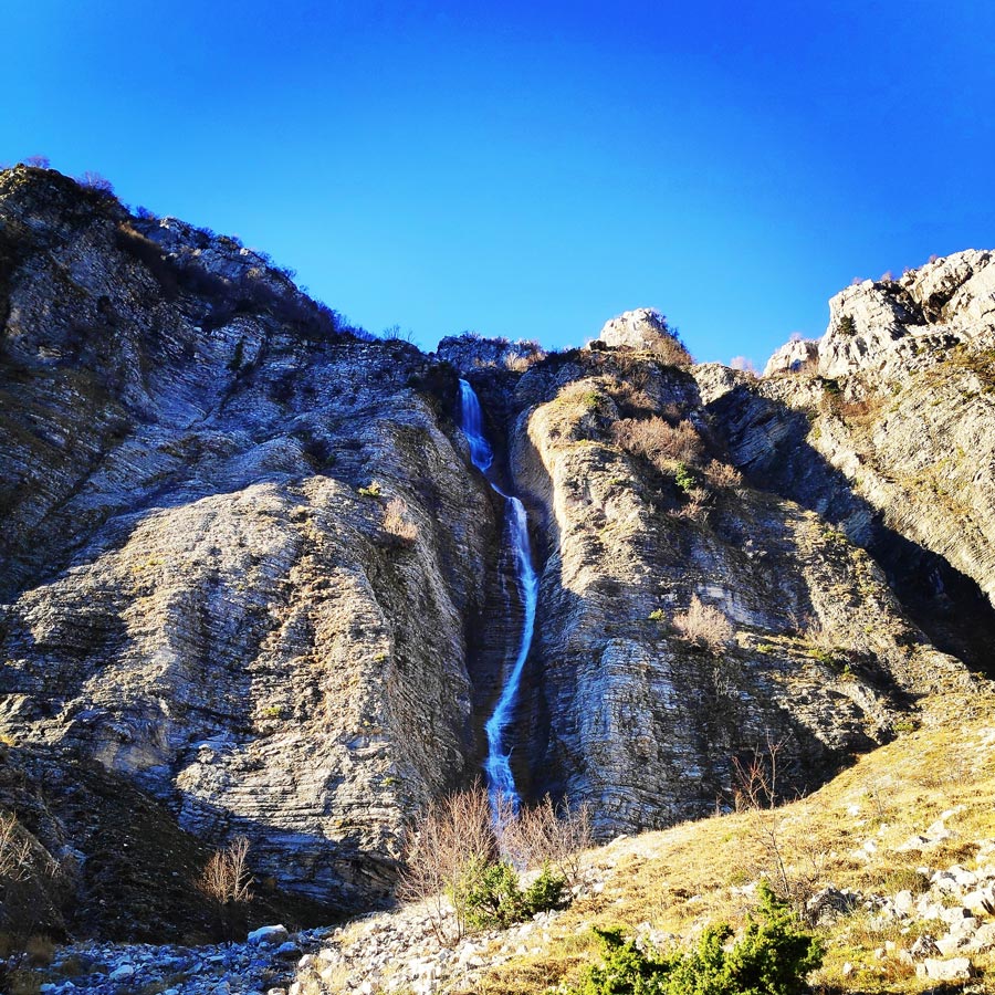
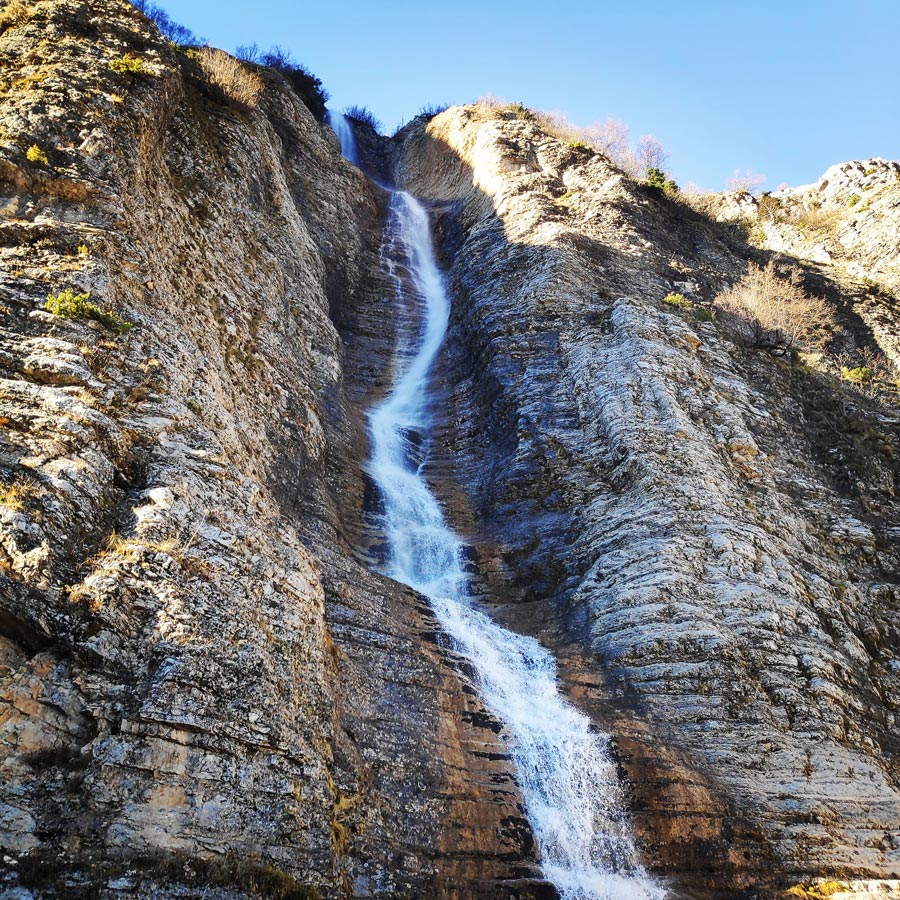
Once you arrive near the waterfall, the views are really stunning and the surrounding environment one of the nicest I have ever seen. In fact, when I reached the waterfall, I got the same sensation I had few months ago when I had visited the Verliga Alpine Lake.
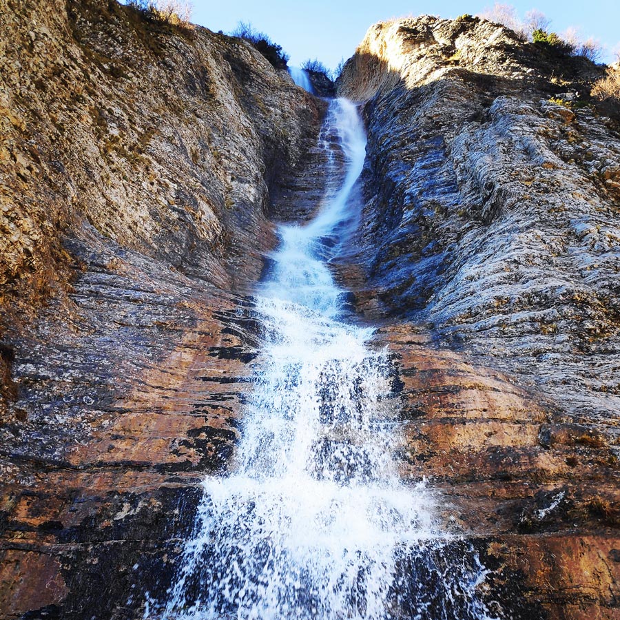
The waterfall of Kefalovriso, the highest of Greece (350 m.).
Explore all outdoor activities in a convenient list view here
About Pramanta
Pramanta is situated at an altitude of 840 m., at the foot of the imposing peak of Strogoula, behind which lies the mountain range of Tzoumerka.
It’s at the centre of the broader area of Tzoumerka, with a population of approximately 800 residents, which however exceeds 1500 at summertime. It’s the seat of the municipality of North Tzoumerka and now a mountainous holiday resort, as the visitor can find everything there, from hotels, restaurants, bakeries, cafés and nightlife to a modern health centre, pharmacy, a centre of environmental education, gas station, bank, ATM, post-office, police station and schools of all levels. In this traditional village that embraces modern lifestyle, the visitor has access to any kind of information one may need.
It is worth visiting the village’s central square, with its centenary plane tree and the famous fountain of Arapis in front of the prestigious church of Saint Paraskevi. The marvelous cave of “Anemotrypa”, the monastery of Saint Paraskevi, the forest of Markopoulos and the fountain of Skala are also places one has to see. Other sights of interest are the traditional watermill at Christoi, the mountain shelters at “Isioma” and Melissourgi, as well as the waterfall of Kefalovriso, the highest of Greece (350 m.), at the nearby village of Melissourgi.
Support the journey — buy me a coffee
I share these articles and the climbing guidebooks because I love the outdoors, and they’ll always be free. If they’ve helped you, help me keep them coming. Click the button to support my work.
Details of the Hike:
- Location: Athamanika (Tzoumerka) Mountains
- Starting Point: Pramanta Mountain Refuge
- Ending Point: Waterfall of Kefalovriso
- Trail Signs: Well signed path
- Minimum Elevation: 1.300 m
- Maximum Elevation: 1.399 m.
- Total Distance: 8.5 km
- Difficulty: Easy
- When to Hike: All year round
- Water Features: One
Bellow you can see the route we have followed on a map and 3D:
Subscribe & Stay Informed
Enter your email address to follow this blog and receive notifications of new posts by email
See more hiking/mountaineering routes around this area:
- Winter Climb in Strogoula via Agrofylakas Couloir
- Winter Mountaineering Lakmos/Peristeri
- Verliga Alpine Lake
- Alpine Dragon Lake
- Astraka Peak
- Gamila Peak
- Syrrako – Kallarites
Before you leave this blog check out the following map
Below: This map marks all the mountaineering adventures that have been featured on Olympus Mountaineering so far, including several Sport climbing crags – Select full screen to expand, zoom in for more detail, or click on a marker for a link to the post.

Well, that was a pretty well kept secrete; I wasn’t aware that you had bears and wolves in Greece.
LikeLike
Oh well, yes! Actually, there are certain areas like Kastoria, Grammos, Pindos, Agrafa etc. Which are quite dangerous to hike alone.
Nevertheless, is not really easy to come across any bear or wolf. 🙂
LikeLike
Yes, I guess they want to run off somewhere as soon as they sense that there are any of us present.
LikeLike
Pingback: Hiking in Tzoumerka (Athamanika) – Skala Stamati – Katafidi – Olympus Mountaineering
Pingback: Hiking in Tzoumerka (Athamanika) – Katarraktis Waterfalls – Katarraktis Refuge – Faneromeni – Olympus Mountaineering
Pingback: Hiking in Tzoumerka (Athamanika) – Pramanta Refuge – Kefalovriso Waterfall – Melissourgoi Refuge – Olympus Mountaineering
Pingback: Hiking in Kouiassa Waterfall and Kipinas Monastery – Olympus Mountaineering
Pingback: Winter Mountaineering Climb in Strogoula – Tzoumerka (Athamanika) – Olympus Mountaineering
Pingback: Hiking in Tzoumerka (Athamanika) Theodoriana – Marks Stream – Rema Marks – (family friendly) – Olympus Mountaineering
Pingback: Souda Twin Waterfalls – Theodoriana – Hiking in Tzoumerka (family friendly) – Olympus Mountaineering
Pingback: Hiking in Tzoumerka (Athamanika) – Pramanta Refuge – Kefalovriso Waterfall – Melissourgoi Refuge – Pramanta Refuge (family friendly) – Olympus Mountaineering
Pingback: Hiking in Tzoumerka (Athamanika) – Melissourgoi – Kryoneri Waterfall – Melissourgoi (family friendly) – Olympus Mountaineering
Pingback: Hiking in Captain’s Baths (Λουτρά Καπετάνιου) – Vourgareli – South Tzoumerka (family friendly) – Olympus Mountaineering