Winter time in Greece can be very exciting! Despite popular belief, in Greece we do have some mid-range peaks but we also have snow. This is great for whoever is interested exploring winter mountaineering routes.
Our initial plan was to visit Tzoumerka for a three day “expedition”, but due to bad weather we decided to enjoy the mountain at least for one day.
About Athamanika Mountains (Tzoumerka)
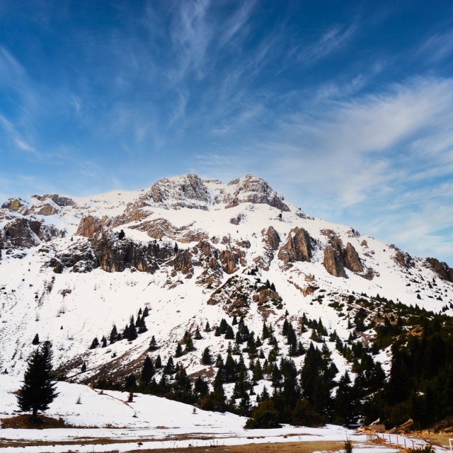
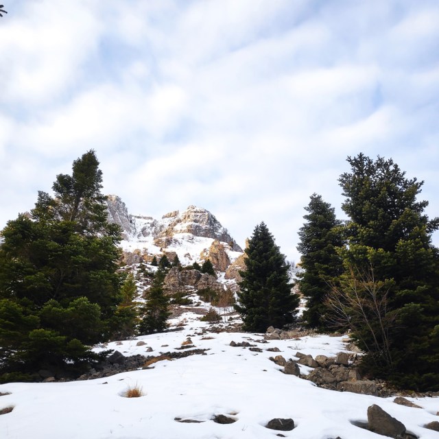
Athamanika mountains, also known as Tzoumerka, are part of Pindos mountain range located at the boundaries of the regions of Thessaly and Epirus. Both the physical landscape and the traditional settlements set Athamanika mountains as one of the most popular tourist destinations in Greece.
Athamanika mountains rise in-between the boundaries of the counties of Arta, Ioannina and Trikala. At the West the mountains are bounded by Aracthos river and at the East by Acheloos river. Geomorphologically, the region is divided into 2 sections: the northern section, belongs to Ioannina prefecture and hosts the highest peak (2469 meters) and the southern part belongs mainly to the prefecture of Arta.
See more hiking/mountaineering routes around this area:
- Hiking in Tzoumerka (Athamanika) – Katarraktis Waterfalls – Katarraktis Refuge – Faneromeni
- Winter Climb in Strogoula via Agrofylakas Couloir
- Hiking in Tzoumerka – Skala Stamati – Katafidi
- Hiking in Kefalovriso Waterfalls
- Syrrako – Kallarites
Geologically, Athamanika Mountains are consisted mainly of limestones and flysch formations. This alternation of rocks combined with intense rainfall has resulted the development of an extensive groundwater with a presence of springs in many places. The most famous water spring is “Agathi“, near the village of Melisourgoi.
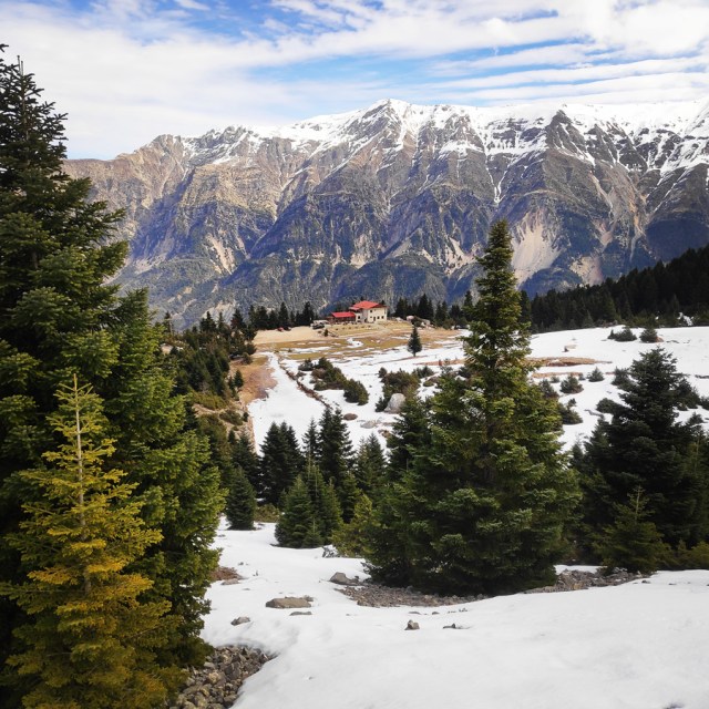
Our stay before the climb was at the mountain hut of Melissourgoi, which is a nice, cosy and very friendly mountain hut which is fully serviced, including hot water.
Climbing via “Bear’s Couloir”
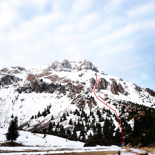
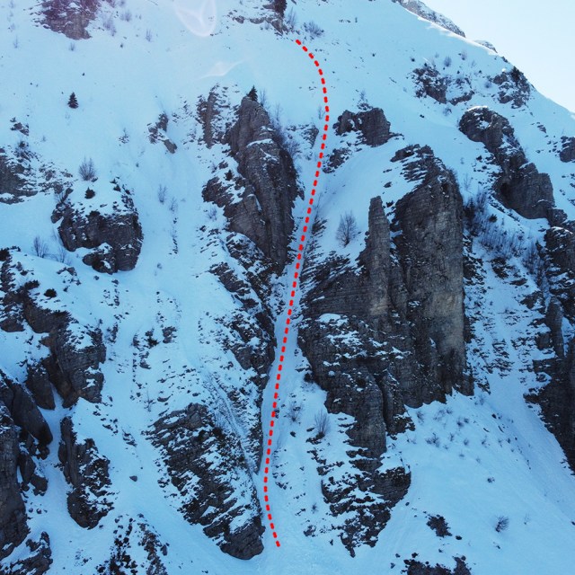
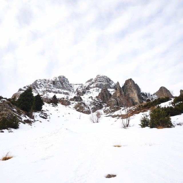
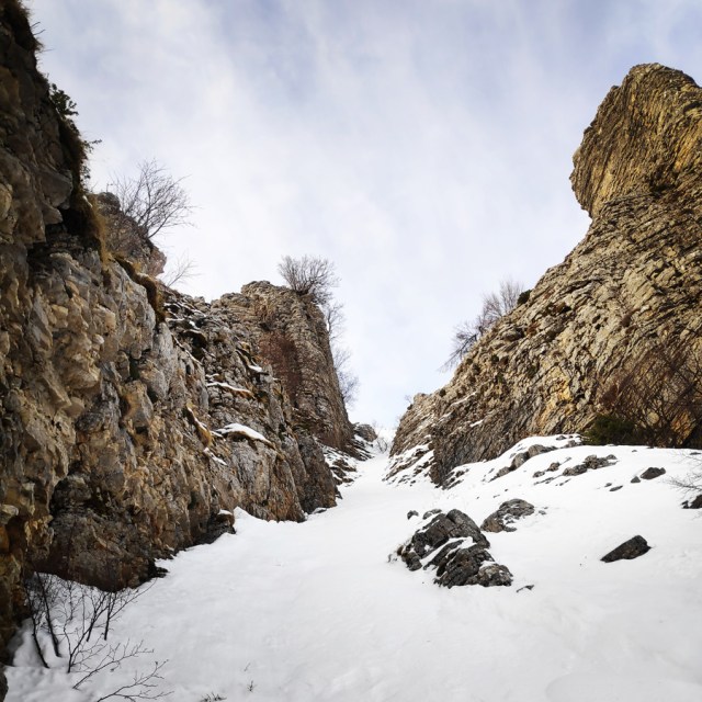
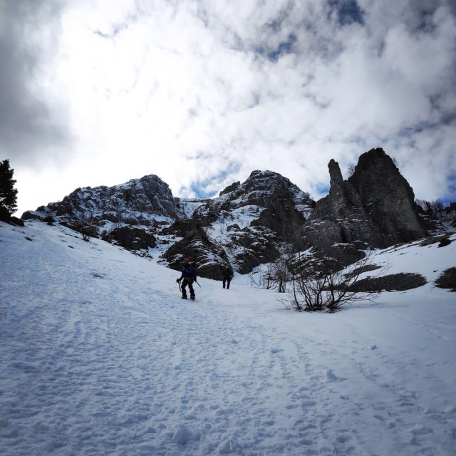
Prior of arriving in the area of Tzoumerka, we had a plan to establish a new route in a couloir we had spotted from the mountain refuge of Pramanta. This couloir is located on the right of the established route “Melissourgoi I” and it was looking very appealing for a first ascent. In fact, we soon started to gather info and a climbing buddy provided us with some recent photos while he was in the area. Having checked the photos, we decided that it would be an interesting route to follow.
The Route
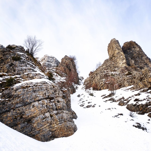
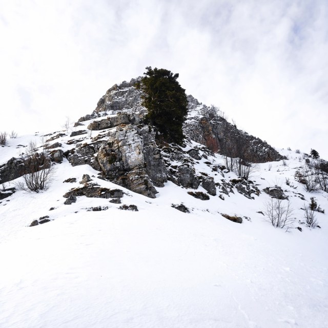
Prior of visiting again the area of Tzoumerka, I looked at my photos archive and I tried to understand how this couloir could be, what kind of difficulty we could face so we could also arrange to carry with us the correct gear. The route we wanted to climb, starts very near from the refuge and follows the couloir between the obvious pillars.
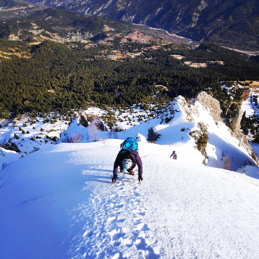
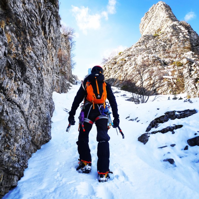
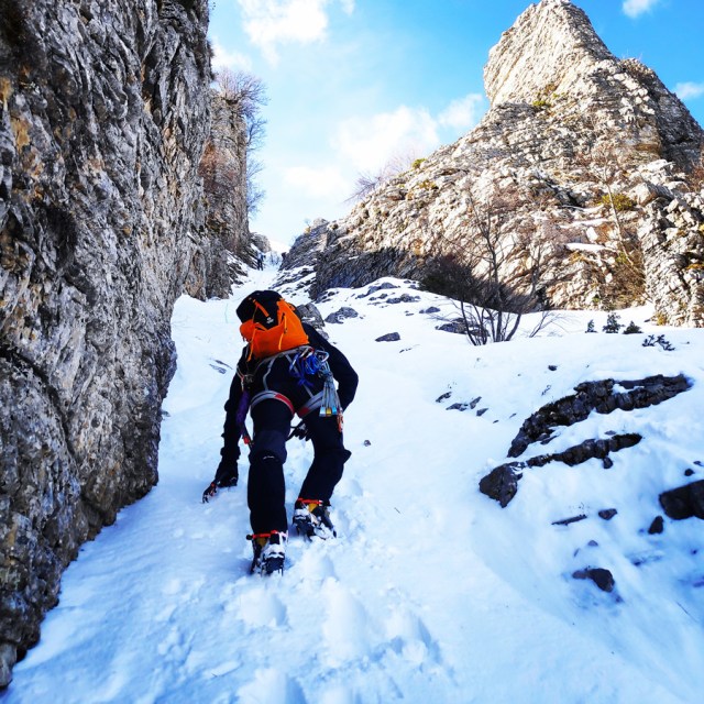
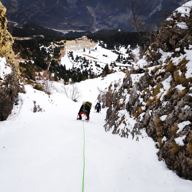
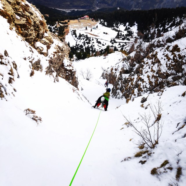
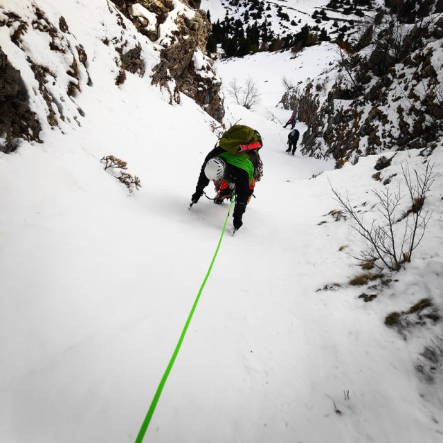
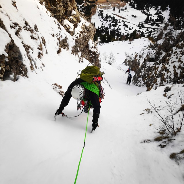
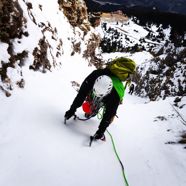
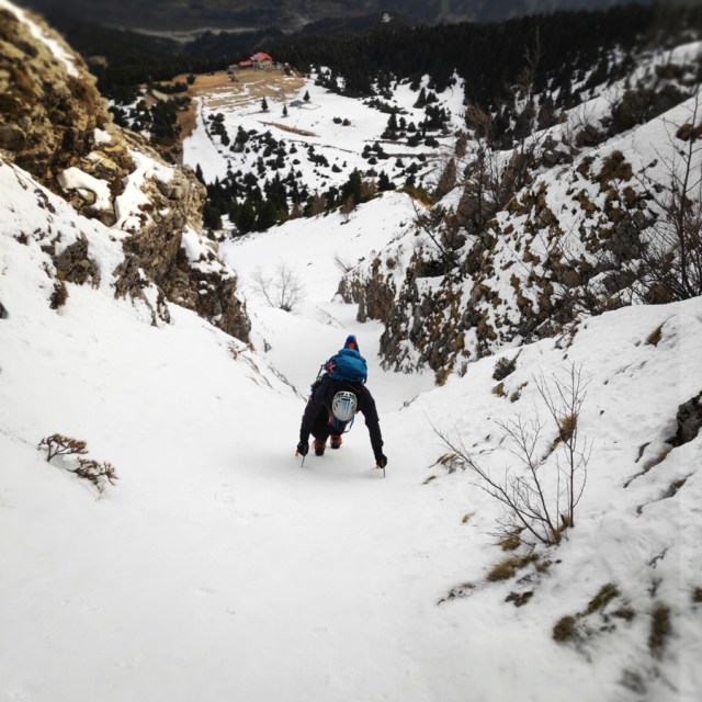
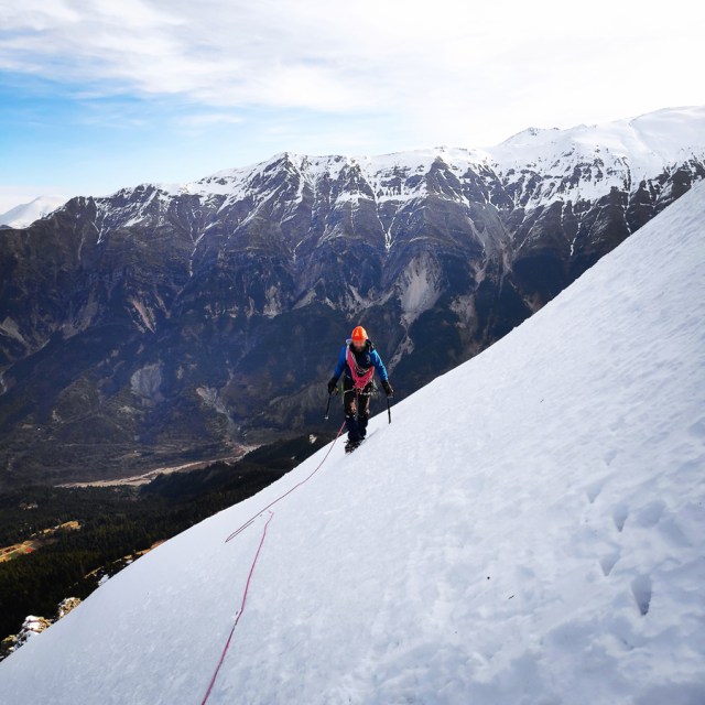
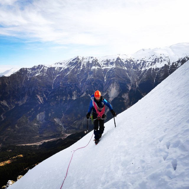
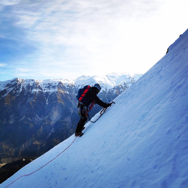
The Climb
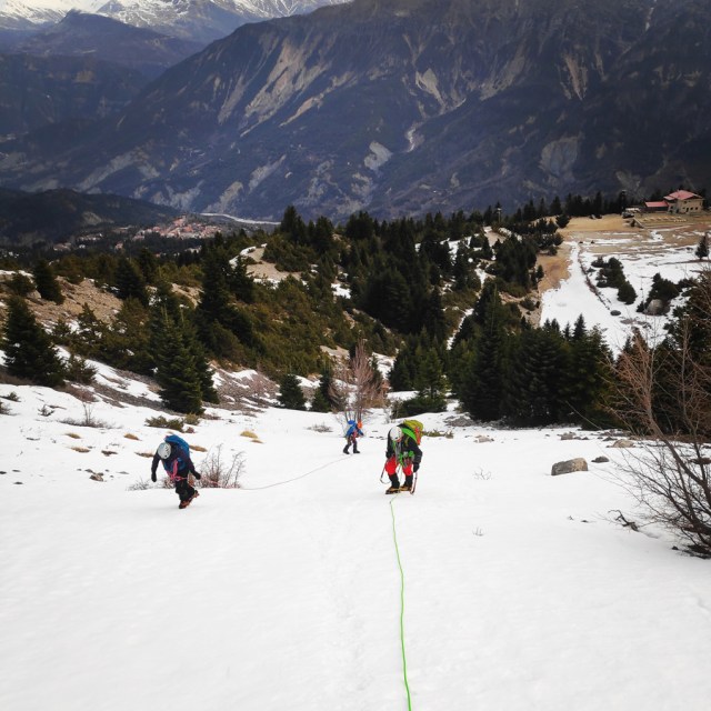
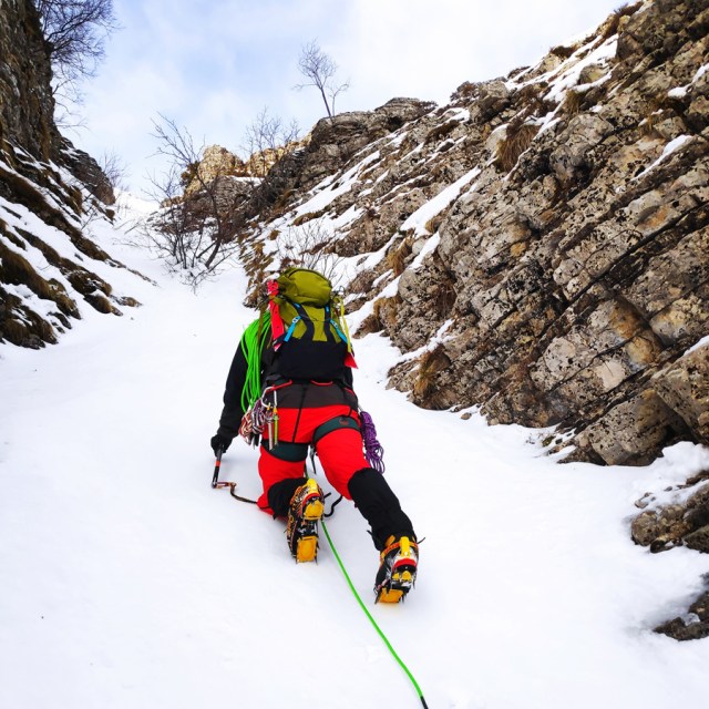
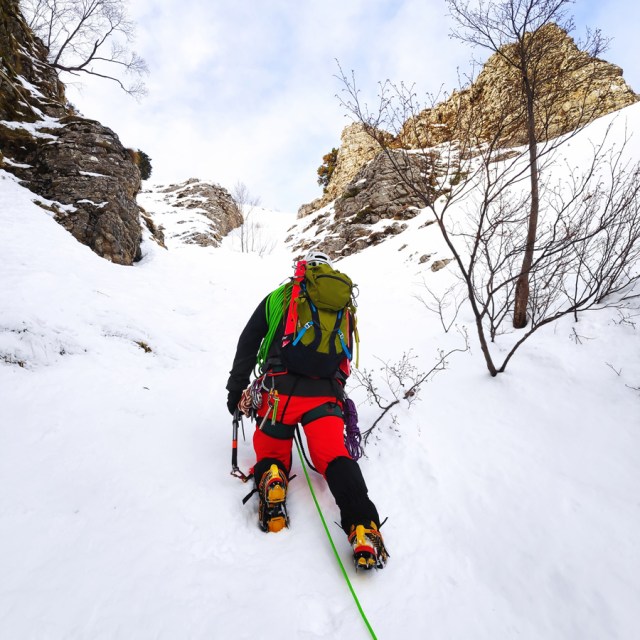
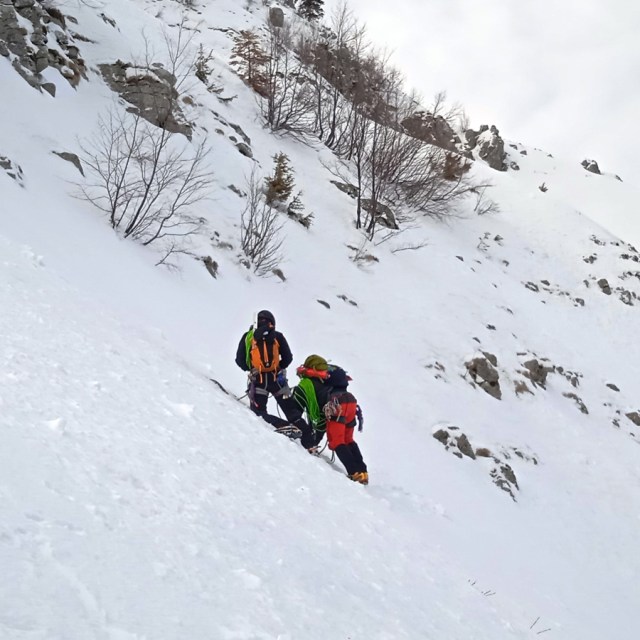
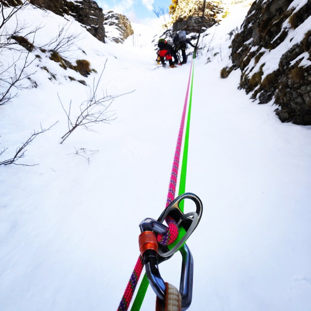
We started with the approach hike around 7.30 and within 15-20 minutes we were at the base of the route. The more we were approaching the base of the route, the more I could see and understand that this couloir was not difficult to climb. I could see that it would be around 40-50 degrees in terms of steepness and therefore we decided to climb it without any belay and protection. Just a rope in parallel movement.
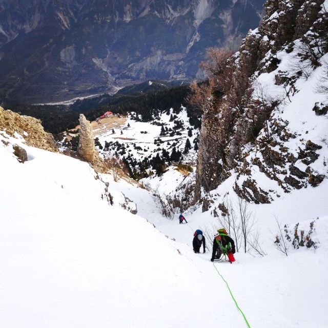
Avalanche Risk
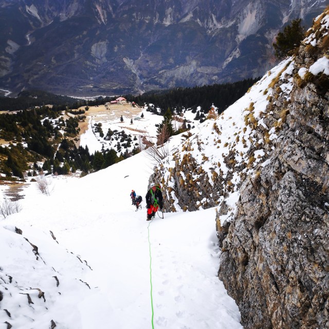
As soon we reached the highest point, and actually we exited the couloir, we wanted to traverse southern direction. While traversing, I was feeling the snow beneath my feet a bit unstable.
Most of us pay little attention to avalanches unless someone gets injured or killed in one. The sad fact is that most people caught in an avalanche trigger the slide themselves by traveling on or beneath unstable snow slopes.
In fact, on the point I felt not very comfortable, together with one of the most experience members of our team we did a quick check up of the snow conditions, and all the team took the decision to abandon the rest of the route.
An avalanche can go as fast as 120 miles per hour, a force that can easily sweep you into trees and rocks, pull you over cliffs and tangle you in your ski or snowboard equipment. Nearly one–third of avalanche deaths are the result of trauma.
There are mainly two types of avalanches:
Loose–snow Avalanches
- Loose–snow avalanches occur where there is little or no cohesion in the snowpack. They usually start at a point on or near the surface and gather more snow and momentum as they progress down the slope, often forming a triangular–shaped path. Snow clumps falling onto the slope from a cliff above can set off these slides, as can melting within the snowpack.
Slab Avalanches
- Even more dangerous are slab avalanches, in which a layer of snow breaks away from the layer beneath it and slides downhill. Most backcountry travellers are caught in these avalanches. Slab avalanches are the result of many snowstorms or strong winds depositing layers of snow that change over time. Some layers settle and become stronger, while others grow weaker. Weak layers are frequently grainy or fluffy so that other layers can’t bond to them.
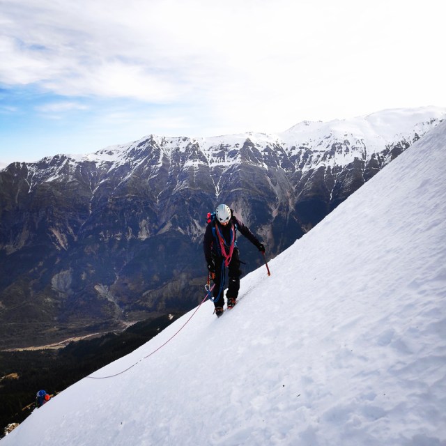
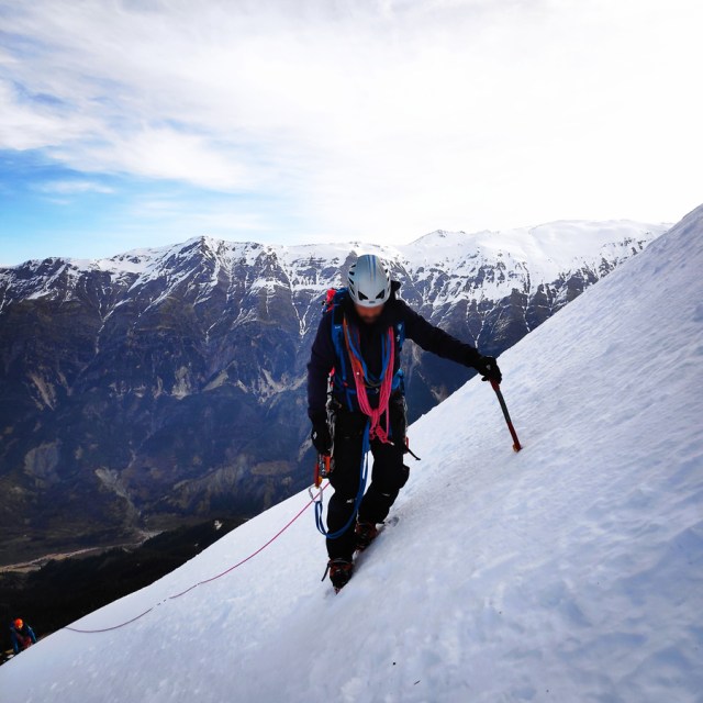
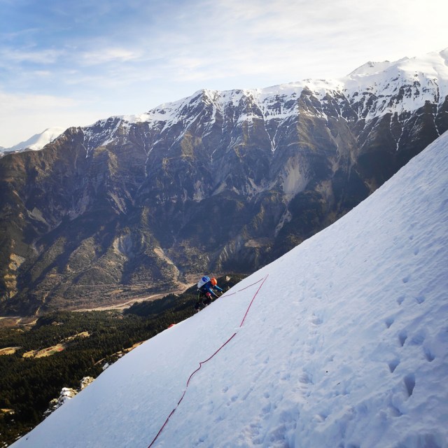
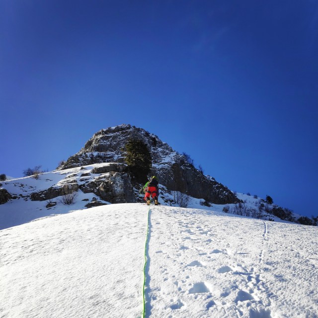
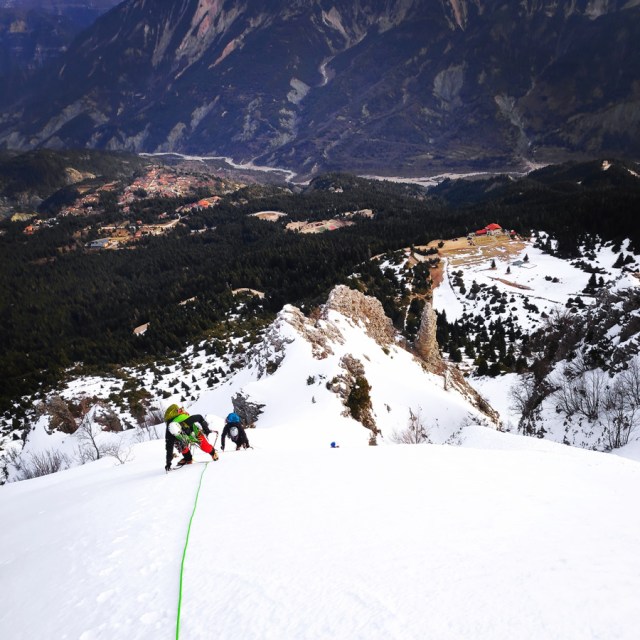
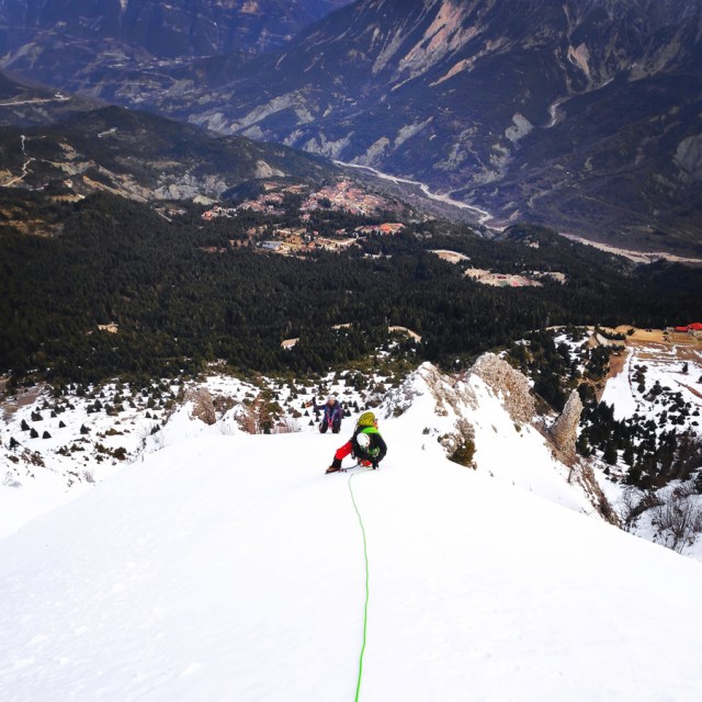
Retreating from the route and Abseiling
Although we drove for many hours and hundreds of kilometres in order to try to establish a new route, unfortunately we had to abandon our goal and retreat. Of course we were not happy about it, but considering the high avalanche risk it was certainly the wiser and best decision we could take.
The return was basically done from the route we climbed up. Part of the route we down-climbed it and part of the route we abseiled it.

Gear & Equipment
For this trip, I was carrying the following main gear:
- La Sportiva Spantik
- Cassin Alpinist Tech Crampons
- Petzl Quark Ice Axe
- The North Face Verto 27 Summit Series Backpack
- Mammut Ophir Harness
- Camp Mach Express Alpine Quickdraws
- Garmin Dakota 20 GPS device
- Cumulus Minilite Down vest
- Rab Spark Waterproof Jacket
- Petzl e-lite headlamp
- Mammut Wall Rider Helmet
- Wild Country Rocks Nuts
- Olympus Snow Picket
- Cumulus Incredilite Endurance
- Simond 2-in-1 Mountaineering Gloves
Before you leave this blog check out the following map
Below: This map marks all the mountaineering adventures that have been featured on Olympus Mountaineering so far, including several Sport climbing crags – Select full screen to expand, zoom in for more detail, or click on a marker for a link to the post.

Wow… amazing!!! Great adventure 🙂
LikeLiked by 1 person
Thanks for reading and although we didn’t complete the route, we had really nice time!
LikeLiked by 1 person
What a great outing, even though you didn’t complete the route. It sounds like it was a smart decision. Avalanches are one thing I take extremely seriously as well.
LikeLiked by 1 person
Absolutely Diana! We go to the mountains to enjoy the outdoors, to challenge ourselves and of course to have a good time.
Though, by no means we should challenge our “luck” and therefore we should always watch for any signs the mountain can give us, and act accordingly.
Thanks for your comment Diana.
LikeLiked by 1 person
Even though you had to abandon your route, it sounds like you made the right decision considering the high risk of an avalanche. It’s better to be safe than sorry. And hey, at least you made it out there and tried!
LikeLiked by 1 person
You absolutely correct. It’s always bette to be safe than sorry!
Thanks for reading through this post and your comment.
LikeLiked by 1 person
Great post, well done for writing about the retreat off the route and your decision to do so, this will help encourage other people to make the right decision too!
LikeLiked by 1 person
Thank you for your comment and I agree with you that the decision to retreat was the correct one.
Many times, we overate our skills and underestimate the conditions of the snow, and then accidents happen.
Thank you again for your kind comment.
LikeLiked by 1 person
Pingback: Monsters of the Wind – A Mixed Climbing Attempt of the South-West Ridge – Mount Ortholithi – Olympus Mountaineering
Nice job getting after that couloir! It does look quite nice.
My mind was also on avalanches. While the snow in the couloir itself looked fairly solid, if the slope above let loose, that would be quite the terrain trap. Where I am, our avalanche cycle is so prolific that we normally only descend via a couloir in order to limit the amount of time in them. There are several skiable couloirs here too.
Well done!
LikeLiked by 1 person
Pingback: Hiking in Tzoumerka (Athamanika) Theodoriana – Marks Stream – Rema Marks – (family friendly) – Olympus Mountaineering
Pingback: Souda Twin Waterfalls – Theodoriana – Hiking in Tzoumerka (family friendly) – Olympus Mountaineering
Pingback: Hiking in Tzoumerka (Athamanika) – Pramanta Refuge – Kefalovriso Waterfall – Melissourgoi Refuge – Pramanta Refuge (family friendly) – Olympus Mountaineering
Pingback: Hiking in Tzoumerka (Athamanika) – Melissourgoi – Kryoneri Waterfall – Melissourgoi (family friendly) – Olympus Mountaineering
Pingback: Hiking in Captain’s Baths (Λουτρά Καπετάνιου) – Vourgareli – South Tzoumerka (family friendly) – Olympus Mountaineering