Summer time in Greece can be rather hot and the best way to escape the heat wave is not to follow the masses and go by the sea side or to a beautiful Greek island, but to move towards the north of the country and specifically in one of the high peaks of Central and/or North of Greece. This is actually how I have planned to escape the 40 C degrees heat wave and specifically to go for a nice hiking trip in the stunning Athamanika Mountains (Tzoumerka).
Tzoumerka together with the mountains Kakarditsa and Lakmos are the most important mountains of the region. Its peak, Katafidi, reaches at an altitude of 2.393 meters. The steep slopes are its main characteristic that cover the biggest part of the western side. Its eastern side is mild and easier for hiking in winter. Like in the rest of Pindos, in Tzoumerka there are some of the biggest and most rare mammals of Greece.
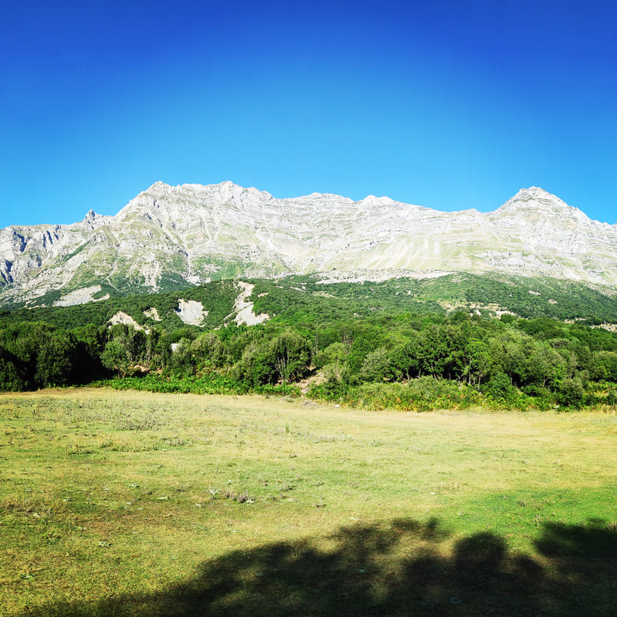
If you are lucky you might see bears, wolves, elks and other smaller species. The mountain is full of oak and pine trees while at some points there are cercis siliquastrum, wild cherry trees and plane trees.
See more hiking/mountaineering routes around this area:
- Winter Climb in Strogoula via Agrofylakas Couloir
- Winter Mountaineering Lakmos/Peristeri
- Verliga Alpine Lake
- Alpine Dragon Lake
- Astraka Peak
- Gamila Peak
- Syrrako – Kallarites
About Athamanika Mountains (Tzoumerka)
Athamanika mountains rise in-between the boundaries of the counties of Arta, Ioannina and Trikala. At the West the mountains are bounded by Aracthos river and at the East by Acheloos river. Geomorphologically, the region is divided into 2 sections: the northern section, belongs to Ioannina prefecture and hosts the highest peak (2469 meters) and the southern part belongs mainly to the prefecture of Arta.
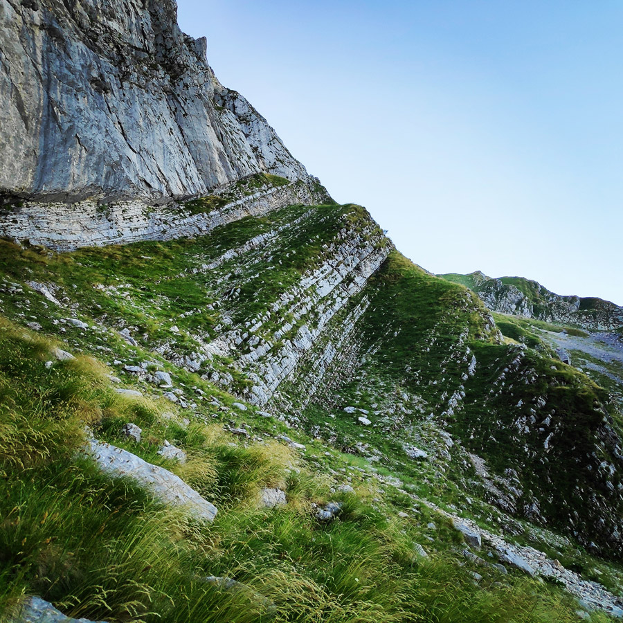
Geologically, Athamanika Mountains are consisted mainly of limestones and flysch formations. This alternation of rocks combined with intense rainfall has resulted the development of an extensive groundwater with a presence of springs in many places. The most famous water spring is “Agathi“, near the village of Melisourgoi. Also, a nice natural attraction is the waterfall of Kefalovriso.
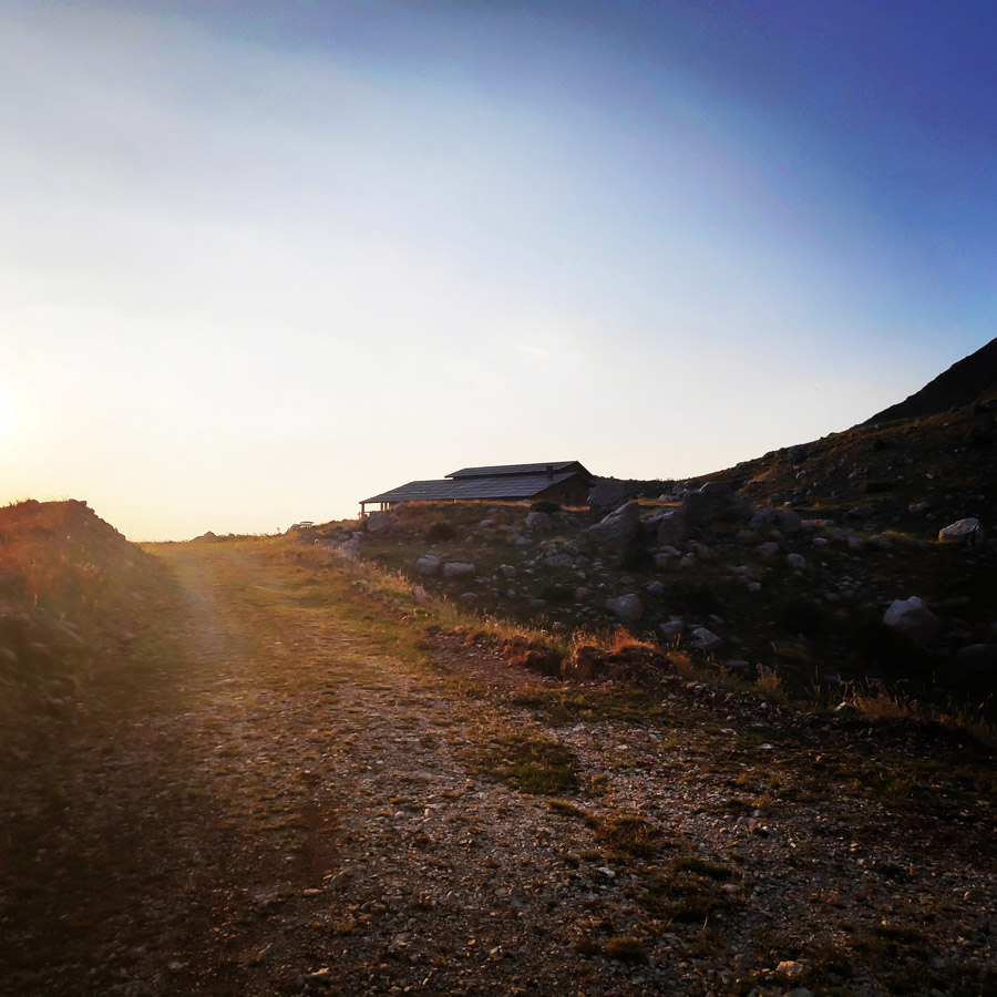
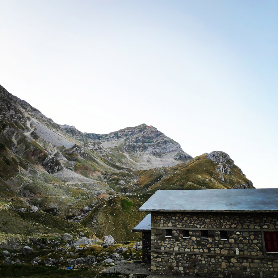
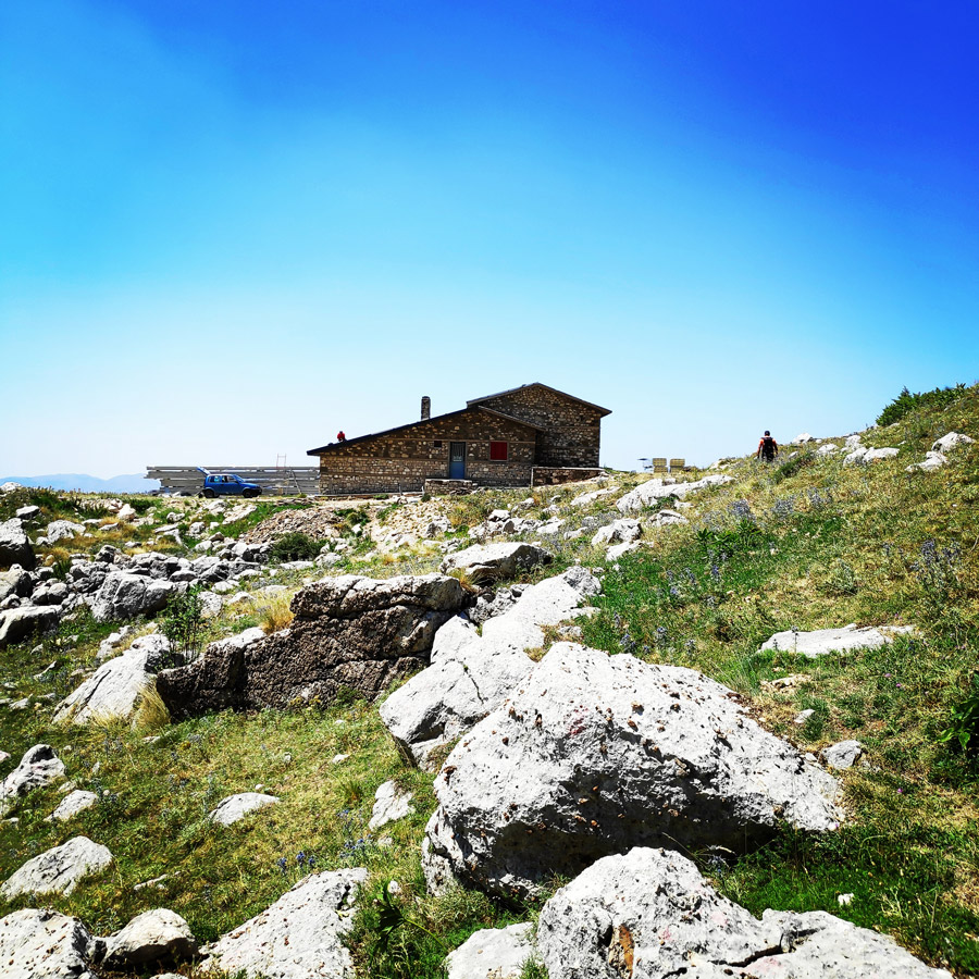
After a full day of driving we have reached the mountain hut of Katarraktis, which at the moment is under construction. Out plan was to stay overnight in the abandoned mountain hut and the day after to start our ascent to the Katafidi peak via Skala Stamati.
Explore all outdoor activities in a convenient list view here
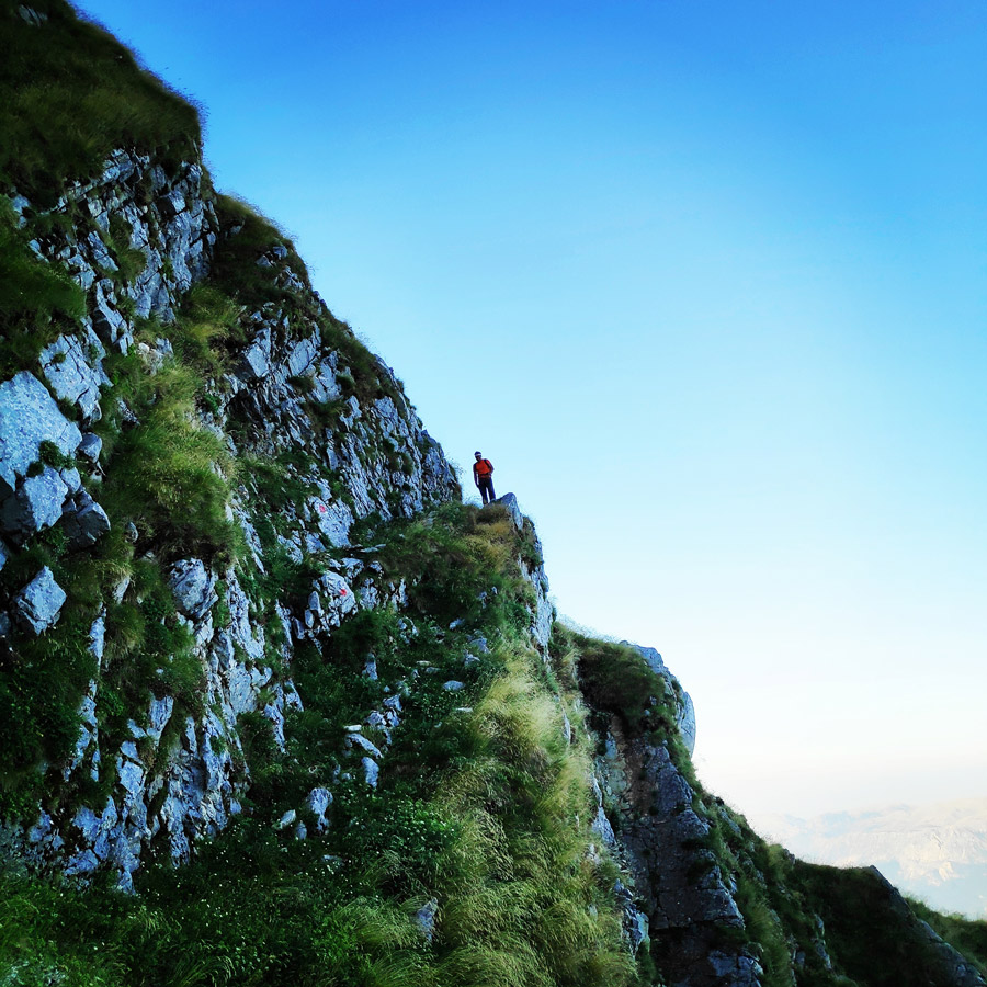
About Skala Stamati
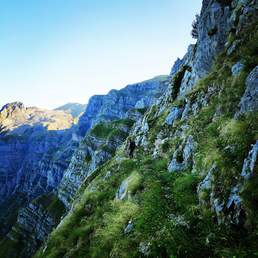
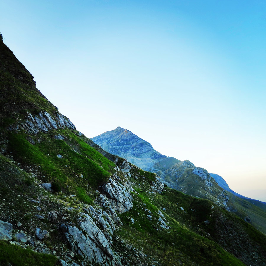
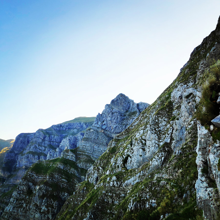
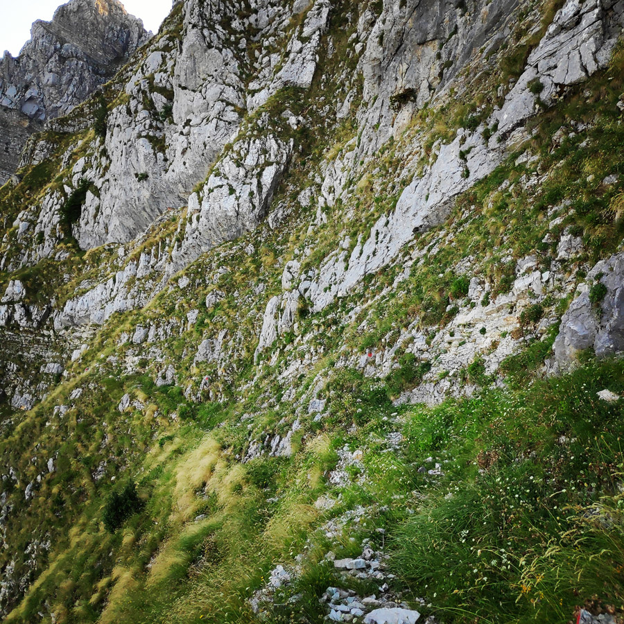
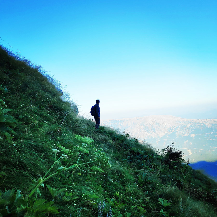
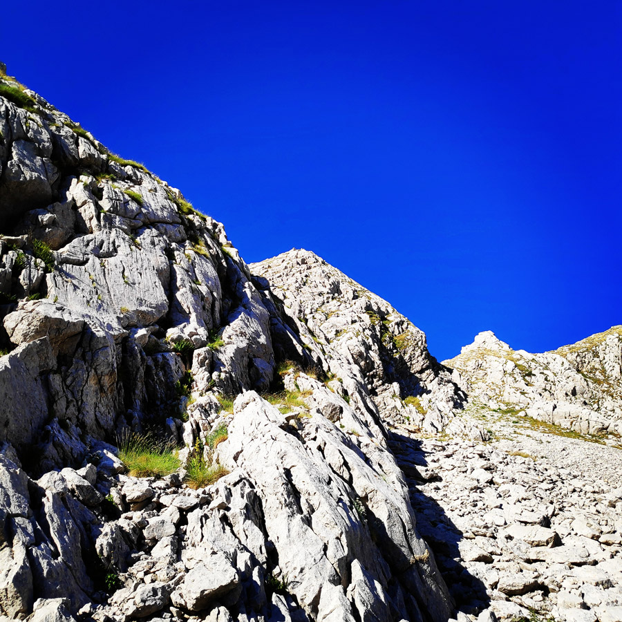
Skala Stamati: a mysterious path that moves in midair using a chain of successive zones (zonaria) on the mountain slope. The whole face of Tzoumerka is scattered with many narrow paths that were used for hundred of years by shepherds moving from winter to summer pastures on the mountain plateau. Nowadays there are no shepherds staying there for the whole summer. Shepherd Salamouras was perhaps the last to uphold this tradition up to a couple of years ago. It would have been great to visit these shepherds and be able to spend a whole day in their lovely company and listen as they talk about the old days when Bresena plateau was full of shepherds, sheep and goats. In the old days the wives of the shepherds carried to the plateau food supplies and other essentials and took to the village of Katarraktis feta cheese. All this was done using the historical Skala Stamati.
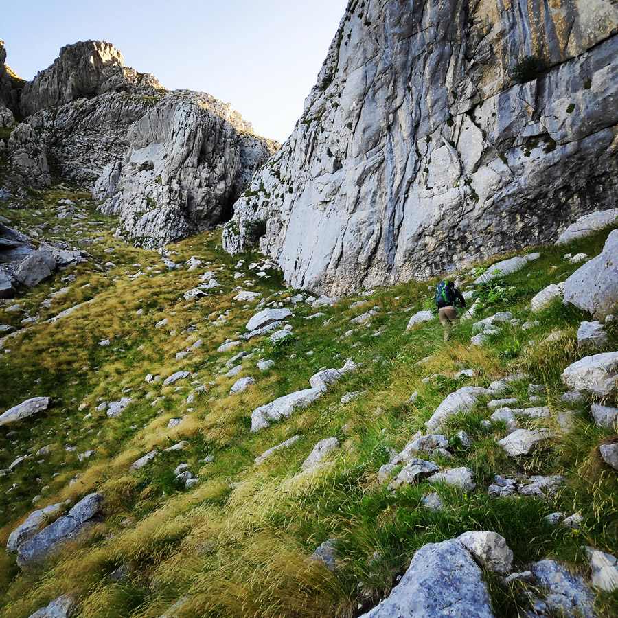
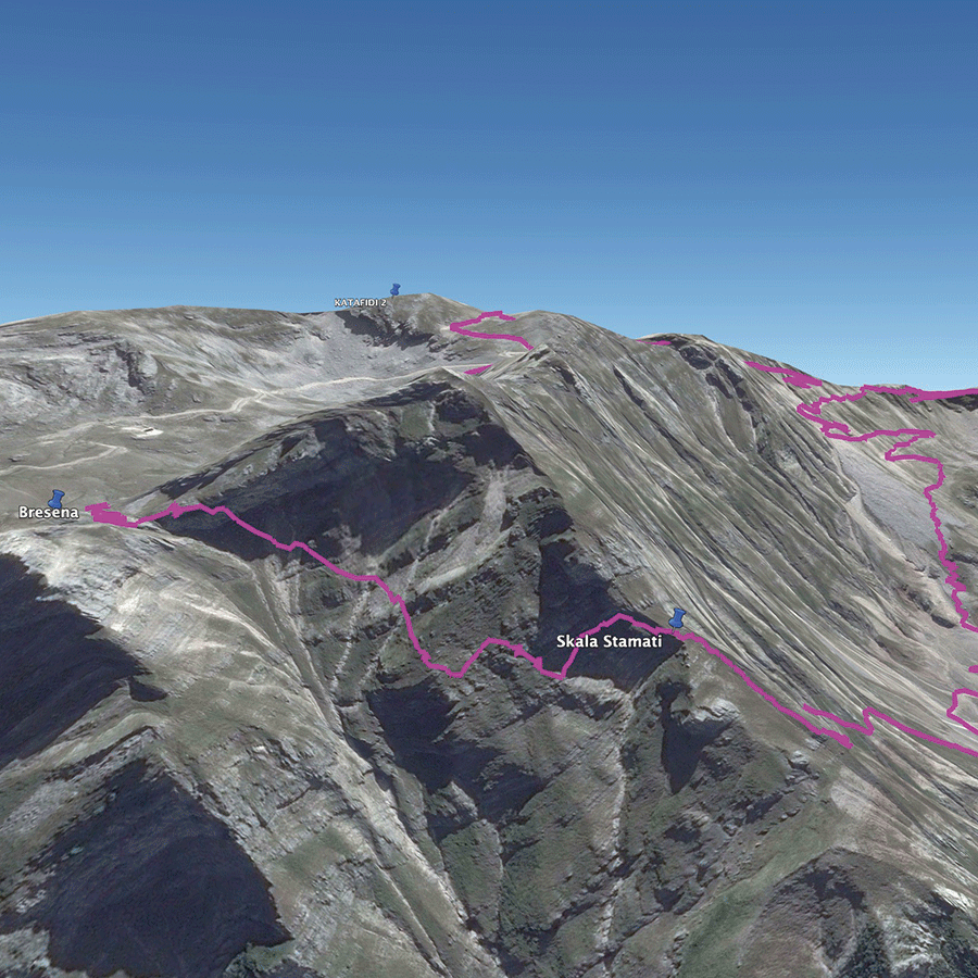
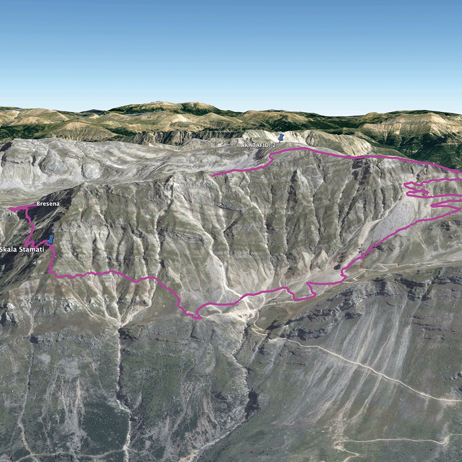
Katarraktis Mountain Refuge – Skala Stamati – Bresana Plateau
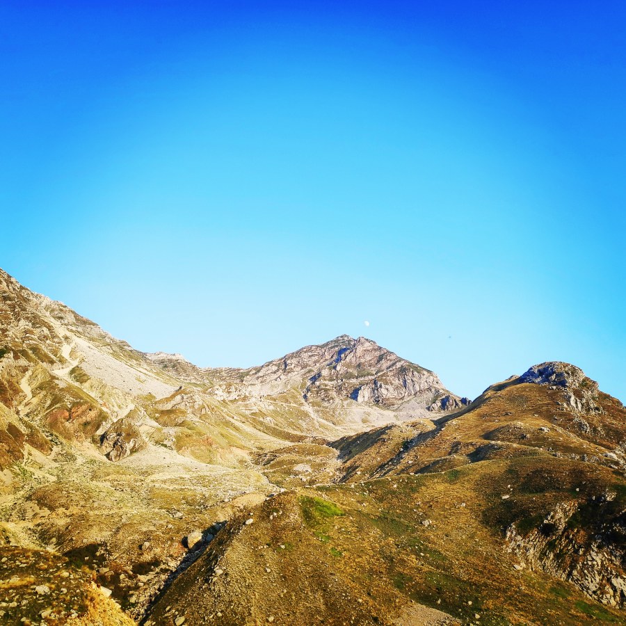
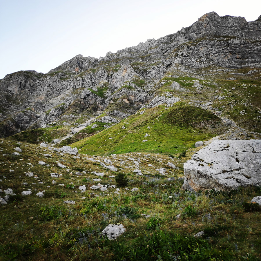
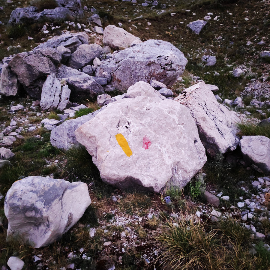
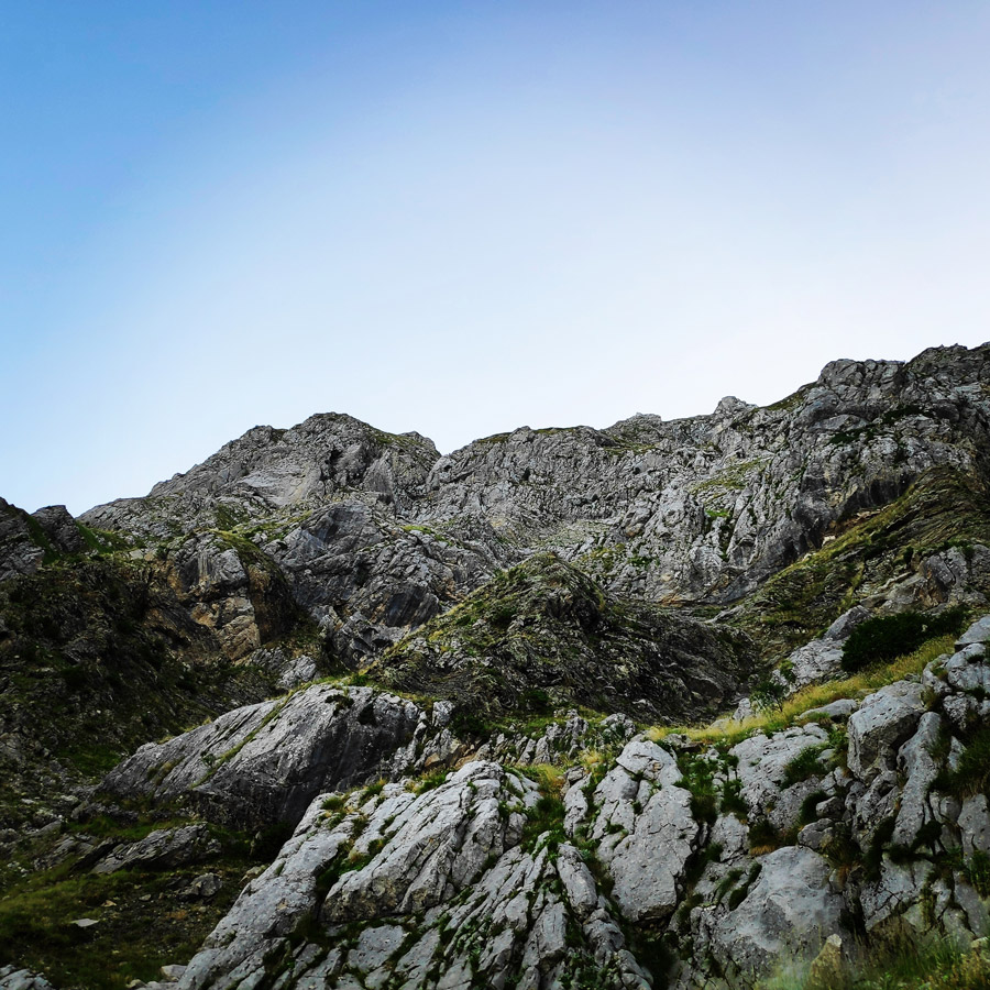
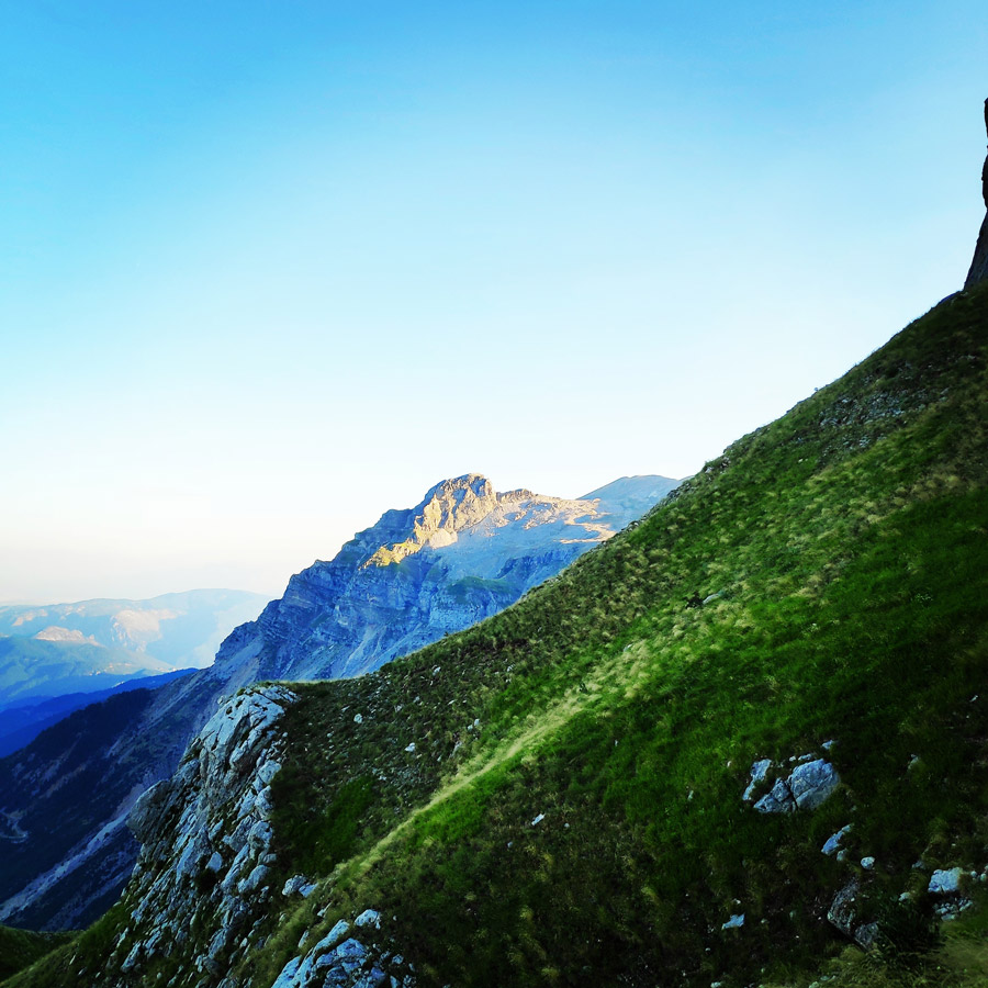
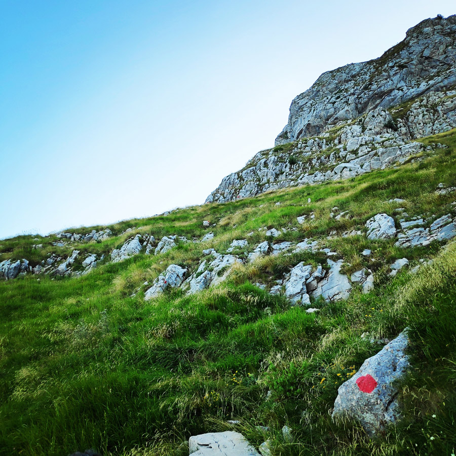
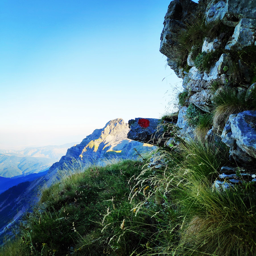
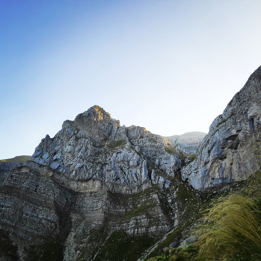
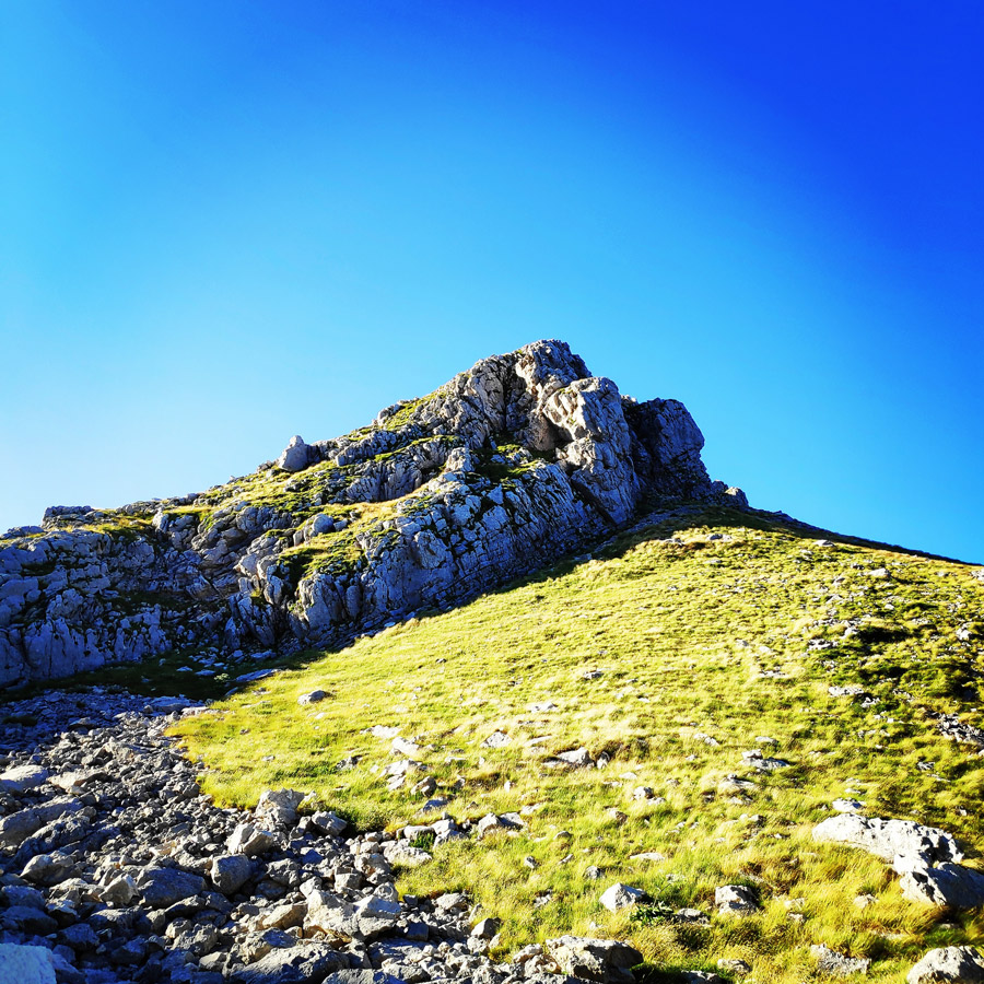
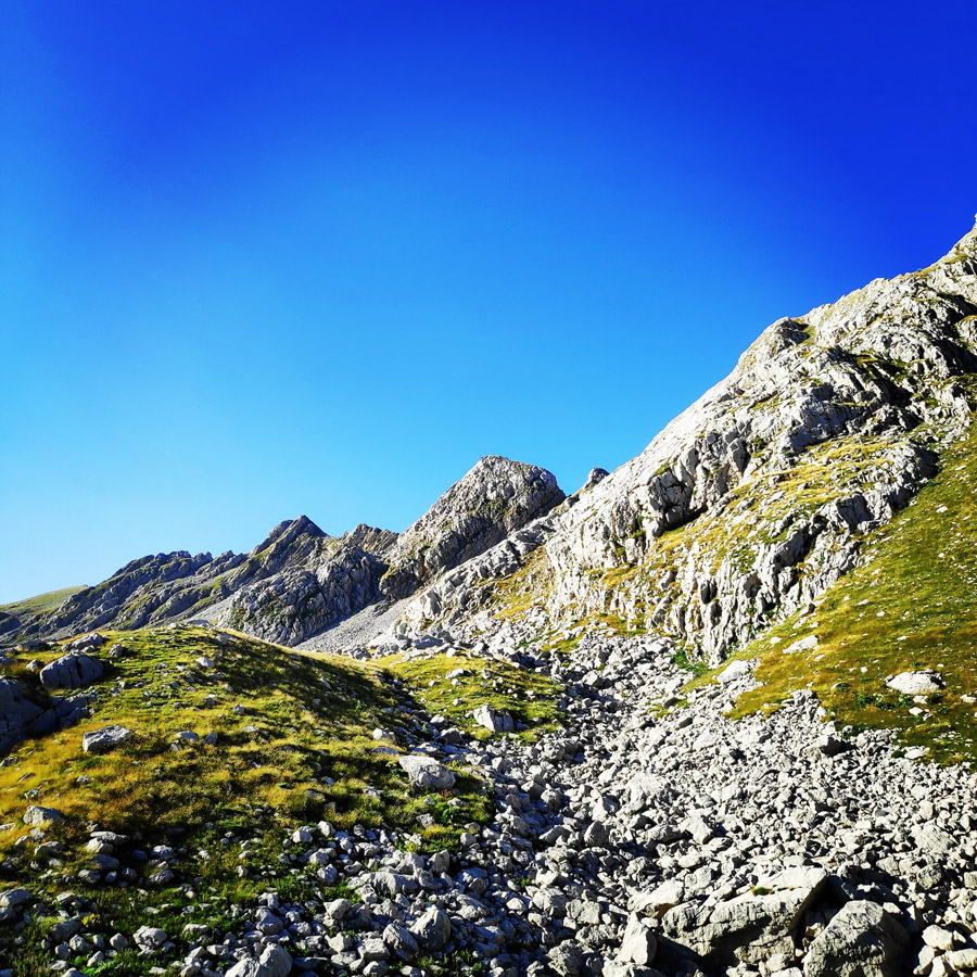
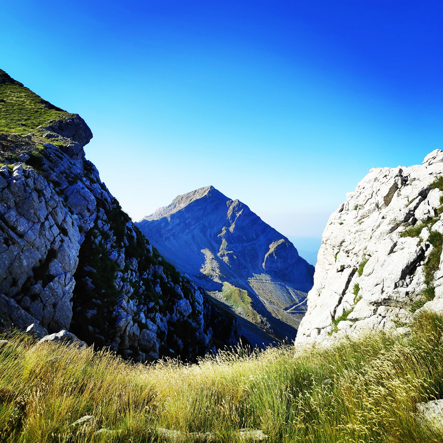
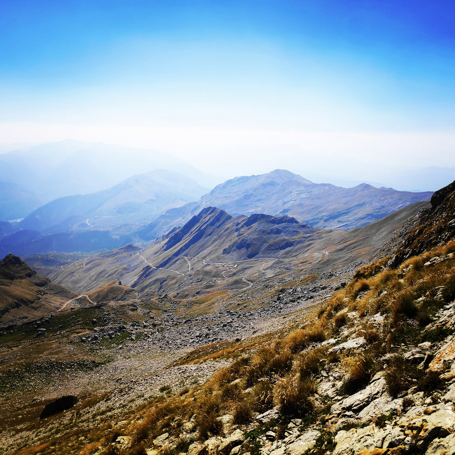
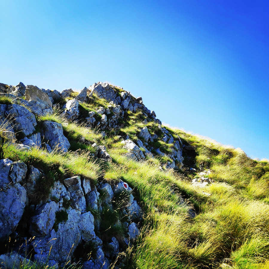
Our path starts from Katarraktis refuge and is marked with red dots starτing on the hump on the right side of the refuge. In the beginning we move up the hill on a steep slope and then we enter Skala Stamati. The vastness and rough slopes of Tzoumerka open in front of us into a magnificent scenery.
Seeing the slope you need a lot of imagination to find the path and probably you will say that there is no way to cross it. But the red dots are here to guide you through one of the most magnificent path in Greece. Looking behind, the trace of the path is lost in slope but for the one who knows it is there.
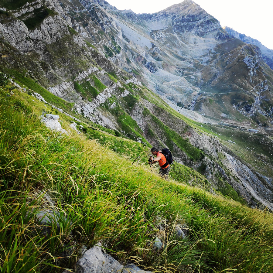
Our plan was to start early in the morning (7.00 a.m.) so we would hike uphill in the shadow. That was actually a great decision and in combination with a lovely morning breeze we did not face any issue from the heat wave.
Furthermore, due to the fact we wanted to do a round trip (Katarraktis mountain hut – Skala Stamati – Bresena Plateau – Katafifi peak – Katarraktis mountain hut) we had to start early so we would make sure to be back at the starting point on time.

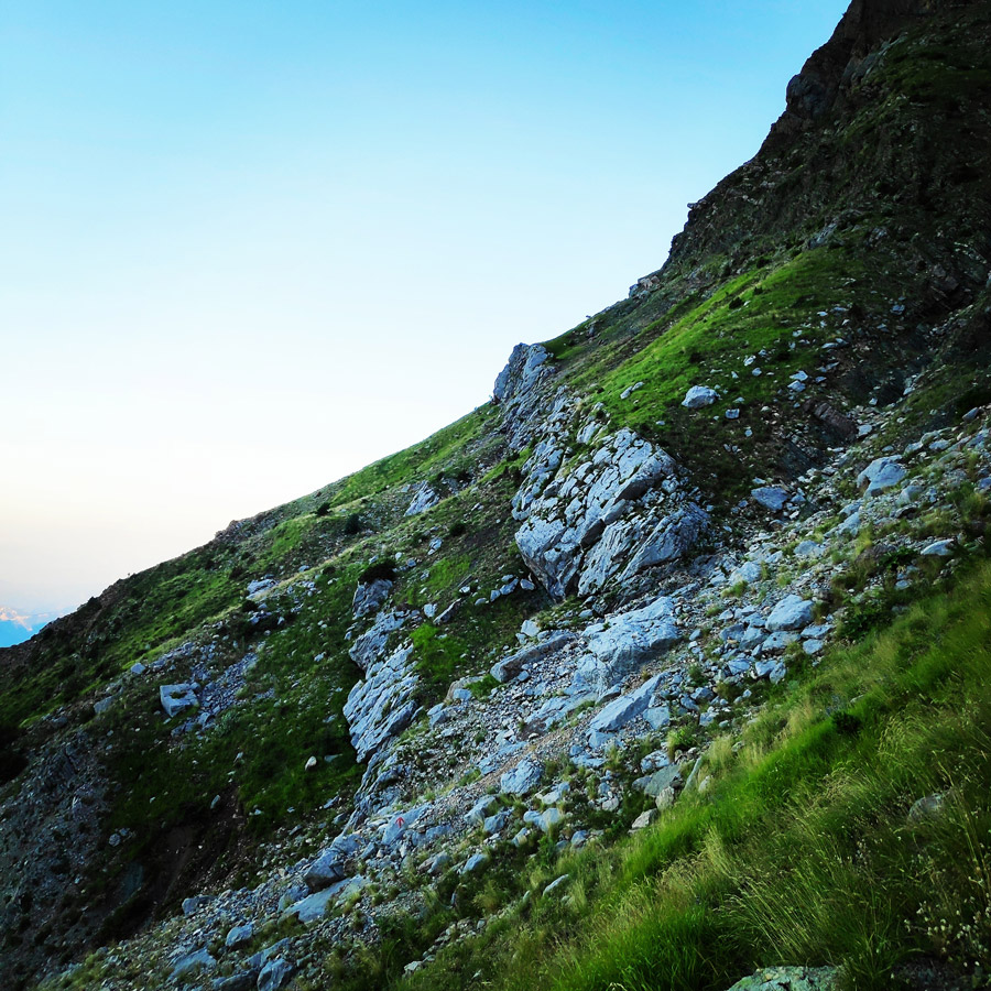

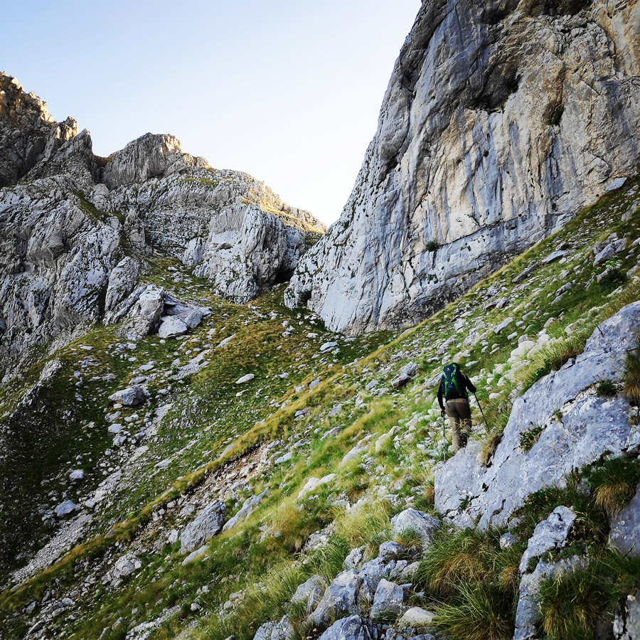

The whole trail lasts 1:30 hours from the refuge of Katarraktis to Bresena plateau. It is suggested for experienced hikers and it is a good idea to avoid it when it has rained and the grass is wet.
As soon we reached Bresena plateau, we also had our first contact (of the day) with the beams of sun. Therefore, on that point I covered the exposed parts of my body with sunscreen in order to avoid any sun burns.

Check out more FREE Guidebooks
Download now for free! Explore breathtaking landscapes and conquer thrilling heights with our collection of guidebooks and topos.
Don’t miss out on this opportunity to elevate your outdoor adventures. Click, download, and let the exploration begin!
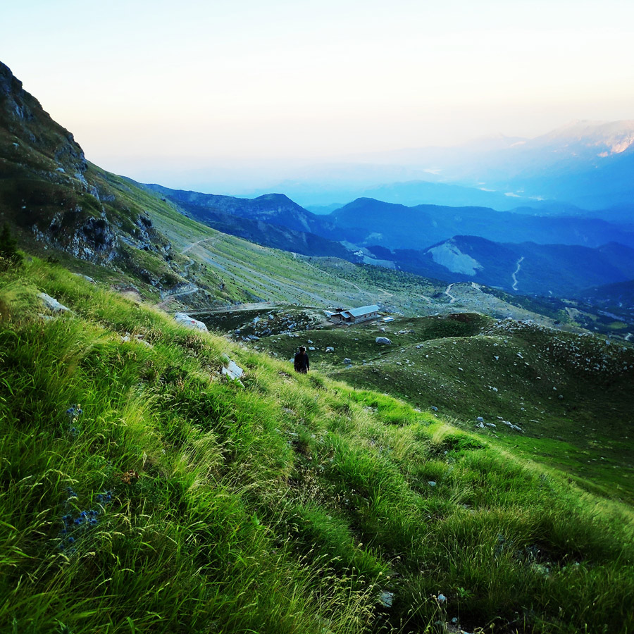
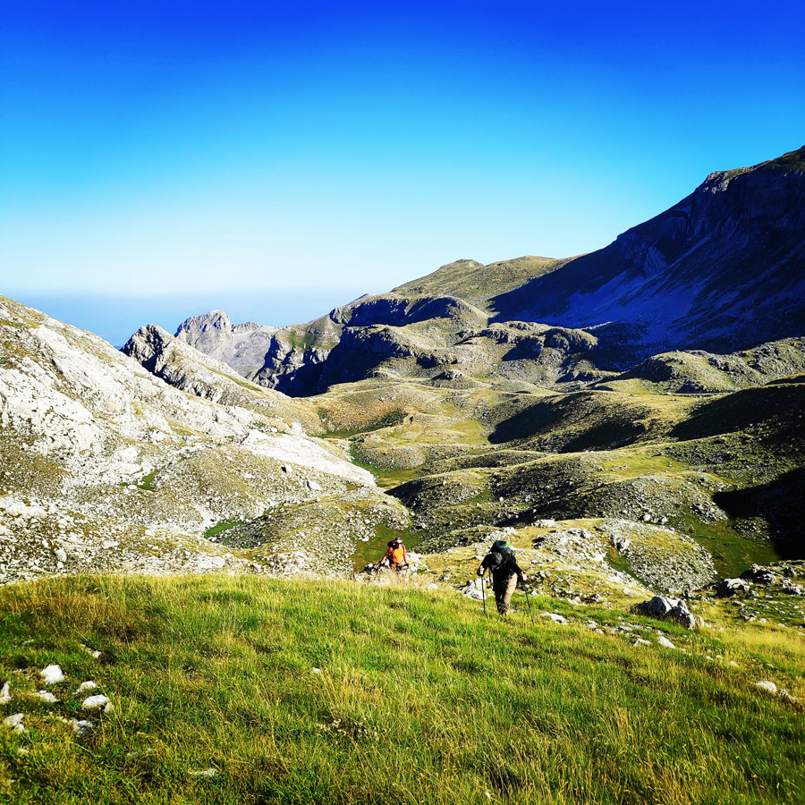
Bresana Plateau – Katafidi Peak
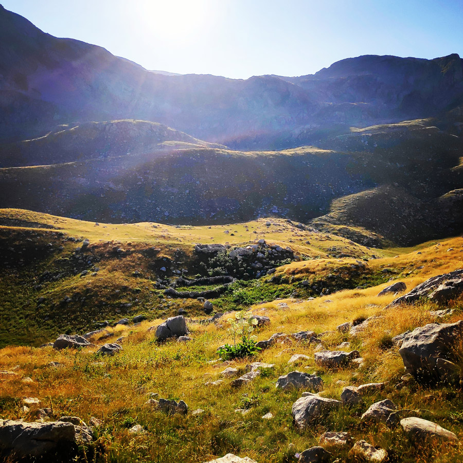
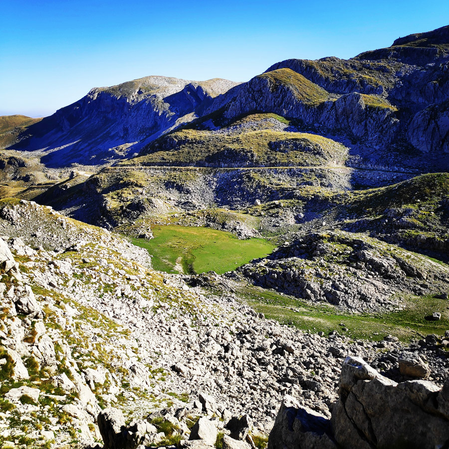
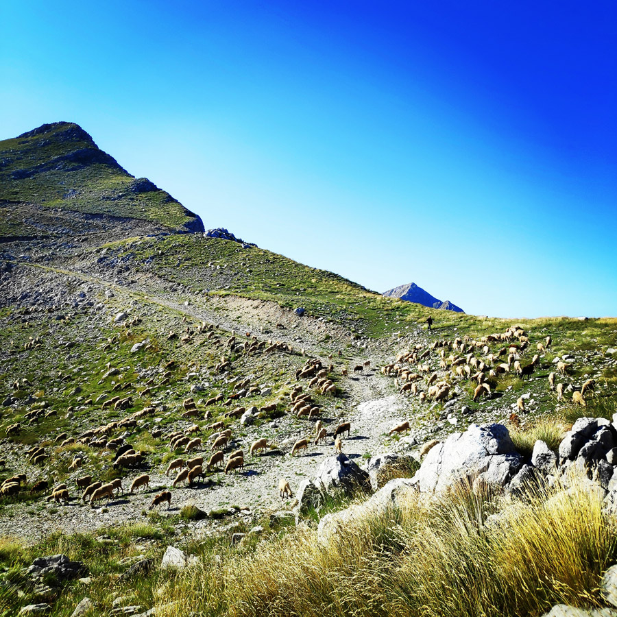
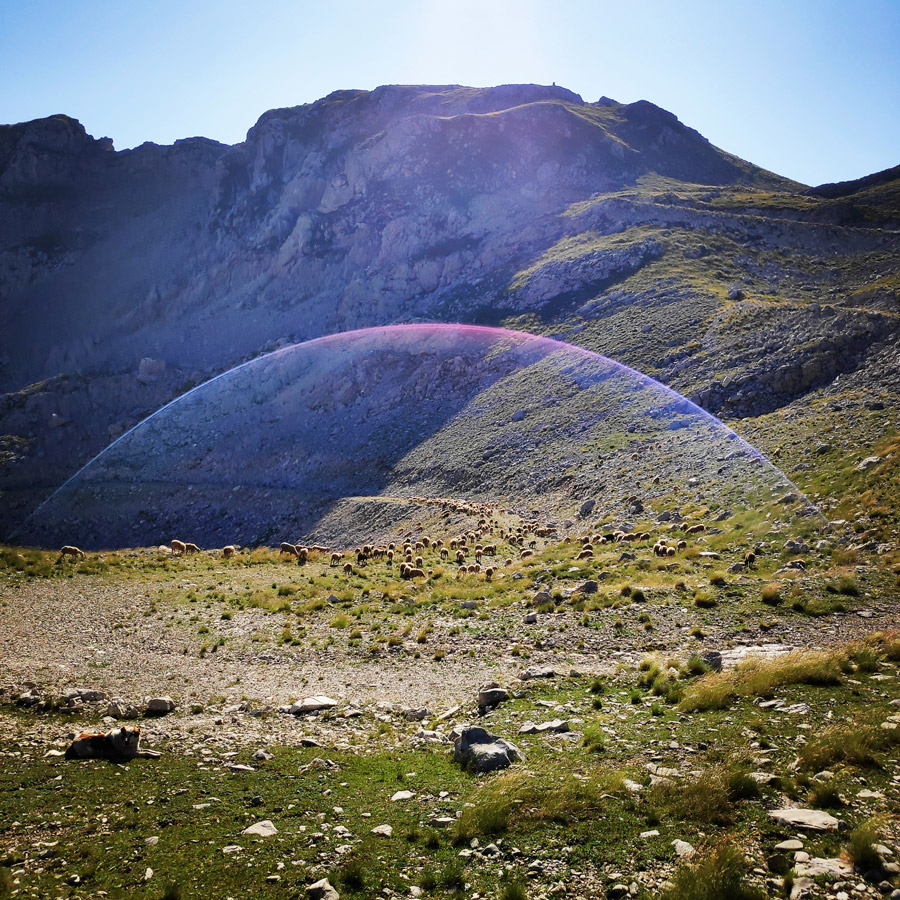
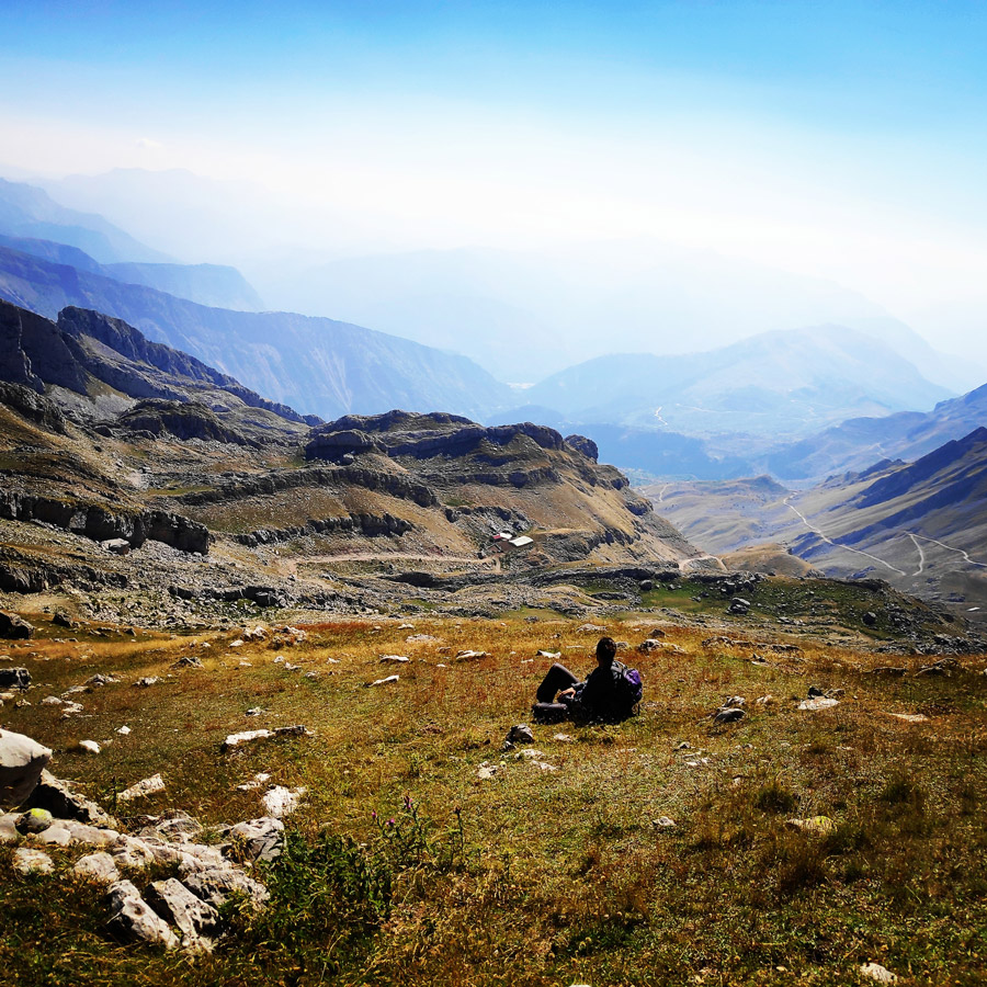
After one hour and thirty minutes we have reached the Bresena plateau. Up to few years ago, during the summer months, the Bresena plateau was full of shepherds, sheep, goats, horses, donkeys, shepherd dogs, and of course all the wild life such as bears and wolfs.
In addition, in Bresena plateau in the past were few springs with fresh water and therefore all the animals could survive the entire summer period.
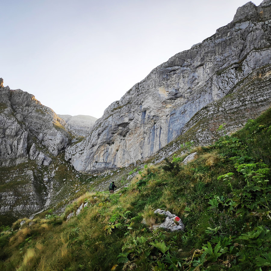
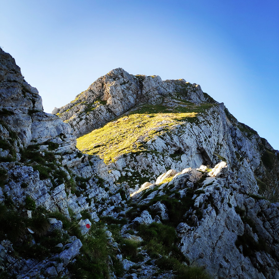
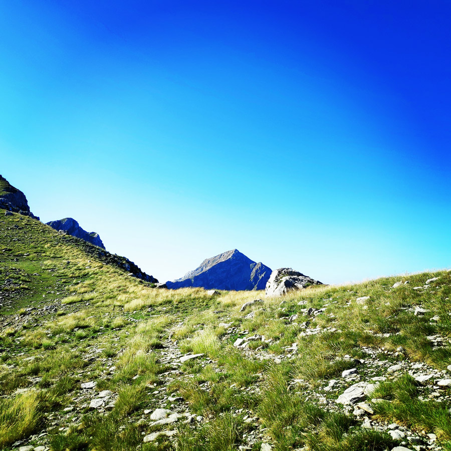
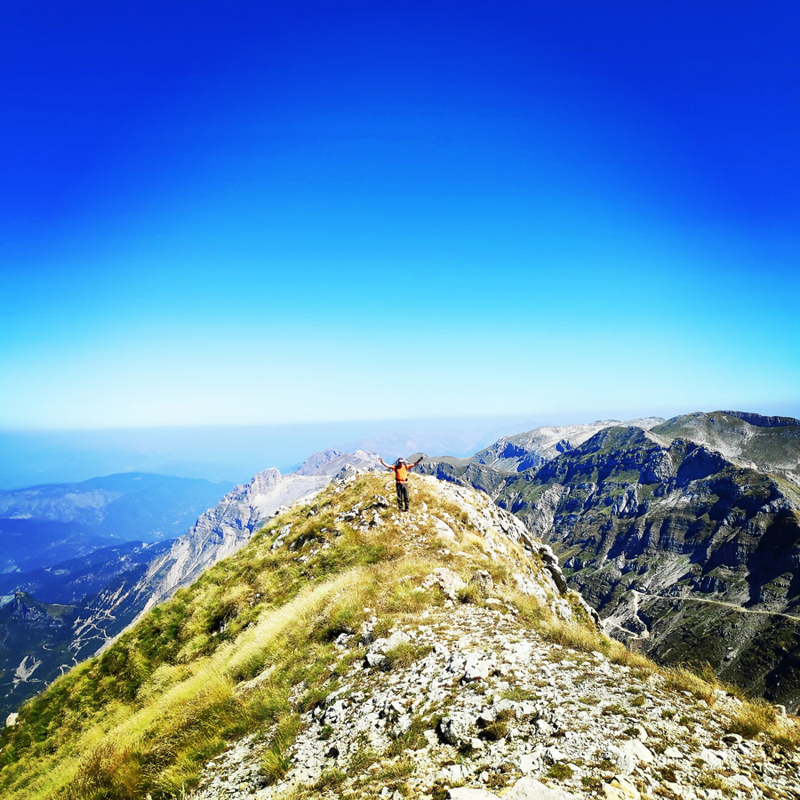
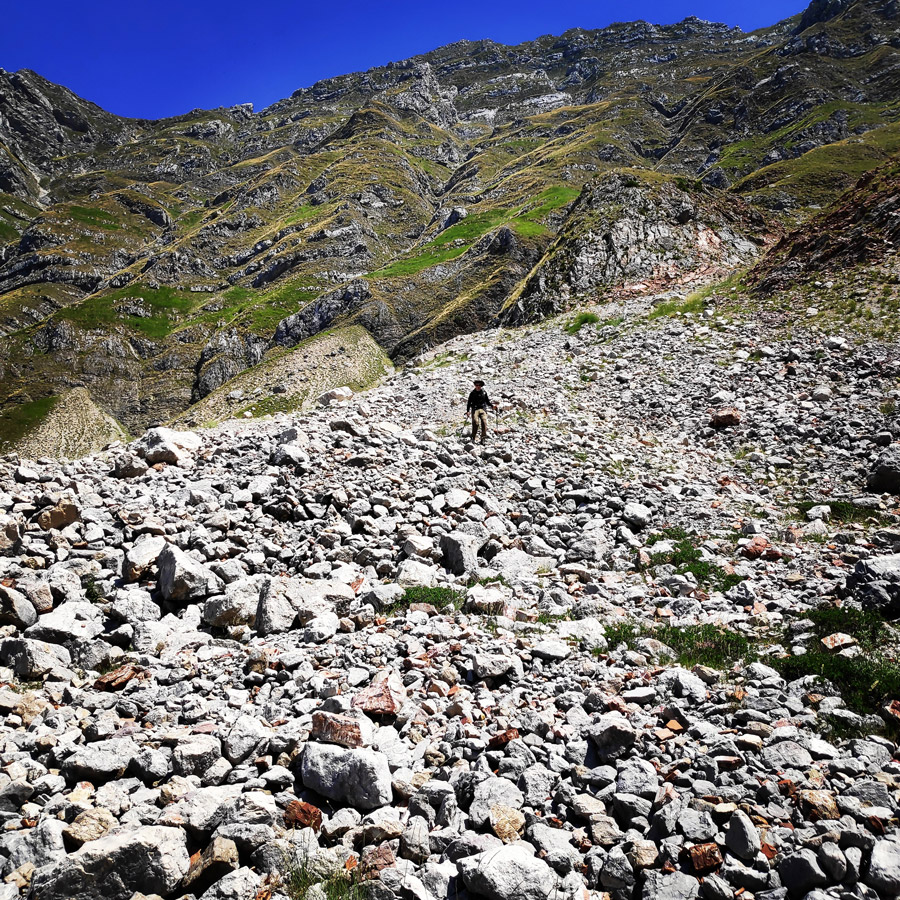
The hike from Bresana plateau to Katafidi peak (2.393 m.) is a rather easy hike and due to the fact we wanted to have a bit more fun, every time we would find a part where we could scramble, we were going from there and not from the traditional trail. In fact, we were moving parallel of the ridge of Skismeno Lithari, which was nice and fun to do.
Once we have reached the col of Katafidi, we had a short break in order to have some snacks, to get refreshed with some water and of course to have some rest before the final push.
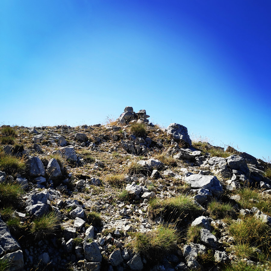
The last part of the trail, is a straight uphill and the last few meters require an easy scrambling (perhaps II UIAA).
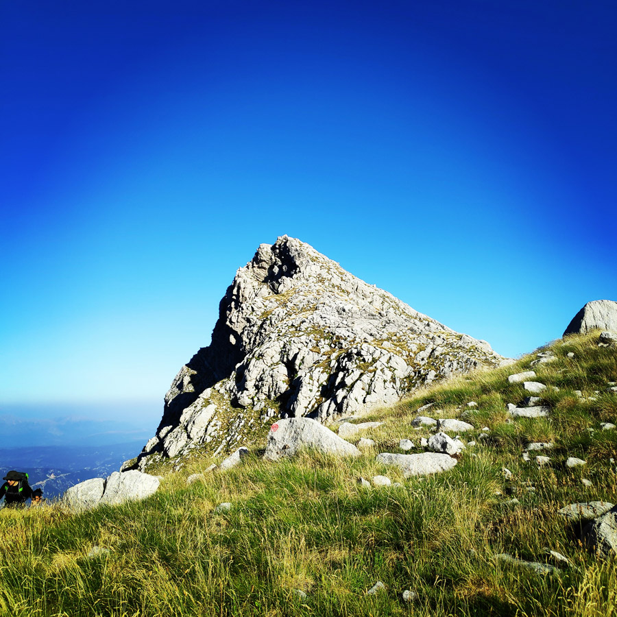

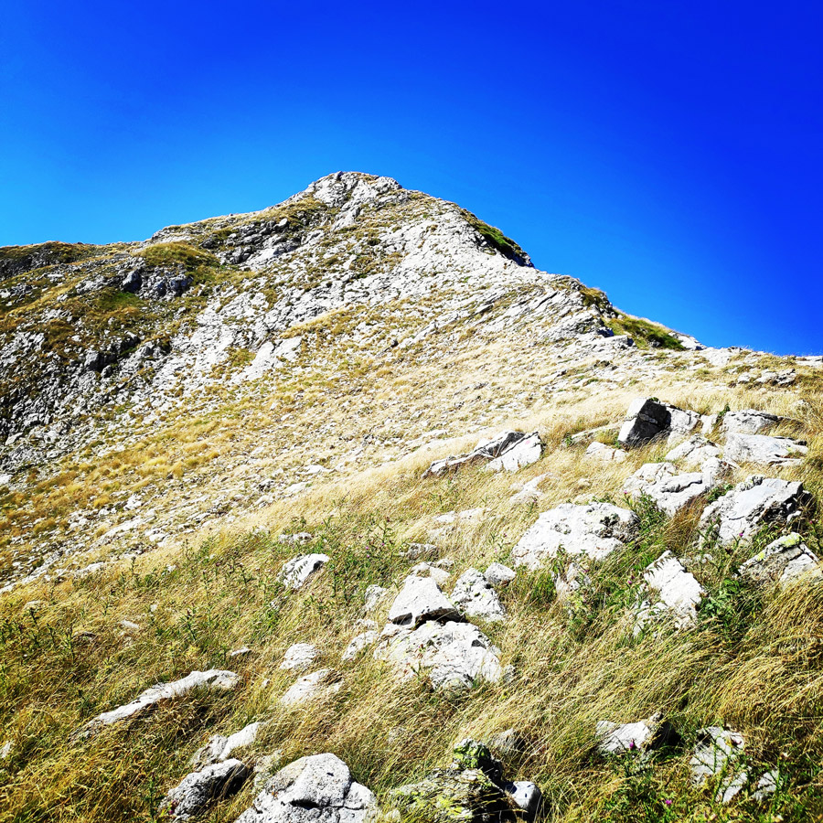

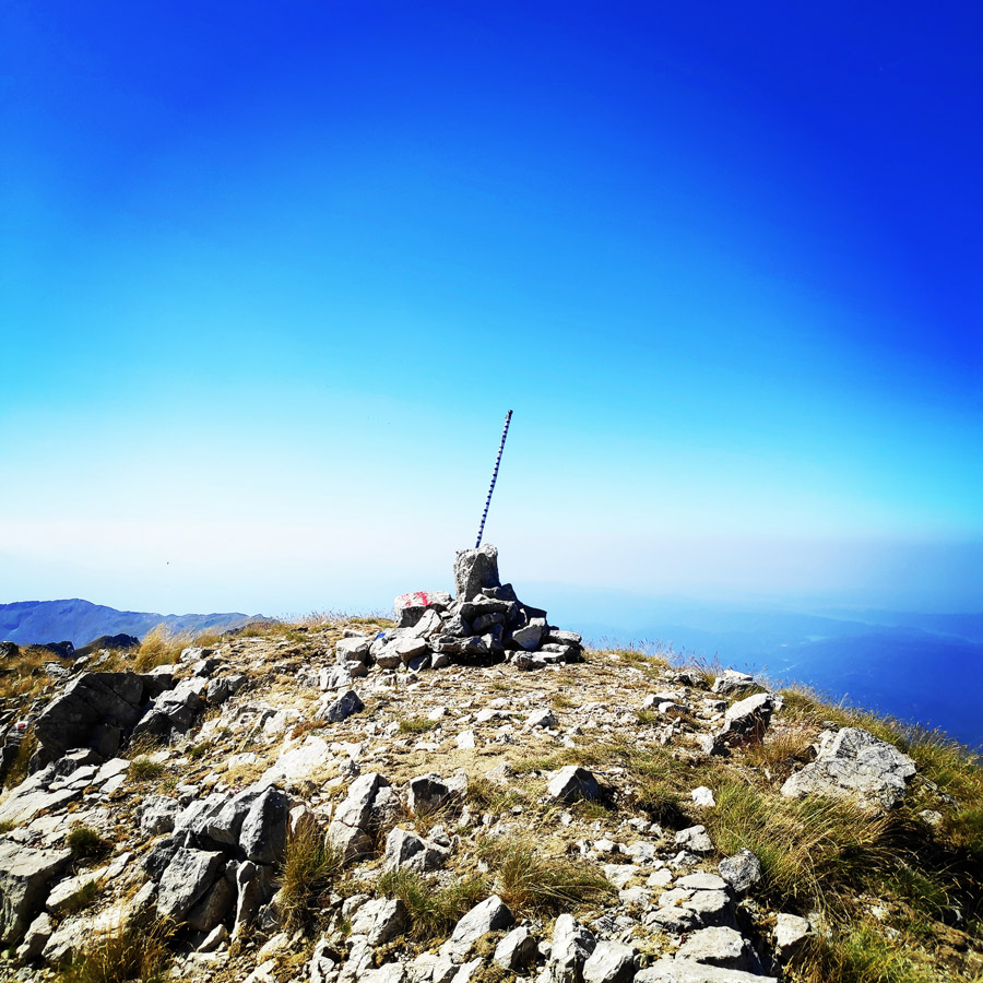
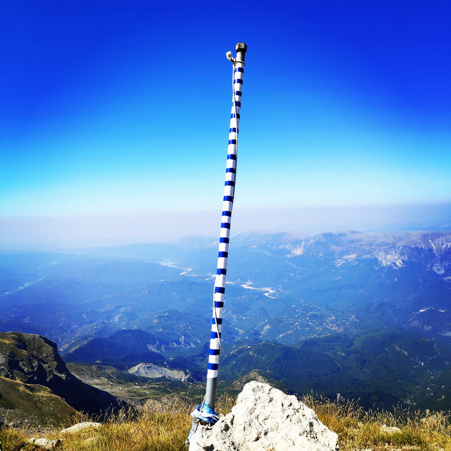
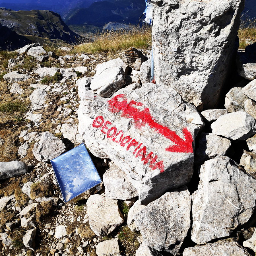
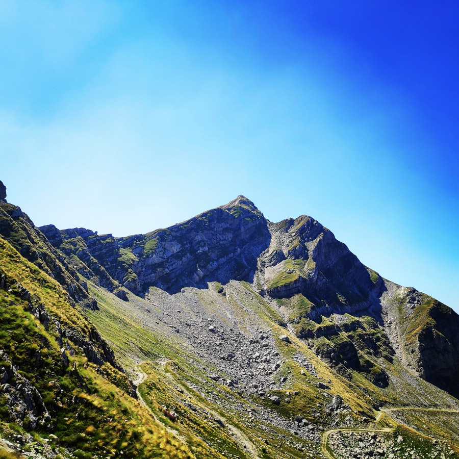
Finally, after few hours of hiking and partly scrambling, we have reached our goal and specifically, Katafidi peak, which is located 2.393 meters above sea level.
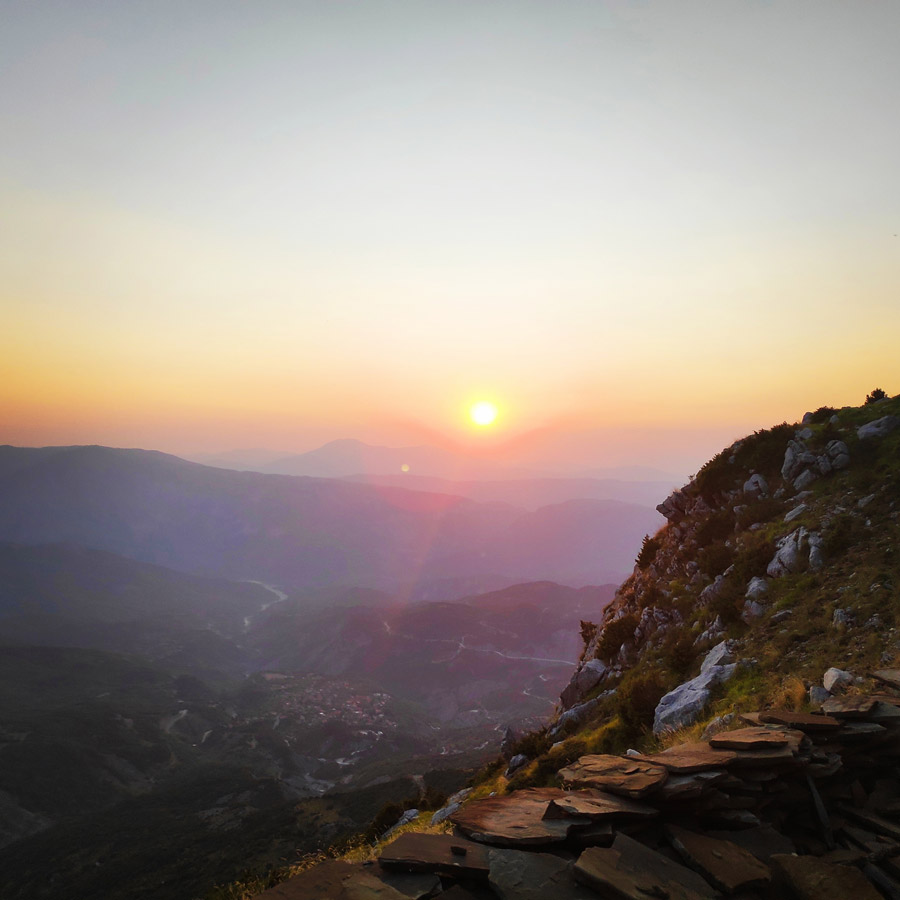
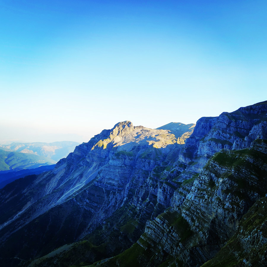
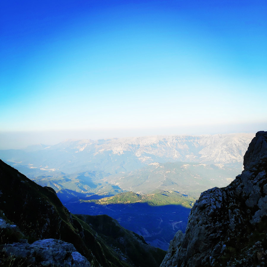
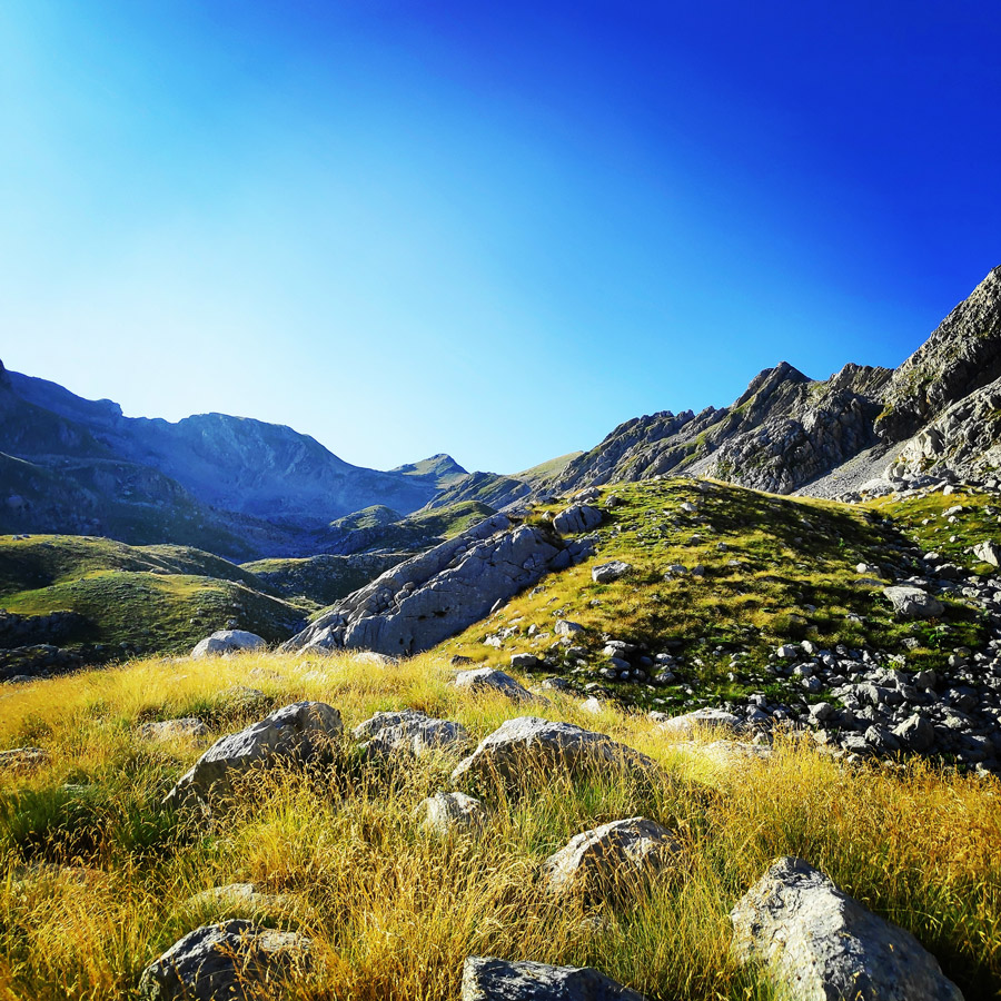
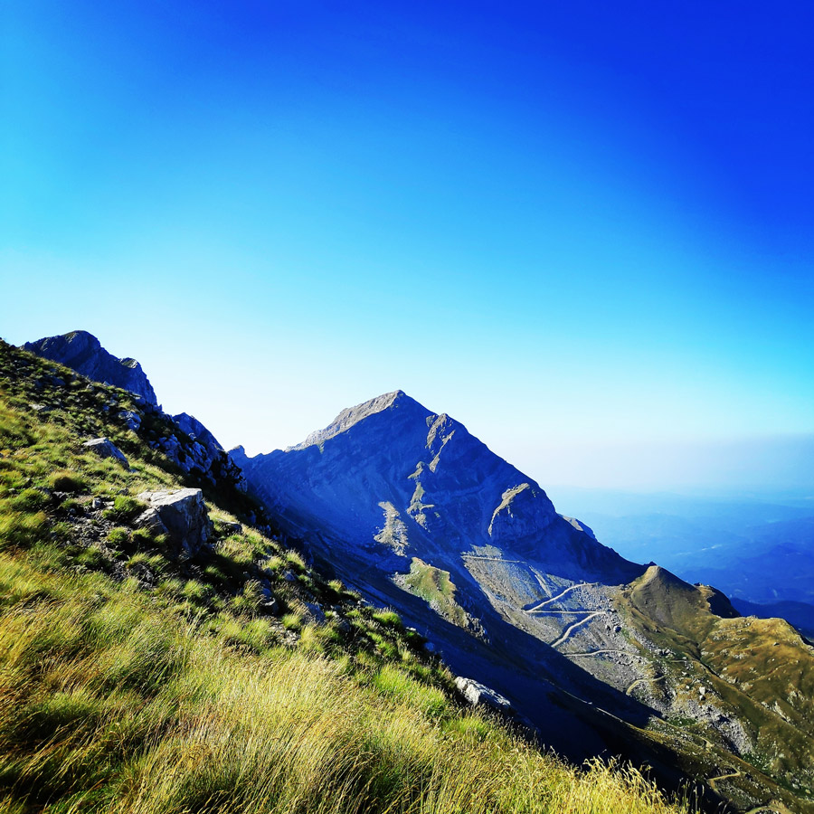
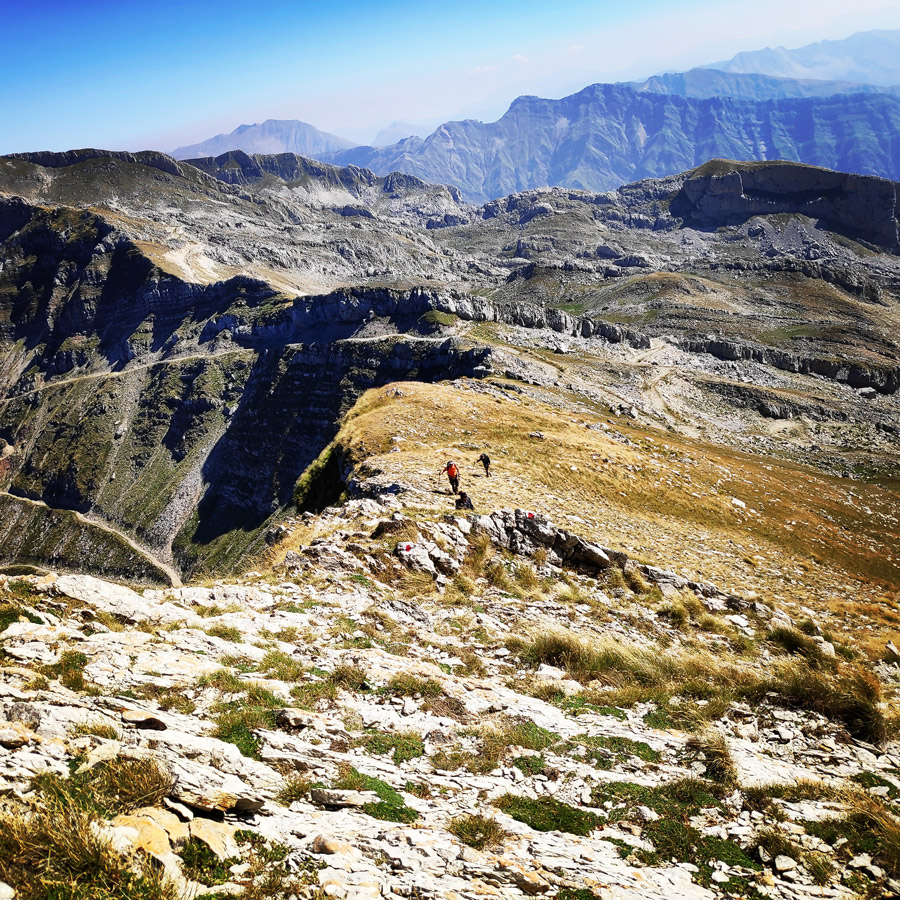
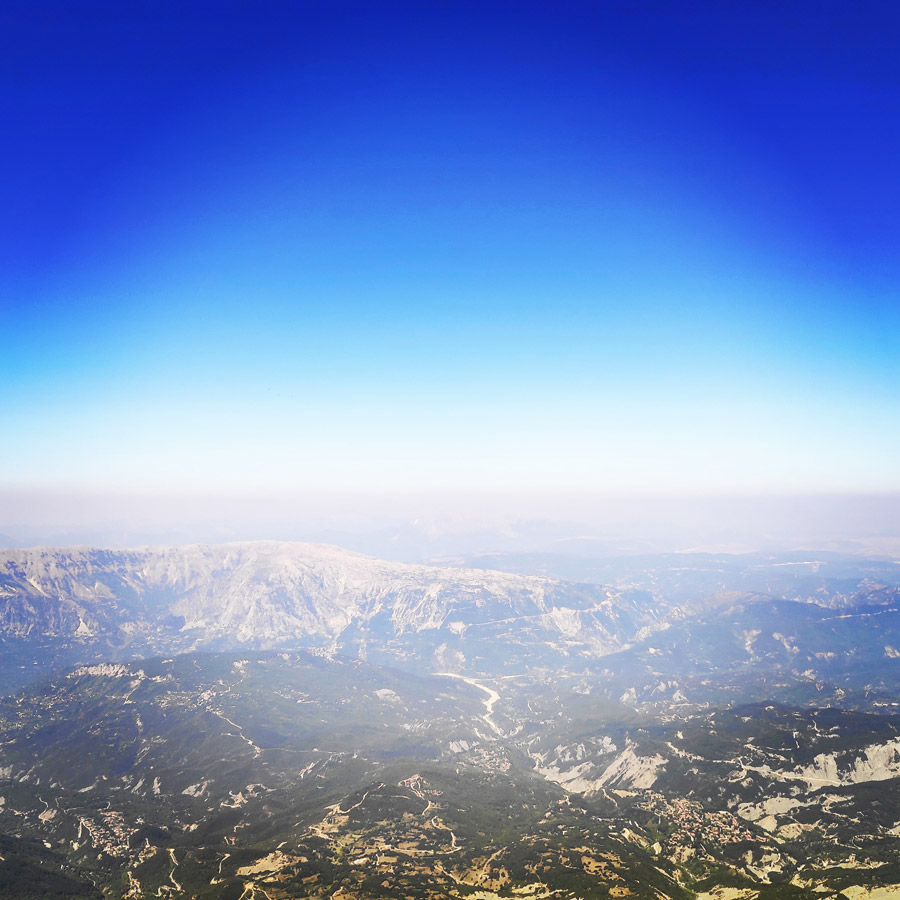
It is always great feeling when reaching a mountain peak and the views from Katafidi was really stunning. From this peak, one can see the following other peaks and mountain ranges such as Stroggoula, Kakarditsa, Tymfi, Tomaros, Lakmos and even Agrafa mountains.
Katafidi peak – Katarraktis Mountain Hut
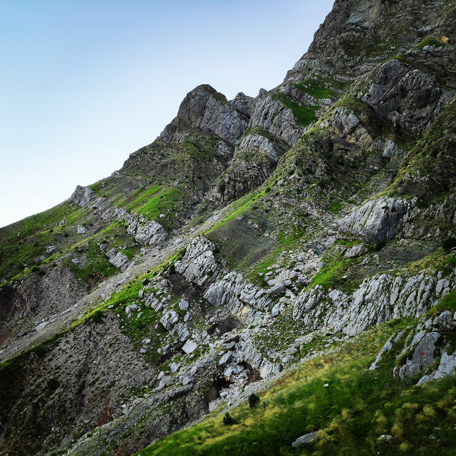
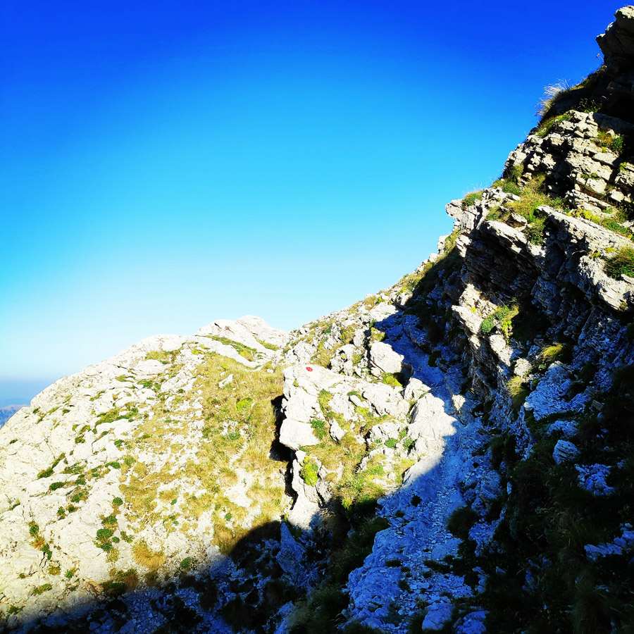
Although is really nice to seat and observe from mountain peaks, staying for prolonged times is not ideal. Therefore, after a short break on Katafidi peak (2.393 m), we started our descent in order to reach the mountain hut of Katarraktis. The descent to the mountain hut was perhaps the less interesting part from the entire trail.
At the beginning the descent moves along an old dirt road that leads to Bresena plateau and after a while moves downhill along huge and smaller blocks of limestone rocks. In fact, from the entire trail, that was the most tiring part because we had to pay attention to the moving blocks.
Panagia Faneromeni Chapel
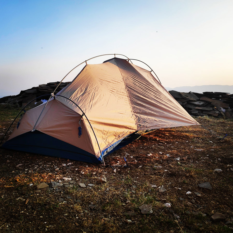
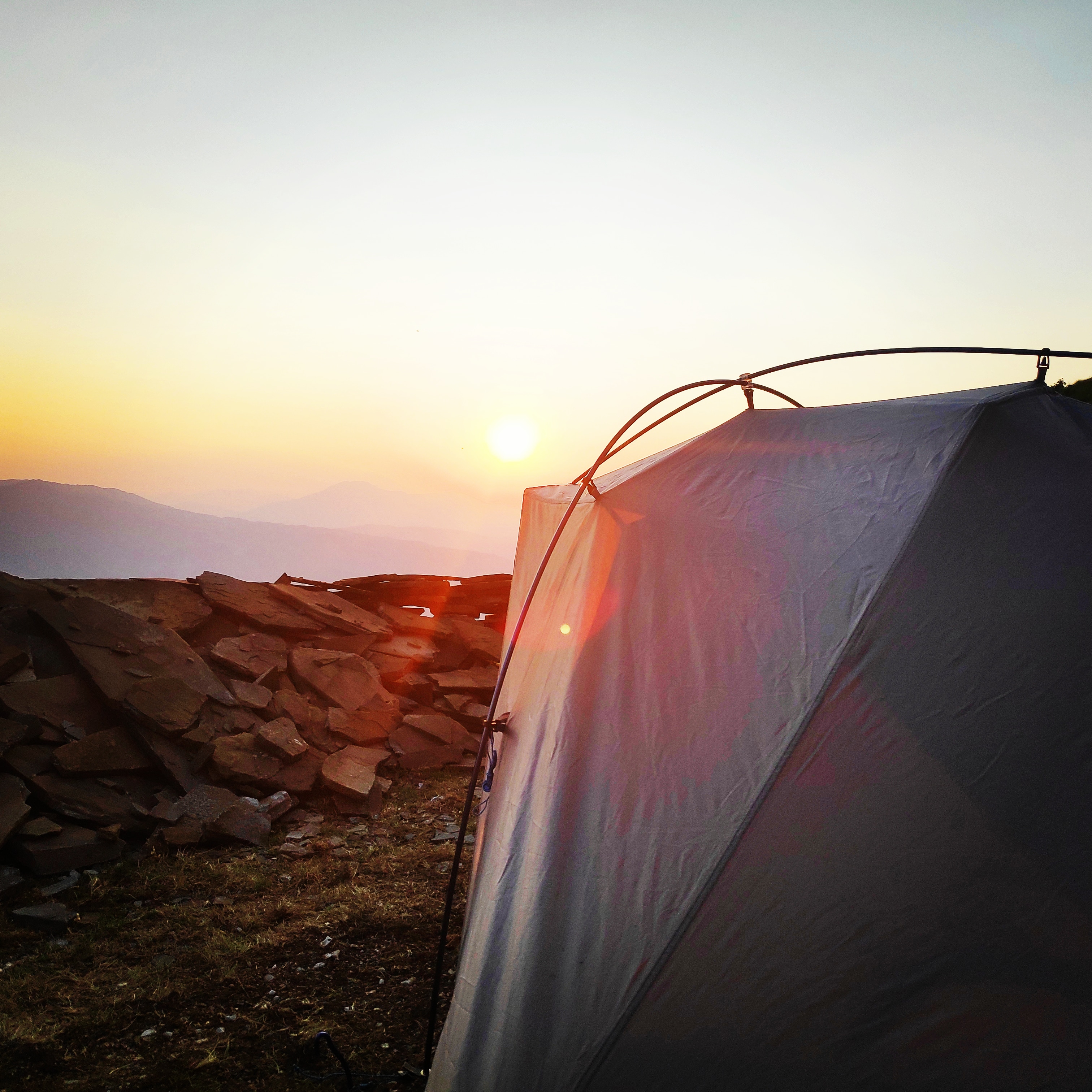
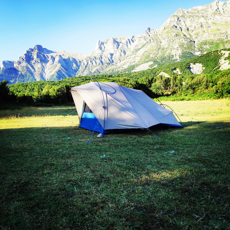
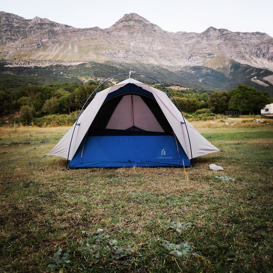
After a long day on the alpine heights, we moved lower and we decided to camp in a lovely spot just in the backyard of Panagia Faneromeni Chapel.
This unofficial campsite which is about 2.5 km far from Katarraktis village offers a flat grass plateau, a spring with fresh running water and of course a magnificent view of the entire western Tzoumerka mountain range.
On this unofficial campsite we also met a family from Italy. In the evening time we placed our tents and we had a lovely sleep.
Support the journey — buy me a coffee
I share these articles and the climbing guidebooks because I love the outdoors, and they’ll always be free. If they’ve helped you, help me keep them coming. Click the button to support my work.

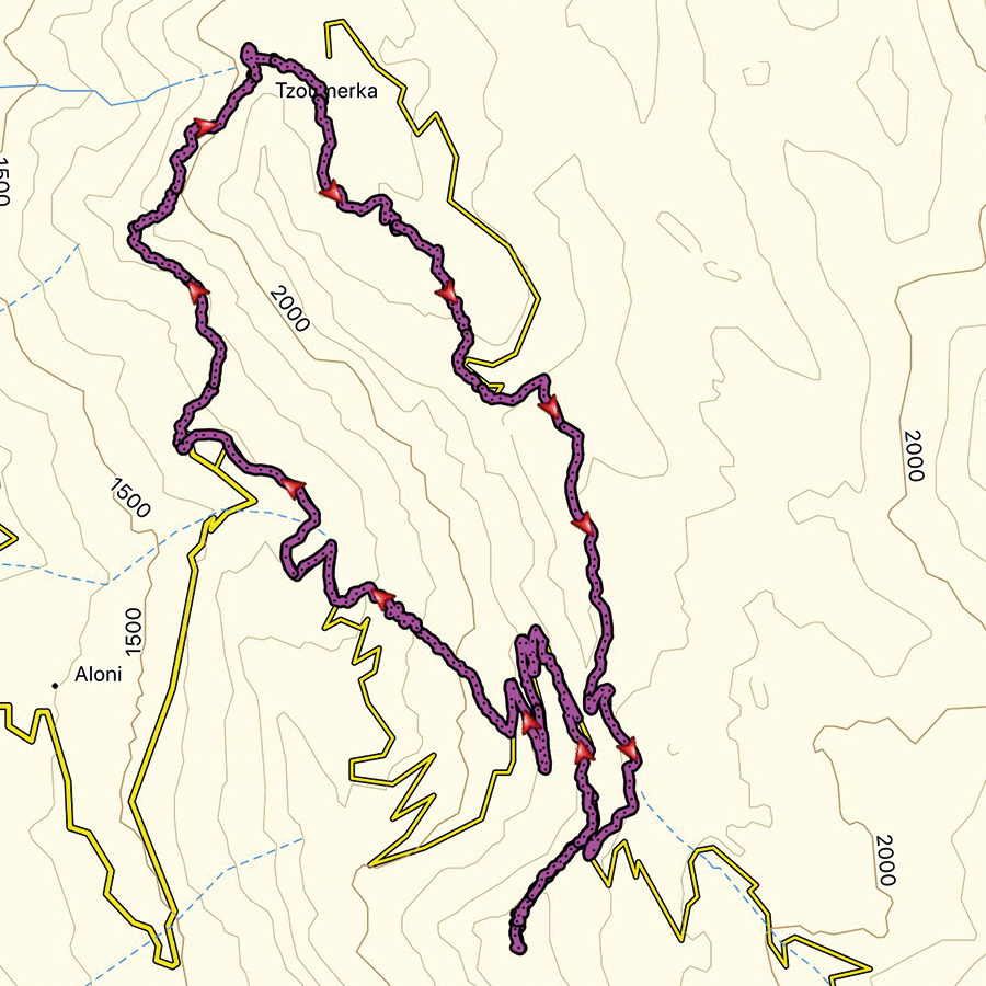
Details of the Hike:
- Location: Athamanika (Tzoumerka) Mountains
- Starting Point: Katarraktis Mountain Refuge
- Ending Point: Katafidi
- Trail Signs: Well signed path
- Minimum Elevation: 1.635 m
- Maximum Elevation: 2.393 m.
- Total Distance: 12.7 km
- Difficulty: Medium
- When to Hike: Summer and Autumn
- Water Features: None
Bellow you can see the route we have followed on a map and 3D:
Subscribe & Stay Informed
Enter your email address to follow this blog and receive notifications of new posts by email
See more hiking/mountaineering routes around this area:
- Winter Climb in Strogoula via Agrofylakas Couloir
- Winter Mountaineering Lakmos/Peristeri
- Verliga Alpine Lake
- Alpine Dragon Lake
- Astraka Peak
- Gamila Peak
- Syrrako – Kallarites
Before you leave this blog check out the following map
Below: This map marks all the mountaineering adventures that have been featured on Olympus Mountaineering so far, including several Sport climbing crags – Select full screen to expand, zoom in for more detail, or click on a marker for a link to the post.

Pingback: Hiking in Tzoumerka (Athamanika) – Katarraktis Waterfalls – Katarraktis Refuge – Faneromeni – Olympus Mountaineering
Pingback: Hiking in Tzoumerka (Athamanika) – Pramanta Refuge – Kefalovriso Waterfall – Melissourgoi Refuge – Olympus Mountaineering
Pingback: Hiking in Kouiassa Waterfall and Kipinas Monastery – Olympus Mountaineering
Pingback: Winter Mountaineering Climb in Strogoula – Tzoumerka (Athamanika) – Olympus Mountaineering
Pingback: Hiking in Tzoumerka (Athamanika) Theodoriana – Marks Stream – Rema Marks – (family friendly) – Olympus Mountaineering
Pingback: Souda Twin Waterfalls – Theodoriana – Hiking in Tzoumerka (family friendly) – Olympus Mountaineering
Pingback: Hiking in Tzoumerka (Athamanika) – Pramanta Refuge – Kefalovriso Waterfall – Melissourgoi Refuge – Pramanta Refuge (family friendly) – Olympus Mountaineering
Pingback: Hiking in Tzoumerka (Athamanika) – Melissourgoi – Kryoneri Waterfall – Melissourgoi (family friendly) – Olympus Mountaineering
Pingback: Hiking in Captain’s Baths (Λουτρά Καπετάνιου) – Vourgareli – South Tzoumerka (family friendly) – Olympus Mountaineering