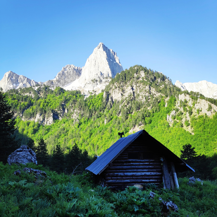
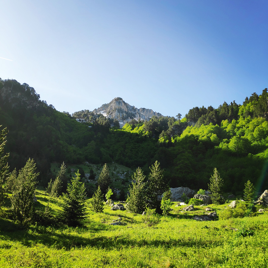
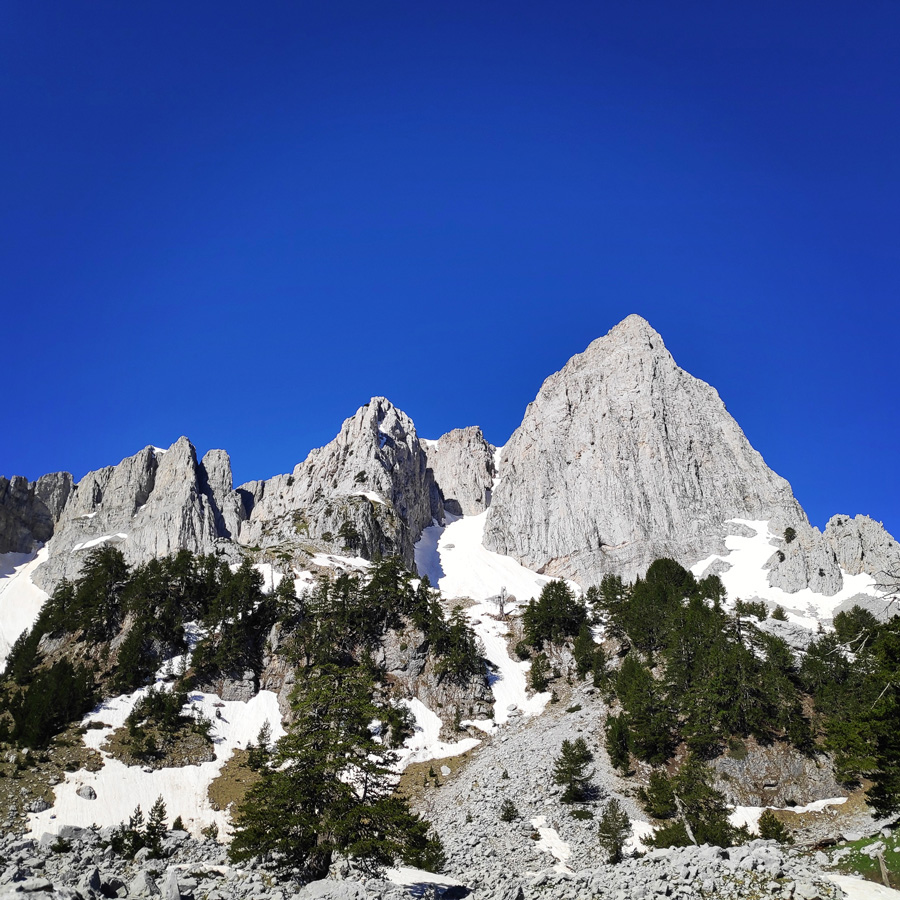
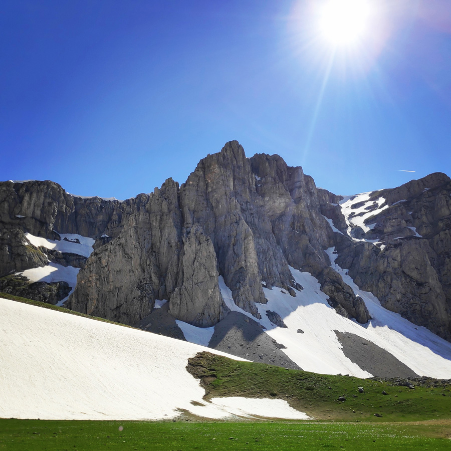
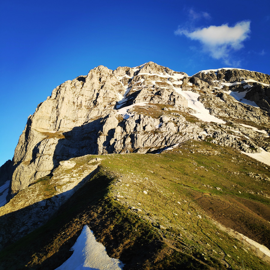
Following a rather good night of sleep in the “secret” log cabin, we woke up with a unique and mesmerising morning view. The early morning sun beams were gently hitting the high peaks of Mt. Tymfi and specifically Gamila peak. The contrast of the rock and the clear blue sky was great and there was clearly visible a line, which happens to be one of the most repeated trad-climbing routes of Gamila, Tsekouri.
Although this second day we had to cover quite some distance and to climb up Karteros’ pass, we took it rather easy with our breakfast. We enjoyed our morning coffee and talked about past mountaineering activities and climbing routes.
Our morning view from the log cabin
This is the second (of the three) part of the Mount Tymfi (Pindos) North Side Thru-Hike. In case you haven’t checked the first part, feel free to check it out here:
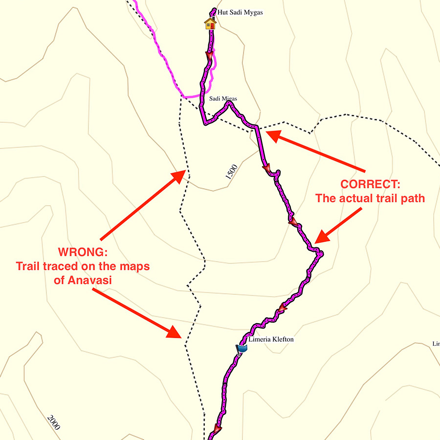
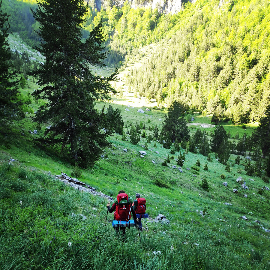
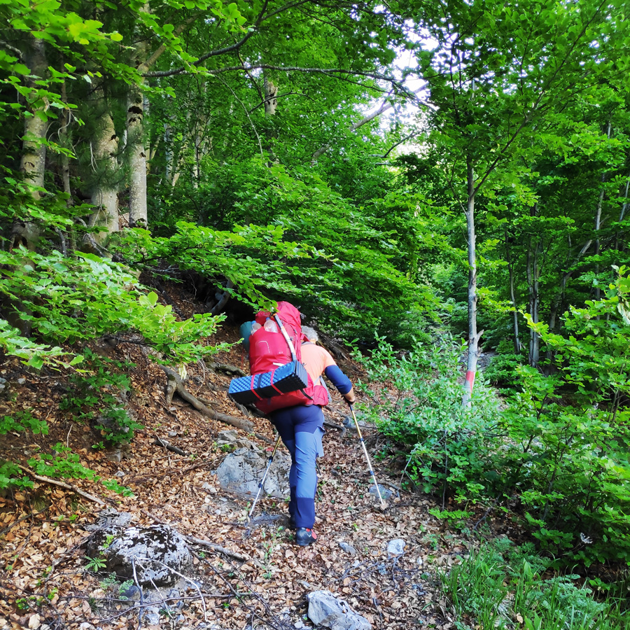
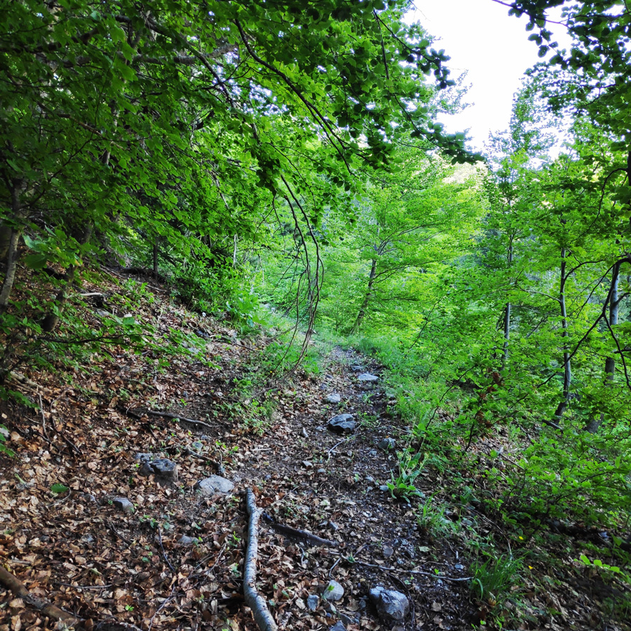
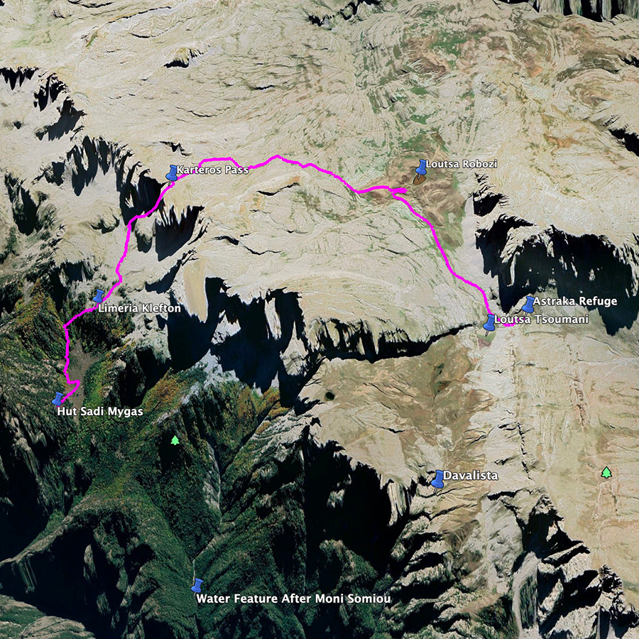
Having enjoyed our breakfast, we carefully cleaned up and ordered the interior of the mountain hut, and upon a farewell, we started to hike. The first part consisted to come down from the hill, from where the mountain hut is “hidden” and to reach the plateau of Sadi Migas. At Sadi Migas, there is a concrete water pond (but in this time of the year there was not any water), where the official maps of Anavasi showed the trail towards the pass of Karteros.
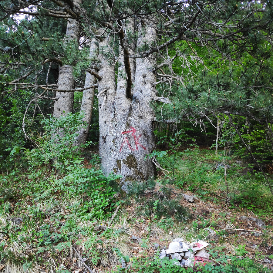
We had a short break in order to understand how the path would lead us to the pass between Gamila II and Karteros peaks, but we were unable to understand what the map was showing. Upon a quick meeting, we decided to ignore the trace of the map and to move towards the east and to follow the trail which leads to Stani Katsanou. In fact, that was the correct choice, because about 200 meters on this trail we came across a tree with a sprayed sign with the greek letters “ΛΚ” (most probably, meaning Limeria Klefton – Λιμέρια Κλεφτών).
ATTENTION: Should you be using the maps of Anavasi, Topoguide, Pegasus (and perhaps other maps), ignore the traced trail on the map that leads you directly to Karteros pass, because such trail does not exist (or at least it was impossible for us to locate).
Keep on the normal trail, up to the point you see a large tree with the red sprayed sign, we turned left and we continued the uphill. This is the correct trail that leads you to Karteros Pass.
Map Correction: Follow the purple line and Ignore the trace of the map
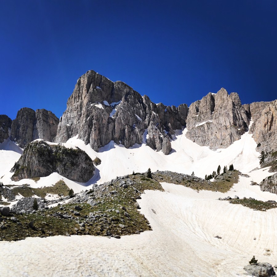
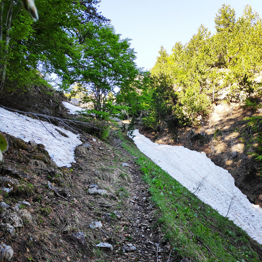
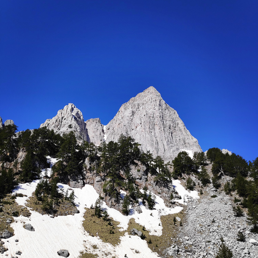
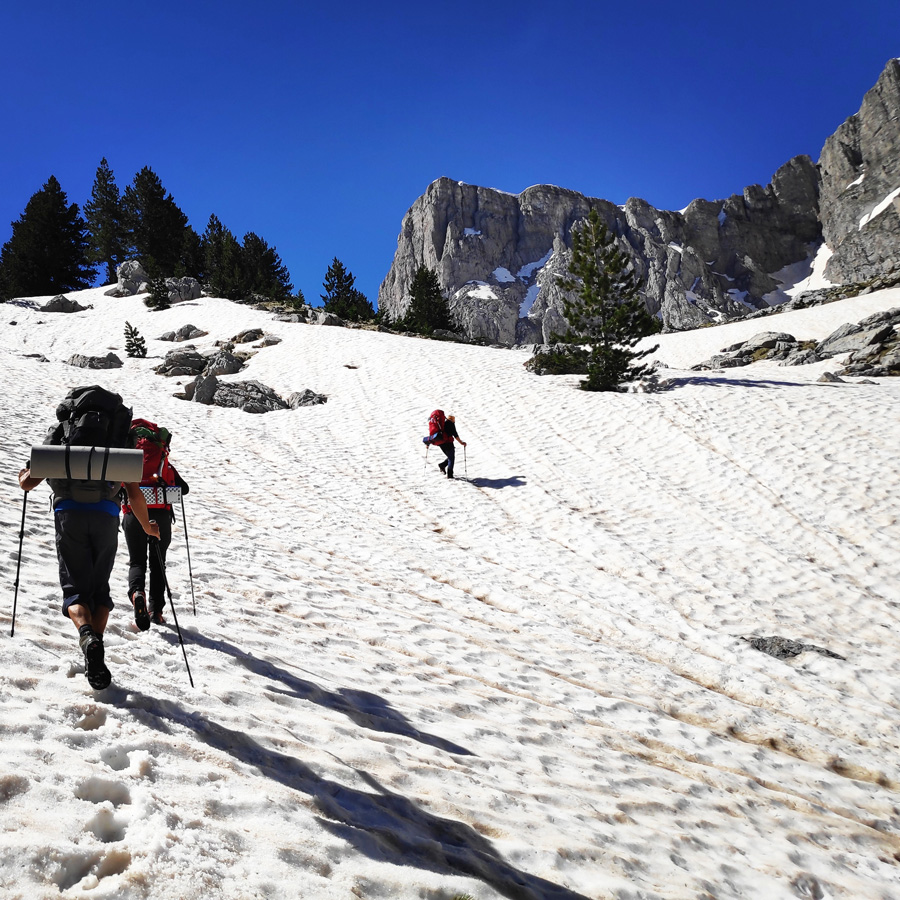
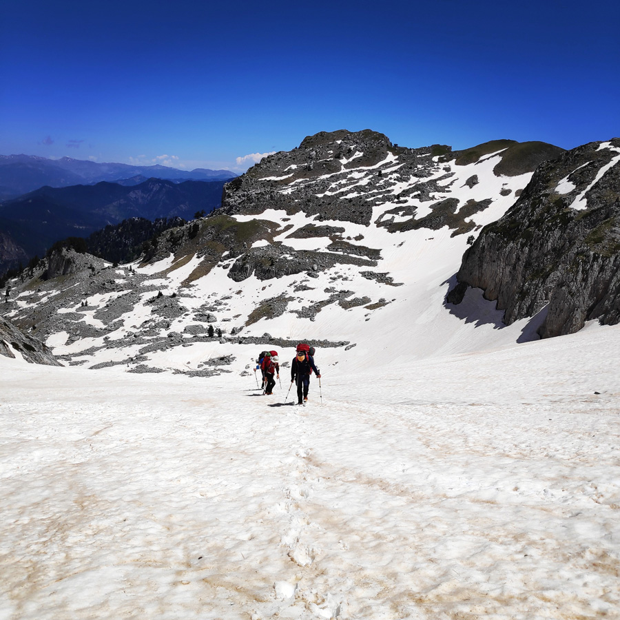
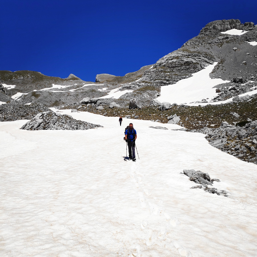
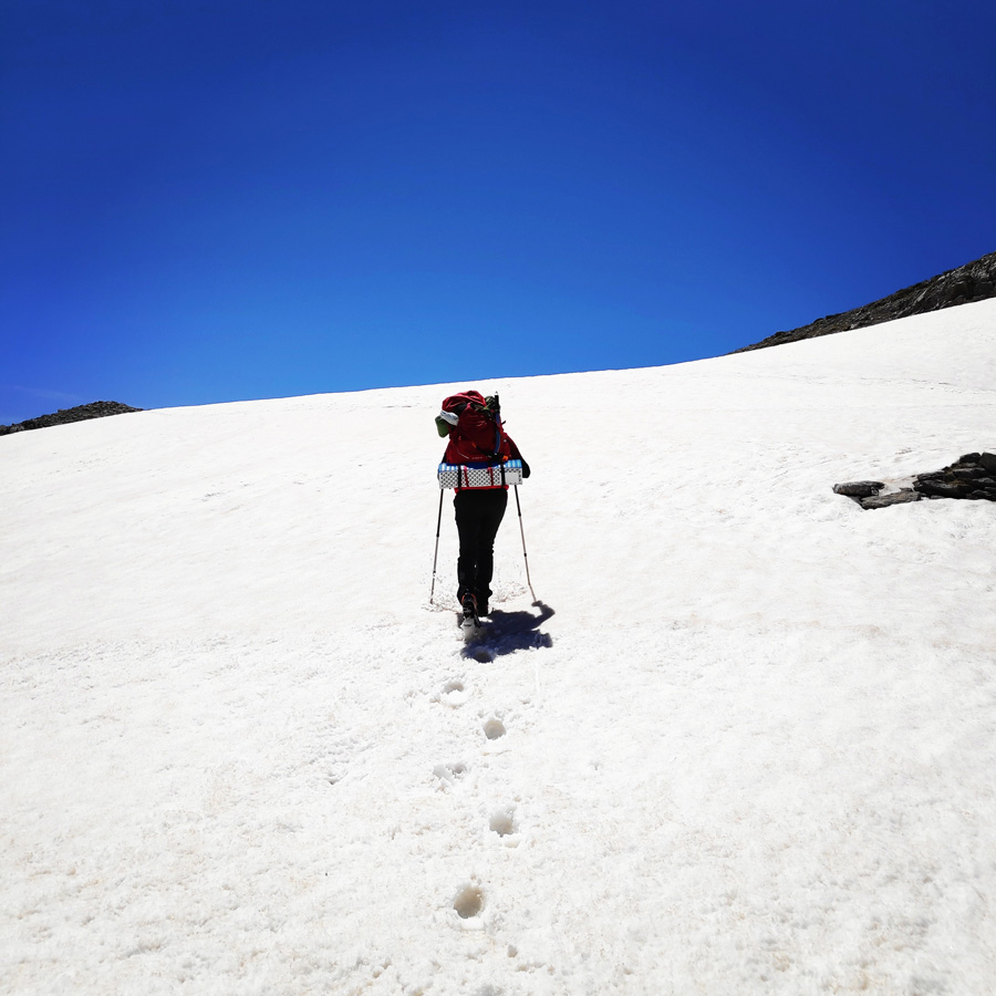
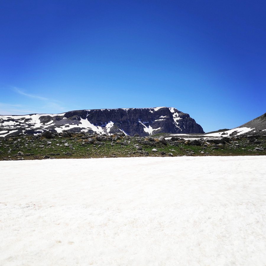
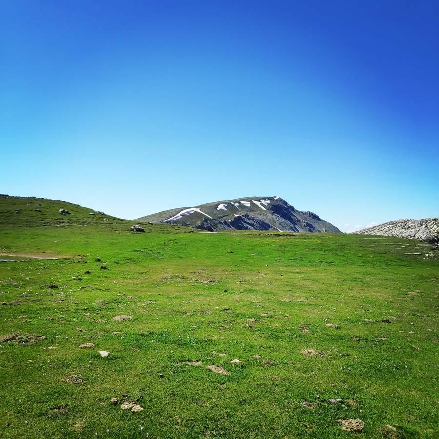
Not far from the crossroad, we also came across the first snow patches of the day and the more we were moving uphill, the better view we had towards the high peaks of Tymfi.
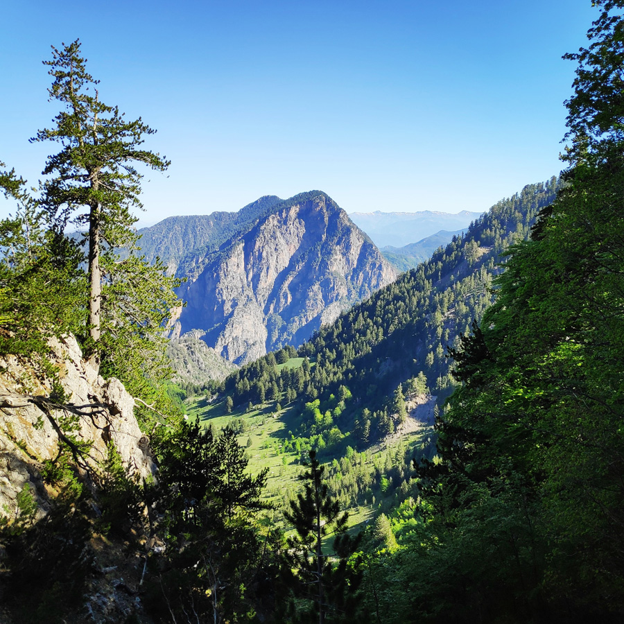
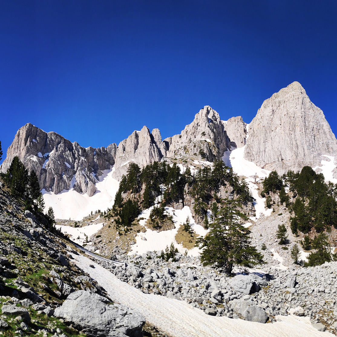
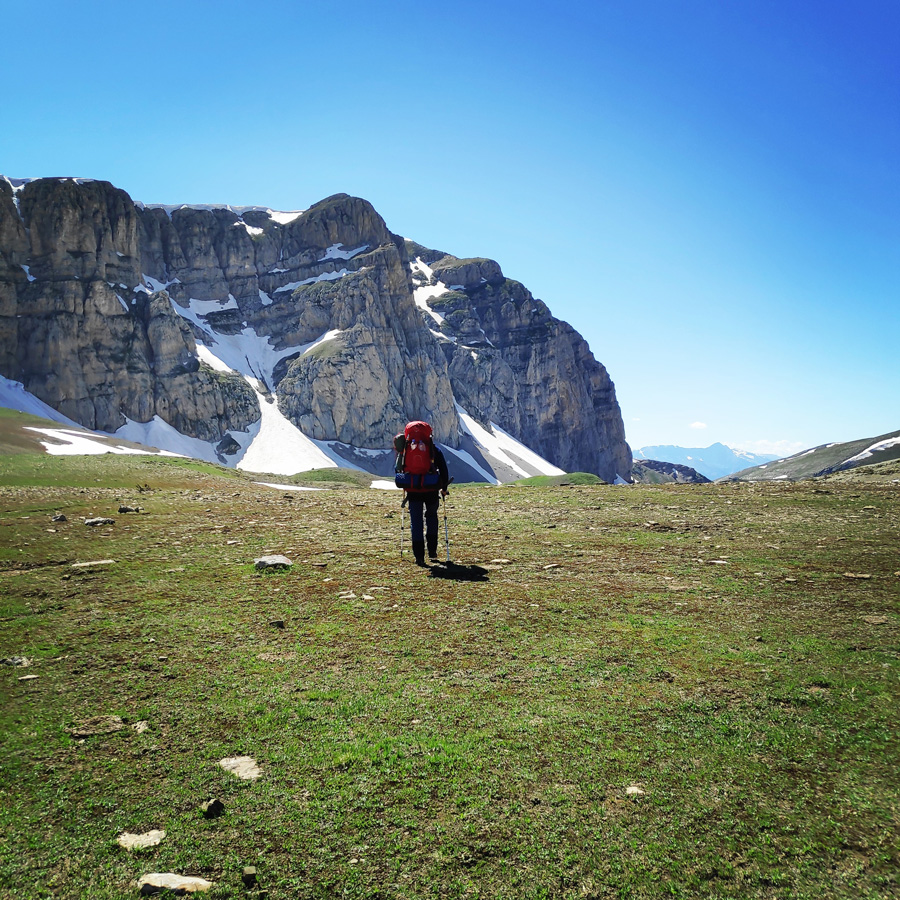
Although we had heavy load on our backpack, we soon reached “Limeria Klefton“. On that amazing spot we decided to have our first bread of the day and to enjoy the stunning view of the amphitheatre of all the various peaks. From right to left, Gamila, Gamila II, Karteros and Stoma.
Support the journey — buy me a coffee
I share these articles and the climbing guidebooks because I love the outdoors, and they’ll always be free. If they’ve helped you, help me keep them coming. Click the button to support my work.
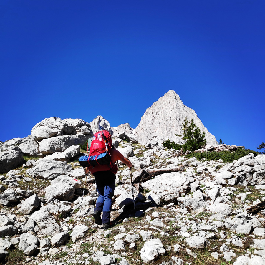
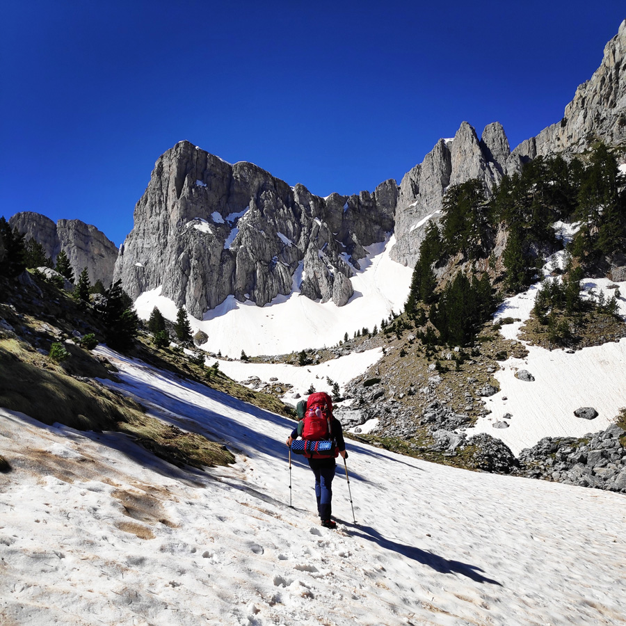
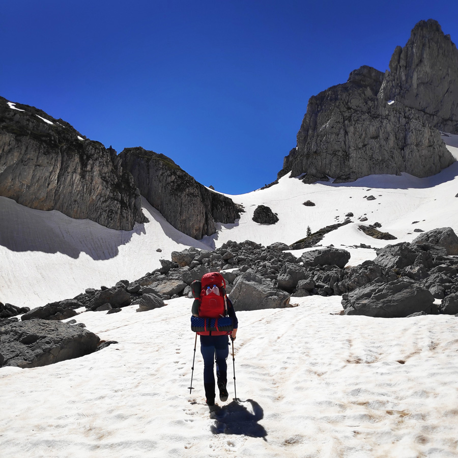
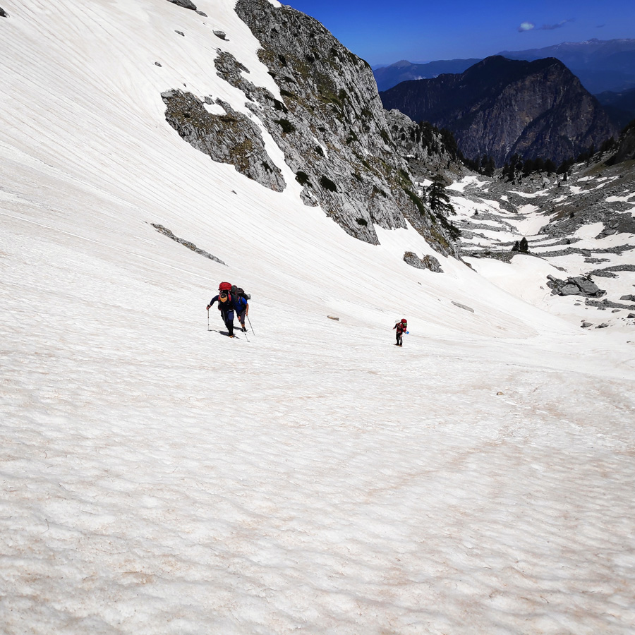
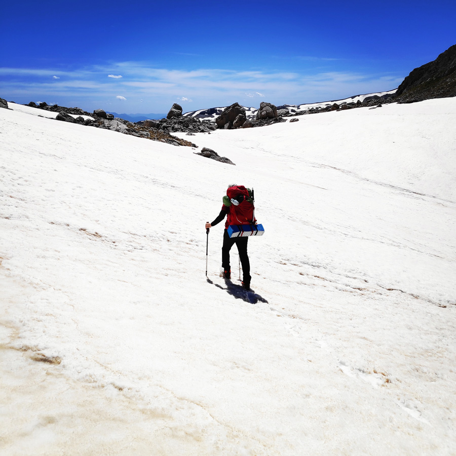
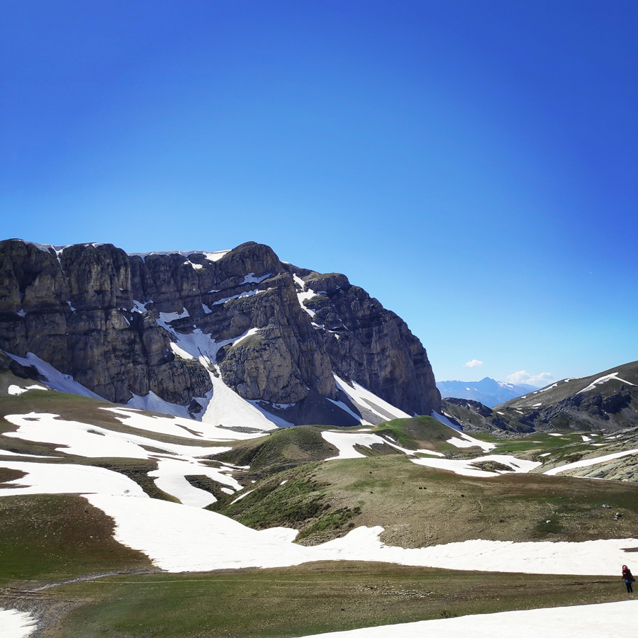
Limeria Klefton! What an amazing location to have a short break for a refreshment and some extra sun screen. Although we did not want to leave from such a great “balcony with a view”, due to the fact we still had to cover quite some kilometres, we got our backpacks again and we soon started to traverse towards Karteros Pass.
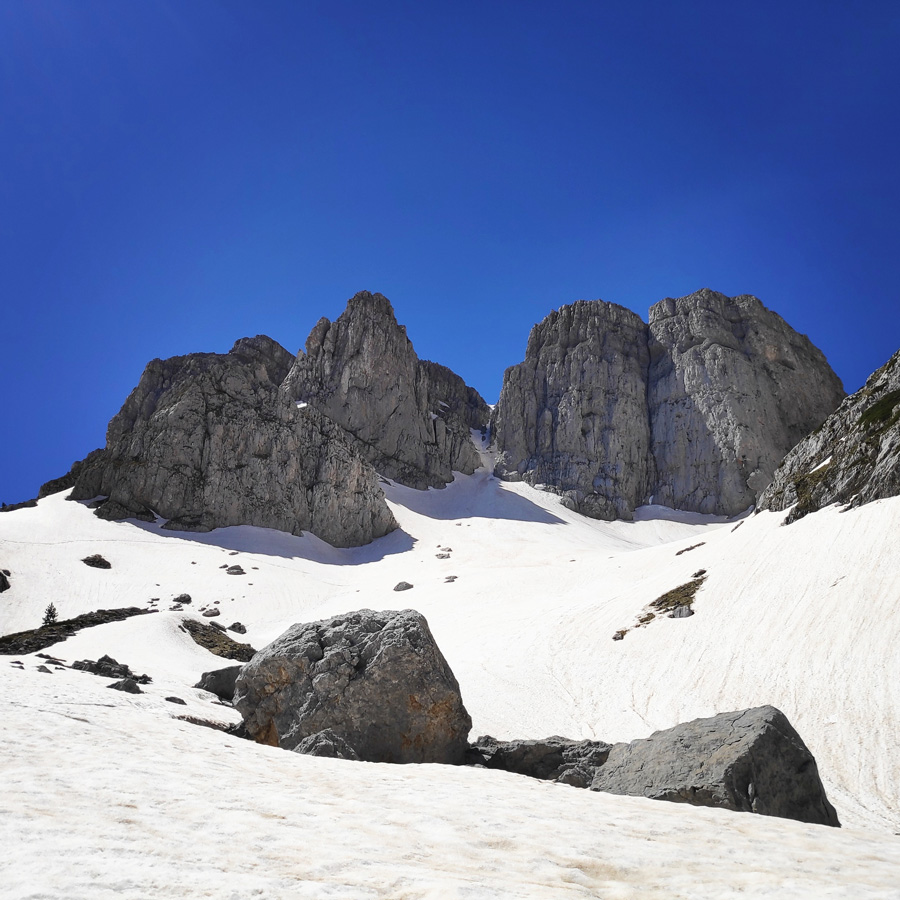
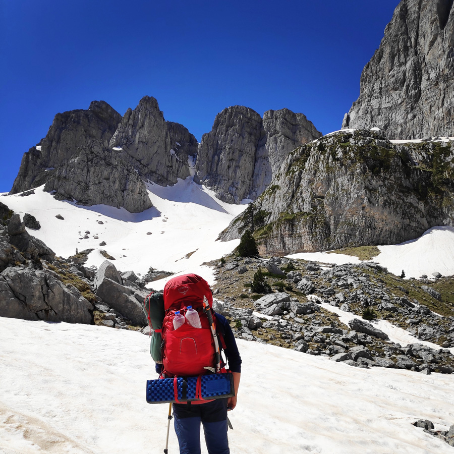
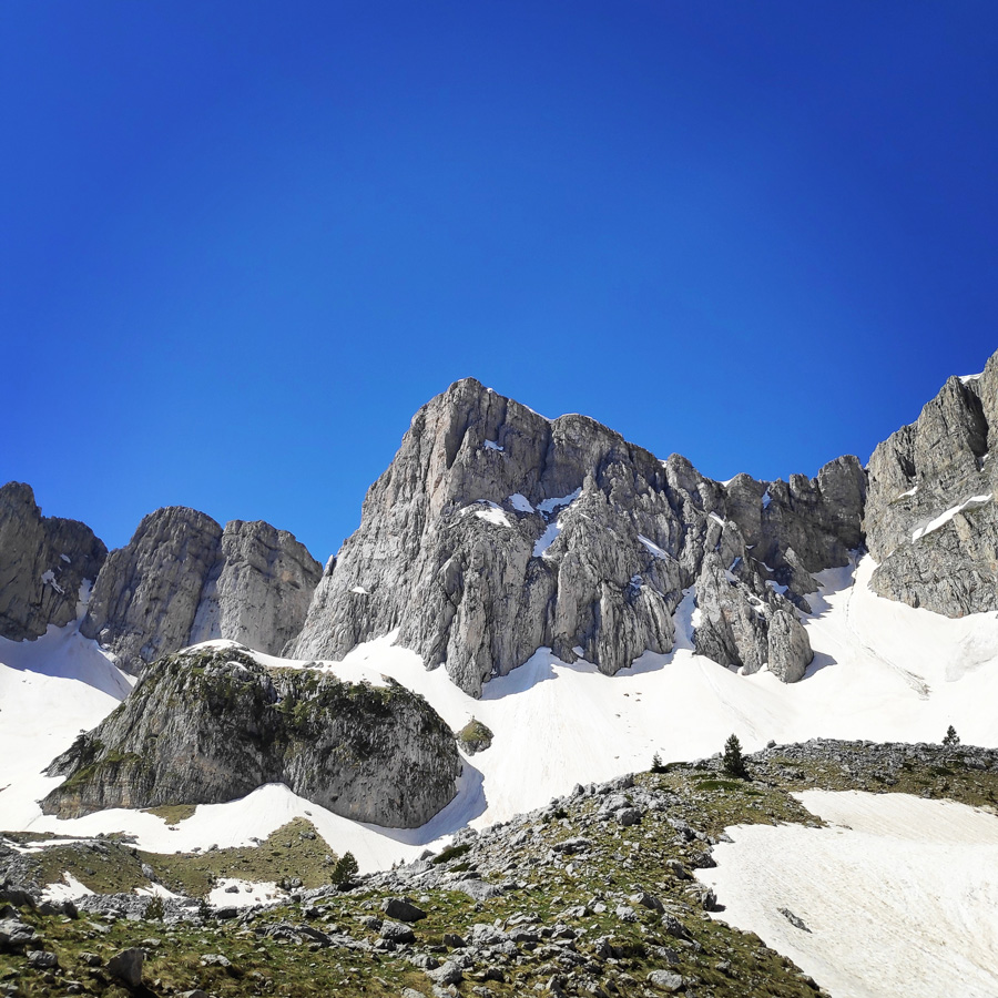
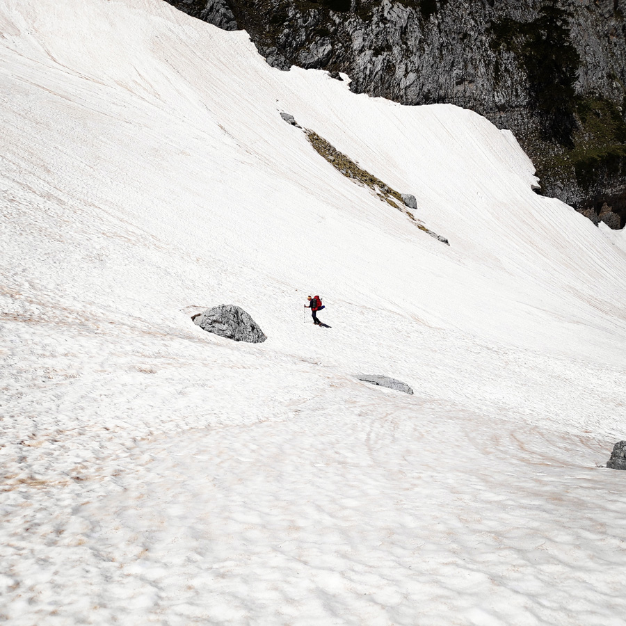
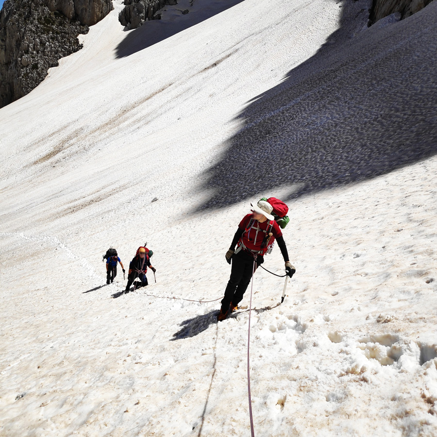
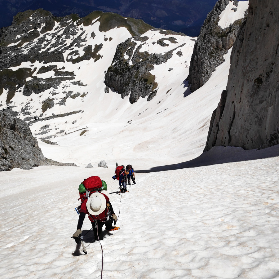
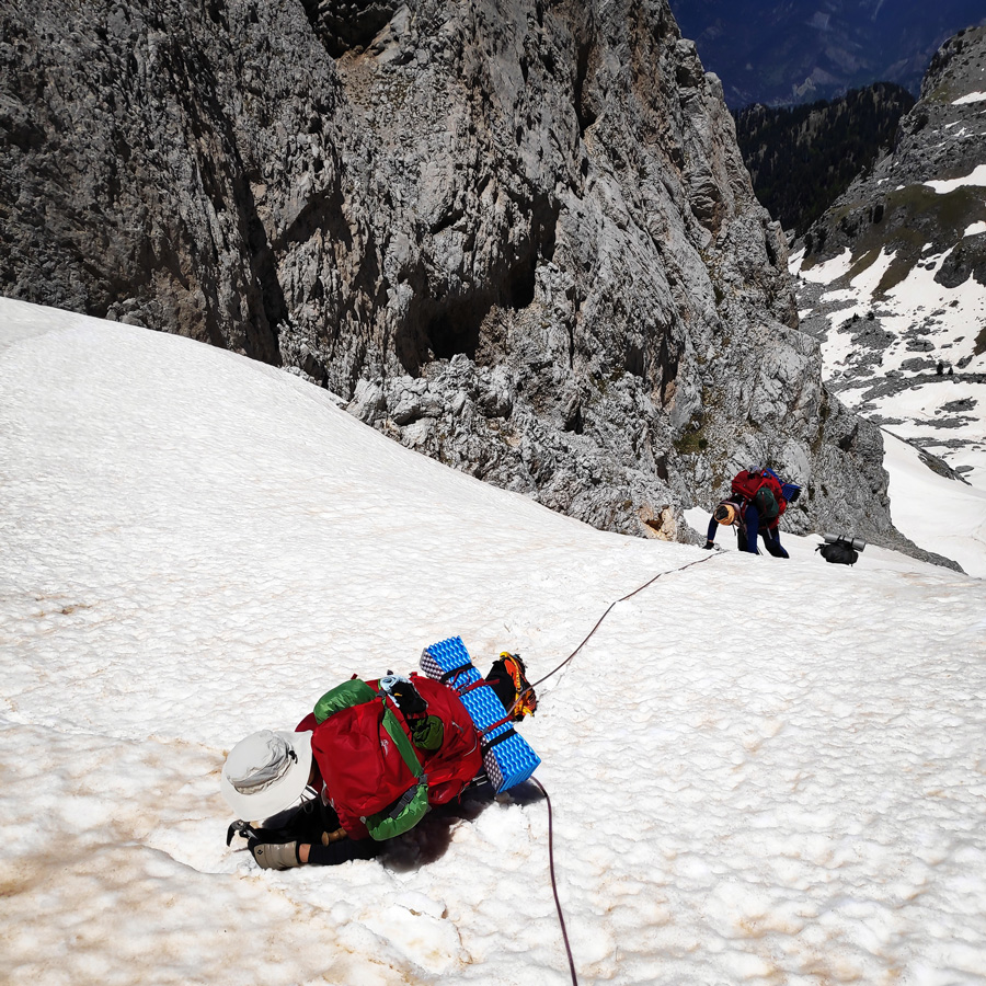
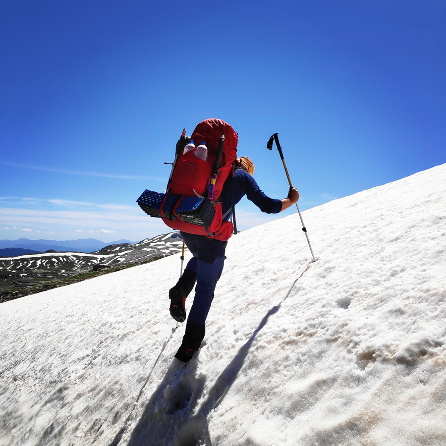
Karteros pass, is a narrow gap between two peaks: Gamila II peak and Karteros peak. This pass is reached by a couloir, is about 40-45 degrees of inclination and about 200 meters of elevation difference.
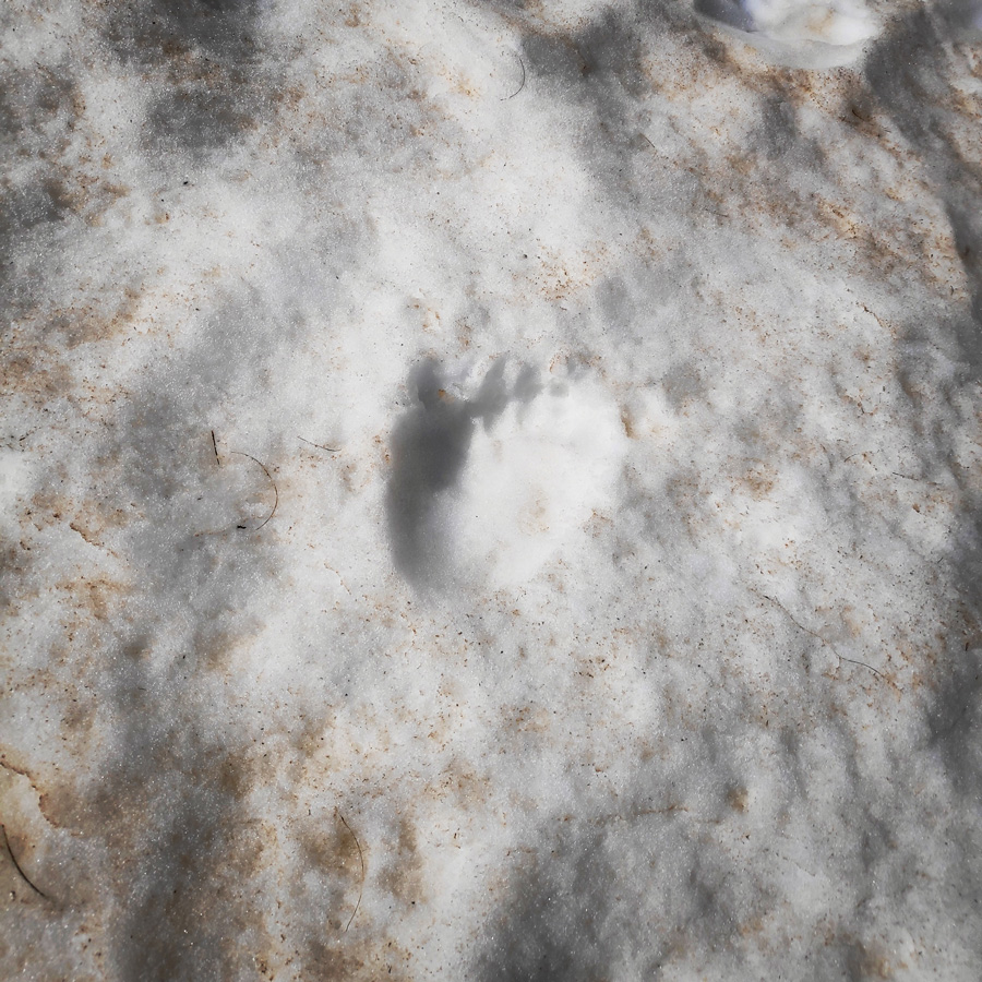
Prior of reaching this pass, we were really hypnotised by the amazing views of this part of Mt. Tymfi. Also, we stumbled upon some bear footprints (most probably mama bear with two bear cubs).
In order to climb safely Karteros’ pass, we used crampons, ice axe and a 30 m. rope.
Stunning view
Traversing Limeria ton Klefton
Gamila peak
Moving on
Stunning peaks
enjoying the view
Majestic Gamila II peak
Bear footprint
Steep uphill
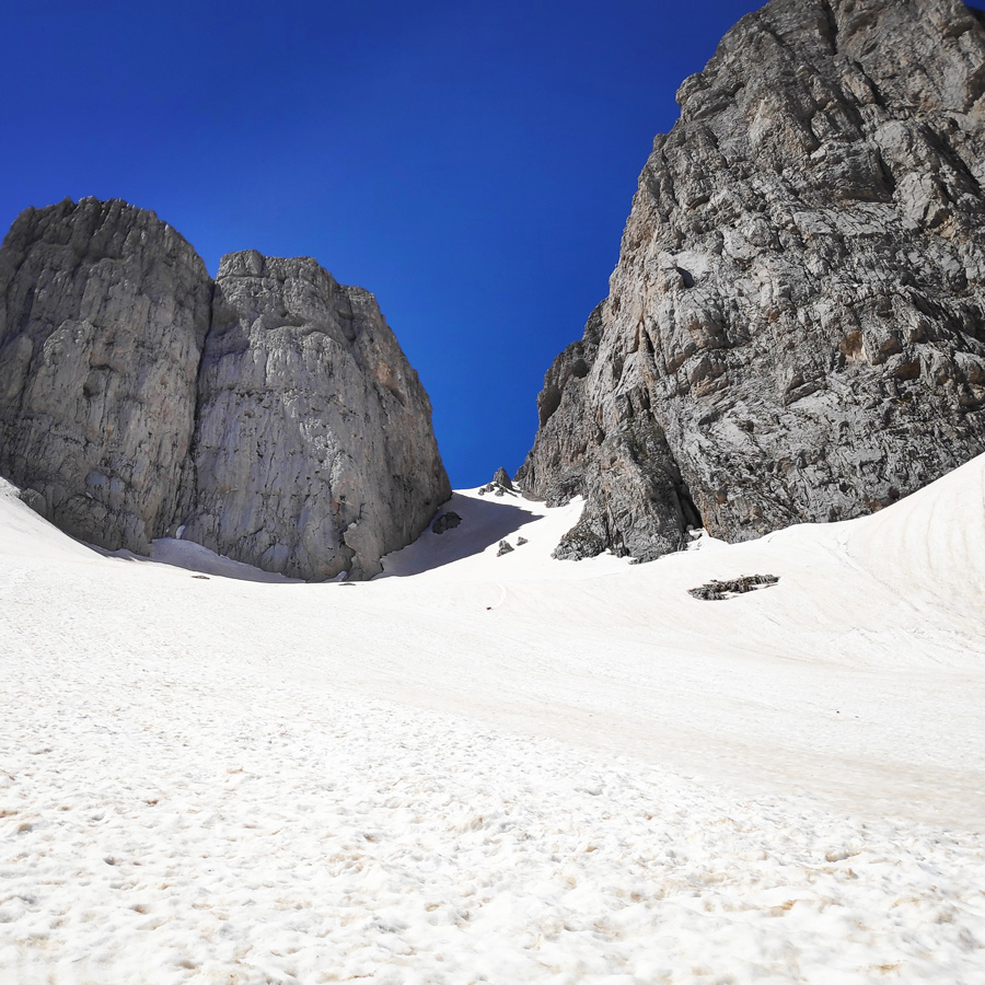
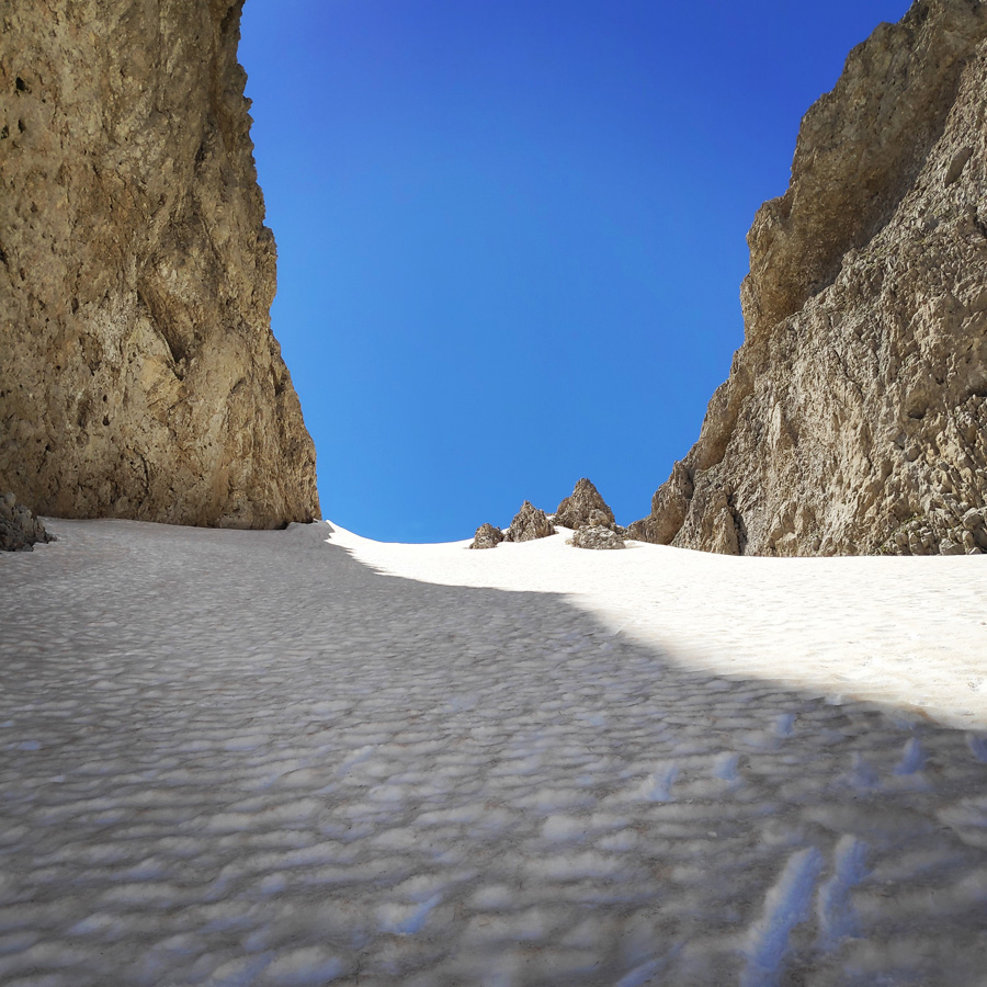
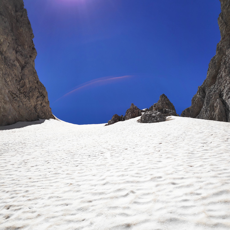
Karteros Pass – Left side Karteros – Right side Gamila II
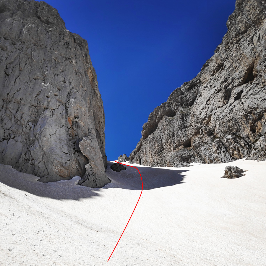
Karteros pass – follow the red line
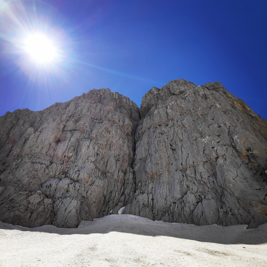
Climbing route – Arapis
Roped partners
Stunning View
Karteros pass couloir – about 40-45 degrees of inclination
Almost at the exit of Karteros pass
Dropping dead tired after the uphill of the couloir
Karteros pass exit view
Karteros pass as seen from above
Karteros Pass – Astraka Mountain Refuge
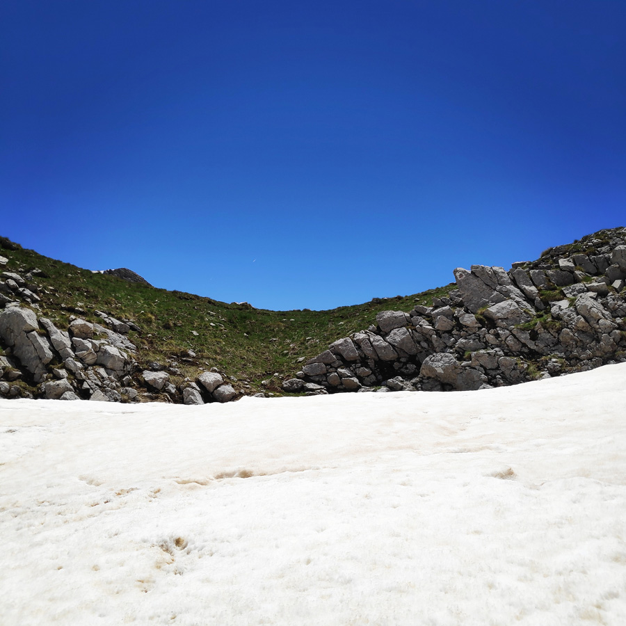
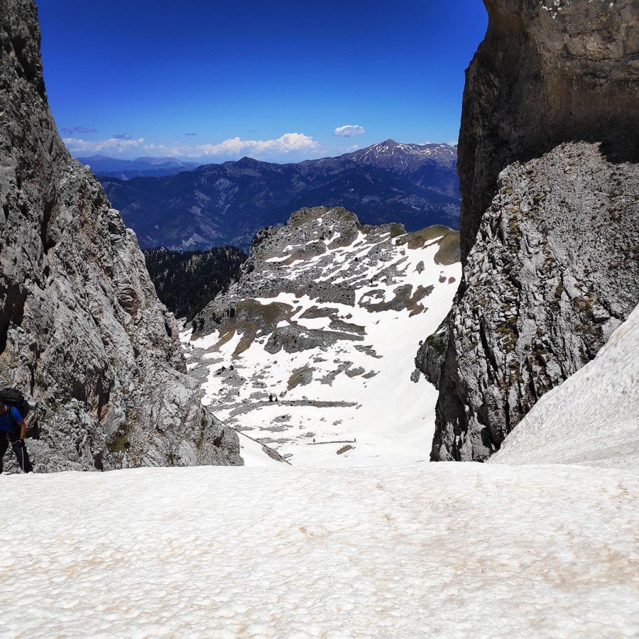
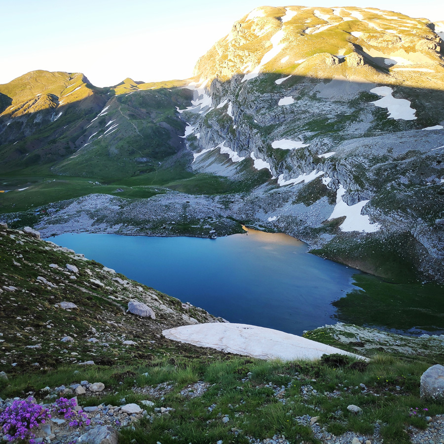
As soon we reached the top of Karteros pass, we were very happy for this successful climb on the snow, but also because that was the steepest section of the entire route. The view from this narrow gap -amongst Gamila II and Karteros peaks- offers great views towards the south. From that point we could see and identify various mountains and peaks, but also Loutsa Robozi (Loutsa = water pond), but also Astraka.
Besides enjoying the stunning views from that point, we also took a break in order to eat a snack, hydrate ourselves but also to collect and order our equipment, such as crampons, ice axe and a 30 m. rope.
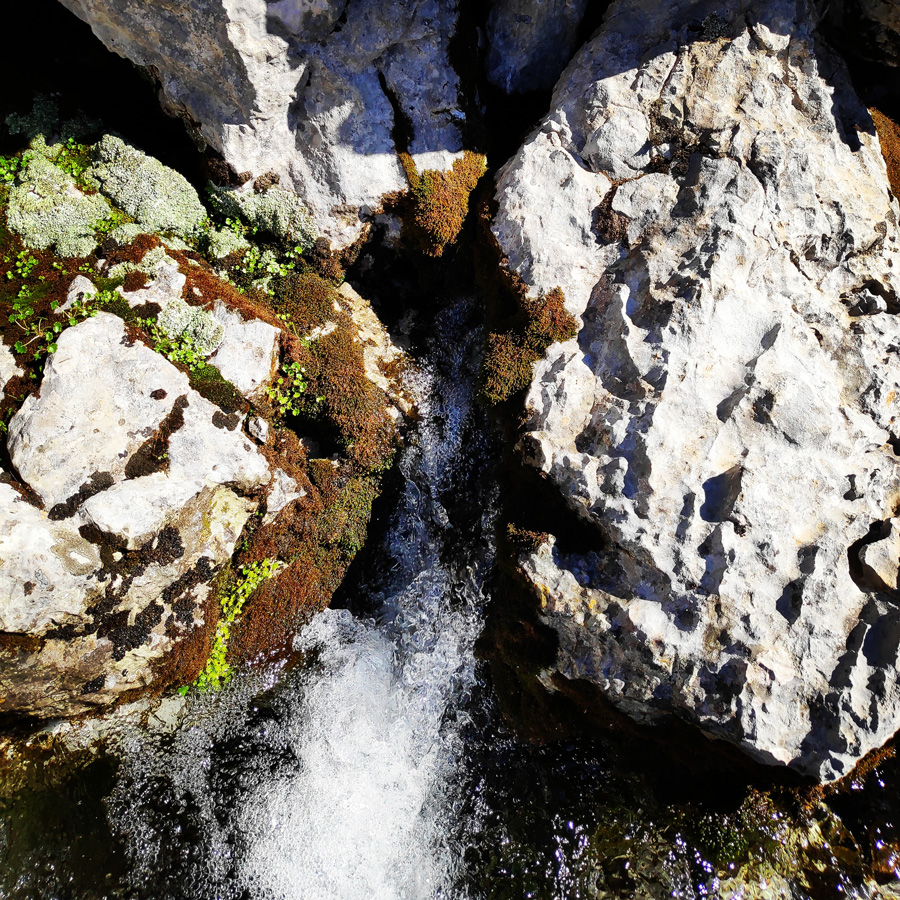
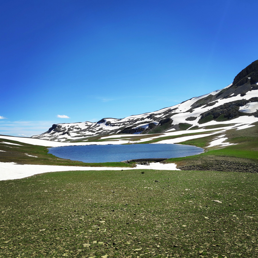
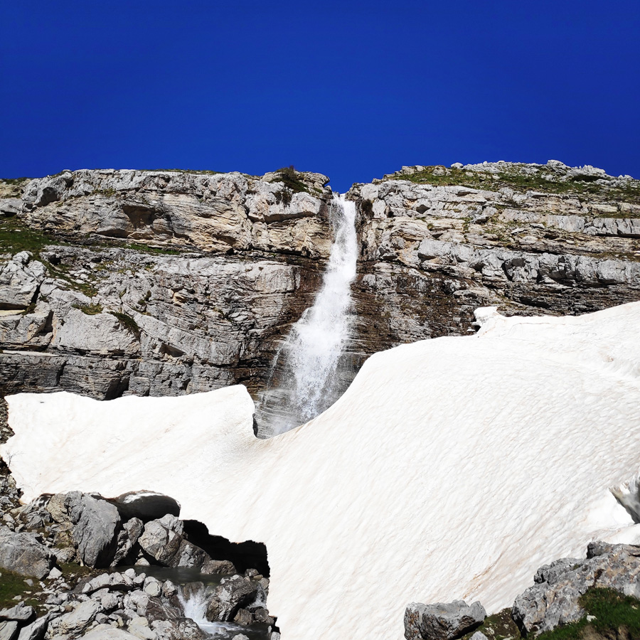
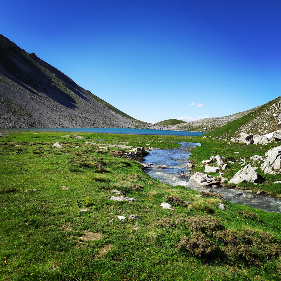
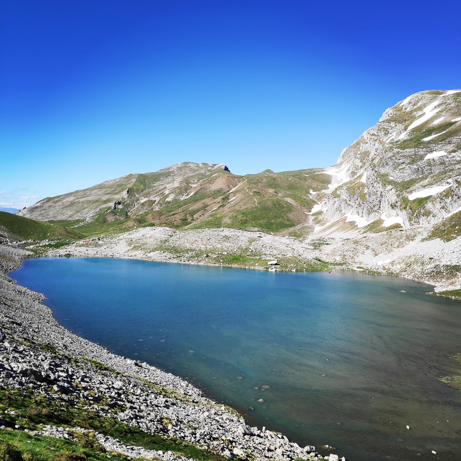
Upon that, we carried on hiking again, with first goal to downhill towards Loutsa Robozi. As soon we reached Loutsa Robozi, we turned west (right) and we followed the creek that leads to Laka Tsoumani. Just before Laka Tsoumani, we have seen an impressive waterfall, and also the only natural water fountain that exists from that side of Tymfi.
The only water source you will find during the summer months is located here
Water spring coordinates: 39.976848, 20.774332
Natural water spring
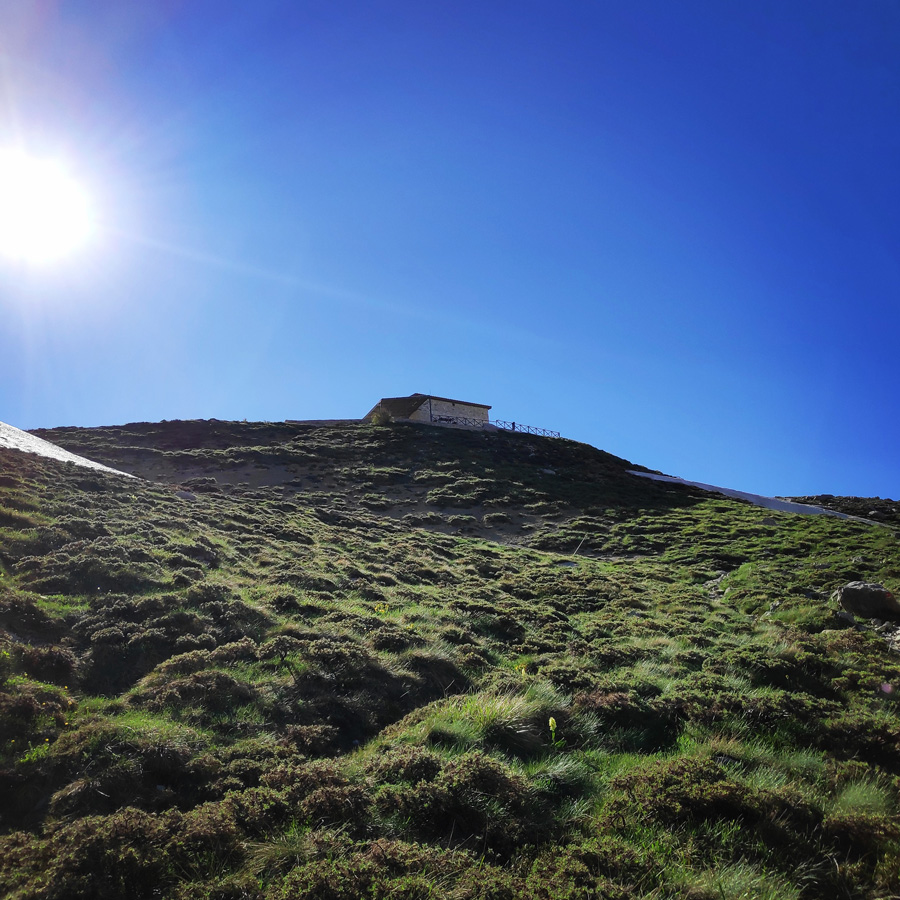
The final section of the second day, was a rather steep uphill of 150 m. of altitude difference. Basically, we had to hike uphill from Laka Tsoumanito the Astraka Refuge.
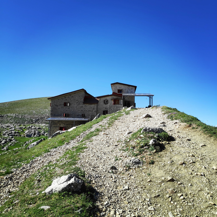
The Astraka Refuge is located at an altitude of 1950m in Radovoli place, particularly in the neck formed between the peaks of Astraka (2.436 meters) and Lapatos. The refuge/mountain hut was constructed in 1966 on the initiative of the Alpine Club of Ioannina and Mountaineering Group of Papigo. In 2004 it was renovated and expanded to its current form. Recently with the contribution of a European financial program solar panels where installed and wind turbines will follow and they will account a 13KW renewable and green power.
Check out more FREE Guidebooks
Download now for free! Explore breathtaking landscapes and conquer thrilling heights with our collection of guidebooks and topos.
Don’t miss out on this opportunity to elevate your outdoor adventures. Click, download, and let the exploration begin!
The shelter can accommodate 51 people in total during the summer months in rooms with bunk beds. The shelter provides beds, pillows and blankets. The refuge/mountain hut is fully equipped with a kitchen and restaurant.
The refuge is open daily from May to October. During the winter months it remains closed and opens for groups under an arrangement with the administrator. Last but not least, it is a base for mountain activities such as hiking, climbing and mountain/backcountry skiing. Bellow, some photos of the surrounding environment.
Downhill from Karteros pass
Snow hiking
Blue, White and a hiker
Kicking steps on the snow
First view of Astraka
Water pond – Loutsa Robozi
Hiking towards Astraka
Getting closer to Astraka
Alpine meadow
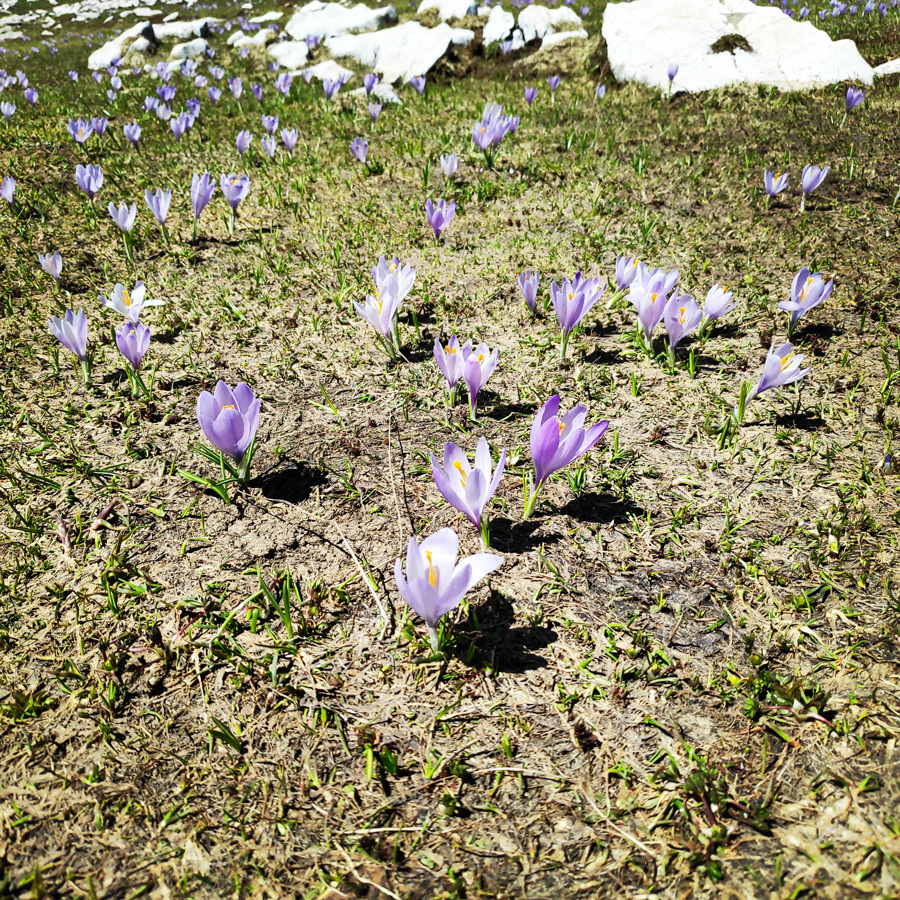
Alpine flowers – Krokos
Waterfall near Xeroloutsa Tsoumani
Xeroloutsa Tsoumani
Water pond Xeroloutsa Tsoumani and the trail that leads to the Dragon lake
Water pond Xeroloutsa Tsoumani as seen from the path that leads to the Astraka Refuge
Almost at the Astraka refuge
Astraka Mountain Refuge
Astraka peak as see from the refuge
Gear & Equipment
For this trip, I was carrying the following main gear:
In the coming days, there will be the 3rd part of the Mount Tymfi (Pindos) North side Thru-Hike, so make sure to come back to this blog to see the exciting third and final part which consists of arriving back to our starting point (Konitsa) via Davalista.
Support the journey — buy me a coffee
I share these articles and the climbing guidebooks because I love the outdoors, and they’ll always be free. If they’ve helped you, help me keep them coming. Click the button to support my work.
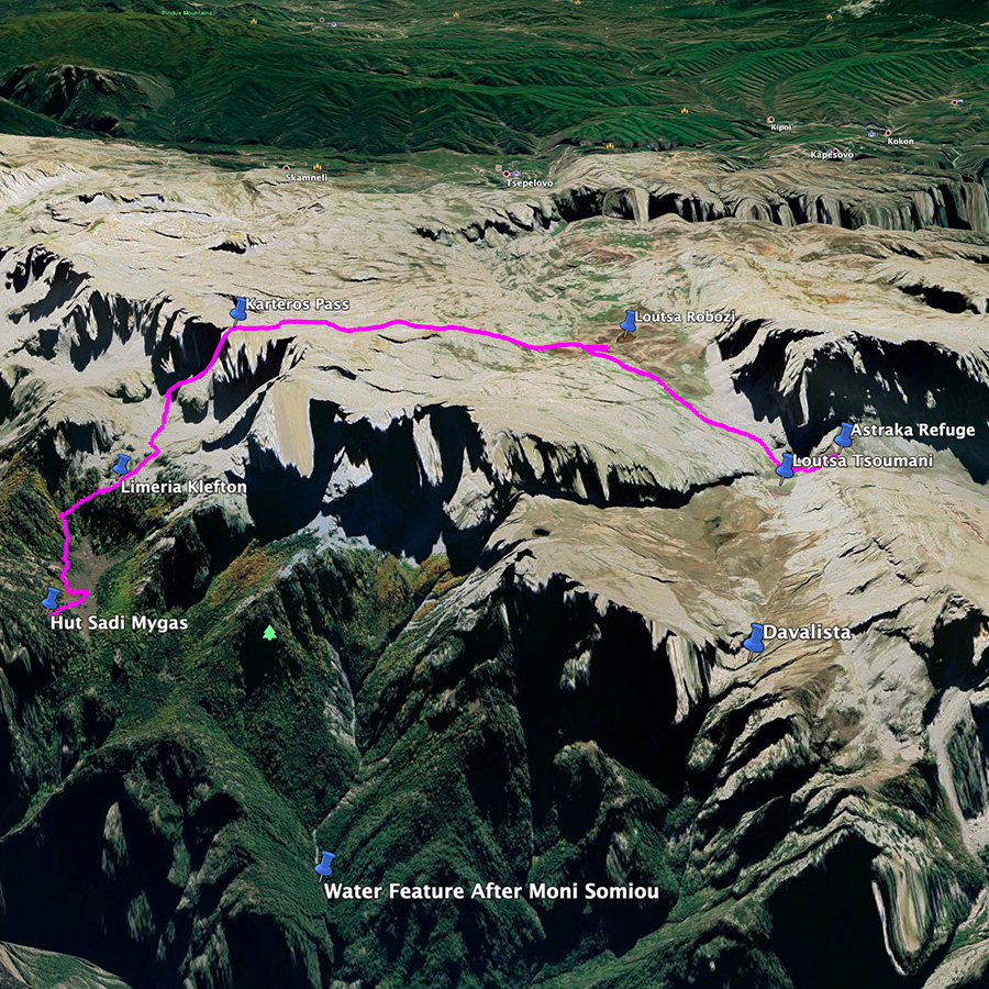
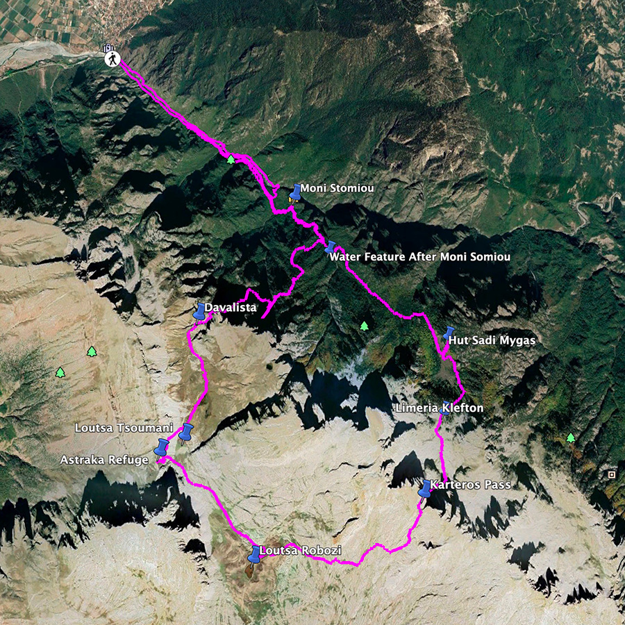
Overview of the entire route | Konitsa – Karteros Pass – Astraka Refuge – Davalista – Konitsa
The route we have decided to follow is perhaps one of the nicest hiking routes in Greece. This route, offers majestic views with great trails. In addition, if you will visit this area end of May up to mid-June, you will be overwhelmed by the different kind of sceneries you can experience just by one round-trip hiking route.
The entire route is about 30 km long, and it can be split in three sections and each section can be an enjoyable day hike. The way we split the route was the following:
Below: This map marks all the mountaineering adventures that have been featured on Olympus Mountaineering so far, including several Sport climbing crags – Select full screen to expand, zoom in for more detail, or click on a marker for a link to the post.
Wow, we are definitely adding this one to our list. The views are amazing and so different on one side of the pass to the other. It’s letting me comment today too:) Maggie
I can certainly recommend this hike and should you visit Greece, feel free to get in touch so I can provide you additional information about this hike, and other activities in the area of Mt. Tymfi.
And the adventure continues! This hike just keeps getting better and better. Although I gotta say, the hike through the snow looks super challenging. Glad you just saw bear footprints instead of the actual mama bear and her cubbies.
Indeed, the adventures continues and as you could see from the photos it’s getting better and better.
With regards the bear, I have been visiting the mountains of Greece, for quite few years now, and I have never seen any bear. So I guess they are quite “shy”.
You are definitely breaking stereotypes of Greece. Look at that snow! 🙂 I bet you wished you were climbing some of those peaks?
Nothing like kicking steps for hours on end going up to the col, but there is a simple rhythm to it that I enjoy. Nice to see that you had snow on the downside too, which is fun to run through.
You had a gorgeous weather for the trek! The blue skies above the snow is spectacular. Well done!
Your first sentence, is exactly the reason I started this blog few years ago. To brake the stereotypes of Greece (sea, sun and islands), and to give a different insight about mainland Greece.
Greece, in contrary of what most people thing is a very mountainous country and I could dare to say still unexploited. This means a lot of wilderness areas great for mountain exploration.
For this trek, weather was just fabulous! Perfect temperature, blue skies and in combination with the landscape was just a magical trek.
Thank you for taking the time to read through this post and for commenting.
Well then, well done to you! If you are one of the first to write about the hiking trails and routes, do you plan to publish a guide? I know you have a free climbing guide on your site, but I’m sure people would pay for a book version.
Although I have never thought thoroughly about publishing a hiking-guide, in the future, I might collect the best hiking/trekking adventures of Greece and will create a guide for new hikers.
Though, again, as the climbing guides I already publish on this blog, it will be released and distributed for free.
Truly spectacular and amazing photos. Thank you for showing me a side of Greece that I never knew existed. I also had no idea that you have bears there…good to hear!
My guess is that the flower is not krokos, but Colchicum Autumnale (κολχικό), from which Medea made the poison to kill her children, as greek mythology narrates. Of course those two flowers are very similar, but if you know the difference, it is quite easy to recognise them if you are close enough.
No surprise for me about the hike, since i am a greek living in Epirus. I am here to read the comments of foreign people, that are very funny considering their surprise about the scenery, i really enjoyed the commends.
Hi there! Amazing to read about this trek! I’m looking into doing it the opposite way (starting at Vlikos) around the end of October (if weather allows) and my main concern is about Karteros Pass. Of course I’ll be going downhill which should make it easier (if not for the fact that it’s also easier to slip). I guess my questions are:
is there always snow (did you do this trek in summer? In that case: yes there’s always snow)?
And do you think it’s possible to do it the opposite way? What would be your assessment?
I did the hike in early June and there was still some snow at that time. By the end of October it’s most probably possible to do without snow, unless there’s an exception and it happens to snow in the days just before your hike. Doing it the opposite way from Vlikos should be fine, just keep in mind that downhill sections can be more slippery.
Of course, you always have to check the conditions on that day.


Looks amazing!! Great views!
LikeLike
Indeed, great views!
Thanks for checking out this post and of the comment.
LikeLiked by 1 person
Wow, we are definitely adding this one to our list. The views are amazing and so different on one side of the pass to the other. It’s letting me comment today too:) Maggie
LikeLike
Thank you Maggie.
I can certainly recommend this hike and should you visit Greece, feel free to get in touch so I can provide you additional information about this hike, and other activities in the area of Mt. Tymfi.
LikeLiked by 1 person
And the adventure continues! This hike just keeps getting better and better. Although I gotta say, the hike through the snow looks super challenging. Glad you just saw bear footprints instead of the actual mama bear and her cubbies.
LikeLike
Indeed, the adventures continues and as you could see from the photos it’s getting better and better.
With regards the bear, I have been visiting the mountains of Greece, for quite few years now, and I have never seen any bear. So I guess they are quite “shy”.
Thank you for your kind and positive comment.
LikeLiked by 1 person
You are definitely breaking stereotypes of Greece. Look at that snow! 🙂 I bet you wished you were climbing some of those peaks?
Nothing like kicking steps for hours on end going up to the col, but there is a simple rhythm to it that I enjoy. Nice to see that you had snow on the downside too, which is fun to run through.
You had a gorgeous weather for the trek! The blue skies above the snow is spectacular. Well done!
LikeLike
Your first sentence, is exactly the reason I started this blog few years ago. To brake the stereotypes of Greece (sea, sun and islands), and to give a different insight about mainland Greece.
Greece, in contrary of what most people thing is a very mountainous country and I could dare to say still unexploited. This means a lot of wilderness areas great for mountain exploration.
For this trek, weather was just fabulous! Perfect temperature, blue skies and in combination with the landscape was just a magical trek.
Thank you for taking the time to read through this post and for commenting.
LikeLiked by 1 person
Well then, well done to you! If you are one of the first to write about the hiking trails and routes, do you plan to publish a guide? I know you have a free climbing guide on your site, but I’m sure people would pay for a book version.
LikeLike
That’s a very good question Alisen.
Although I have never thought thoroughly about publishing a hiking-guide, in the future, I might collect the best hiking/trekking adventures of Greece and will create a guide for new hikers.
Though, again, as the climbing guides I already publish on this blog, it will be released and distributed for free.
LikeLiked by 1 person
You are too kind 🙂 Your work and time is valuable, especially if there is not already a guide book being published. Something to think about.
LikeLike
Pingback: Mount Tymfi (Pindos) North Side Thru-Hike Part 3 – Astraka Refuge – Davalista – Konitsa – Olympus Mountaineering
Pingback: Mount Tymfi (Pindos) North Side Thru-Hike Part 1 – Konitsa – Moni Stomiou – Sadi Migas – Olympus Mountaineering
Truly spectacular and amazing photos. Thank you for showing me a side of Greece that I never knew existed. I also had no idea that you have bears there…good to hear!
LikeLike
That part of the hike was truly wonderful with the view of the high peaks.
Many more people, just like you, didn’t think Greece had such mountainous environments.
Concerning the bears, well, here in Greece we have the brown bears and the last years their population is growing rapidly.
So, next time you hike in Greece (in mainland) just keep an eye on them.
LikeLiked by 1 person
Great to hear about your increasing bear population.
LikeLike
So cool!! I would not guess Greece looks like this!
LikeLike
Hi Melanie,
Many people have a totally different idea about Greece. But Greece, besides the islands, is also a very mountainous country with plenty of nice peaks.
LikeLiked by 1 person
Pingback: Hiking in Zarogi – Villages and Stone Bridges – Greece (family friendly) – Olympus Mountaineering
Pingback: Mount Tymfi (Pindos) North Side Thru-Hike Summary – Olympus Mountaineering
Pingback: Hiking to Balta di Stringa Waterfall – Iliochori – Zagori (Tymfi) – Olympus Mountaineering
My guess is that the flower is not krokos, but Colchicum Autumnale (κολχικό), from which Medea made the poison to kill her children, as greek mythology narrates. Of course those two flowers are very similar, but if you know the difference, it is quite easy to recognise them if you are close enough.
No surprise for me about the hike, since i am a greek living in Epirus. I am here to read the comments of foreign people, that are very funny considering their surprise about the scenery, i really enjoyed the commends.
LikeLike
Thank you for your comment and for your info about the flower.
I’ll check it out in more detail.
Again, thank you for your kind comment
LikeLike
Pingback: Immerse in Greek Mountain Beauty: 10 Hiking Routes That Ignite the Spirit of Adventure – Olympus Mountaineering
Hi there! Amazing to read about this trek! I’m looking into doing it the opposite way (starting at Vlikos) around the end of October (if weather allows) and my main concern is about Karteros Pass. Of course I’ll be going downhill which should make it easier (if not for the fact that it’s also easier to slip). I guess my questions are:
Looking forward to hearing from you. Cheers, Bram
LikeLike
Hi Bram,
I did the hike in early June and there was still some snow at that time. By the end of October it’s most probably possible to do without snow, unless there’s an exception and it happens to snow in the days just before your hike. Doing it the opposite way from Vlikos should be fine, just keep in mind that downhill sections can be more slippery.
Of course, you always have to check the conditions on that day.
LikeLike