Last few months, I was mainly focused on sport climbing and mountaineering routes, though, finally once again I hit the trail for a great hike to the Methana Volcano.
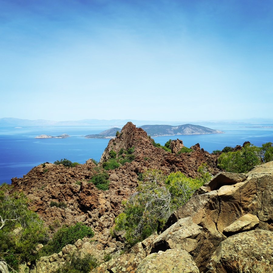
Geologically speaking, Methana is a very interesting region: a long time ago, it was very volcanic and nowadays, it counts no less than 32 ancient craters. One can also see some ancient lava flows, but it is the volcano located in the north-west, not far from the village of Kameni Chora (= burned village), that is the most spectacular witness of this volcanic past – over here, one can really imagine oneself in a true landscape of volcanoes.
About Methana Volcano
Methana is one of the youngest volcanic areas in the western part of Greece and its 30-32 volcanoes are still determined as “active“. There are many lava domes and lava flows around the volcanic centre. The thermal springs, gases and rare small earthquakes show that in future there may be new eruptions.
The peninsula belongs to the western serial of active volcanoes in the Aegean arc. The volcanoes of Methana (Poros, Egina, Sousaki), Milos, Santorin and Nisyros are the active parts of the subduction of the plates that are pushed from north Africa below Europe and little Asia. All these volcanoes are defined as active. Eruptions in future are possible.
The Methana volcanoes differ a lot from the famous volcanoes of Santorini (Koloumbos & Kameni islands). There are mostly lava domes.
According to the Pausanias traveler, his last explosion occurred in the 3rd century BC. century. The Methana volcano belongs to the Aegean volcanic arc along with those of Santorini and Nisyros. Geologically interesting is the fact that there are underwater volcanoes along the arc (one of them, outside Methana, had volcanic activity around 1,700 AD)
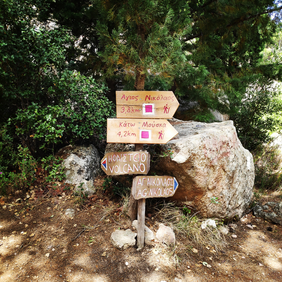
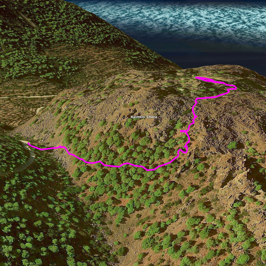
How to reach Methana Volcano (Kameni Chora)
Leaving Athens, you will travel towards the highway in direction to Elefsina-Corinth. You will drive until the channel of Corinth (but do not turn towards Loutraki & the touristic view of the channel, if you do not want to take photos there) and follow the road sign towards Epidavros, leaving the highway. Than you will turn left (be careful with the traffic!) and you follow the route towards Epidavros passing first Loutra Elenis.
After Nea Epidavros it is till about 15 minutes until you turn right towards Palia Epidavros / Poros / Methana. In the circle you take the first exit towards Poros / Galata / Methana / Koliaki. After about 2 km you turn left to Poros / Galata / Kaloni / Methana and drive about 30 – 45 minutes to Kaloni. After the lake Psifta you turn left towards Methana (still 13 km).
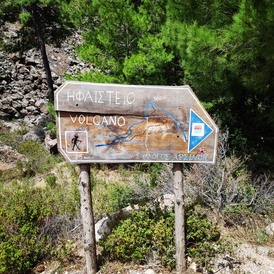
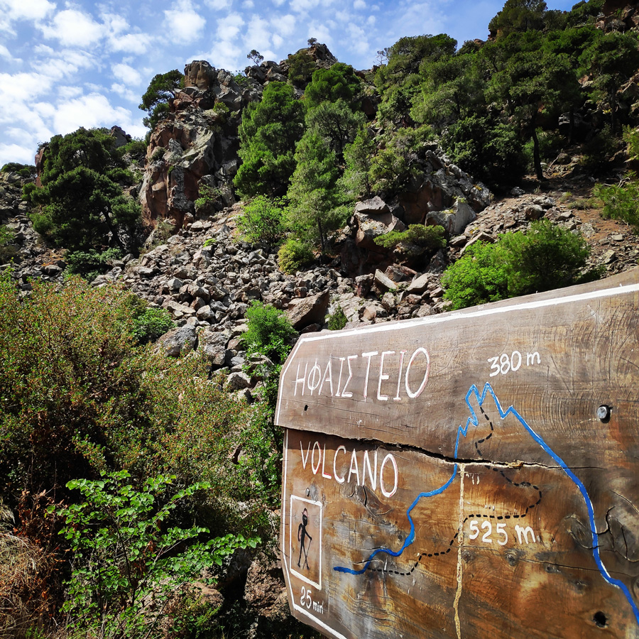
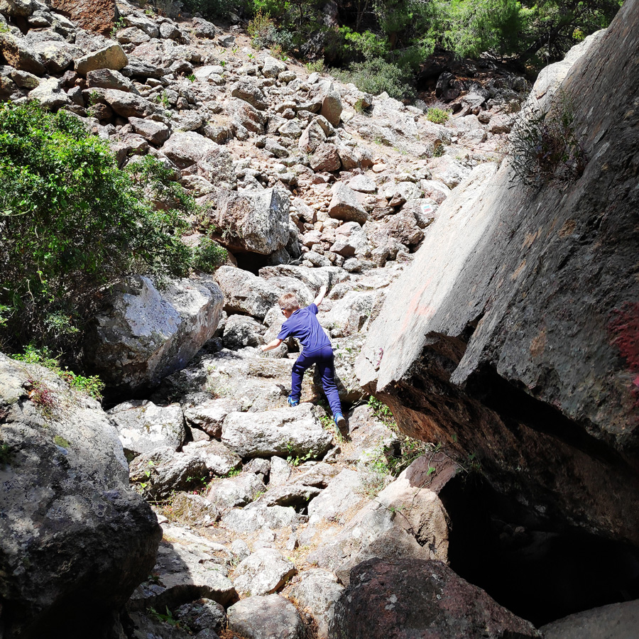
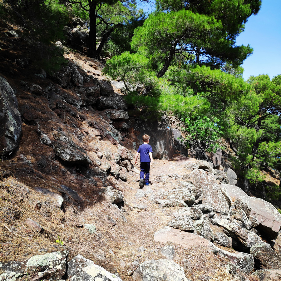
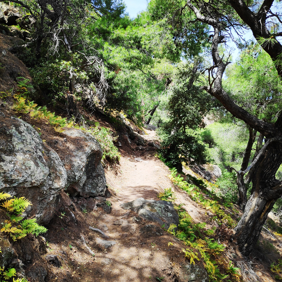
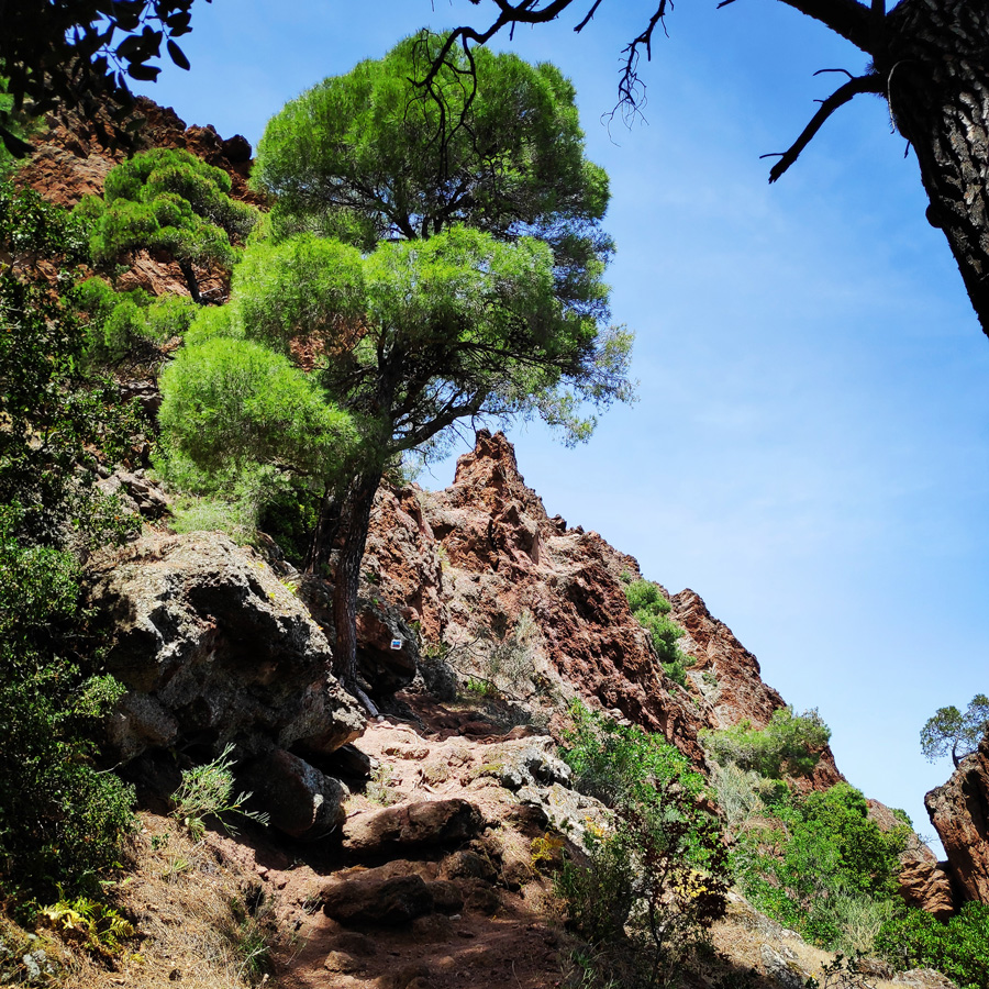
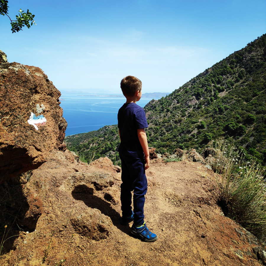
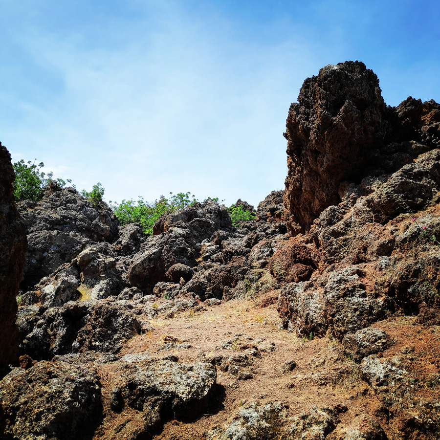
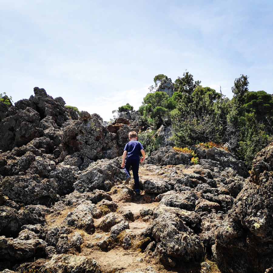
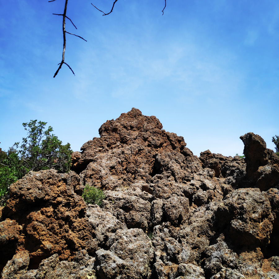
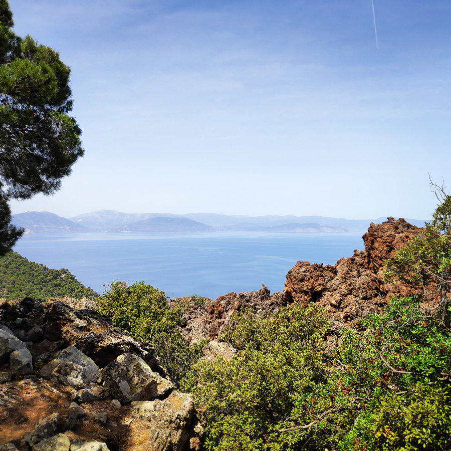
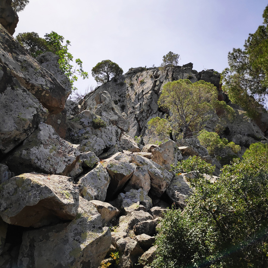
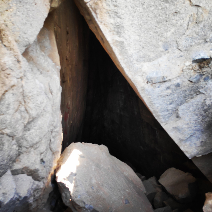
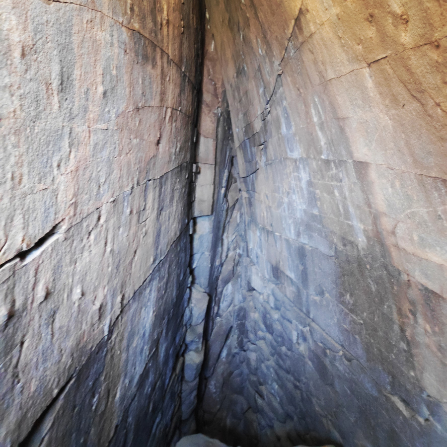
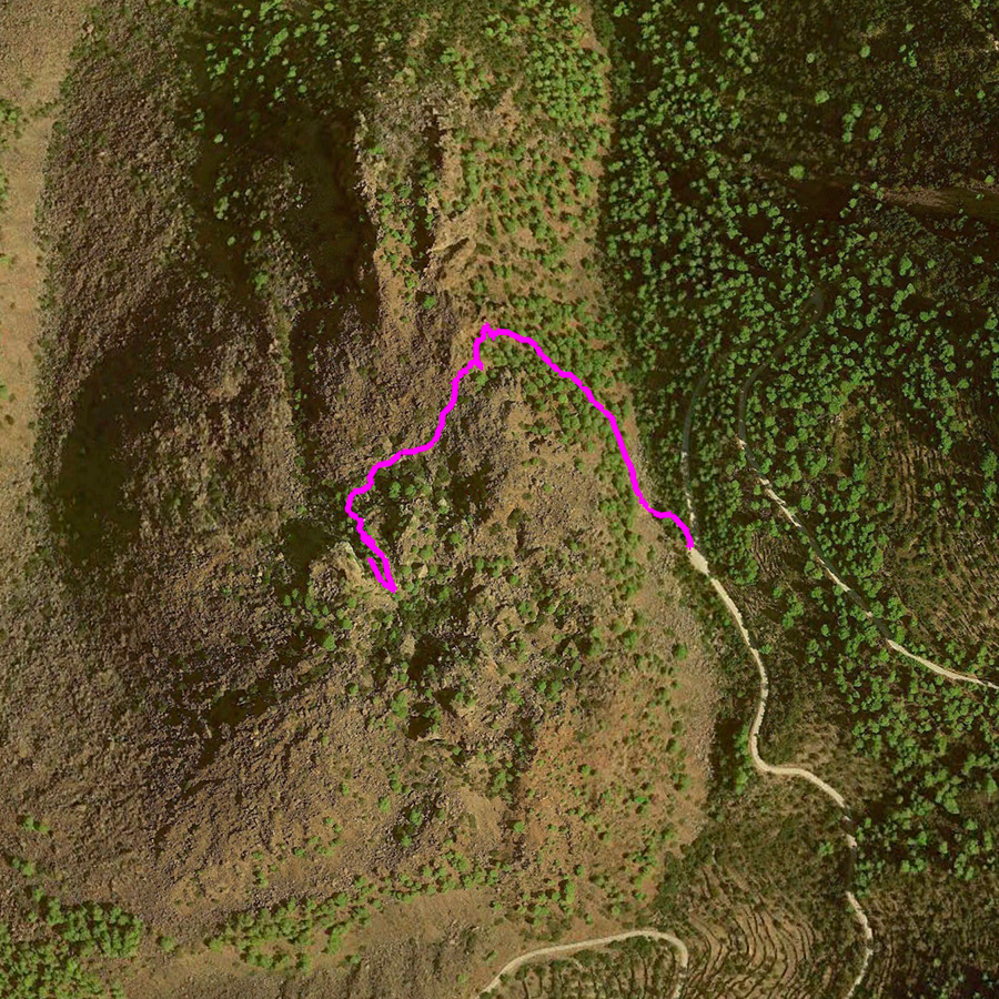
Trail to the Volcano
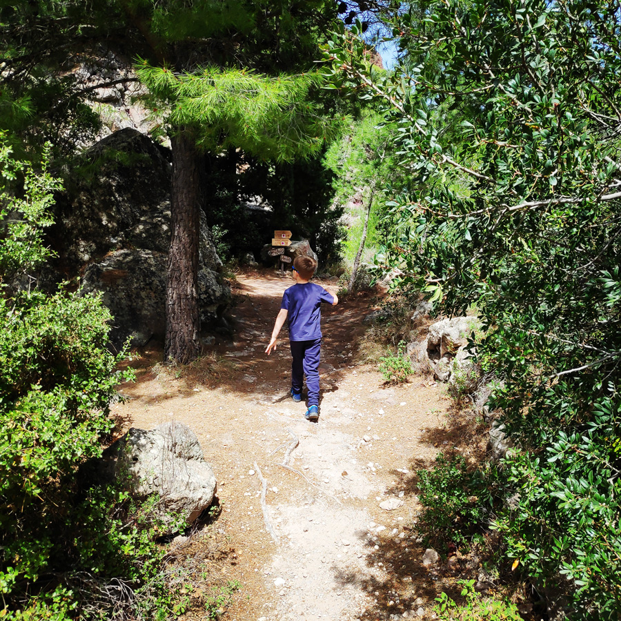
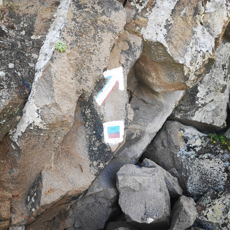
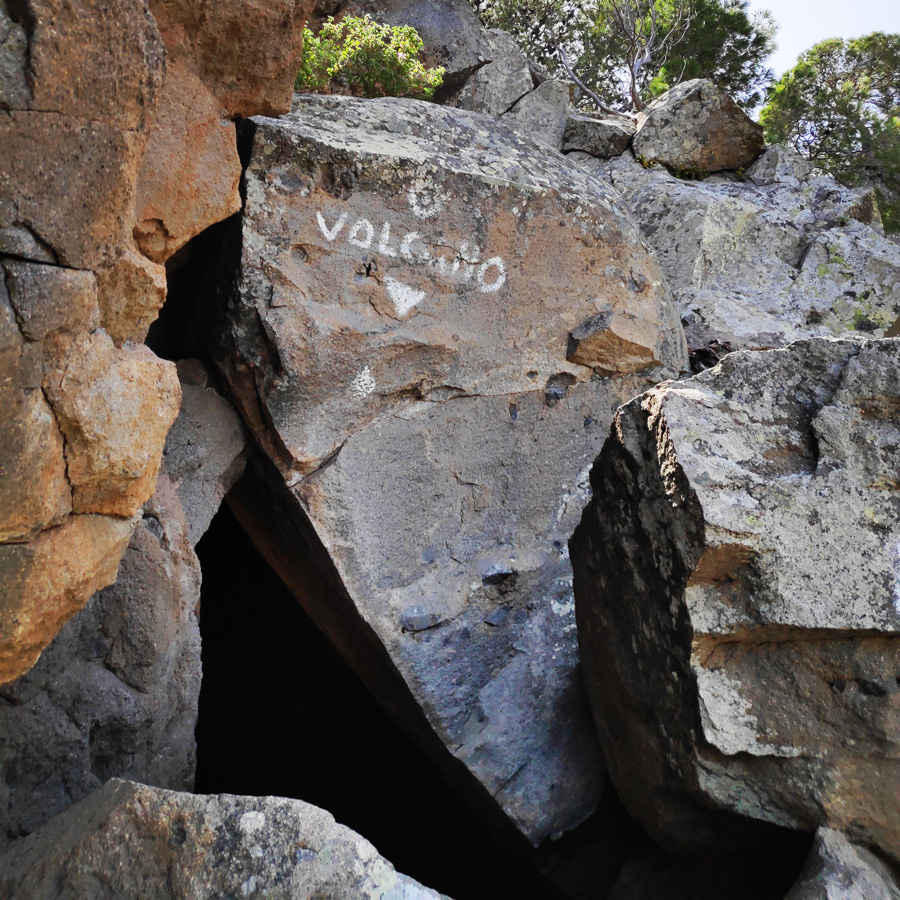
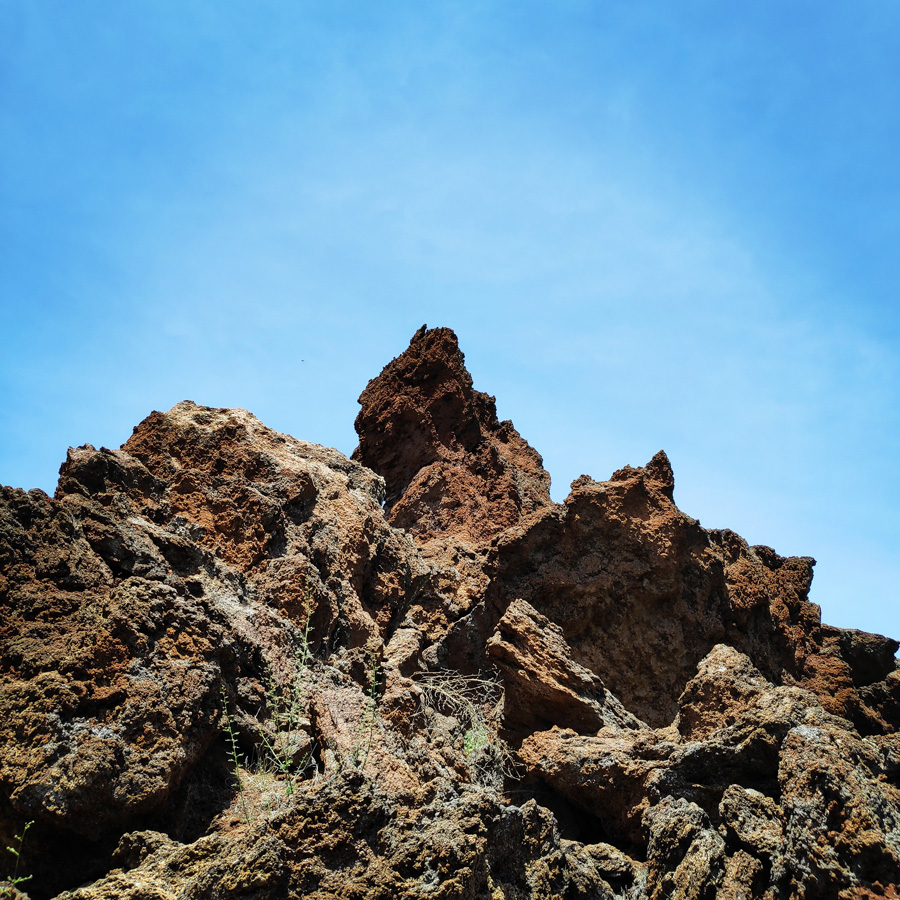
While the journey begins with a paved road, the path to the summit takes hikers through a beautiful pine forest and past imposing limestone rocks. At the end of the clearly marked trail, visitors climb up to the very precipice of the volcano’s crater.


Support the journey — buy me a coffee
I share these articles and the climbing guidebooks because I love the outdoors, and they’ll always be free. If they’ve helped you, help me keep them coming. Click the button to support my work.

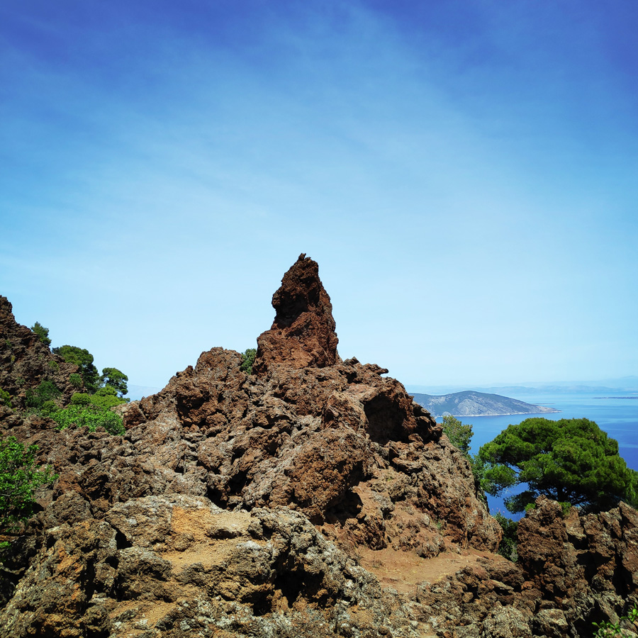
The Lavadome of Methana
About 273 BC (about the exact date there are discussions, one speaks of 230 BC or 270 BC) a gap opened up on the mountain slope of northwest methana, from which sulfur dioxide gas and ash swelled first. Soon, a viscid dacitic lava emerged and built a dome that reached a height of 411.5 m over a period of months.
At this central lava dome a series of gaps broke up, and a stream of molten rock blocks and lava flowed down to 1.5 km in length towards the sea. Like a bulldozer, the rock pushed forward, and eventually, at the end of the activity, a crack split out again at the southern foot of the lava, from which lava flowed out for the last time. It is situated at the today village of Kameni Chora. When the activity was over and the magma chamber was empty, the dugout collapsed and a pseudocrater emerged. Rudolf von Leyden explains the phenomenon of the primary and secondary lavas in his book and also he described the mechanical processes of pressing the lava between primary lava blocks and how the central peak area has formed.
This volcanic eruption was visible until ancient Athens and so there were reports of the ancient writers Ovid and Strabon. There were surely first visitors, too, because the near shrine of Troezen, destroyed by earthquakes as a result of the volcanic eruption, attracted many Athenians. At that time, there were also hot springs at Methana, and as a result of the volcano, which later on, around 180 AD, was also being described by the Roman travel writer Pausanias.
Lavadomes, such as those in Kameni Chora, are very common on the Methana peninsula and there are still much larger ones, such as the lava dome of Kypseli.
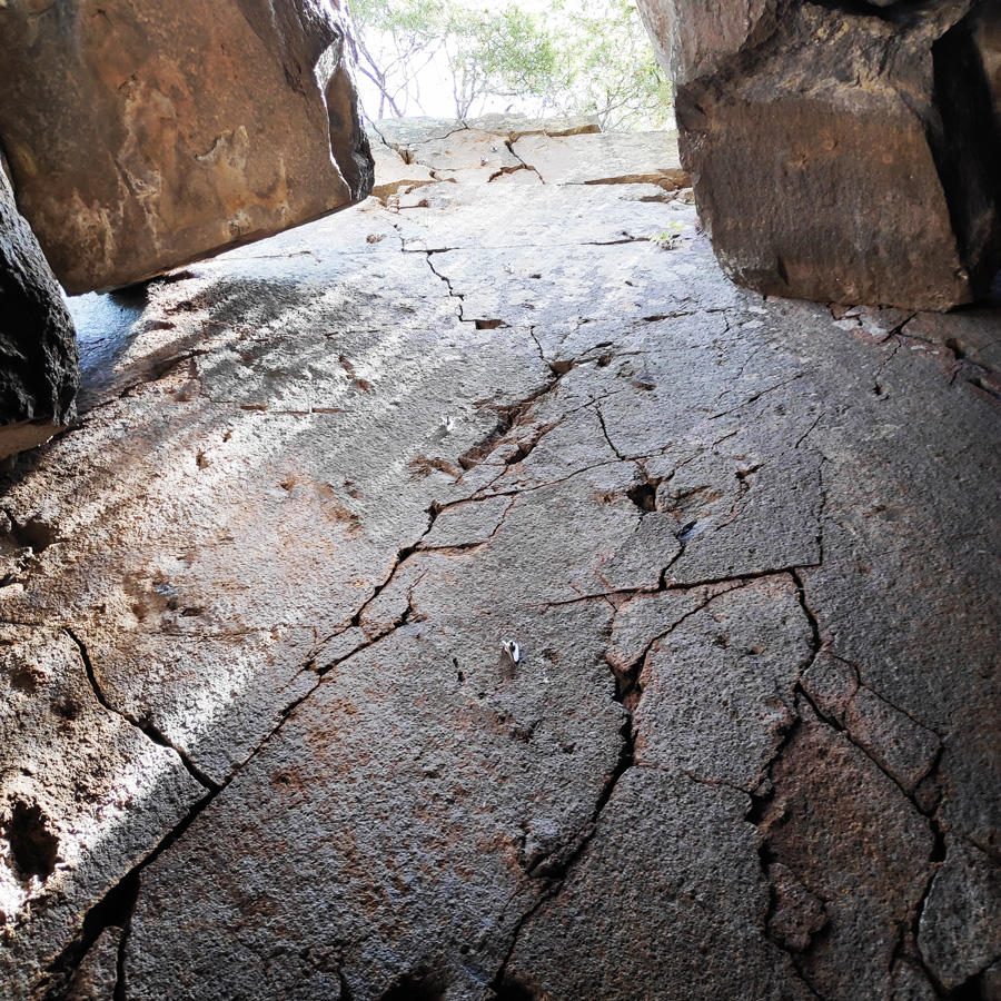
Down to the volcano’s crater
The volcanic activity in the peninsula began 1 million years ago and continued sporadically until 300 years ago. The last eruptions took place in 1700 at a submarine volcano north of Kameni Chora. On land there is also the historic lava dome of Kameni Chora that erupted in 230 BC.
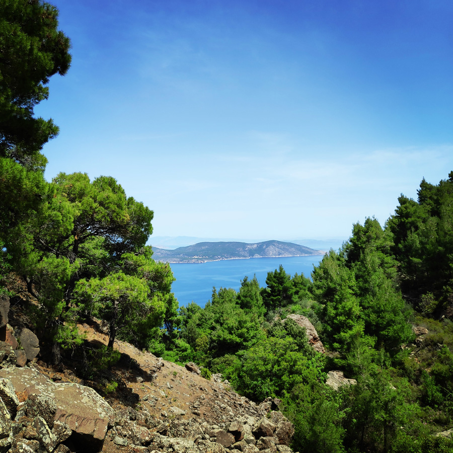
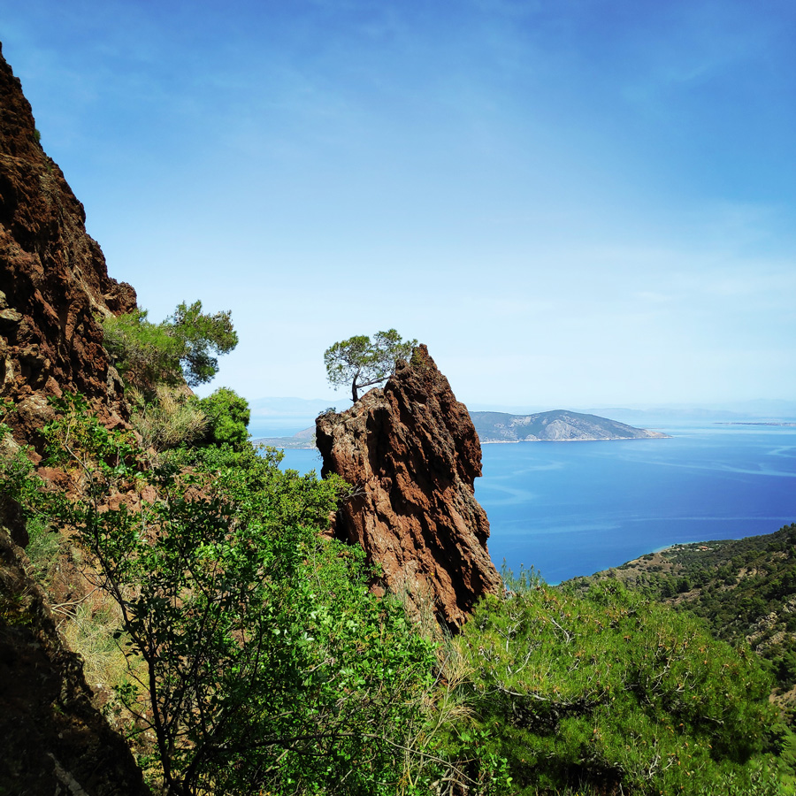
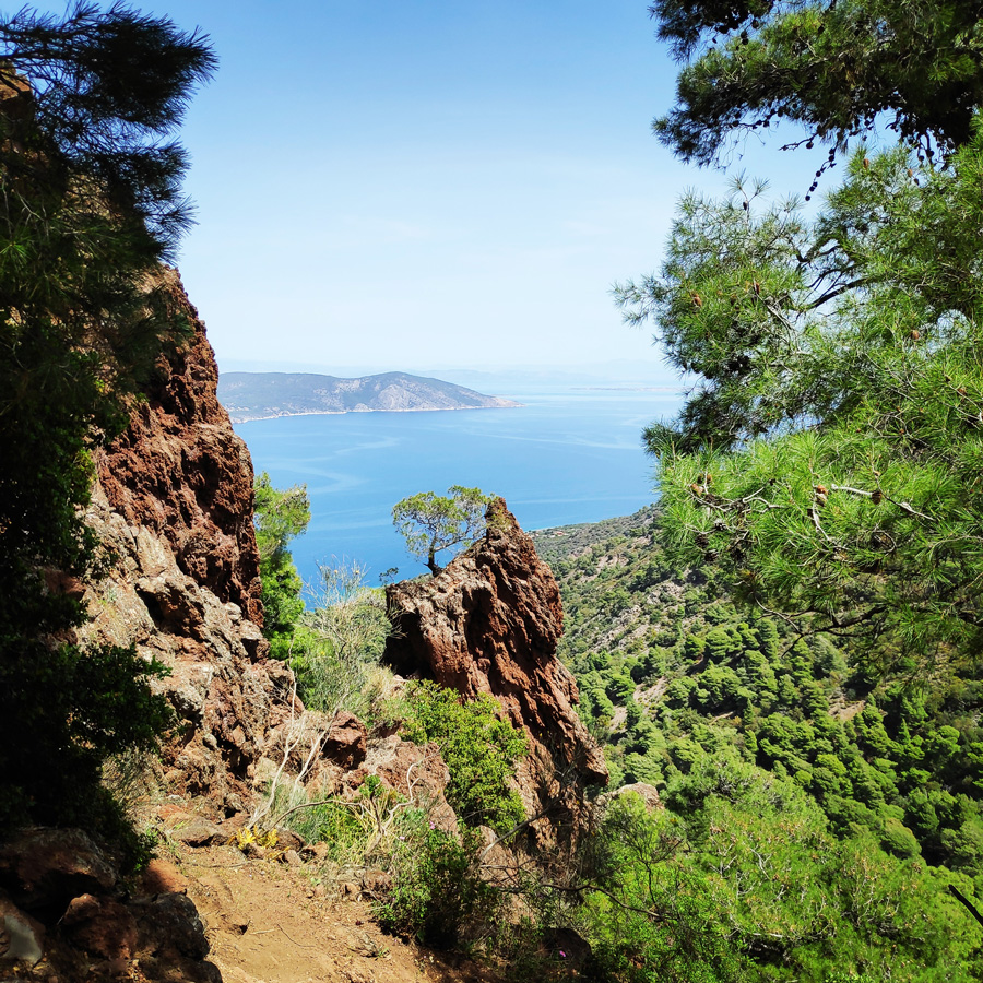
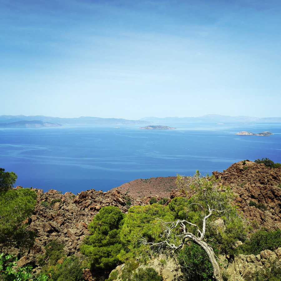
View from the top

Other Hiking Trails at Methana
- Megalochori – Panagitsa – Chelona – Makrylongos
- Kameni Chora – Aghios Andreas
- Volcano – Aghios Nikolaos
- Makrylongos – Kameni Chora
- Palea Loutra – Aghios Nikolaos
You can get more info on other hiking trails at Methana and valuable info about the volcano via the following two links:
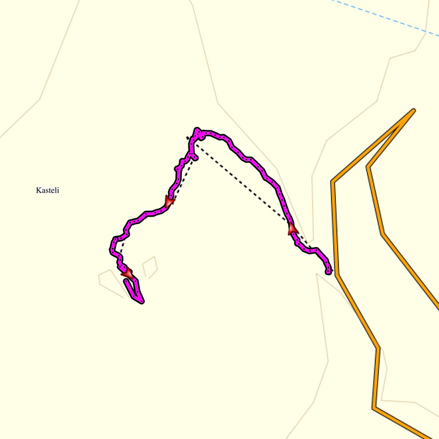
Details of the Hike:
- Location: Methana Volcano
- Starting Point: Kameni Chora
- Ending Point: Methana Volcano
- Trail Signs: Well signed path
- Minimum Elevation: 300 m
- Maximum Elevation: 389 m.
- Total Distance: 1,3 km
- Difficulty: Easy
- Water Features: No
Support the journey — buy me a coffee
I share these articles and the climbing guidebooks because I love the outdoors, and they’ll always be free. If they’ve helped you, help me keep them coming. Click the button to support my work.
Below: This map marks all the mountaineering adventures that have been featured on Olympus Mountaineering so far, including several Sport climbing crags – Select full screen to expand, zoom in for more detail, or click on a marker for a link to the post.

Looks amazing! Beautiful photos!
LikeLike
Thank you. Much appreciated your kind comment.
LikeLiked by 1 person
This looks like such a unique place to go hiking and climbing. The landscape looks beautiful. I love how well signed everything is.
LikeLike
It’s indeed a very nice place, and besides the hike on the volcano, at Methana one can enjoy plenty of other hikes, nice beaches, natural spa and great food.
LikeLiked by 2 people
Must have been a great experience! Wonderful captures!!
LikeLike
It was very nice experience and a really beautiful place to hike!
LikeLiked by 1 person
Some great photos here, and I enjoyed your model. 🙂 It’s a neat way of saying this is a trail for most people. Also, I always like your maps. –Curt
LikeLike
Thank you for your comment Curt! Much appreciated and glad to know you like the maps.
I try to provide as many info as possible for every different hike and/or climb I do.
LikeLike
I suspect your efforts are much appreciated in Greece! And by visitors!
LikeLike
The views from the trail and from the summit are stunning! Looks like you have a good little hiker/climber accompanying you:)
LikeLike
That little hiker that joins me on many hikes, as you can imagine, is the best company ever!
LikeLiked by 1 person
That is an amazing hike, and so FUN for kids. Lots of changing rocks, views and trail conditions. I love that the volcano is still active too – adds a bit of excitement to the hike. Keep sharing! These posts are amazing!
LikeLike
Thank you very much for such supportive comment Alisen.
LikeLiked by 1 person
Really relateble I just started my own travel blog and then covid hit and I could not travel anymore from my country. No travel planning for me at all 😦
LikeLike
Thank you for your comment, and keep the spirit up, cause sooner or later we will be done with the travelling ban.
LikeLiked by 1 person
Pingback: Methana Volcano Peak - womo-traveller