
The third day of this amazing thru-hike, started after a good sleep and rest in the mountain refuge of Astraka. Although, day one and day two we had to carry a heavy load, we were very excited to carry on with our adventure and exploration of Mt. Tymfi.
For this third and last day on the mountain, we had as first goal to go through the Davalista pass which is located NW from the Astraka refuge, and as a final destination to get back to Konitsa where we had parked our car.
This is the third and final part of the Mount Tymfi (Pindos) North Side Thru-Hike. In case you haven’t checked the previous two parts, feel free to check it out here:
- Mount Tymfi (Pindos) North Side Thru-Hike Part 1 – Konitsa – Moni Stomiou – Sadi Migas
- Mount Tymfi (Pindos) North Side Thru-Hike Part 2 – Sadi Migas – Karteros Pass – Astraka Refuge
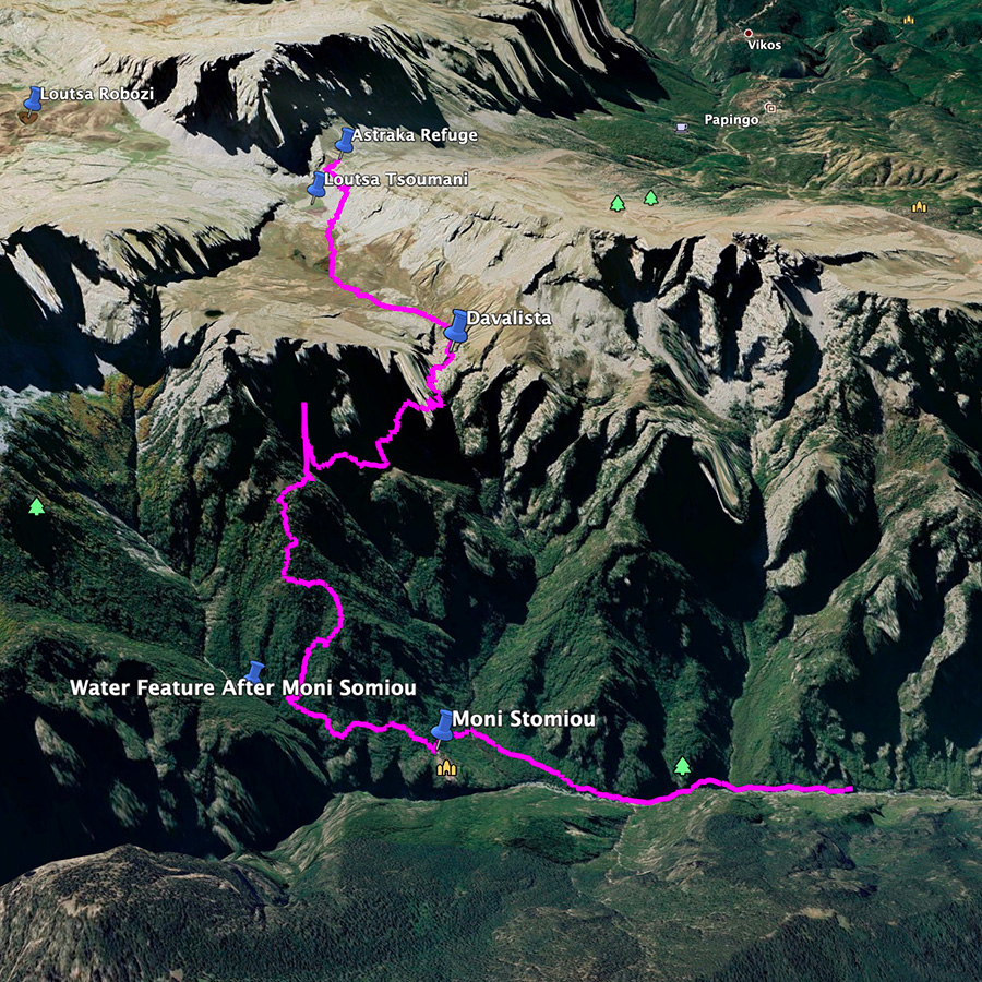
Astraka Refuge – Alpine Meadows – Davalista Pass
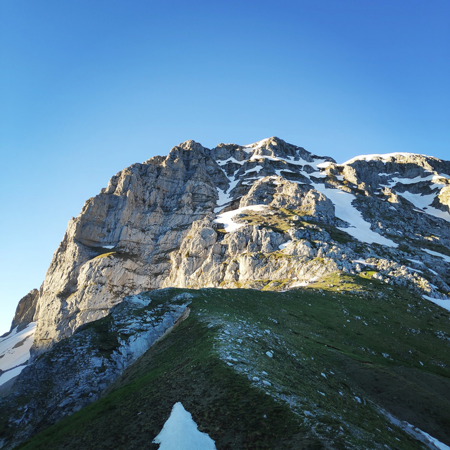
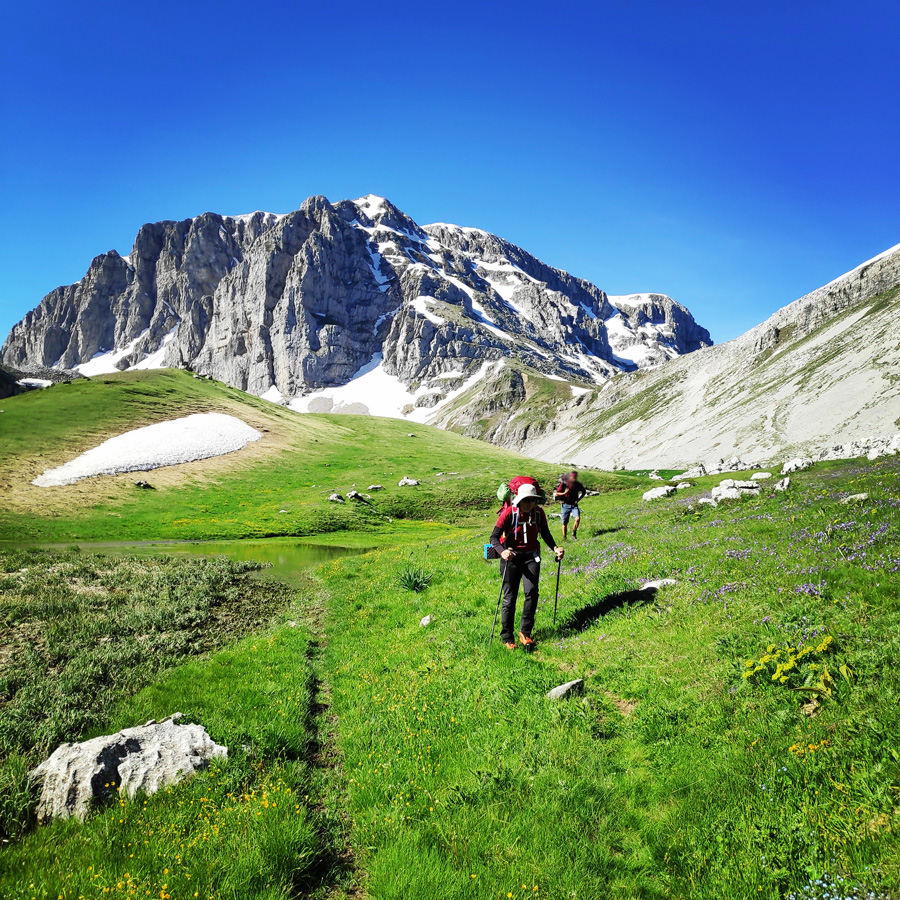
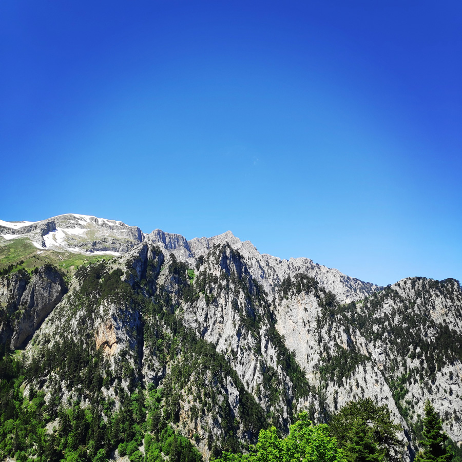
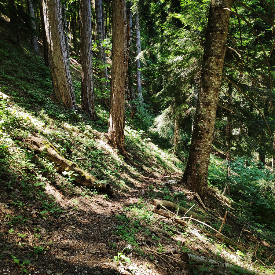
As soon we had our breakfast, we collected all our gear and left the Astraka refuge. As soon you step our of the door, the first thing one sees, is the impresive Astraka with the various climbing routes. In fact, this past winter, I was planning to visit the area and try some winter mountaineering routes, such as “Louki tis Dimokratias” ( III 2 400 m.), but the strict lockdown (due to covid-19) that was imposed in Greece did not leave the space for such a visit. Let’s hope the upcoming new winter season (2021-2022) will be better.
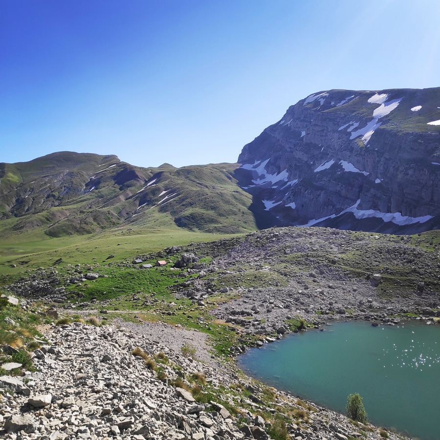
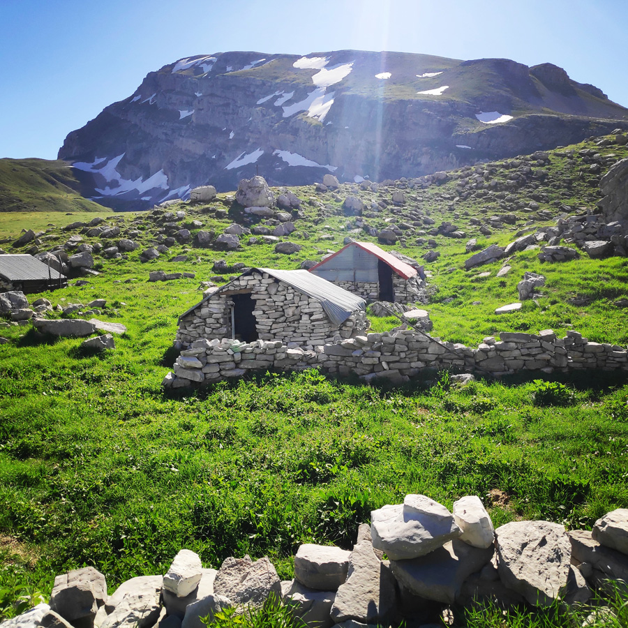
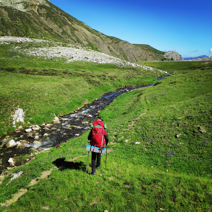
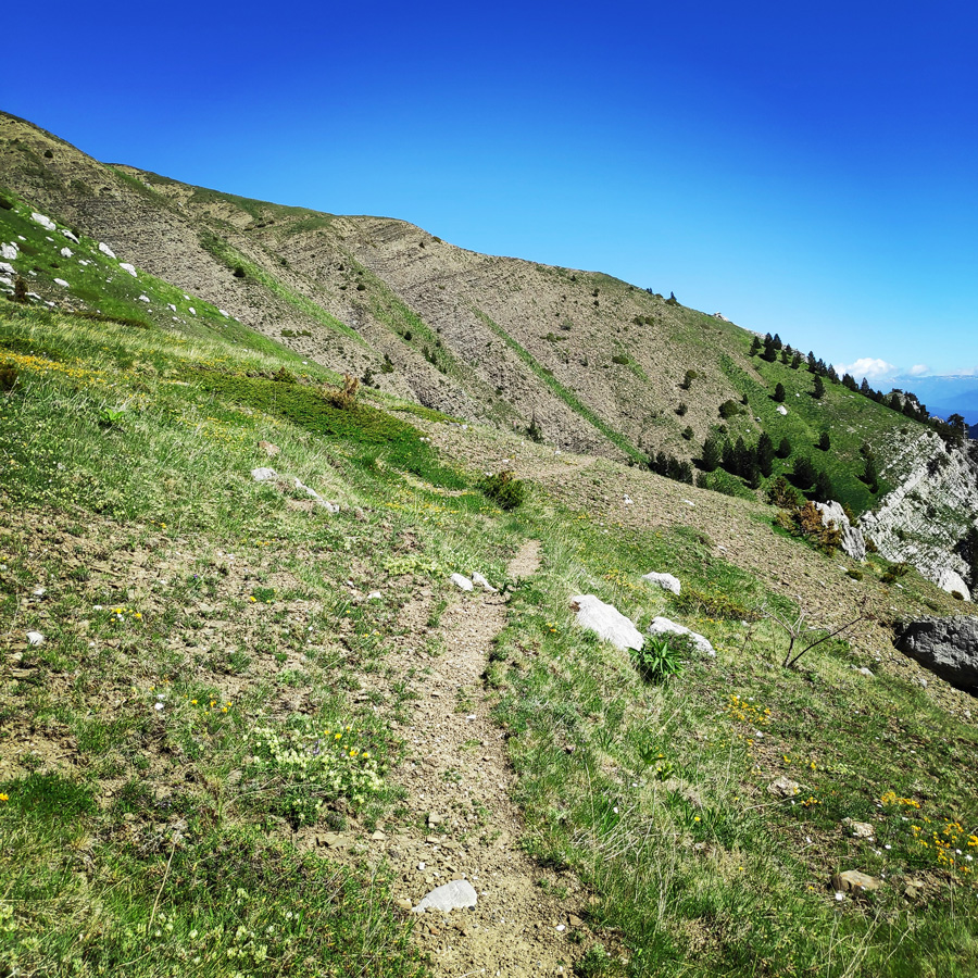
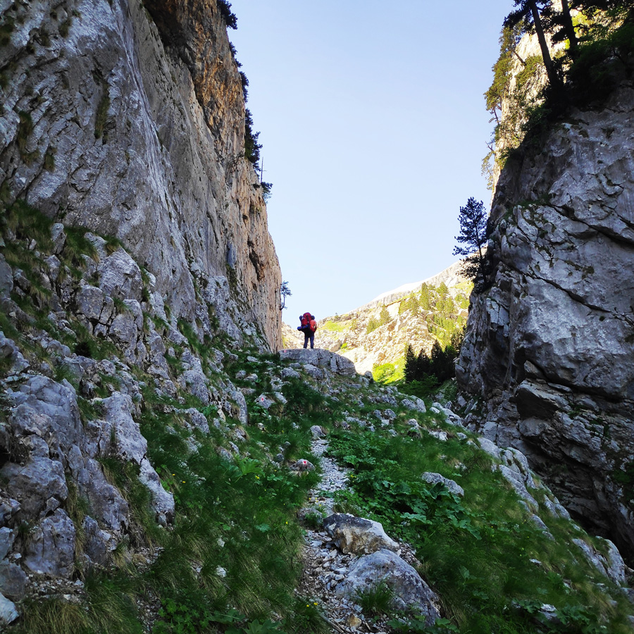
The first section of this trail is a downhill from the Astraka refuge towards the water pond, Xeroloutsa Tsoumani. Xeroloutsa Tsoumani, is actually the union of two lakes that are formed by the water of the springs of the valley Laka Tsoumani. It is found in Xeroloutsa Tsoumani and it offers a very beautiful spectacle in combination with the natural wealth that surrounds it. It does not have permanent water as the water usually dries up in summertime because of the small depth, but when there is water, it is a beautiful landscape worth admiring.
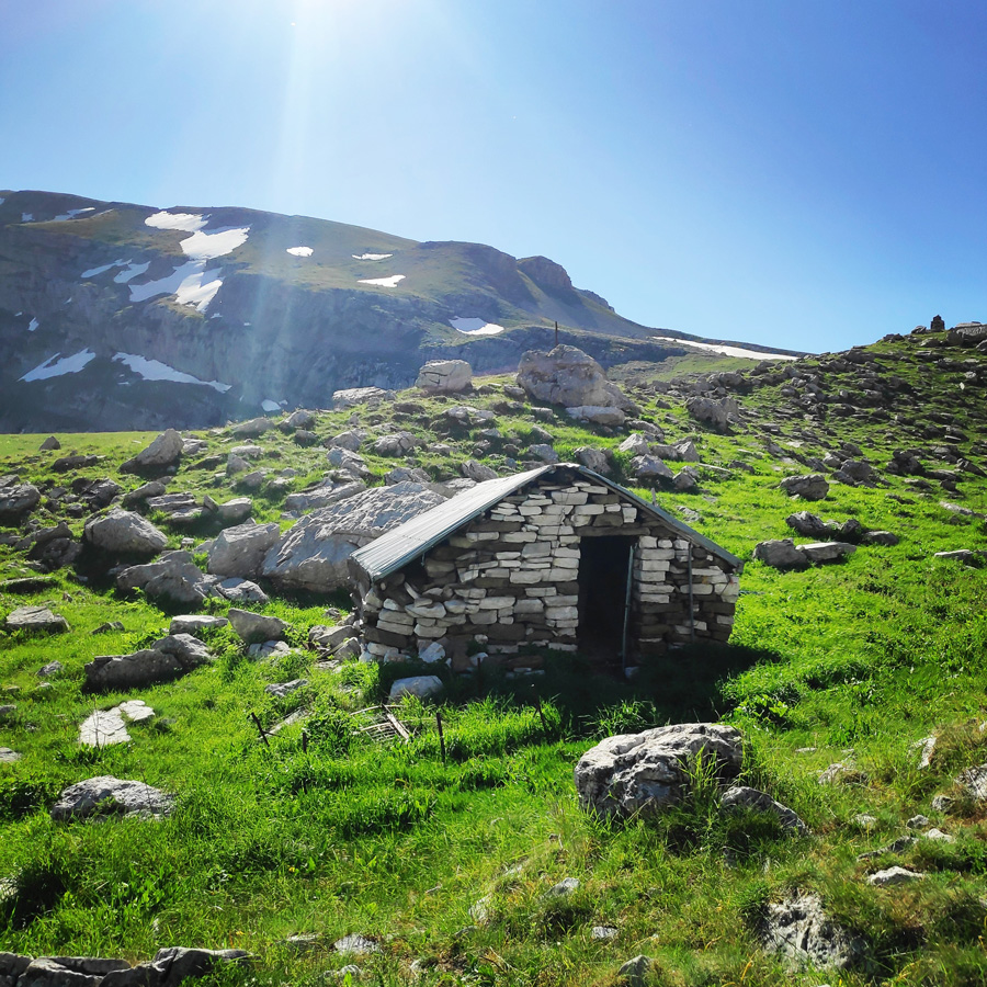
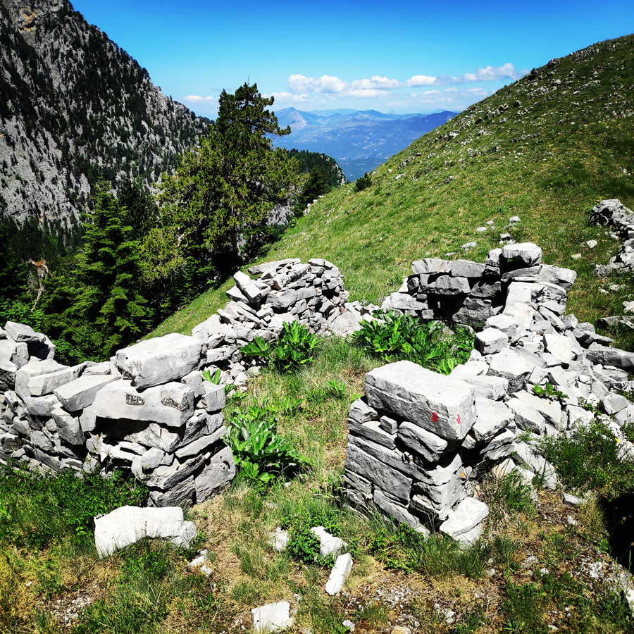
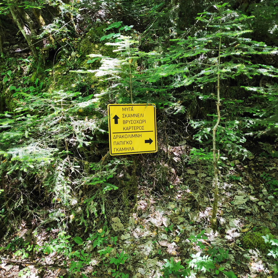
On the shore of the water pond, there are three shepherd’s mountain huts that are used by the local shepherds during the summer time. On that point, instead of going straight, we follow the trail towards the west (left turn). In case you would like to visit the famous Dragon Lake (Drakolimni) of mount Tymfi, you have to continue straight ahead.
Support the journey — buy me a coffee
I share these articles and the climbing guidebooks because I love the outdoors, and they’ll always be free. If they’ve helped you, help me keep them coming. Click the button to support my work.

More details about the Dragon lake here:
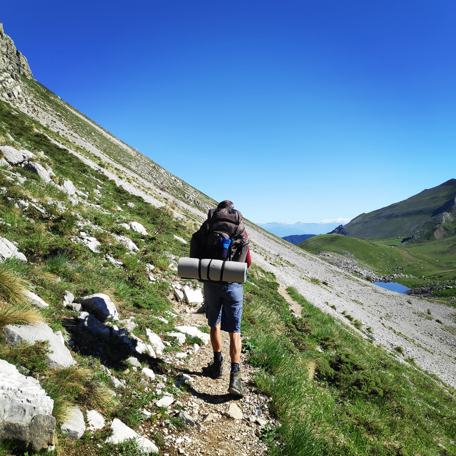
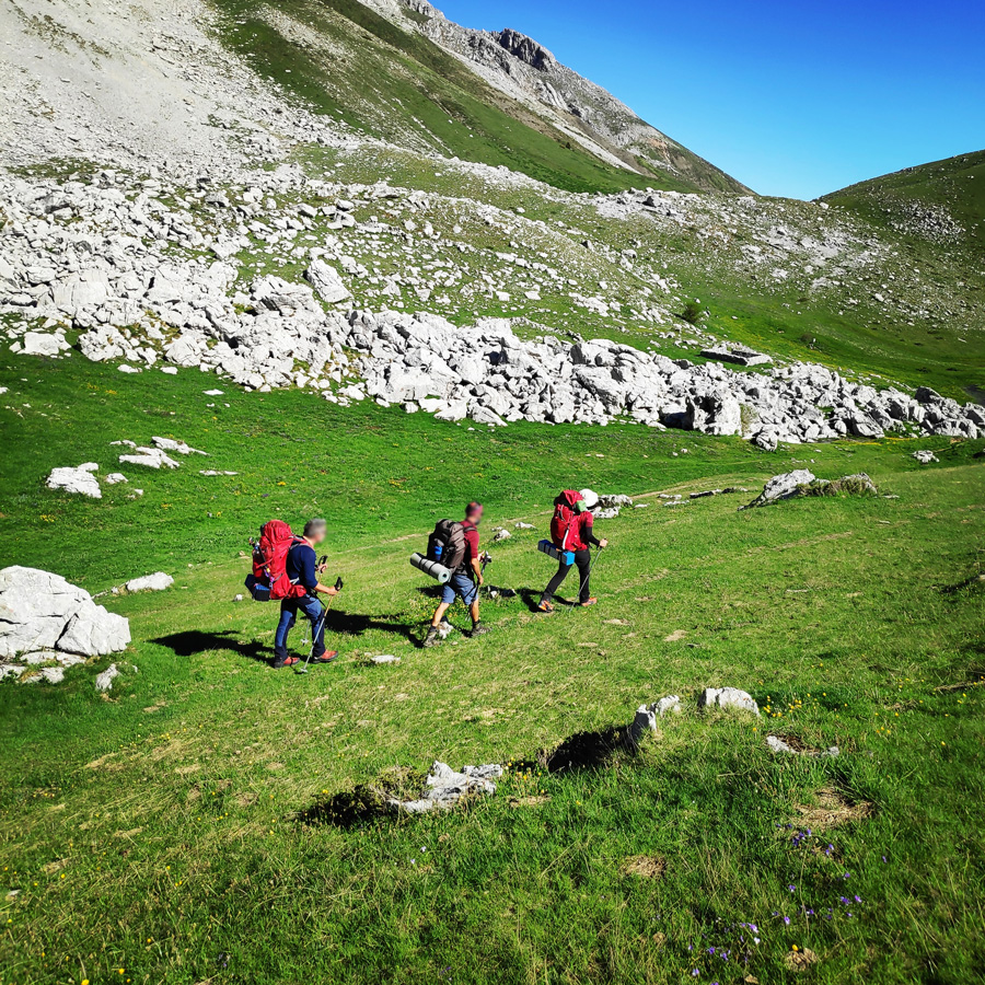
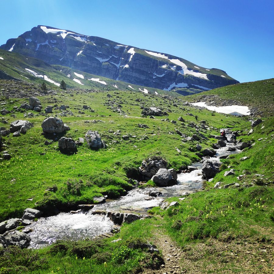
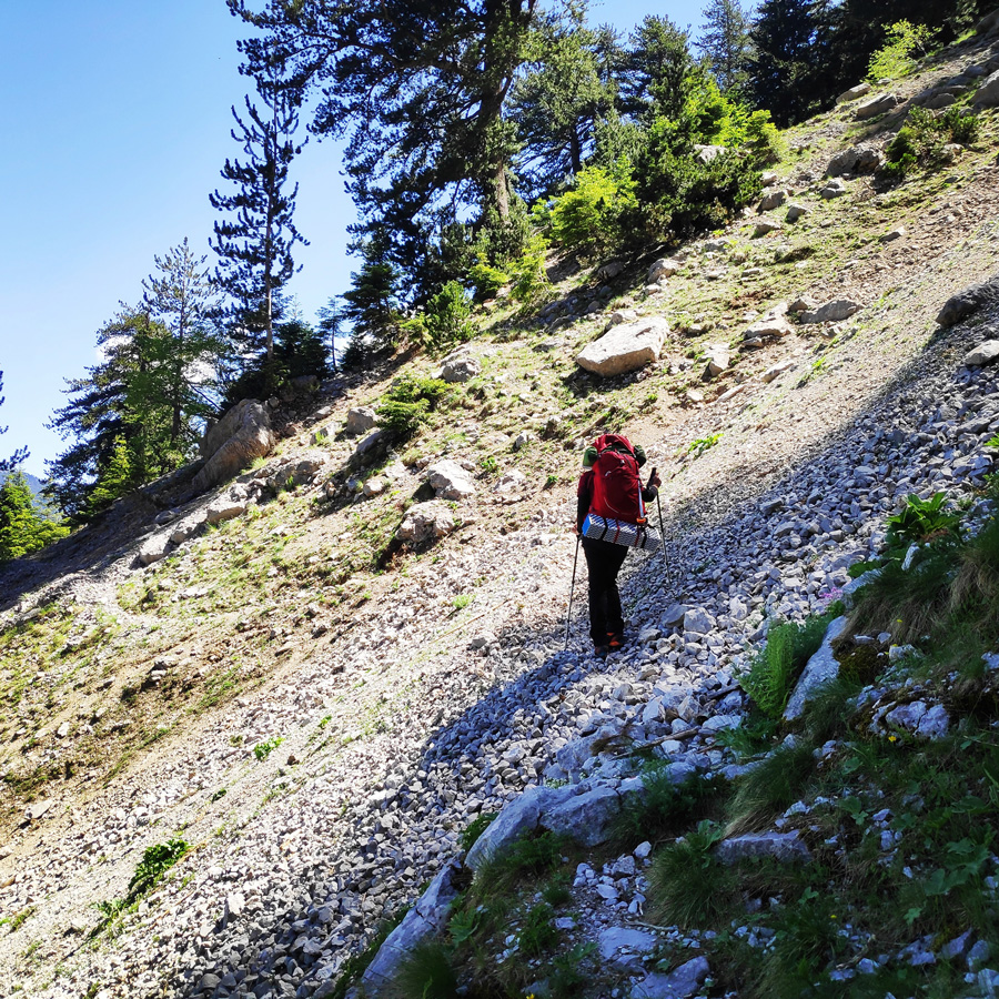
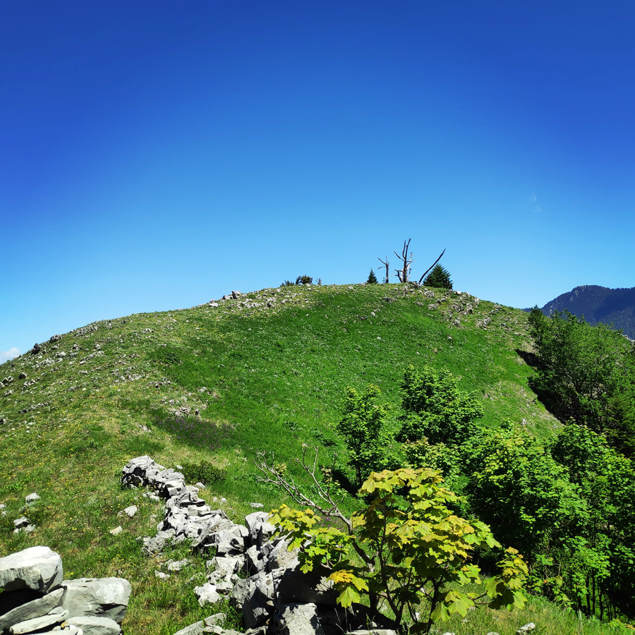
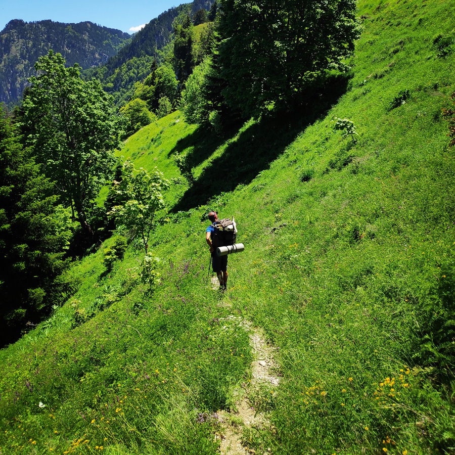
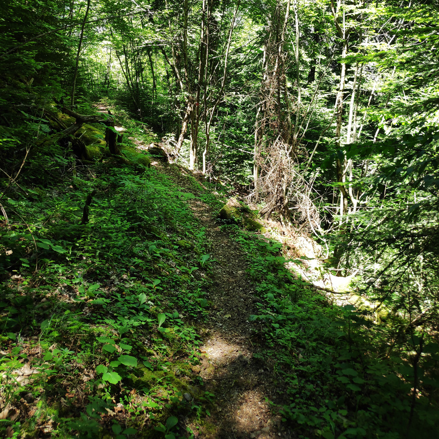
The trail path is very obvious and the elevation difference up to Davalista pass, is minimal. This means, the hiker can enjoy the wonderful landscape and the surrounding peaks, such as Ploskos, Lapatos and of course on our back, the majestic Astraka peak.
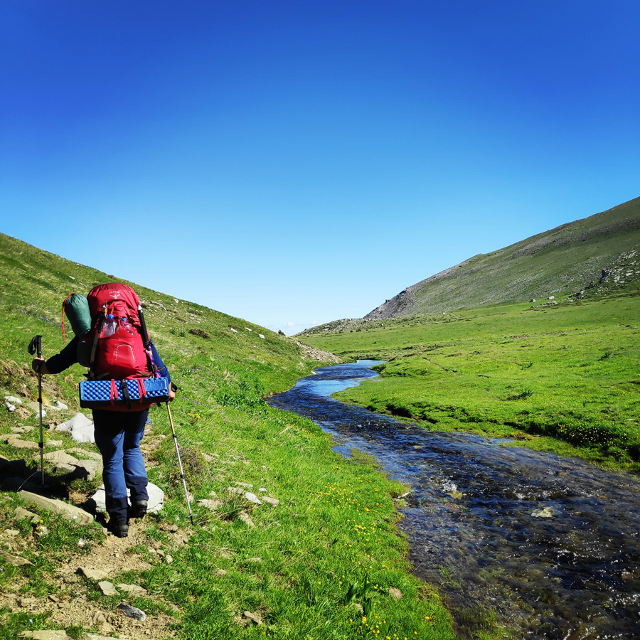
During later spring and early summer time, there is a creek formed that brings water from Xeroloutsa Tsoumani towards the Davalista gorge. If there is water, always hike on the left side of the creek and do not cross the creek in order to follow the trail signs. If you cross over the creek, at the Davalista pass, you will have to cross it again. So, my advice is to have the creek always on your right side.

Explore all outdoor activities in a convenient list view here

Check out more FREE Guidebooks
Download now for free! Explore breathtaking landscapes and conquer thrilling heights with our collection of guidebooks and topos.
Don’t miss out on this opportunity to elevate your outdoor adventures. Click, download, and let the exploration begin!
Davalista – Moni Stomiou (Monastery Panagias Stomiou)
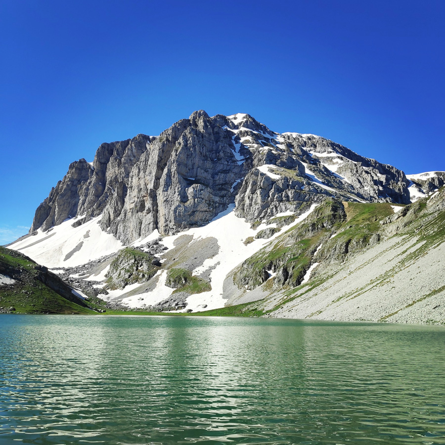
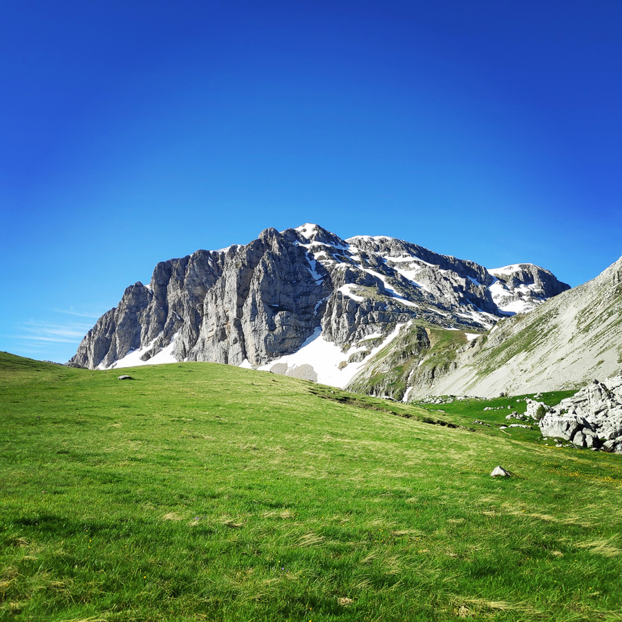
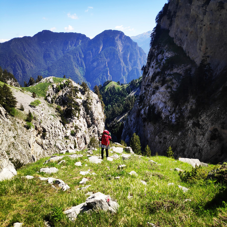
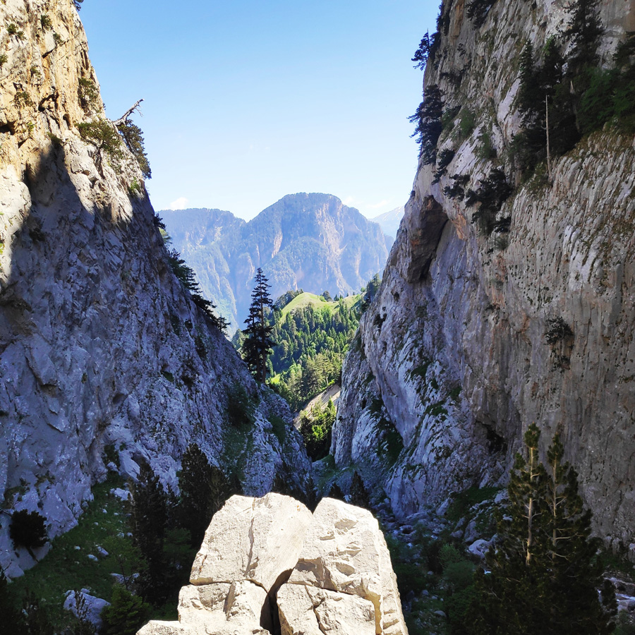
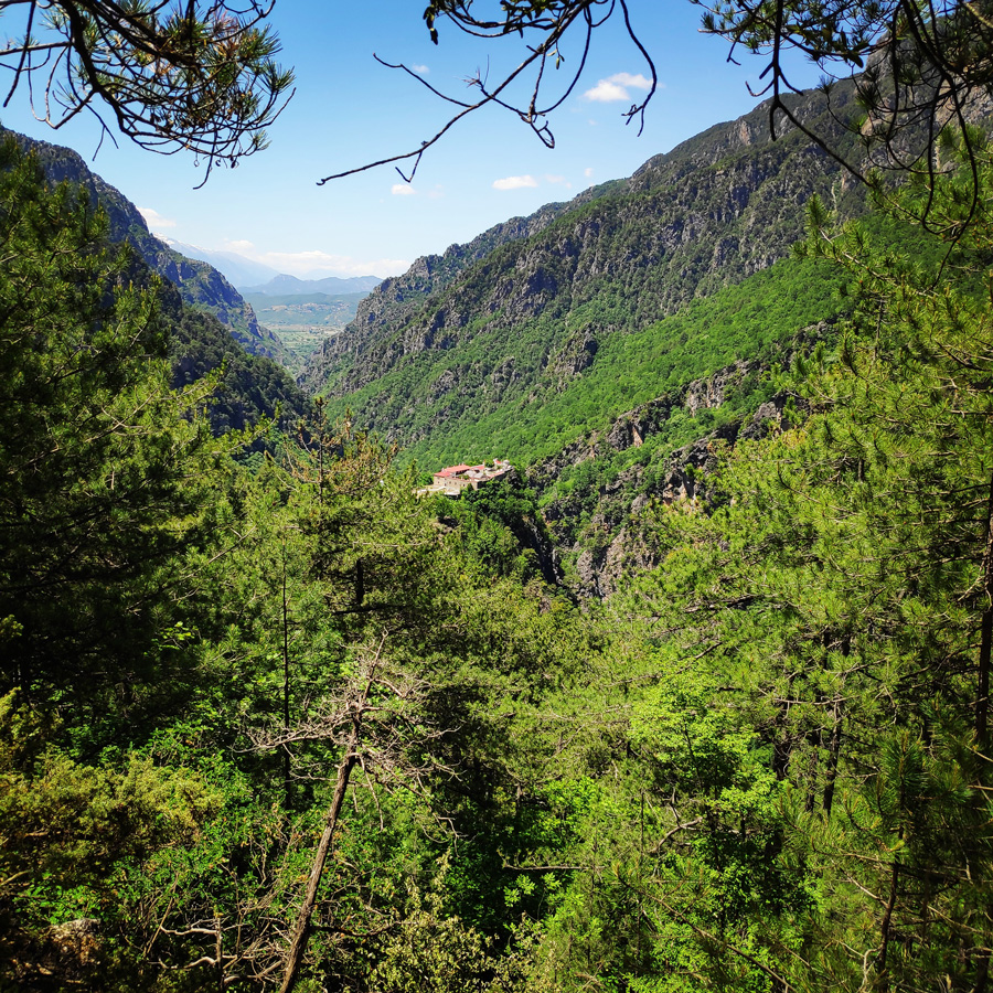
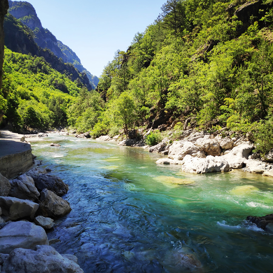
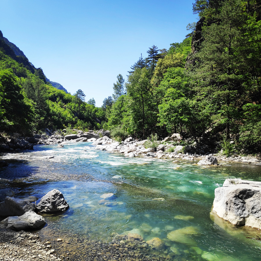
Davalista Pass is located in the NW part of the Tymfi mountain complex, near Drakolimni and above the Stomiou Monastery. It is a watery (rocky) passage, basically a gorge, from the waters of Xeroloutsa Tsoumani that flows into Aoos, this wonderful river that crosses almost all of northern Pindos.
The word Davalista seems to be of Slavic origin because the suffix lista is usually Slavic. The region of Epirus is full of Slavic toponyms.
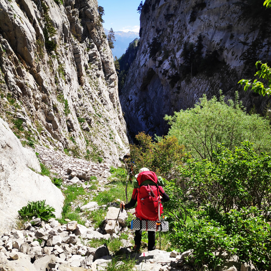
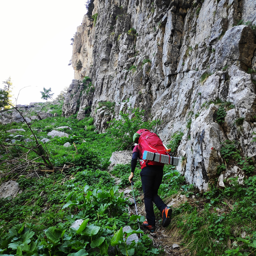
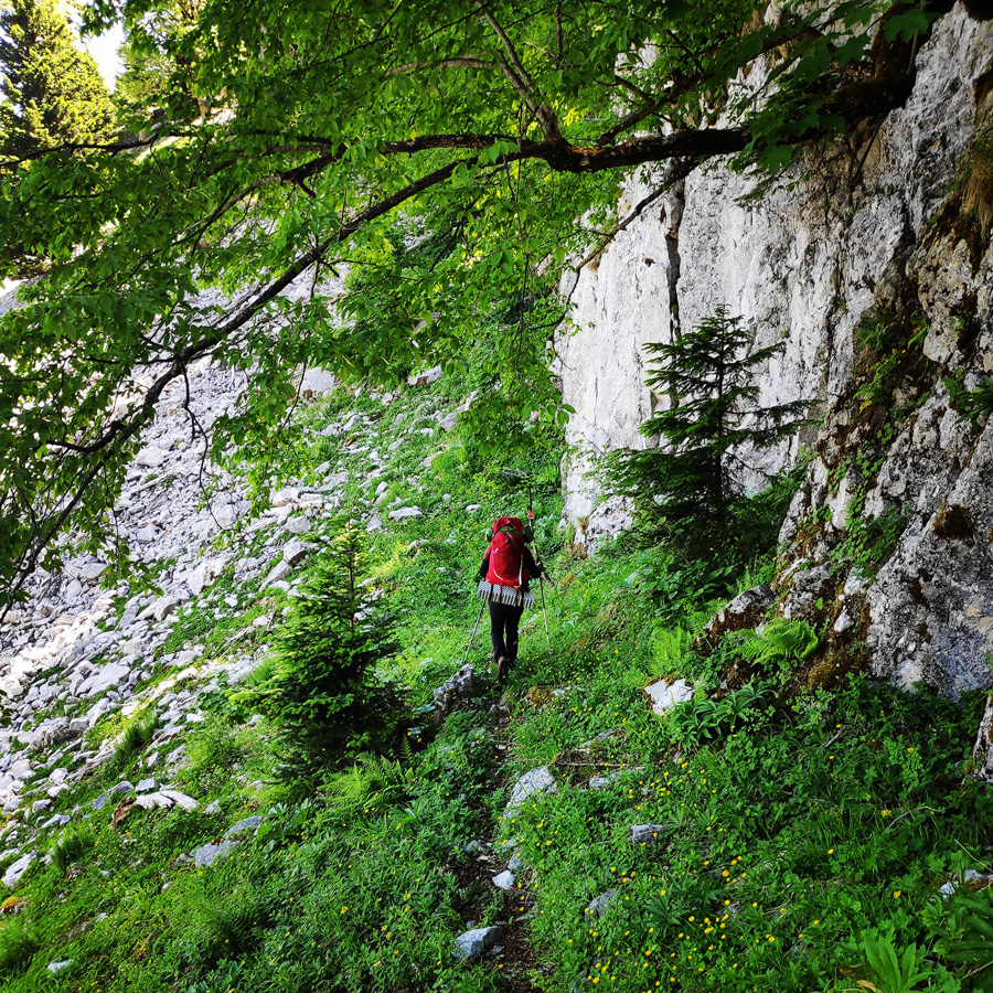
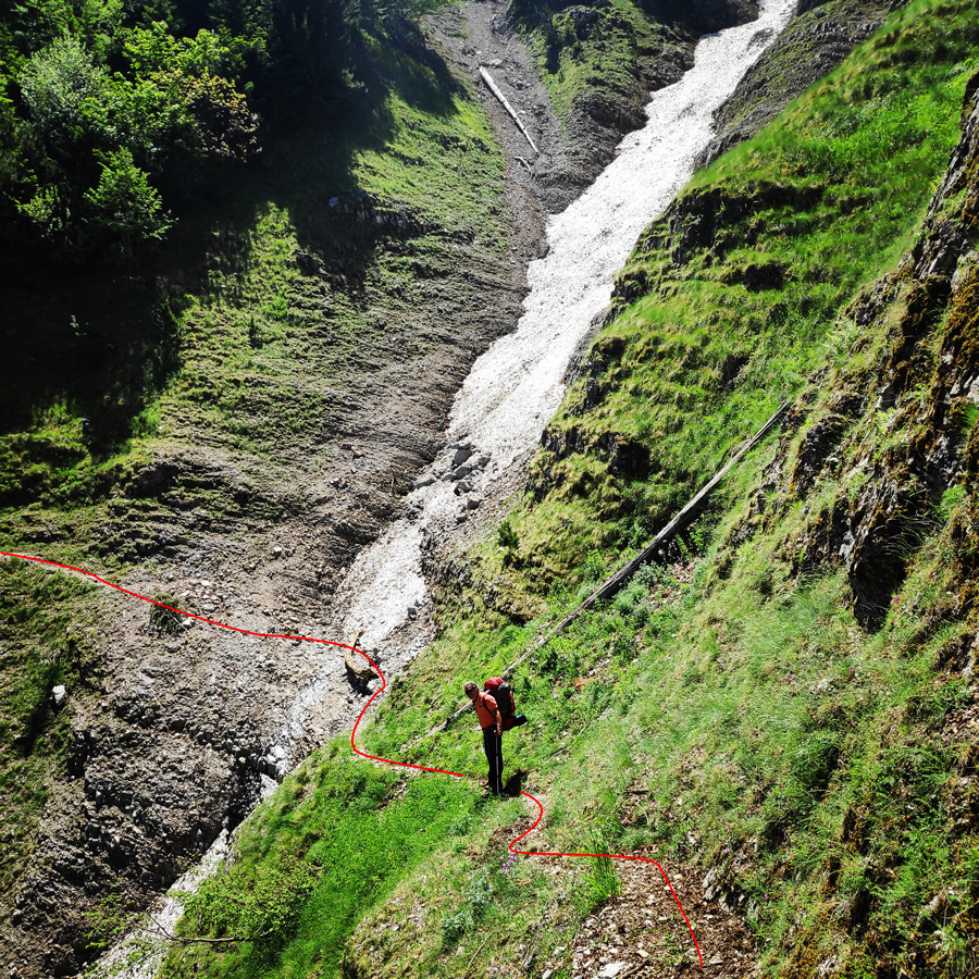
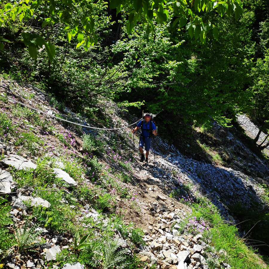
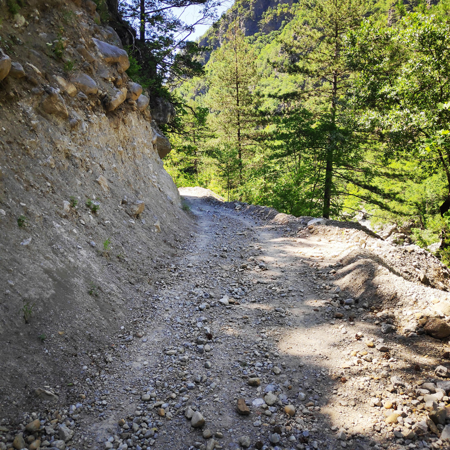
As soon we enter the Davalista Pass, the terrain becomes very steep and in our case we had to down climb it. If there is humidity or rain, the hiker should be a bit more careful, because in case of a slip it can be fatal. The trail path is well signed and up to Moni Stomiou, most of the trail is a very steep downhill (or uphill depending from which side you come).
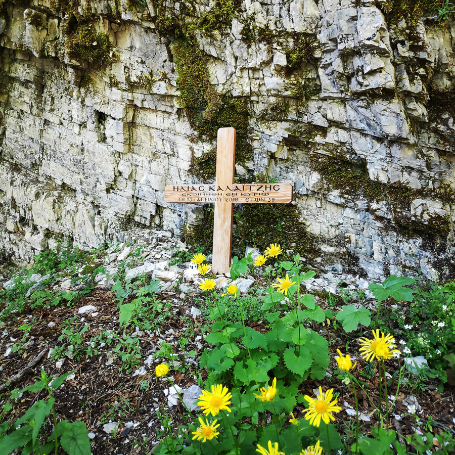
At certain point, the trail crosses the small river that leads the alpine waters to the main river Aoos. This crossing, was a bit tricky because the stream was strong and the rocks very slippery. Though, having successfully crossed the river, we continued to hike downhill and we also had to cross a couple of traverses with scree and snow patches. In one of these traverses, a couple of years ago (2019), there was also a fatal accident. Upon this fatal accident, some ropes has been installed, but should you be crossing these traverses during winter time pay extra attention.


Moni Stomiou – Konitsa
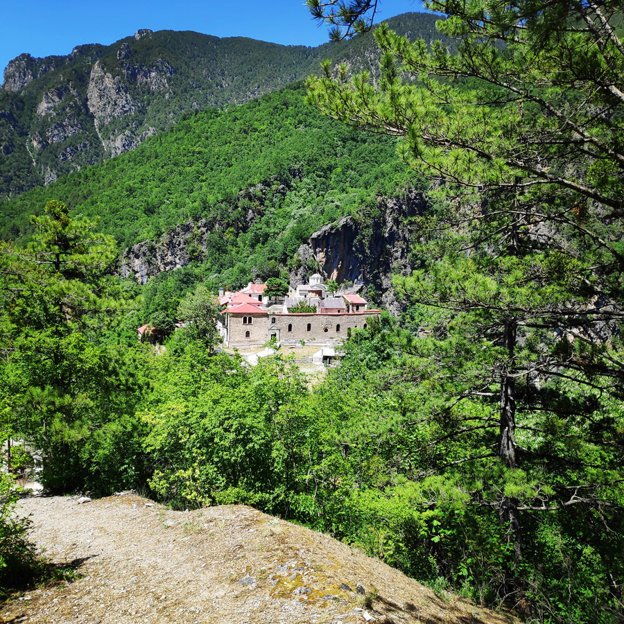
In one of the most impressive locations of Greece, in the ravine of Aoos, between the steep slopes of Tymfi (altitude 2497 m.) And Trapezitsa (altitude 2024 m.) Is the Monastery of Panagia Stomiou.
The original location of the monastery, founded in 1442, is located on the opposite slopes of Trapezitsa, where the name “Old Monastery” is preserved. In its current location, in an elevated elevation of the lower altitudes of the slopes of Tymfi, it was moved by the abbot Constantine, in 1774. From the almost complete destruction of the Monastery by the German army in 1943, only the church survived.
Stomiou Monastery is today an active male monastery. It has 11 newly built cells with auxiliary spaces and a small cruciform-type catholic with a dome. The iconostasis with several Byzantine icons and the remains of many saints, which were transferred to the monastery from the Old Monastery, are interesting. The visit to the monastery is only a 2-hour walk from the bridge of Konitsa.
About Vikos – Aoos Geopark
Vikos- Aoos Geopark is one of the four Greek Geoparks and was delighted to become a member of the European and Global Geopark Networks in 2010. It is located in the region of Epirus, Ioannina, NW Greece.
It occupies the NW part of the Pindus Mountain Range and is characterized by a high rugged relief and an impressive landscape. It also includes Mt. Smolikas (alt. 2637m) the second highest mountain in Greece and Mt. Tymfi (alt. 2497m) with the two spectacular gorges of Vikos and Aoos.
The Geopark covers an area of 1,200 km² and the 9,500 inhabitants reside in 61 settlements in the municipalities of Zagori and Konitsa. The territory contains several traditional settlements and monuments dating back to the 14th – 19th century including monasteries, schools, churches, chapels and arched stone bridges.
Vikos Aoos Geopark is one of the most impressive areas in Greece in terms of its aesthetic values and range of geodynamic processes. Numerous geosites within the territory are situated in landscapes of incomparable beauty. They owe their origin to a wide range of geological processes and are of excellent scientific and educational value.
Gear & Equipment
For this trip, I was carrying the following main gear:
- Lowe Alpine Cholatse II 55-65 lt backpack
- Hilleberg Akto tent
- Cumulus Panyam 600 Hydrophobic Down sleeping bag
- Klymit Stativ V Ultralight sleeping pad
- Garmin Dakota 20 GPS device
- Cumulus Minilite Down vest
- Quechua Tech-Fresh 50 T-shirt
- Cumulus Incredilite Endurance jacket
- The North Face Verbera hiking boots
- Salewa Tec X Ice Axe
- Rock Empire Mackki crampon
- Rab Spark Waterproof Jacket
Support the journey — buy me a coffee
I share these articles and the climbing guidebooks because I love the outdoors, and they’ll always be free. If they’ve helped you, help me keep them coming. Click the button to support my work.
Details of the Hike:
- Location: Tymfi Mountain (Pindos)
- Starting Point: Astraka Refuge
- Ending Point: Konitsa
- Trail Signs: Signed path
- Maximum Elevation: 1.919 m.
- Minimum Elevation: 460 m
- Total Distance: 12.1 km
- Hiking time: 7 hours (with easy pace – including the breaks)
- Difficulty: Medium
- When to Hike: Any time of the year (during winter time winter mountaineering gear is needed)
- Water Features: one
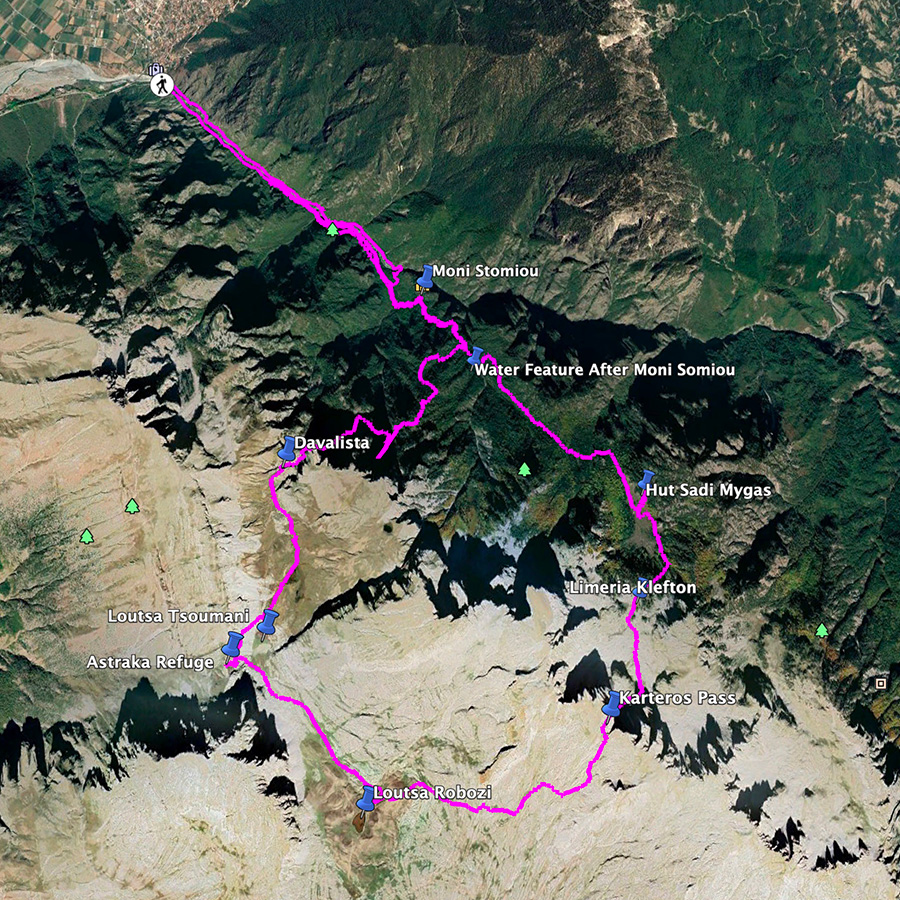
Bellow you can see the route we have followed on a map and on 3D:

Overview of the entire route | Konitsa – Karteros Pass – Astraka Refuge – Davalista – Konitsa
The route we have decided to follow is perhaps one of the nicest hiking routes in Greece. This route, offers majestic views with great trails. In addition, if you will visit this area end of May up to mid-June, you will be overwhelmed by the different kind of sceneries you can experience just by one round-trip hiking route.
The entire route is about 30 km long, and it can be split in three sections and each section can be an enjoyable day hike. The way we split the route was the following:
- Section 1: Konitsa – Moni Stomiou – Sadi Migas
- Section 2: Sadi Migas – Karteros Pass – Astraka Refuge
- Section 3: Astraka Refuge – Davalista – Konitsa
Subscribe & Stay Informed
Enter your email address to follow this blog and receive notifications of new posts by email
If you wish to see a Thru-Hike of Tymfi, but from the south side, check the following posts:
Mount Tymfi (Pindos) Thru-Hike Part 1 – Kapesovo – Mezaria Gorge – Vikos Canyon – Mikro Papingo
Mount Tymfi (Pindos) Thru-Hike Part 2 – ASTRAKA REFUGE – ASTRAKA PEAK
Mount Tymfi (Pindos) Thru-Hike Part 3 – Dragon Lake (Drakolimni)
Mount Tymfi (Pindos) Thru-Hike Part 4 – GAMILA – STOMA – MEGAS LAKOS -TSEPELOVO – KAPESOVO
Below: This map marks all the mountaineering adventures that have been featured on Olympus Mountaineering so far, including several Sport climbing crags – Select full screen to expand, zoom in for more detail, or click on a marker for a link to the post.

Pingback: Mount Tymfi (Pindos) North Side Thru-Hike Part 1 – Konitsa – Moni Stomiou – Sadi Migas – Olympus Mountaineering
Beautiful views for the hike out too! Is it a busy trail? It didn’t look like there were any other groups.
LikeLike
Hi Maggie,
thank you for your comment and indeed, the hike was really nice and I enjoyed it a lot.
Generally, Tymfi is visited from many people during the summer time, bust mostly the southern part of the mountain.
See here: https://olympusmountaineering.com/2017/09/10/mount-tymfi-pindos-thru-hike-summary/
In addition, the section between Astraka refuge till Dragon lake (Drakolimni), I guess is on the top 5 mountain trails in Greece.
See about Dragonlake here: https://olympusmountaineering.com/2017/08/23/mount-tymfi-pindos-thru-hike-part-2-dragon-lake-drakolimni/
In contrary, although the route I did is an established trail, when there is snow, not many people are willing to go, cause you need equipment (such as ice axe and crampons) and of course the skills.
LikeLike
Wow… amazing views!! Lovely captures! Loved it!
LikeLike
Thank you and pleased you enjoyed the views and the photos!
LikeLiked by 1 person
What a gorgeous three day backpack. Thank you so much for sharing. Again, you had beautiful blue-bird skies.
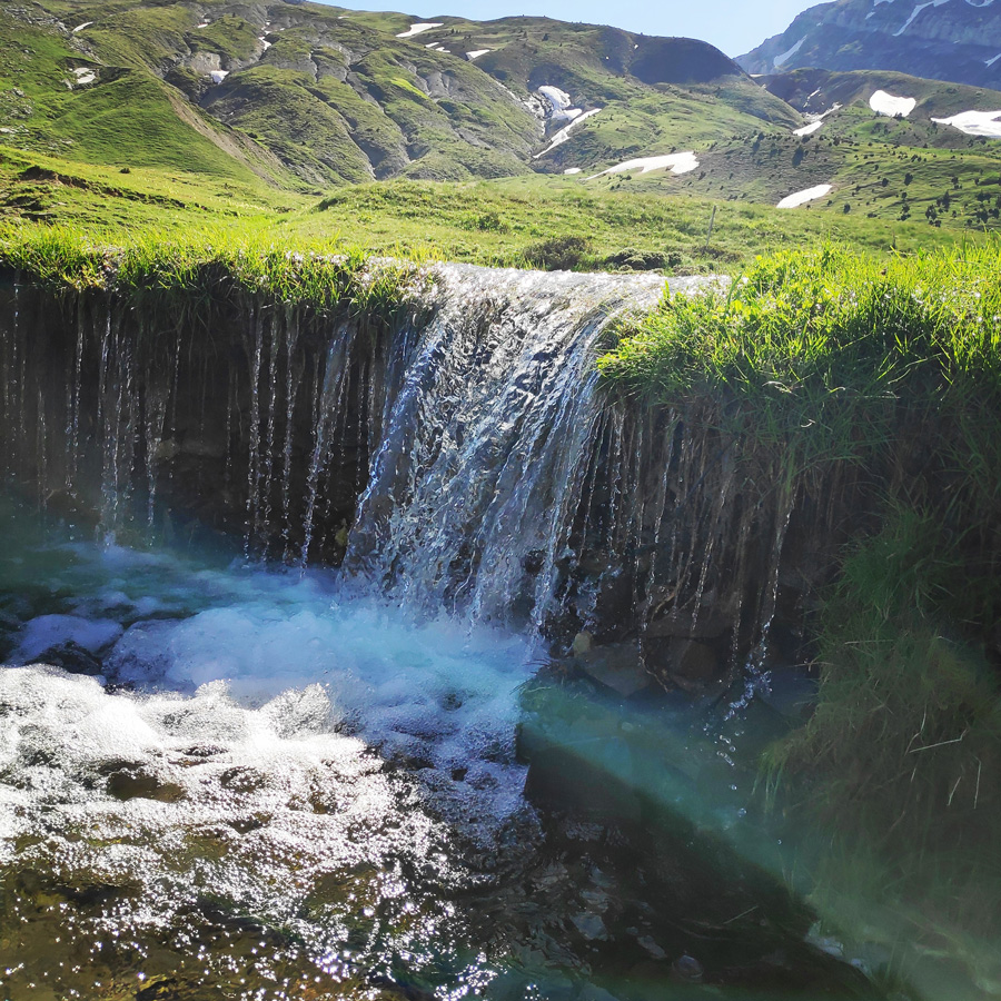
The waterfall and pond below look beautiful. I bet it is a tempting spot for a soak during the heat of the summer.
Well done my friend! I am glad you got the trail to yourself. That is the reward for going outside of peak times!
Alisen
LikeLike
Thank you again for your very positive comment Alisen. Much appreciated and I am very glad to know that you can enjoy such posts.
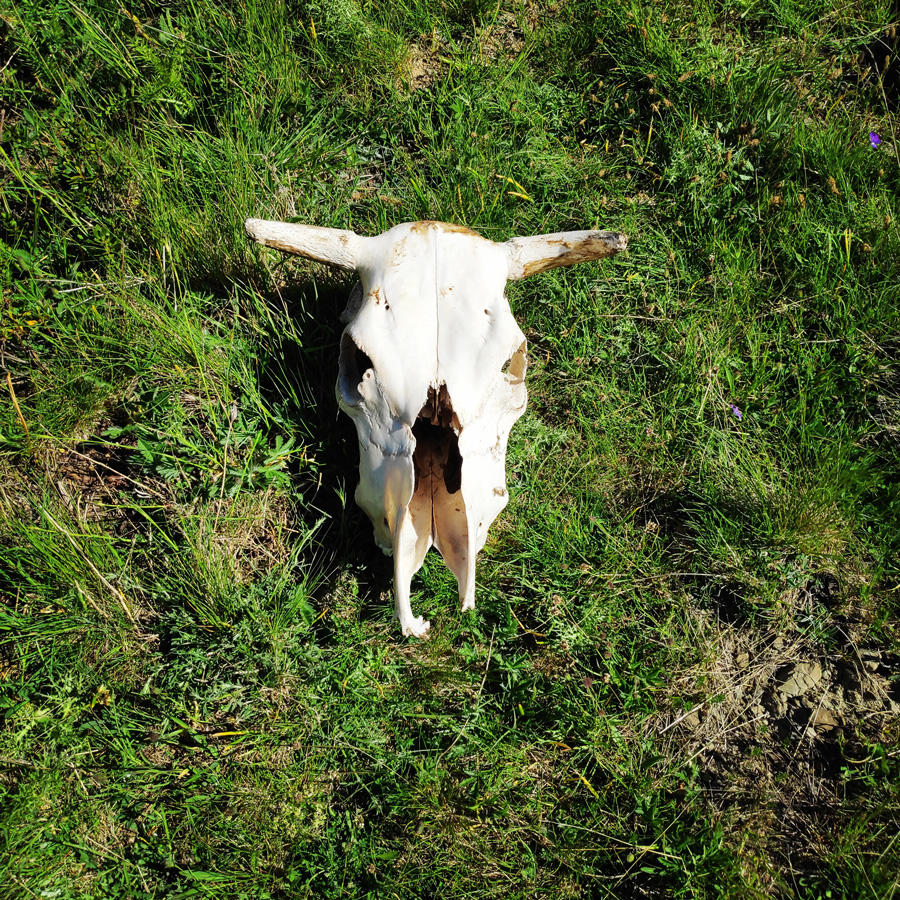
This pond, during the summer season is mostly used by kettle and wild horses. In fact, the previous evening we have seen some wild horses to run and play amongst them.
It was really nice to see.
LikeLiked by 1 person
Looks like you had wonderful weather to complete your three day backpacking adventure. The trail looks extremely challenging in certain sections, but the great views along the way I’m sure provide great motivation.
LikeLike
Weather conditions for this three day hike were simply the best! Blue skies but fresh enough to enjoy such a hike under the sunshine.
Of course, most of the time I was wearing UV long sleeve shirt, trousers and UV hat.
If you are experienced on mountain trails, then, this specific section of the trail was not that challenging, but quite tiring for the knees due to the steep downhill.
Thank you for such supportive comment. All the best there in lovely Canada.
LikeLiked by 1 person
I envy you this gorgeous landscape. I a particuliary love the shepherds huts. These were so awesome. !!
LikeLike
Thank you for your comment and believe me, the entire route had gorgeous landscape.
Sometimes, I was pausing to take a photo, and I was just amazed by the beauty of the nature.
LikeLike
The lakes and meadows (so green!) are really pretty and make such a wonderful contrast to the craggy peaks. The shepherd huts are another novelty for me. After lots of local hiking in British Columbia (no complaints) during the pandemic, it is refreshing to see a different type of hike.
LikeLike
I was also so amazed by how green and full of life the alpine meadows were.
Actually, I strongly believe that such hikes, on such mountains are always best to do them between half of May up to half of June. Is the period, when most of the snow is melted, alpine lakes are formed, waterfalls everywhere and alpine flowers get to blossom.
I think you were very lucky that you had the chance to hike there in Canada during the lockdown, because, in Greece we had an almost 7 month non-stop strict lockdown that officially, we were not allowed to leave our homes further than 2km (crazy rules).
Anyway, thanks again for all your comments and looking forward to read more of your BC adventures on your blog.
LikeLiked by 1 person
Wow, I would have gone crazy with those restrictions! I’m looking forward to several multi-day hikes in BC in the coming months(May-June is still a little early for the alpine here).
LikeLike
I look forward to read on your blog about your multi-day hikes! All the best.
LikeLike
Pingback: Hiking in Zarogi – Villages and Stone Bridges – Greece (family friendly) – Olympus Mountaineering
Pingback: Mount Tymfi (Pindos) North Side Thru-Hike Summary – Olympus Mountaineering
Pingback: Hiking to Balta di Stringa Waterfall – Iliochori – Zagori (Tymfi) – Olympus Mountaineering
Hi folks,
thank You for this great website! I am from Germany and fell in love with the greek mountains more than 30 years ago. This Oktober I did a 3 day hike with Your help in Mt. Timfi: Starting in Vrissochory, the first day i spent in Siadi Mighas hut (5 hrs.) This place at S.M. is one of the most impressing landscapes, I ever faced in Greece. The 2nd day, I crossed Karteros to Gamila and Astraka-refuge (7 hrs.). On the 3rd day I went down to Aoos (M. Stomiou direction) and 1 hr. before the the monastry I turned right up again to S.M. and back to Vrissochory (9 hrs.). In S.M. I faced a brown-bear, but he escaped, when he recognized me (luck for me!)..
I am very happy, that the north face of Timfi is such a grat and unspoiled landscape until today. Thanks again for Your help..!!
LikeLike
Thank you for your kind message.
I am very pleased to know you had such a great hike, and Mt. Tymfi and specifically the route you have done is simply amazing!
If I may suggest you, try to do the same route beginning/mid June! Although the route is the same, the landscape is really stunning with all the snow patches, the green fields and you will also have plenty of water!
Again, thank you for your positive feedback.
LikeLike