Few years ago, I have visited the magnificent Mt. Tymfi from the south side and I was amazed by the beautiful landscape, villages and hiking routes had to offer. The past winter, Greece was under strict lockdown and it was rather difficult -and illegal- to visit Mt. Tymfi from another area. Though, nowadays, it is possible again to travel within Greece and therefore we have decided to visit again this magnificent mountain, but this time to reach the high peaks via the north side hiking routes.
Specifically, we decided to start from Konitsa, then hike towards Moni Panagias Stomiou, Sadi Mygas, Karteros Pass, Loutsa Robozi, Xeroloutsa Tsoumani, Astraka Refuge, Davalista and return back to Konitsa.
About Mount Tymfi
Tymfi is a mountain in the northern Pindus mountain range, northwestern Greece. It is part of the regional unit of Ioannina and lies in the region of Zagori, just a few metres south of the 40° parallel. Tymfi forms a massif with its highest peak, Gamila, at 2,497 m (8,192 ft), being the sixth highest in Greece.
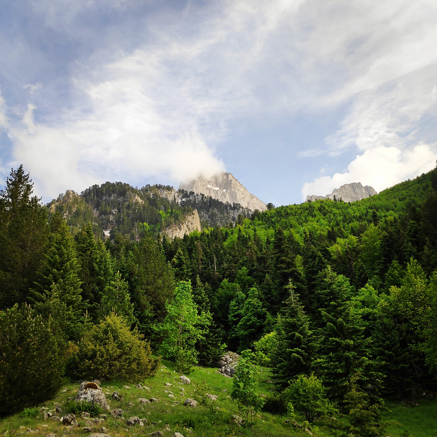
The mountain is surrounded by various massifs that also form part of the northern Pindus mountain range. Northeast of Tymfi lies the highest mountain of Pindus, Smolikas. The mountain of Trapezitsa lies to the north, Lygkos to the east and Mitsikeli to the south. The Aoos river flows to the north and its tributary Voidomatis to the southwest. Vikos Gorge is formed by the latter to the southwestern side of the mountain. The length of the mountain is approximately 20 to 25 km with a direction from east to west and its width is approximately 15 km from north to south. The southern and southeastern slopes of the mountain are comparatively smooth. The north side, however, forms cliffs reaching 400 m (1,312 ft), whereas the western side is equally steep since the mountain is fragmented by Vikos Gorge.
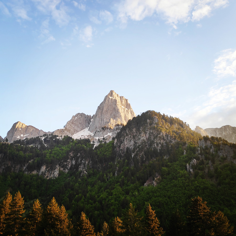
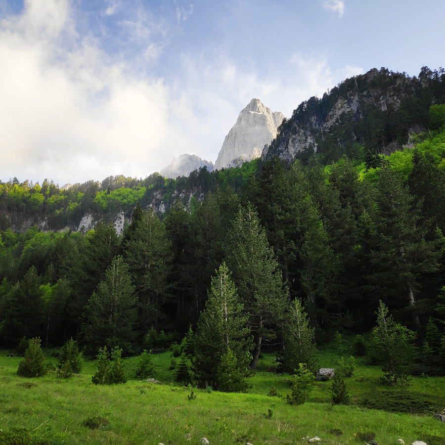
The massif includes several peaks that stand above 2400m. From west to east the most prominent are the following: Astraka, 2,436 m (7,992 ft), Ploskos, 2,377 m (7,799 ft), Gamila, 2,497 m (8,192 ft), Gamila ΙΙ, 2,480 m (8,136 ft), Karteros, 2,478 m (8,130 ft), Megala Litharia, 2,467 m (8,094 ft), Tsouka Rossa, 2,379 m (7,805 ft), and Gkoura, 2,466 m (8,091 ft). With the exception of Astraka, the peaks are arranged from north to northeast with their southern slopes forming a plateau. Astraka, being the only peak located to the south, dominates that plateau with its north face.
If you wish to see a Thru-Hike of Tymfi, but from the south side, check the following posts:
Mount Tymfi (Pindos) Thru-Hike Part 1 – Kapesovo – Mezaria Gorge – Vikos Canyon – Mikro Papingo
Mount Tymfi (Pindos) Thru-Hike Part 2 – ASTRAKA REFUGE – ASTRAKA PEAK
Mount Tymfi (Pindos) Thru-Hike Part 3 – Dragon Lake (Drakolimni)
Mount Tymfi (Pindos) Thru-Hike Part 4 – GAMILA – STOMA – MEGAS LAKOS -TSEPELOVO – KAPESOVO
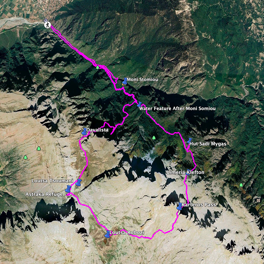
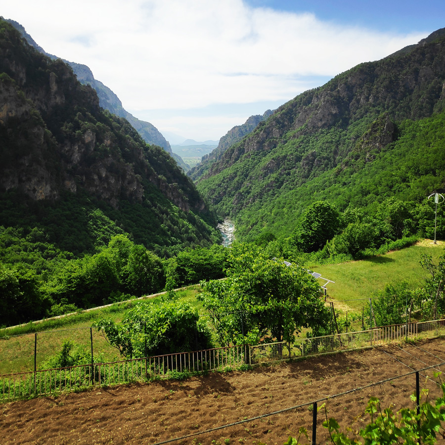
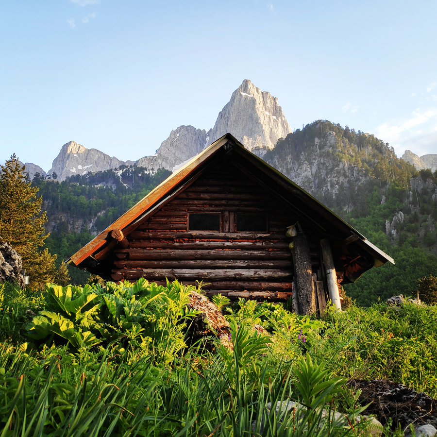
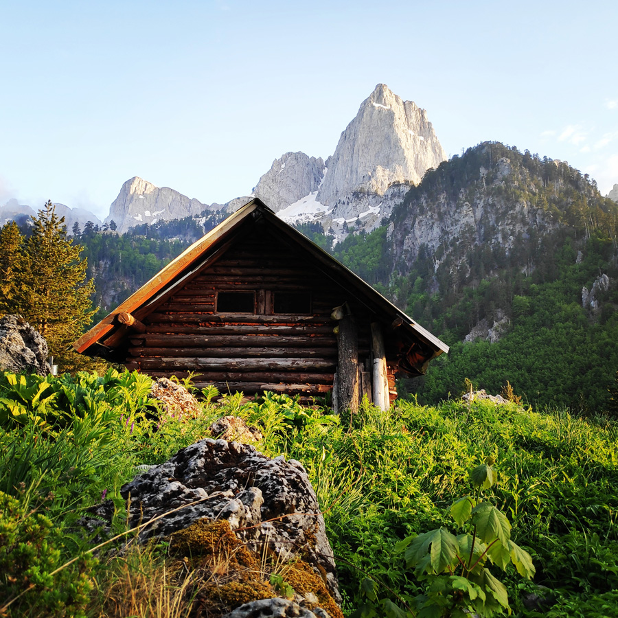
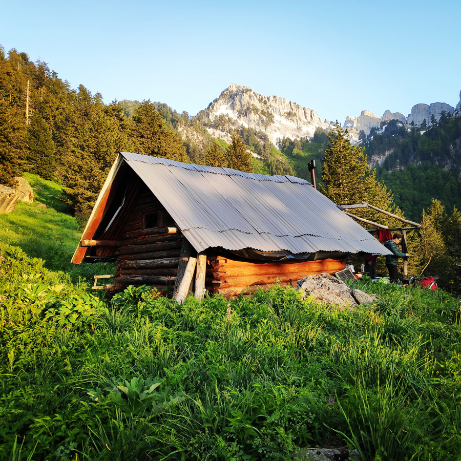
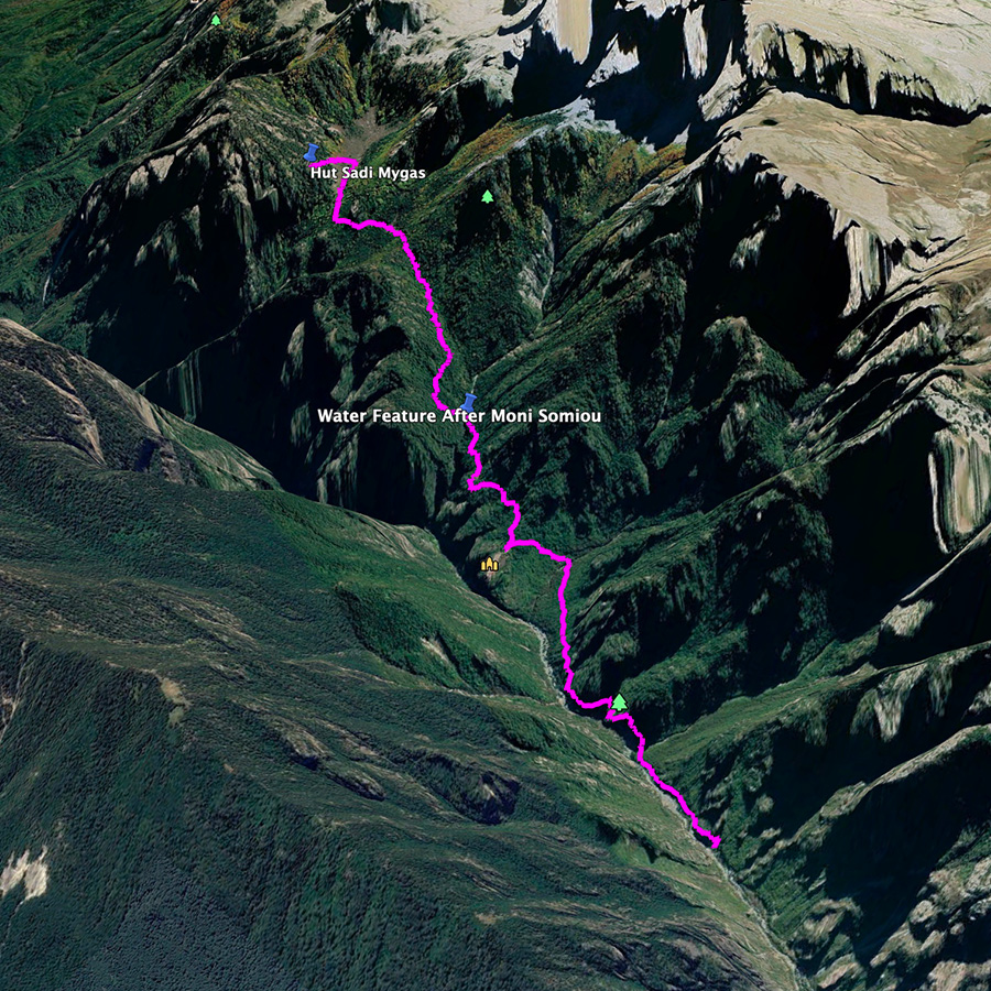
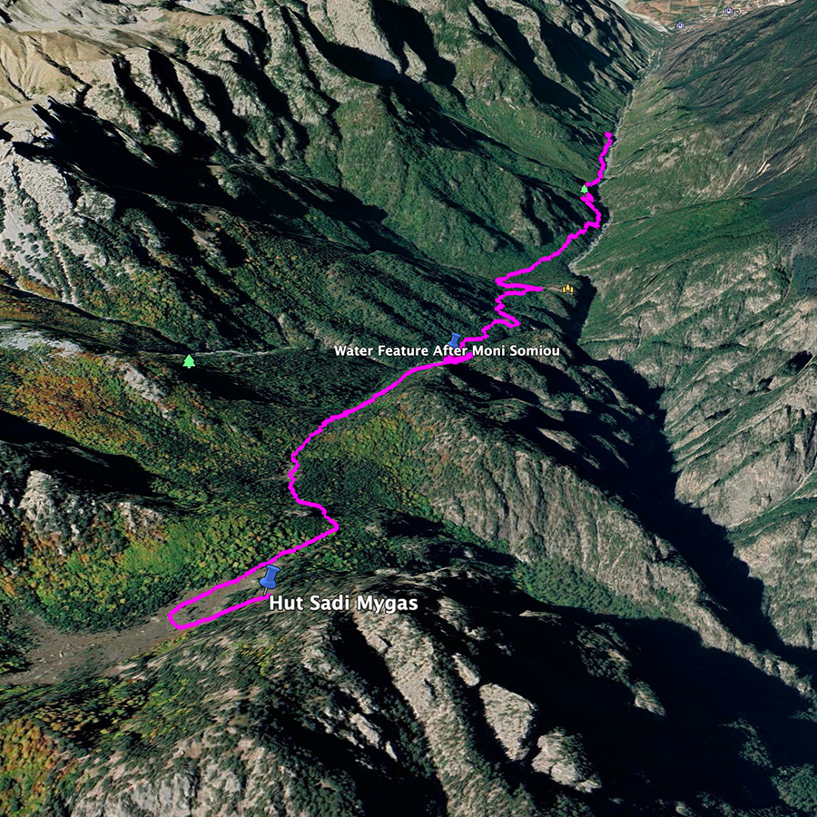
Overview of the entire route | Konitsa – Karteros Pass – Astraka Refuge – Davalista – Konitsa
The route we have decided to follow is perhaps one of the nicest hiking routes in Greece. This route, offers majestic views with great trails. In addition, if you will visit this area end of May up to mid-June, you will be overwhelmed by the different kind of sceneries you can experience just by one round-trip hiking route.
The entire route is about 30 km long, and it can be split in three sections and each section can be an enjoyable day hike. The way we split the route was the following:
- Section 1: Konitsa – Moni Stomiou – Sadi Migas
- Section 2: Sadi Migas – Karteros Pass – Astraka Refuge
- Section 3: Astraka Refuge – Davalista – Konitsa
In this post, you will read about section 1, and specifically the trail from Konitsa to Sadi Migas.
About Konitsa
This is the 1st of a total 3 parts in which we will try to show you our thru-hike in this wonderful mountain that combines beautiful villages, green forests, deep canyons, rivers, high-peaks and even alpine lakes.
Konitsa is a town of Ioannina in Epirus, Greece. It is located north of the capital Ioannina and near the Albanian border. South of Konitsa lies a group of villages known as the Zagorochoria. The town was built amphitheatrically-shaped on a mountain slope of the Pindos mountain range from where it overlooks the valley where the river Aoos meets the river Voidomatis.
Konitsa acts as a regional hub for several small villages of Pindos, and features many shops, schools and a general hospital. Primary aspects of the economy are agriculture and tourism; it is a popular starting point for tourists and hikers who want to explore the Pindos mountains, or who want to go rafting in the river Aoos or parapenting. Due to Konitsa’s closeness to places of particular interest, such as the Vikos–Aoös National Park, which includes the Vikos Gorge, the Aoos Gorge and the Tymfi mountains, where the Vikos spring water brand is collected, the Dragonlakes of Tymfi and Smolikas and the sulfur baths of Kavasila, contributed to the increase of tourism in the region.
How to reach Konitsa
The quickest way to reach the town of Konitsa is by following the National Road of Athens to Patra. After crossing the Rio-Antirio Bridge, you will keep driving to Ionia Highway and the National Road of Rio to Agrinio with a direction towards Arta/Ioannina/Preveza. When you arrive in Ioannina, you will keep driving for 43 kilometers and after passing the area of Vigla and the village of Klidonia, you will reach the town of Konitsa.
Support the journey — buy me a coffee
I share these articles and the climbing guidebooks because I love the outdoors, and they’ll always be free. If they’ve helped you, help me keep them coming. Click the button to support my work.

Starting point: Konitsa – Moni Stomiou (Monastery Panagias Stomiou)
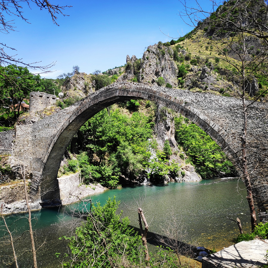
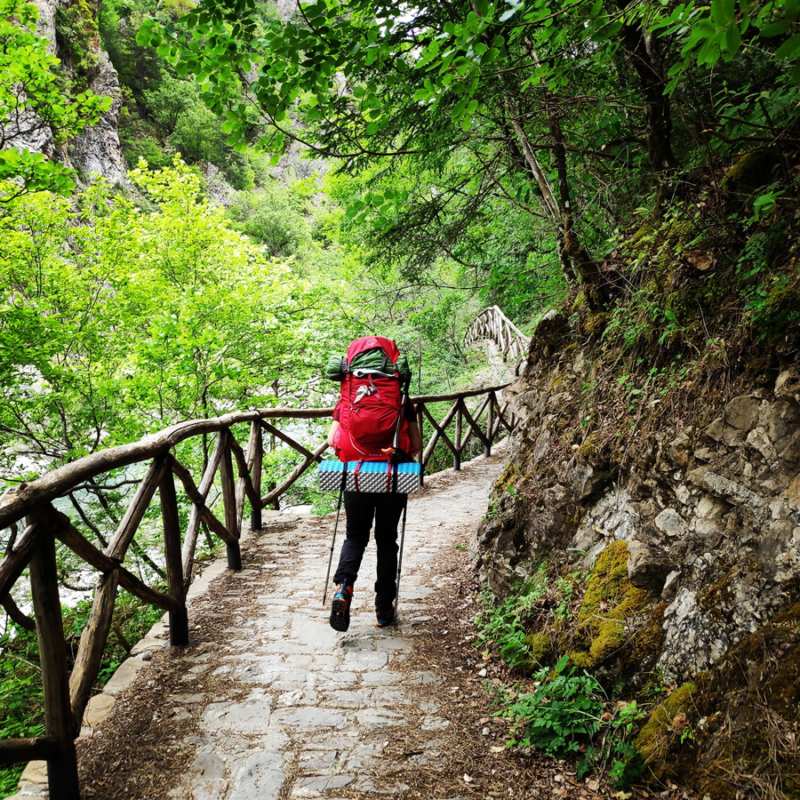
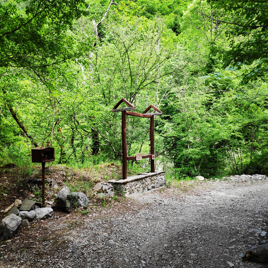
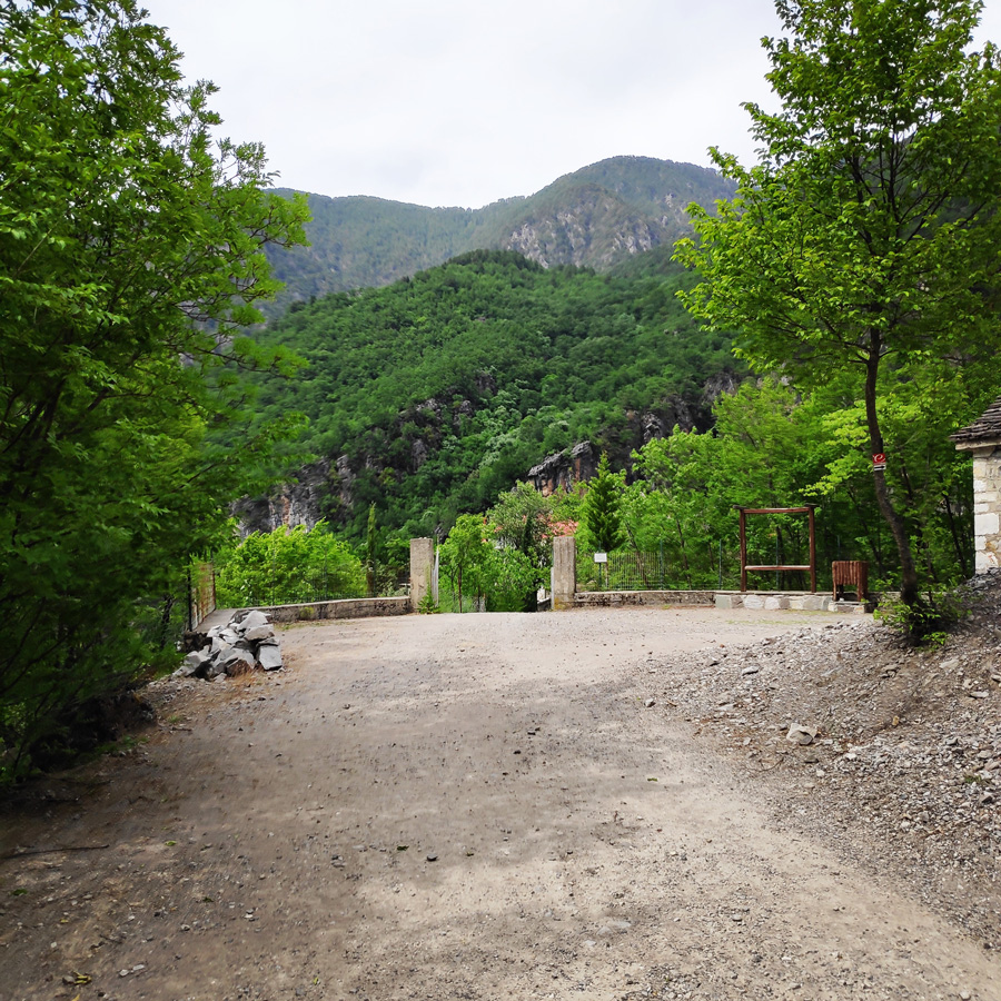
The route starts from the famous old bridge of Konitsa and at the beginning the trail is a paved road. If you have a 4×4 car, you can drive through this paved road for about 2 km and to park the car at the end of the paved road. You can recognise that point, by a wooden kiosk.
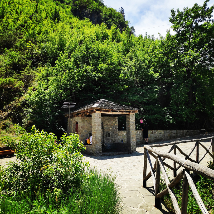
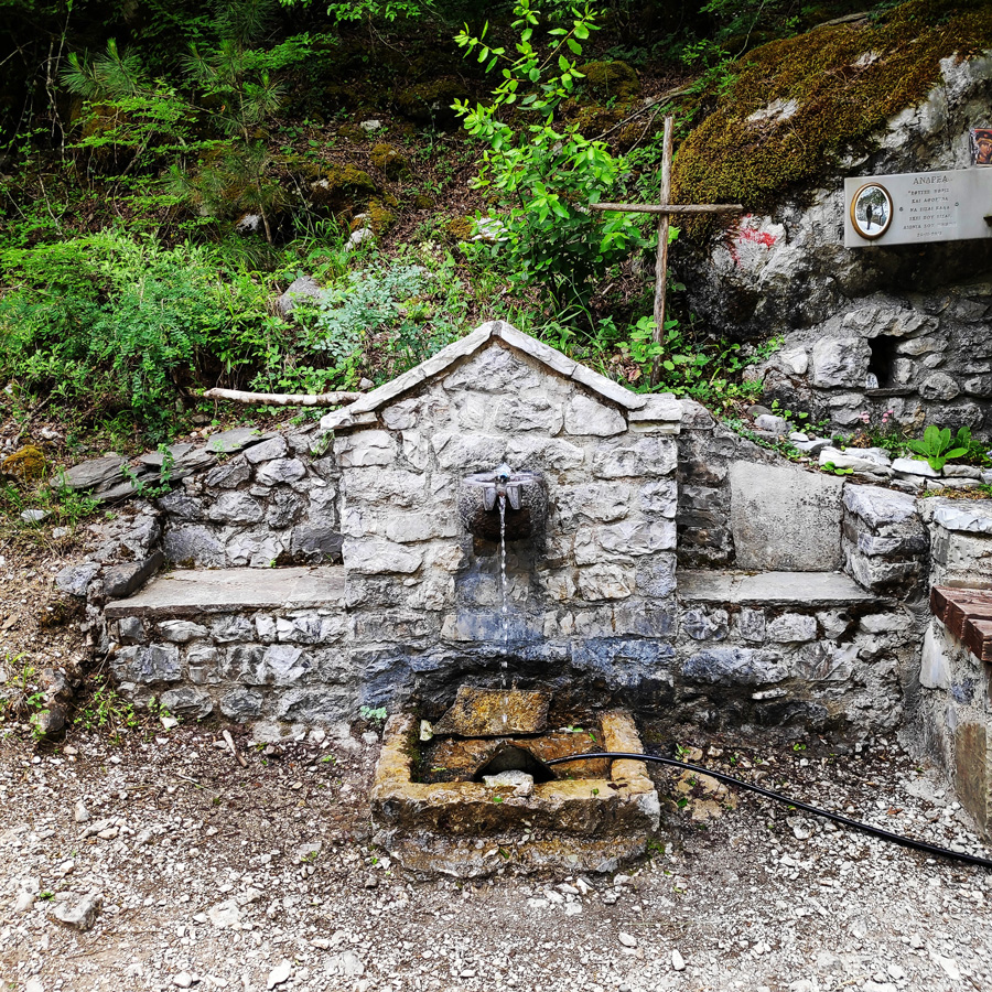
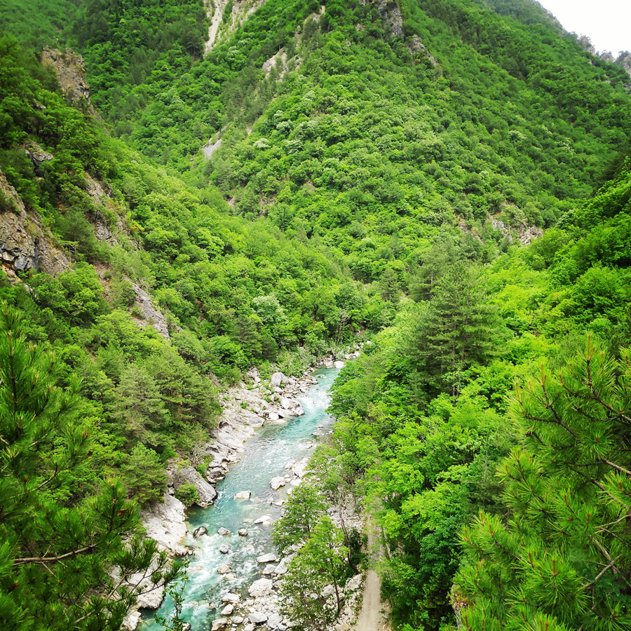
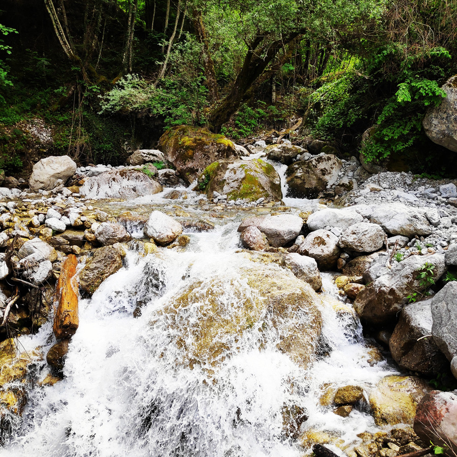
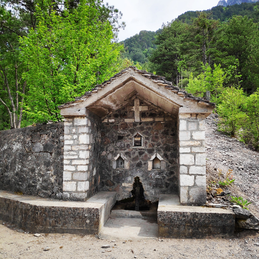
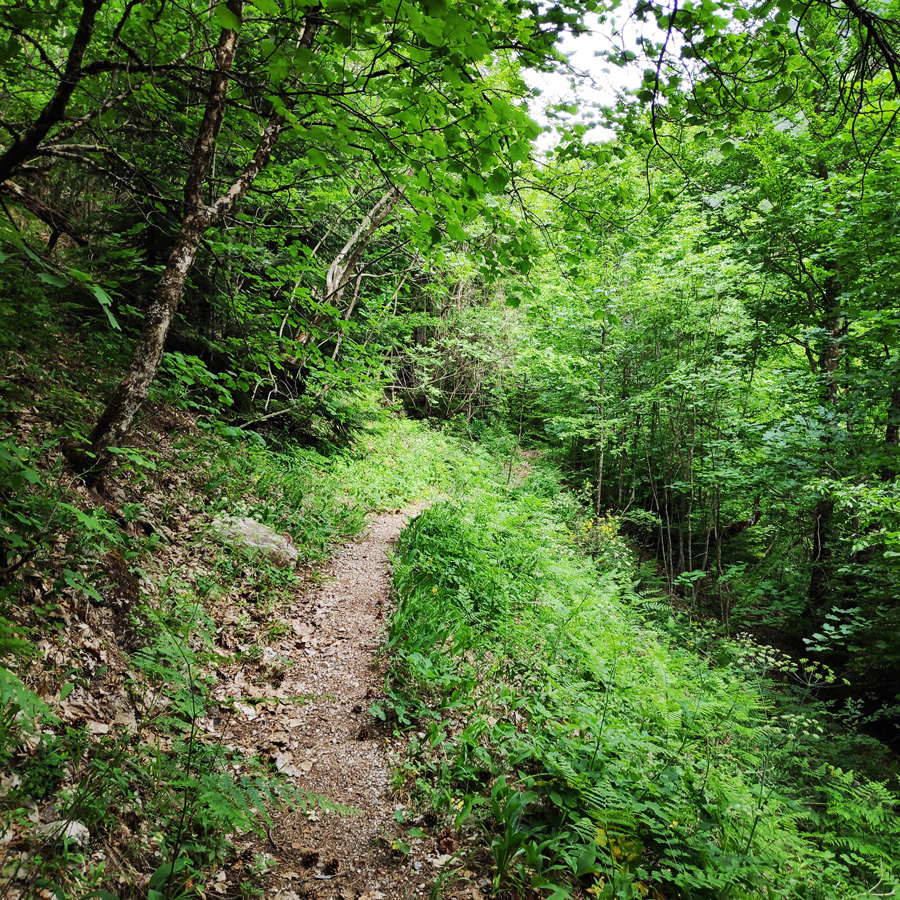
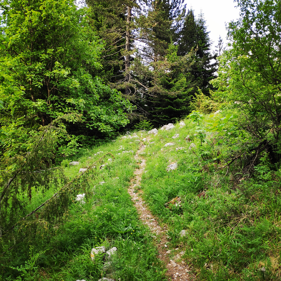
Having passed the kiosk, the actual trail starts and the first meters are done by the banks of Aoos river. The first part of the trail is very easy and rather flat. A first stop, can be done by a fountain, where actually the paved road splits with the trail that leads to Moni Stomiou.
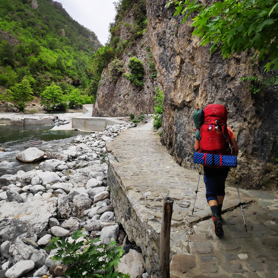
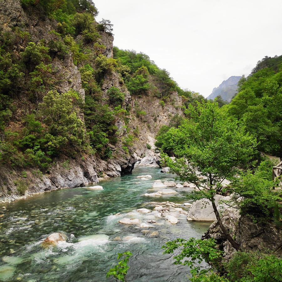
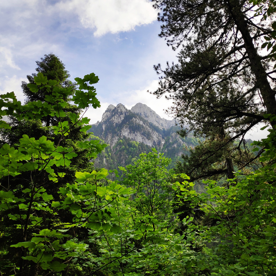
The trail moves along a beautiful forest and offers great views towards Aoos River, Trapezitsa peak and of course Moni Stomiou.
The hike up to the Monastery of Panagias Stomiou will take about 1.30 – 2 hours max.


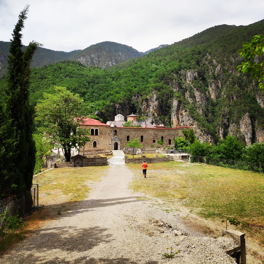
About Moni Stomiou (Monastery Panagias Stomiou)
In one of the most impressive locations of Greece, in the ravine of Aoos, between the steep slopes of Tymfi (altitude 2497 m.) And Trapezitsa (altitude 2024 m.) Is the Monastery of Panagia Stomiou.
The original location of the monastery, founded in 1442, is located on the opposite slopes of Trapezitsa, where the name “Old Monastery” is preserved. In its current location, in an elevated elevation of the lower altitudes of the slopes of Tymfi, it was moved by the abbot Constantine, in 1774. From the almost complete destruction of the Monastery by the German army in 1943, only the church survived.
Stomiou Monastery is today an active male monastery. It has 11 newly built cells with auxiliary spaces and a small cruciform-type catholic with a dome. The iconostasis with several Byzantine icons and the remains of many saints, which were transferred to the monastery from the Old Monastery, are interesting. The visit to the monastery is only a 2-hour walk from the bridge of Konitsa.
Explore all outdoor activities in a convenient list view here
Moni Stomiou – Kalogeriko
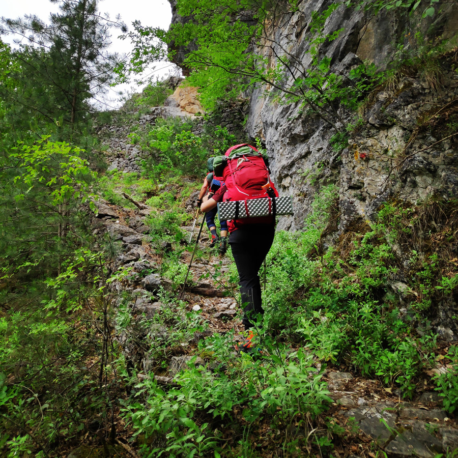
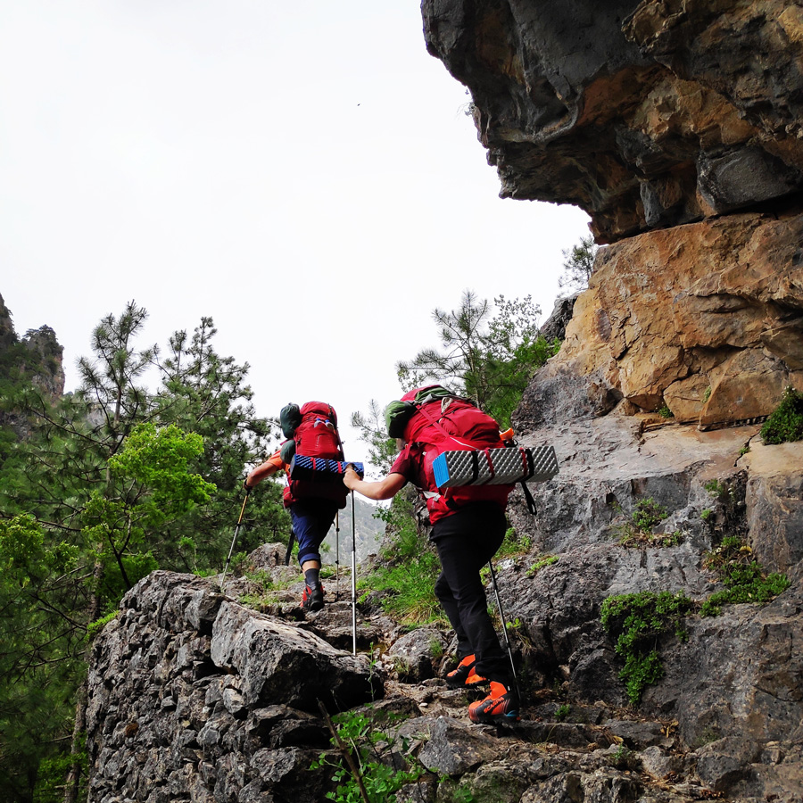
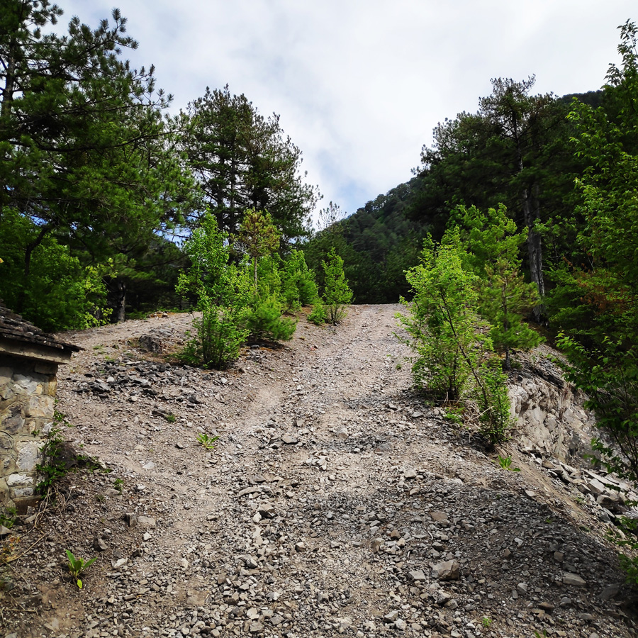
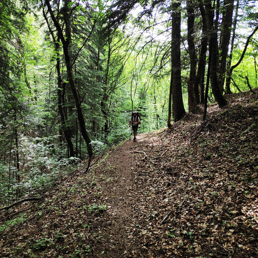
Upon a short break and a necessary water refill, we left this beautiful monastery and we hiked higher towards Kalogeriko. This time, the trail is a lot steeper and we had to cover about 900 meters of altitude difference. The hike is again easy in terms of seriousness and exposure, but nevertheless, is steep. Therefore, you should be aware that once you leave the monastery, the pace will be slower and therefore you have to make sure to have enough day light in front of you.
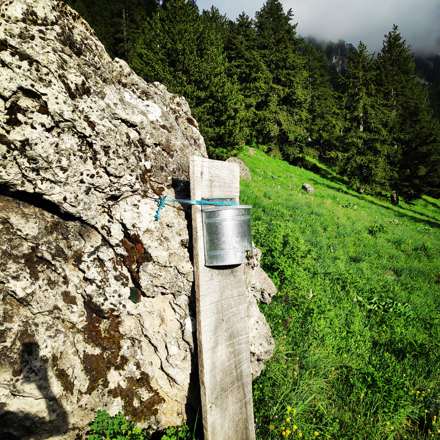
In addition, is very important to refill with water because from that point and on, during the summer months you won’t find any more water, until you reach Romiovrysi which is located nearby the Astraka refuge.
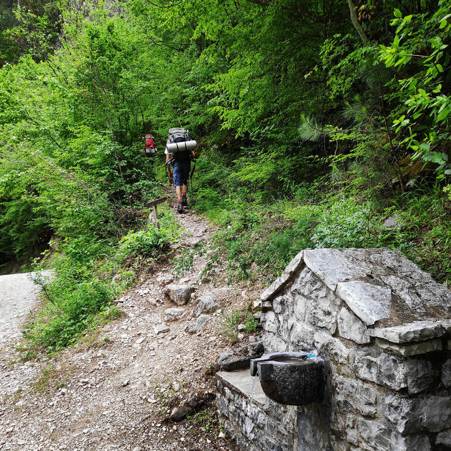
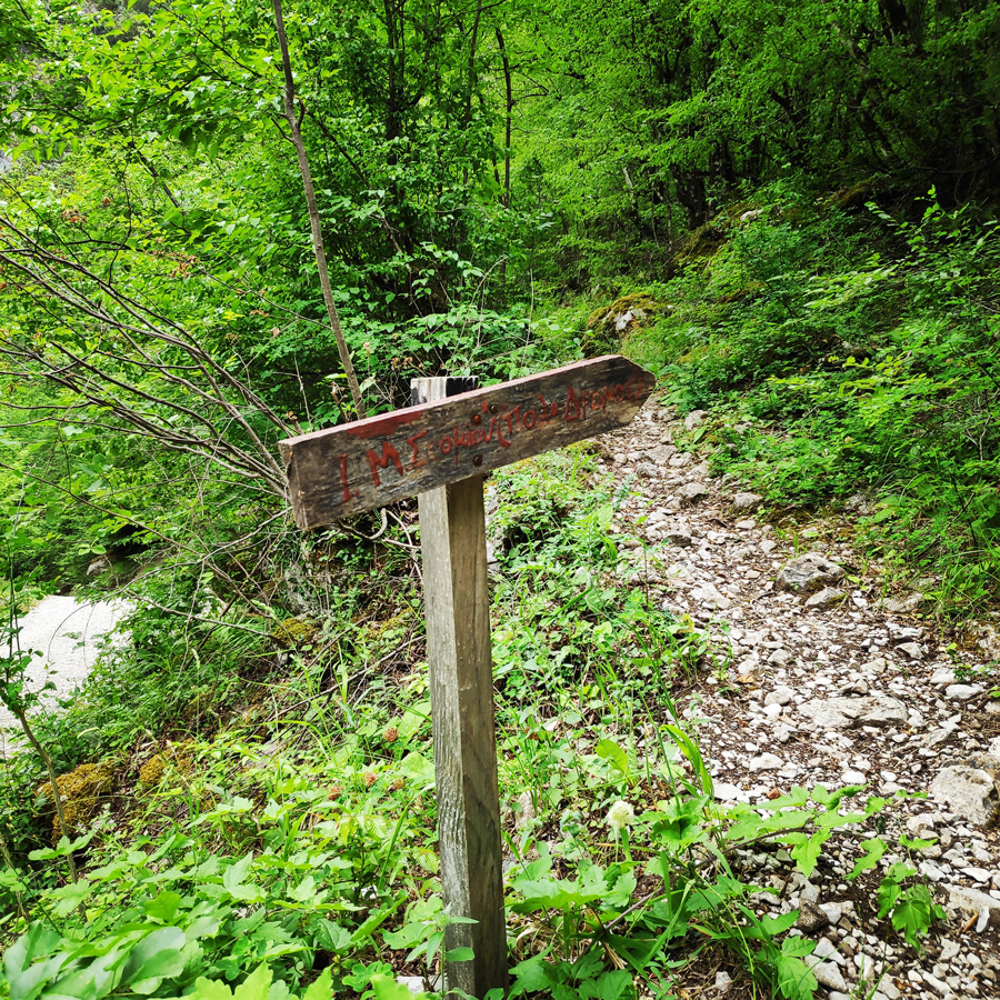
Kalogeriko – Sadi Migas – Mountain Hut
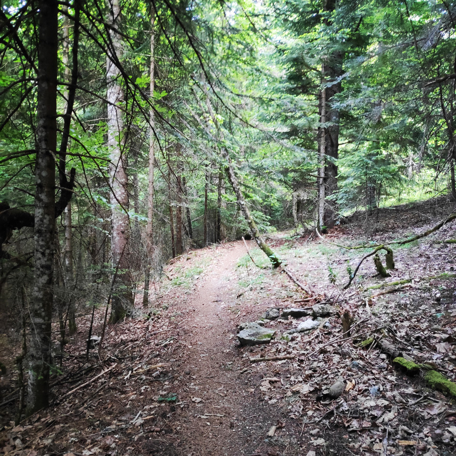
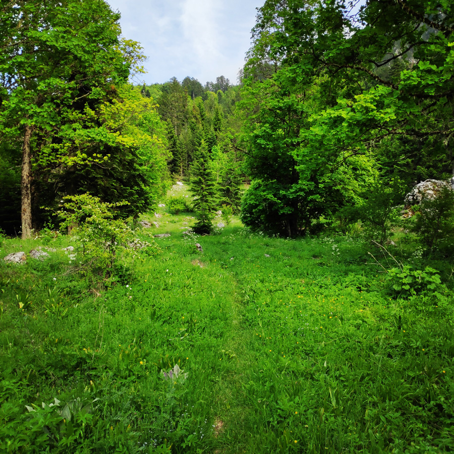
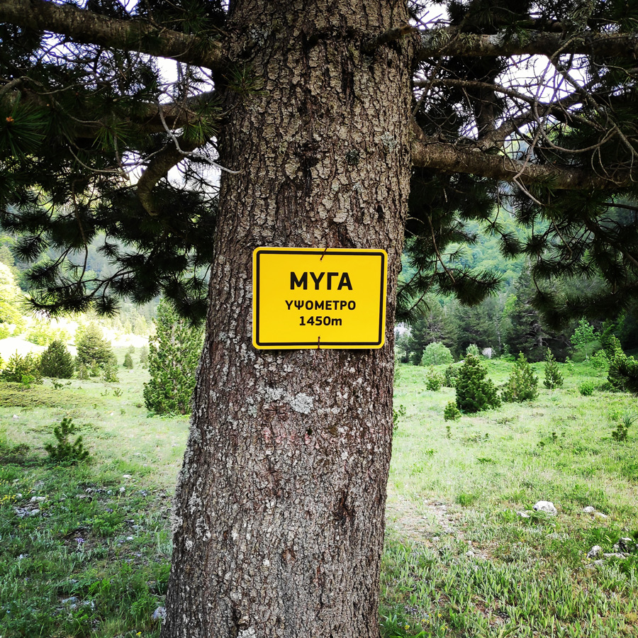
Having reached Kalogeriko, the most steep part of this section of the hike was completed successfully. Our next and final stop of the day would be a “secret” mountain hut which is located on a hill above Sadi Migas. The trail which leads to Sadi Migas, is less steep than the previous section. The path is well signed and within 30 – 45 minutes from Kalogeriko you will be reaching Sadi Migas.
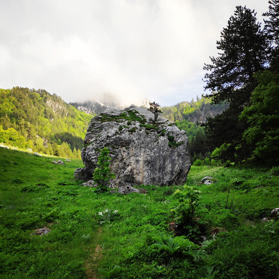
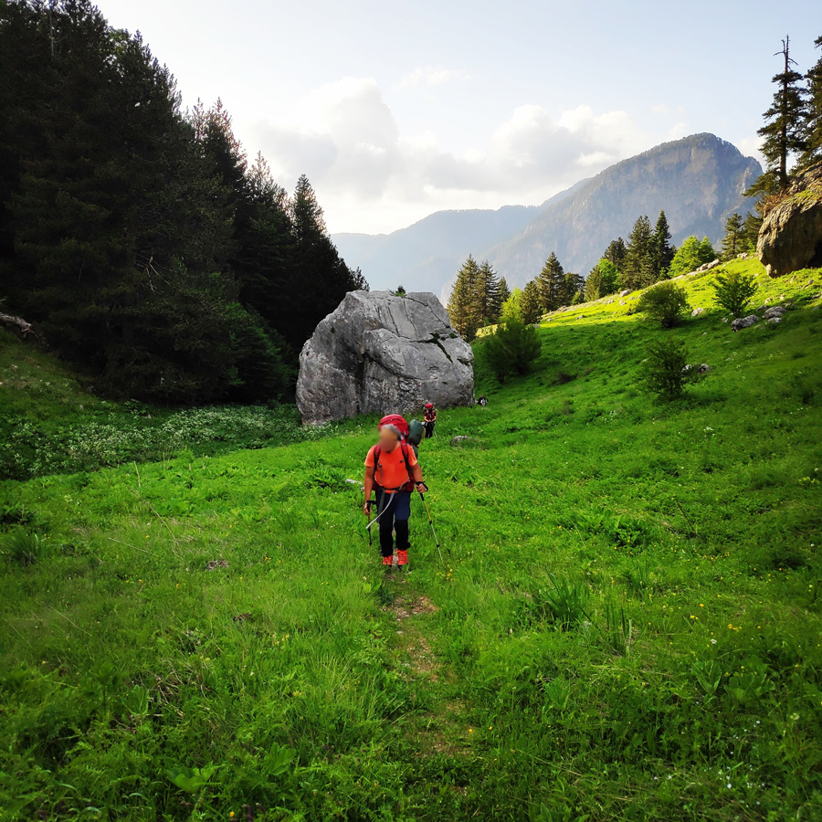
Carrying a tiny house on our backs, following a relentless steep uphill and gaining elevation quickly, we were all silently praying for a more benign inclination and longing for the promised plateau known as “Sadi Mιgas”, roughly translated as the Flats of the Fly – allegedly getting its title from being a traditional summer hangout of swarm of flies, drawn to the artificial waterhole gaping in its center.
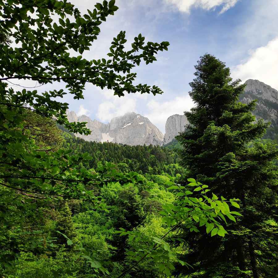
In this case, the waterhole was dry and arid and there was no exceptional gathering of flies or any other bugs whatsoever. Gasps and oh-my-god’s escaped our lips, as we entered the stunning secluded plateau, featuring a “welcoming committee” of two massive boulders, showing us to awe-inspiring views of Gamila Peak, looming to our right.

Check out more FREE Guidebooks
Download now for free! Explore breathtaking landscapes and conquer thrilling heights with our collection of guidebooks and topos.
Don’t miss out on this opportunity to elevate your outdoor adventures. Click, download, and let the exploration begin!
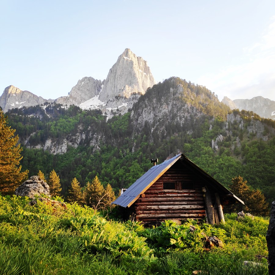
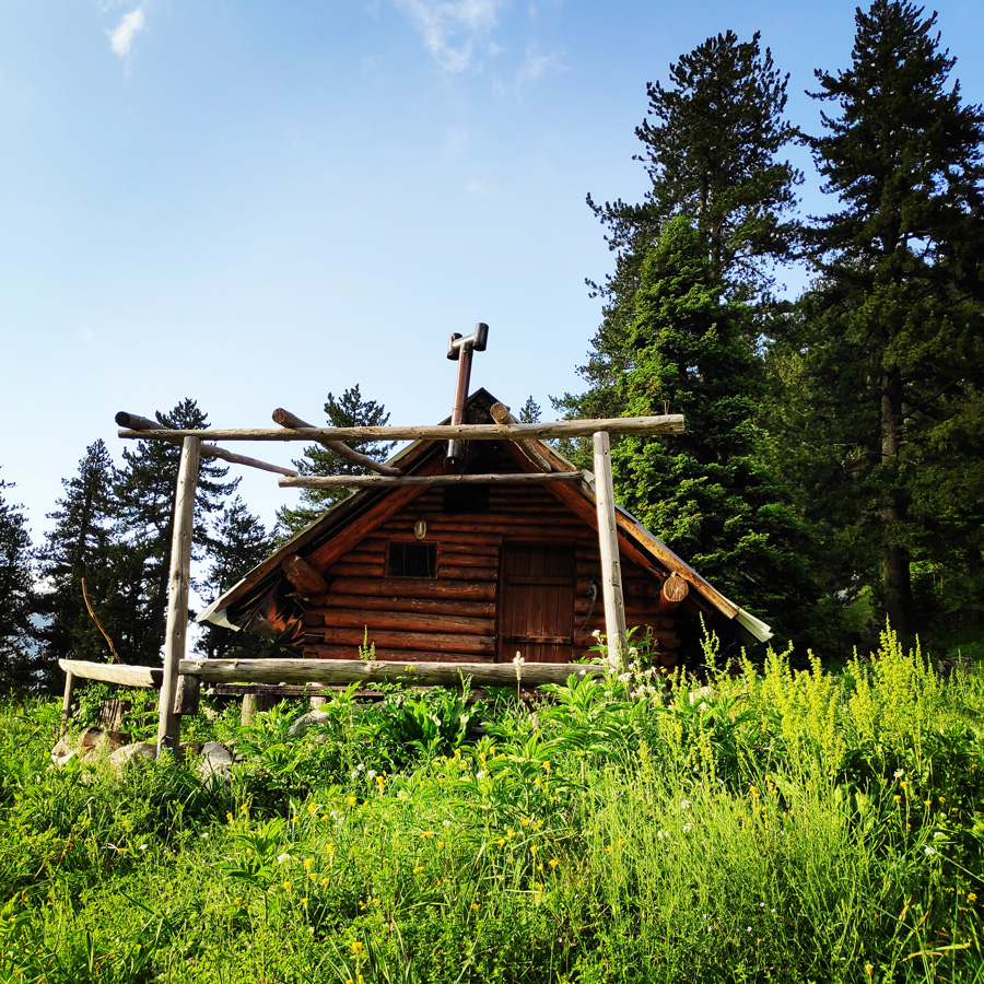
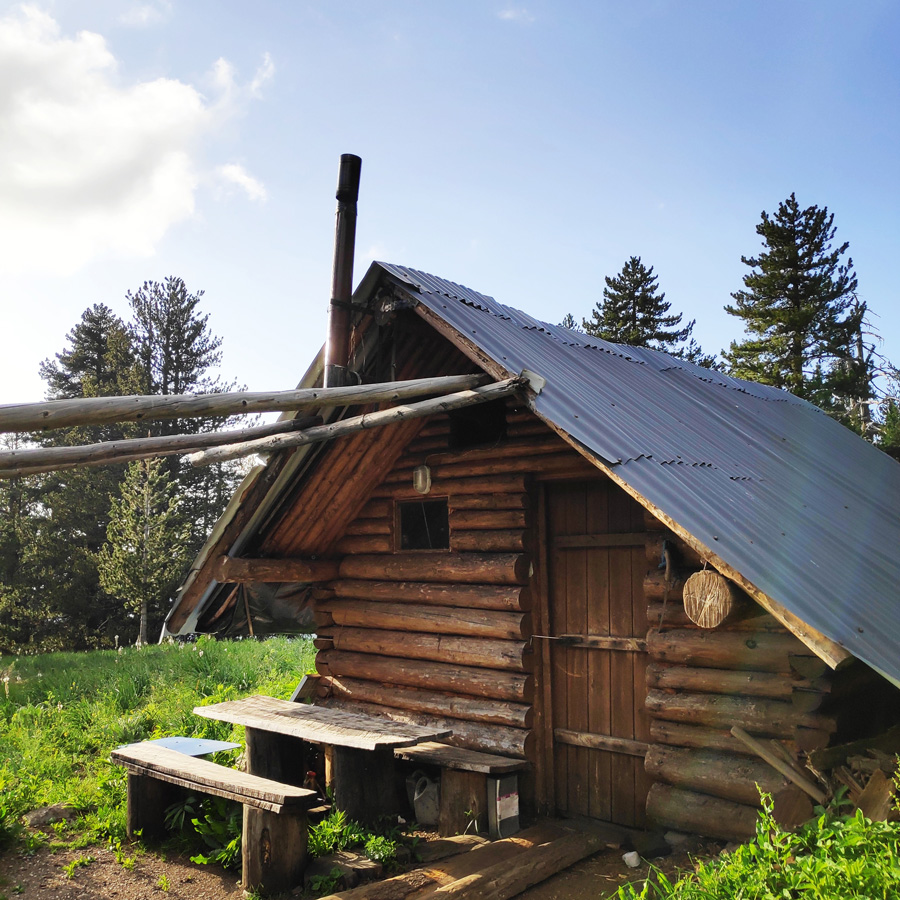
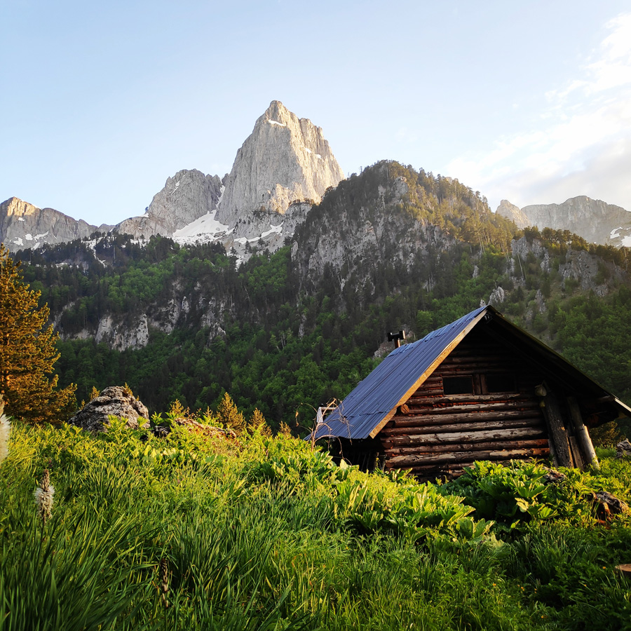
Mountain Hut at Sadi Migas
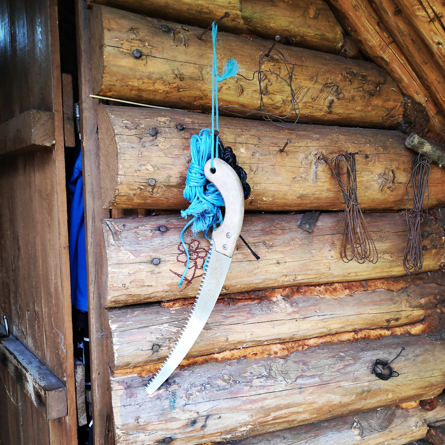
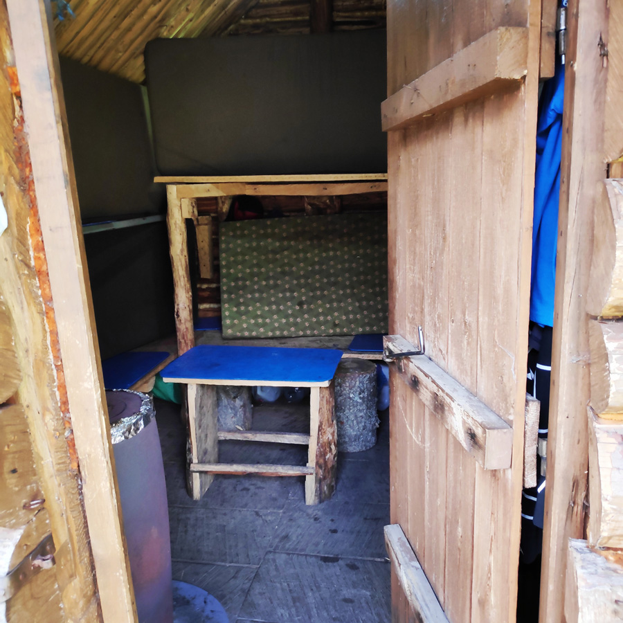
From Sadi Migas, we took no particular path, but a general sense of direction and orientation, assuming that it would be there or nowhere. As soon as we walked uphill for a few minutes, we traversed north, following a hint of a faint path –stampeded shrubbery namely–, and there it was: a cute tiny wooden cabin atop, with its chimney, its makeshift shower, its wooden table and benches waiting for us to liven it up with a well-deserved dinner and our tales and woes of the day.
We creaked the wooden, lock-less door open and we were surprised to discover two sets of bunk beds, a tiny “kitchen” with an indoor table and basic cutlery and, even, culinary tributes from the travellers before us. It was a most welcoming sight, after a challenging first day, during which we had to harden up and get used to trekking with 15 kg backpacks on our shoulders.
The decision was silently unanimous: we wouldn’t pitch our tents; we would instead opt for the convenience of the cabin, but also take our chances with the dusty mattresses and pillows. Apart from that, the general consensus was that we would have easily loved to retire for a whole day there (or even a lifetime, someone said), if it wasn’t for the lack of water and zero access to phone networks – which would probably send our folks and spouses back home calling for throngs of rescue teams for us.
We slept relatively well that night. We could hear various creaks from the wooden infrastructure and we could see small spider webs over our heads, but there is something especially serene in lodging in a solid, protected wooden structure and perhaps humans are naturally drawn to it. It wasn’t the cleanest, nor the most luxurious, but there had been selfless hard work put into it and this aura reigned in this snug little crib in the woods with the most impressive views of Mt. Tymfi.
This magnificent log cabin is located here: N40° 00.104′ E20° 49.110′


Gear & Equipment
For this trip, I was carrying the following main gear:
- Lowe Alpine Cholatse II 55-65 lt backpack
- Hilleberg Akto tent
- Cumulus Panyam 600 Hydrophobic Down sleeping bag
- Klymit Stativ V Ultralight sleeping pad
- Garmin Dakota 20 GPS device
- Cumulus Minilite Down vest
- Quechua Tech-Fresh 50 T-shirt
- Cumulus Incredilite Endurance jacket
- The North Face Verbera hiking boots
- Salewa Tec X Ice Axe
- Rock Empire Mackki crampon
- Rab Spark Waterproof Jacket
Support the journey — buy me a coffee
I share these articles and the climbing guidebooks because I love the outdoors, and they’ll always be free. If they’ve helped you, help me keep them coming. Click the button to support my work.
Details of the Hike:
- Location: Tymfi Mountain (Pindos)
- Starting Point: Konitsa
- Ending Point: Sadi Migas
- Trail Signs: Signed path
- Minimum Elevation: 441 m
- Maximum Elevation: 1.510 m.
- Total Distance: 8 km
- Hiking time: 4 hours (with easy pace – including the breaks)
- Difficulty: Medium
- When to Hike: Any time of the year (during winter time winter mountaineering gear is needed)
- Water Features: three
Bellow you can see the route we have followed on a map and on 3D:
Stay tuned for Part 2 and Part 3 of this hike
In the coming days, there will be the 2nd part of the Mount Tymfi (Pindos) North side Thru-Hike, so make sure to come back to this blog to see the exciting second part which consists of arriving to the Astraka Shelter via the famous and exciting Karteros Pass.
Subscribe & Stay Informed
Enter your email address to follow this blog and receive notifications of new posts by email
If you wish to see a Thru-Hike of Tymfi, but from the south side, check the following posts:
Mount Tymfi (Pindos) Thru-Hike Part 1 – Kapesovo – Mezaria Gorge – Vikos Canyon – Mikro Papingo
Mount Tymfi (Pindos) Thru-Hike Part 2 – ASTRAKA REFUGE – ASTRAKA PEAK
Mount Tymfi (Pindos) Thru-Hike Part 3 – Dragon Lake (Drakolimni)
Mount Tymfi (Pindos) Thru-Hike Part 4 – GAMILA – STOMA – MEGAS LAKOS -TSEPELOVO – KAPESOVO
Below: This map marks all the mountaineering adventures that have been featured on Olympus Mountaineering so far, including several Sport climbing crags – Select full screen to expand, zoom in for more detail, or click on a marker for a link to the post.

This looks like an incredibly scenic hike, although parts of the trail do look challenging. That’s awesome that you can stop to rest and refill your water mid-way at the monastery. The mountain hut looks beautiful tucked underneath the mountains. I totally would have slept inside it too, even with the dust and spider webs.
LikeLike
I absolutely agree with all you have said in your comment!
Stay tuned for Part 2 and Part 3, which are really breathtaking!
Thanks for your comment.
LikeLiked by 1 person
Absolutely incredible! I have seen so many pictures of Greece but they’re always of the towns and coastal areas. Never have I seen anything that comes close to this place. Your pictures of the hut in front of the mountains is breathtaking. Just wow!
LikeLike
I understand what you mean. Most of the people, when they think about Greece, they usually think of sea and white houses on the islands.
On the contrary, Greece is a very mountainous country and this route, is perhaps one of the nicest routes I have done in Greece.
Thanks for reading through this post.
LikeLiked by 1 person
Wow..wow..superb! What an adventure!! Thanks for showing the beautiful and different part of Greece. Awesome captures!! Keep exploring 🙂
LikeLike
Thanks for such positive feedback!
LikeLiked by 1 person
You’re taking me to parts of Greece that I never knew existed. This hike is particularly appealing to me, especially with those views of Gamita Peak! By the way Reader wouldn’t me comment on this post, it wanted me to register, I had to go to the mobile app.Not sure if it’s your site or WP.
LikeLike
I am glad you liked this post and you had the chance to see such part of Greece. Mt. Tymfi and overall Pindos range of mountains offers great hikes and other outdoor activities.
Furthermore, there are many beautiful villages, especially in Zagori area.
With regards the comments, thank you for letting me know. I didn’t do any change, so I guess is something from WP, that I will have to investigate.
Thank you again for the comment and for informing me you had difficulty to comment.
LikeLiked by 1 person
Wow, this looks stunning!
LikeLike
Indeed, Diana. What a magical place, isn’t it?
LikeLiked by 1 person
Very well done!!! Such mouth dropping views. Definitely in the to-do list.
LikeLike
I highly recommend this route.
I gully agree with you with the “mouth dropping” views, and stay tuned for Part 2 and Part 3.
As. you might already know, Mt. Tymfi is amazing!
LikeLike
Pingback: Mount Tymfi (Pindos) North Side Thru-Hike Part 2 – Sadi Migas – Karteros Pass – Astraka Refuge – Olympus Mountaineering
Well done! I absolutely LOVE a good mountain traverse with huts. The water fountains at the start are so nice. I wish every hike had a fresh water station like that. It’s a nice mix of established trails, and then it peters out into wilderness. It looks like you had the hut to yourselves as well, which is also nice. I can’t wait for parts two and three!
LikeLike
Hi Alisen and thank you for your comment.
This mountain traverse/crossing is indeed one of the nicest in Greece and the mountain “hidden” hut was the highlight of that day.
Although this hut was fully equipped, which means that is being visited often (perhaps from the locals), we had the chance to enjoy it all by ourselves.
LikeLiked by 1 person
I’m sure you mentioned this in your blog, but do you pre-book the huts? In Canada, the huts are owned and maintained by the Alpine Club of Canada.
LikeLike
Here in Greece, you can either pre-book your stay in the hut or not. Though, in popular destinations and especially the weekends, is always better to pre-book so you are 100% sure there will be a place fo you.
Mountain huts are either managed by the local mountaineering clubs, or are sub-rented to individuals that run them throughout the season.
In most organised mountain huts in Greece, you also have the chance to have dinner and breakfast and actually of rather good quality.
In the case of this blogpost, the mountain hut we stayed, is considered an emergency hut, thus is not managed by someone and there are no costs to stay. The only thing everyone should do is to take care of while the stay and leave it clean upon departure.
LikeLiked by 1 person
Oh, I love the European huts with the full breakfast and dinner. I was in Slovakia before Covid, and it was so nice to have a hot meal that I did not have to carry up myself.
Thanks for the info on the hut bookings. I guess most of our Canadian huts would seem like emergency shelters to you, but that’s all we have. No catering available.
I look forward to more of your adventures.
LikeLike
Pingback: Mount Tymfi (Pindos) North Side Thru-Hike Part 3 – Astraka Refuge – Davalista – Konitsa – Olympus Mountaineering
This hike looks incredible. I love the start on that beautiful bridge and the fact that it takes you through stunning natural scenery and also historically significant monuments like the monastery (we don’t usually get this combination in Canada). That hut is so cute.
LikeLike
It was indeed a great first day.
The monastery had a wonderful spot just under Trapezitsa (peak) and above Aoos river.
I can imagine that in the vastness of Canada, is not so easy to come across such historical monuments.
But again, Canada, is full of nature and wilderness.
Thanks for reading and your comment.
LikeLiked by 1 person
Pingback: Hiking in Zarogi – Villages and Stone Bridges – Greece (family friendly) – Olympus Mountaineering
Pingback: Mount Tymfi (Pindos) North Side Thru-Hike Summary – Olympus Mountaineering
Pingback: Hiking to Balta di Stringa Waterfall – Iliochori – Zagori (Tymfi) – Olympus Mountaineering
Pingback: A Family Adventure in Greece: Top 10 Hiking Routes for Nature-Loving Families – Olympus Mountaineering