Hiking on Mount Mainalo – Traversing Ostrakina to Mavri Korifi (Black Peak)

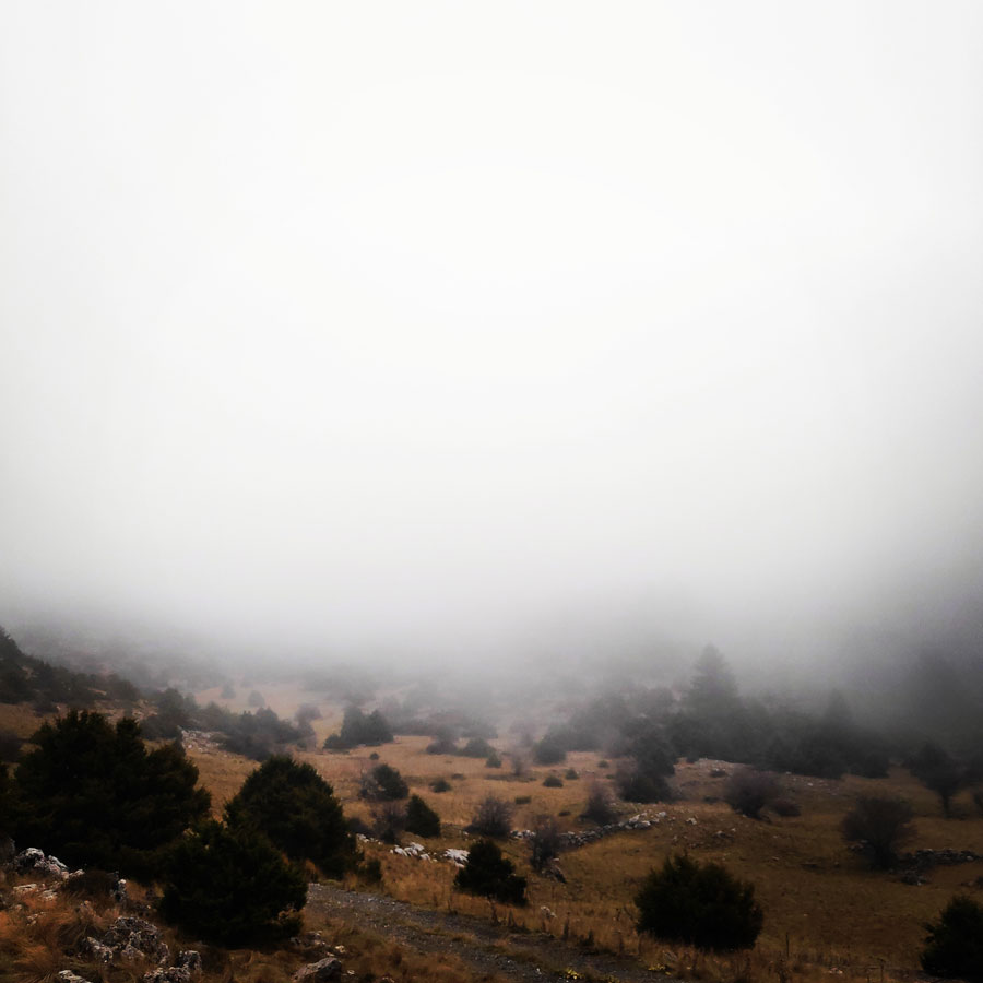
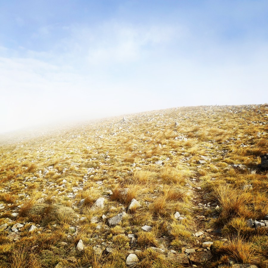
Autumn is a really nice season and full of surprises while adventuring in the outdoors. One day can be with beautiful sunny conditions, the day after the scenery can change dramatically and become full of mist and fog. This is what actually happened on our last visit on Mainalo mountain.

The climate of the area is quite unique given the elevation. The range feels more like the PWN than the alps, this is due to the high forestation and large amounts of precipitation in the area. The range is very humid and rather cold boasting some of the coldest fronts in Greece, easily falling under -10C during storms. The area has stable weather and gets storms for multiple days although harsh weather is a staple of the area, quick changes of weather during storms (i.e. from rain to no rain, from cloudy to snowy) is another problem.

Mainalo_Menalo_Mountain_Ostrakina-Mavri_Koryfi_Travere_20181125_201155_514
early morning view from my tent
Continue reading “Hiking on Mount Mainalo – Traversing Ostrakina to Mavri Korifi (Black Peak)”

Hiking on Mount Mainalo – Tzelati Peak

Mount Mainalo, with almost 2000 m altitude (Ostrakina Peak) is one of the most mysterious mountains of Greece. It dominates the middle of the Peloponnese and is distinguished for its natural wealth and beauty. On its lush green slopes, since the dawn of the world man became a predator, architect, and musician, learned to live in towns, discovered the charms of art, the assistance of divination and met face to face with God.

Last time we have visited Mount Mainalo (or Menalo) was for a winter mountaineering ascent a couple of years ago. Now, a couple of years later on, it was again time to visit Mainalo, wich was named after the mythical Maenalus.

Mainalo_Menalo_Mountain_Refuge_Tzelati_20181125_174336_738
EOS Tripolis Refuge
Continue reading “Hiking on Mount Mainalo – Tzelati Peak”

Taygetus Mountain Crossing Pentadaktylos (Five Fingers) – Anavriti – Tsarkos – Spanakaki – Sidirokastro – Athanati Rachi – Profitis Elias – EOS Refuge

It has been quite some time since the last update on Olympus Mountaineering blog. This summer was rather busy and rather hot, so the high peaks had to wait for the beginning of the Autumn. As first mountaineering adventure for this new season was -once again- selected the beautiful mountain of Taygetos (or Taygetus).

Taygetus, is a mountain range in the Peloponnese peninsula in Southern Greece. The highest mountain of the range is Mount Taygetus, also known as the “Profitis Ilias”, or “Prophet Elias”. The name is one of the oldest recorded in Europe, appearing in the Odyssey. In classical mythology, it was associated with the nymph Taygete. During Byzantine times and up until the 19th century, the mountain was also known as “Pentadaktylos” which means “five fingers” in Greek. The name was related to the 5 peaks of the mountain range.

Taygetos_Pentadaktylos_Anavriti_Crossing_1219
Starting point Anavriti Village
Continue reading “Taygetus Mountain Crossing Pentadaktylos (Five Fingers) – Anavriti – Tsarkos – Spanakaki – Sidirokastro – Athanati Rachi – Profitis Elias – EOS Refuge”

Hiking in picturesque villages Kallarites and Syrrako

The region of Pindos is an amazing place and full of pleasant surprises. Having been in this region several times, I have also decided to do a small hike between two beautiful picturesque villages, Kallarites and Syrrako.

This hike was done just few hours after the completion of the Lakmos mountain crossing and after a very peaceful night I have stayed on the Alpine lake of Verliga.

Kallarites_Syrakko_9311
From Kallarites to Syrrako
Continue reading “Hiking in picturesque villages Kallarites and Syrrako”

Hiking in South Pindos – Lakmos Mountain Pt.01 | Anthochori – Tsoukarela Peak – Verliga Alpine Lake

It’s almost summer and it’s perfect time for Long Distance mountain crossing. This time, we have decided to visit one of the nicest mountainous areas of Greece and specifically, the area of south Pindos.

The Pindos (also Pindus or Pindhos) (Greek: Πίνδος) mountain range is located in northern Greece. It is roughly 160 km long, with a maximum elevation of 2,637m (Mount Smolikas). Because it runs along the border of Thessaly and Epirus, the Pindos range is known colloquially as the spine of Greece. The mountain range stretches from near the Greek-Albanian border in Northern Epirus, entering the Epirus and Macedonia regions in northern Greece down to the north of the Peloponnese. Geologically it is an extension of the Dinaric Alps, which dominate the western region of the Balkan Peninsula.

Lakmos_Peristeri_Verliga_9204
Starting point – Anthochori village
Continue reading “Hiking in South Pindos – Lakmos Mountain Pt.01 | Anthochori – Tsoukarela Peak – Verliga Alpine Lake”

Hiking and Crossing Lambia Mountains

Lambia Mountains or Lampia or Lampio (Greek: Λάμπεια όρη) are a branch and ridge of Erymanthos mountain, located in the Peloponnese, and are administratively owned by Ilia. Its highest peak is “Analipsi” at an altitude of 1,795 meters above sea level.

The name of this mountains come from the “shine of the snow” on the top of the mountain where the sunlight strikes it on its highest points. From Lambia Mountains, many tributaries of the Pineios spring . On the slopes of Lambia mountains there are various villages such as Divri (or Lambia), Kryovrisi, Kalyvia Kryovrisi, Tsipiana, Astras, Oreni, Amigdali, Kresova and Agia Kyriaki.

Lambia_Ori_Tsipiana_Analipsi_Dirvi_8154
Starting Point Tsipiana Village
Continue reading “Hiking and Crossing Lambia Mountains”

Hiking and Scrambling on Oligyrtos’ peak Chionotripa

Oligyrtos is a mountain located at the junction of Arcadia, Corinthia and Argolis in the northeastern Peloponnese in Greece. The mountain diagonally stretches from southwest to northeast, with about 35 km length and 15 to 20 km breadth. Its highest point is the peak Skipiza, at 1,935 m elevation. Other peaks are Gkrimini (1,831 m), Parnias (1,800 m), Skiathis (1,777 m) and Mavrovouni (1,695 m).

Neighbouring mountain ranges are Kyllini (Ziria) to the north, Mainalo to the southwest, Mount Trachi to the south and Chelmos (Aroania) to the northwest. Local flora consists mostly of grasslands and bushes. Pine trees and barren lands are found in higher areas. It is drained towards the Lake Stymphalia (which is located nearby Lake Doxa) to the north, and towards the plain of Kandila to the south.

Mount_Oligyrtos_Chionotripa_Grimini_7827
Starting point of the route. Lafka Village – Saint Athanasios Square.

Continue reading “Hiking and Scrambling on Oligyrtos’ peak Chionotripa”

Hiking in Ermionida – Ermioni – Kranidi (Argolis) Part 03 | Katafyki Gorge

About 5 km away from Ermioni there is a great hiking opportunity in Katafyki Gorge. This route is suitable for all the family due to the easy trail of only 2,5 kilometres. The wild beauty of this gorge will astonish you. Of course, this route can be extended up to 7 kilometres if one wants to hike from Katafyki Gorge up to the village of Fournoi.

Katafyki gorge is a beautiful natural landscape, located between the villages of Fournoi and Ermioni. It consists of a protected area of outstanding beauty and a wild life refuge that attracts the most demanding visitors. Hikers can leave their car in Ermioni and take the path that passes through the dense vegetation of pines, laurels, myrtles, shrubs and other endemic plants. The sound of the running water and the presence of rare animals and wild birds give the impression of an earthly paradise. The imposing rough rocks host mysterious caves, one of which is said to consist of the entrance to the underworld, the point from where Hercules found Cerberus. The locals narrate stories of various offenders that used the caves as refuge.

Ermioni_Katafyki_Katafiki_6467
Start/End point of the Katafyki trail

Continue reading “Hiking in Ermionida – Ermioni – Kranidi (Argolis) Part 03 | Katafyki Gorge”

Hiking in Ermionida – Ermioni – Kranidi (Argolis) Part 02 | Pikrodafni – Avlona – Crow Hill – Pikrodafni

Spring time in Greece is one of the best seasons. Weather conditions are optimum almost on daily basis where there is clear blue sky but the sun is not burning hot as it becomes during summer time. In fact, during, spring time one can go for an alpine climb with neve and snow and just after that can go for a refreshing dive into the crystal clear blue sea waters of Greece.

For this spring, I have decided to explore the trail paths of a small town in the east of Peloponnese called Ermioni. Ermioni is a small fishing town of Argolida (Argolis) at the east of Peloponnese. The traditional taverns, the cafes, the paved streets, the beautiful houses and the crystal clear beaches around this area are some of the reasons this town is an interesting summer destination of Peloponnese. While travelling around this area you will have the chance to admire the olive and the pine trees and plenty of bays with turquoise water.

Hiking-Ermioni-Argolis_5704
Beginning of the trail

Continue reading “Hiking in Ermionida – Ermioni – Kranidi (Argolis) Part 02 | Pikrodafni – Avlona – Crow Hill – Pikrodafni”

Hiking in Ermionida – Ermioni – Kranidi (Argolis) Part 01 | Ermioni – Ag. Anargyroi – Pikrodafni – Ermioni

Having enjoyed some more heavy duty winter mountaineering activities, it is time to do some simple hiking in a rather unexplored area of Greece, Ermioni.

Ermioni is a small fishing town of Argolida (Argolis) at the east of Peloponnese. The traditional taverns, the cafes, the paved streets, the beautiful houses and the crystal clear beaches around this area are some of the reasons this town is an interesting summer destination of Peloponnese. While travelling around this area you will have the chance to admire the olive and the pine trees and plenty of bays with turquoise water.

Wandering around this town you will definitely feel like you are on an island. You can walk on the paved streets until the slope of the ancient hill “Pronos” where you will find the beautiful chapel of Agia Kiriaki. When you arrive at the chapel you will be rewarded with the beautiful view of the sea and the plains where olive trees, citrus trees and pomegranates are cultivated. Ermioni, besides being a very picturesque town is also the harbour that leads to Hydra island and not far from there, one can find Spetses island too. Continue reading “Hiking in Ermionida – Ermioni – Kranidi (Argolis) Part 01 | Ermioni – Ag. Anargyroi – Pikrodafni – Ermioni”