It has been quite some time since the last update on Olympus Mountaineering blog. This summer was rather busy and rather hot, so the high peaks had to wait for the beginning of the Autumn. As first mountaineering adventure for this new season was -once again- selected the beautiful mountain of Taygetos (or Taygetus).
Taygetus, is a mountain range in the Peloponnese peninsula in Southern Greece. The highest mountain of the range is Mount Taygetus, also known as the “Profitis Ilias”, or “Prophet Elias”. The name is one of the oldest recorded in Europe, appearing in the Odyssey. In classical mythology, it was associated with the nymph Taygete. During Byzantine times and up until the 19th century, the mountain was also known as “Pentadaktylos” which means “five fingers” in Greek. The name was related to the 5 peaks of the mountain range.
The Taygetus (Taygetos) Massif is about 100 km (62 mi) long, extending from the center of the Peloponnese to Cape Matapan, its southernmost extremity. It contains the tallest mountain in the Peloponnese, the Profitis Ilias summit, reaching 2,407 m (7,887 ft); this is probably the classical Mount Taléton mentioned by Pausanias.The summit is an ultra prominent peak.
Check out previous ascent on Mount Taygetus (Taygetos) here:
- Mount Taygetus Winter Ascent
- Climbing in Taygetos Mountain
- Taygetus Mountain Autumn Ascent via Athanati Rachi
The mountain provides plenty of hiking routes which are well signposted and attract a lot of travellers during the summer period. At the winter the snow makes the climbing quite difficult and special equipment is necessary. One of the most rewarding experiences is reaching the top of the mountain with the chapel of Prophet Elias and the breathtaking view of Peloponnese, but perhaps the most exciting adventure on this mountain is to do the “Pentadaktylos” (five fingers) crossing. This is the route we have selected to hike this time. Our starting point was the picturesque village of Anavriti which is located at an altitude of 850 meters above sea level.
Support the journey — buy me a coffee
I share these articles and the climbing guidebooks because I love the outdoors, and they’ll always be free. If they’ve helped you, help me keep them coming. Click the button to support my work.

Anavriti – Livadi – Tsarkos
Our starting point was the small village named Anavriti. Anavriti is a small village in Laconia, Greece on Taygetus mountain,. Above the Evrotas valley, Anavryti is traversed by European walking route E4. It is part of the municipal unit of Mystras.
A paved road to Anavryti was built in the 1980s with donations sent by the Anavryti Hometown society in Astoria, Queens, New York. Until that time, the village could only be accessed on foot or by donkey.
Over the years the village has been established as an eco-tourism destination. The many walking paths combined with its landscape makes the area popular with photographer. The village has a simple hotel and restaurants.
In Anavryti’s Geological Museum, a variety of elements and pictures related to the fauna and flora of the village and its surroundings are exhibited. There is also an exhibit about Mount Taygetus.
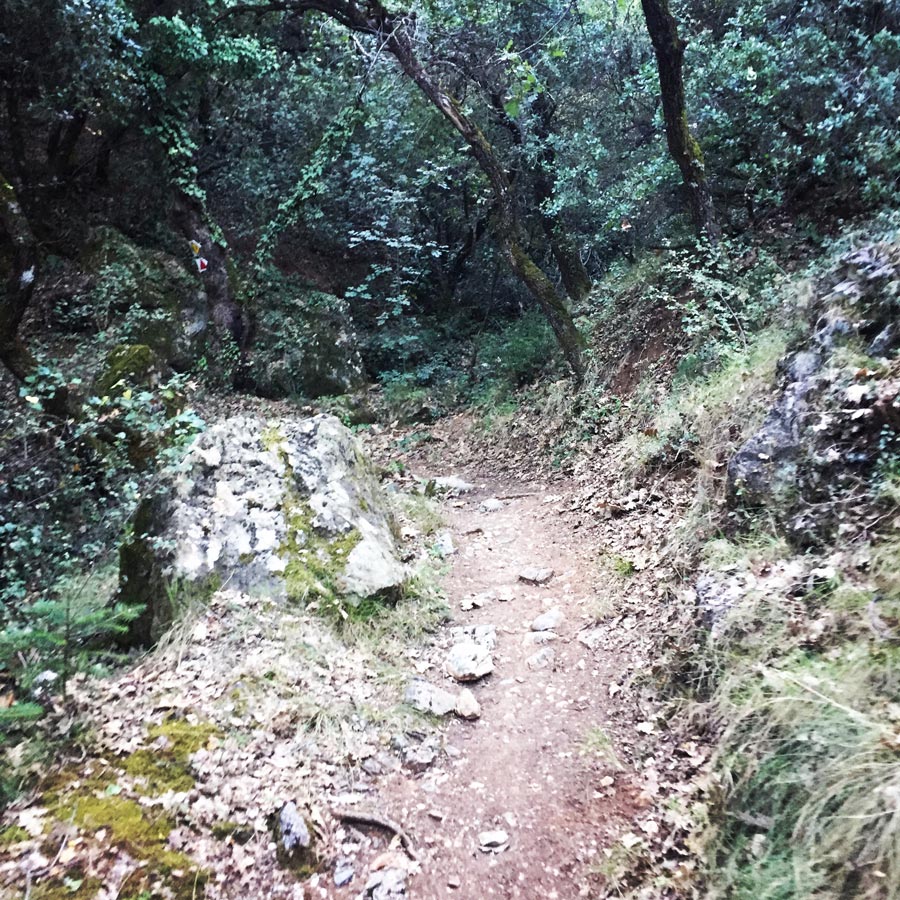
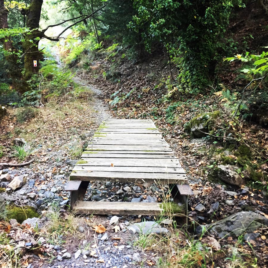


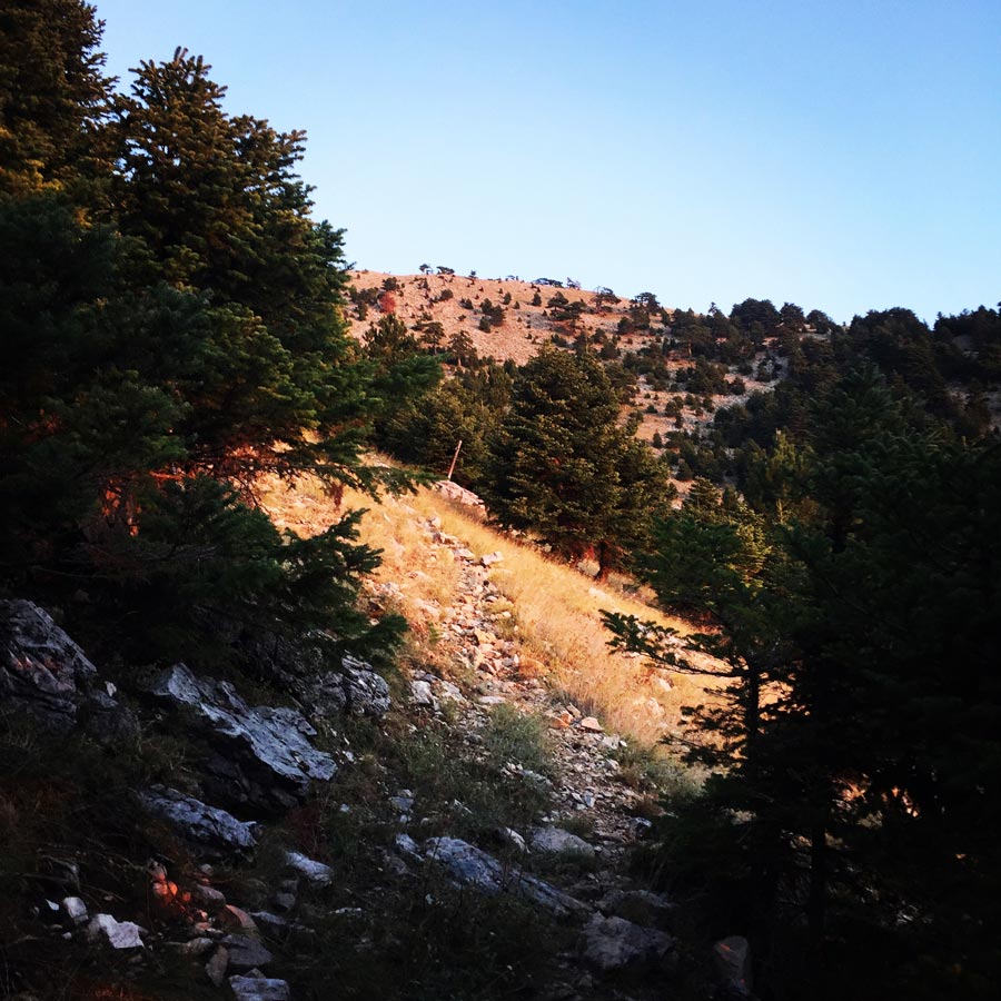
The first part of the trails is a very easy, well signed and a bit steep trail. It crosses a small creek and the entire trail in under the beautiful pine trees of Taygetos mountain.
At certain point, we came across a sign which was indicating the crossroad of multiple trails. One trail was heading directly to the mountain hut of mount Taygetos which happens to be the E4 trail path and the other trail was towards the location of Livadi. We followed the one that was leading to Livadi, where we have spent the night.
Although our backpacks were very heady with all equipment and more than 5 litres of water each, we have managed to reach Livadi within 1 hour and 45 minutes since our departure from Anavriti village. We had to carry so much water, because for almost 2 days we would not have access to any water feature. It was almost dark when we have reached Livadi and therefore we have set up very soon our shelters. For this trip, I was carrying my Hilleberg Akto tent because I wanted to have minimum weight and volume within my Lowe Alpine Cholatse II backpack.
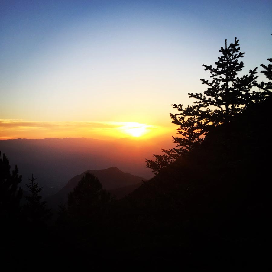
Just before entering into the Hilleberg Akto I wanted to watch the night sky and it was simply beautiful. I wish the camera of my phone (that I take all photos) could capture this mystical experience the Taygetus’ night sky had to offer. Having watched the starts for sometime, I entered in my Cumulus Panyam 600 and I had a pleasant sleep till around 6 a.m.

Check out more FREE Guidebooks
Download now for free! Explore breathtaking landscapes and conquer thrilling heights with our collection of guidebooks and topos.
Don’t miss out on this opportunity to elevate your outdoor adventures. Click, download, and let the exploration begin!


Tsarkos – Spanakaki – Unonymus 2.229 – Sidirokastro – Athanati Rachi – Profitis Elias
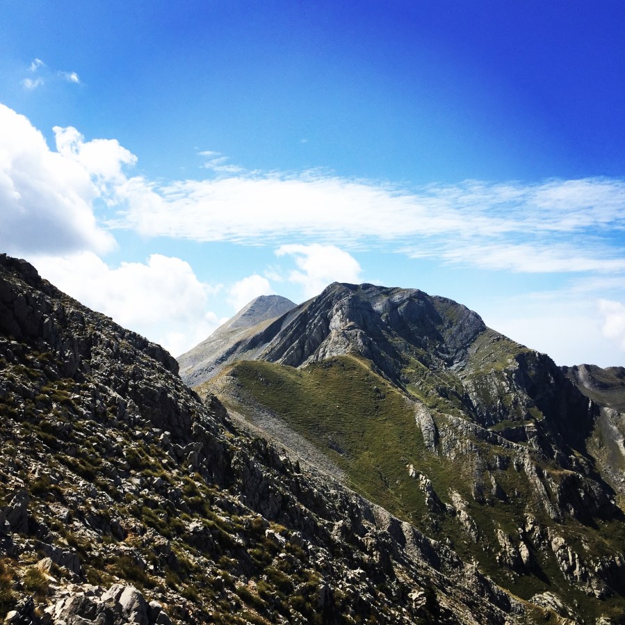
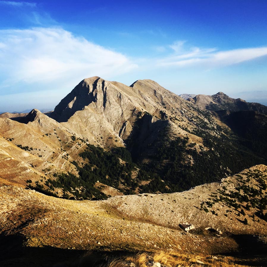
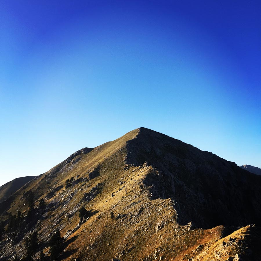
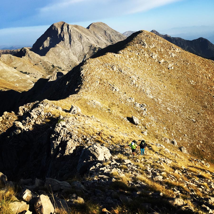
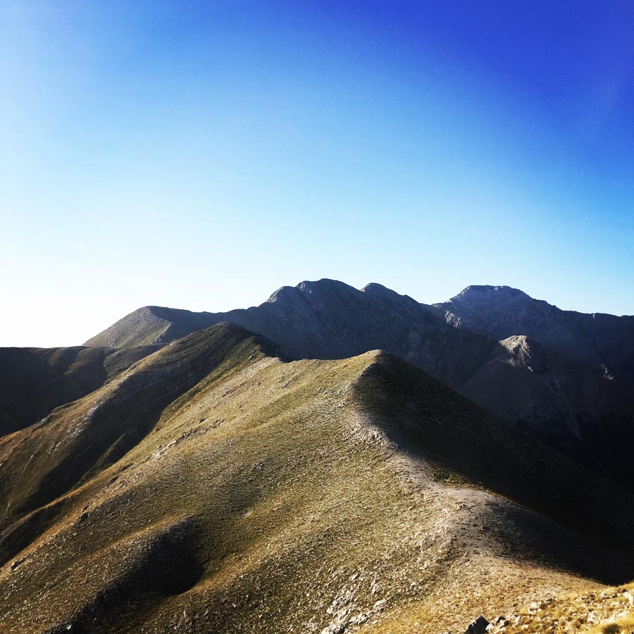
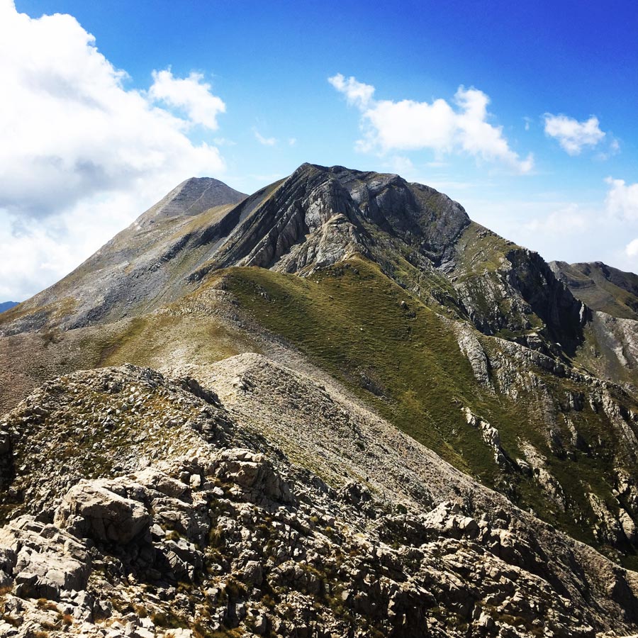
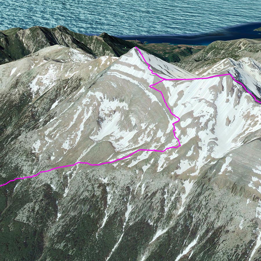
The sun was still rising when we have reached Tsarkos and from that point we were able to see the entire ridge that would lead us to the highest peak of Taygetos, Profitis Elias at an altitude of 2.407 meters above sea level.
It was a breathtaking view and we were very excited to follow this ridge and to overcome a couple of crux points, one before Sidirokastro and the major in Athanati Rachi. While the sun was rising the temperature was rising too, though, due to a gentle breeze it was very enjoyable to hike on such high altitude and under the sun light.

Explore all outdoor activities in a convenient list view here
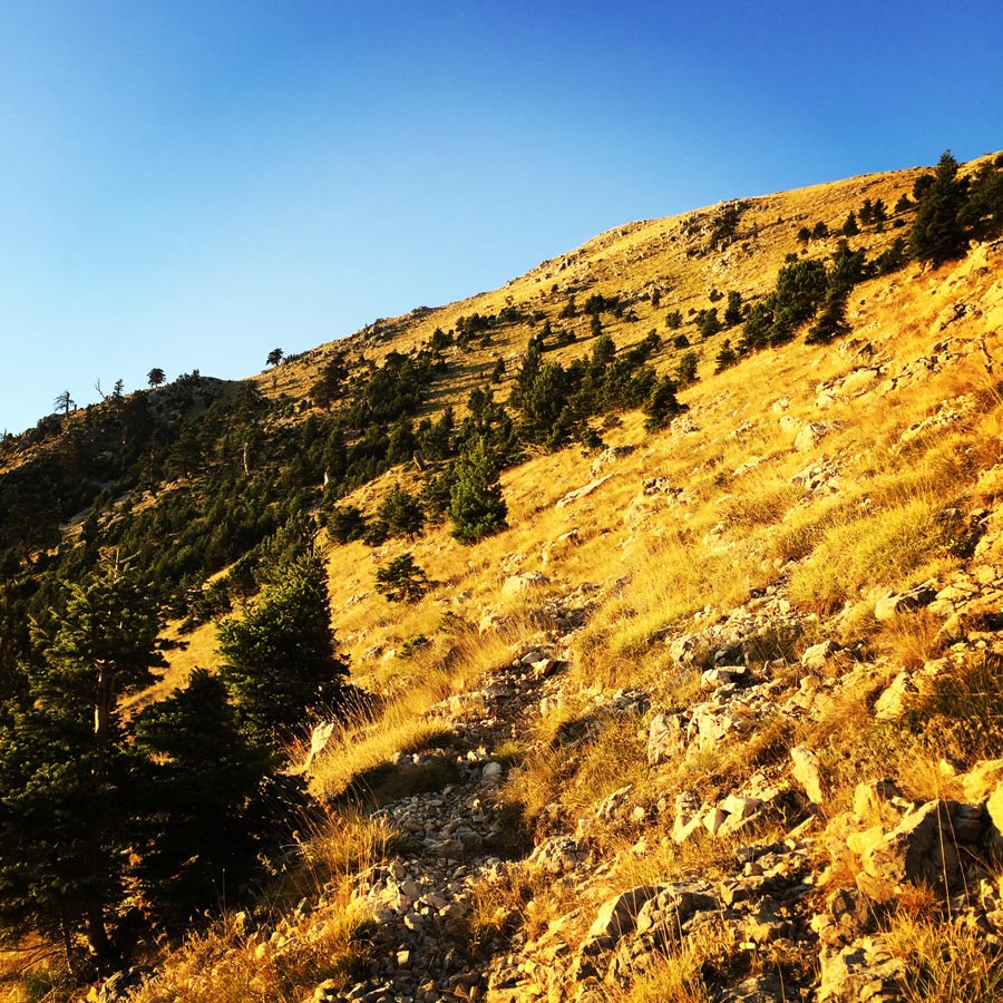
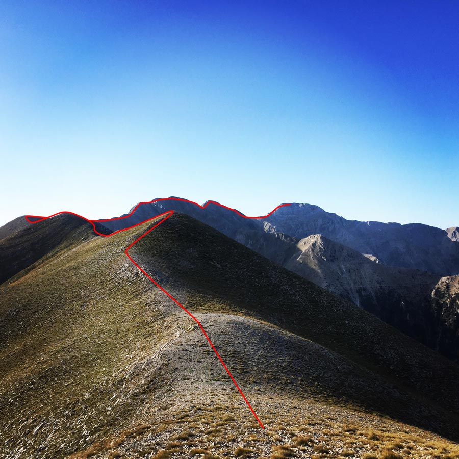
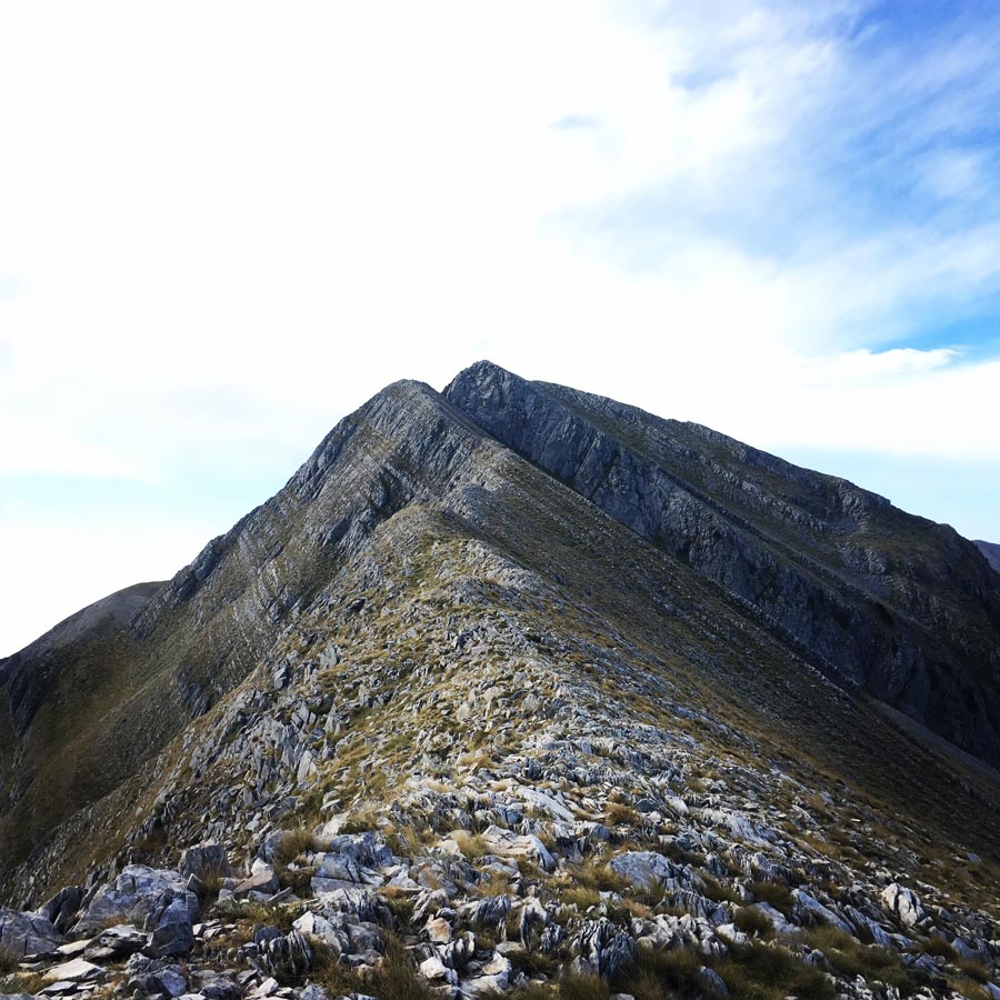
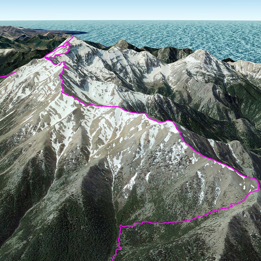
Hiking above 2.000 meters and especially on such a ridge line is a great experience. Breathtaking views, combined with exposed passages and long hikes is something unique. Especially on Pentadaktylos (five fingers), the views are really nice, because from one side you can see Laconia and from the other side Messinia. From one side you can Mount Parnonas and from the other side you can see the Messinian gulf.
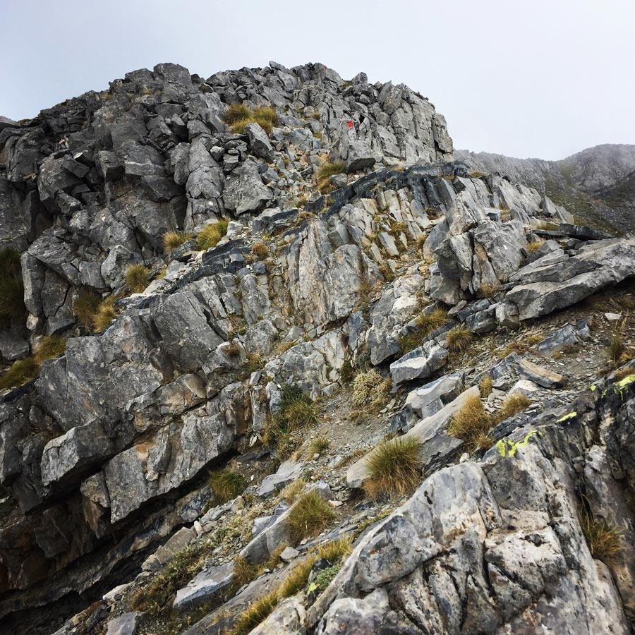
The trail on this altitude is not signed but is pretty easy to follow the ridge line. Though, in this entire ridge line, there are two rather exposed passages that one has to pay a bit more attention. On those two crux points, there are red signs to follow in order to climb to the peaks without issues.


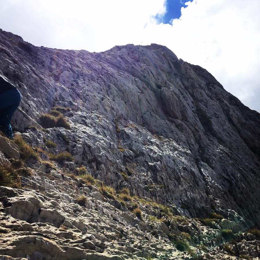
About half way of the ridge and just before Sidirokastro, there is an exposed passage that the one has to pay a bit of attention. This is an easy scrambling of II degree, but is a bit exposed. The hiker needs to keep in mind to follow the red marks and the climb up to the peak it will be a rather easy operation.


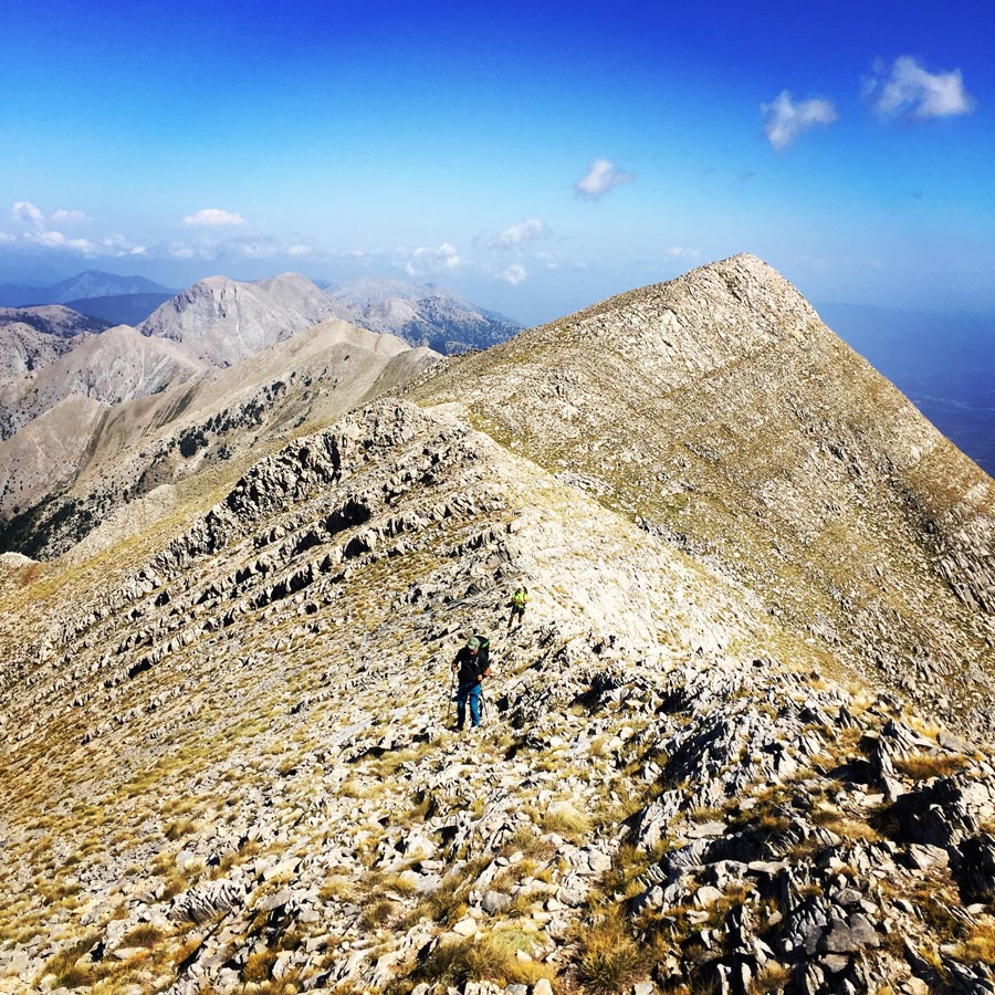

Almost at the final stage of the entire Pentadaktylos, there is the most crucial point of Athanati Rachi. Athanati Rachi is a ridge that leads from Portes to Chalasmeno peak. The meaning of Athanati Rachi is “Immortal Ridge” and I believe due to its name many hikers avoid to climb it. Nevertheless, we have climbed the Athanati Rachi and it is actaully a rather easy scrambling operation of max III degree. I believe that it might be a bit fearful for people that have never scrambled before, but for experience mountaineers it is like a very easy scramble.
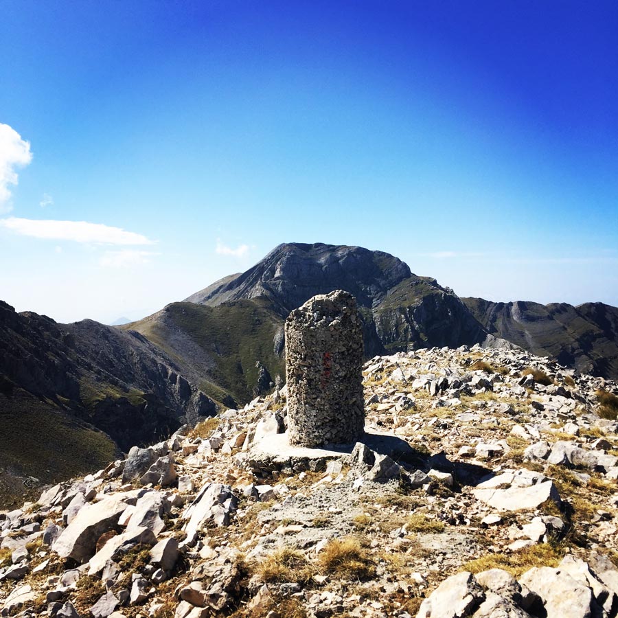
After Athanati Rachi, we donw climbed towards portes and from there was the final peak of Profitis Elias.


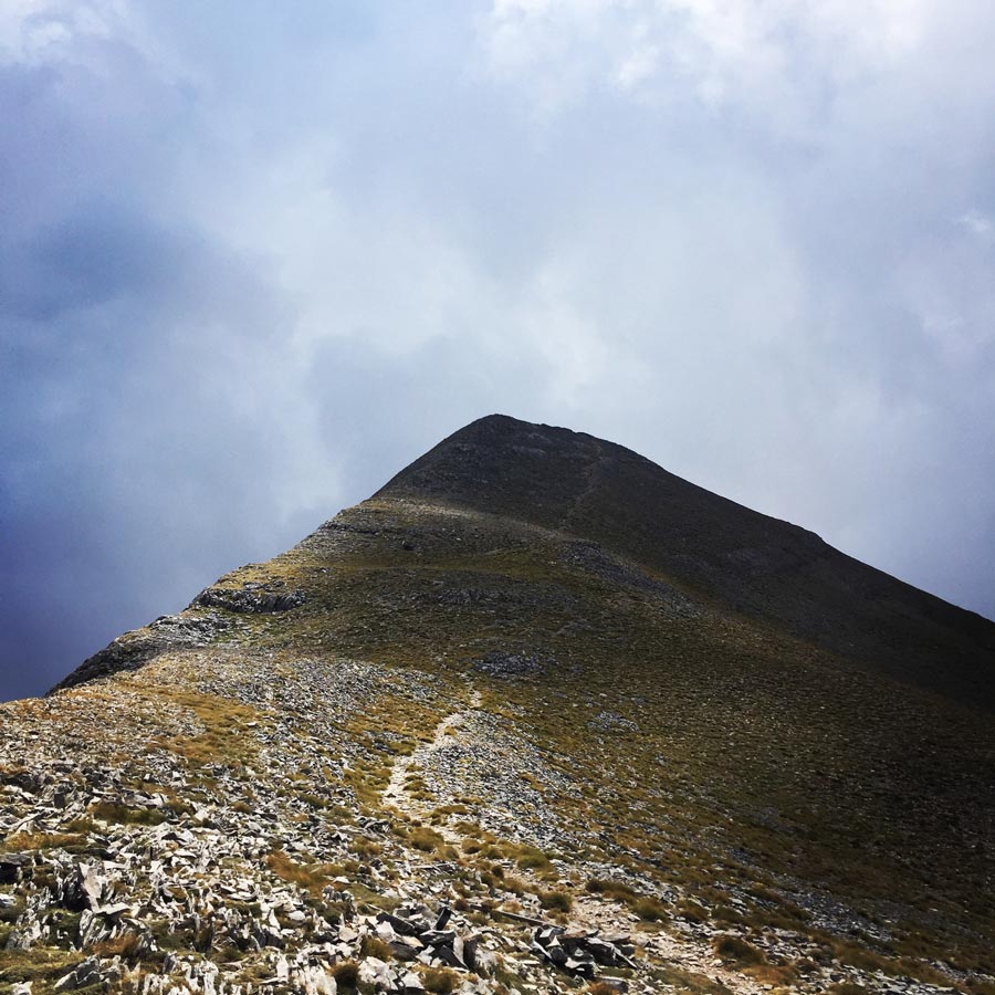
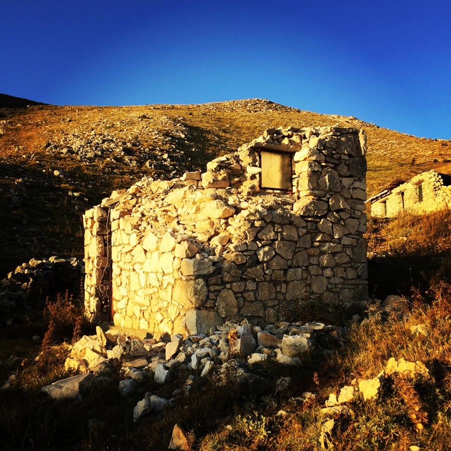
About 8 hours since our departure, we have managed to reach the refuge of Mount Taygetos.
Taygetos Alpinists Refuge – Varvara, is located at 1550m. altitude just beneath the mountains highest peak, Profitis Elias. The refuge was built in 1962 by the local Mountaineering Club as the previous refuge was destroyed during WW2. The access is via a rough dirt road, which become even harder during winter, or via the trail from Magganiaris Springs. The building is equiped with a heating, bunk beds for up to 26 people, blankets and a kitchen. In order to spend the night there, you will have to make prior arrangement with the local Mountaineering Club. Recently, the mountain hut was equipped with solar panels and there is also electricity.
It was an amazing day, full of beautiful peaks, breathtaking views and a great feeling of having complete such a route.
Gear & Equipment
For this trip, I was carrying the following main gear:
- Lowe Alpine Cholatse II 55-65 lt backpack
- Hilleberg Akto Tent
- Cumulus Panyam 600 Hydrophobic Down sleeping bag
- Klymit Stativ V Ultralight sleeping pad
- Garmin Dakota 20 GPS device
- Cumulus Minilite Down vest
- Quechua Tech-Fresh 50 T-shirt
- La Sportiva Bushido
Details of the Hike:
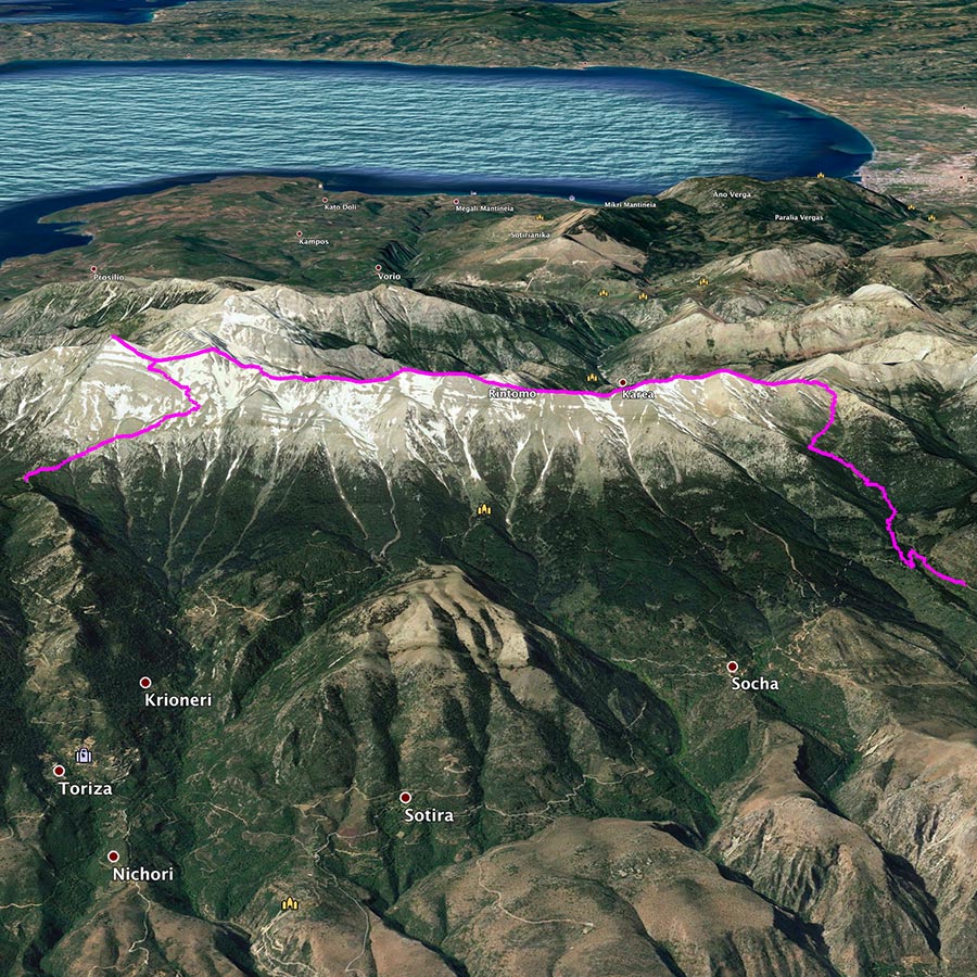
- Location: Taygetos Mountain
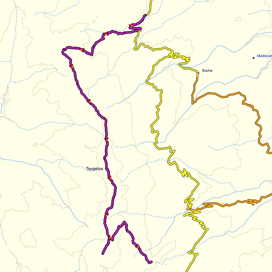
- Starting Point: Anavriti village
- Ending Point: Taygetos Mountain Refuge
- Trail Signs: Well signed path
- Minimum Elevation: 850 m
- Maximum Elevation: 2.407 m.
- Total Distance: 17 km
- Difficulty: Medium
- When to Hike: Autumn to Spring (Not in summer due to heat)
- Water Features: None
Bellow you can see the route we have followed on a map and on 3D:
Subscribe & Stay Informed
Enter your email address to follow this blog and receive notifications of new posts by email
Other Hiking routes on Mount Taygetus (Taygetos)
Except Prophet Elias there are even more hiking routes and locations on this mountain range which will astonish you with their wild beauty and will make you forget your everyday problems.
Mystras – Taygeti – Moni Faneromenis
This route starts from Mystras (320m altitude) and after 2,5 kilometers and 1 hour of hiking you will end up to Taygeti village (700m altitude). At the entrance of this village you will see a beautiful fountain. Here starts another path which, after two hours of walking, ends up to Moni Faneromenis where you will find the homonym monastery.
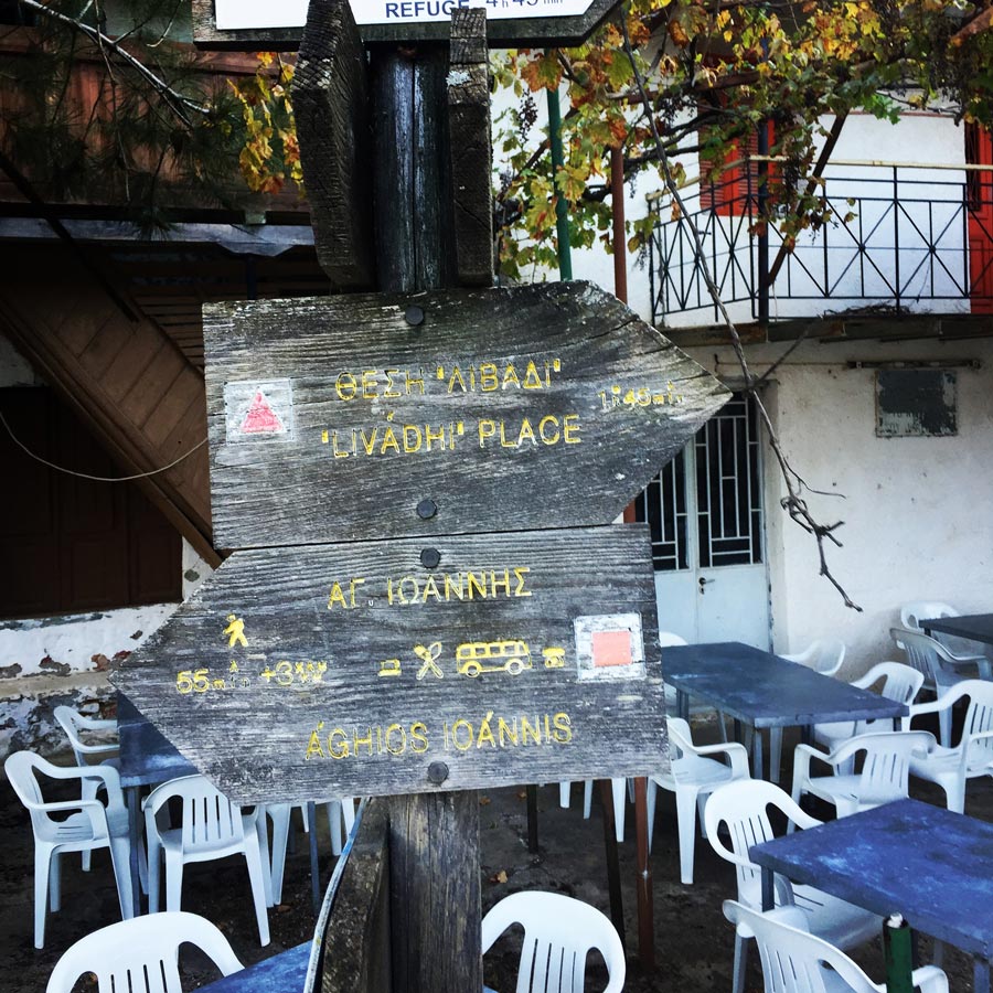
Anavriti settlement – Agios Ioannis (St. John) The Anavriti settlement is connected with a lot of hiking paths. One of the most beautiful routes is the stone path which ends up to Agios Ioannis after one hour of walking. This route is about 3,5km and passes through a gorge.
Koumousta – Moni Golas
Koumousta is a medieval village built at 750 meters altitude on the Taygetos Mountain. From this village you could start your beautiful hiking route of 3,5 kilometers which ends up to the monastery called Moni Golas. After about 1 ½ hour you will see the monastery which is one of the seven monasteries in Greece which host images of ancient Greek philosophers.
Koumousta – EOS shelter of Taygetos
From Koumousta there is another beautiful route which crosses the forest of Pentavlon (1200m altitude). During the route you will come across springs, waterfalls and lakes. Along the route you will find another path which leads to the mountain shelter of Taygetos.
Check out previous ascent on Mount Taygetus (Taygetos) here:
- Mount Taygetus Winter Ascent
- Climbing in Taygetos Mountain
- Taygetus Mountain Autumn Ascent via Athanati Rachi
Before you leave this blog check out the following map
Below: This map marks all the mountaineering adventures that have been featured on Olympus Mountaineering so far, including several Sport climbing crags – Select full screen to expand, zoom in for more detail, or click on a marker for a link to the post.

Wow, what a beautiful hike! Nice to hear from you again too. I just love those sunsets and sunrises too.
LikeLike
Thank you Brian!
It was indeed a beautiful hike and the first morning, waking up almost at the ridge, was one of the nicest mornings I have had for quite some time now.
Thanks for checking out.
LikeLiked by 1 person
Pingback: Taygetus Mountain E4 path – Teygetus Mountain Refuge – Anavriti – Olympus Mountaineering
Pingback: Mount Taygetos Hike: Manganiari Spring, Taygetos Refuge, Profitis Ilias Peak (2.407 meters) | Just for one summer
Hello there,
what a beautiful hike.
I am planning a similar hike in early April. Can you tell me how many cm of snow will be on the mountain range?
Thanks for your help!
LikeLike
Hi Valentin,
thank you for your comment, and it’s great to know you plan to visit Taygetus in early April.
This year, in the area of Taygetus there has not been much snowfall (so far), and therefore I am not able to tell you how much snow there will be.
Having said that, with a pair of crampons and an ice axe, I think you will be ok.
If you need any further info, feel free to get in touch.
LikeLike
You are a legend! Thanks for providing the information.
LikeLike