Spring time in Greece is one of the best seasons. Weather conditions are optimum almost on daily basis where there is clear blue sky but the sun is not burning hot as it becomes during summer time. In fact, during, spring time one can go for an alpine climb with neve and snow and just after that can go for a refreshing dive into the crystal clear blue sea waters of Greece.
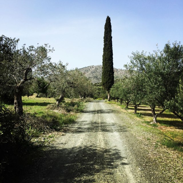
For this spring, I have decided to explore the trail paths of a small town in the east of Peloponnese called Ermioni. Ermioni is a small fishing town of Argolida (Argolis) at the east of Peloponnese. The traditional taverns, the cafes, the paved streets, the beautiful houses and the crystal clear beaches around this area are some of the reasons this town is an interesting summer destination of Peloponnese. While travelling around this area you will have the chance to admire the olive and the pine trees and plenty of bays with turquoise water.
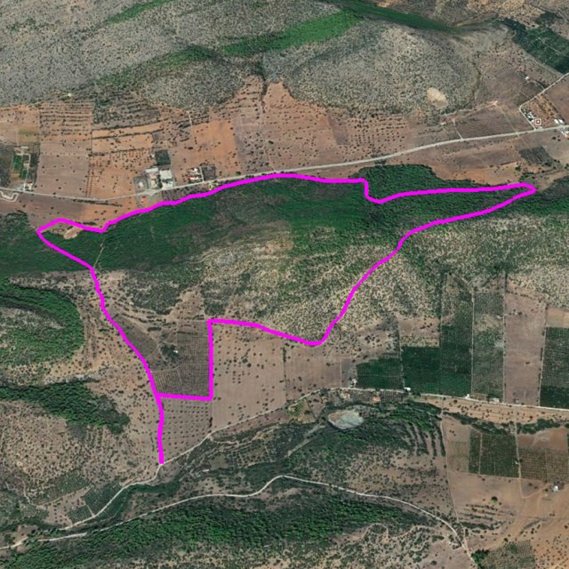
On the previous post I have described a 12,5 kilometres route and on this post I will provide information of a shorter but very nice route just in the suburbs of the town of Ermioni. This route starts from an area called “Pikrodafni” which is located between Ermioni and Kranidi. It is only 5,5 kilometres and is an excellent trail for mountain running and/or for a hike alone or the family.
Check other similar trails in Ermioni here
- Ermioni – Katafyki Gorge
- Ermioni -Monastery Agioi Anargyroi – Agioi Theodoroi – Pikrodafni – Ermioni
- Pikrodafni – Crow Hill – Pikrodafni
- Castle of Thermisia
- Mount Didimo
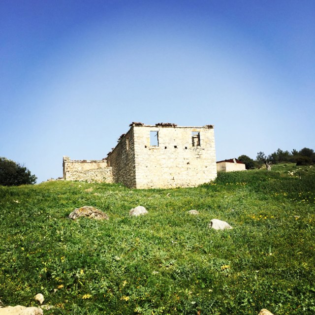
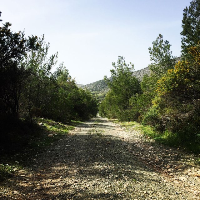
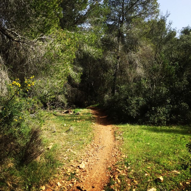
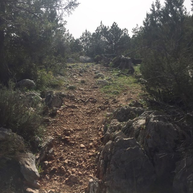
The first part of the route is in an abandoned dirt road that is crossing Crow Hill and leads from Pikrodafni to Avlona. I assume, this path was used many years ago from local inhabitants as a passage from one side of the hill to the other. To testify my assumption, one can see a couple of abandoned and wrecked stone houses that most probably have been used something like a century ago.
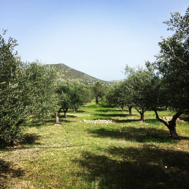
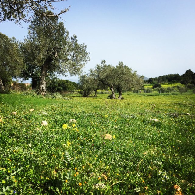
This first part of the route is crossing through an olive grove and it elevates from 44 m. above sea level to something like 86 m.
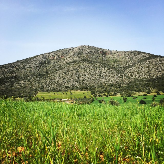
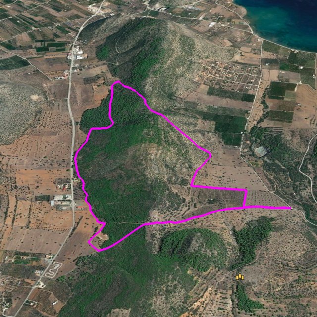
Having crossed Crow Hill, we arrive to the area named “Avlona”. This is the area where a local road connects the nearby town of Kranidi to Ermioni and actually this local road end to Bisti. Bisti is the small piney peninsula, Poseidion of the ancient, in the east, on the edge of town, is at the same time an important outdoor archeological area of history and culture. Brilliant temples were built here! In the central plateau of Bisti, in the “square” we meet the stone foundations of the base of the temple of goddess Sophia and Athena.
At the edge of Peninsula, on Cape Posedio, is the temple of Poseidon that its foundations extending up to the restored whitewashed mill fighters Mitseon. In place of the church of St. Nicholas was the Temple of the Sun, on St. John the temple of Sarapis and Isis and the temple of goddess Demeter on the entrance of the peninsula. In all Historical periods, the area of Bisti was surrounded by walls, of which vestiges see until today. On the south side of that, was located the “Cyclopean walls” and on the north, the medieval. In place of the windmill Mitseon were also located the workshops of the famous Hermione purpura. All seasons of the year, Bisti is the ideal place for walking, study and tranquility. In summer, offers a delightful swimming at beaches with crystal clear waters.
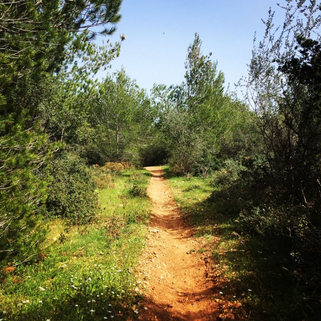
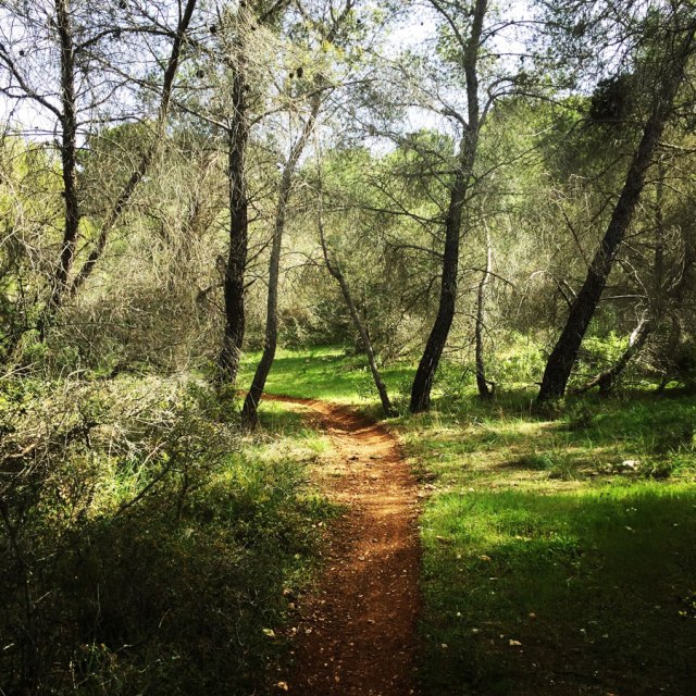
The second part of the trail is an easy uphill where we have to move from about 23 m. up to 126 m. There is not an official trail but it is easy to see and identify the trail path that is created from the goats that move everyday on this area.
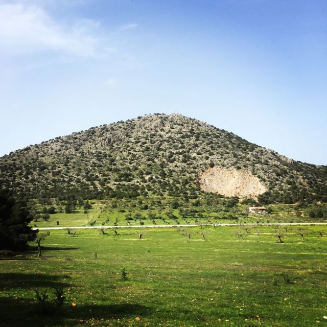
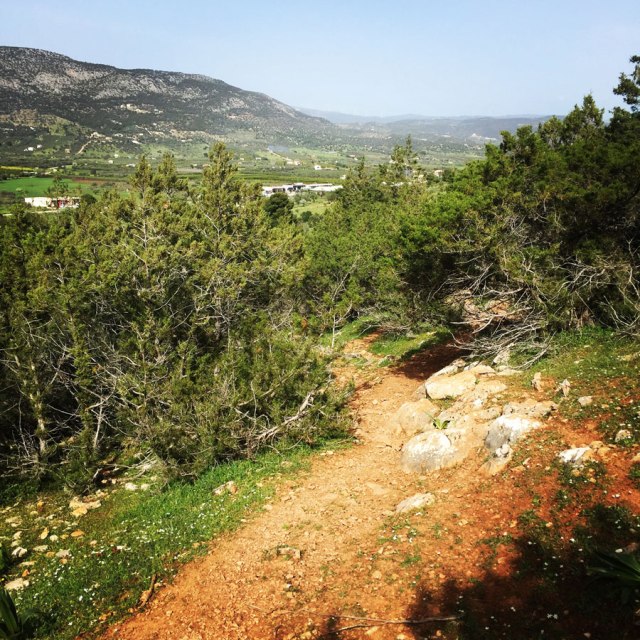
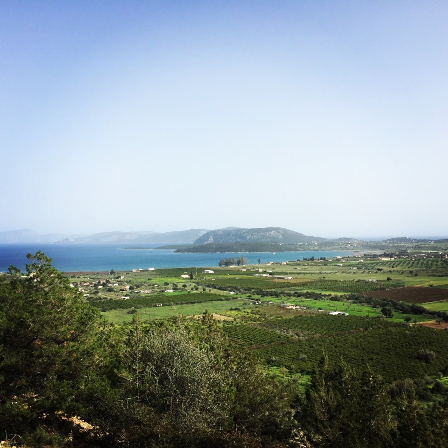
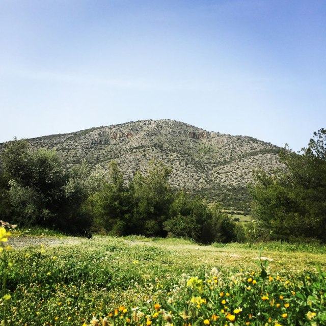
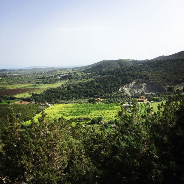
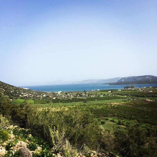
Once we reach the highest point of Crow Hill, we are able to see the rest of Ermionida, but also Agioi Anargyroi Monastery, the chapel of Agios Theodoros, Dokos Island, Porto Cheli and even Spetses island. The view from that point is really nice because of the combination of the colours of the sea, sky and land. In fact, during spring time everything looks very nice green and all the orange and olive groves give a special feeling to the whole area.
Details of the Hike:
- Location: Ermioni, Argolis
- Starting Point: Pikrodafni
- Ending Point: Pikrodafni
- Trail Signs: No Signs (easy to identify the route)
- Minimum Elevation: 44 m.
- Maximum Elevation: 126 m.
- Total Distance: 5.5 km
- Difficulty: Easy
- When to Hike: It can be rather hot during summer months. Better to hike this route duringAutumn, Winter or Spring time
- Water Features: None
Bellow you can see the route we have followed on a map and on 3D:
see more hiking routes here:

Beautiful photos!
LikeLike
Pingback: Hiking in Ermionida – Ermioni – Kranidi (Argolis) Part 03 | Katafyki Gorge – Olympus Mountaineering
Pingback: Hiking in Kilada – Patima Park – Ermionida (family friendly) – Olympus Mountaineering