
It’s almost summer and it’s perfect time for Long Distance mountain crossing. This time, we have decided to visit one of the nicest mountainous areas of Greece and specifically, the area of south Pindos.
The Pindos (also Pindus or Pindhos) (Greek: Πίνδος) mountain range is located in northern Greece. It is roughly 160 km long, with a maximum elevation of 2,637m (Mount Smolikas). Because it runs along the border of Thessaly and Epirus, the Pindos range is known colloquially as the spine of Greece. The mountain range stretches from near the Greek-Albanian border in Northern Epirus, entering the Epirus and Macedonia regions in northern Greece down to the north of the Peloponnese. Geologically it is an extension of the Dinaric Alps, which dominate the western region of the Balkan Peninsula.

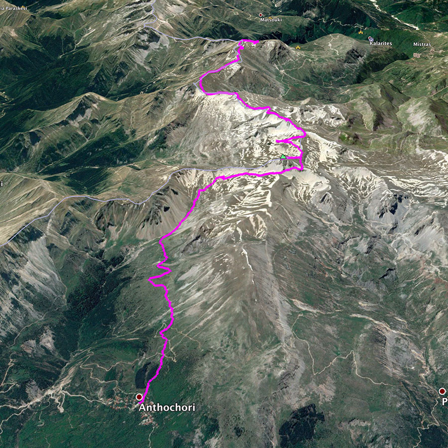
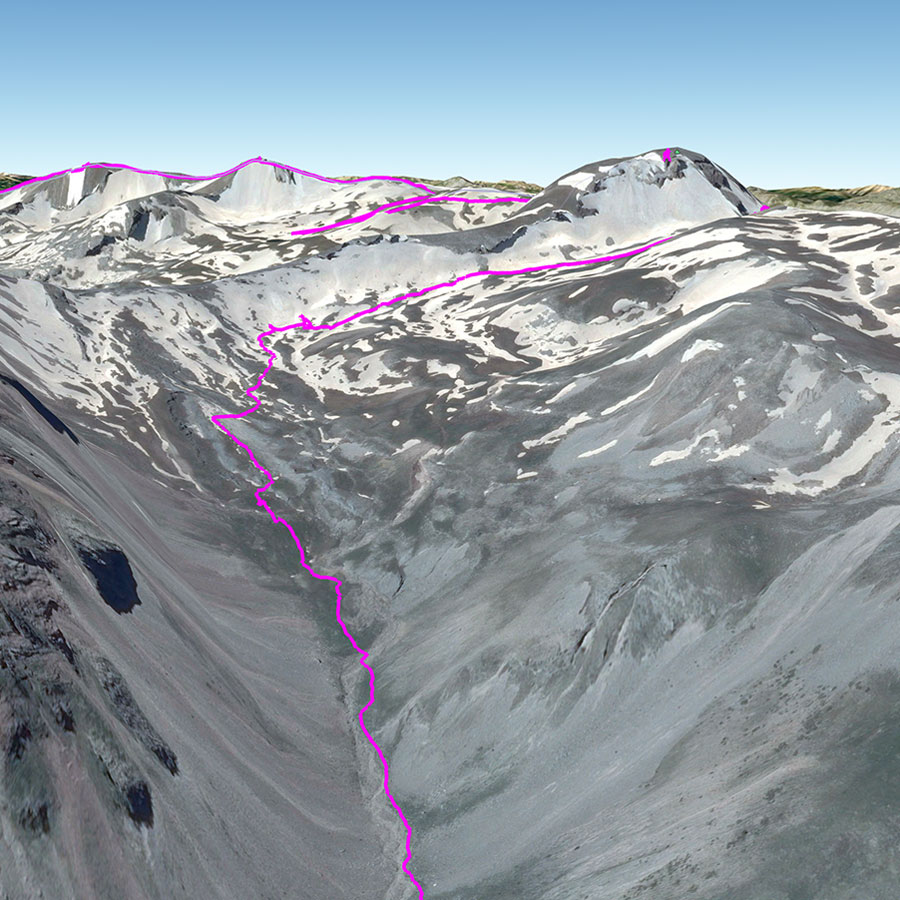
Our goal was to cross the entire Lakmos mountain (or Peristeri mountain) by starting from Anthochori village, reaching the highest peak of Lakmos, staying overnight on Verliga which is one of the nicests alpine lakes and ending in Kallarites village.
Explore all outdoor activities in a convenient list view here
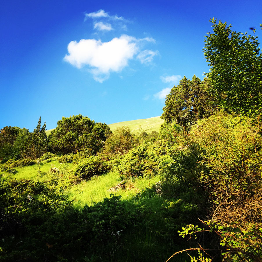
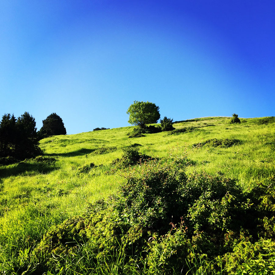
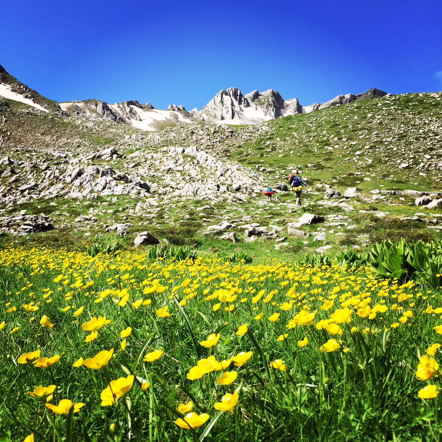
Anthochori Village – Shepherd’s Mountain Refuge
Anthochori is a mountainous village in the prefecture of Ioannina. It is built at an altitude of 1,060 meters on the slopes of Lakmos (Peristeri) mountain. It belongs to the municipality of Metsovo and according to the 2011 census the permanent residents of the settlement are 244.
On the hill between Saint Apostles and Saint Charalambos there are ruins of the acropolis that King Pyrros had to control the borders of Epirus and Thessaly. The old name of the village was Derventista and means “passage“, it was built on the left bank of Arachthos where the road passed from Macedonia-Thessaly-Epirus.
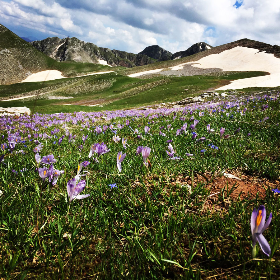
The first part of the route, is crossing a beautiful pine forest with nice views towards the high peaks. The trail, although well maintained, in some parts is not very clear and the use of a map ore better of a GPS device might be very useful.


Lakmos is a mountain in eastern Ioannina and western Trikala regional units. The mountain is a part of the Pindus mountain range. Its highest peak is Tsoukarela, at 2,295 m elevation. It stretches from the village Krapsi in the west to near Metsovo in the east, over a length of about 20 km (12 mi). The nearest mountains are the Athamanika to the south, the Lygkos to the north and the Mitsikeli to the west. It is drained by the river Arachthos and its tributaries to the north, west and south, and by the Acheloos to the east.
Support the journey — buy me a coffee
I share these articles and the climbing guidebooks because I love the outdoors, and they’ll always be free. If they’ve helped you, help me keep them coming. Click the button to support my work.

The most important mountains in the range are Mount Grammos, Mount Smolikas, Mount Vasilitsa, Tymfi or Gamila, Lakmos or Peristeri, the Athamanika or Tzoumerka mountains, and the Agrafa mountains. Some mountains in Southern Greece are also considered part of the extended Pindus range. Its highest peak is on Mount Smolikas at an altitude of 2,637 meters.


Check out more FREE Guidebooks
Download now for free! Explore breathtaking landscapes and conquer thrilling heights with our collection of guidebooks and topos.
Don’t miss out on this opportunity to elevate your outdoor adventures. Click, download, and let the exploration begin!
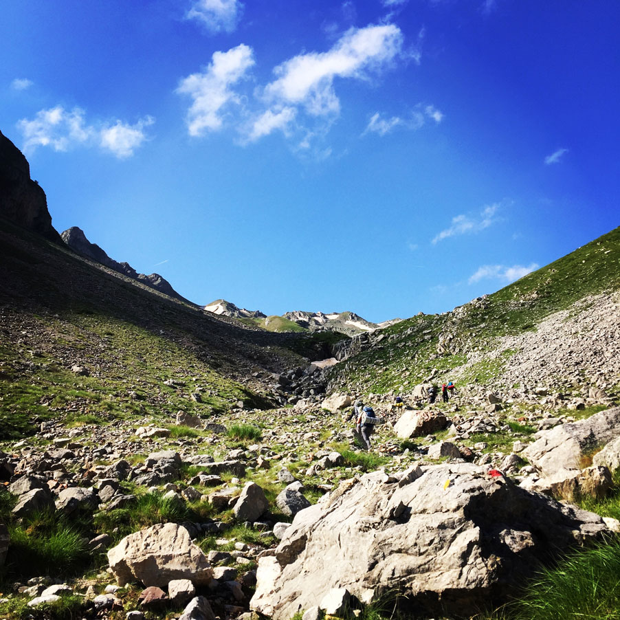
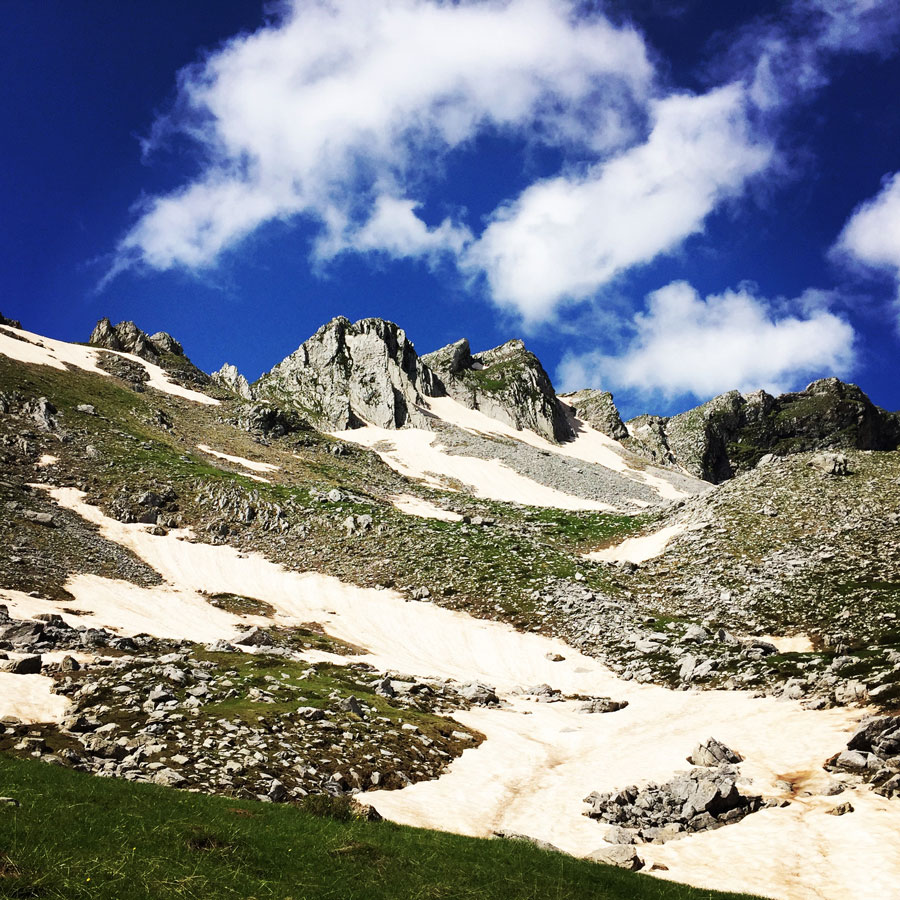
Shepherd’s Mountain Refuge – Tsoukarela Peak
About four (4) hours since the moment we have left Anthochori village, we have reached a mountain refuge that is used from local shepherds during summer time. This mountain refuge is just bellow the highest peak of mount Lakmos, Tsoukarela peak. On that point, we had a break for some fresh water that we could find there and some snacks.
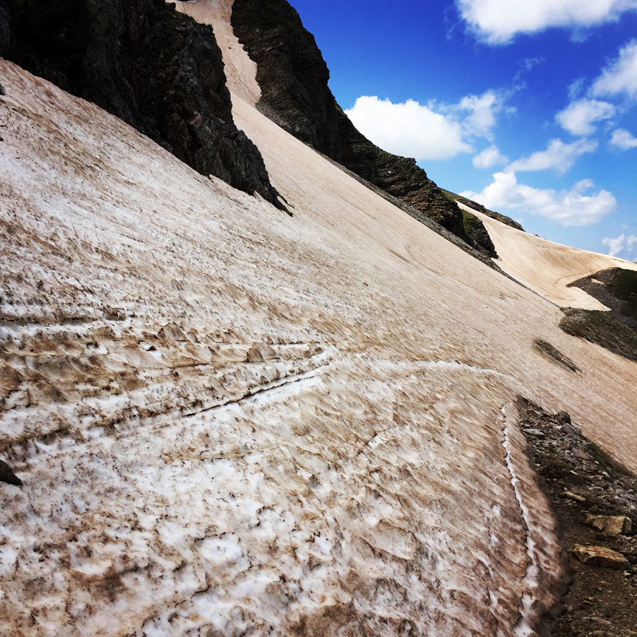
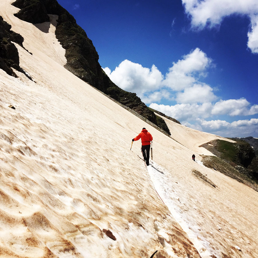
After the short break, we have moved on for the final push, towards the conquest of mount Lakmos. Though, we came across a rather steep icy snow slope and there we lost relatively a lot of time in order to break the neve, place ropes and make sure that the entire team could cross this slope with safety.
Of course, such occasions, and if weather conditions are good can be a lot of fun too. Personally, I have enjoyed to break steps to this traverse and help securing people on a fixed rope.
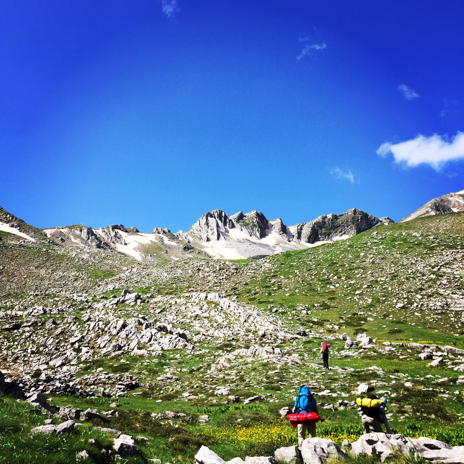
As soon the entire team crossed the tricky traverse, it was about time for the final push and we have reached Tsoukarela peak, 2.295 m.


Tsoukarela Peak – Verliga Alpine Lake
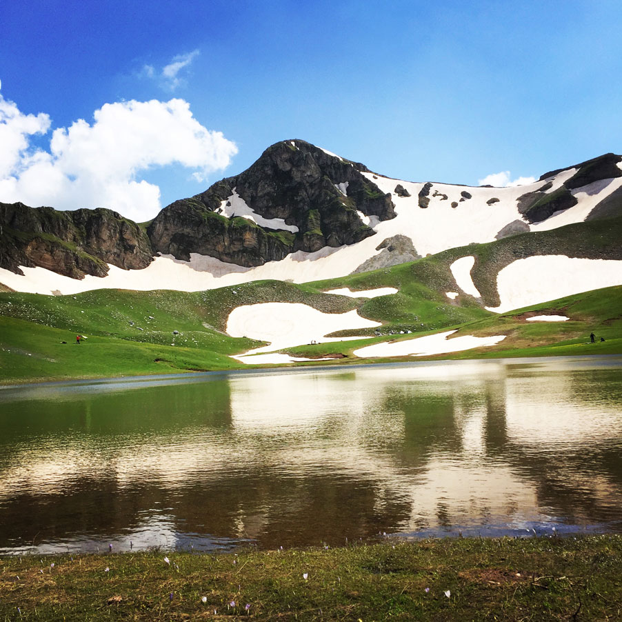
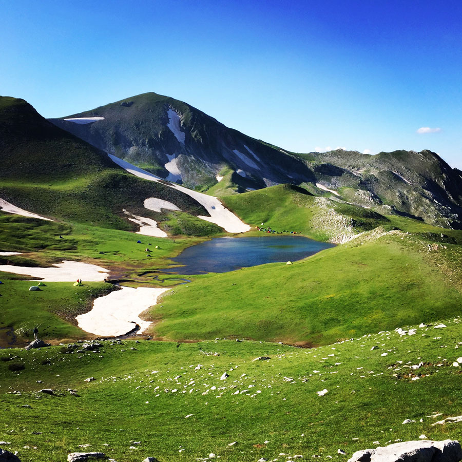
We have been on the trail for about 6 hours and we have finally reached the highest peak of Lakmos mountain, Tsoukarela (2.295 m.). It has been a long but beautiful hike with breathtaking landscape and the view from Tsoukarela was stunning. Due to eventual thunderstorm that was approaching, we have decided to not stay long on the peak and instead to move on towards the final destination of that day, the alpine lake of Verliga.
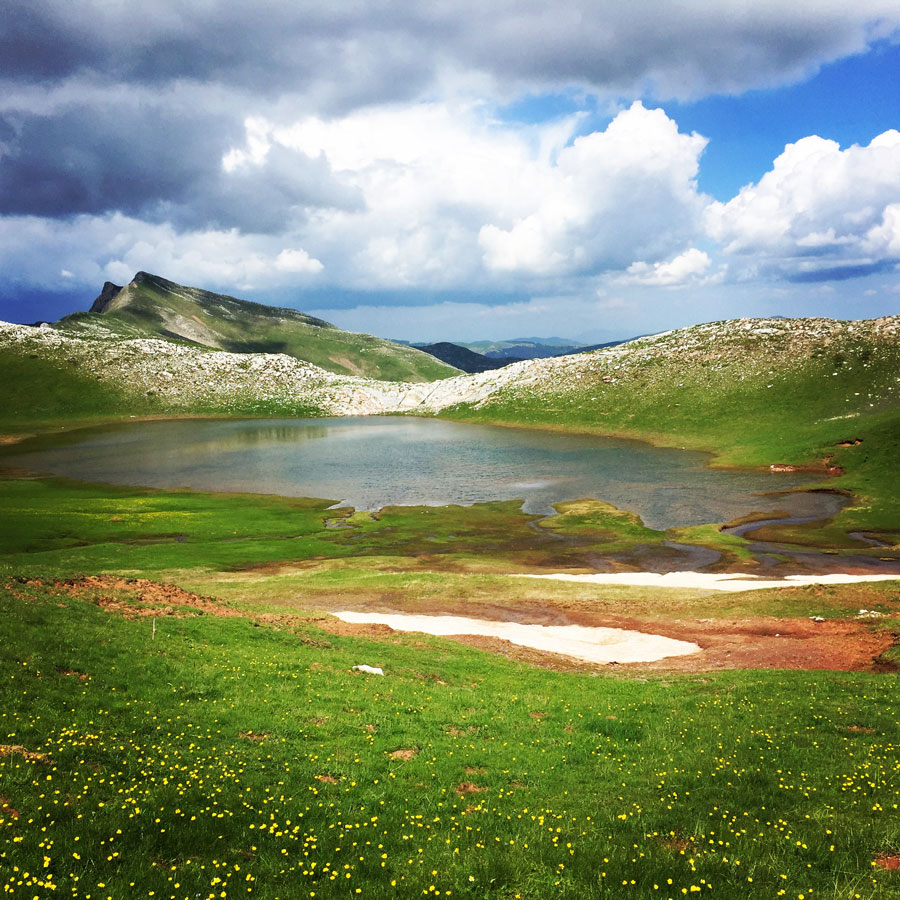
The legendary mountainous lake Verliga in Lakmos mountain is in central Greece. Located in the Alpine zone, at an elevation of 2.050m, it is the third lake of the mountain range of Pindos, and it is the fountainhead of the great Acheloos (Aspropotamos) river. The whole area and the view from this location are really breathtaking.
From Tsoukarela towards the alpine lake of Verliga it was an easy downhill hike. This is perhaps one of the nicest alpine areas of Greece and perhaps of South Europe.
What makes this lake special is the 10 meanders (serpentine course) creeks that form descend from the main lake towards the Acheloos river. In addition, the lake is surrounded by various peaks, such as Tsoukarela, but most of all of the stunning peak of Megas Trapos.
Verliga was our final destination for the first day where we stayed overnight in tents.


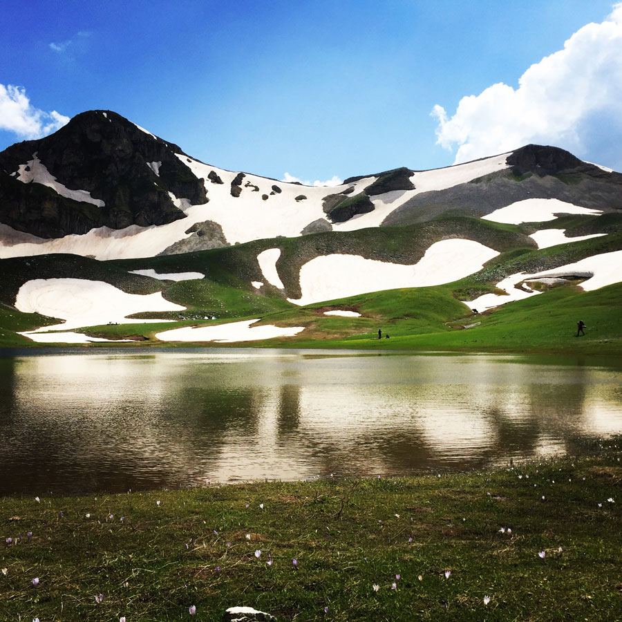
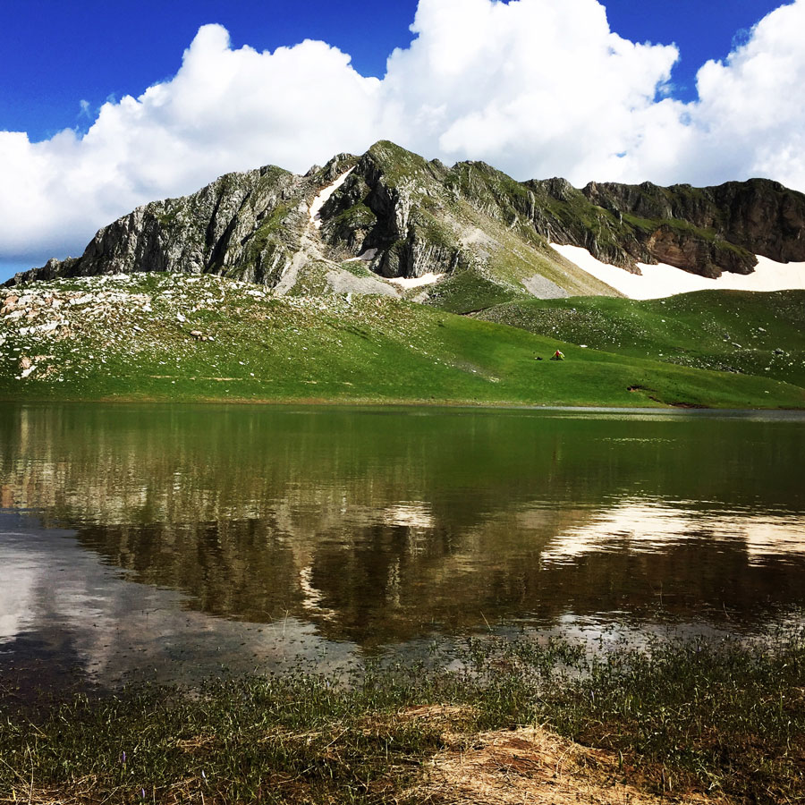
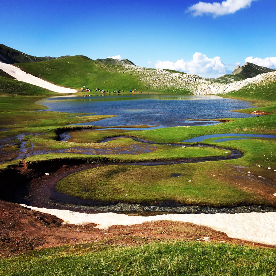


As soon we have reached Verliga, we have set up our tents and enjoyed this magical and mysterious place. There is a local myth that says that the dragon of this lake was a donkey that was invisible. Having the form of a snake, he jumped off Megas Trapos rock and was wandering for a while, when he found a hole and sank back into the land where the waters were disappeared. From the point where the dragon came out spilled water, following its serpentine course.
Nature and Wildlife
The Pindus ecoregion covers a wide range of elevations and habitats, from deep canyons to steep mountains. The wide range in altitude results in two major forest zones:
- A conifer zone, with trees such as a subspecies of Austrian Pine and the endemic Greek fir, characterizes the highest elevations, with juniper woodlands dominating near the timberline.
- A mixed broadleaf forest zone dominates the valleys and canyons of the middle and lower elevations.
Large breeding colonies of herons, spoonbills, egrets, and pelicans fish the cool waters of the mountain lakes of the Pindus Mountain Conifer and Broadleaf Mixed Forests ecoregion. This is one of the few areas in Europe where the rare Dalmatian pelican can be found. Wolves, jackals, and bears are found in the forests.


Gear & Equipment
For this trip, I was carrying the following main gear:
- Lowe Alpine Cholatse II 55-65 lt backpack
- Sierra Designs Lightning 2 tent
- Cumulus Panyam 600 Hydrophobic Down sleeping bag
- Klymit Stativ V Ultralight sleeping pad
- Garmin Dakota 20 GPS device
- Cumulus Minilite Down vest
- Quechua Tech-Fresh 50 T-shirt
Subscribe & Stay Informed
Enter your email address to follow this blog and receive notifications of new posts by email
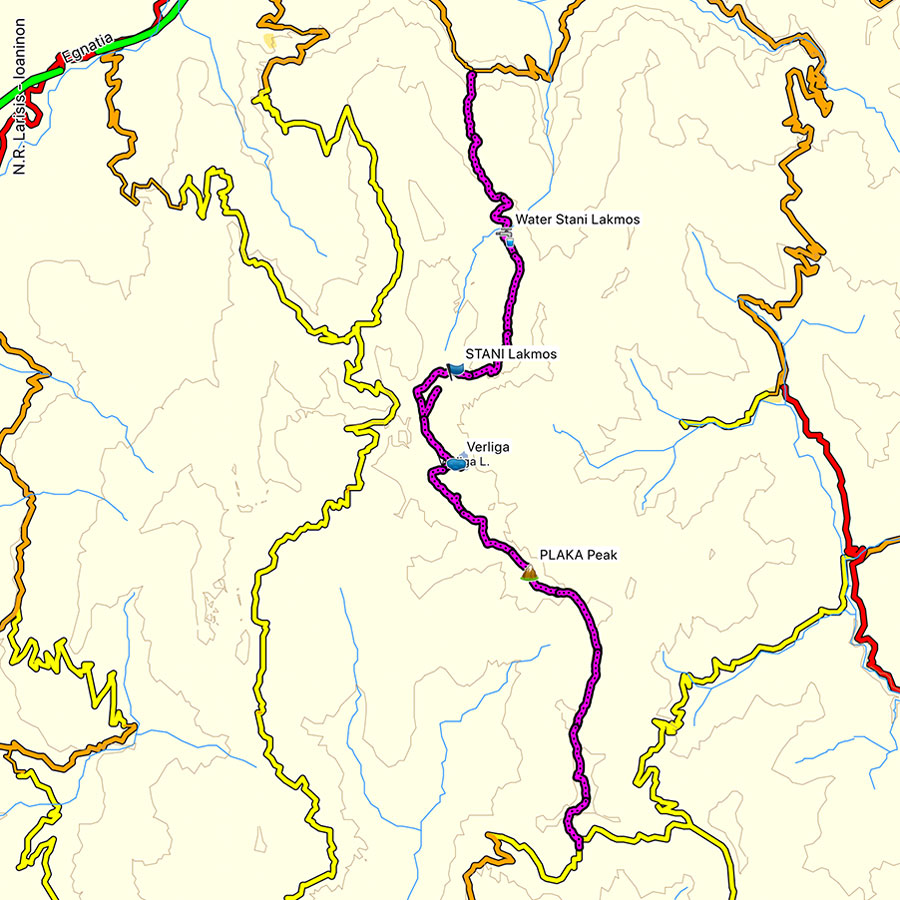
Details of the Hike:
- Location: Lakmos (Peristeri) Mountain
- Starting Point: Anthochori village
- Ending Point: Kallarites village
- Trail Signs: Partly signed path
- Minimum Elevation: 1.060 m
- Maximum Elevation: 2.295 m.
- Total Distance: 22 km
- Difficulty: Medium
- When to Hike: Any time of the year (during winter time winter mountaineering gear is needed)
- Water Features: three
Bellow you can see the route we have followed on a map and on 3D:
Stay tuned for the second part of this amazing hike we have done in Lakmos (Peristeri) mountain. The second part will be published in the coming days, so make sure to come back or feel free subscribe as a follower of this blog.
Support the journey — buy me a coffee
I share these articles and the climbing guidebooks because I love the outdoors, and they’ll always be free. If they’ve helped you, help me keep them coming. Click the button to support my work.
Before you leave this blog check out the following map
Below: This map marks all the mountaineering adventures that have been featured on Olympus Mountaineering so far, including several Sport climbing crags – Select full screen to expand, zoom in for more detail, or click on a marker for a link to the post.

Nice photos, and I really enjoy your multiday trip reports. I’m looking forward to the second part.
LikeLike
Thanks for reading this post and I’m pleased to know you like these trip reports. The second part will be published soon.
LikeLike
Pingback: Hiking in South Pindos – Lakmos Mountain Pt.02 | Verliga Alpine Lake – Megas Trapos – Baros – Kallarites – Olympus Mountaineering
Pingback: Verliga alpine lake – Wild camping on Greece’s secret paradise – Olympus Mountaineering
Pingback: Hiking between picturesque villages Kallarites and Syrrako – Olympus Mountaineering
Thank you for the detailed report.
Could you please tell me how can I get to the starting point from Thessaloniki by public transportation? and how can I go back to the city fro the ending point?
Thanks,
Yaya
LikeLike
Hi Yaya,
Thank you for reading this post and glad you are planning to visit this area of Greece.
Unfortunately, via public transport is not easy to reach that area and therefore I would recommend you rent a car if possible. If driving with a car is not an option, then I would advice you take the train from Thessaloniki towards the city of Kalabaka and from there to get a bus or a taxi in order to reach the village Chaliki.
LikeLike
Pingback: Winter Mountaineering Climb in Strogoula via Agrofylakas Couloir (Tzoumerka-Athamanika) – Olympus Mountaineering
Pingback: Hiking in Tzoumerka (Athamanika) – Pramanta Refuge – Waterfall Kefalovriso – Olympus Mountaineering
Pingback: Hiking in Tzoumerka (Athamanika) – Skala Stamati – Katafidi – Olympus Mountaineering
Pingback: Immerse in Greek Mountain Beauty: 10 Hiking Routes That Ignite the Spirit of Adventure – Olympus Mountaineering
Hi! How did you handle overnight food storage? Any concerns about wildlife? Thanks!
LikeLike