
Oligyrtos is a mountain located at the junction of Arcadia, Corinthia and Argolis in the northeastern Peloponnese in Greece. The mountain diagonally stretches from southwest to northeast, with about 35 km length and 15 to 20 km breadth. Its highest point is the peak Skipiza, at 1,935 m elevation. Other peaks are Gkrimini (1,831 m), Parnias (1,800 m), Skiathis (1,777 m) and Mavrovouni (1,695 m).
Neighbouring mountain ranges are Kyllini (Ziria) to the north, Mainalo to the southwest, Mount Trachi to the south and Chelmos (Aroania) to the northwest. Local flora consists mostly of grasslands and bushes. Pine trees and barren lands are found in higher areas. It is drained towards the Lake Stymphalia (which is located nearby Lake Doxa) to the north, and towards the plain of Kandila to the south.
Oligyrtos is renown for its green slopes and panoramic views. It boasts a fir forest of 21,250 acres and 24 animal species, including several kinds of woodpecker, the rare golden eagle, six species of mammals and 14 different amphibians.
If you wish to read other hiking and climbing adventures on nearby mountains check out the following ones:
- Winter Ascent on Mount Oligyrtos
- Sping Ascent on small Mount Kyllini (Ziria)
- Mount Kyllini (Ziria) Highest peak
- Wild Camping and Hiking on Lake Doxa
- Autumn Ascent on Skiathis mountain
- Trachi Mountain Ascent
- Winter Ascent on Nisi Peak (Arete of Chelmos)
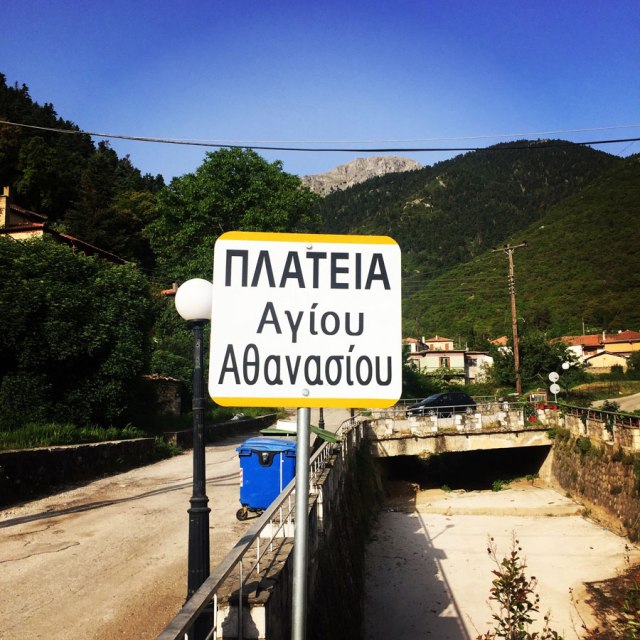
We have started our route from the central square of a village named Lafka. Lafka is a village in Stymfalia in Corinth in the Peloponnese Region of Greece. Lafka is also a Mountain resort. Lafka is at an altitude of 680 meters. In the central square of Lafka there is an old church with the name Agios Athanasios (Saint Athanasios) and a water feature with fresh running water.
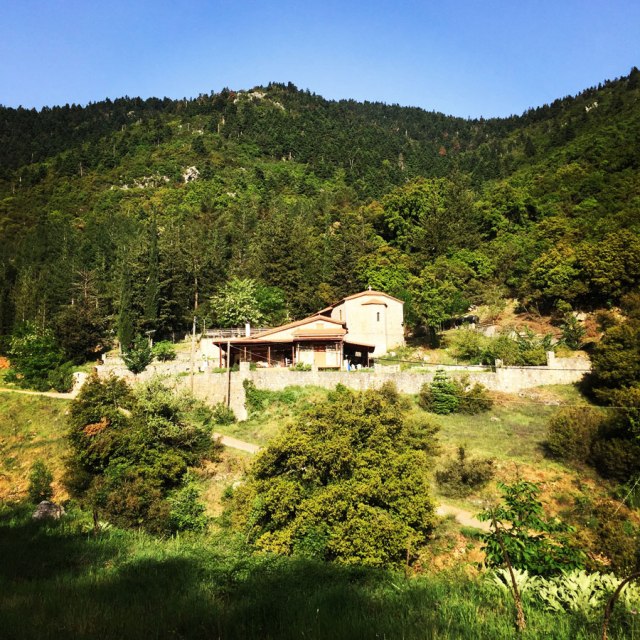
Lafka village – Agia Sotiria chapel
The first 600 meters of the route is done on a local dirt road and we can see a small chapel with a small house. From that point and on, the actual trail starts in a beautiful pine forest. Our first scheduled stop is predefined for a beautiful small chapel of Agia Sotiria which is located about 2.5 km of trail from Lafka.


We have been hiking for about 45 minutes when we came across the Agia Sotiria church. The trail signs till that point are very good and the first thing the hiker will notice is a water feature. Though, unfortunately on this time of the year there was not any running water and therefore our decision to carry more water since the beginning was a wise one.


Agia Sotiria – Goupato Plateau – Chionotripa
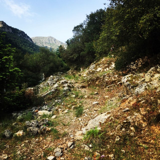
After a very short break in order to have some water, we have soon moved towards higher elevations. Until the point we reached the Goupato Plateau the trail is moving between the beautiful pine forest and impressive cliffs.
Also, on this section, there are many trail signs, which have been placed from EOS Elefsinas. From that point and on we have been gaining elevation in a fast pace and therefore we came above the tree line and on the alpine level.
While hiking higher and higher we came across to a rock where a cross was placed. There is a local legend that a kid had disappeared and found dead on that rock, but this has to be yet confirmed.
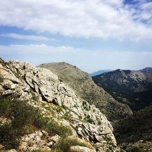
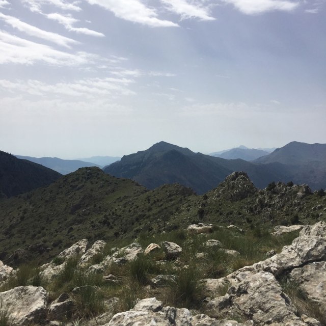
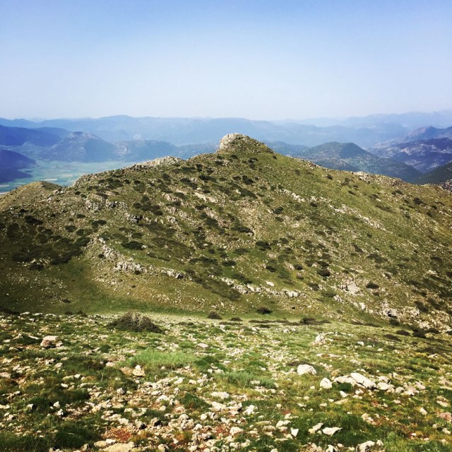
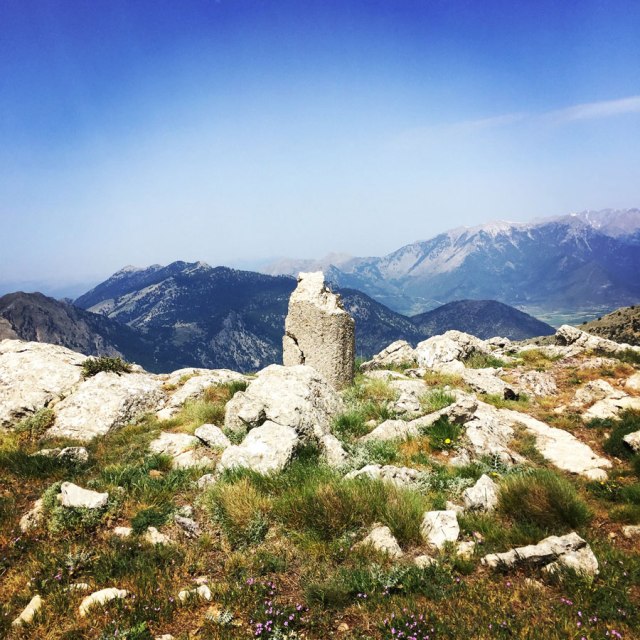
As soon we reached the Goupato Plateau, we were able to see the highest peak of Oligyrtos, Skipiza (1.935 m), but also the beautiful pyramid shape peak that we wanted to reach, Chionotripa.


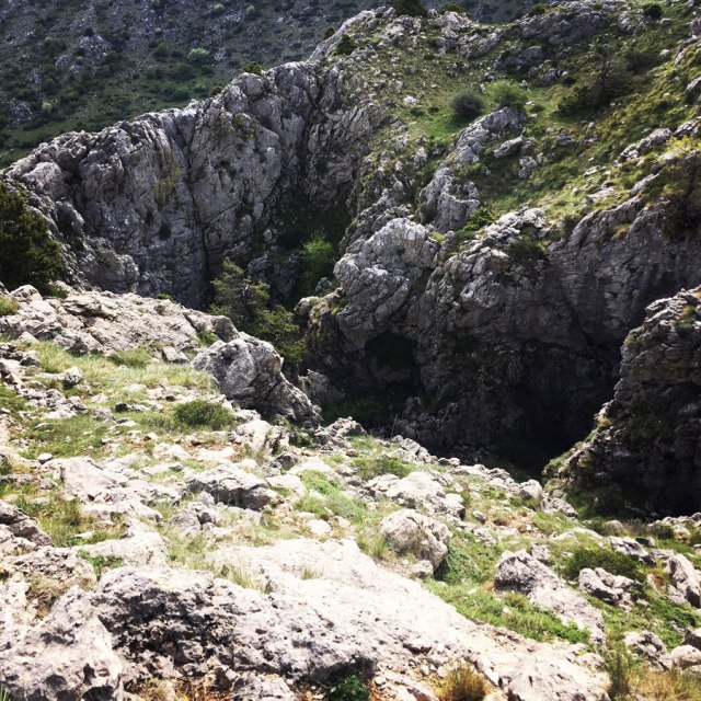
Chionotripa
Chionotripa (literally translated as “snow hole” in English) is a deep and steep depression with a width of more than 40 meters. The main feature of this snow hole is the altitude at which it is located at 1.700 meters.
In order to reach the actual Chionotripa, we had to scramble carefully, because there was quite a void and a long fall in case of a wrong movement.
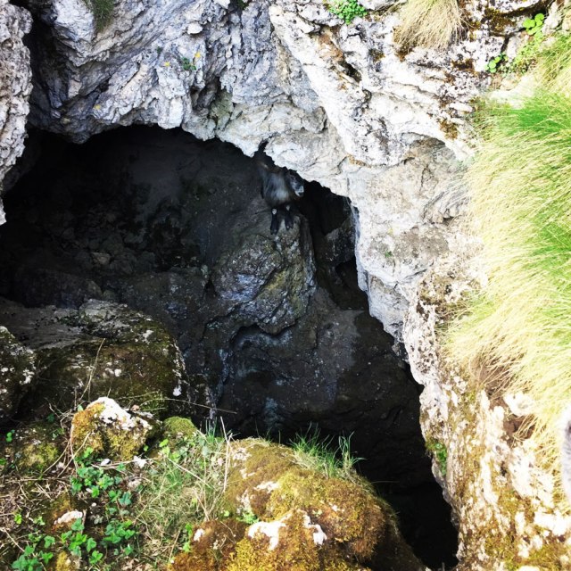
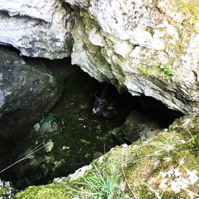
As you can see from the photos bellow, there is a deep and steep depression and at one point there is another “hole” where it was even deeper. After a small scramble, we reached the Chionotripa and to our surprise we have seen a male goat (buck) looking at us with the same curiosity as we have been looking at him too. Having introduced ourselves to our new friend, we asked for permission to take him a photo and after that we left him in his own peaceful world.

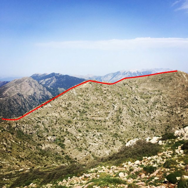
Chionotripa Peak – Unnamed Peak – Agia Sotiria – Lafka
The snow hole “Chionotripa” is located at an altitude of around 1.700 meters above sea level, though the Chionotripa peak, is located at an altitude of 1.794 meters. In order to reach the peak, there is the easiest route where you can just follow a small trail created by the wild goats of the mountain, or to reach the peak via scrambling (grade 2). We, of course, chose for the scrambling option because we wanted to incorporate a bit more fun and adventurous conquest of Chionotripa peak.
Finally, and about 2 hours since we ledt Lafka village, we reached the highest level of Chionotripa, 1.784 m. From that peak, we were able to enjoy beautiful views and surrounding mountains and peaks such as the following ones:
- Skipiza Peak
- Menalo mountain
- Mount Pentelia (Dourdouvana)
- Nisi Peak
- Chelmos mountain
- Mount Kyllini and even
- Erymanthos Mountain
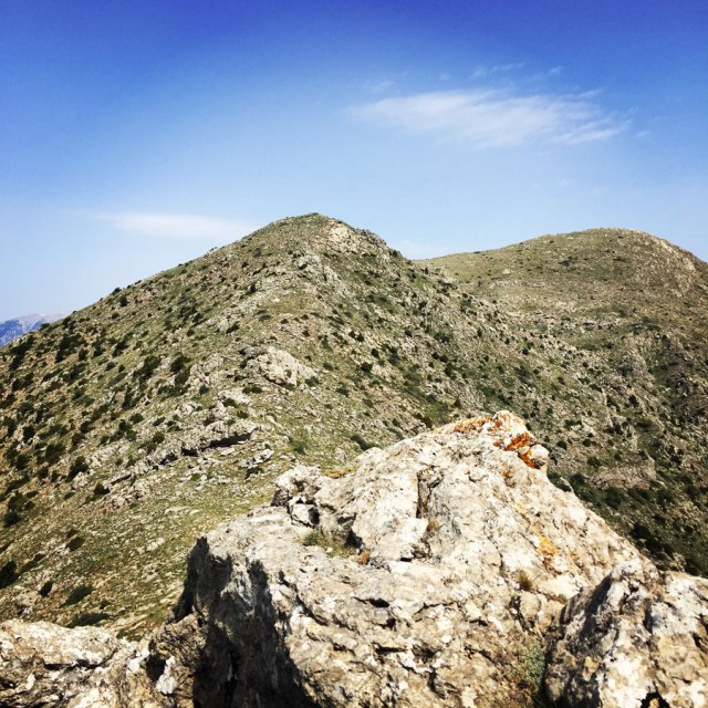
Once we have reach Chionotripa peak, we had another short break for a snack and some water and we have decided to follow the mountain ridge towards the peak of Gkimbrini. The ridge line was so inviting, that we could not refuse to go till the next unannamed peak which is at an altitude of 1.786 meters above sea level.


Details of the Hike:
- Location: Olygirtos Mountain
- Starting Point: Lafka village
- Ending Point: Lafka village
- Trail Signs: Partly yes. Large part of the route was off trail
- Minimum Elevation: 680 m
- Maximum Elevation: 1.794 m.
- Total Distance: 14.5 km
- Difficulty: Medium
- When to Hike: October – May
- Water Features: One but at the end of April there was not water
Bellow you can see the route we have followed on a map and on 3D:


If you wish to read other hiking and climbing adventures on nearby mountains check out the following ones:

Pingback: Hiking on Mount Mainalo – Tzelati Peak – Olympus Mountaineering