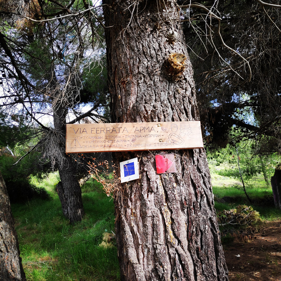
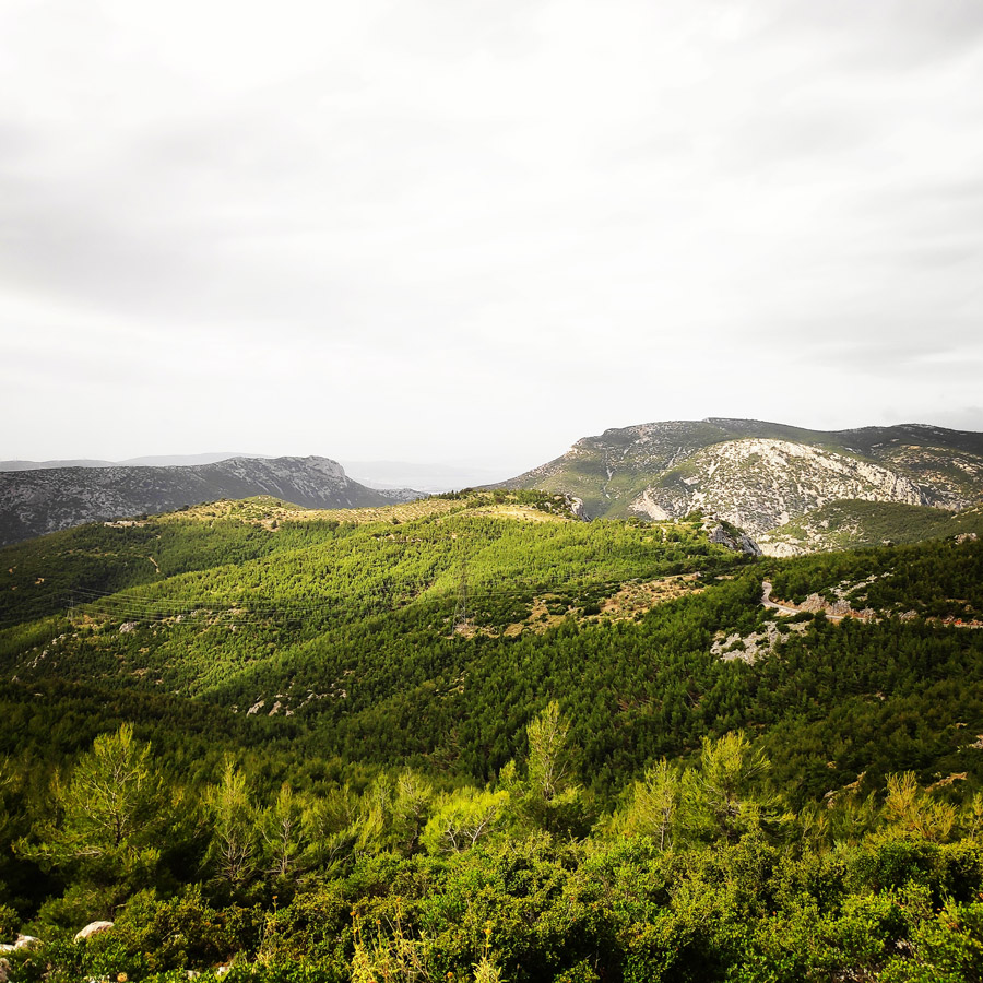
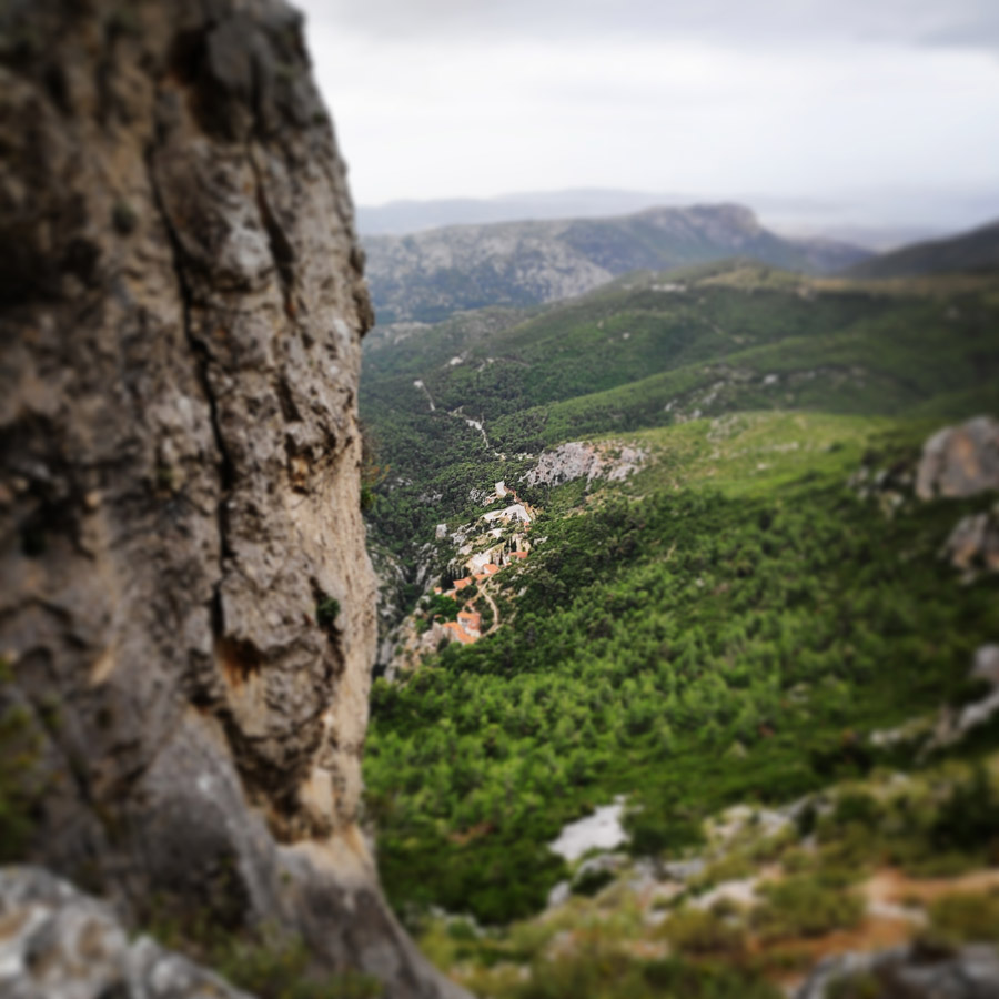
Athens is the capital of Greece and offers many different outdoor activities for the visitors of the city just 30 minutes from the city centre. One of the most visited location for such activities is mount Parnitha that besides hiking, climbing and cycling, one can enjoy a really nice Via Ferrata route that is located in “Arma“.
A via ferrata (Italian for “iron path”, plural vie ferrate or in English via ferratas) is a protected climbing route found in the Alps and certain other locations. The via ferrata found on Mount Parnitha is called “Arma” and the starting point is nearby “Moni Kliston” monastery. For the most part, it is the route that climbers have been following year after year in order to access the climbing barracks.
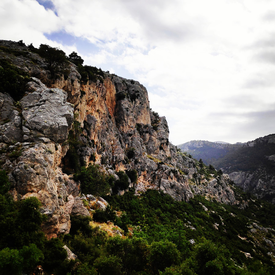
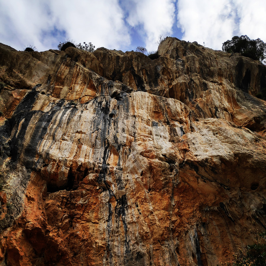
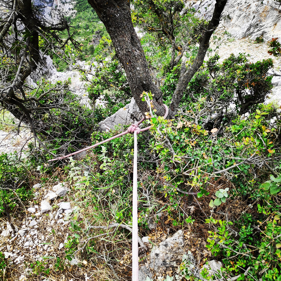
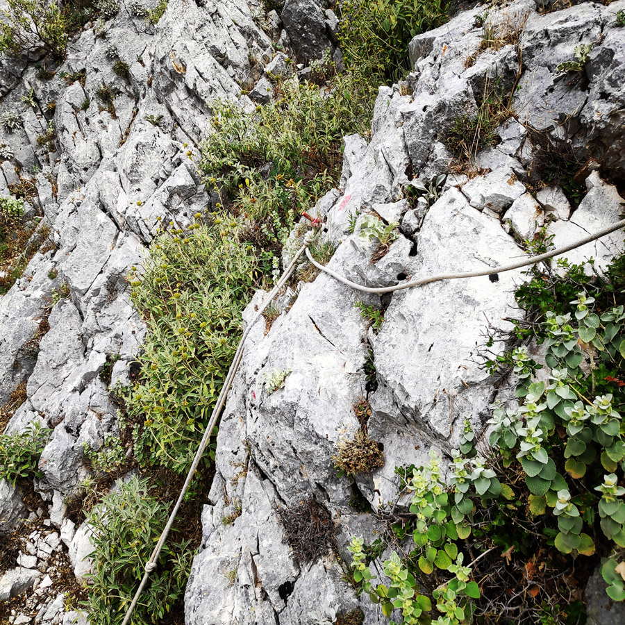
At many exposed locations, ropes are mounted on the rock and often fitted with mechanical plugs, which offer relative security. The path passes through cliffs that are fully exposed in the void. What makes it special is the direct contact with the special nature of the imposing cliff. Two small traverses which need via ferrata gear, offer the first short via ferrata sensation. The path rises up the slope with relatively easy climbing, but minimal security and the scree is quite loose. It is one of the most exposed parts of the route and needs special attention.
See other outdoor activities in Parnitha:
- Training on Mount Parnitha
- Winter Hike on Mount Parnitha
- Climbing in Korakofolia – Parnitha
- Climbing in Epos Fylis – Parnitha
- Dry Tooling in Rizos’ Cave – Parnitha
- Via Ferrata Arma – Parnitha
Access
From Attiki Odos Exit #6, follow Fylis Avenue towards Fyli/Chasia (north/west). Follow the road for 500m until big roundabout.
Take the third exit and continue on Fylis Avenue. 3,1 km after the roundabout you will see a golden-domed church on your right hand (Panagia Kanala) and a football pitch on your left.
Continue and go further than the Fyli village and follow the direction towards Monastery Kliston.
Via Ferrata Arma
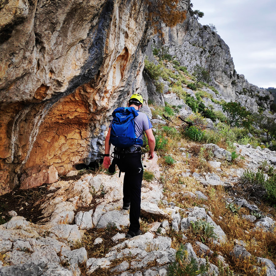
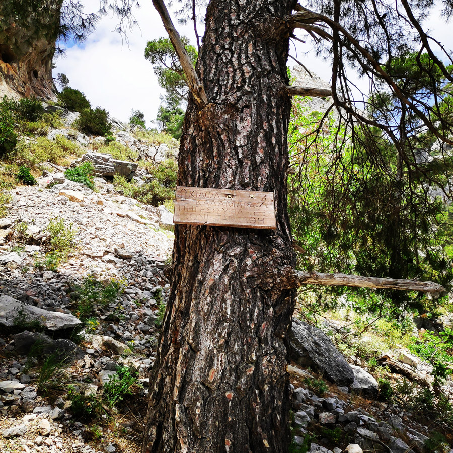
The path to the Via Ferrata starts right from the road curve that leads to the climbing crag “Arma”. This is about 10 minutes of easy hike, perfect for a nice warm up.

Support the journey — buy me a coffee
I share these articles and the climbing guidebooks because I love the outdoors, and they’ll always be free. If they’ve helped you, help me keep them coming. Click the button to support my work.

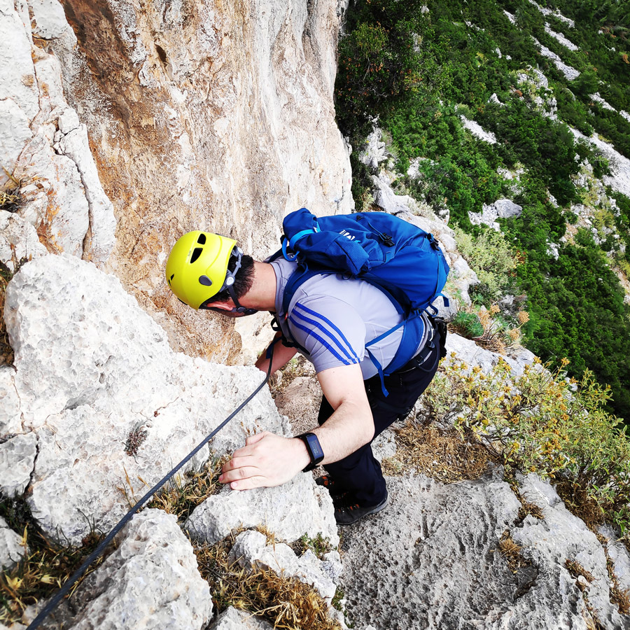
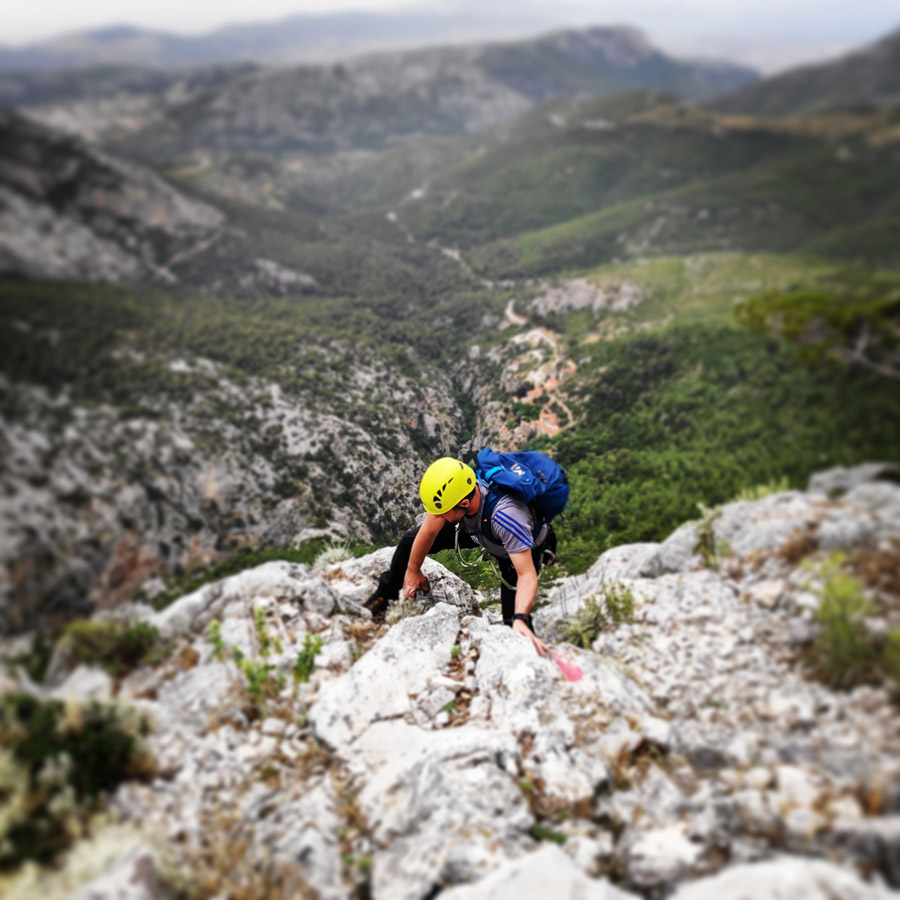
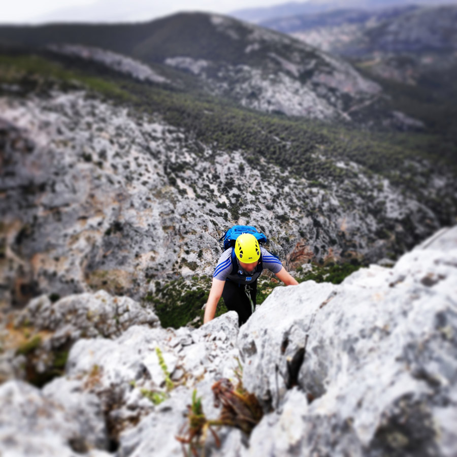
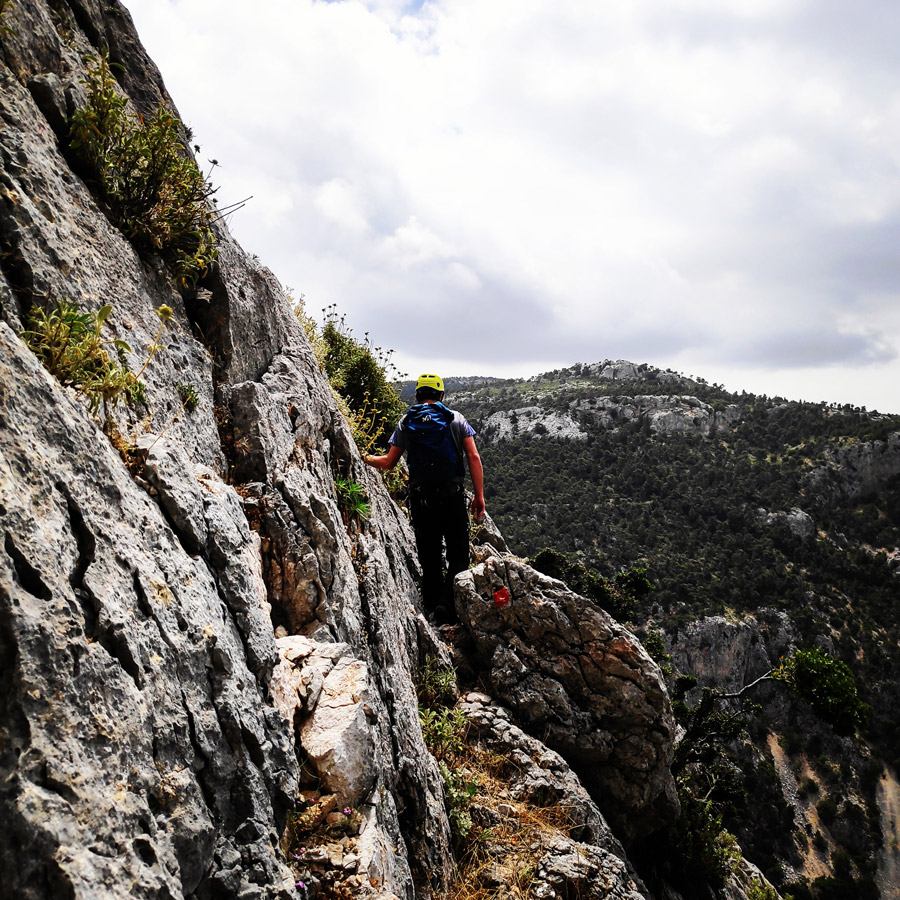
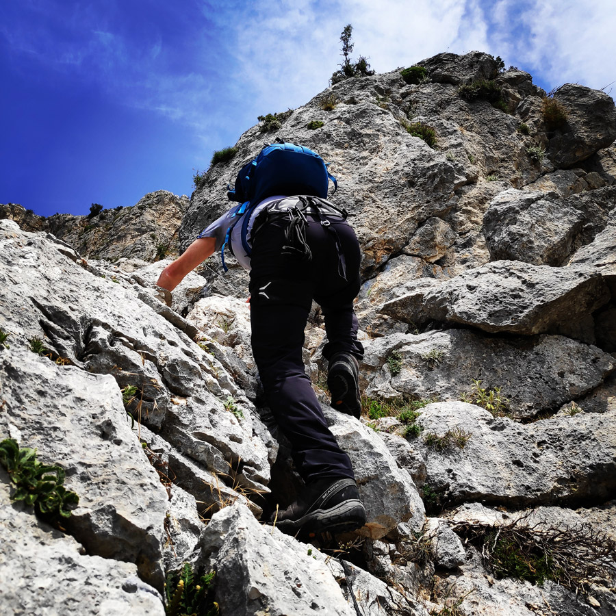
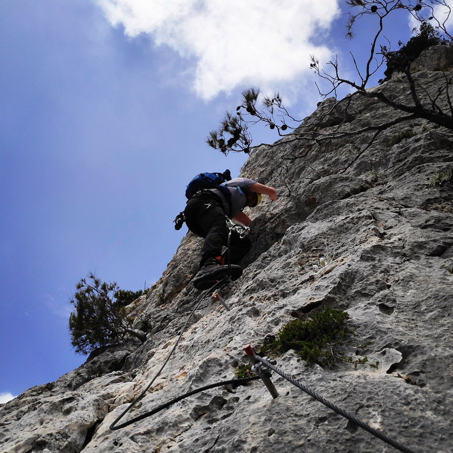
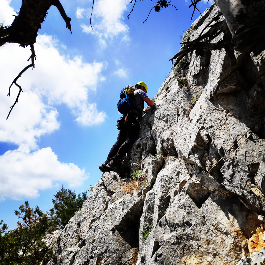
The Via Ferrata Arma is divided in three main parts.
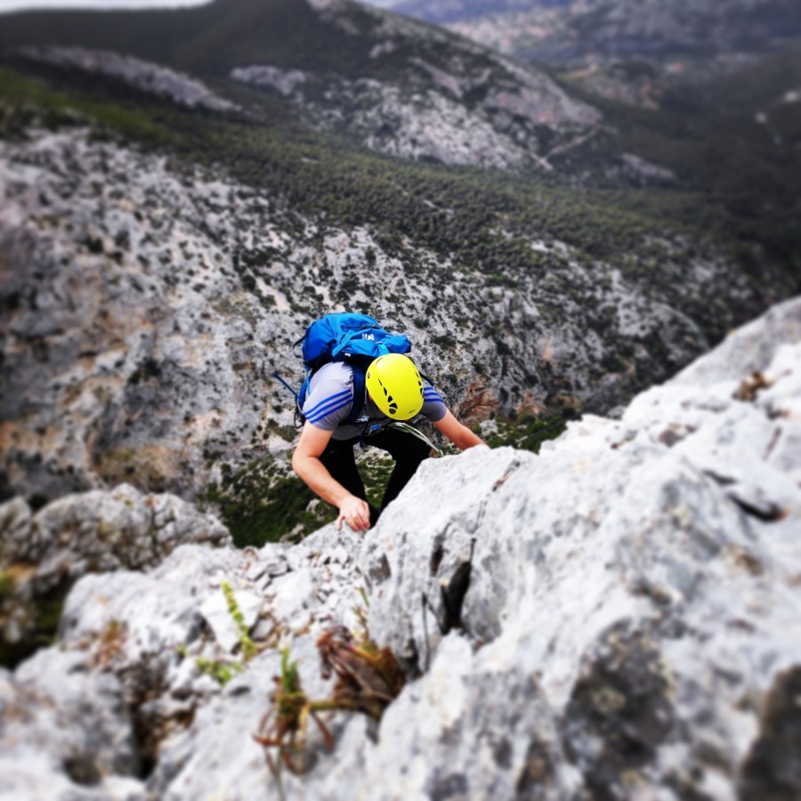
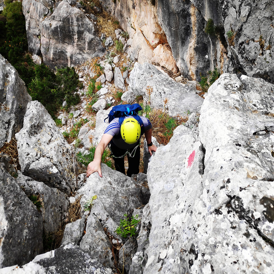
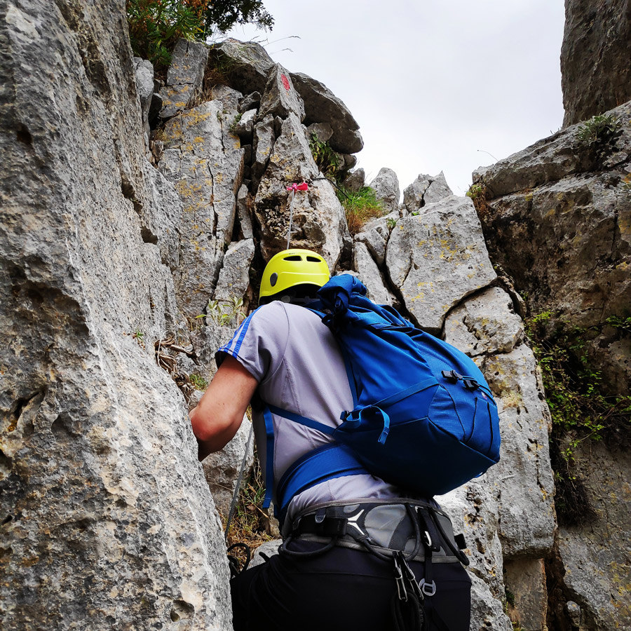
The first section consists of some scrambling III UIAA and some exposed passages that are secured by steel cable and ropes. This first part is about 30-35 minutes of scrambling and hiking which leads to the highest point of Arma.
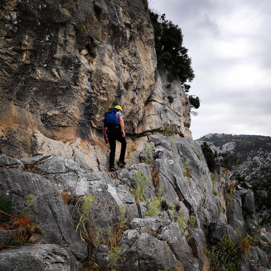
The second section of Via Ferrata Arma, consists of multiple down-climbs that might be a bit tricky for beginners, though for experienced mountaineers is just a pleasant and entertaining route. In fact, in all the exposed and/or difficult passages, there are secured steel cables and/or ropes.
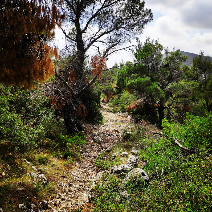
The third section, is the return trail that leads you to the starting point via a beautiful pine tree forest.
Via Ferrata Arma Section 1


Check out more FREE Guidebooks
Download now for free! Explore breathtaking landscapes and conquer thrilling heights with our collection of guidebooks and topos.
Don’t miss out on this opportunity to elevate your outdoor adventures. Click, download, and let the exploration begin!
Via Ferrata Arma Section 2
The second section of Via Ferrata Arma, consists of multiple down-climbs that might be a bit tricky for beginners, though for experienced mountaineers is just a pleasant and entertaining route. In fact, in all the exposed and/or difficult passages, there are secured steel cables and/or ropes.


Via Ferrata Arma Section 3
The third section, is the return trail that leads you to the starting point via a beautiful pine tree forest.


About Parnitha
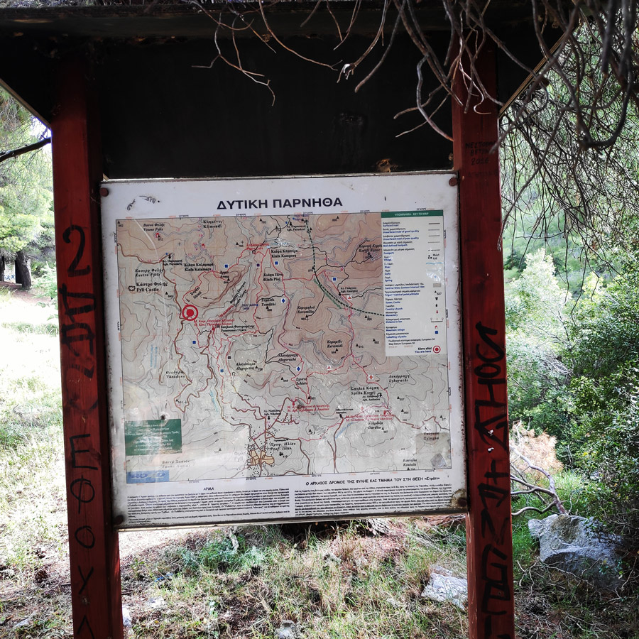
Hiking is a very popular activity in Parnitha. Two climbing associations, along with the Forest Service of Parnitha have created a dense network of trails, that covers the whole mountain range. Numerous paths pass along springs, thick forests and pastures. There are many options, according to the altitude difference that someone intends to cover (0 -800m.), the distance (500-5,000m.) and the time needed (30΄- 6 hours). Several routes give the opportunity to observe different vegetation types: firs, pines, oaks, junipers, plane-trees, phrygana.
The most important trails are indicated either by simple red signs on rocks and trees or by red tapes or finally, by special signs for each path, such as red triangles, red squares, yellow rhombs etc. In this way, following the same shape and colour of the signs, one can find the path and follow it to its end.
Check out more FREE Guidebooks
Download now for free! Explore breathtaking landscapes and conquer thrilling heights with our collection of guidebooks and topos.
Don’t miss out on this opportunity to elevate your outdoor adventures. Click, download, and let the exploration begin!
Details of the climb:
- Location: Parnitha Mountain
- Starting Point: Moni Kleiston
- Ending Point: Moni Kleiston
- Trail Signs: Well signed path
- Minimum Elevation: 557 m
- Maximum Elevation: 828 m.
- Total Distance: 7 km
- Difficulty: Moderate for experiences / Difficult for beginners
- Water Features: No
See map of the Via Ferrata here bellow:
See other outdoor activities in Parnitha:
- Training on Mount Parnitha
- Winter Hike on Mount Parnitha
- Climbing in Korakofolia – Parnitha
- Climbing in Epos Fylis – Parnitha
- Dry Tooling in Rizos’ Cave – Parnitha
- Via Ferrata Arma – Parnitha
Before you leave this blog check out the following map
Below: This map marks all the mountaineering adventures that have been featured on Olympus Mountaineering so far, including several Sport climbing crags – Select full screen to expand, zoom in for more detail, or click on a marker for a link to the post.

Pingback: Hiking to the Wildfire Observation Station of Skipiza – Parnitha (family friendly hike) – Olympus Mountaineering
Pingback: Climbing the Ridge of Horned Owl – Mount Pateras (Kopsi Boufou) – Olympus Mountaineering
Really nice photos as usual. That scrambling part looked like a really fun part of the route.
LikeLike
Pingback: Via Ferrata Arma – Parnitha Mountain – Olympus Mountaineering
Pingback: Camp Mach Express Dyneema Quickdraw Review – Olympus Mountaineering
Pingback: Hiking in West Parnitha – Kliston Monastery – Pan’s Cave – Arma – Kliston Monastery – Olympus Mountaineering
Pingback: Hiking in West Parnitha – Agios Kiprianos – Koromilia peak – Tamilthi peak – Alogopetra peak – Agios Kiprianos – Olympus Mountaineering
Pingback: Skytali V+ UIAA 35 m. – Trad Climbing in Arma – Mt. Parnitha – Attica – Olympus Mountaineering
Pingback: La Vita è Bella VI- UIAA 60 m. – Trad Climbing in Arma – Mt. Parnitha – Attica – Olympus Mountaineering
Is the via ferrata still there (and safe) after the wildfires in the region a couple of years back?
LikeLike