
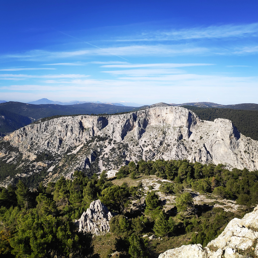
Every now and then I try to visit one of my favourite outdoor locations of Greece, and specifically Mt. Parnitha which is located just 30 minutes far from Athens city centre. Mt. Parnitha is located in Attiki province, 25km N from the city of Athens. It is one of the 4 mountains(the others are Immitos, Penteli and Poikilo) that surround the circular plain, in which the city of Athens is built. Mt Parnitha is the tallest and more impressive among the mountains that surround Athens.
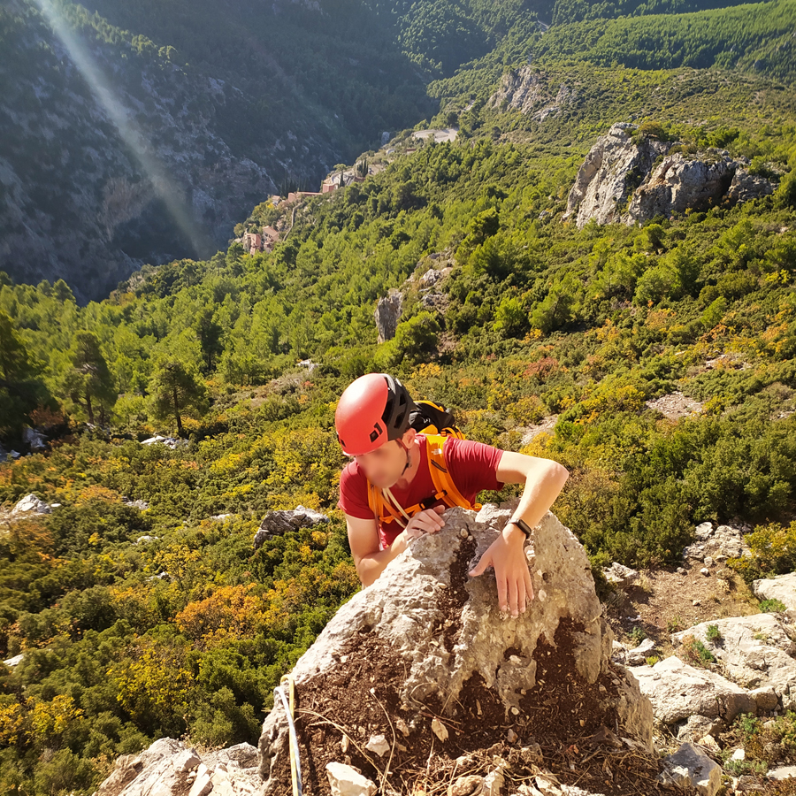
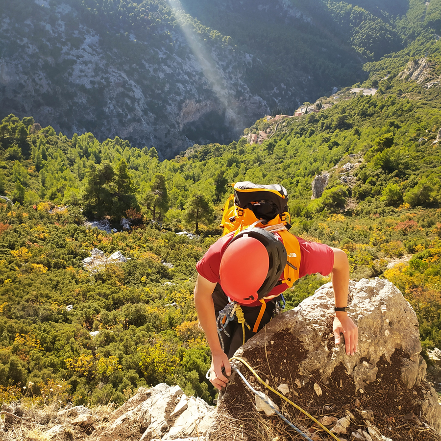
During my previous visits in Parnitha, I had the pleasure to climb in the area of Flabouri, but this time I want to visit and climb in the area of Arma.
About Arma
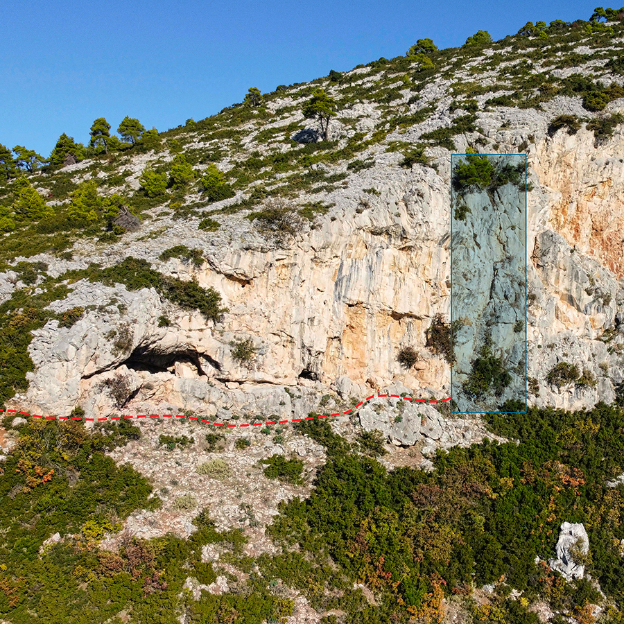
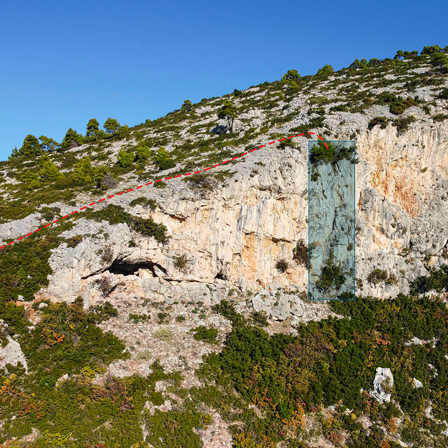
Arma is located nearby Fyli. Fyli, also known as Chasia, is a town situated in the southwestern area of Parnitha. In near proximity, thee are numerous cliffs which have been of great interest of the greek climbing community. The most prominent of these cliffs is Arma which has played a primary roe in the rock climbing history of the region.
Many of the exploratory steps of the first greek rock climbers took place on the Arma Cliffs. Arma consists of four main distinct areas:
- Notio Arma (South Arma)
- Kentriko Arma (Central Arma)
- Vorios Tichos (North Wall)
- Spilia Sarri (Sarri’s Cave)
The rock is limestone of good quality and in some areas, even excellent quality.
More general info about Arma and generally climbing in Attica, you can find on the following guidebook:
Furthermore, since a couple of years, a small group of local climbers led by K. Lafogiannis and A. Papandreou worked hard in order to revive the old routes that were established many years ago. More info about all the works carried out by K. Lafogiannis and A. Papandreou in the following Facebook Group.
Thank you and much appreciated all your efforts!
Explore all outdoor activities in a convenient list view here
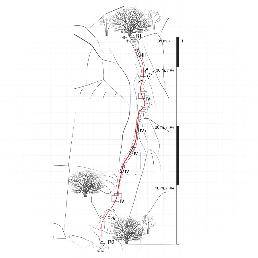
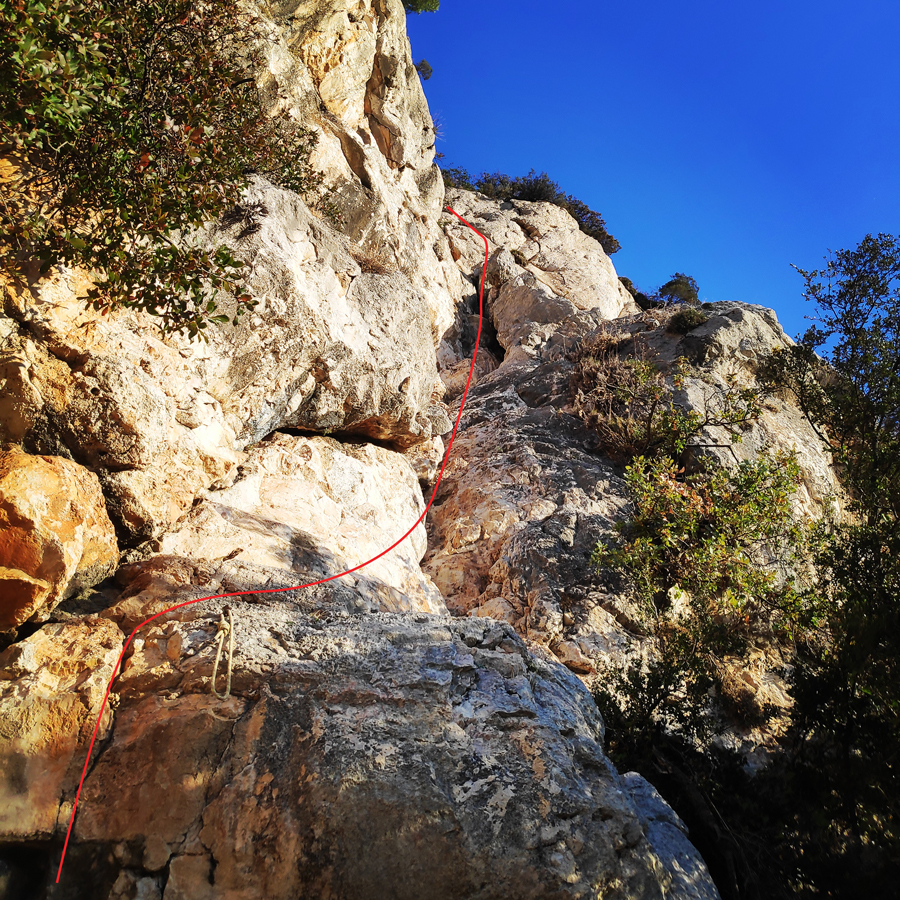
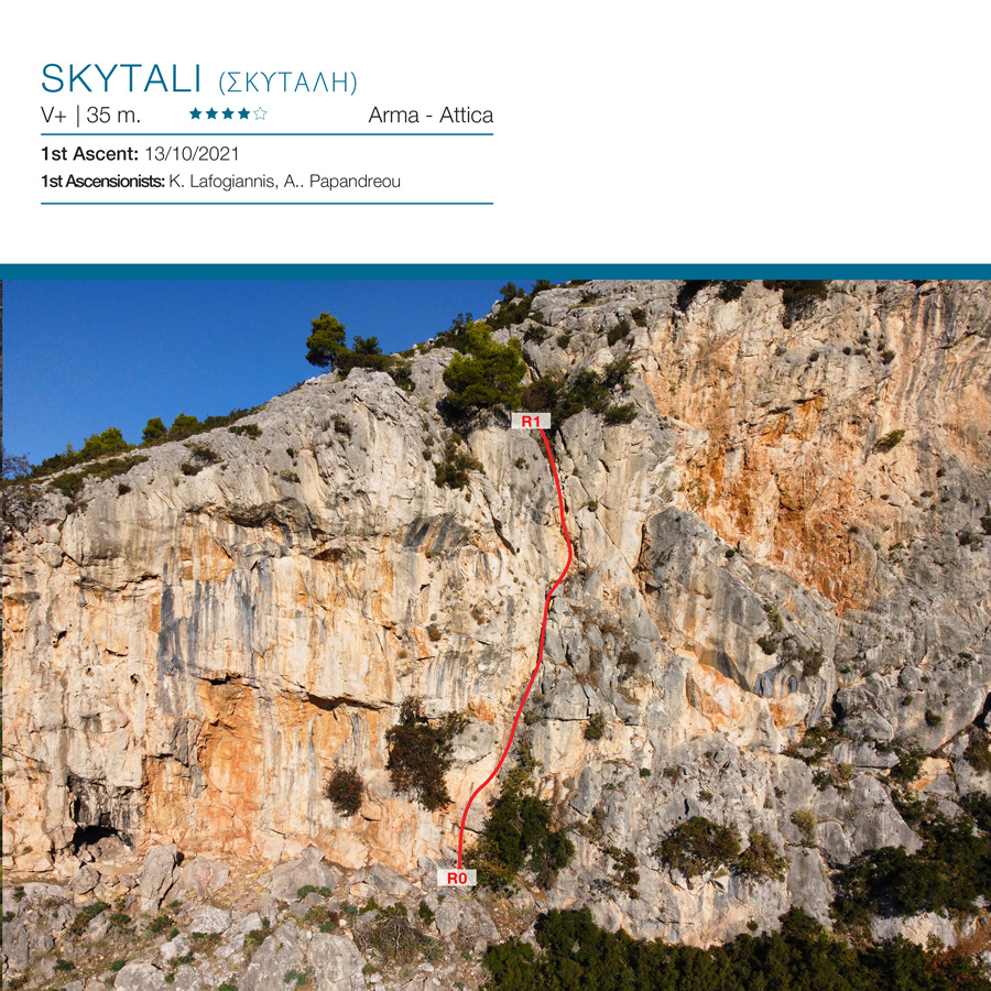
Skytali (Σκυτάλη) – V+ UIAA, 35 m. – Trad Climbing in Arma
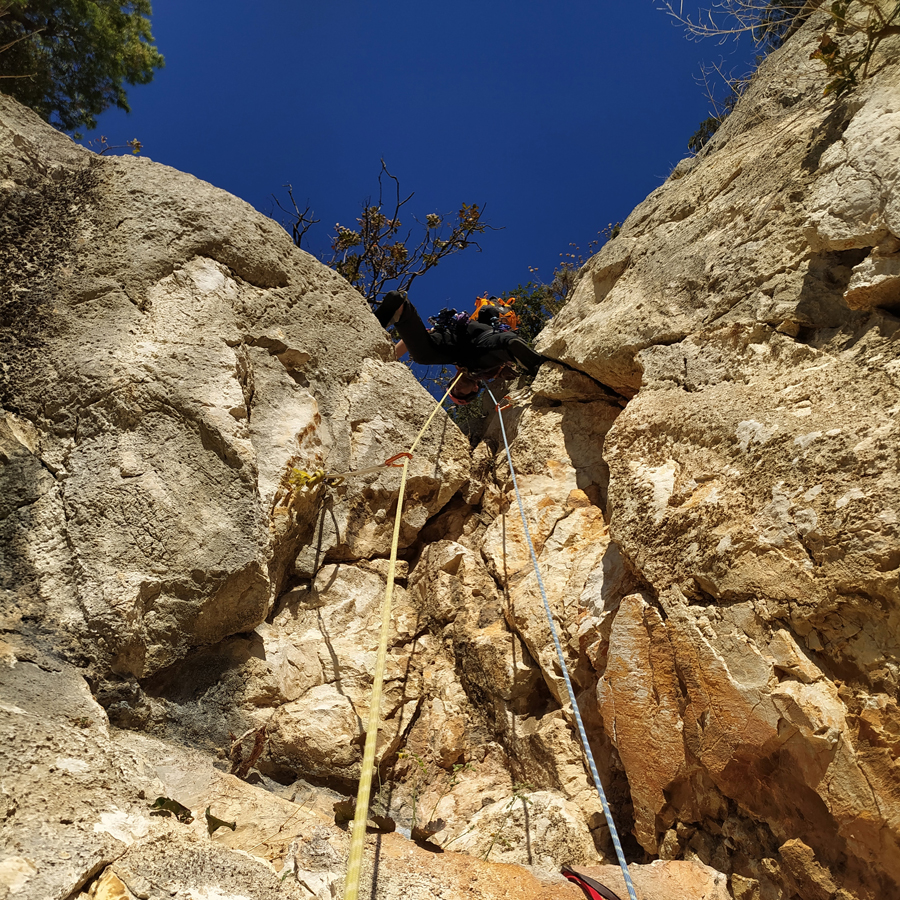
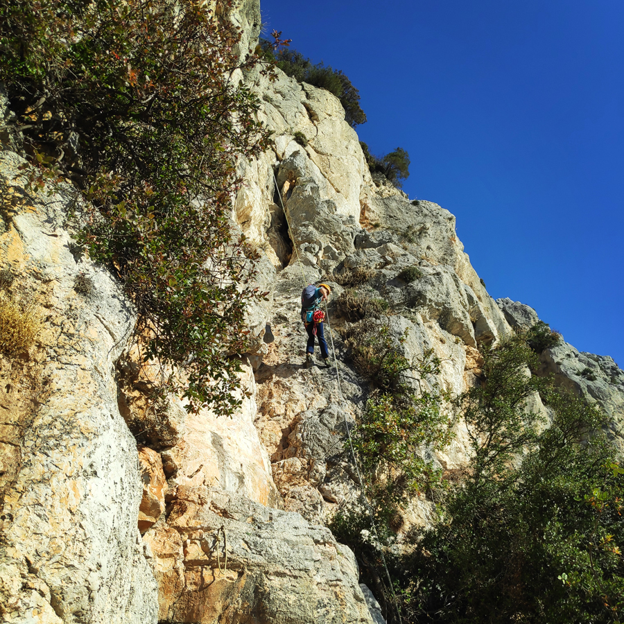
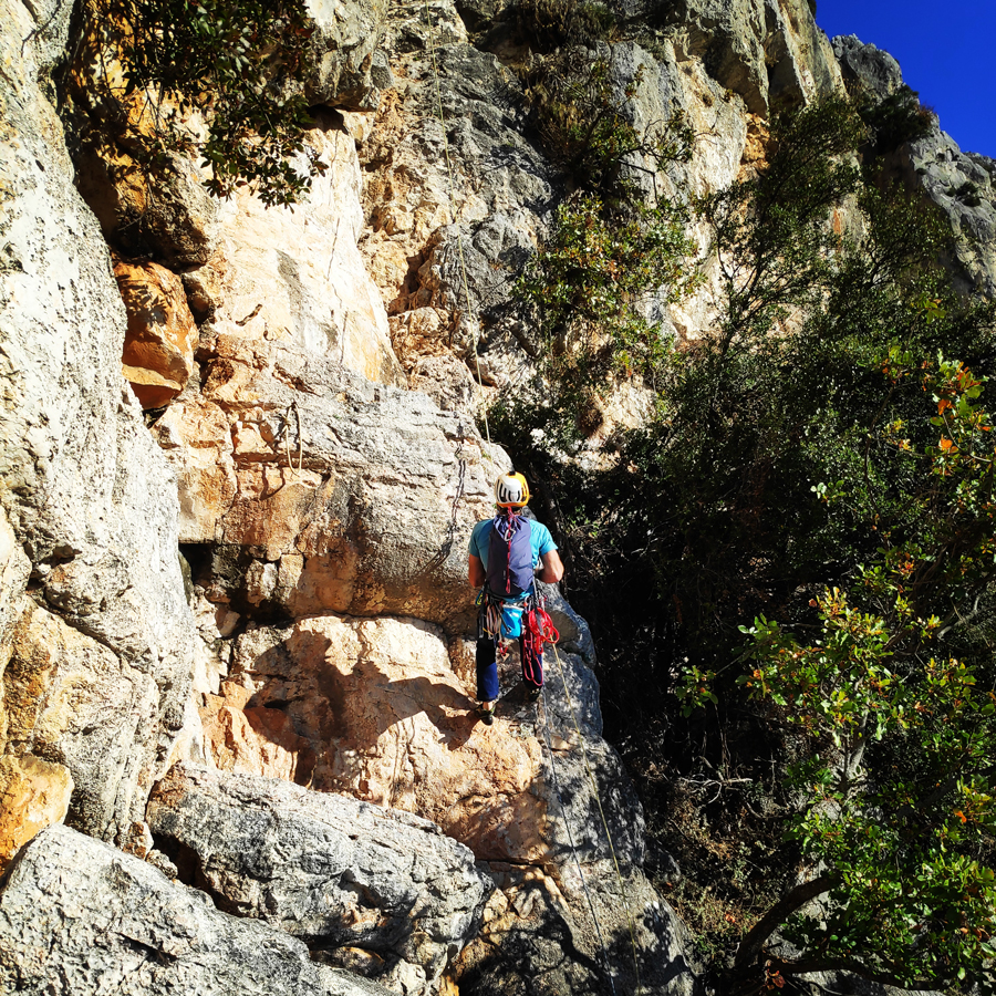
Skytali (Σκυτάλη = Relay Buton) (V+ UIAA, 35 m.) is one of the newest routes that was established in Arma area and specifically in the Southern Arma sector.
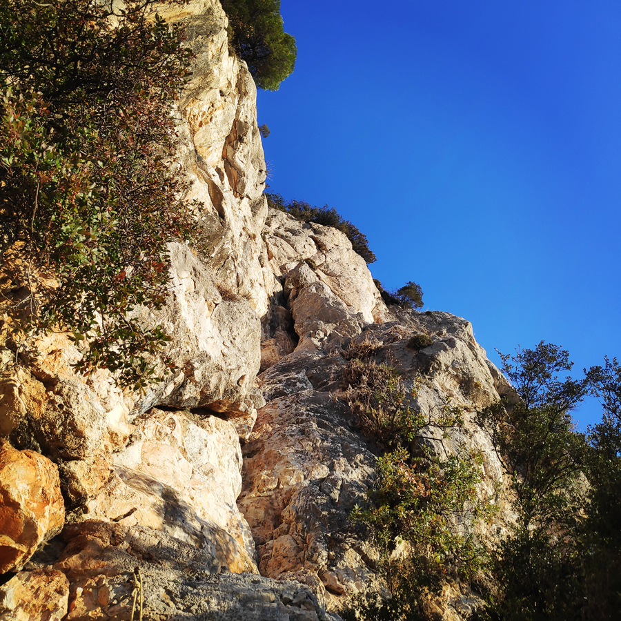
The route is located on the rock formation known as Arma(Fyli area) and due to its proximity to the city center of Athens and the excellent rock quality (limestone) is has been of a great interest to the Greek rock climbing community.
The route can be described as an “introduction” to Trad Climbing in Arma. It is a clean and well maintained route, and there are also three permanent pitons (one with an attached cordelette) and two cordelettes in the critical points. The route is not difficult and can be well protected with different kind of gear. The rock is limestone and its quality is good.
Notice: Although this is a single pitch trad route, due to avoid any rope drag, we split the route in two, but this is not necessary. In addition, personally I would rate this route at V UIAA and not V+ UIAA.
Support the journey — buy me a coffee
I share these articles and the climbing guidebooks because I love the outdoors, and they’ll always be free. If they’ve helped you, help me keep them coming. Click the button to support my work.

Download for free the complete route description and Topo map
- Download the complete Interactive Guidebook in PDF spreads (best for Tablets/Laptops/Desktops)
- Download the complete Interactive Guidebook in PDF single pages (best for Phones)

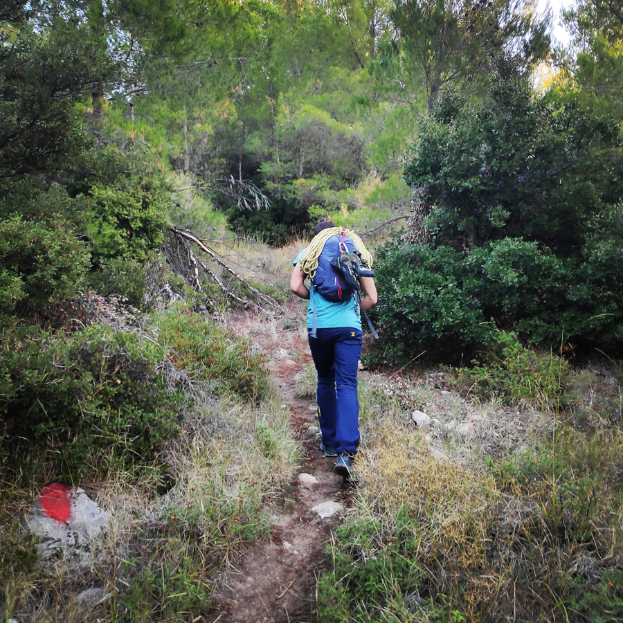
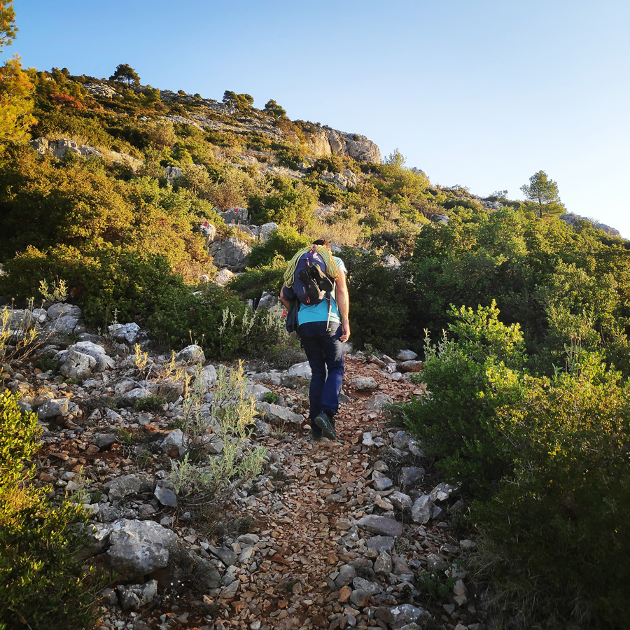
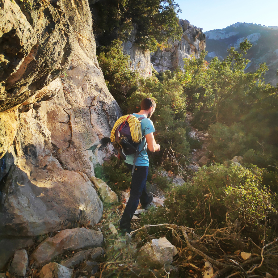
Approach
From Attiki Odos Exit #6, follow Fylis Avenue towards Fyli/Chasia (north/west). Follow the road for 500m until big roundabout. Take the third exit and continue on Fylis Avenue. 3,1 km after the roundabout you will see a golden-domed church on your right hand (Panagia Kanala) and a football pitch on your left. Continue and go further than the Fyli village and follow the direction towards Monastery Kliston. You will drive further on from Monastery Kliston till the following location 38.133639, 23.650956.
As soon as you park, follow the red signs which they lead to the Via Ferrata and the beginning of the route is located here: 38.135403, 23.655060
- Parking spot: 38.133639, 23.650956
- Beginning of the route: 38.135403, 23.655060


Check out more FREE Guidebooks
Download now for free! Explore breathtaking landscapes and conquer thrilling heights with our collection of guidebooks and topos.
Don’t miss out on this opportunity to elevate your outdoor adventures. Click, download, and let the exploration begin!
Route description
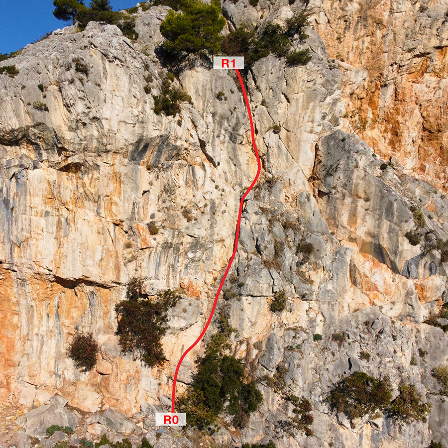
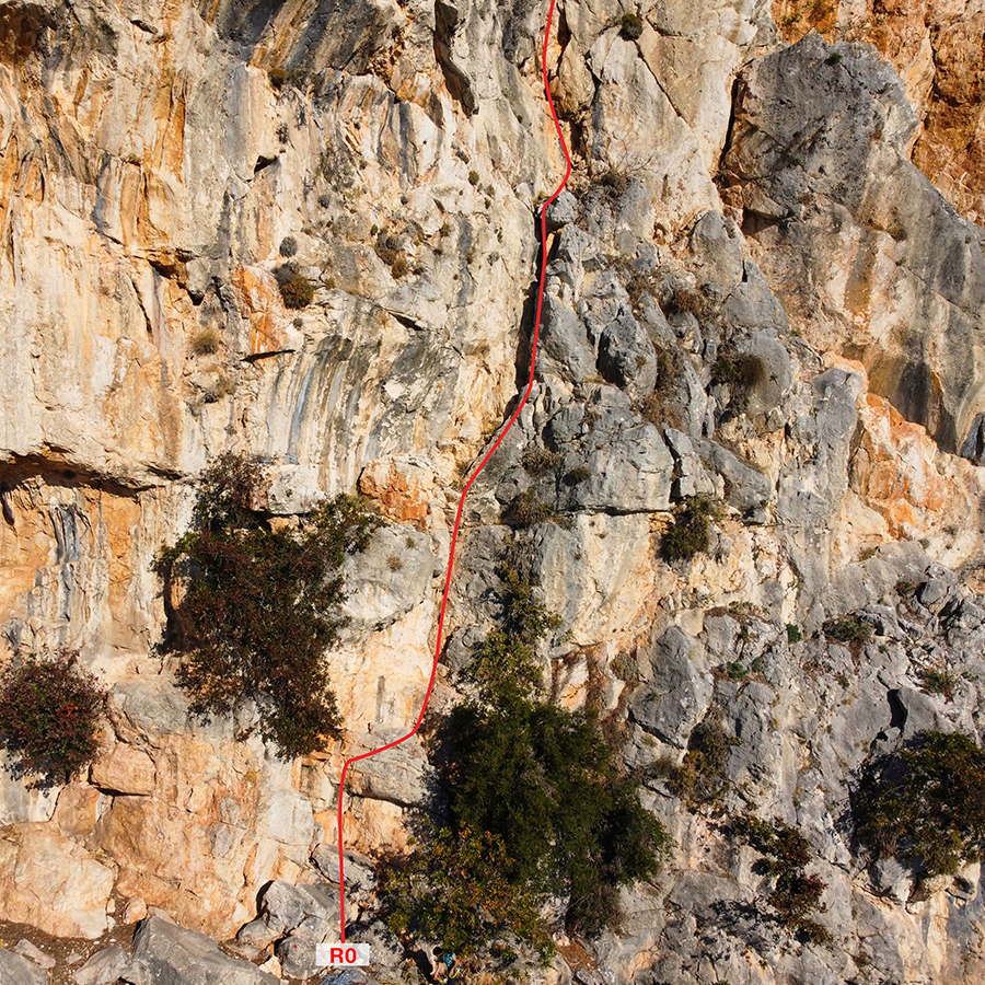
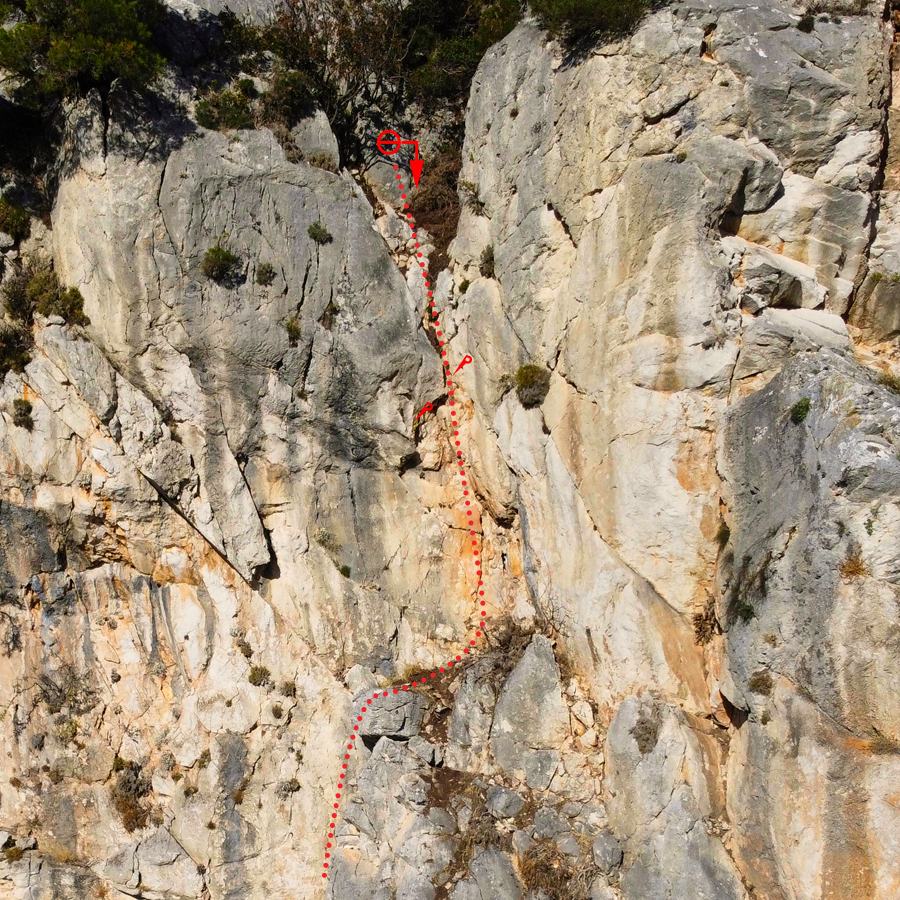
R0 – R1 | V+ UIAA – 35 m.
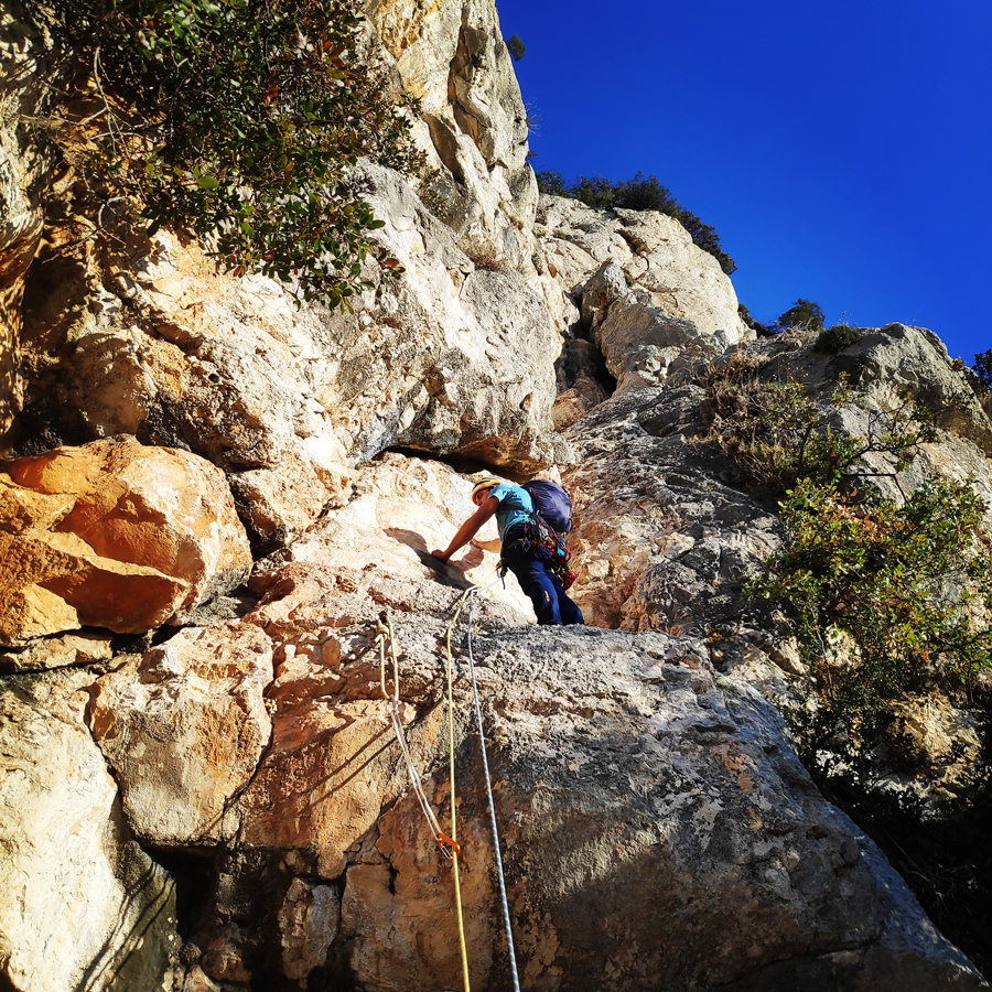
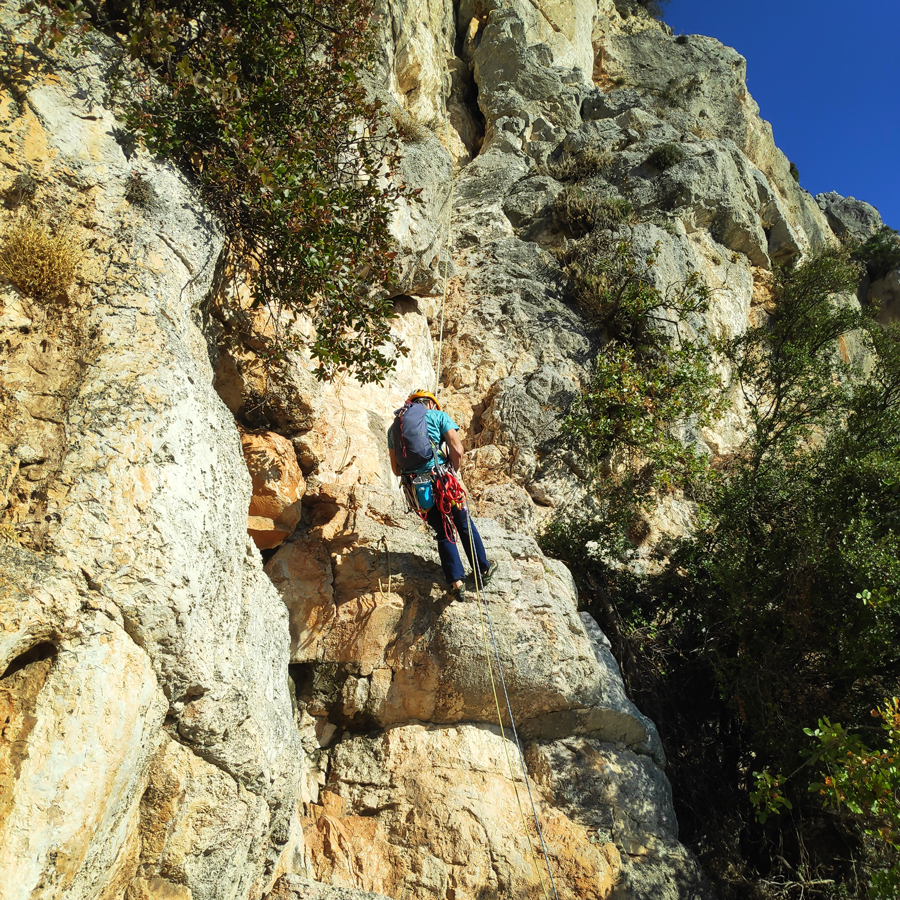
The route starts with a small overhang of about 1,5 meters with a maximum difficulty of IV+ UIAA, though also not experienced climbers will feel comfortable, because there is a newly placed piton with a cordelette attached. As soon we climb this part we will be on a very comfortable ledge. Upon that, we continue to follow the natural line on a slab.
On that point, we can place the first protection gear (left side). We continue to climb up and we enter the dihedral where the climb is easy (IV UIAA). Just before the first exit to a comfortable ledge, the climb becomes slightly more difficult (IV+ UIAA), but the climber will find two well positioned cordelettes which offer good protection.
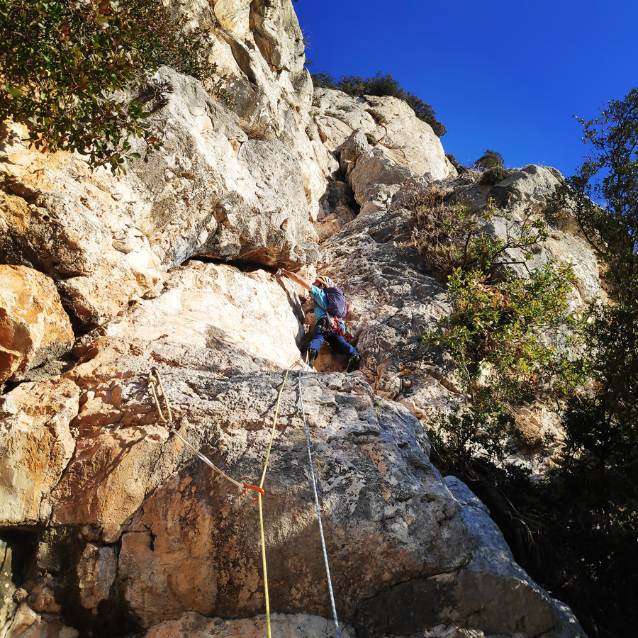
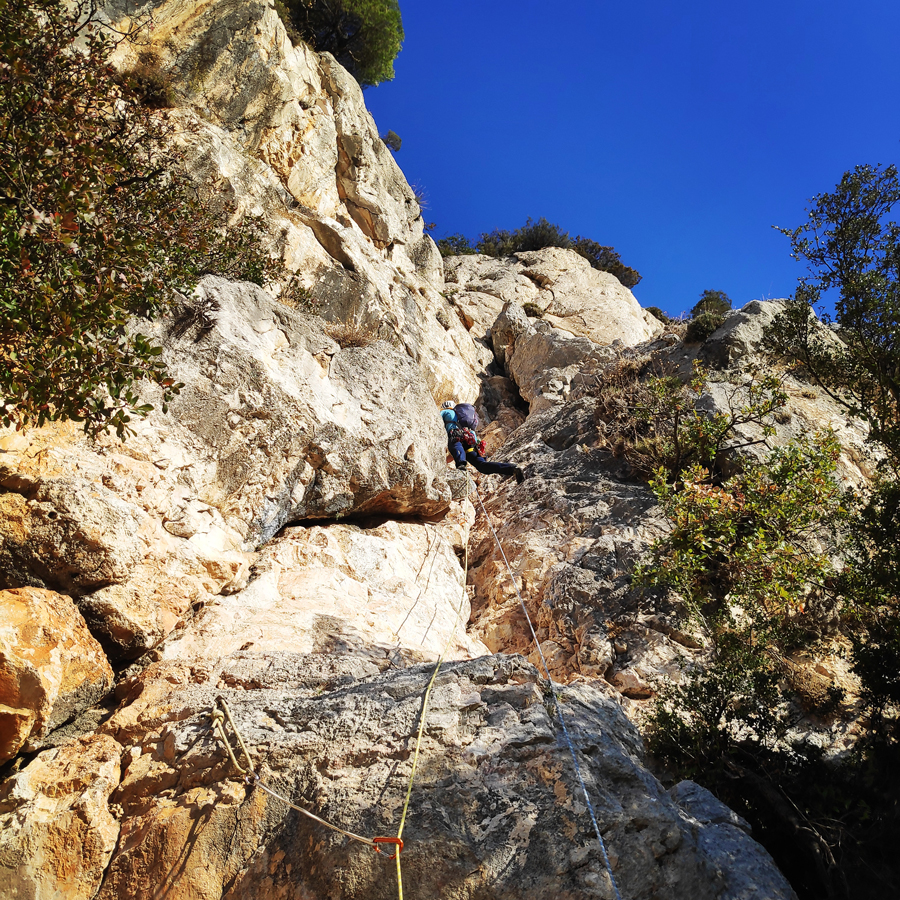
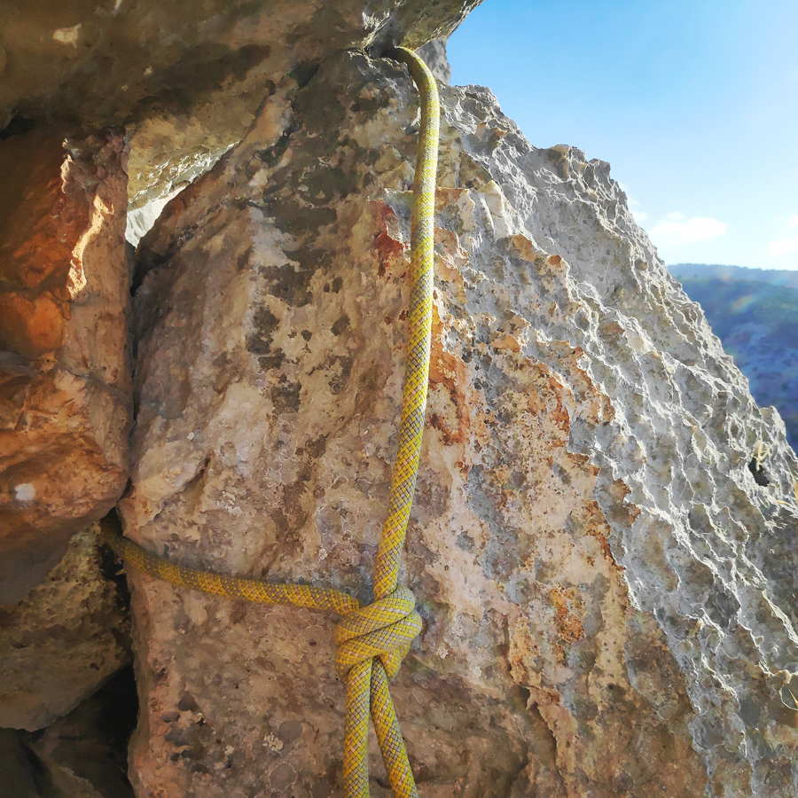
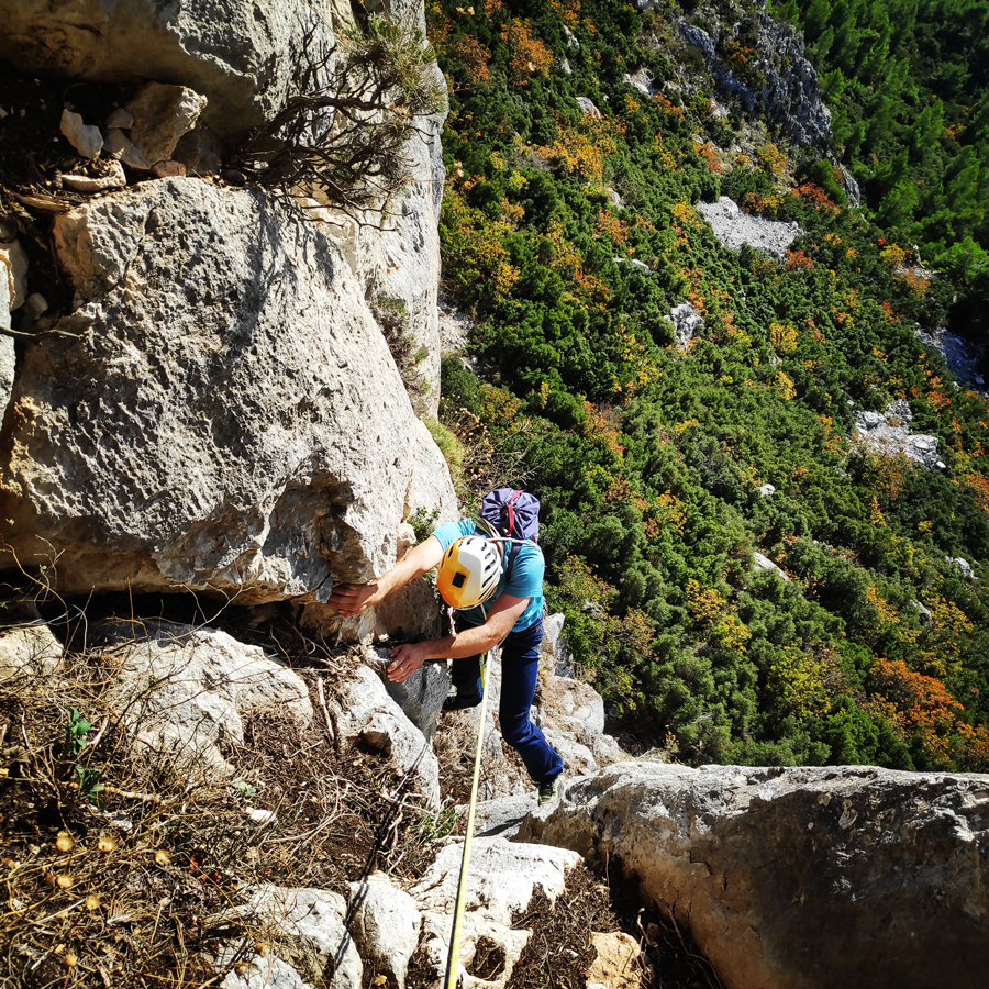
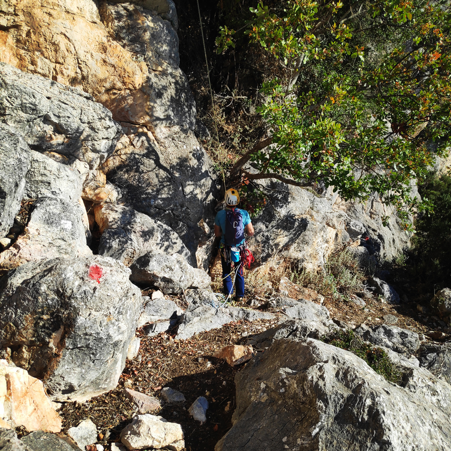
As soon we climb over a large boulder, we will be again on a comfortable ledge. Just above that ledge, we can spot the crux of the route. The crux of Skytali (Σκυτάλη = Relay Buton) is an overhang with clear and good holds and plenty locations for correct foot placement. In addition, the excellent job done by K. Lafogiannis and A. Papandreou made this crux (V+ UIAA) to be and feel safe by placing two pitons. The first piton, is located on the left side just before the crux and the second piton is located on the right side about 2 meters higher. As soon we climb over the crux, the route is basically completed, and we can see the anchor (a large cordelette with two carabiners) located on a tree.
The belay is very comfortable.


Important
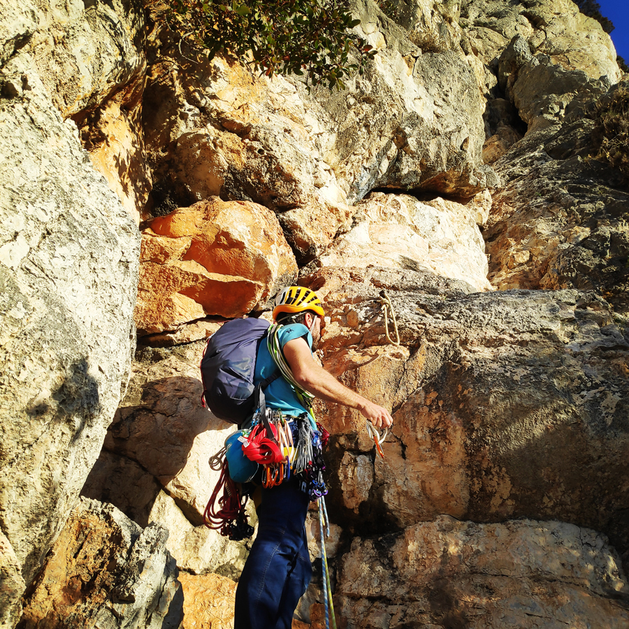
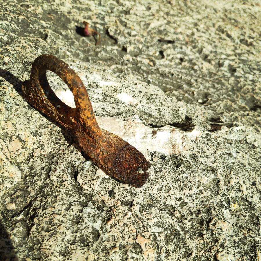
During my climb (November 2022), at the crux, there was also a third piton, which was very rusty and it was obviously an old piton. As soon will clipped in a quickdraw and we climbed over it, the piton was removed without exercising any force on it. The other two pitons, are new and hold strong. Bellow a photo with clear indication of the locations of the two pitons and the anchor of R1.
Return
From the top of the rock, we have two options. The first is to abseil down the route (make sure to have 2×60 meters half ropes) or to follow the trail which leads to the beginning of the via Ferrata trail.
Return without Abseil
Move towards the south which leads to the beginning of the via Ferrata trail.
Recommended Gear
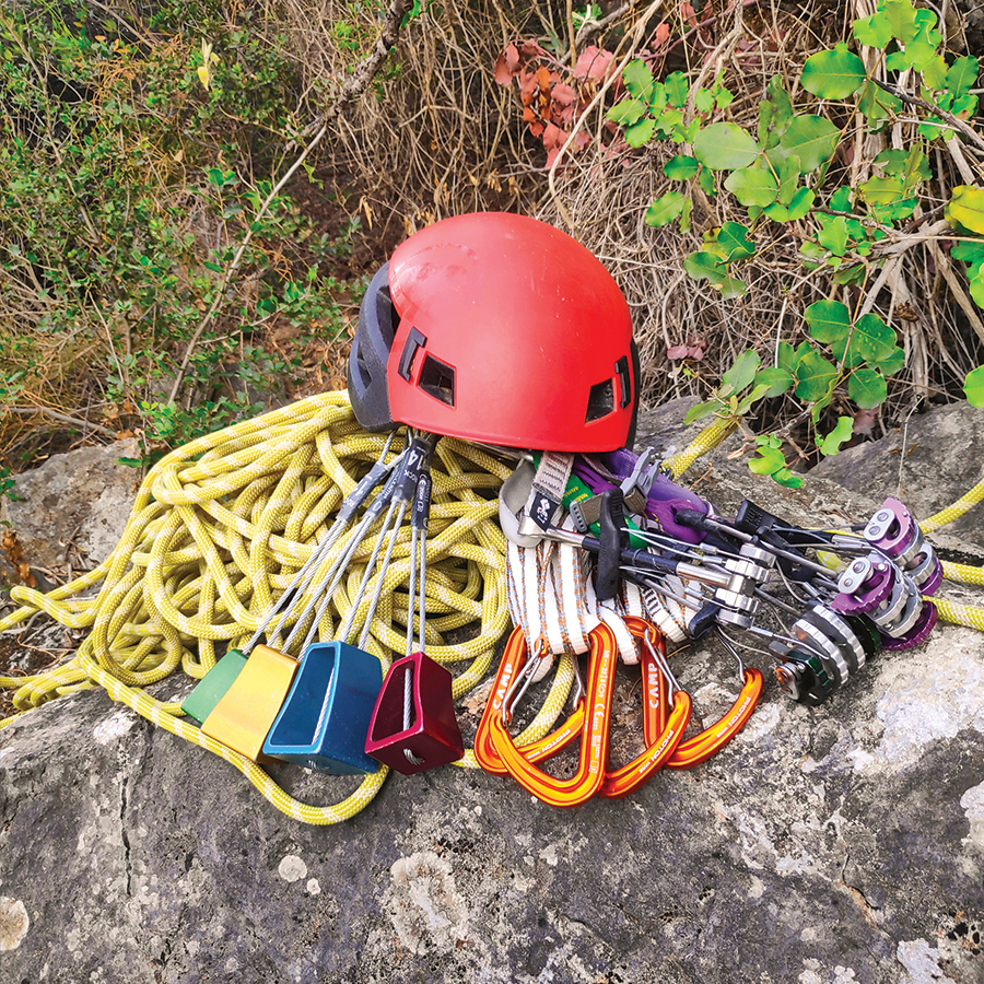
For this trad climb, I used the following gear:
- Mammut Wall Rider Helmet
- 5 lanyards 60 cm
- 1 lanyard 120 cm
- 4 locking carabiners
- 1 HMS carabiner
- The North Face Verto 27 Backpack
- Petzl Hirundos Harness
- Simond Climbing shoes
- Alpine Quickdraws
- Cordelette for prusik
- 2 x 60 m. rope
- 4 carabiners
- Reverso
- 1 lt of Water
- 1 energy bar
- Friends / Camalots
- Rock Nuts
Details of the Climb
- Location: Mt. Parnitha – Arma
- Difficulty: V+ UIAA
- Length: 35 meters
- Pitches: 1
- When to Climb: Late Autumn – Early Spring
- Water Features: None
Support the journey — buy me a coffee
I share these articles and the climbing guidebooks because I love the outdoors, and they’ll always be free. If they’ve helped you, help me keep them coming. Click the button to support my work.
Download for free the complete route description and Topo map
- Download the complete Interactive Guidebook in PDF spreads (best for Tablets/Laptops/Desktops)
- Download the complete Interactive Guidebook in PDF single pages (best for Phones)
Subscribe & Stay Informed
Enter your email address to follow this blog and receive notifications of new posts by email
See other outdoor activities in Parnitha:
- Trad Climbing in Kato Flabouri – Klassiki
- Hiking in West Parnitha – Kliston Monastery – Pan’s Cave – Arma
- Training on Mount Parnitha
- Winter Hike on Mount Parnitha
- Climbing in Korakofolia – Parnitha
- Hiking in West Parnitha – Ag. Kiprianos – Koromilia – Alogopetra
- Climbing in Epos Fylis – Parnitha
- Dry Tooling in Rizos’ Cave – Parnitha
- Via Ferrata Arma – Parnitha
- Scrambling and Climbing the Flabouri Ridge
Before you leave this blog check out the following map
Below: This map marks all the mountaineering adventures that have been featured on Olympus Mountaineering so far, including several Sport climbing crags – Select full screen to expand, zoom in for more detail, or click on a marker for a link to the post.

Pingback: Ek Tou Anasfalous VI UIAA 90 m. | Trad Climbing in Karathona beach – Nafplio – Olympus Mountaineering
Pingback: La Vita è Bella VI- UIAA 60 m. – Trad Climbing in Arma – Mt. Parnitha – Attica – Olympus Mountaineering
Pingback: Electra VI UIAA 4 Pitches – 145 m. | Trad Multi Pitch Climbing in Pleiades Crag – Katafyki Ravine – Ermioni – Olympus Mountaineering