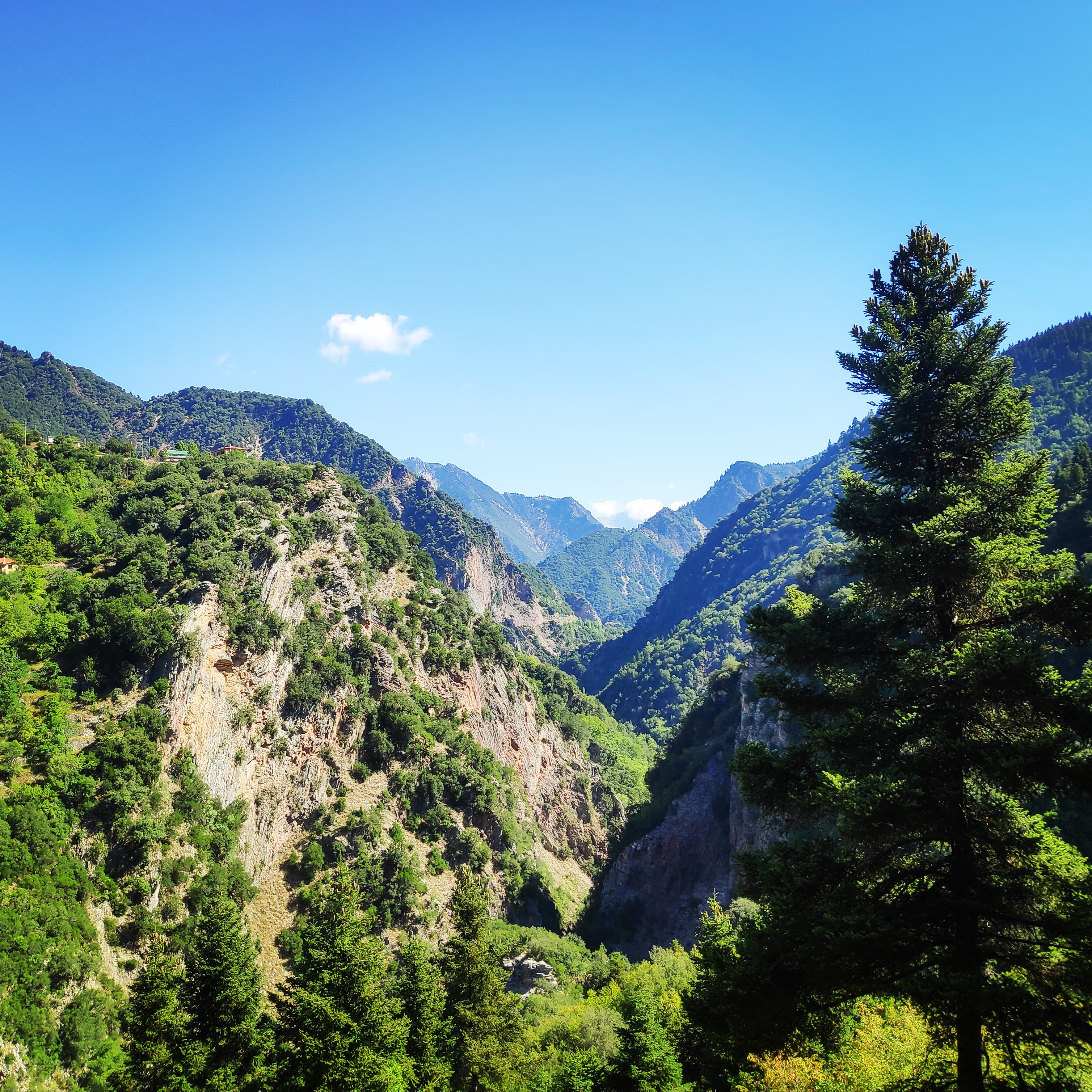
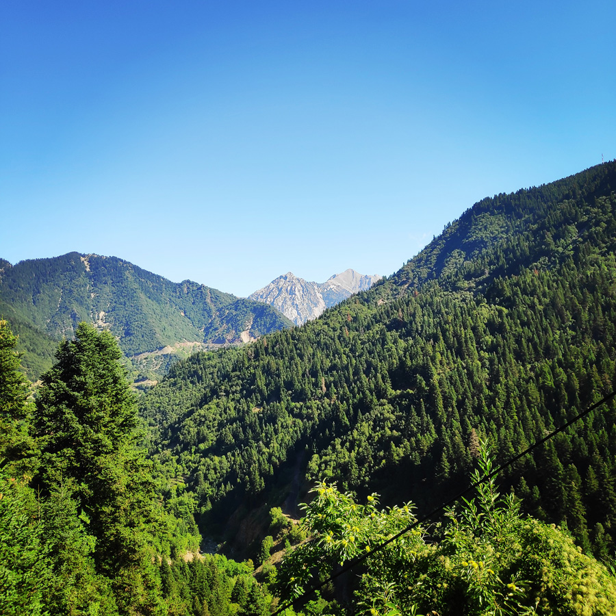
There are several areas in Greece that I always want to dedicate more time exploring them, but for one or the other reason, I do not visit them that often. This is the region of Evrytania. Evrytania boasts to be the Alpine Greece. The well wooded mountain of Tymfristos and the high altitude has formed a unique and rare unspoiled beauty of dense fir forests and traditionally built little villages. The mountainous region of Evrytania has a wide range villages around the city of Karpenisi and it is rather popular as a winter destination as it has a ski centre on Mount Tymfristos and offers numerous outdoor activities like rafting in Karpenissiotis River and horse back riding in the forests.
About Evrytania
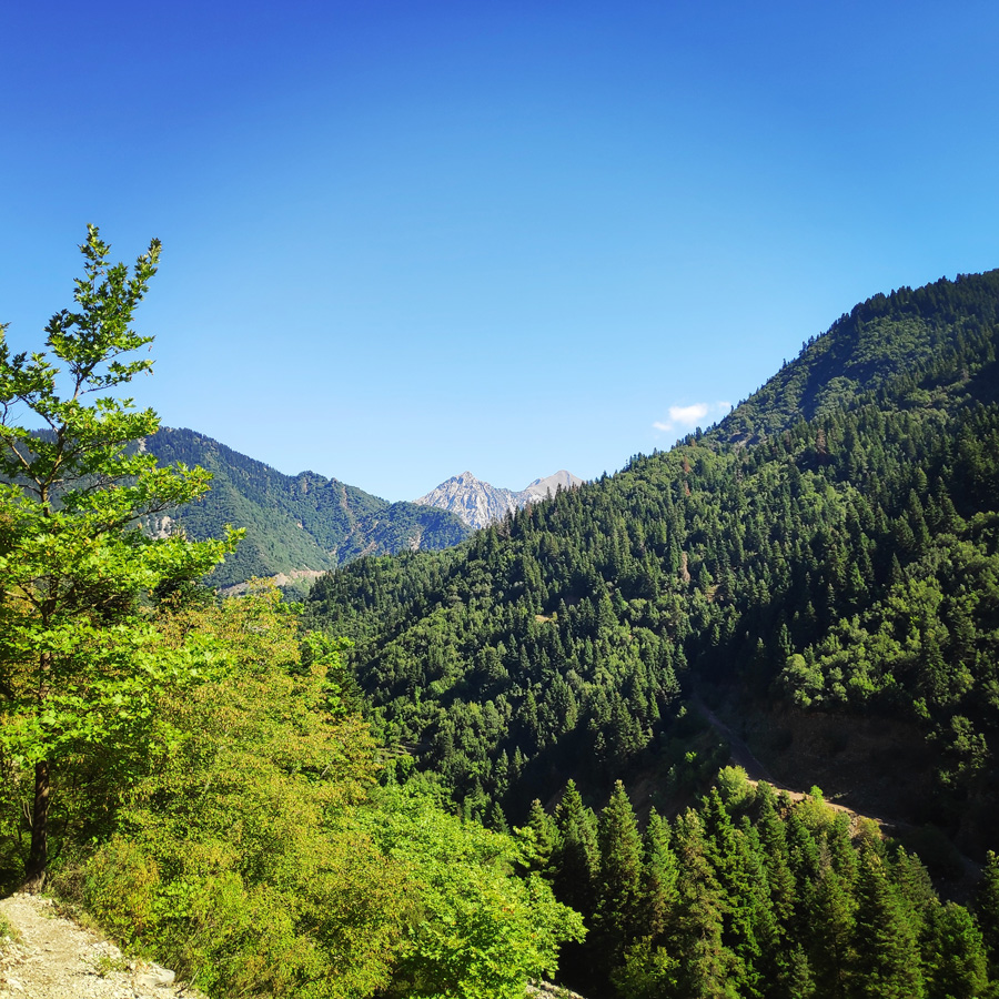
Evritania is a region situated in the west part of the Central Greece and its neighbouring regions are Aetoloacarnania to the south, Fthiotida to the east and Karditsa to the north. The region spans an area of 1.868 sq. km. and a total population of 34.855 inhabitants. The capital city of the region is Karpenisi. The region is mostly covered with mountains: Mount Timfristos and Panaitoliko. The region has also many rivers: Acheloos, Agrafiotis and Megdovas while the reservoir of Kremasta Lake is to the south.
The area of Evrytania has been inhabited since antiquity as the fact of their participation in the Trojan War proves. The mountainous region has shaped different culture and tradition to the people as in antiquity it is found that they were speaking their own dialect unintelligible from other Greeks. When the area fell under the Turks, it was given privileges of autonomy and authority.
See other activities in the region of Evrytania here:
- Winter hike Mt. Panaitoliko (Panetoliko)
- Winter Ascent Mount Tymfristos
- Winter Ascent Mount Kaliakouda
- Winter hike in the Black Cave
The inaccessible mountains of Agrafa became a safe haven for thieves. The north part of the region is called Agrafa, meaning unrecorded, as such difficult was the access of the area that the Turks excluded it from tax collection.
Subscribe & Stay Informed
Enter your email address to follow this blog and receive notifications of new posts by email
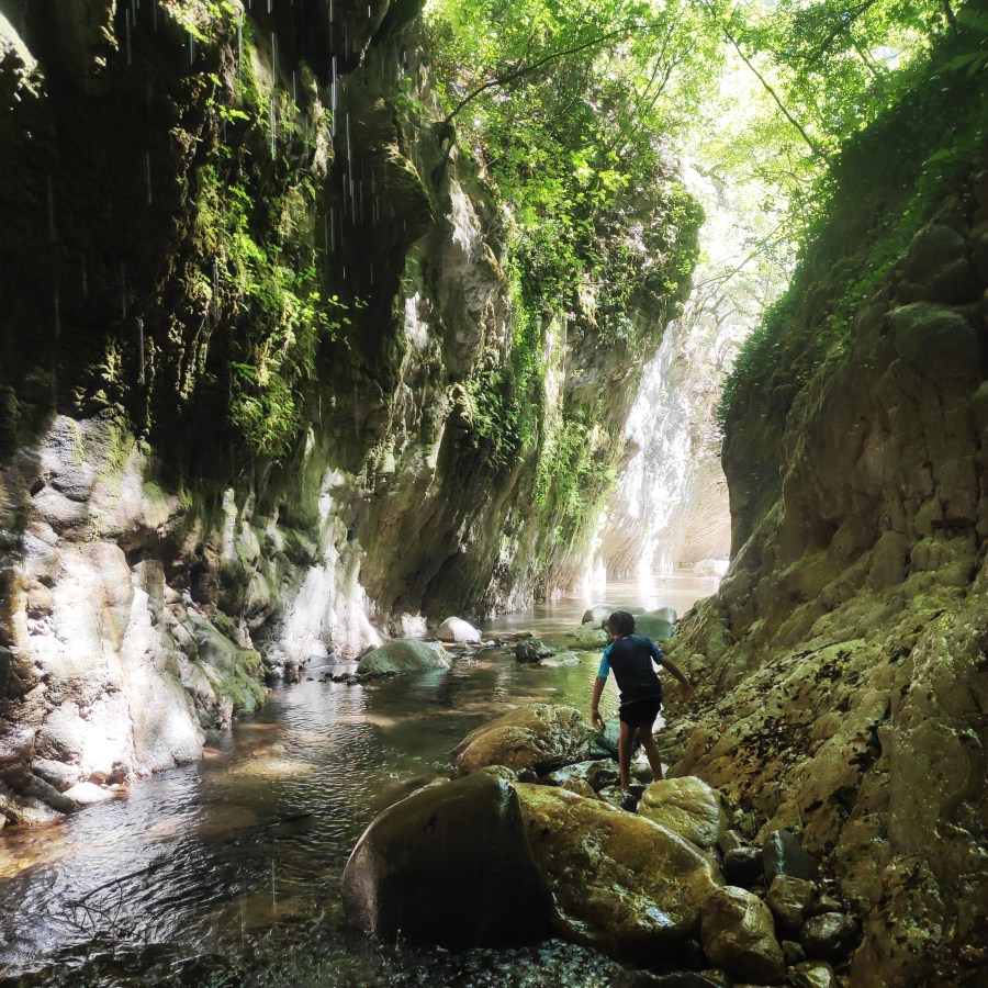
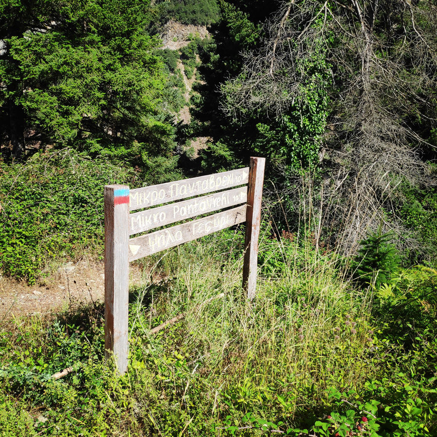
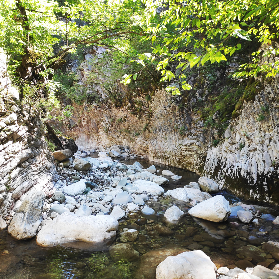
Hiking to the gorge Mikro Panta Vrechi
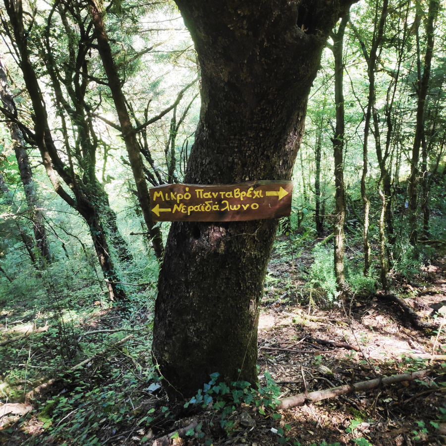
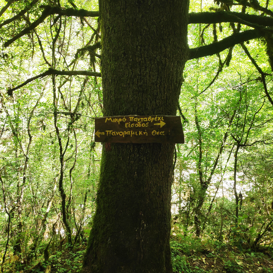
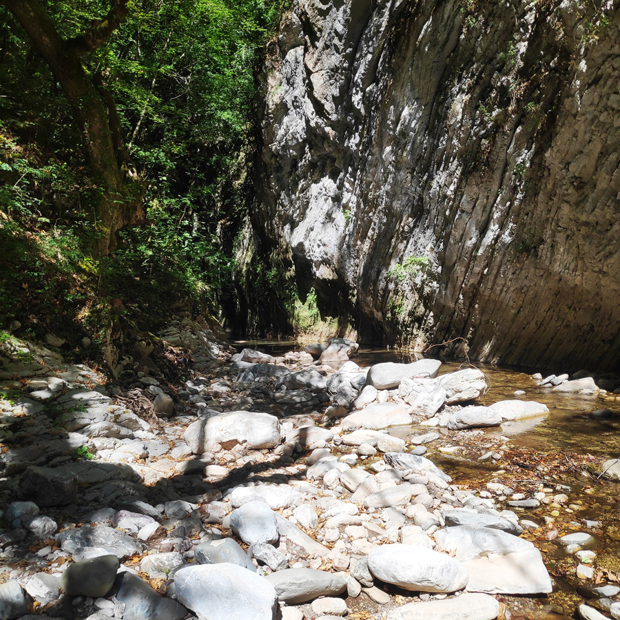
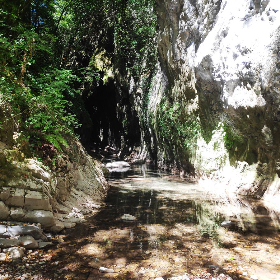
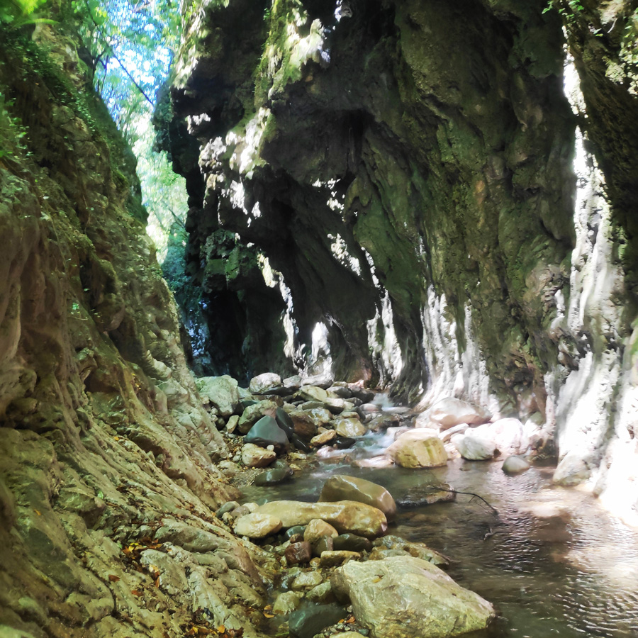
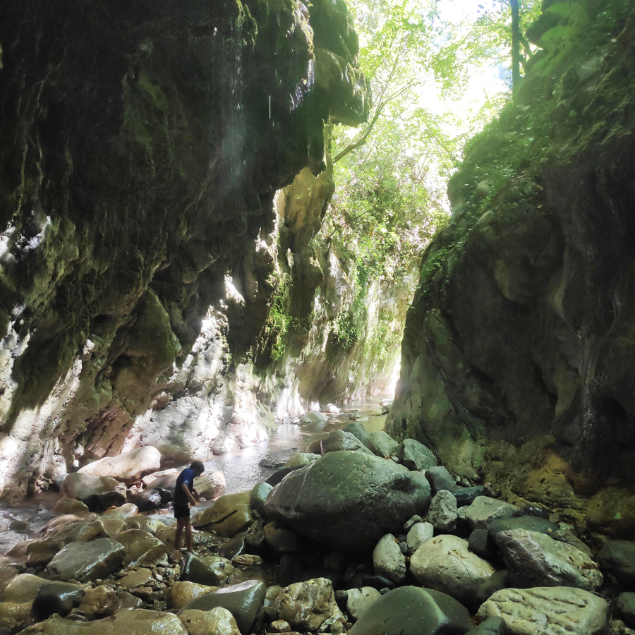
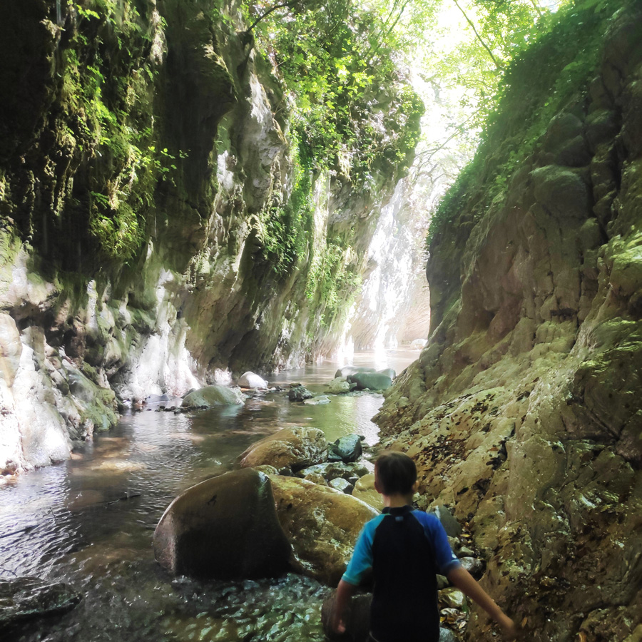
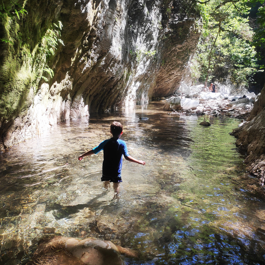
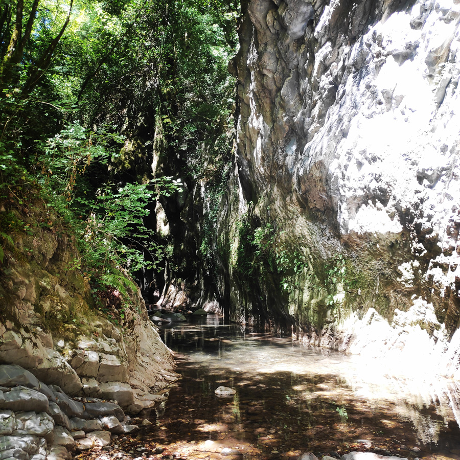
Mikro Panta Vrechi is an impressive but not very well-known gorge near the village of Tornos in Evrytania. It got its name, “It always rains” (Panta Vrechi), from the water that falls along like rain throughout the year from springs located on the tops of the vertical cliffs, creating a unique sight and experience for the visitor.
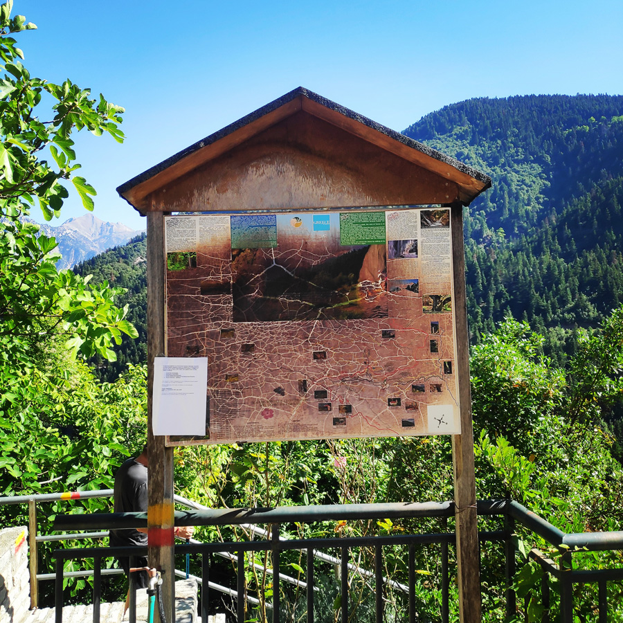
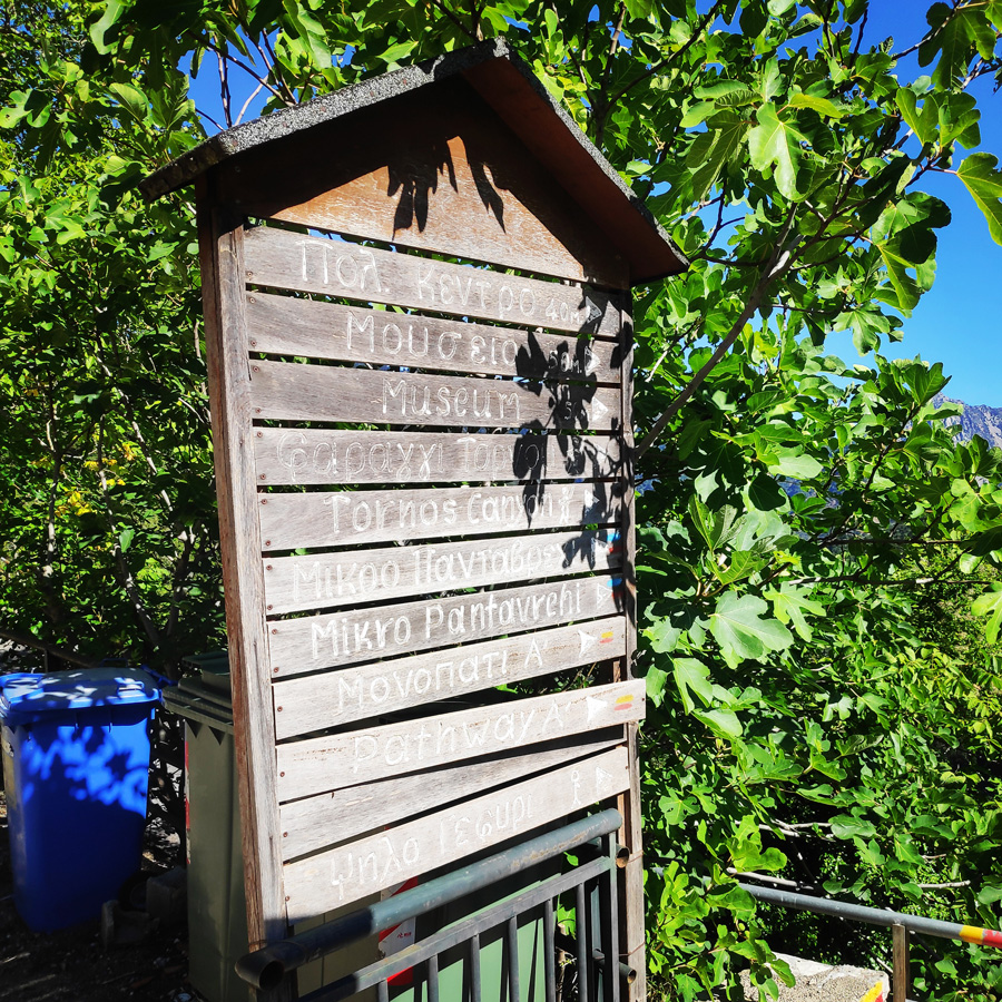
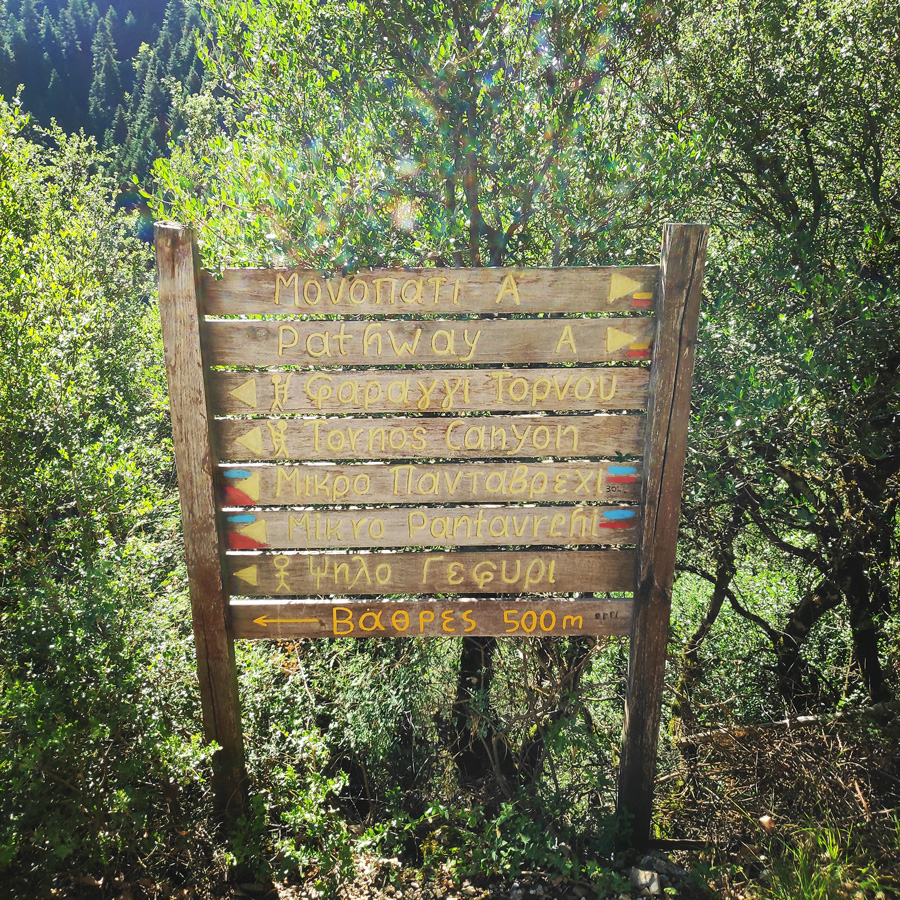
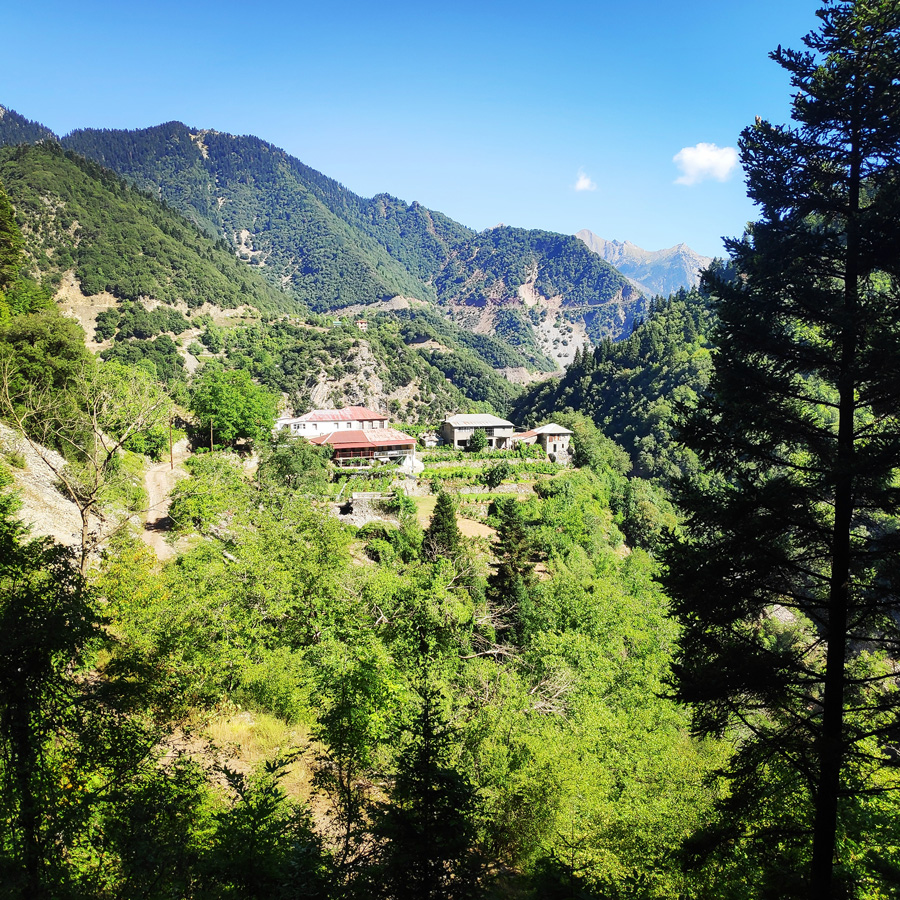
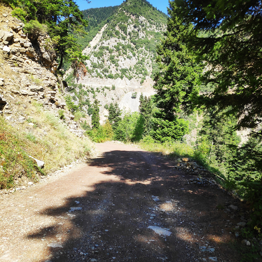
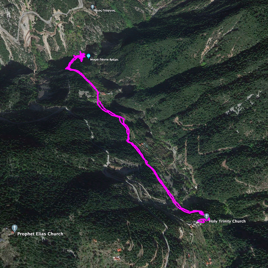
In order to visit “Mikro Panta Vrechi” one must first reach the village Tornos, a location of unparalleled natural beauty that is about 34 kilometers from Karpenisi. Tornos is the village immediately after Prussos and it is about 8 kilometers from the monastery of Prusiotisa.
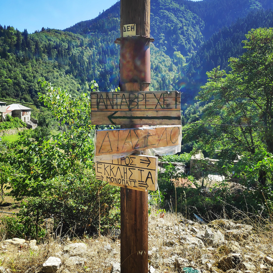
Prior of entering the village of Tornos, we turn left towards the church of Holy Trinity. At that point we can locate a parking spot ( 38.740969, 21.674825 ) where we can leave the car and is also the starting point of the trail.
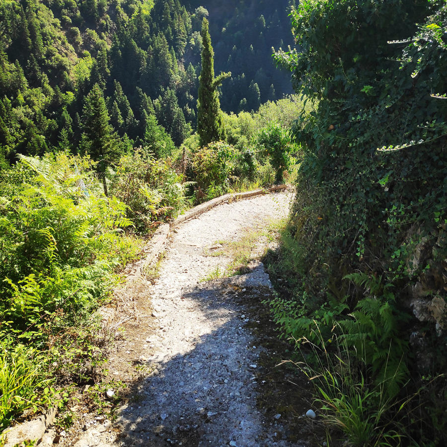
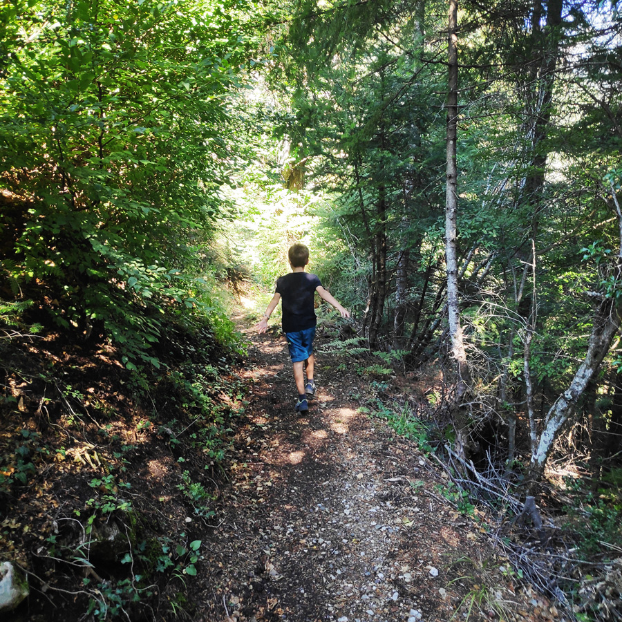
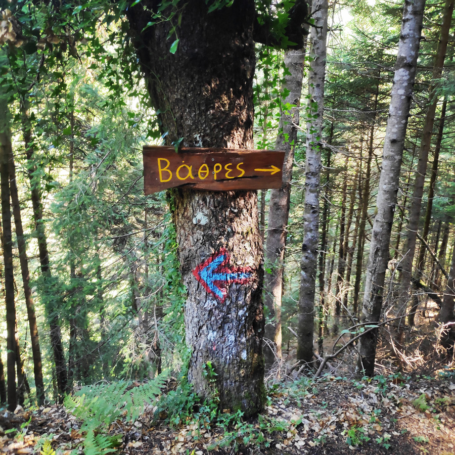
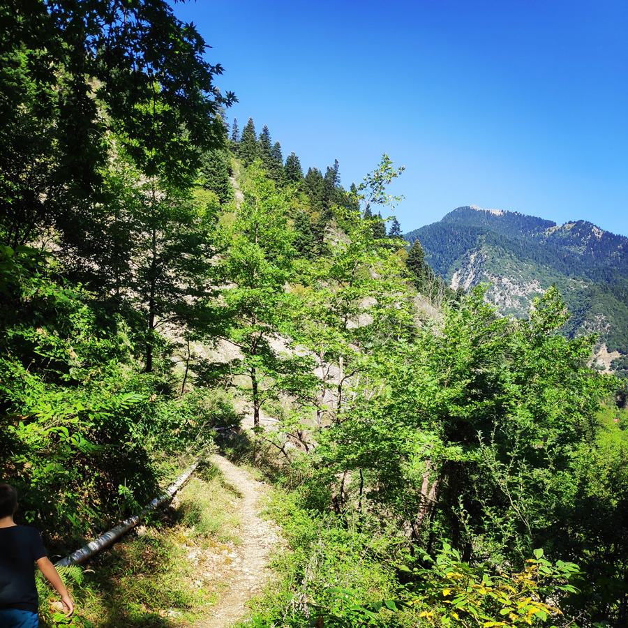
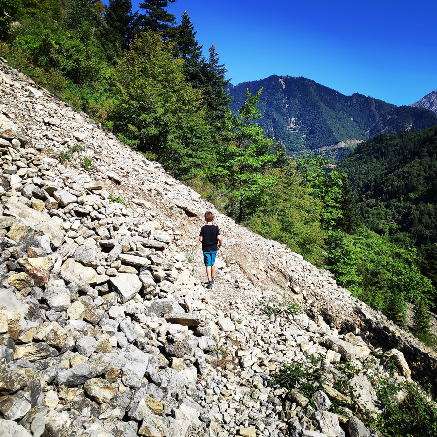
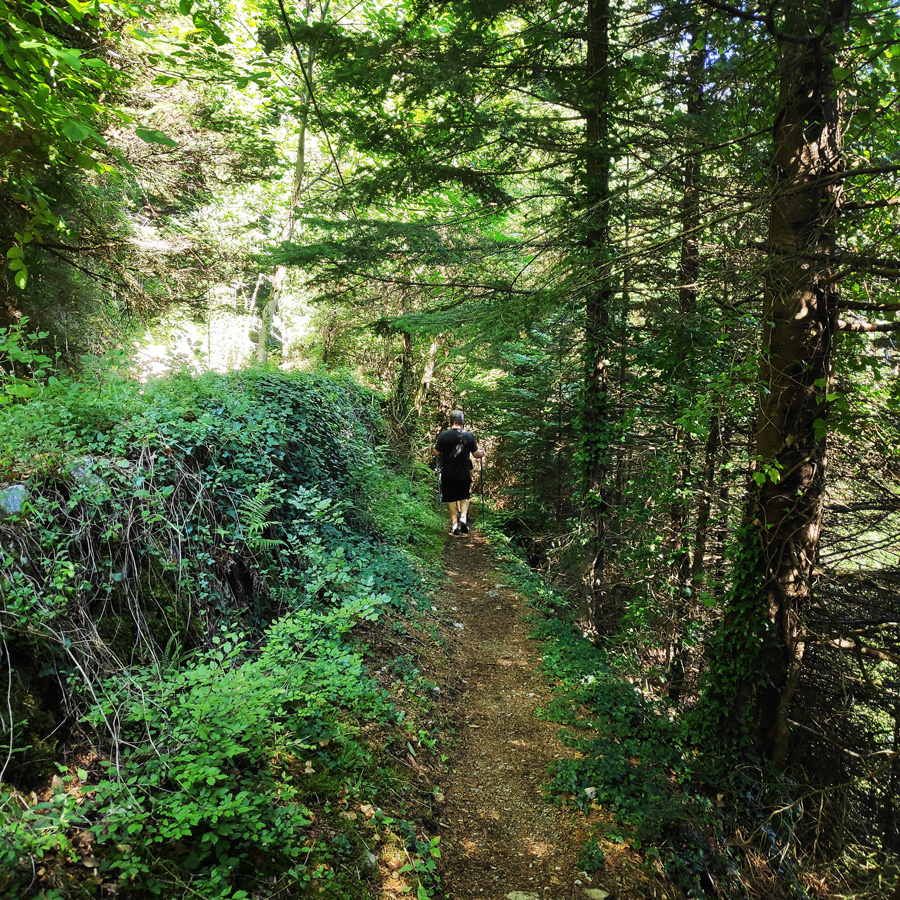
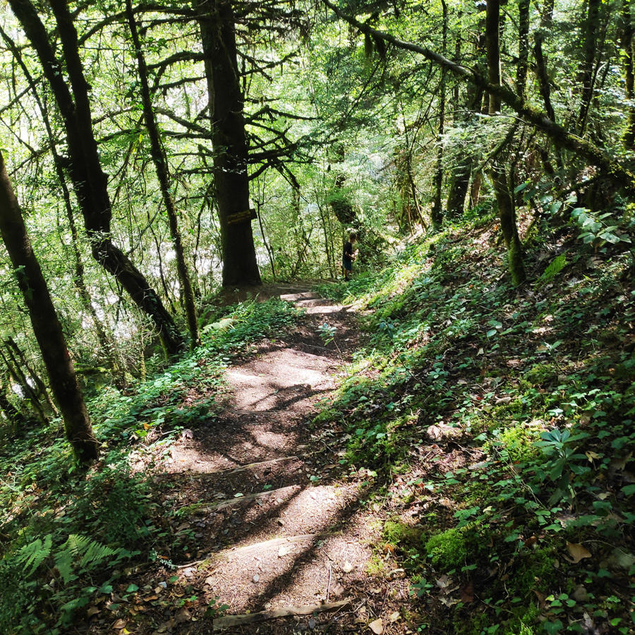
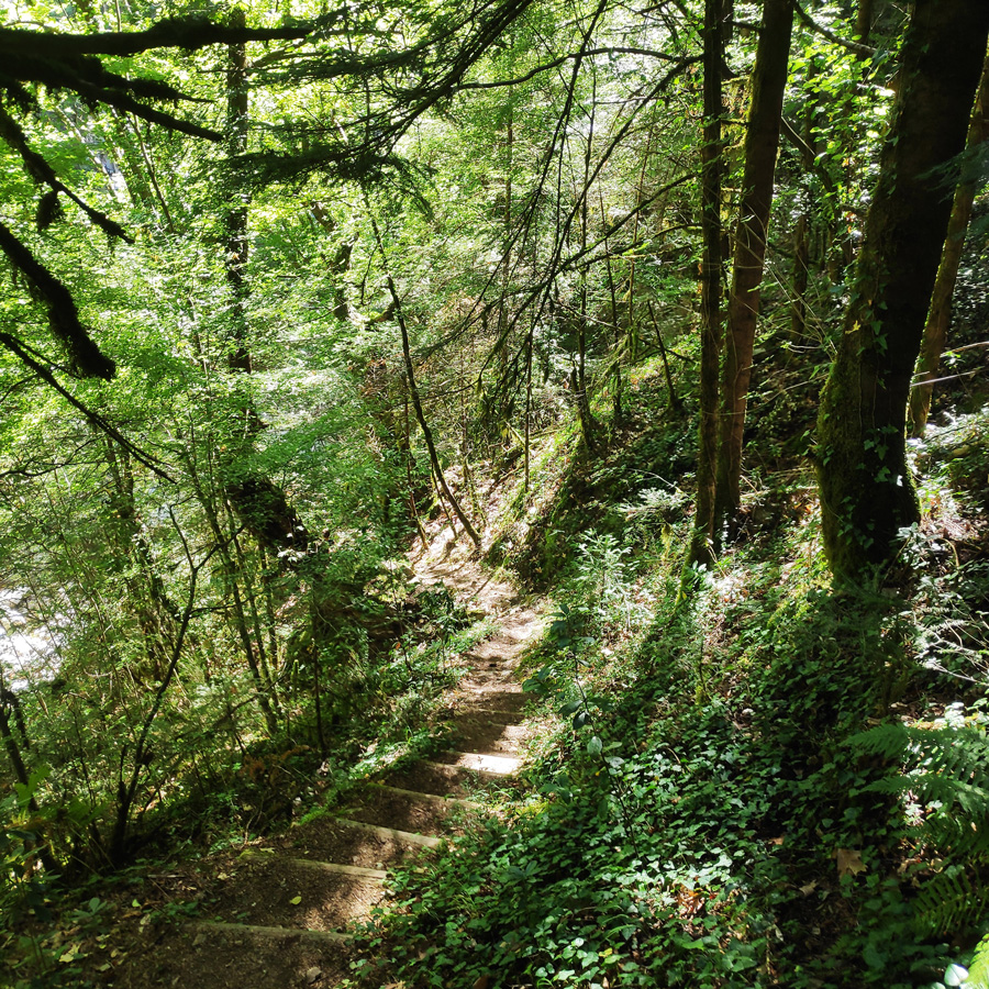
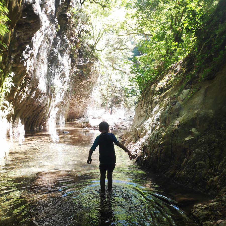
The trail is very easy for any kind of hiker including families. The only part that might challenge some, is the last 10 minutes of hike that lead right in the heart of the gorge.
Support the journey — buy me a coffee
I share these articles and the climbing guidebooks because I love the outdoors, and they’ll always be free. If they’ve helped you, help me keep them coming. Click the button to support my work.

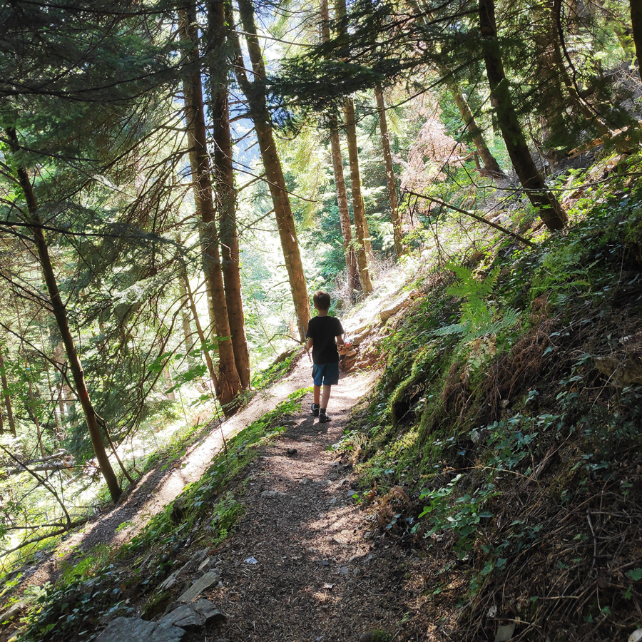
Last section of the hike
As soon we reach that point, we can have a short break in order to forage some wild blackberries and in order to get ready for the last section of the hike. The last section of the hike is a very well signed path, under the coverage of the trees. It is a steep downhill with plenty of zig-zags that is not difficult. It might pose some minor challenge on the way back (uphill) for elder hikers or the ones in not good shape.
Mikro Panta Vrechi
Mikro Panta Vrechi is an impressive but not very well-known gorge near the village of Tornos in Evrytania. It got its name, “It always rains” (Panta Vrechi), from the water that falls along like rain throughout the year from springs located on the tops of the vertical cliffs, creating a unique sight and experience for the visitor.
Support the journey — buy me a coffee
I share these articles and the climbing guidebooks because I love the outdoors, and they’ll always be free. If they’ve helped you, help me keep them coming. Click the button to support my work.
Details of the Hike:
- Location: Mikro Panta Vrechi (Tornos Evrytania)
- Trail Signs: Signed path
- Maximum Elevation: 758 m.
- Minimum Elevation: 568 m
- Total Distance: 4,2 km
- Hiking time: 2 hours (with easy pace – including the breaks)
- Difficulty: Easy
- When to Hike: Late Spring – Early Autumn
Before you leave this blog check out the following map
Below: This map marks all the mountaineering adventures that have been featured on Olympus Mountaineering so far, including several Sport climbing crags – Select full screen to expand, zoom in for more detail, or click on a marker for a link to the post.

Fantastic hike!
LikeLiked by 1 person
It was indeed a very nice hike!
Thanks for reading and glad to know you liked this post.
LikeLike
Thank you for sharing.
I keep all your info for our next trip to Greece, hopefully next spring.
Cool that you give the GPS coordinates of the parking. Suggestion : add a remark on its size and/or a photo so that I can see if OK for my camper van (length 640 cm).
Any gpx file available for all your hikes ?
LikeLike
Hi Pierre,
first of all, I would like to thank you for your kind comment and I am pleased to know that you will be using the info found on Olympus Mountaineering blog during your next trip in Greece.
You remark about the size of the parking area is good and I will adopt it for future ports. Thank you.
With regards the GPX files, you can find them on the individual posts. If you want any specific GPX track, let me know via the contact form and I will happily provide it to you.
Again, thank you for reading through the blog Pierre.
LikeLike
Pingback: Hiking the Black Cave (Mavri Spilia) Gorge – Proussos Evrytania (family friendly) – Olympus Mountaineering
This is absolutely stunning! Thanks for the detailed trip report, as well as the history. Must be nice to be tax-exempt! 😅
LikeLiked by 1 person