Tymfi is a mountain in the northern Pindus mountain range, northwestern Greece. It is part of the regional unit of Ioannina and lies in the region of Zagori, just a few metres south of the 40° parallel. Tymfi forms a massif with its highest peak, Gamila, at 2,497 m (8,192 ft), being the sixth highest in Greece.
As mentioned on a previous post, we have decided to do a complete thru-hike of Mount Tymfi. This is the 1st of a total 4 parts in which we will try to show you our thru-hike in this wonderful mountain that combines beautiful villages, green forests, deep canyons, rivers, high-peaks and even alpine lakes.
ARRIVING IN KAPESOVO AND VISITING BELOI
The night before starting our thru-hike we arranged our tents on a beautiful hill nearby Kapesovo Village. From there, we moved to Vradeto Village and we hiked for about 15 minutes in order to reach a location named “Beloi”. On that spot, there is a kind of a “balcony” formed by rocks from where you can see the magnitude and depth of Vikos Canyon. Once we enjoyed the stunning views, we returned to Kapesovo, got prepared for the coming demanding days, and we soon fall asleep on our tents.


Support the journey — buy me a coffee
I share these articles and the climbing guidebooks because I love the outdoors, and they’ll always be free. If they’ve helped you, help me keep them coming. Click the button to support my work.


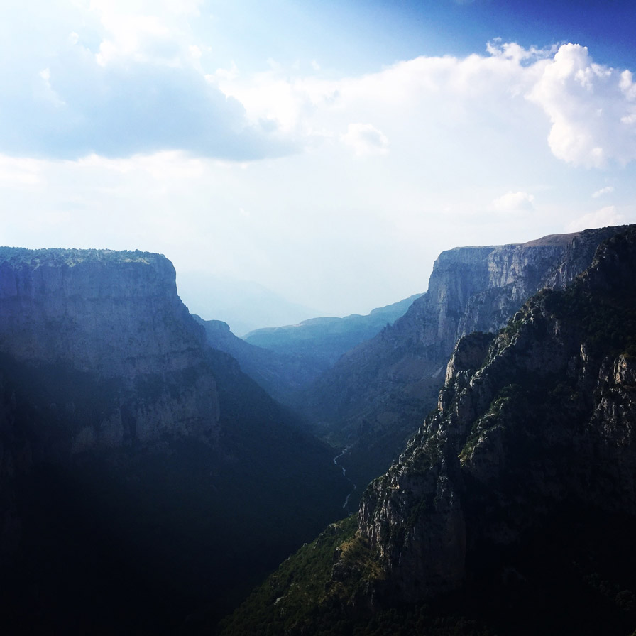
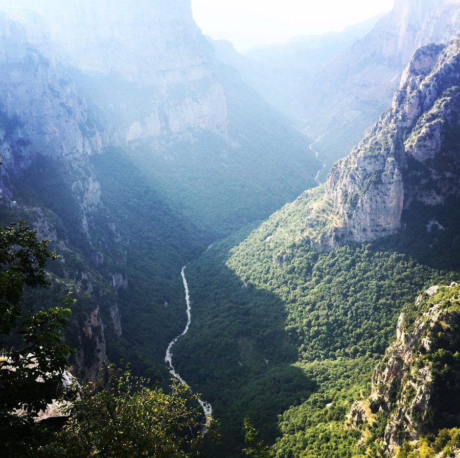

After this wonderful small hike to Beloi, and the stunning views of the Canyon of Vikos, time has come to set our tents and get a comfortable sleep. On this trip, I have used the Sierra Designs Lightning 2 tent.

STARTING POINT KAPESOVO – MEZARIA GORGE
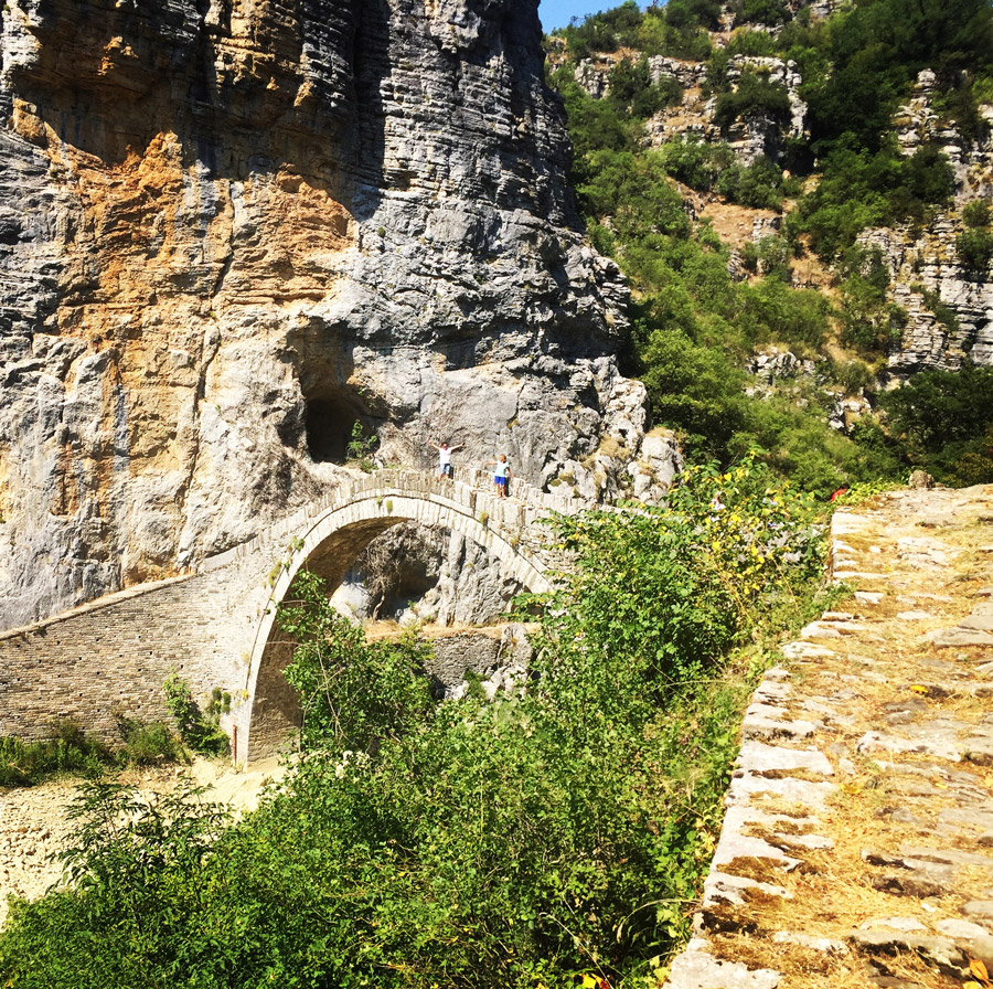
Kapesovo is a village in the Zagori region, it is 43 km north of Ioannina. The name Kapesovo is Slavic and means garden. There is a big cliff next to the village called “Kapesios” (a Slavic word that means cliff) and the name of the village might be related to it. It is from there where the Mezaria Gorge has it’s starting point. The beginning of the route starts from a beautiful rock bridge on the base of “Vradeto Stairs”. We had to do a small exposed downhill in order to end up right in the middle of the gorge.


Explore all outdoor activities in a convenient list view here


Mezaria Gorge is not the most well known gorge of Mount Tymfi, but is a great place for canyoning. Although during August the river is dry, we enjoyed a lot to hike through the whole Mezaria gorge. At the end of Mezaria Gorge, we will meet the great canyon of Vikos. Bellow, a selection of photos from Mezaria Gorge.


VIKOS CANYON (Gorge)
The Vikos Gorge is a gorge in the Pindus Mountains of northern Greece. It lies on the southern slopes of Mount Tymfi, with a length of about 20 km, depth ranging from 450 to 1600 m and a width ranging from 400 m only a few metres at its narrowest part. Vikos is listed as the deepest gorge in the world by the Guinness Book of Records among others.
The gorge is found in the core zone of the Vikos–Aoös National Park, in the Zagori region. It begins between the villages of Monodendri and Koukouli and ends near the village of Vikos. The gorge collects the waters of a number of small rivers and leads them into the Voidomatis River which forms in the gorge. The major part of Voidomatis is only seasonal, and is permanent only at the lowest part of the gorge. Vikos is also a site of major scientific interest, because it is in almost virgin condition, it is a haven for endangered species and contains many and varied ecosystems.


In less than two hour of hike, we came across a sign that was indicating a water fountain was nearby. In such a hot day, this was looking like an oasis in the desert. The name of that fountain is “Klima” and there is all year round fresh cold water running. On that spot, we met other fellow hikers, surprisingly, most of them from Israel. After a short break for some snacks, we refilled our bottles and we moved on.


Subscribe & Stay Informed
Enter your email address to follow this blog and receive notifications of new posts by email
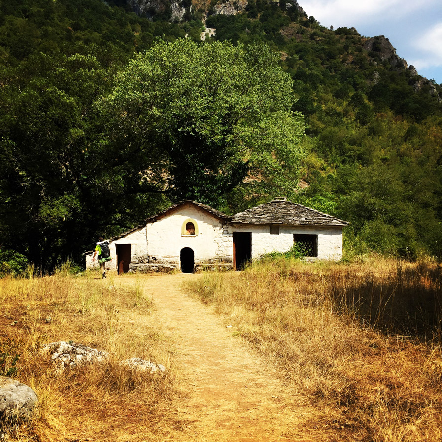
Our next stop was the baths of Voidomatis river. A paradise looking place just bellow a small church. In order to reach that location, one has to move towards Vikos village, but before the traditional stairs that leads to Vikos, should take the right path towards the little church. Once arrived there, we refreshed our selves with the icy-cold water of the river. That is a spot that almost all hikers stop by for a while, because besides the beautiful location is also fully covered by the trees.




MIKRO PAPINGO
After a rather longer break to take a swim in the icy-cold river water, we moved ahead towards our final destination of the first day, Mikro Papingo.
Papingo is a former community in the Ioannina regional unit, Epirus, Greece. Since the 2011 local government reform it is part of the municipality Zagori, of which it is a municipal unit. It is located in the Vikos–Aoös National Park.
Papingo actually consists of two villages: Megalo Papingo (Greek: Μεγάλο Πάπιγκο) and Mikro Papingo (Greek: Μικρό Πάπιγκο), big and small Papingo. The only access road for cars first takes you to Megalo Papingo and a kilometre further to Mikro Papingo.
The area and the neighbouring Vikos Gorge attracts many hikers and mountaineers from around the world. The Vikos Gorge is the largest canyon in Greece and (disputably) in all of Europe: it has the greatest depth to width ratio – as shown in the Guinness Book of Records 1997.


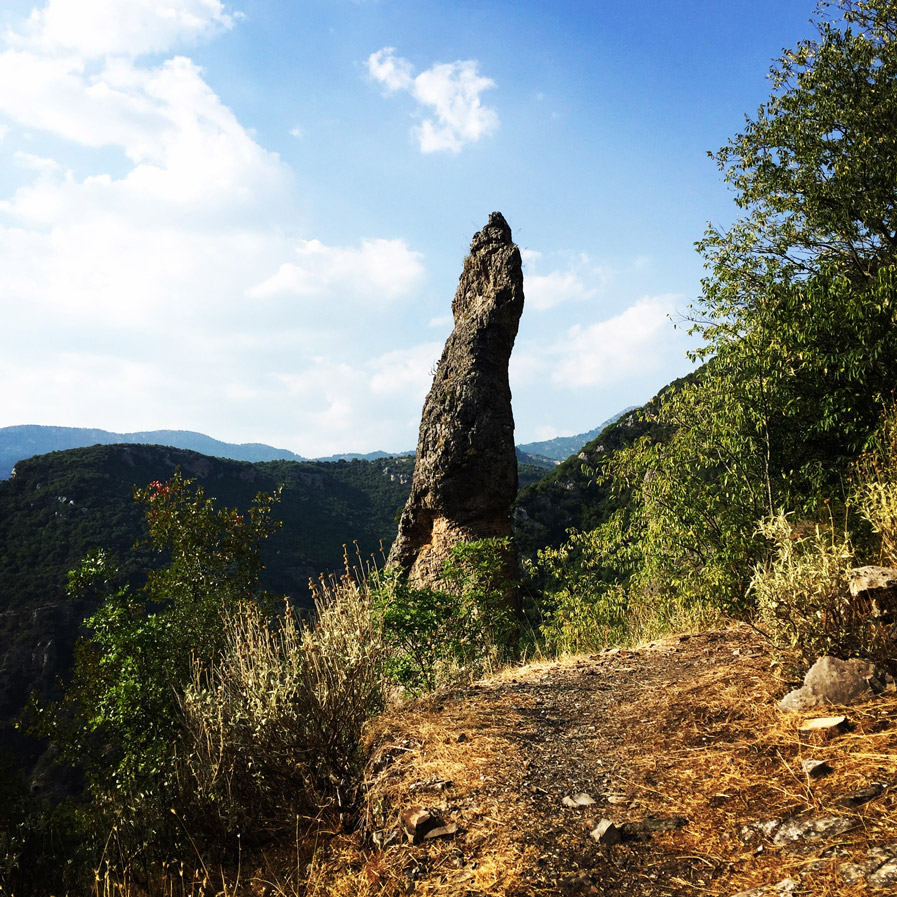
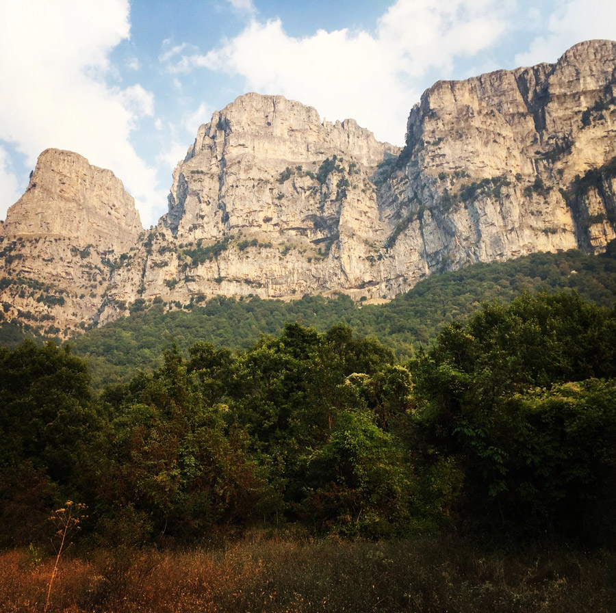


We needed almost 12 hours to cross the Mezaria Gorge and the Vikos Canyon, and it was almost dark by the time we reached Mikro Papingo. As soon we reached Mikro Papingo, we had some rest, prepared some dinner and then we moved on for another 10 minutes hike in order to find a small church which also has a water fountain. That was the location where we decided to set up camp for the night and to have rest.
In the coming days, there will be the 2nd part of the Mount Tymfi (Pindos) Thru-Hike, so make sure to come back to this blog to see the exciting second part which consist of arriving to the Astraka Shelter and the Astraka Peak.
Support the journey — buy me a coffee
I share these articles and the climbing guidebooks because I love the outdoors, and they’ll always be free. If they’ve helped you, help me keep them coming. Click the button to support my work.
Before you leave this blog check out the following map
Below: This map marks all the mountaineering adventures that have been featured on Olympus Mountaineering so far, including several Sport climbing crags – Select full screen to expand, zoom in for more detail, or click on a marker for a link to the post.

Pingback: Mount Tymfi (Pindos) Thru-Hike Part 2 – ASTRAKA REFUGE – ASTRAKA PEAK – Olympus Mountaineering
Wow, the view from Vikos Canyon seemed to be great! This definitely seems like a place I have to visit.
LikeLike
The Vikos Canyon besides being a long and very deep canyon is beautiful too. Actually, all routes of mount Tymfi are really nice. In sun-alpine and alpine level too.
On part 3 of this series of post (it will be published in the coming days) you will be able to see also the stunning alpine lake, the Dragon Lake.
Ps. I think that the best period to visit this area is around May.
LikeLike
Pingback: Mount Tymfi (Pindos) Thru-Hike Part 3 – Dragon Lake (Drakolimni) – Olympus Mountaineering
Vikos Canyon is beautiful. I am not familiar with your part of the world, but it looks like I have to visit some time in the future. Are you allowed to camp where you want to on this trail?
LikeLike
Vikos is beautiful canyon and believe me in some sections very deep!
Answering to your question, officially in Greece wild camping is prohibited by the law, though, this law is rarely applied and if it is applied is usually in high traffic summer destinations in the Greek islands and/or other famous sea side locations.
With regards wild camping in the mountains of Greece, or for example in Vikos, although same law is valid, I have never heard anyone that had issues with any local authorities.
Actually, locals are in favour of wild camping (as far everyone respects the natural environment).
In addition, due to the fact Greece has many mountains and most of them are not much visited, there are chances that besides some wild life you will not meet anyone else while camping.
Finally, if you need more details, feel free to let me know.
LikeLiked by 1 person
Thank you for your information on wild camping in this region. We are planning a trip next June and I am looking for detailed trail maps (printed). Would you have any suggestions on where to order them.
LikeLike
Hi David,
Perhaps you can check out if “Anavasi” has such a map you are looking for:
https://anavasi.gr/maps-en
In case you would need any additional info, feel free to get in touch.
LikeLike
Thanks a lot for your post! So much useful info! I plan to make a loop from Konitsa via Astraka, Vikos Gorge, Papingo, Monodendri, Kapesevo, Vradeto Village and back to Konitsa. I want to do it alone at the end of April this year. What you can say about wild animals in that area? Is is safe to camp out of the villages?
LikeLiked by 1 person
Hi Vlad,
I’m glad you found the information helpful! Your planned loop sounds like a great hiking adventure.
Regarding wild animals in the area, I’ve spent many years exploring the Greek mountains and have never encountered any dangerous wildlife. Generally, the region is quite safe for camping outside of the villages. Just be sure to take standard precautions, such as properly storing food and disposing of waste responsibly, to minimize any potential encounters.
LikeLike
Pingback: Mount Tymfi (Pindos) Thru-Hike Part 4 – GAMILA – STOMA – MEGAS LAKOS -TSEPELOVO – KAPESOVO – Olympus Mountaineering
This looks like a wonderful hike. What distance were you going each day?
LikeLike
In total we have done 81 km per day. First day was 23 km, and the other two days we have done the rest.
We were in good condition and we enjoyed a lot the whole trekking part. Though, my advice would be this whole mountain crossing to be done in at least 4 days instead of three
LikeLiked by 1 person
Pingback: Mount Tymfi (Pindos) Thru-Hike Summary – Olympus Mountaineering
Pingback: Hiking in South Pindos – Lakmos Mountain Pt.01 | Anthochori – Tsoukarela Peak – Verliga Alpine Lake – Olympus Mountaineering
Pingback: Verliga alpine lake – Wild camping on Greece’s secret paradise – Olympus Mountaineering
Pingback: Winter Mountaineering Climb in Strogoula via Agrofylakas Couloir (Tzoumerka-Athamanika) – Olympus Mountaineering
So we did the same thru hike in late september/oktober. After we decended into the mezaria gorge the way got very steep and in my opinion dangerous without climbing equipment.We dicided to turn and go the path from kapesovo to vikos gorge. Is it only the first part of the mezaria gorge where you have to decent that steep? We turned rather fast so we dont know how the gorge continues.
Some more details which you didnt mention in your block about the trip:
-The hike from katafygio astrakas to kapesovo takes about 6 hours. There was infact a spring after about 3 hours but I am not sure if there is water all year.
-If you dont want to go through mezaria gorge you can use another path from kapesovo to vikos gorges which is also quite nice. I think that took us about 1,5 hours.
-some of the springs on the anavasi map/maps.me were dry, so you can not count on refilling your water there unless you know if they are flowing. In general the routes on maps.me were sometimes very bad and sometimes not existant.
-dont underestimate the mountains, two people died in the past month on astraka as they fell down the cliffs.
Greetings Ilias
LikeLike
Thank you for your comment and your personal experience/information. Much appreciated.
LikeLike
great post!
Is there a GPX file for this hike?
LikeLike
Hi Yaniv,
yes, there is a GPX file. Feel free to get in touch via the Contact & About page so you can get it via email.
LikeLike
Pingback: Mount Tymfi (Pindos) North Side Thru-Hike Part 1 – Konitsa – Moni Stomiou – Sadi Migas – Olympus Mountaineering
Great postt thank you
LikeLiked by 1 person
Pingback: Immerse in Greek Mountain Beauty: 10 Hiking Routes That Ignite the Spirit of Adventure – Olympus Mountaineering