Hiking to the top of Mount Parnonas

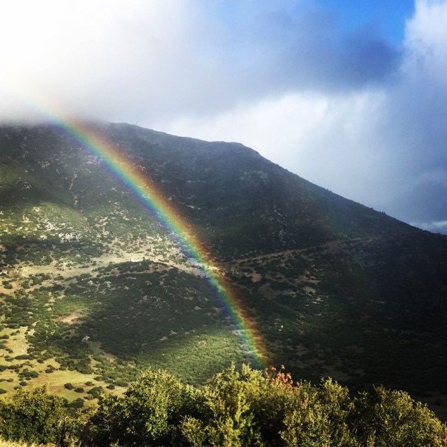
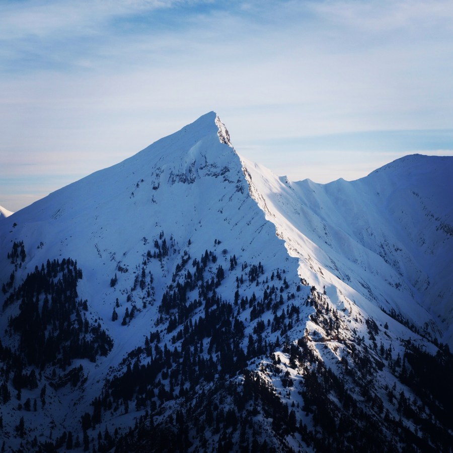
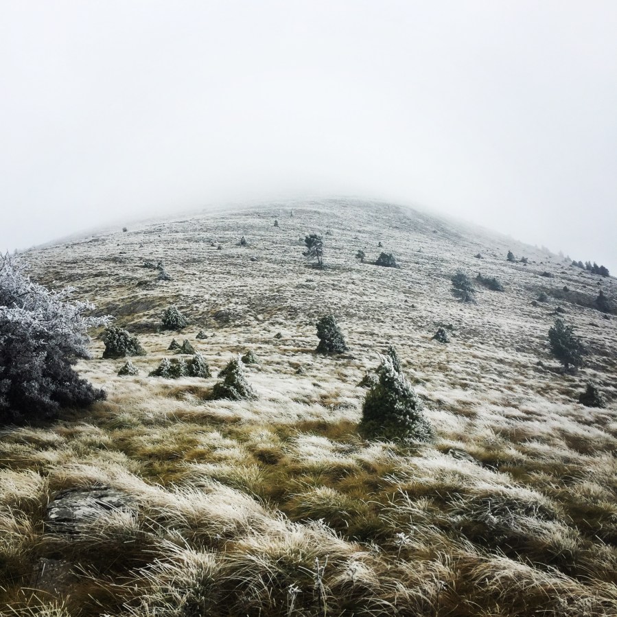
This winter, weather conditions in Greece have not been very harsh and therefore we did not have many snowfalls till now. In our search for snow, we have decided to visit one of the nicest mountains of Pelopennese area, Mount Parnonas (or Malevos).

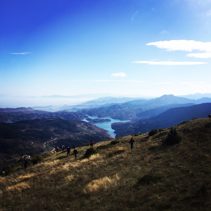
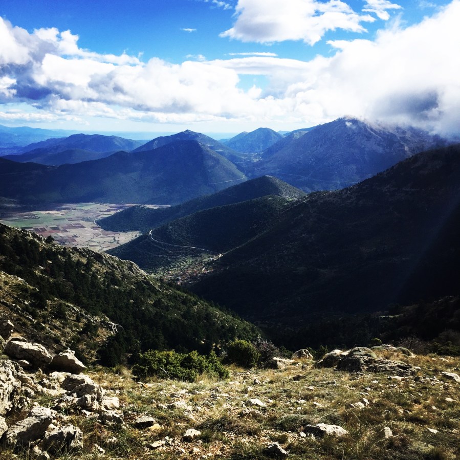
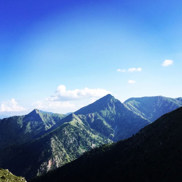
Parnonas is a mountain range, or massif, on the east of the Laconian plain and the Evrotas valley, upon which Grant Parnon resides. It is visible from Athens above the top of the Argive mountains. The western part is in the Laconia prefecture and the northeastern part is in the Arcadia prefecture. The Parnon range separates Laconia from Arcadia. Its summit offers panoramic views of southeastern Arcadia and South Kynouria and much of Laconia that includes the northern and the central portions and reaches as far as the Taygetos mountains. It also views a part of the central Arcadia and the southern Argolis prefectures.

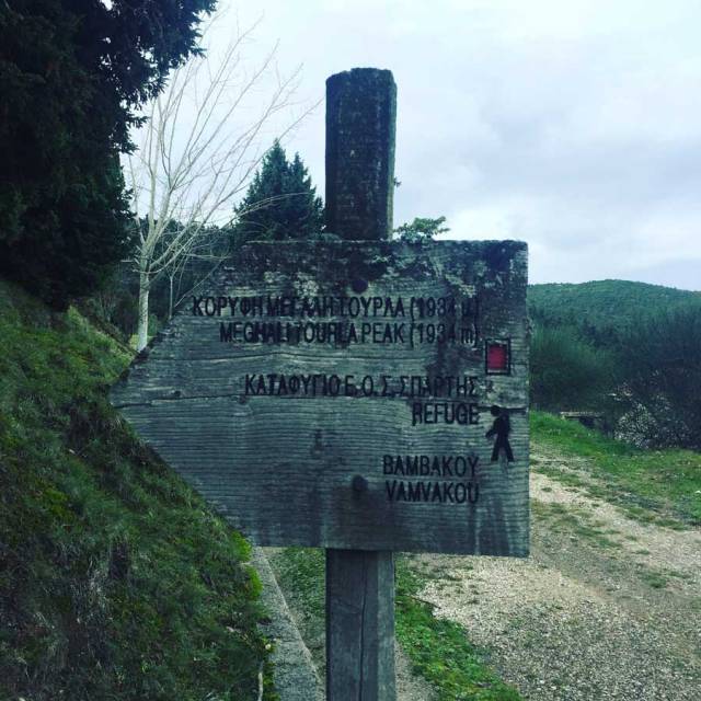
Parnonas also known as “Malevos” is the mountain range which divides two large counties of Peloponnese, Arcadia and Laconia. The highest peak of Parnonas is called “Megali Tourla” also known as “Kronio” and has 1936 meters altitude. The mountain ends in Laconia at the Cape Maleas, south of Peloponnese.

Parnonas_Mountain_Ascent3854
Starting point

Continue reading “Hiking to the top of Mount Parnonas”

Hiking in Agrafa – Panagia Pelekiti – Karamanoli – Neraida

Hiking in the Agrafa region is one of our favourite activities. Having already hiked and climbed Voutsikaki, Five Towers, Papadimitri, Pouli and Svoni, we have decided to visit another trail path in the mountainous region of Agrafa.

Agrafa is a mountainous region in Evrytania and Karditsa regional units in mainland Greece, consisting mainly of small villages. It is the southernmost part of the Pindus range.  The Agrafa region is famous for its complete autonomy throughout the entire 400 years of Ottoman Turkish occupation of Greece. The word agrafa literally translates to unwritten which means unregistered or uncharted; because the Ottomans were unable to conquer this region, the area and its population were not recorded in the Sultan’s tax register. As a result the people were usually free to conduct their business and customs as they pleased without Ottoman influence.

Agrafa_PanagiaPelekiti_Karamanoli_Neraida_Hiking_3483 Continue reading “Hiking in Agrafa – Panagia Pelekiti – Karamanoli – Neraida”

Autumn Ascent on Skiathis Mountain

It was a cloudy and rainy Sunday morning, and we have decided to visit a mountain peak that is not well known. The name of this mountain is Mount Skiathis (also called Scathes or Sciathis) and is in the boarders of the prefecture of Argolis and Arcadia. In the north part is connected with Mount Oligyrtos and in the southern part with Lyrkio Mountain.

The highest point of Mount Skiathis is 1.777 meters above sea level. This mountain is not often climbed and therefore during our ascent we have not met any other hikers. Actually, the path towards the peak is not well signed and therefore in case of not optimal weather conditions, it is suggested to have a GPS device with the route already loaded in it.

Skiathis_Mountain_Autumn_Ascent_2830
While arriving in Alea, a beautiful rainbow was welcoming us

Continue reading “Autumn Ascent on Skiathis Mountain”

Agrafa Mountains Svoni Peak Expedition Preparation – Autumn 2017

Agrafa is a mountainous region in Evrytania and Karditsa regional units in mainland Greece, consisting mainly of small villages. It is the southernmost part of the Pindus range.  The Agrafa region is famous for its complete autonomy throughout the entire 400 years of Ottoman Turkish occupation of Greece. The word agrafa literally translates to unwritten which means unregistered or uncharted; because the Ottomans were unable to conquer this region, the area and its population were not recorded in the Sultan’s tax register. As a result the people were usually free to conduct their business and customs as they pleased without Ottoman influence.

Agrafa_Five_Towers_26
Pouli and Svoni Peak 2.042 m. as seen from 5 Towers (5 Pyrgoi)

Continue reading “Agrafa Mountains Svoni Peak Expedition Preparation – Autumn 2017”

Scrambling in Artemisio Mountain (Artemisio Arete)

Artemisio mountain is on the border between Arcadia and Argolis, in the Municipalities of Argos-Mycenae and Tripolis respectively. It forms part of the mountain range that connects the Argolic Gulf with the Corinthian, and as such, it borders with Lyrkeio mountain on the north and with Ktenias mountain on the south. On its west is the plateau of Mantineia. Its tallest peak which is called Malevos is 1,771 metres in height.

Scrambling_In_Artemisio_2005
Route 34 leads to Malevos peak 1.771 m.
Continue reading “Scrambling in Artemisio Mountain (Artemisio Arete)”

Hiking in Ancient Epidaurus – Mount Myronia – Sanctuary of Asklepios

Flanked by two gulfs, the Saronic and the Argolic, the land of Epidavros (Epidaurus) is a blessed region of natural beauty and with a long historic heritage.

Travellers take a journey into myth and history, along the rocky, wooded slopes of Mount Arachnaion, the breathtaking beaches and sheltered creeks with fishing boats and sailboats. Fortresses, ancient roads with bridges and guard posts, tombs, Byzantine churches, imposing theatres and impressive monuments make up the “canvas” of the region of Epidaurus.

Epidaurus (Ancient Greek: ἘπίδαυροςEpidauros) was a small city in ancient Greece, on the Argolid Peninsula at the Saronic Gulf. Two modern towns bear the name Epidavros Palaia Epidavros and Nea Epidavros. Our starting point for this day hike was nearby Ancient/Palaia Epidavros.

Ancient_Epidavros_Myronia_Epidavros_Theater_1695
Starting point of the path

Continue reading “Hiking in Ancient Epidaurus – Mount Myronia – Sanctuary of Asklepios”

Top 5 Hiking Trails in Greece

One of the great cradles of Western civilization, Classical Athens in particular the birthplace or nurturer of democracy, philosophy, history, poetry, tragedy and comedy, and some of the world’s greatest architecture and sculpture. Through cultural influence (Greek colonies extended around the Mediterranean; the Greeks not the Romans brought wine to France) and expansion (think Alexander), this small rocky country profoundly influenced the world as far afield as Ghandara in what are now Afganistan and Pakistan and hence along the Silk Road to China.

Greece has things to fascinate everyone, children included. The variety of travel and tours you can make in Greece is as a result huge. You can explore Greece’s variety of landscapes, remote coves and the ruins of ancient cities, walking!

The core of Mainland Greece runs from the European Long Distance Walking Path Ε4 (- GR), beginning from the Pyrinaia it arrives in Greece via Yugoslavia, at the Nikis guard-post in Florina. The E4, crossing the Peloponnese, stops at Gythio and continues on to Crete. The mountain-climber is thus given the opportunity to see the enjoy of the Greek scenery and the wealth of Greek nature.

Bellow our favourite Top 5 Hiking Trails in Greece

Continue reading “Top 5 Hiking Trails in Greece”

Autumn Ascent on Mount Aselinon (Giona) via Karagiannis path

It has been three years ago since our last visit to Mount Aselinon (Giona), and time has come to pay one more visit to the highest Greek mountain south of Olympus.

Mount Aselinon (Giona) is a mountain in Phocis, Central Greece. It is located between the mountains of Parnassus to the east, Vardousia to the west, and Oeta to the north. Known in classical antiquity as the Aselinon Oros (moonless mountain), it is the highest mountain south of Olympus and the fifth overall in Greece. Pyramida is its highest peak at 2,510 metres (8,235 ft).

Mount_Aselinon_Giona_Karagianni_2017_1477
View of Sykia wall from Sykia Village
Continue reading “Autumn Ascent on Mount Aselinon (Giona) via Karagiannis path”

Mount Tymfi (Pindos) Thru-Hike Summary

Tymfi is a mountain in the northern Pindus mountain range, northwestern Greece. It is part of the regional unit of Ioannina and lies in the region of Zagori, just a few metres south of the 40° parallel. Tymfi forms a massif with its highest peak, Gamila, at 2,497 m (8,192 ft), being the sixth highest in Greece.

This is a short summary post with the highlights of the Thru-Hike of mountain Tymfi. If you wish to see the individual posts which contain detailed information and more photos, you can click to the following links:

Mount Tymfi (Pindos) Thru-Hike Part 1 – Kapesovo – Mezaria Gorge – Vikos Canyon – Mikro Papingo

Mount Tymfi (Pindos) Thru-Hike Part 2 – ASTRAKA REFUGE – ASTRAKA PEAK

Mount Tymfi (Pindos) Thru-Hike Part 3 – Dragon Lake (Drakolimni)

Mount Tymfi (Pindos) Thru-Hike Part 4 – GAMILA – STOMA – MEGAS LAKOS -TSEPELOVO – KAPESOVO

Mount_Tymfi_(Pindos)_Thru-Hike_Part_01_Kapesovo_Mezaria_Gorge_Vikos_Canyon_Mikro-Papingo_0605
Vikos Canyon as see from Beloi

Continue reading “Mount Tymfi (Pindos) Thru-Hike Summary”

Dokos Island – Backpacking, exploring and surviving in a deserted island

Summer in Greece is about to end and this time, instead of a mountain and a high peak we have decided to go and explore an inhabited island. The island of Dokos.

Dokos is a small Greek island of the Argo-Saronic Gulf, adjacent to Hydra, and separated from the Peloponnese by a narrow strait called on some maps “the Hydra Gulf.” It is part of the municipality of Ýdra (Hydra) in Islands regional unit and reported a population of 18 persons at the 2011 census. The island is rocky reaching a height of 308 metres. Although official registries claim there is a population of 18 people, in reality there is no one else besides an old lady with her goats and dogs. So, basically, this is her “private” island.

Dokos_Island_0764
Departing from Ermioni
Continue reading “Dokos Island – Backpacking, exploring and surviving in a deserted island”