It is again this time of the year that winter is about to kick in and one of the best ways to explore and enjoy the outdoors is to go for a nice day-hike. Greece, is a very mountainous country and there are plenty of peaks of about 2.000 meters of altitude.
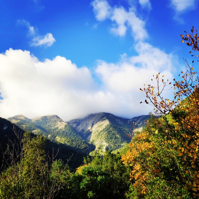
Although we have already been in Mount Parnon previous times, we have decided to visit again this beautiful mountain, once again from a different route. We hiked a steep but beautiful trail which starts from Sitena (Sitaina) village, passes Russa Petra and via the South-to-North ridge we reached Megali Tourla (1.935 m.) which is the highest peak of mount Parnon.
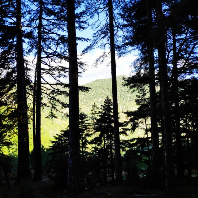
Parnonas is a mountain range, or massif, on the east of the Laconian plain and the Evrotas valley, upon which Grant Parnon resides. It is visible from Athens above the top of the Argive mountains. The western part is in the Laconia prefecture and the northeastern part is in the Arcadia prefecture. The Parnon range separates Laconia from Arcadia. Its summit offers panoramic views of southeastern Arcadia and South Kynouria and much of Laconia that includes the northern and the central portions and reaches as far as the Taygetos mountains. It also views a part of the central Arcadia and the southern Argolis prefectures.
see other hiking activities on mount Parnonas here:
Parnonas also known as “Malevos” is the mountain range which divides two large counties of Peloponnese, Arcadia and Laconia. The highest peak of Parnonas is called “Megali Tourla” also known as “Kronio” and has 1936 meters altitude. The mountain ends in Laconia at the Cape Maleas, south of Peloponnese.
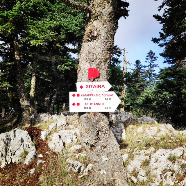
The natural beauty of the mountain and the traditional villages attract many travellers throughout the year. The best time to visit the area is during the spring season when the snow melts and forms small waterfalls. There are many signposted hiking routes which allow the visitor to admire the gorges, the caves, the waterfalls, the springs and the rivers of this amazing mountain. Climbers will love the challenge of reaching the top of the mountain. “Megali Tourla” (1936 m. altitude) can be reached through a large path which crosses an amazing gorge. Parnonas has five gorges Loulougas, Mazias, Zarbanitsas, Spilakion, Lepidas where rare species of flowers blossom. Mazias gorge is the easiest for hiking whereas the Lepidas gorge is very demanding and you will need special equipment and knowledge to cross it.
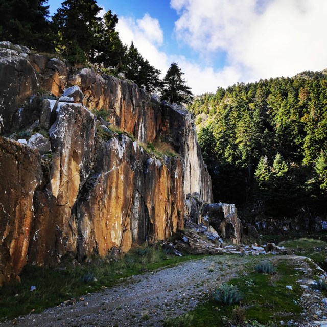
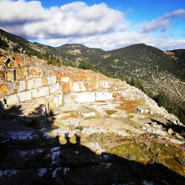
Sitaina – Old Quarry
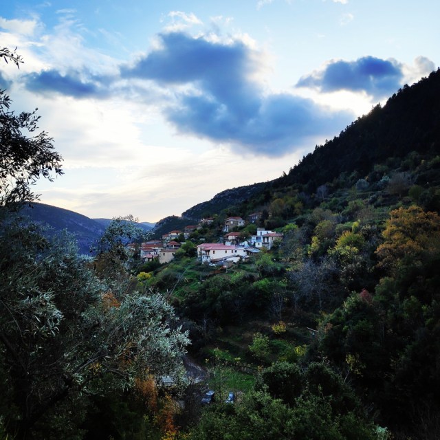
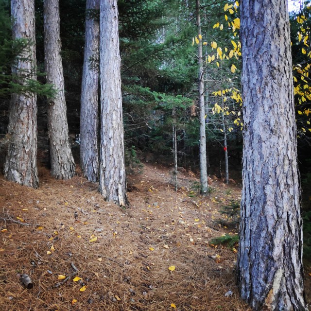
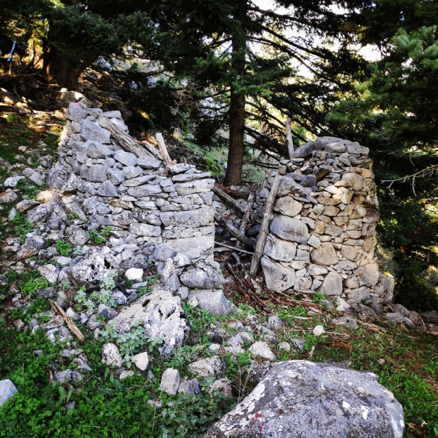
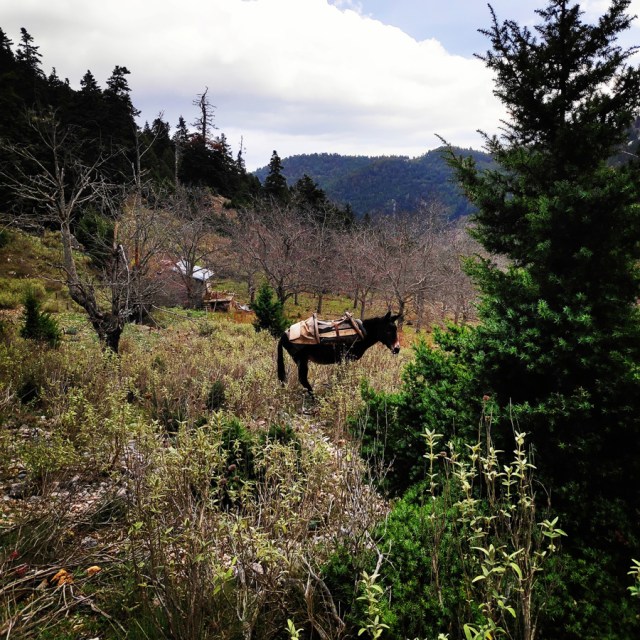
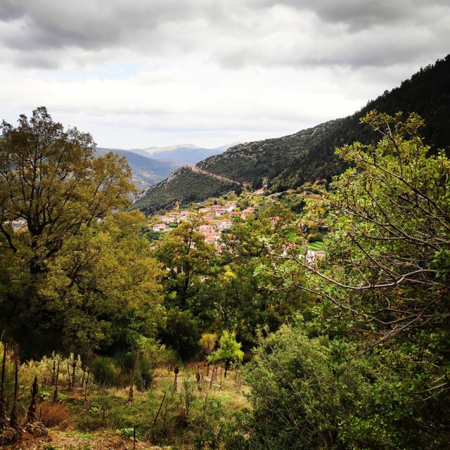
Sitaina, Kastanitsa, and Prastos made up the original core of Tsakonia. Sitaina is a very picturesque village among the fir trees, and it offers many opportunities for excursions to enjoy the natural beauty of Parnonas. The village has traditional stone houses and abundant water.
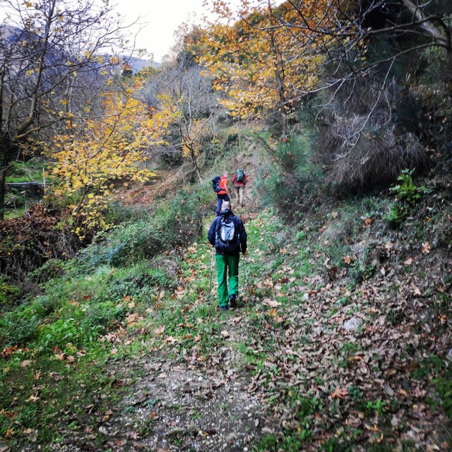
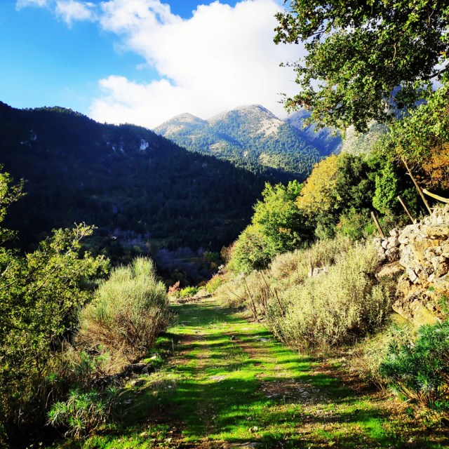
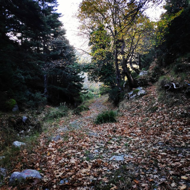
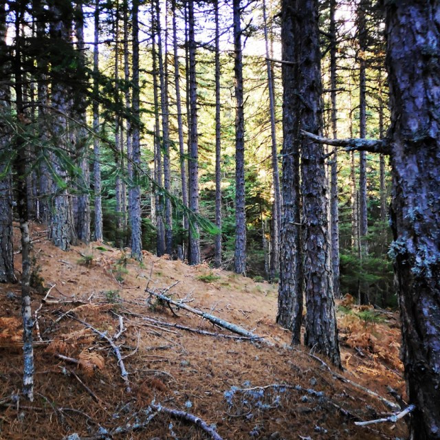
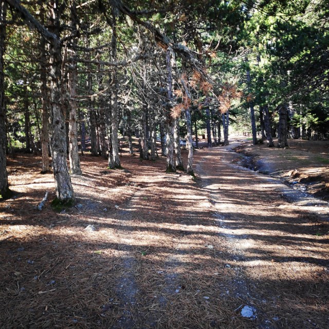
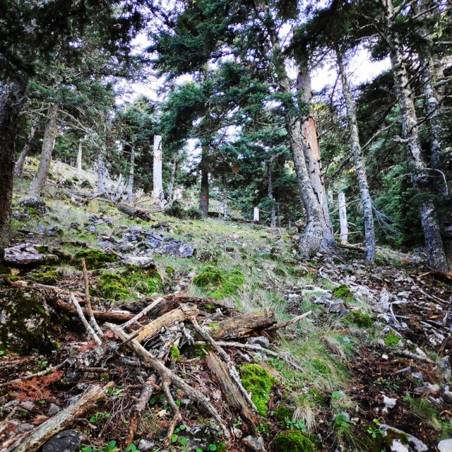
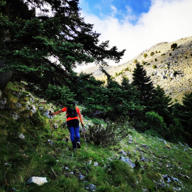
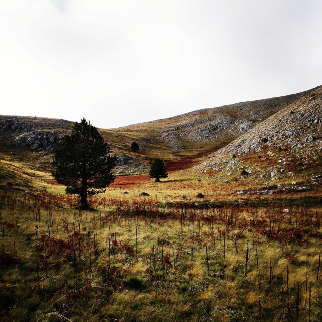
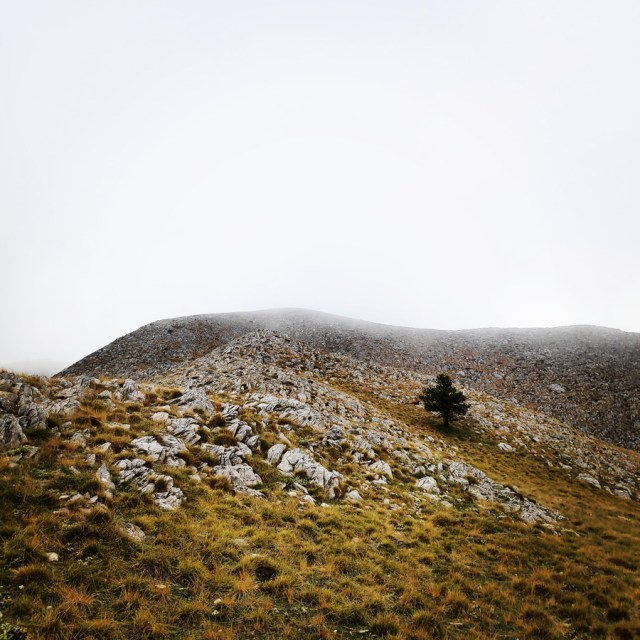
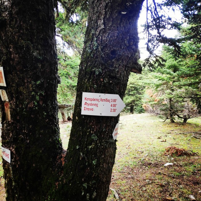
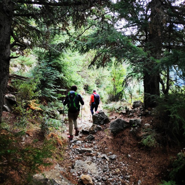
The trail to Megali Tourla starts right at the entrance of the village, in a water spring. On that spot there is a small parking lot and there is where we left our cars. The first part of the trail is a very narrow old path that is leading to the various plots of land that the locals were cultivating in the past.
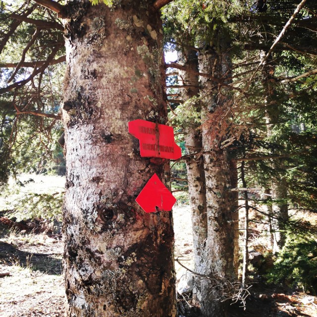
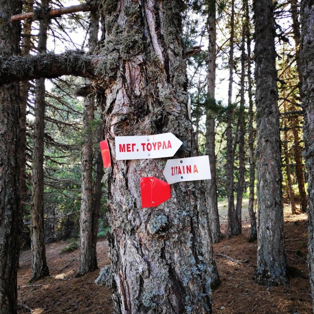
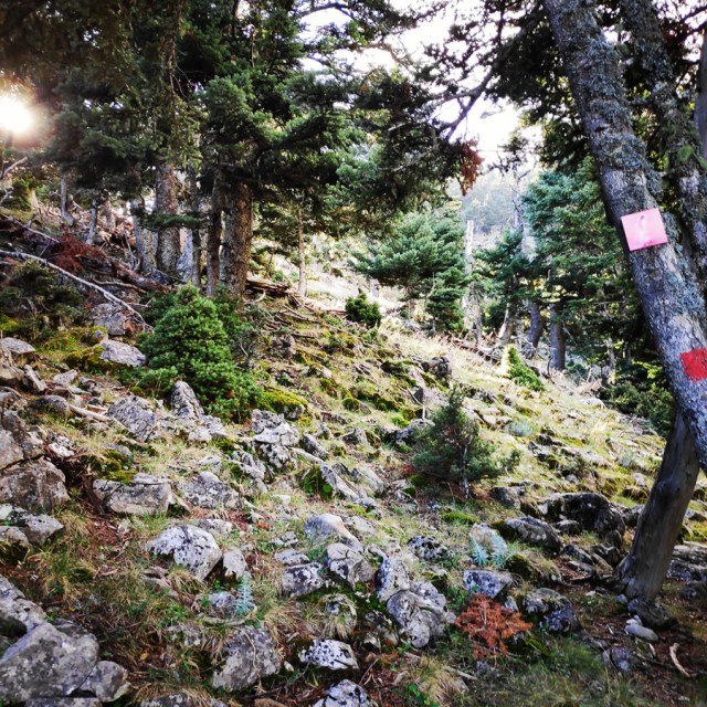
It is obvious, that this trail is not visited often, because there was plenty of wild vegetation, thus, the trail was not very obvious. Nevertheless, there are plenty of trail signs and the hiker won’t have any orientation issues.
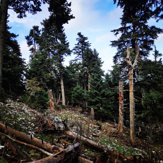
Old Quarry – Russa Petra – Megali Tourla
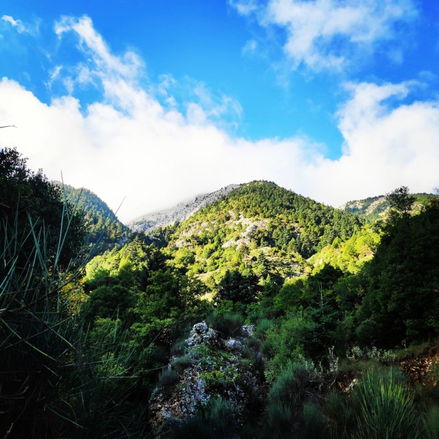
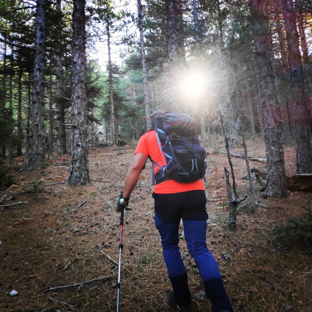
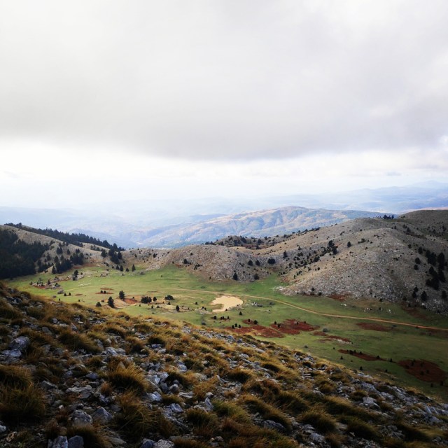
From Sitaina till the old quarry we did about 1 hour and 30 minutes. The hike was rather easy with some steep parts, but nothing of really tiring. As soon we reached the old quarry, we had a small break for a snack and some water and of course to enjoy the views towards the Myrtoan sea.
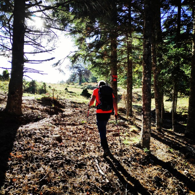
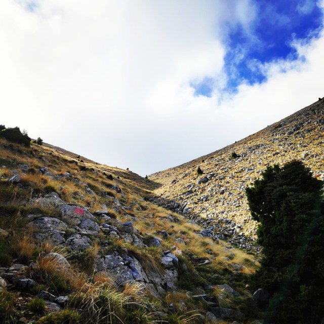
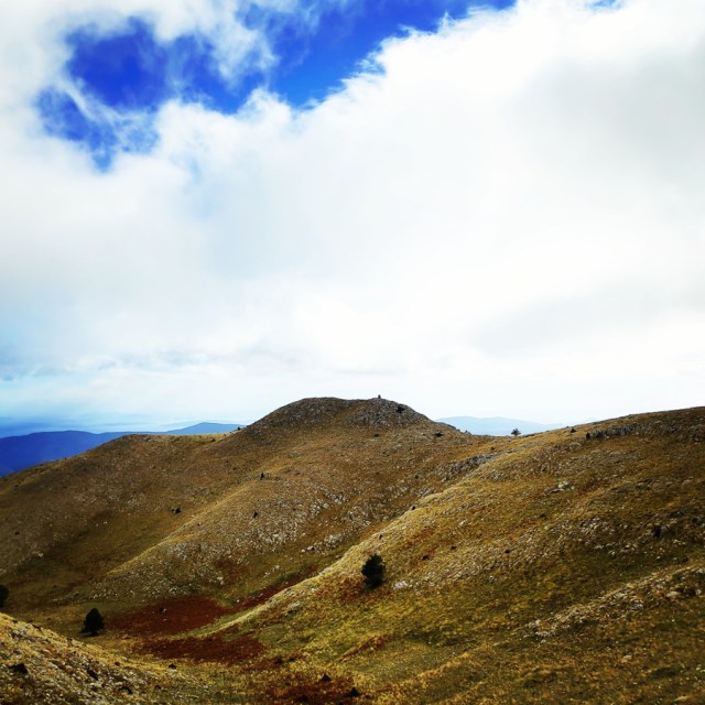
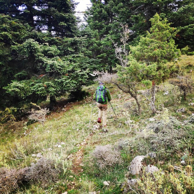
After the small break, we carried on our ascent. Our first goal was to reach Russa Petra and from there to follow the ridge which leads to the higher peak of Parnonas, Megali Tourla (1.935 m.).
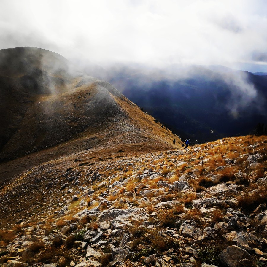
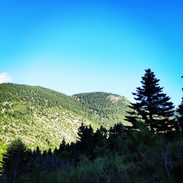
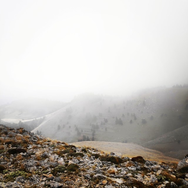
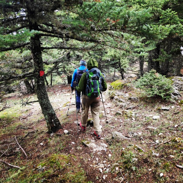
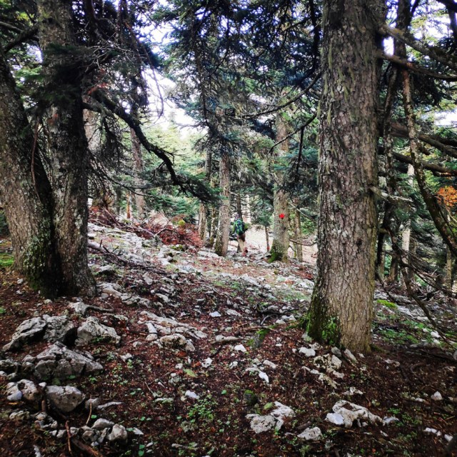
This section, is getting rather steep and good physical condition is required in order to move in fast pace. In addition, the trail signs from that point an on are a bit more difficult to be spotted, and in a foggy day -like the day we have been there- the route finding can become a bit tricky.
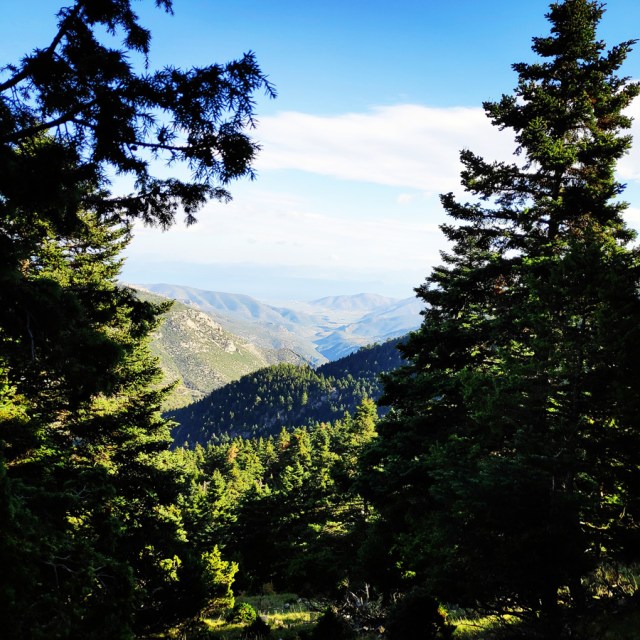
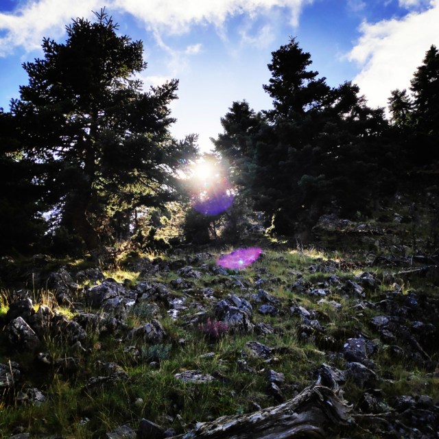
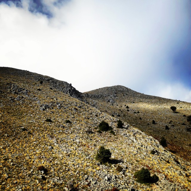
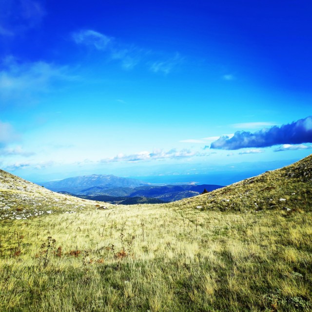
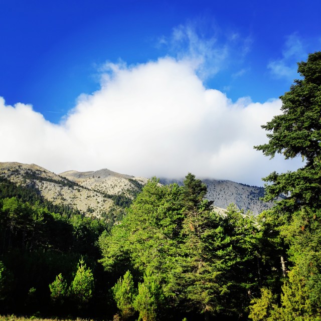
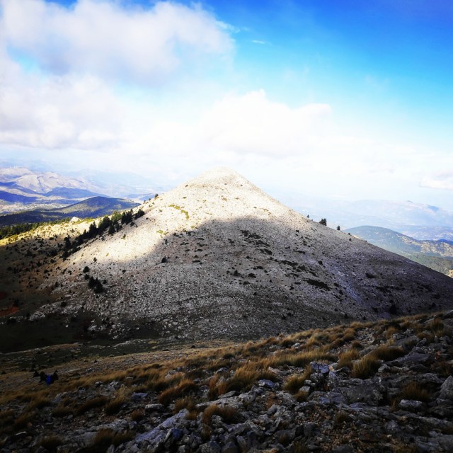
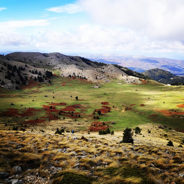
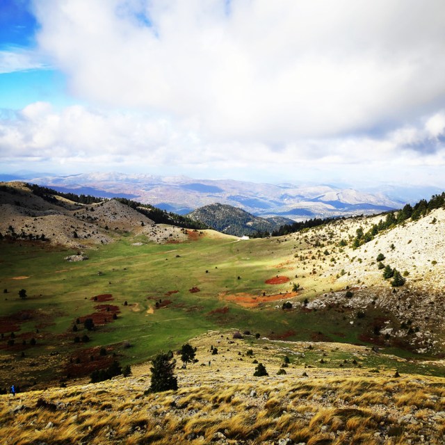
We hiked uphill for about 35 minutes and then we reached this magical alpine plateau with the most magnificent view towards the Myrtoan sea.
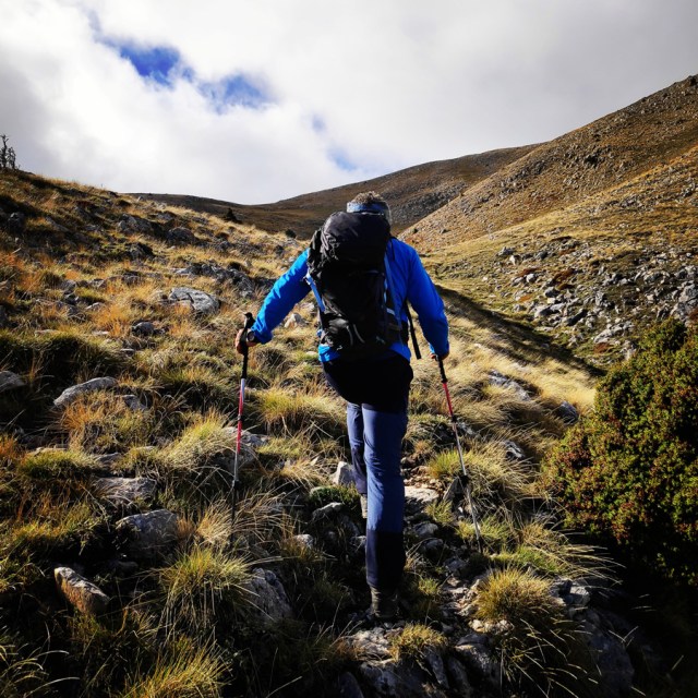
On that altitude, weather conditions were rather different compared to lower altitude. We had strong north bound winds and the fog kicked in. This resulted to low visibility and we had to be careful for the route finding. The Garmin Dakota 20 was very helpful on that section of the hike.
The name Parnonas existed already since the ancient period and the name meant “the ridge which shines”. During the ancient times the mountain was also called “Kronion” because it was considered to be the sacred mountain of Cronus, who was the leader of the Titans.
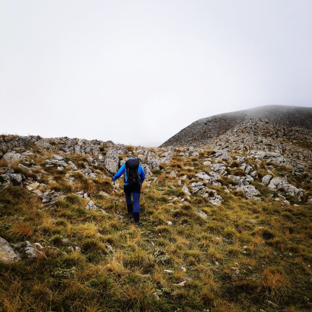
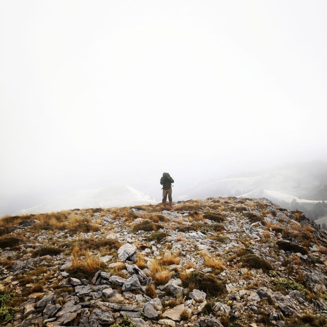
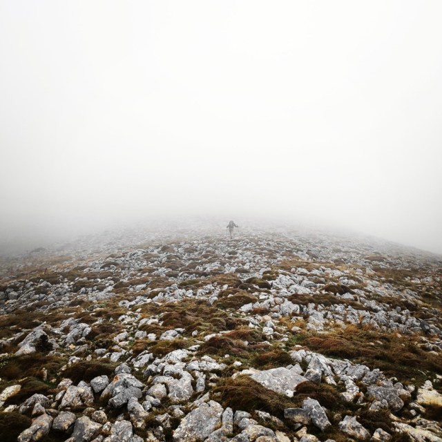
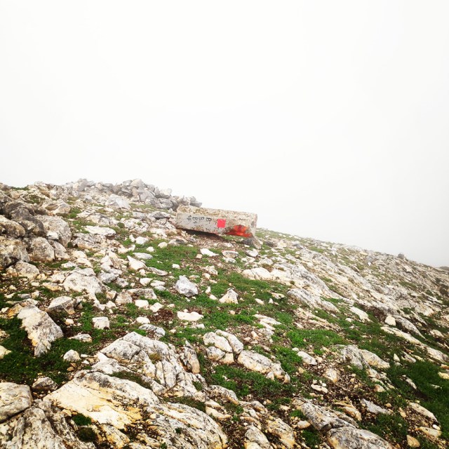
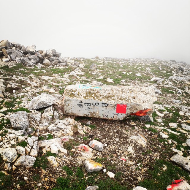
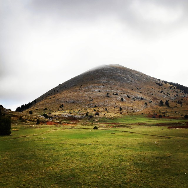
Three hours and twenty minuted after our departure from Sitaina, we have managed to reach the highest peak of Mount Parnon, Megali Tourla. Unfortunately, there was mist and fog and we were not able to enjoy the splendid views from the peak. In addition, the strong winds, did not allowed us to stay for long on that altitude and therefore once we have drunk some water, we soon started our descent.
The name Parnonas existed already since the ancient period and the name meant “the ridge which shines”. During the ancient times the mountain was also called “Kronion” because it was considered to be the sacred mountain of Cronus, who was the leader of the Titans.
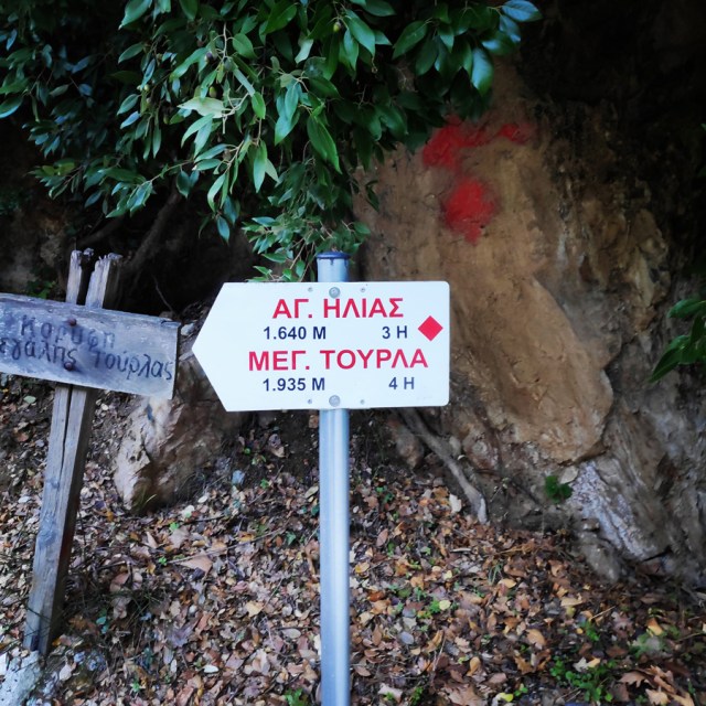
Megali Tourla – Profitis Elias – Sitaina
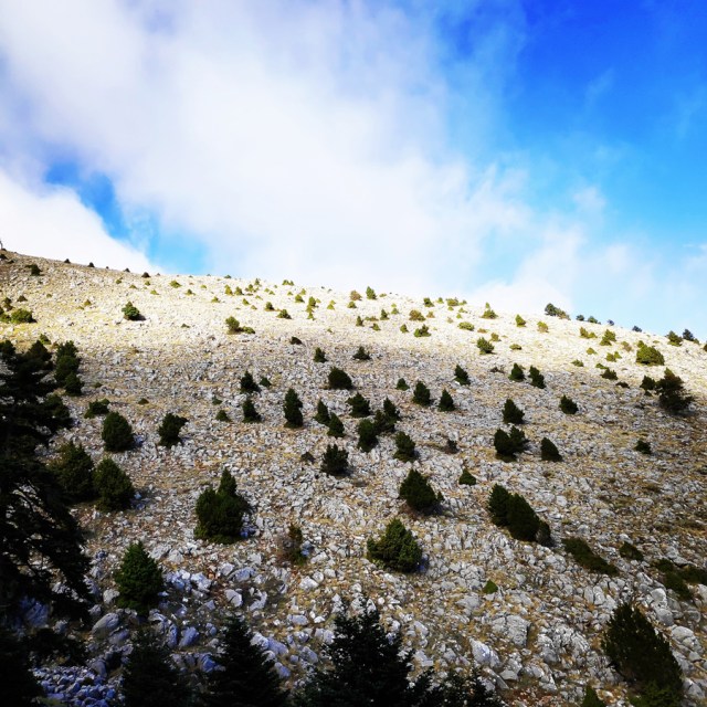
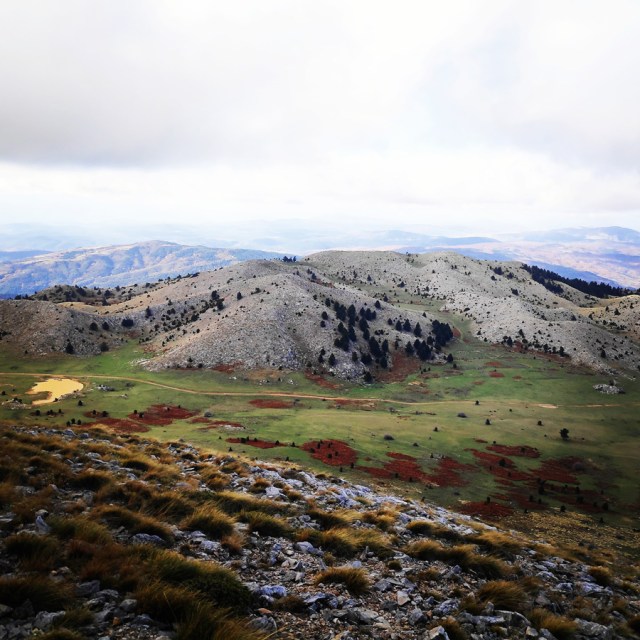
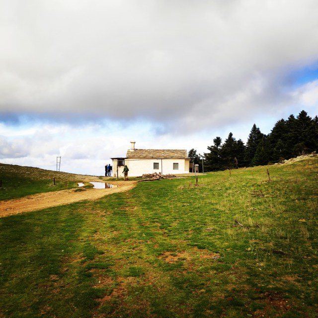
From Megali Tourla towards profitis Elias, is the most common route to the peak. Though, we, instead of climbing up, we went down-hill from this path. When the atmosphere is clear, there is a beautiful view over the alpine plateau which is located about 1.640 meters above sea level.
Due to the strong winds, we descended as fast as we could and once we reached the Profitis Elias chapel, we have met two other hikers that they were hiking from Panagia Malevi.
Parnonas is also a very important ecological zone in Peloponnese as it is covered with forests of firs, black pine trees, plane trees etc. Around the monastery of Malevi there is the “Juniperus drupacea” tree forest which is the only one in Europe and has been classified as protected area of the “Natura 2000”.
Juniperus drupacea is the tallest species of juniper, forming a conical tree 10–25 m tall, exceptionally up to 40 m, and with a trunk up to 1–2 m thick. It has needle-like leaves in whorls of three; the leaves are green, 5–25 mm long and 2–3 mm broad, with a double white stomatal band (split by a green midrib) on the inner surface. It is usually dioecious, with separate male and female plants.
At this mountain there are also many rare species of flora, some of them are known for their healing powers.
Details of the hike:
- Location: Parnonas Mountain
- Starting Point: Sitaina Village
- Ending Point: Megali Tourla Peak
- Trail Signs: Signed path (some parts are less obvious)
- Minimum Elevation: 610 m
- Maximum Elevation: 1.935 m.
- Elevation Gain: 1.458 m.
- Total Distance: 16.3 km
- Difficulty: Medium
- Water Features: Yes
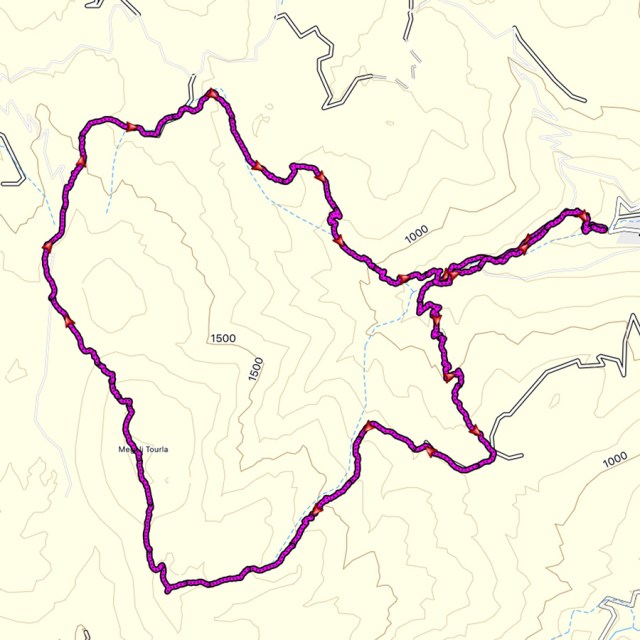
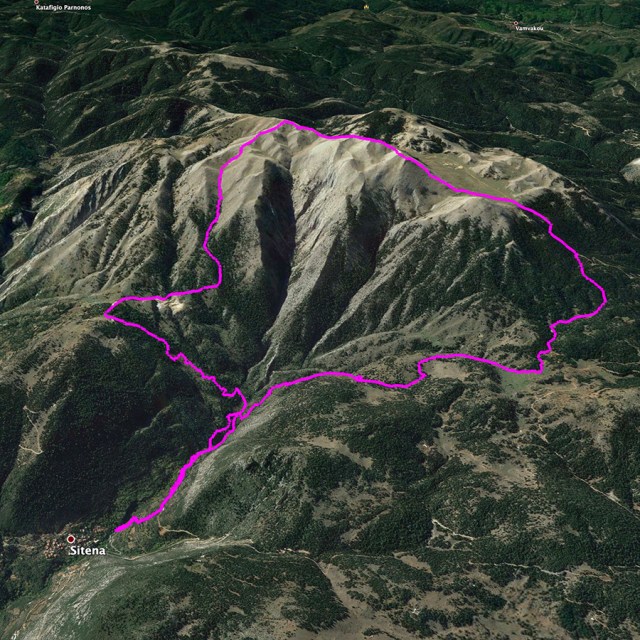
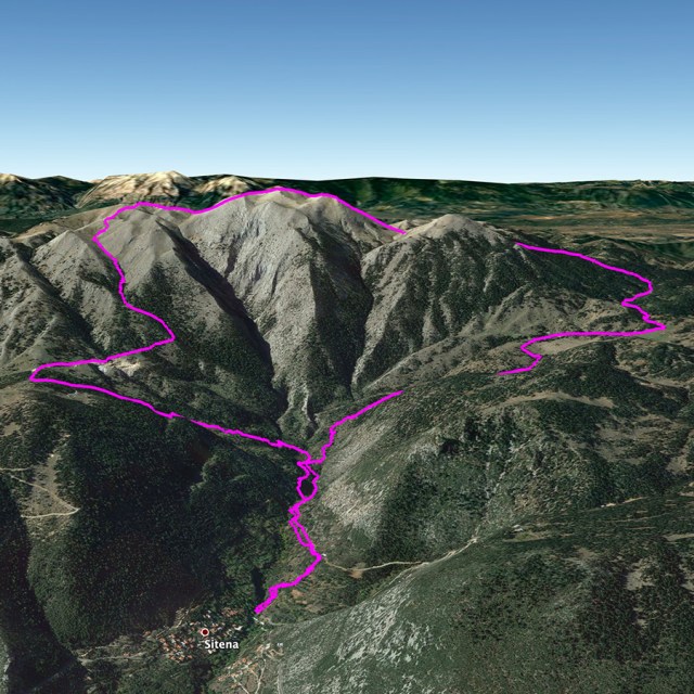
Bellow you can see the route we have followed on a map and on 3D:
see other hiking activities on mount Parnonas here:

Pingback: Ek Tou Anasfalous VI UIAA 90 m. | Trad Climbing in Karathona beach – Nafplio – Olympus Mountaineering
Pingback: Immerse in Greek Mountain Beauty: 10 Hiking Routes That Ignite the Spirit of Adventure – Olympus Mountaineering