
Ermioni is a small fishing town of Argolida (Argolis) at the east of Peloponnese. The traditional taverns, the cafes, the paved streets, the beautiful houses and the crystal clear beaches around this area are some of the reasons this town is an interesting summer destination of Peloponnese. While travelling around this area you will have the chance to admire the olive and the pine trees and plenty of bays with turquoise water.

Wandering around this town you will definitely feel like you are on an island. You can walk on the paved streets until the slope of the ancient hill “Pronos” where you will find the beautiful chapel of Agia Kiriaki. When you arrive at the chapel you will be rewarded with the beautiful view of the sea and the plains where olive trees, citrus trees and pomegranates are cultivated. Ermioni, besides being a very picturesque town is also the harbour that leads to Hydra island and not far from there, one can find Spetses island too.In this area there are several -mostly unexplored- hiking routes and the main ones are the following:
- Ermioni – Katafyki Gorge
- Ermioni -Monastery Agioi Anargyroi – Agioi Theodoroi – Pikrodafni – Ermioni
- Pikrodafni – Crow Hill – Pikrodafni
- Mount Didimo
(Notice: some of these hiking routes where explored on my own initiative, thus there is not any clear description on hiking maps of the area)
Ermioni – Mikrovouni
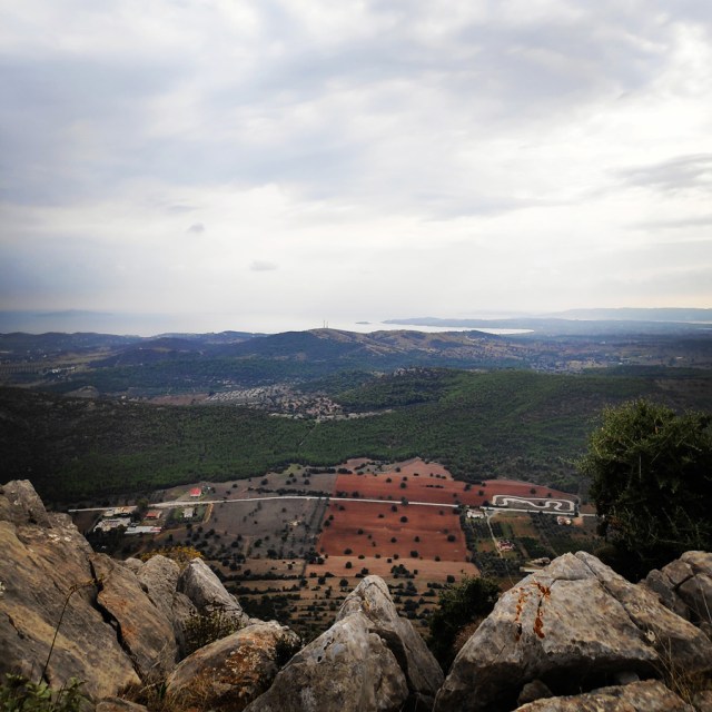
The beginning of this route is about 5 km from the town centre of Ermioni. It starts at the end of a paved road, right in the middle of an olive grove.
To reach the starting point, you have to follow the main road that connects Ermioni and Kranidi and the first hill you are going to see (on the right side), is Mikrovouni.
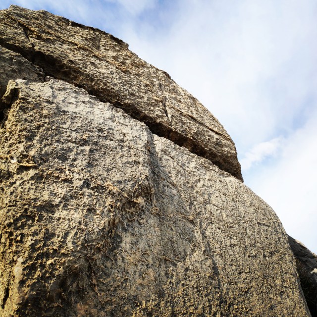
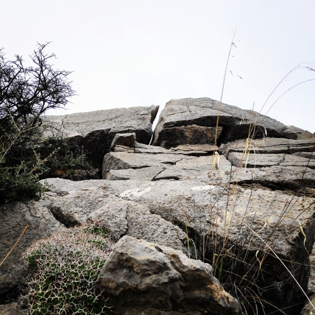
Mikrovouni is a rough hill with highest point 208 meters above sea level. Although the elevation gain is rather small, the hike is very demanding due to the absence of a trail. The ground is full of bushes and rocks. In addition, in order to reach the peak from the direct route (the one that we followed), there is need for scrambling which at some points is IV- UIAA. If someone wants to take it easy and to not scramble, there are other options (north or south) from the rocks.


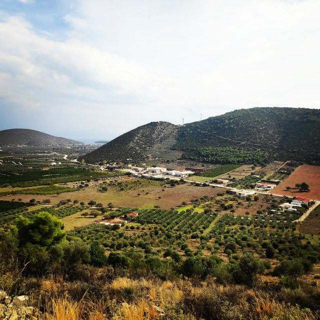


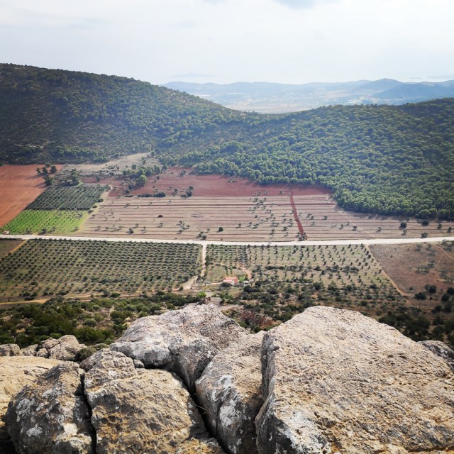


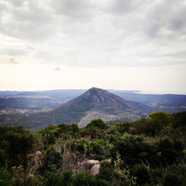
From the top of this hill, we can clearly see the Profitis Elias peak (347 m.), Asprovouni peak (396 m.) and also Mount Didimo peak. In addition, the hiker can see the nearby town Kranidi.
Kranidi is a town and a former municipality in Argolis, Peloponnese, Greece. Since the 2011 local government reform it is part of the municipality Ermionida, of which it is the seat and a municipal unit. The municipal unit has an area of 252.938 km2. Some say the name is derived from the word Koronida, while others claim it is from the word Kranaos, which means “rocky trough”. It is situated in the eastern part of Argolis, on the easternmost “finger” of the Peloponnese peninsula. It is 8 km west of Ermioni, 28 km south of Epidaurus and 38 km southeast of Nafplio.
Kranidi is known for being the location of second homes of several prominent shipping magnates, celebrities, including Sean Connery and the Dutch head of state King Willem-Alexander and his wife Queen Máxima.
Kranidi has traditionally been a prosperous town. In the 19th century it was an important trading centre. The activity on maritime area was also great. Characteristic of the town are the traditional stone mansions with beautiful balconies and special skylights. Beautiful buildings include the town hall, library and churches from the 19th century that are scattered throughout the area.
Mikrovouni – Asprovouni
Having reached the peak of Mikrovouni, it was time for some photos and I soon moved ahead towards the second peak of this grand traverse.
Also on this part of the hike there is not any real trail. At the beginning I had to descent for about 150 meters (in terms of altitude) and it was all on top of large or smaller rocks. In addition, all the bushes and thorns were quite annoying, but with a bit of patience I have managed to reach the col that connects Mikrovouni with Asprovouni. It is very important to state that although there is not real danger to get lost, it is very obvious that the hiker should have good understanding on how to move on such terrain.
Having reached the col that connects Mikrovouni with Asprovouni, I have started to ascent the second pyramid style hill. Again, I had to “fight” with bushes and thorns, but I also had to scramble again. This time, I would rate the scramble at about III UIAA.


Having reached the highest point of Asprovouni, 396 meters above sea level, one can enjoy nice views towards Ermioni, Dokos island and Hydra island. The hike to the top is again demanding due to the total absence of any trail.
It is very important to be very careful on each step, because an ankle sprain and/or any other injury could be catastrophic.
Asprovouni – Profitis Elias
From Asprovouni toward Profitis Elias, again, there is not any obvious trail and there is need for route finding. It is again a bit painful for the knees and the ankles.
The first part is a straight forward downhill till the col that connects Asprovouni with Profitis Elias, and right on the col, there is an old goat trail that leads from north to south. It is advisable to follow this goat trail in order to reach the souther trail which leads right at the top of Profitis Elias.


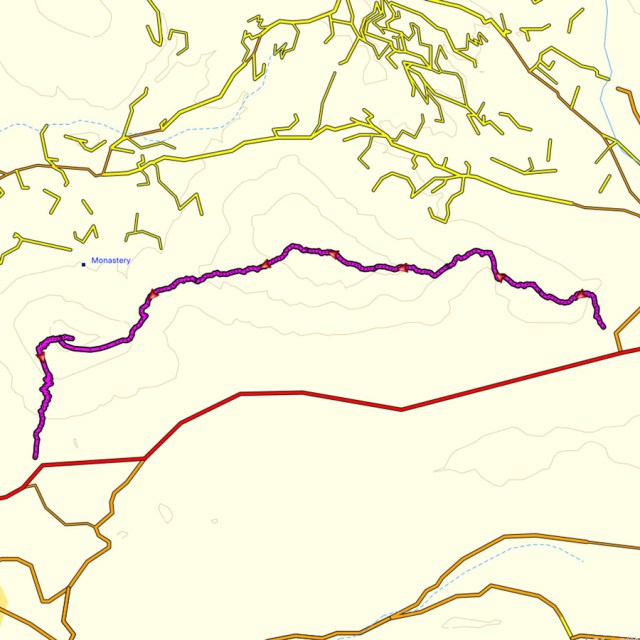
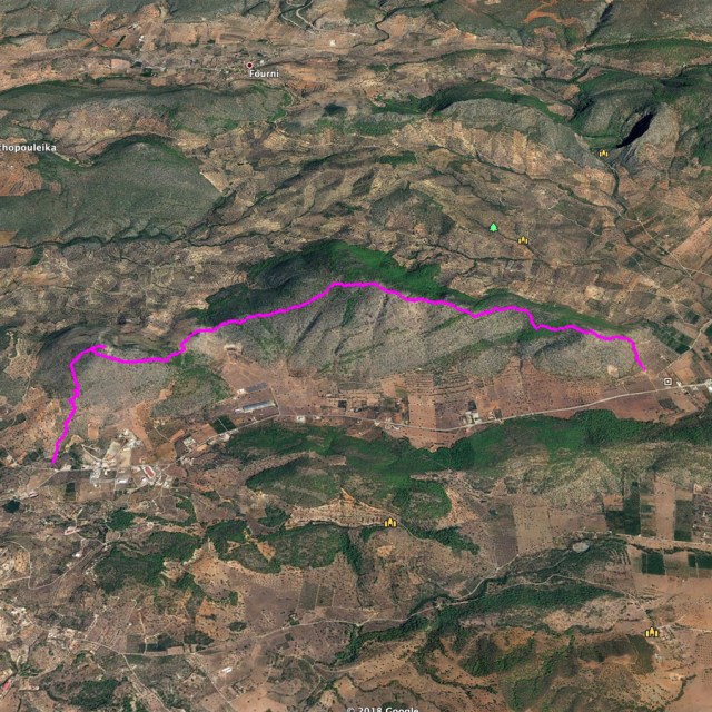
Details of the Hike:
- Location: Ermioni, Argolis
- Starting Point: Ermioni
- Ending Point: Kranidi
- Trail Signs: No Signs (demanding route finding)
- Minimum Elevation: 0 m
- Maximum Elevation: 396 m.
- Total Distance: 13.5 km
- Difficulty: Difficult
- When to Hike: Best to hike at late Autumn, Winter or early Spring
- Water Features: None
Bellow you can see the route we have followed on a map and on 3D:


See other similar hiking activities in the area:
- Ermioni – Katafyki Gorge
- Ermioni -Monastery Agioi Anargyroi – Agioi Theodoroi – Pikrodafni – Ermioni
- Pikrodafni – Crow Hill – Pikrodafni
- Mount Didimo

Pingback: Training in Ermioni’s hills – Olympus Mountaineering
Pingback: Hiking in Kilada – Patima Park – Ermionida (family friendly) – Olympus Mountaineering