Once again, in one of the most mythical mountains of Greece, Mount Taygetus (Taygetos). The slopes of Taygetus have been inhabited since at least Mycenean times. The site of Arkina, near the village of Arna, contains three beehive tombs and is still unexplored. Taygetus was important as one of Sparta’s natural defenses. The Spartans threw criminals and “unfit” (weak, sickly, deformed, or mentally retarded) infants into a chasm of Taygetus known as Ceadas.
During the era of barbarian invasions, Taygetus served as a shelter for the native population. Many of the villages in its slopes date from this period. In Medieval times, the citadel and monastery of Mystras was built on the steep slopes, and became a center of Byzantine civilization and served as the capital of the Despotate of the Morea. Mystras remains occupied by a tiny religious community.
Check out previous ascent on Mount Taygetus (Taygetos) here:
- Mount Taygetus Winter Ascent
- Climbing in Taygetos Mountain
- Taygetus Mountain Autumn Ascent via Athanati Rachi
- Taygetus Mountain Crossing Pentadaktylos (Five Fingers)
Mount Taygetus is a limestone horst bordering the Eurotas Rift Valley. Below its eastern face is the Sparta fault, a normal fault striking perpendicular to the direction of extension. Footwall scarps are visible on the eastern side of Taygetus at the base of its spurs.
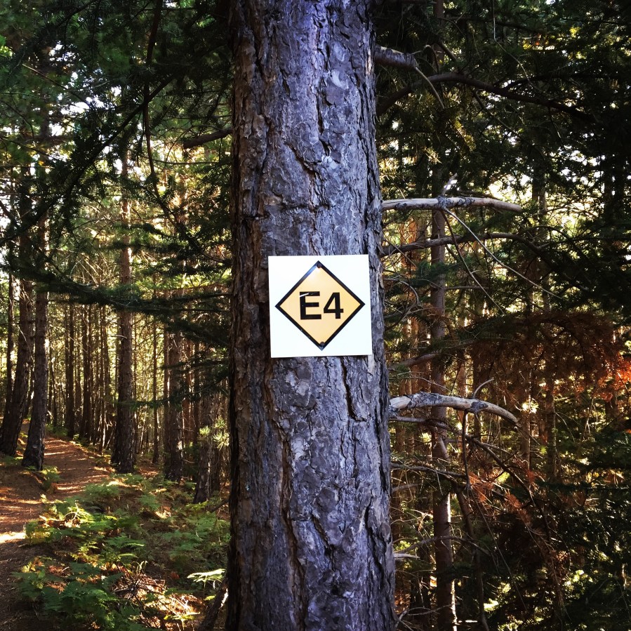
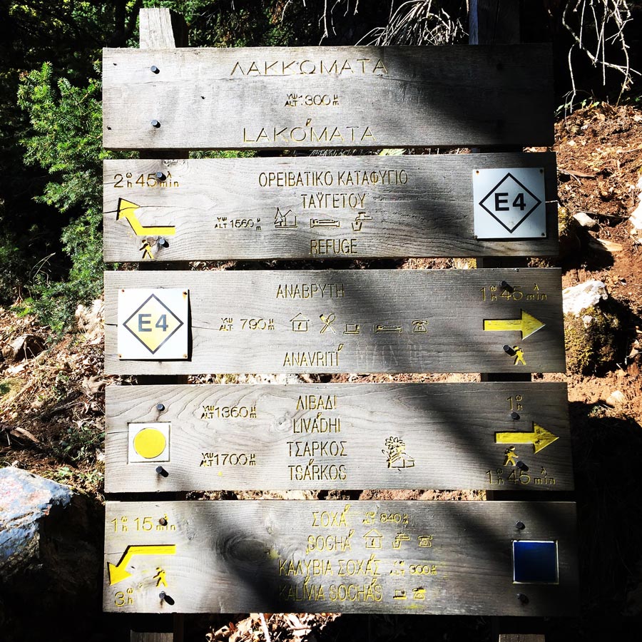
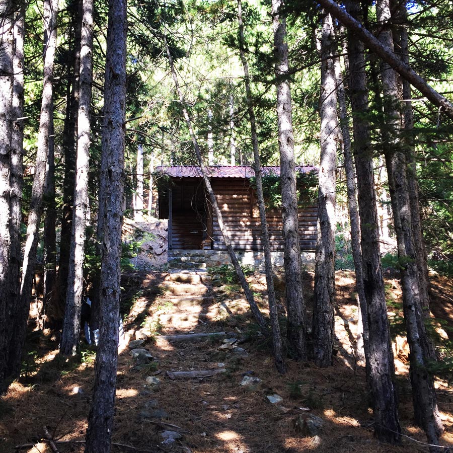
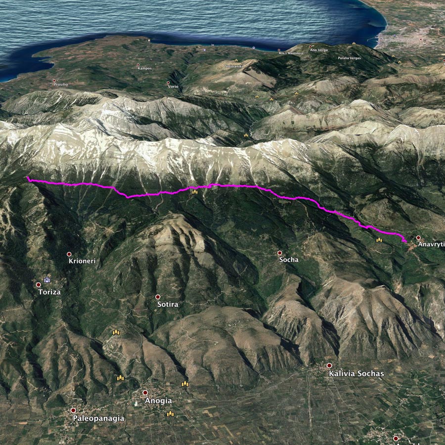
E4 European Path – Taygetus Refuge – Anavriti
The E4 European long distance path or E4 path is one of the European long-distance paths. Starting at its westernmost point in Portugal it continues through Spain, France, Switzerland, Germany, Austria, Hungary, Romania, Bulgaria and Greece to end in Cyprus. It also visits the Greek island of Crete.
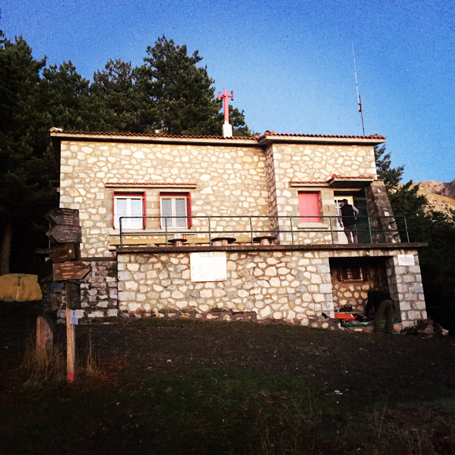
Although the E4 path is passing by the Taygetus mountain refuge, we have done the trail from the refuge till the village of Anavriti, which was our starting point for the Taygetus Pentadaktylos crossing.
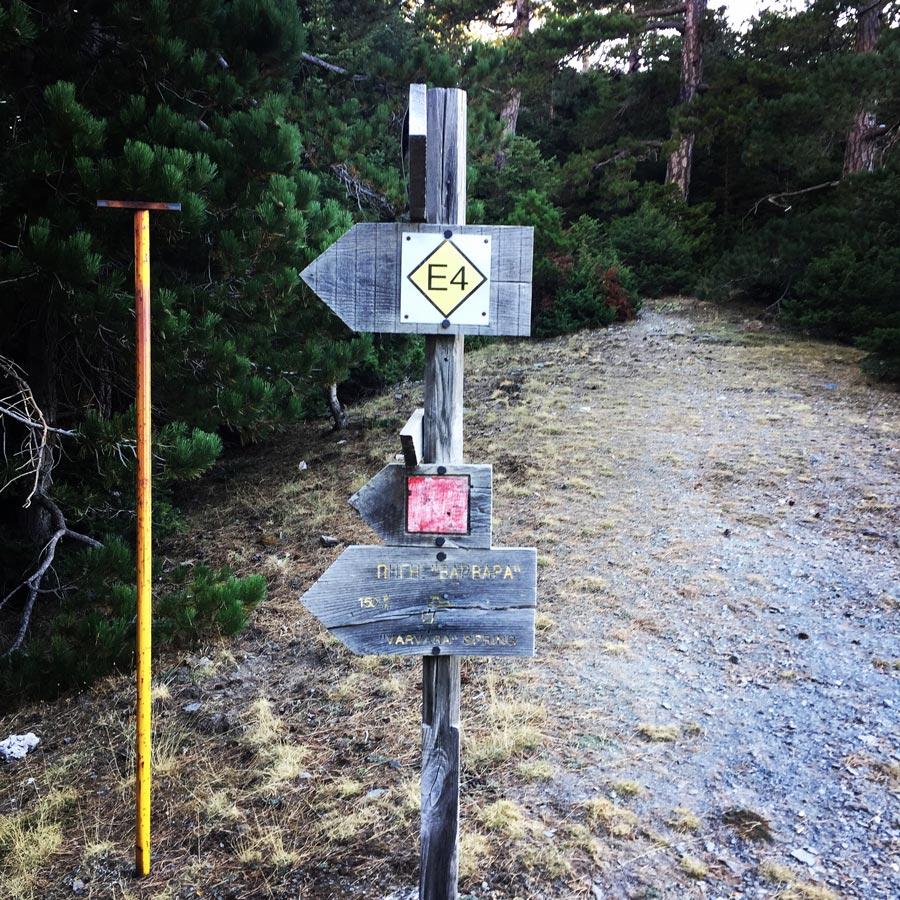


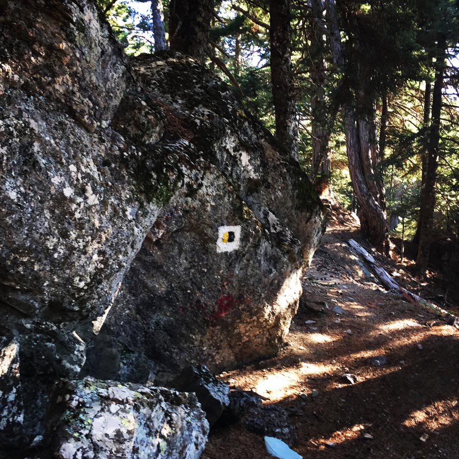
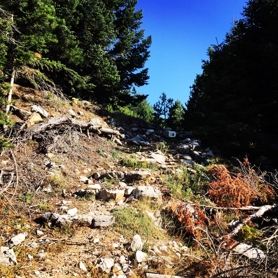
As one would expect, the E4 path that leads from the Taygetus mountain refuge till the village of Anavriti, is a very well signed path. In addition, in this trail there are in total four (4) water features, from which the three of them had fresh running water. Moreover, these springs of water, are spread nicely to the entire trail and therefore evey one hour (more or less) the hiker will have access to some water. Obviously, this means less weight on the back pack.

Check out more FREE Guidebooks
Download now for free! Explore breathtaking landscapes and conquer thrilling heights with our collection of guidebooks and topos.
Don’t miss out on this opportunity to elevate your outdoor adventures. Click, download, and let the exploration begin!
Flora & Fauna
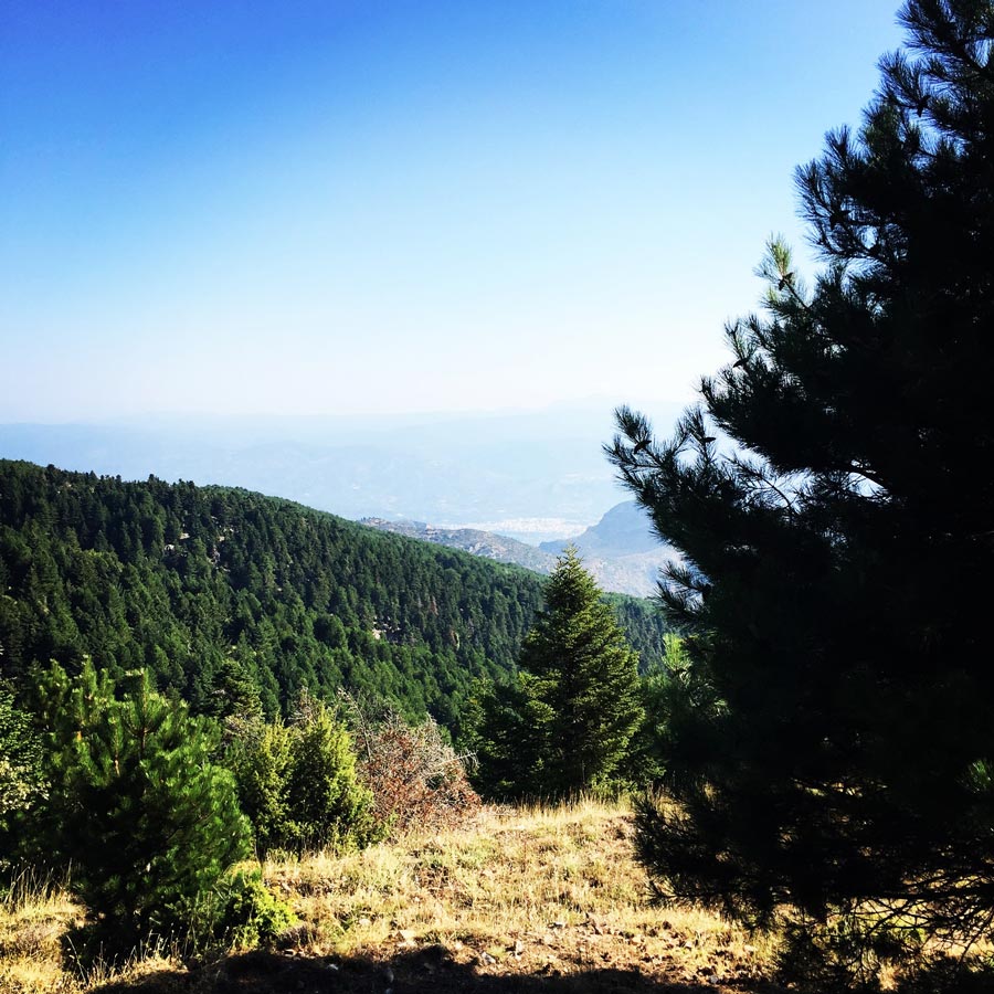
The slopes of Taygetus are heavily forested, primarily with Greek fir (Abies cephallonica) and black pine (Pinus nigra).
The area of central Taygetus, especially, is characterized by a great alternation of habitats, providing shelter to approximately 160 Greek endemic plants, 21 of which are endemic only in Taygetus. Several species are endemic in the Balkans or consist of very small populations, both in Greece and the neighboring countries. Other species are new to science, and, together with one genus, they have not yet been allocated to any category in the Red Book, despite the fact that their populations are small and vulnerable and should be placed among the endangered taxa. The mountain’s great ecological significance has also been officially recognized: The mountain is protected on a national and regional level as a Game Reserve, and on an international level as an Important Area for the Birds.
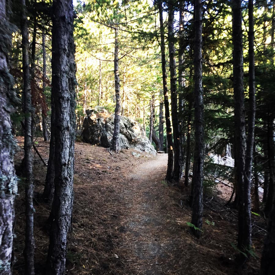
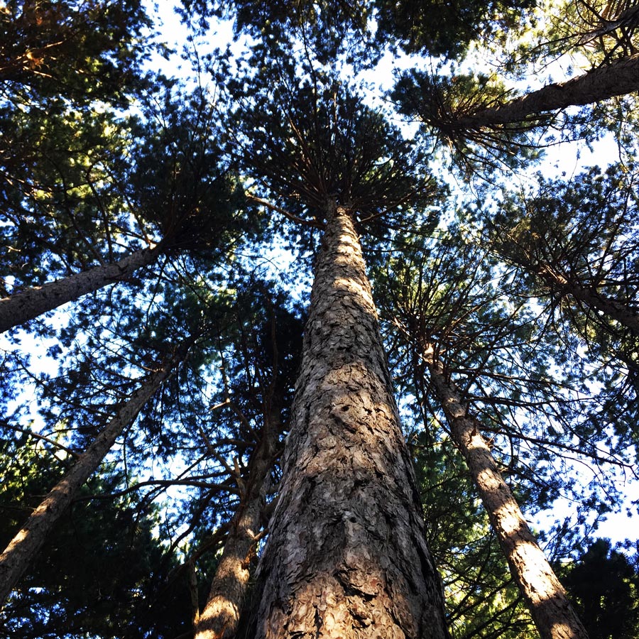


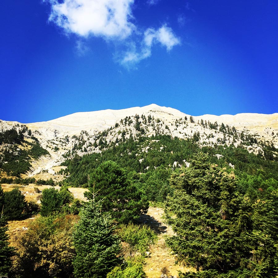
The entire trail is moving parallel with the Pentadaktylos ridgeline and therefore the view from bellow towards the high peaks is impressive. What makes it even more special is these beautiful forests that hiking through them is like being in a fairy tale.
Talking about fairy tales, the mountain got its name after nymph Taygete, the daughter of Atlas, of Greek Mythology. In Classical Greek mythology, Taygete was a nymph, one of the Pleiades and a companion of Artemis, in her archaic role as potnia theron, “Mistress of the animals“, with its likely roots in prehistory.


Explore all outdoor activities in a convenient list view here
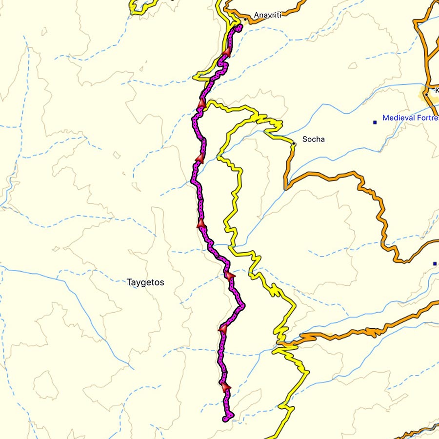
Details of the Hike:
- Location: Taygetos Mountain
- Starting Point: Taygetos Mountain Refuge
- Ending Point: Anavriti village
- Trail Signs: Well signed path
- Minimum Elevation: 850 m
- Maximum Elevation: 2.407 m.
- Total Distance: 12 km
- Difficulty: Easy
- When to Hike: Autumn to Spring (Not in summer due to heat)
- Water Features: 4 in Autumn time 3 of them had fresh running water
Bellow you can see the route we have followed on a map and on 3D:
Subscribe & Stay Informed
Enter your email address to follow this blog and receive notifications of new posts by email
Other Hiking routes on Mount Taygetus (Taygetos)
Except Prophet Elias there are even more hiking routes and locations on this mountain range which will astonish you with their wild beauty and will make you forget your everyday problems.
Forrest Of Vassiliki
The forest of Vassiliki is a small treasure for hiking lovers and not only. You will find it isolated at the southern part of the Taygetus mountain, surrounded by summits, awaiting to immerse you in its secrets of nature and total peace. In this forest, which extends across approximately 2,750 acres, you will find mainly fir trees and black pine, with some pines being almost 300 years old! The forest of Vassiliki suffered great destruction during the Italian rule, when a devastating fire razed a great part of its expanse; gradually, however, it recovered without human intervention.
Mystras – Taygeti – Moni Faneromenis
This route starts from Mystras (320m altitude) and after 2,5 kilometers and 1 hour of hiking you will end up to Taygeti village (700m altitude). At the entrance of this village you will see a beautiful fountain. Here starts another path which, after two hours of walking, ends up to Moni Faneromenis where you will find the homonym monastery.
Anavriti settlement – Agios Ioannis (St. John) The Anavriti settlement is connected with a lot of hiking paths. One of the most beautiful routes is the stone path which ends up to Agios Ioannis after one hour of walking. This route is about 3,5km and passes through a gorge.
Koumousta – Moni Golas
Koumousta is a medieval village built at 750 meters altitude on the Taygetos Mountain. From this village you could start your beautiful hiking route of 3,5 kilometers which ends up to the monastery called Moni Golas. After about 1 ½ hour you will see the monastery which is one of the seven monasteries in Greece which host images of ancient Greek philosophers.
Koumousta – EOS shelter of Taygetos
From Koumousta there is another beautiful route which crosses the forest of Pentavlon (1200m altitude). During the route you will come across springs, waterfalls and lakes. Along the route you will find another path which leads to the mountain shelter of Taygetos.
Check out previous ascent on Mount Taygetus (Taygetos) here:
- Mount Taygetus Winter Ascent
- Climbing in Taygetos Mountain
- Taygetus Mountain Autumn Ascent via Athanati Rachi
- Taygetus Mountain Crossing Pentadaktylos (Five Fingers)
Support the journey — buy me a coffee
I share these articles and the climbing guidebooks because I love the outdoors, and they’ll always be free. If they’ve helped you, help me keep them coming. Click the button to support my work.

Before you leave this blog check out the following map
Below: This map marks all the mountaineering adventures that have been featured on Olympus Mountaineering so far, including several Sport climbing crags – Select full screen to expand, zoom in for more detail, or click on a marker for a link to the post.

Pingback: Immerse in Greek Mountain Beauty: 10 Hiking Routes That Ignite the Spirit of Adventure – Olympus Mountaineering