
Artemisio mountain is on the border between Arcadia and Argolis, in the Municipalities of Argos-Mycenae and Tripolis respectively. It forms part of the mountain range that connects the Argolic Gulf with the Corinthian, and as such, it borders with Lyrkeio mountain on the north and with Ktenia mountain on the south. On its west is the plateau of Mantineia. Its tallest peak is 1,771 metres in height.
According to Pausanias, a sanctuary dedicated to goddess Artemis, patron of hunters and wild nature, used to sit on its peak. The Roman traveller mentions the sacred grove of Itamoi, a European Yew that is very toxic, and according to mythology, the goddess used it to poison her arrows; unfortunately, the grove has not survived. Today, very few fir trees survive. The river Inachos has its spring on the mountain, its mouth in the Argolic gulf, and is one of the few springs that can be used for those who decide to climb the mountain.
Hikers and climbers usually depart from Karya, on the east side of Artemisio. Two trails of different difficulty begin from there, one requiring special knowledge and equipment. In general, Artemisio’s trails are through the canyons and on its slopes, and are a popular destination for both mountain climbing and hiking; though hikers who don’t want to climb or don’t have the knowledge and equipment, should choose the easier trail from Karya. The trails are have good signals to aide the travellers.
As stated above, hikers start from Karya village and this is what we have done. The first sign we have seen was the sign that was indicating the path towards Agios Ioannis Church and after few minutes we have reached the church where a spring with fresh water refilled our bottles.


Leaving back the church we went south and the actual path within the pine tree forest started. Beautiful views and ancient trees just like the one in the photo bellow.


Check out more FREE Guidebooks
Download now for free! Explore breathtaking landscapes and conquer thrilling heights with our collection of guidebooks and topos.
Don’t miss out on this opportunity to elevate your outdoor adventures. Click, download, and let the exploration begin!
The route in some parts is very well signed, though in other parts is poorly indicated. Therefore a map with compass or a GPS unit is needed in order to navigate toward the peak of Artemisia Mountain.

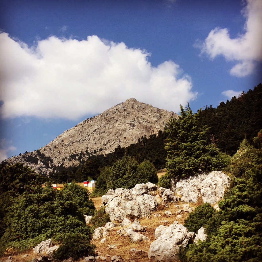
30 minutes after we have left the beautiful plane tree we reached the “Naraidovrisi” and from there we had the first close look of the highest point of Artemisio.
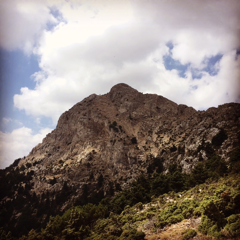
Following the ridge, we had a small climbing part and a good view toward the Ktenias Mountain.
Subscribe & Stay Informed
Enter your email address to follow this blog and receive notifications of new posts by email
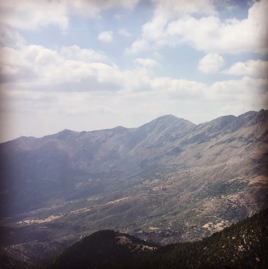
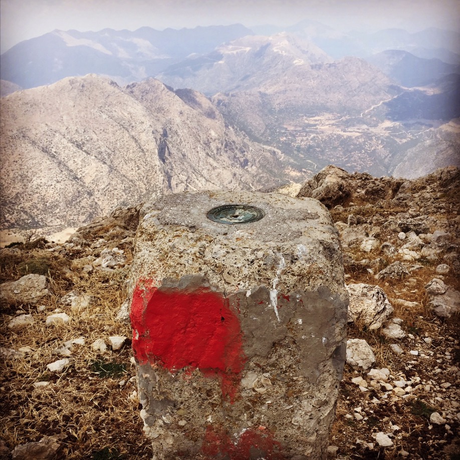
The last part towards the peak of Artemisia is quite demanding and a good physical condition is needed. We reached the top of the mountain 3 hours and 15 minutes upon our departure and the stunning views of the Argolis gulf, the Corinthian gulf, Tripolis, Argos and Nafplio payed dividend to all our physical and mental effort.

In Artemisio’s ecosystem are Important Bird Areas of Greece, and one of the known species found here is Rüppell’s warble.
Before you leave this blog check out the following map
Below: This map marks all the mountaineering adventures that have been featured on Olympus Mountaineering so far, including several Sport climbing crags – Select full screen to expand, zoom in for more detail, or click on a marker for a link to the post.

Pingback: Winter Ascent on Mount Mainalo – Olympus Mountaineering
Pingback: Winter Ascent on Artemisio Mountain – Olympus Mountaineering
Pingback: Trad Climbing on Artemisio Mountain – Olympus Mountaineering