It was a lovely winter Sunday morning, with plenty of sunshine and a refreshing northern breeze, when we decided to go for an explorative climb on the South-West ridge of mount Ortholithi.
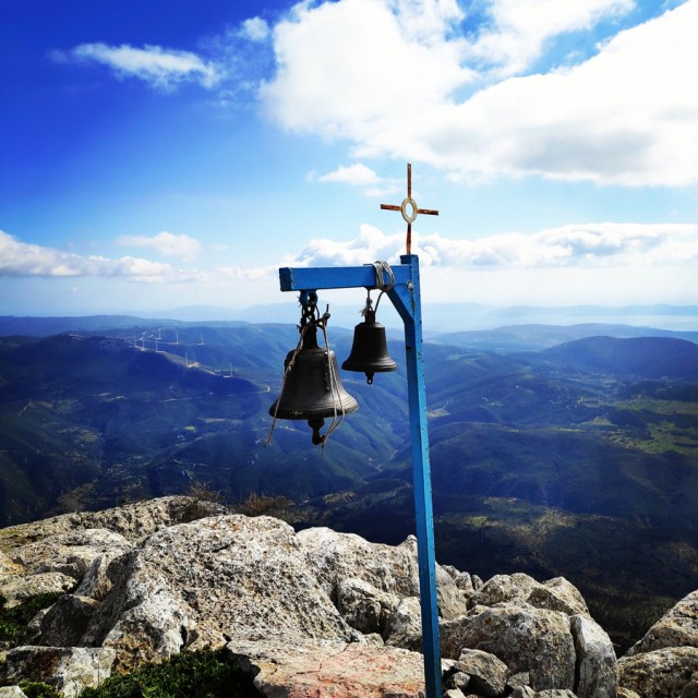
Ortholithi Mountain is situated in the prefecture of Greece, Argolis. One part of the mountain is in Argolis and the North face is in Troizinia. The highest Peak of Ortholithi is 1.105 meters above sea level. From the top of the mountain the view of the sea side is breathtaking and you can easily see the capital of Greece, Athens.

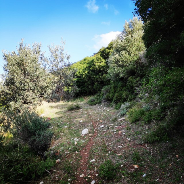
There is not a clear path towards the peak of the mountain but one of the possible routes starts from the village Choriza. From there, you get an initial south direction and via the goats path we come closer to the rocks.
Though, unlike my previous visit on mount Ortholithi, this time, I aimed to go for an adventure by trying to climb successfully the South-West ridge of the mountain.
see other climbing activities in the surrounding area:
- Anatoli Sector – Nafplio
- Neraki Sector – Nafplio
- Karathona Sector – Nafplio
- Acronafplia Sector – Nafplio
- Kondyli
- Didyma
- Pillars of the Wind
- Katafyki Ravine
- Thermisia Castle
- Caves of Frachti
- Mount Ortholithi
- Rock of Ages
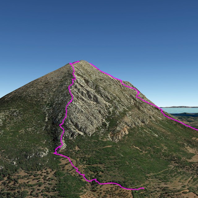
South-West Ridge of Ortholithi | IV UIAA – 500 m.
The South-West ridge of Ortholithi is located on mount Ortholithi and the starting point is about 2km before reaching Choriza village.
This South-West ridge of Ortholithi it is a very good starting point for people that want to get into alpine climbing, although the setting is not on alpine level. Most of the times, the weather is good in this area and the difficulty of the route, besides the first pitch, is almost equal.
The Route
The climb for most of the part is III UIAA. The beginning of the route is a 35 meters IV UIAA pitch and actually is also the crux of the route.
Elevation gain is 500 meters.

Approach
From Athens one needs to drive towards Epidavros and from there should follow the road to Ermionida. Just after Trachia village, should follow the road to Karatzas village and from there to Choriza.
Total distance from Athens: 150 km
About 2 km before arriving in Choriza ( 37.520145, 23.233478 ), there is a dirt road where we can leave the car and start the approach hike.
The approach hike is an easy hike of about 10 minutes.


South-West Ridge Climb – IV UIAA 500 m.
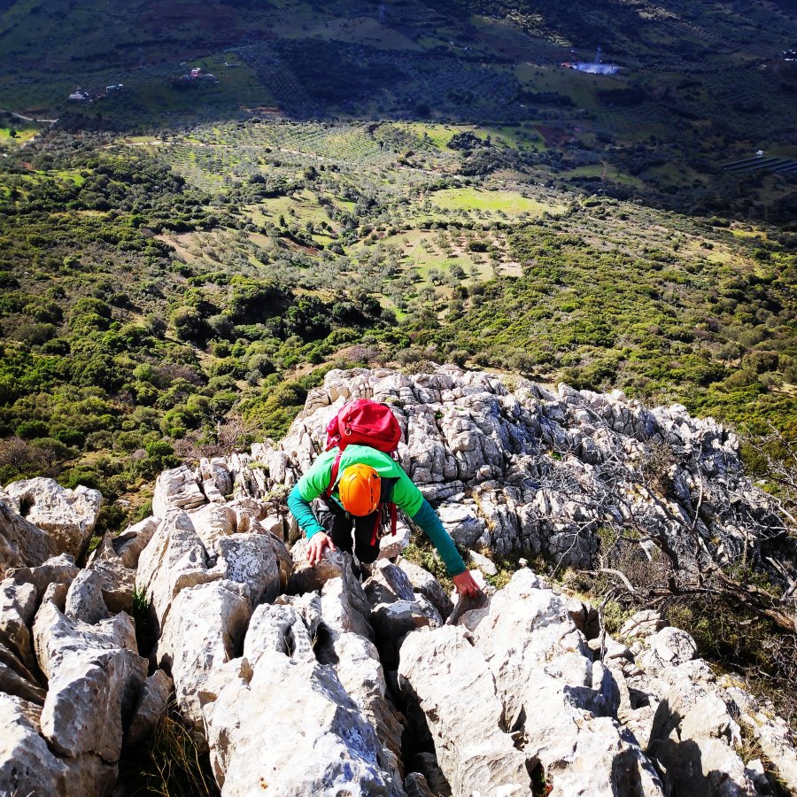
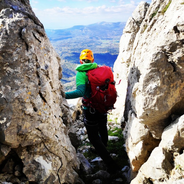
As soon we reached the base of the ridge, we had to get organised with our gear. Our harnesses, quickdraws, nuts, friends, ropes, helmets etc.
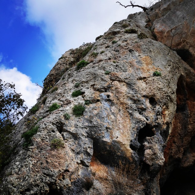
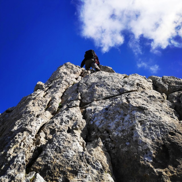
The first view of the ridge is rather stunning and the first pass is about IV UIAA. This first pitch is about 35 meters and it can be well protected by using any kind of gear. I have personally used nuts and slings, but there are plenty of options for friends too. For the entire 35 meters pitch, I used 6 pieces of pro gear.
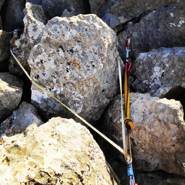
Once reached the top of Pitch 1, I created a solid belay station with a sling around a large block and a nut.


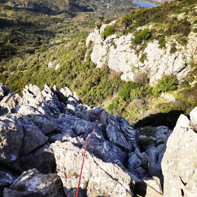


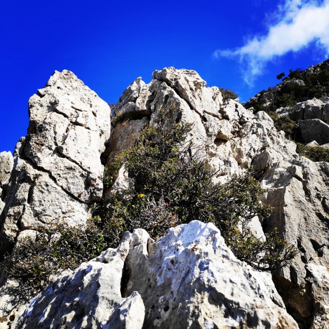
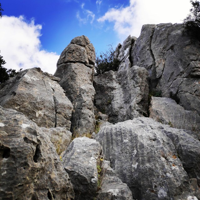
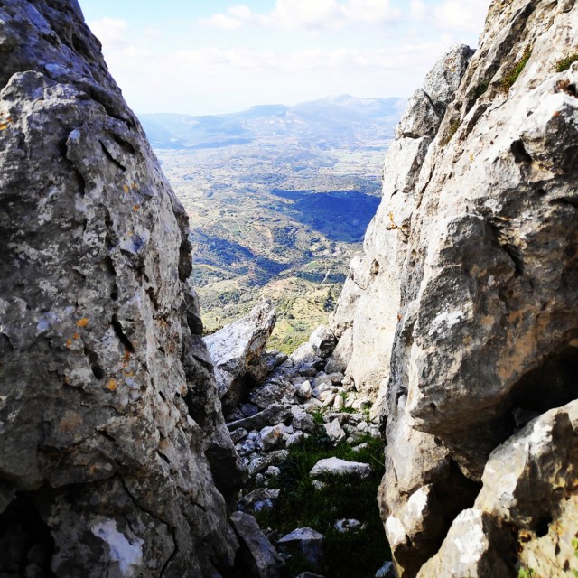
As soon the rest of the fellow climbers reached the belay, we removed the rope and we moved in the entire ridge un-roped. From that point and on the route is rather easy of III UIAA. The view from the ridge is really nice, because one can easily sea the argosaronic sea and the beautiful islands that are part of the argosaronic.

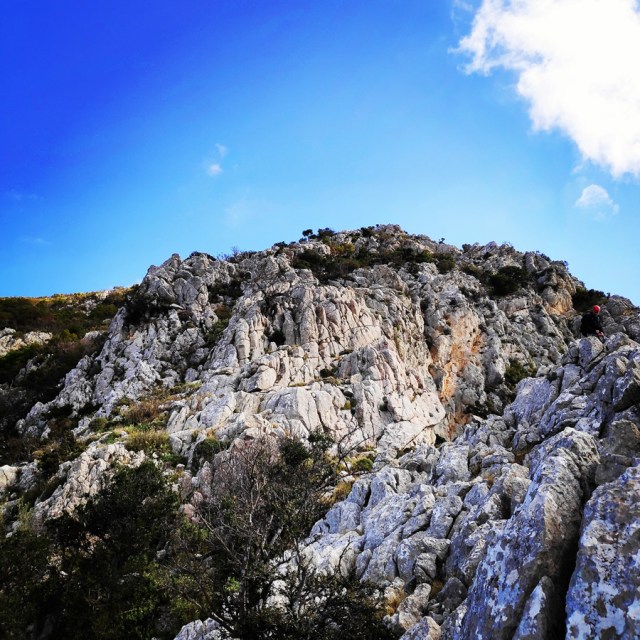


About half way of the ridge, we came across another IV UIAA passage and due to the fact it was only 5-6 meters high, we decided to climb it solo. Of course, by not means this is not the best practice, but we were feeling confident about it.
In case someone that do not feel confident to climb this part solo, there is a way to avoid it by moving south-direction (left from the rock).


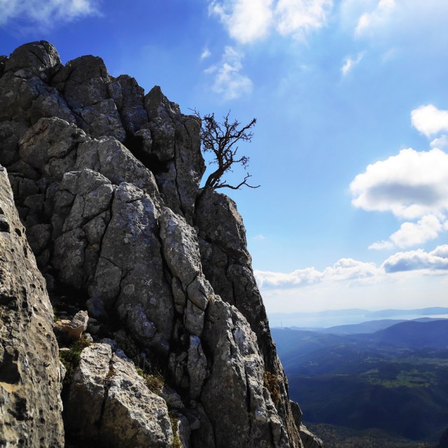

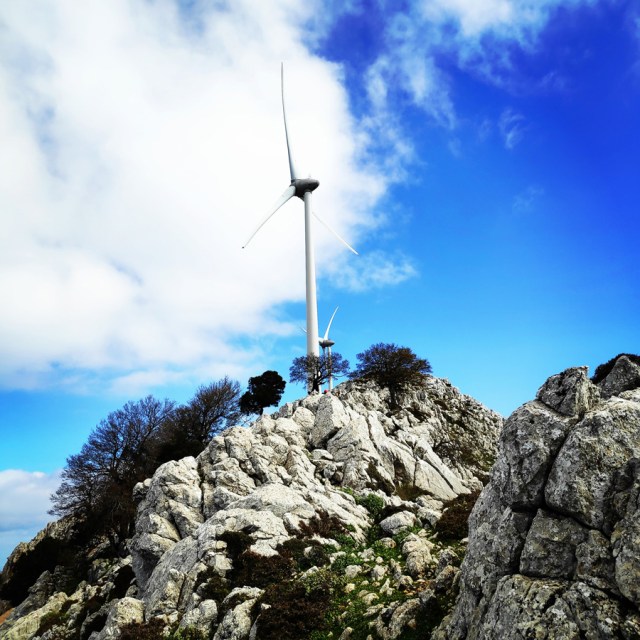
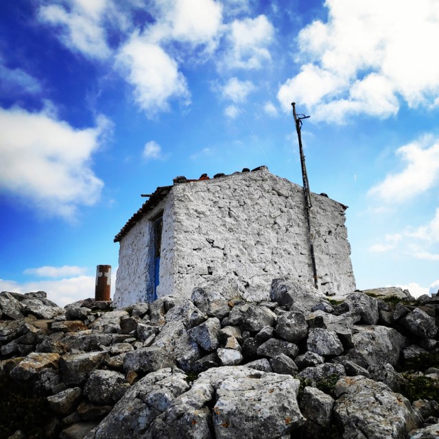
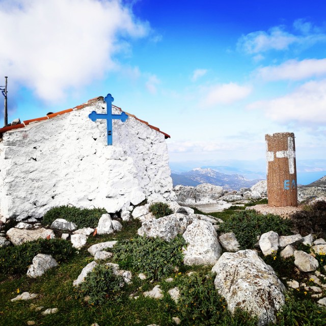
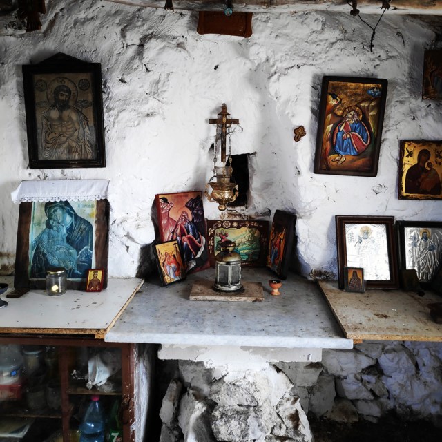
After about 2 hours and 15 minutes of continuous move onto the South-West ridge, we have reached the highest point mount Ortholithi and specifically, the little chapel of Profitis Elias that is located just on the top of the mountain.
Unfortunately, on this mountain, there have been installed monstrous windmills that besides the ugly view they offer, there has also been real damage on the mountain.


Return
As soon we reached the highest point of Mount Ortholithi, we took a short break in order to collect and order our gear inside our backpacks. After that short break we moved north where there is a path that leads to the village of Choriza.
Recommended Gear
For this multi-pitch climb, I used the following gear:
- Mammut Wall Rider Helmet
- Simond 20 lt. Back pack
- 5 lanyards 60 cm
- 1 lanyard 120 cm
- 4 locking carabiners
- 1 HMS carabiner
- Petzl Altitude Harness
- Simond Climbing shoes
- 6 Quickdraws
- Cordelette for prusik
- 60 m. rope
- 4 carabiners
- Reverso
- 1.5 lt of Water
- 1 energy bar
- Rock Nuts
Details of the Climb
- Location: Ortholithi Mountain
- Starting Point: Choriza
- Ending Point: Choriza
- Trail Signs: No
- Minimum Elevation: 528 m
- Maximum Elevation: 1.105 m.
- Total Distance: 3.5 km
- Difficulty: Medium
- When to Hike: Autumn, Winter, Spring
- Water Features: None
Bellow you can see the route we have followed on a map and 3D:


see other climbing activities in the surrounding area:

Pingback: Monsters of the Wind | Climbing the South-West Ridge of Mount Ortholithi – Olympus Mountaineering