Mountaineering is the set of activities that involves ascending mountains. Mountaineering-related activities include traditional outdoor climbing, hiking, winter climbing, Skiing and traversing via ferratas.
As a mountaineer, besides training on the various fields of choice, it is very important to update regularly the skills and to learn new techniques. This is exactly what I have decided to do for the month of March. I will be following a “Mountain Leader” course that will provide all necessary set of skills in order to be a “Mountain Leader”.
This course, is divided in three different sessions and we will be visiting the following mountains:
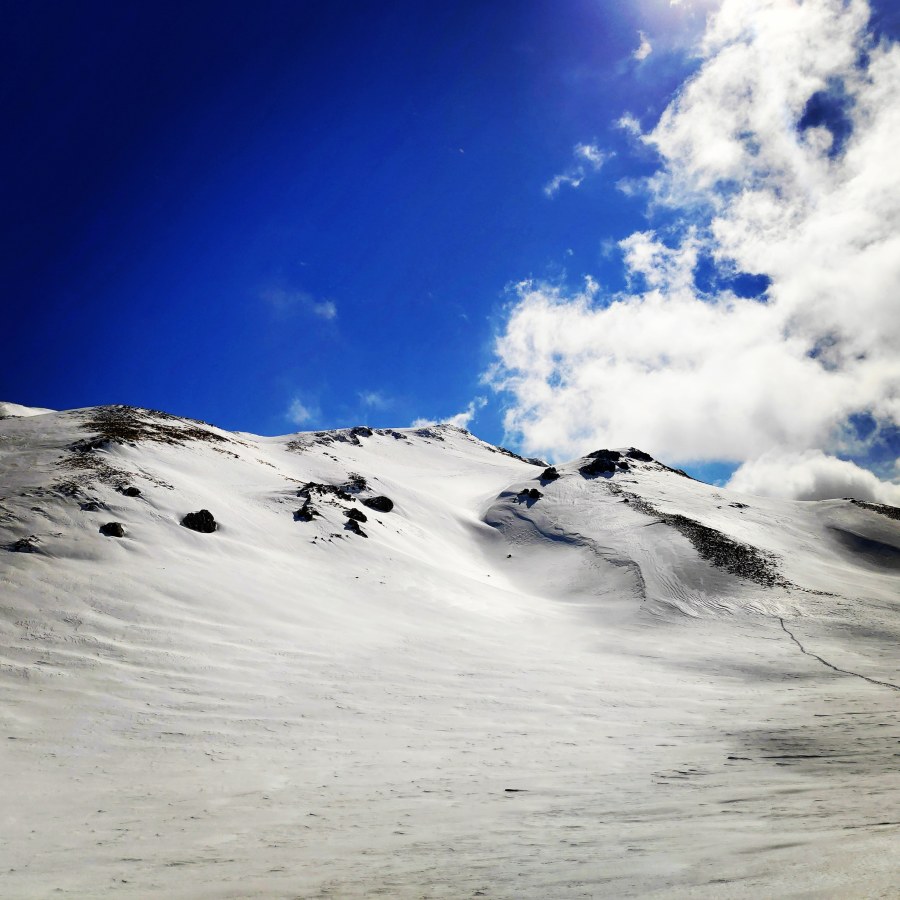
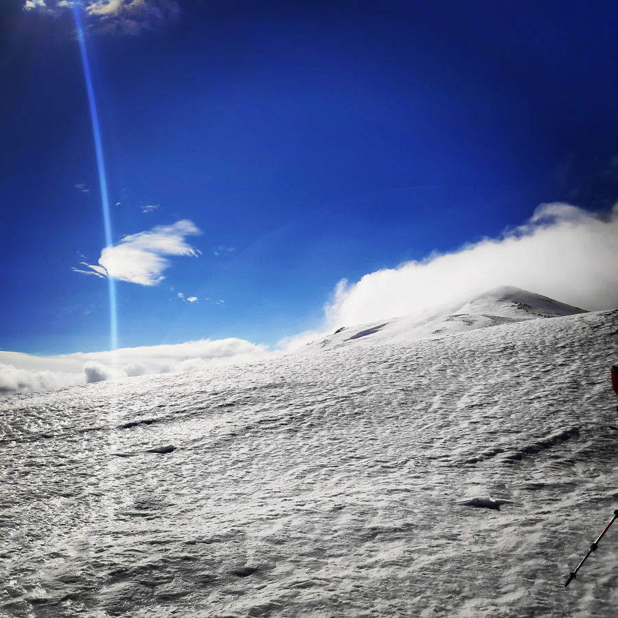
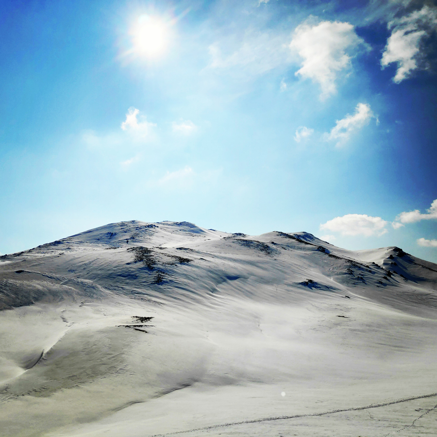
The first weekend, took place on Panachaiko mountain. The Panachaiko, also known as Vodias in the Middle Ages, is a mountain range in Achaea, southern Greece. It spans about 20 km in length from north to south, and 15–20 km from east to west. It is the northernmost mountain range in the Peloponnese. The highest point, named Palavou Pyrgos, is 1,926 m.
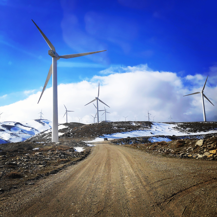
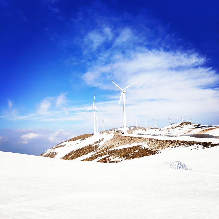
Although I have visited most of Greece’s mountains, I had never been on Panachaiko before and the reason was that I highly dislike to see wind farms on the highest points of the mountains. Unfortunately, the natural ecosystem of Panachaiko has been totally ruined by the installation of numerous wind turbines and besides the natural beauty, the wind turbines destroy the local climate too.
How to reach Panachaiko Moutain
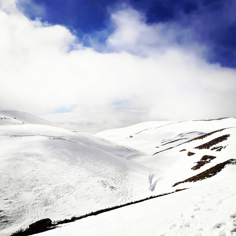
In order to reach Panachaiko mountain, first, we have to reach the town of Rio which is located in the suburbs of the city of Patra. From Rio, we drive towards the Panachaiko Wind Farms.
We leave the cars on the last wind turbine and from there we have a short hike till the mountain hut of Patras Mountaineering Club.
The mountain hut of Panachaiko is named Prasoudi (or Ioannis Diakidis Shelter) and is located in an altitude of 1.760 meters above sea level. Is a basic mountain hut that offers shelter up to to 25 people.


Explore all outdoor activities in a convenient list view here
Mountain Leader Course
The Mountain Leader scheme is designed for people who want to lead groups in the mountains, hills and moorlands of Greece.
Mountain Leaders operate the length and breadth of the country with all sorts of groups of people; from scouts and schoolchildren to outdoor instructors.
Mountain Leaders should be competent in the following key areas, all of which will be covered, to a greater or lesser extent, during the seven day training course.
- Group management
- Navigation
- Access and the environment
- Hazards (including steep ground) and emergency procedures
- Equipment
- Expedition skills
- Weather
- Background knowledge


Check out more FREE Guidebooks
Download now for free! Explore breathtaking landscapes and conquer thrilling heights with our collection of guidebooks and topos.
Don’t miss out on this opportunity to elevate your outdoor adventures. Click, download, and let the exploration begin!
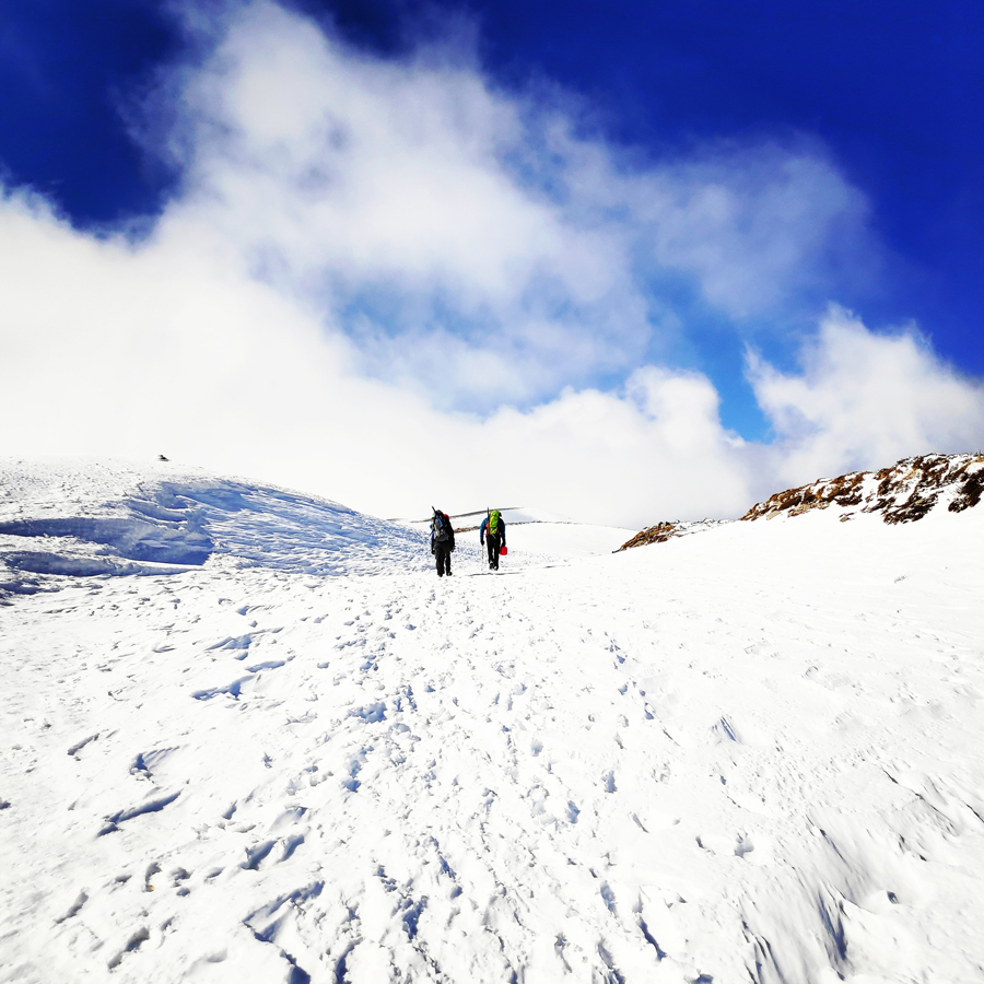
In these first two days of the Mountain Leader course, we had the chance to refresh the following subjects:
- Self Arrest Techniques
- Belay Techniques
- Snow Belay with retrievable anchor Techniques
- Weather / Meteorology
- Navigation


Subscribe & Stay Informed
Enter your email address to follow this blog and receive notifications of new posts by email
Before you leave this blog check out the following map
Below: This map marks all the mountaineering adventures that have been featured on Olympus Mountaineering so far, including several Sport climbing crags – Select full screen to expand, zoom in for more detail, or click on a marker for a link to the post.

The common and the most beautiful way to reach the top of Panachaiko mt is from Pournarokastro village (+650 ) as trailhead (not from Rio). You can drive from Pournarokastro το refuge Psarthi (+1350) through a smooth dirtoad (9 km), or walking/ running on an amazing trail path with a magnificent view expanding on three regions (Sterea Ellada, Ionian Islands & Peloponnese). The path is always clear because of its continuous usage an it is also perfectly marked. From Psarthi you can reach the Prasoudi plateau from two different ways. Firstly, you can follow the path starting from the water source nearby the refuge which leads rirectly to the top of Vodias Peak (+1750). On a kilometer you gain 400 mt + elevation, ok, it is difficult (not dangerous), but the view of the Rio bridge, the Patras’ urban web, the Mesolonghi lagoon, the Ainos (Kefallonia) Peak, the Elia’s flatland, the Patraikos & Korinthiakos Gulf and the breathtaking landscape of the syrrounding Sterea Ellada’ s mountain peaks is worth the effort. From Vodias peak you can follow the marked straight path (1 km) to Prasoudi, where you can also find water (except from August).The alternative way you can follow is through the dirtroad leading to Prasoudi (5 km).
I also mention that there is also a beautiful path (5 km) leading from Glafkos taverns area (+180) to Pournarokastro village (20 m right from the water source and then follow the path). It’s beautiful, but the marks are rare. It is obvious that the city of Patras and the top of Panachaiko Mt are linked with a straight clear path.
Panachaiko mt is almost bear (because of the overgrazing) and heavily injured but not totally ruined, as mentioned. You have the right to call something ” ruined” only in case that it is useless an of course it is out of issue concerning the Panachaiko mt. Panachaiko mt has three main advantages, rarely seen on other Greek mountain. 1) You can reach the top just following a path starting from urban environment, just 2 km away from the exit of the National Road, 2) You don’t have to carry litters of water, even on summer months. You find a watersource everywhere, 3) the view is uncomparable!
LikeLike
Thank you for commenting and for all the additional info. Very interesting an valuable and I am sure that will help and inspire other fellow mountaineers to visit this mountain.
Again, thank you for the nice comment.
LikeLike
Pingback: Alpine Climb on Parnassos Mountain – Gerontovrachos and Touborachi – Olympus Mountaineering
Pingback: Mountain Leader Seminar on Mount Parnassos – Olympus Mountaineering
Keep Posting !!!
One from my Favorite Activities is Hiking Greece nature is Fantastic
i created this Blog to share my adventures!!
https://www.kdexplorer.com/2019/01/hiking-at-cithaeron-mountain.html
LikeLike
Thank you for the comment and I am pleased to know you enjoyed the read.
Also, thanks for sharing the link from your blog. I will certainly have a look.
LikeLike
Pingback: Alpine Climb in Gerontovrachos – Parnassos – Olympus Mountaineering
Pingback: Immerse in Greek Mountain Beauty: 10 Hiking Routes That Ignite the Spirit of Adventure – Olympus Mountaineering