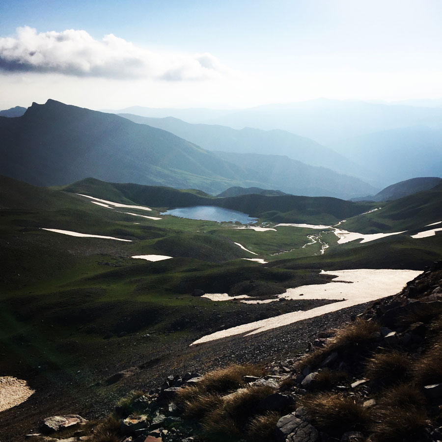
The second day of Lakmos (Peristeri) mountain crossing started rather early. I woke up at 5:45 in order to prepare breakfast and break down the campsite. The early morning sky was beautiful and the water of the alpine lake Verliga peaceful. My breakfast was rather simple (oatmeal with dried fruits) but very enjoyable in such a magical landscape.
On the previous day, we have covered around 10 kilometres of distance and rather good elevation gain, instead the second day, we had to cover a distance of about 12 kilometres.

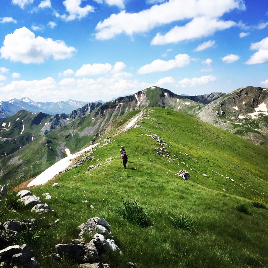
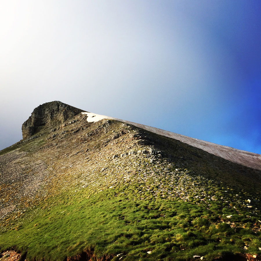
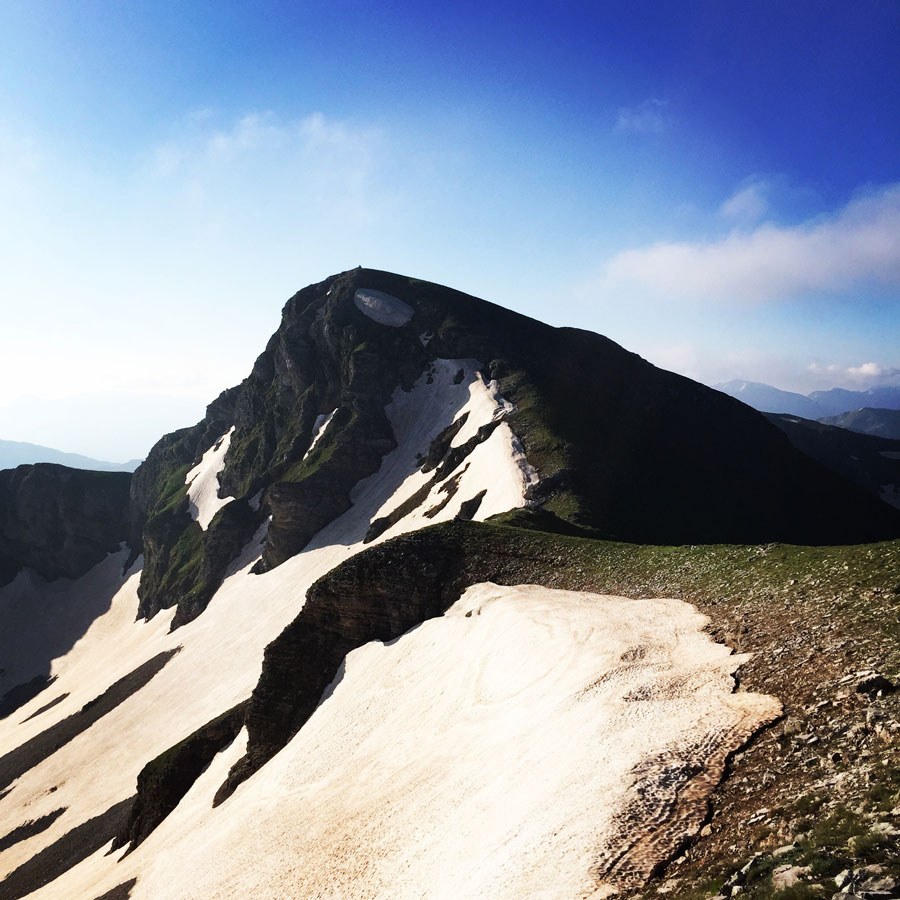
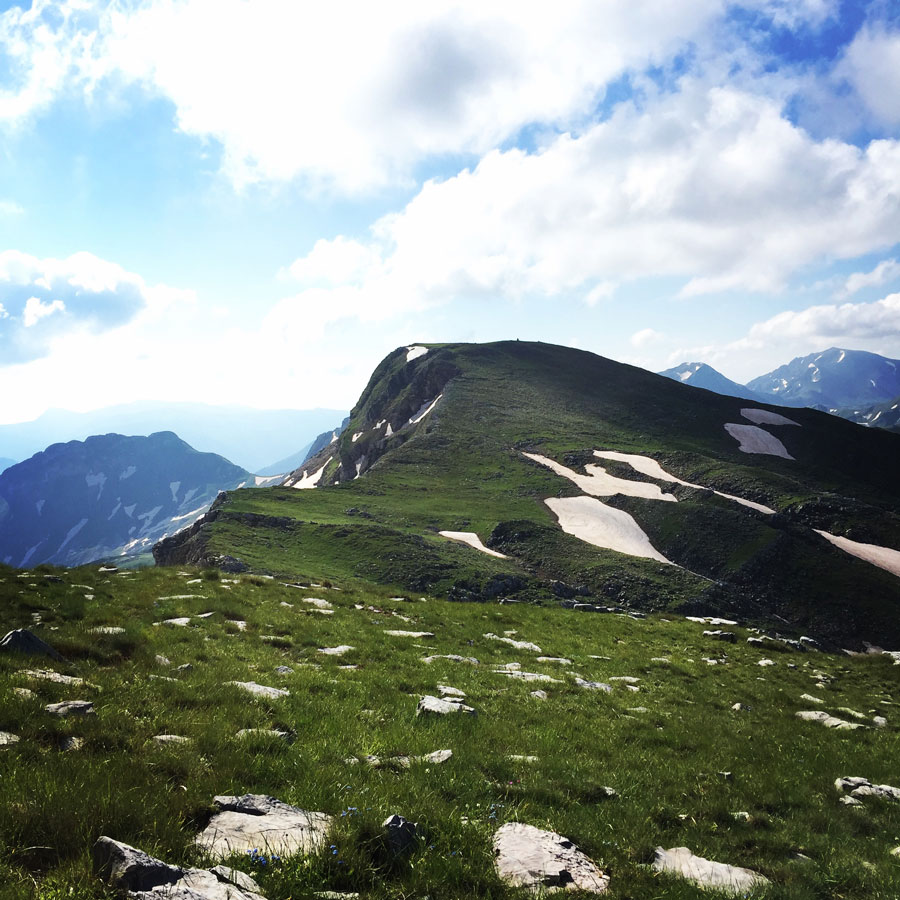
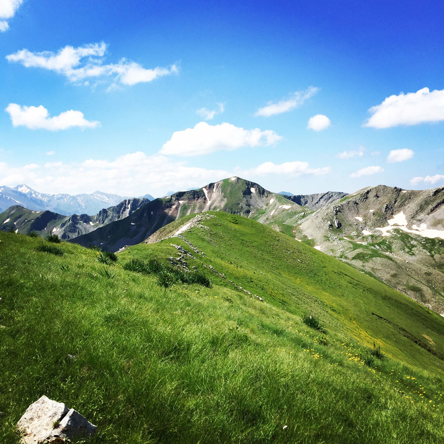
As soon the entire team was ready, we have started our ascent towards the first high peak of the day, Megas Trapos. Megas Trapos is located just above Verliga lake and its highest point is at 2.240 meters above sea level. It is a beautiful peak with several couloirs and gullies that can be climbed during winter time.
Support the journey — buy me a coffee
I share these articles and the climbing guidebooks because I love the outdoors, and they’ll always be free. If they’ve helped you, help me keep them coming. Click the button to support my work.

See here Part 01 of Hiking in South Pindos – Lakmos Mountain
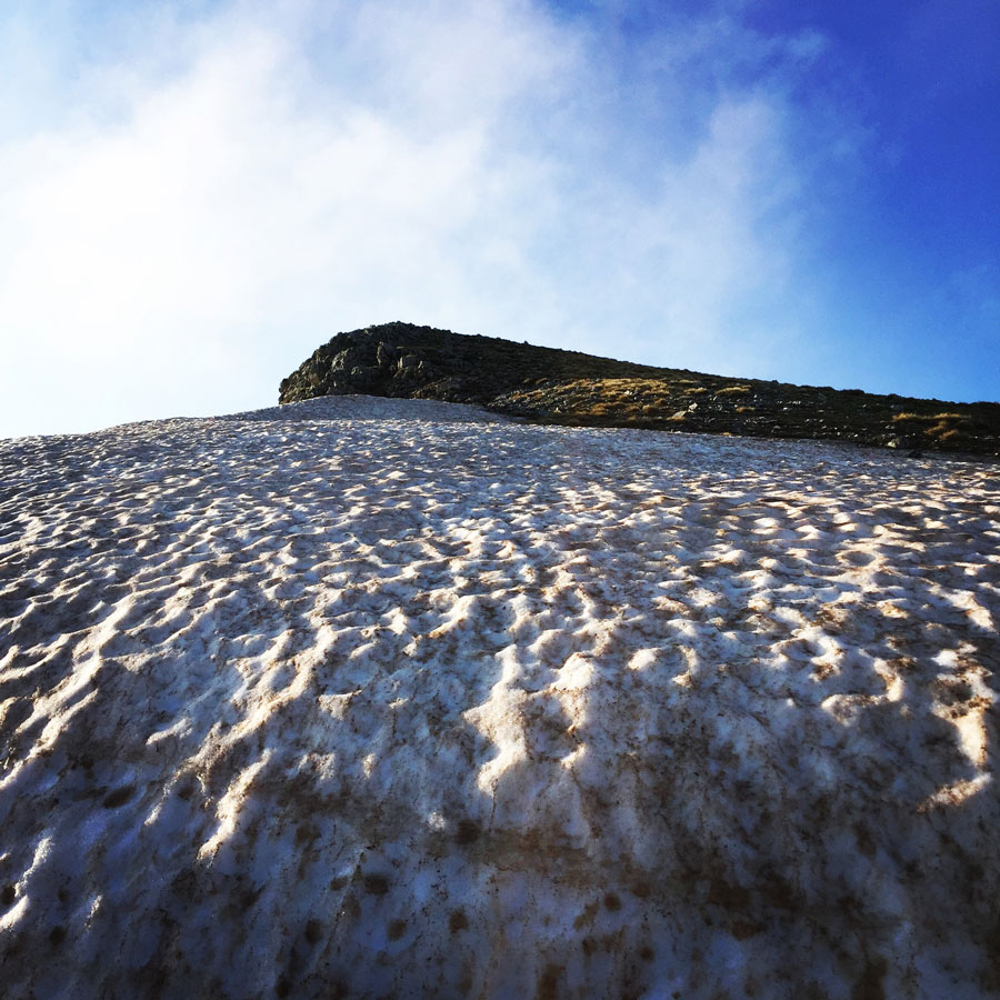
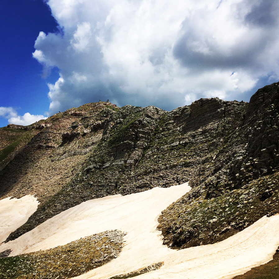
While we were hiking up towards Megas Trapos, we came across another icy snow slope and therefore we had to be careful in order to climb it. Having heavy backpacks (with all the gear) might not be that easy to climb up an icy slope, but the entire team performed great.
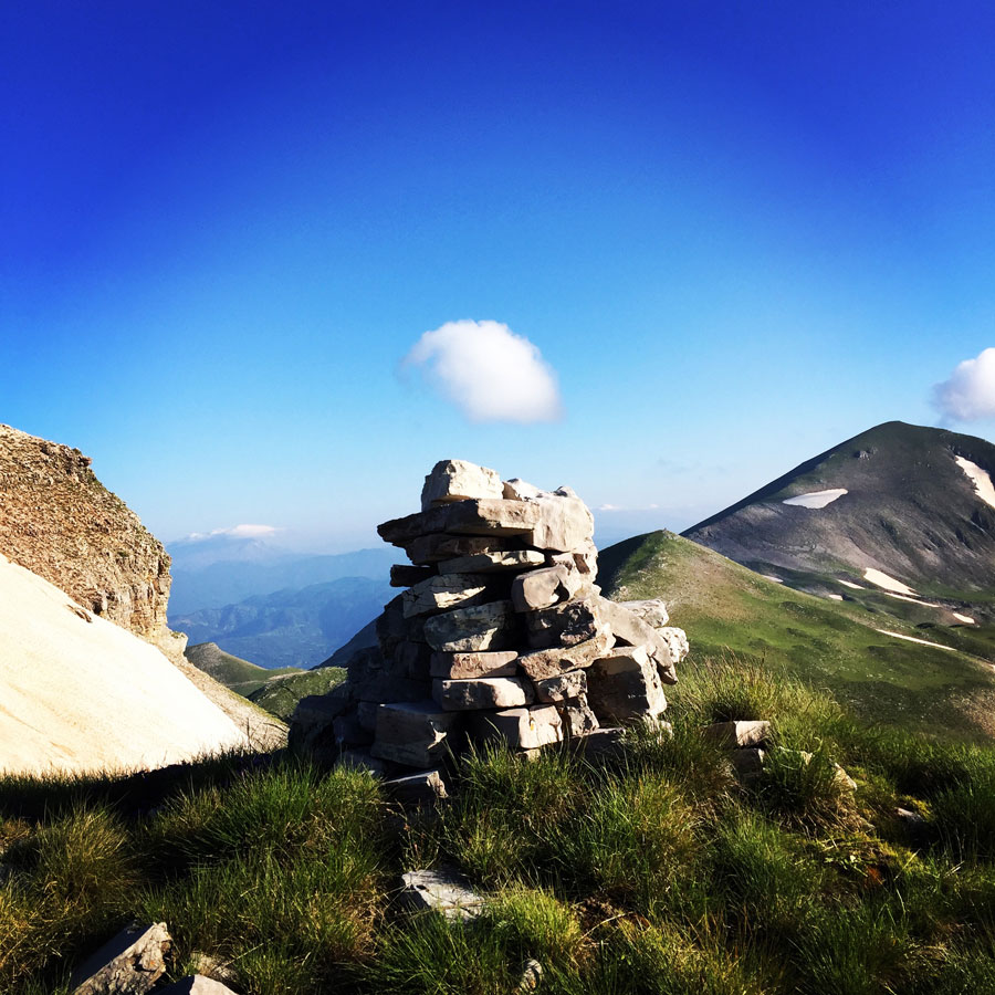
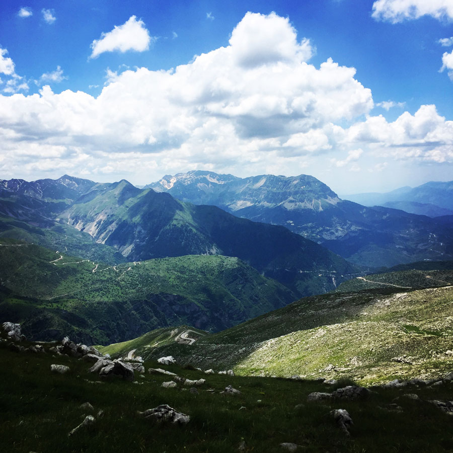
Once we have reached the peak of Megas Trapos (2.240 m), we were able to see the entire ridge of Lakmos mountain that we were about to hike. In detail, we could see the following peaks:
- Unnamed peak 2.190 m.
- Plaka peak 2.140 m.
- Salatoura peak 2.140 m.
- Souflomitis peak 2.010 m.
- Baros peak 2.060 m.
- Kalogeros peak 2.106 m.


Check out more FREE Guidebooks
Download now for free! Explore breathtaking landscapes and conquer thrilling heights with our collection of guidebooks and topos.
Don’t miss out on this opportunity to elevate your outdoor adventures. Click, download, and let the exploration begin!
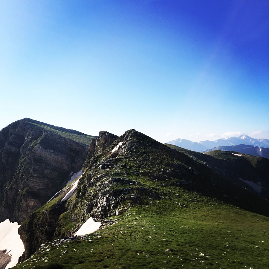
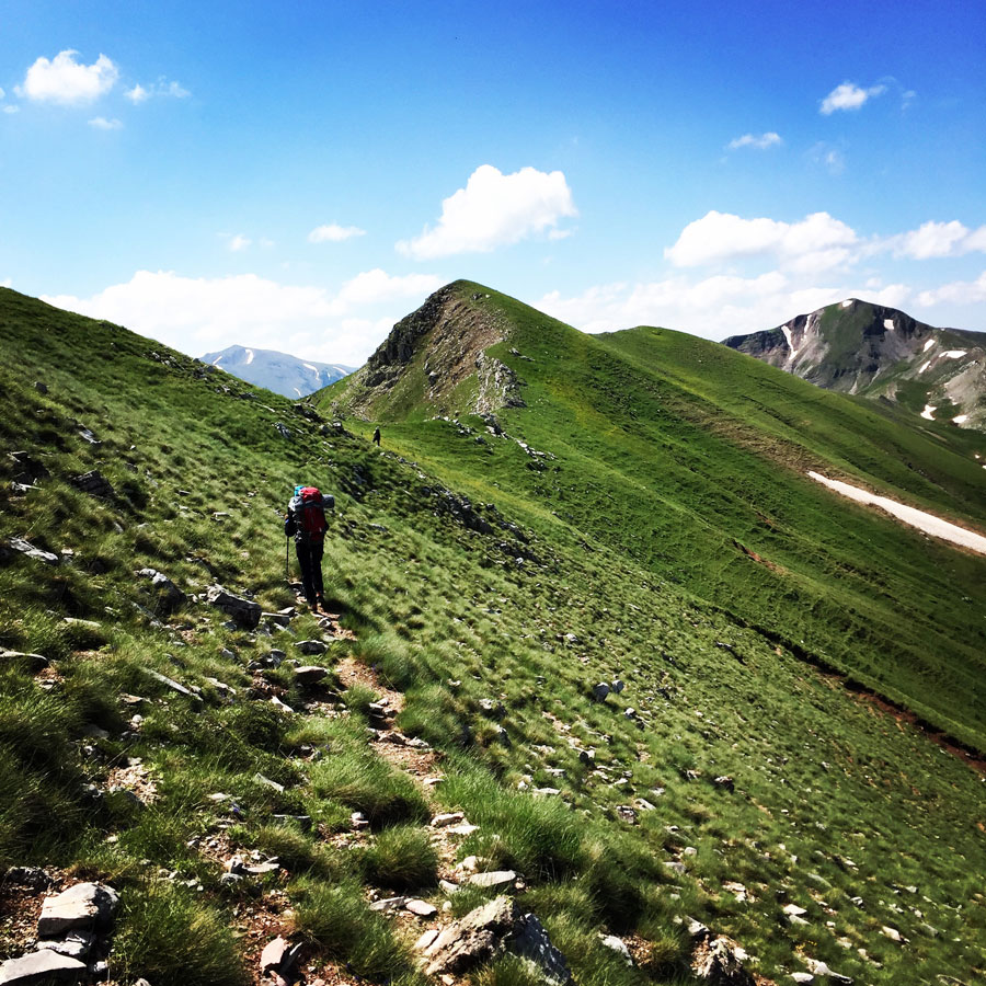
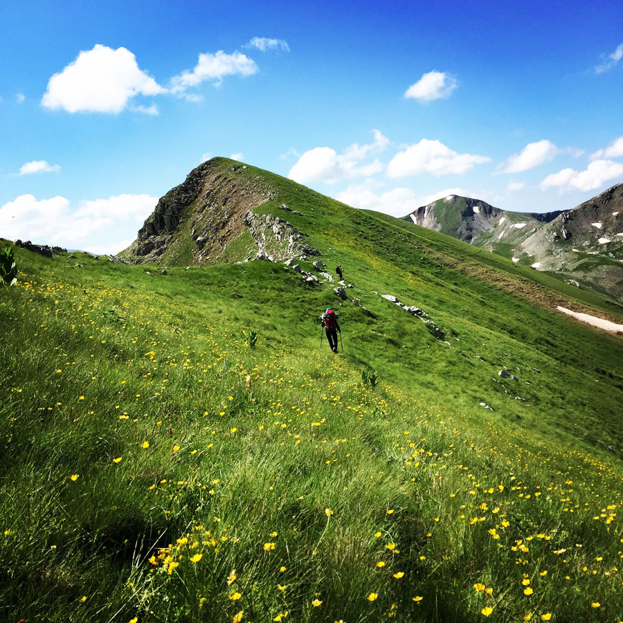
Having reached Megas Trapos, we did not loose any time at all, because we had to follow the entire ridge line towards the south and specifically towards our final destination of Kallarites village.
The weather forecast, if accurate, was giving thunderstorms in the afternoon and evening and therefore we had to move rather fast on this long ridge line.
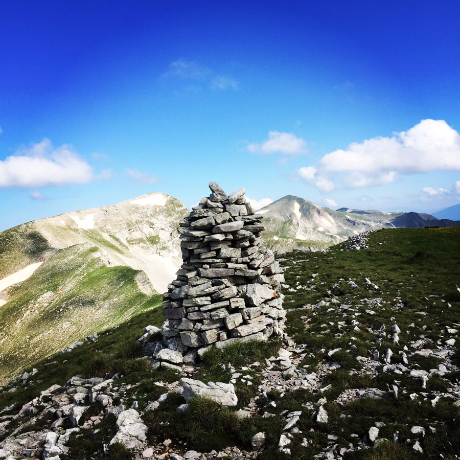
From the ridge line we were able to identify various other peaks such as:
- Tsouma Plastari 2.191 m.
- Katarachia 2.280 m.
- Kagelia with three peaks 2.191 m. , 2.296 m., 2.300 m.
- Kakarditsa 2.429 m.


Subscribe & Stay Informed
Enter your email address to follow this blog and receive notifications of new posts by email
Kalarites Village
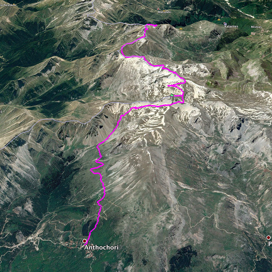
We have been hiking for 2 days and about 22 km since the moment we have left Anthochori village, and we have finally reached our final destination point, Kalarites.
Kalarites is a beautiful and picturesque mountainous village of South Pindos and Tzoumerka. Stone houses are built according to the traditional Epirotic architecture in a magical location under gorgeous imposing mountains. It has been famous from the period of the Othoman domination for the incomparable art of its silversmiths.
In the village you will find shops that sell samples of this insuperable art, pieces that are genuine works of art. It is worth visiting not only in order to see and admire the village itself, but also not to miss the magical route you will follow until you get there passing by the impressive monastery of Kipina.
It was on that village where we set up our tents and had another great night in the outdoors.


Gear & Equipment
For this trip, I was carrying the following main gear:
- Lowe Alpine Cholatse II 55-65 lt backpack
- Sierra Designs Lightning 2 tent
- Cumulus Panyam 600 Hydrophobic Down sleeping bag
- Klymit Stativ V Ultralight sleeping pad
- Garmin Dakota 20 GPS device
- Cumulus Minilite Down vest
- Quechua Tech-Fresh 50 T-shirt
- The North Face Verbera GTX
Support the journey — buy me a coffee
I share these articles and the climbing guidebooks because I love the outdoors, and they’ll always be free. If they’ve helped you, help me keep them coming. Click the button to support my work.
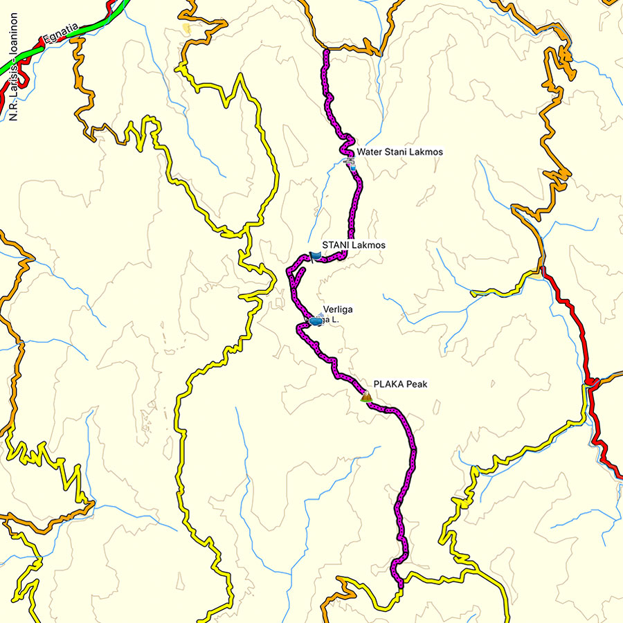
Details of the Hike:
- Location: Lakmos (Peristeri) Mountain
- Starting Point: Anthochori village
- Ending Point: Kallarites village
- Trail Signs: Partly signed path
- Minimum Elevation: 1.060 m
- Maximum Elevation: 2.295 m.
- Total Distance: 22 km
- Difficulty: Medium
- When to Hike: Any time of the year (during winter time winter mountaineering gear is needed)
- Water Features: three
Bellow you can see the route we have followed on a map and on 3D:
Don’t forget to check our the first part of this hiking trip on the link bellow:
Before you leave this blog check out the following map
Below: This map marks all the mountaineering adventures that have been featured on Olympus Mountaineering so far, including several Sport climbing crags – Select full screen to expand, zoom in for more detail, or click on a marker for a link to the post.

Pingback: Verliga alpine lake – Wild camping on Greece’s secret paradise – Olympus Mountaineering
Pingback: Winter Mountaineering Climb in Strogoula via Agrofylakas Couloir (Tzoumerka-Athamanika) – Olympus Mountaineering
Hello! Planning to do this trek this summer, how did you get transportation after Kallarites?
LikeLiked by 1 person
Hi Alex,
Thank you for your comment.
We had pre-arranged transportation prior to our arrival in Kallarites.
As this is a thru-hike, it is necessary to have transportation arranged for returning to the starting location or continuing further.
Should you have any additional questions, please do not hesitate to reach out.
LikeLike
Hi again! Do you happen to happen to remember where were able set up your tents around Kalarites? Thanks!
LikeLike
Hi Alex!
Yes, I remember. We set up our tents in a beautiful spot just outside the village of Kalarites, near a football field. It’s a quiet area with a great view of the surrounding mountains. You’ll love it!
Should you need more detailed info, feel free to send an email via the contact page.
LikeLike