
End of April in Greece, usually is not just spring weather, but we are entering the “summer” temperatures. Though, this year, on the 22nd of April we had one more and perhaps the last snowfall for this season. Due to the weather conditions, we took the chance to hit the road and travel towards Mount Kyllini.
Mount Kyllini or Mount Cyllene (or Ziria), is a mountain on the Peloponnesus peninsula in Greece, famous for its association with the god Hermes. It rises to 2,376 m (7,795 ft) above sea level, making it the second highest point on the peninsula. It is located near the border between the historic regions of Arcadia and Achaea—in the northeast of Arcadia, and entirely within modern Corinthia.
Much of the mountain is barren and rocky, although the area below 2000 m (6500 ft) is largely forested. There is an observatory at 908 m (2979 ft), at 22.67 east longitude and 37.97 north latitude. From the top a large portion of northeastern Peloponnesus is visible, including the eastern part of Achaia and Chelmos, the Gulf of Corinth and most of Corinthia, the southern part of Corinthia and parts of northeastern Arcadia. The nearest mountain ranges are Oligyrtos to the south and Chelmos/Aroania to the west. Roads pass near the southern and western slopes, but there are not many on the mountain itself, as much of the mountain is part of a park. The municipal boundary of Stymfalia–Feneos–Evrostini and Xylokastro passes through the mountain.
After a long drive we reached the Ziria Ski Centre, from where we parked the car and initiated our route towards the peak of Dousias (2.086 m small Mount Kyllini/Ziria). The route we have followed was mostly off trail and we traced it on the map. In total we have hiked and climbed for about 23 kilometres with various elevations.

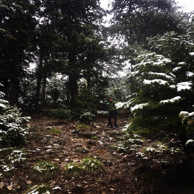
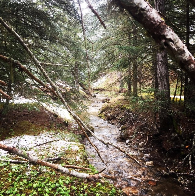
In about 40 minutes of downhill, we have entered the gorge of Flabouritsa and we have followed the beautiful creek, direction South. We had to cross the creek a couple of times but the surrounding environment was really beautiful. Nice tall pine trees, high peaks above us and a nice snowfall from the sky.


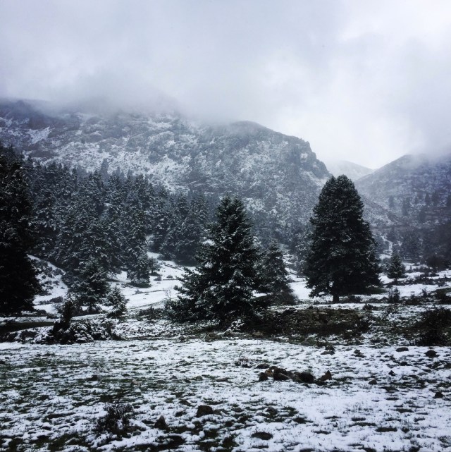
The Flabouritsa trail brought us up on the pre-alpine level where we found some wild horses. Usually on those plateaus in summer time one can find goats, sheep and cows, though on that time we were alone, with the mountains and the wild horses.

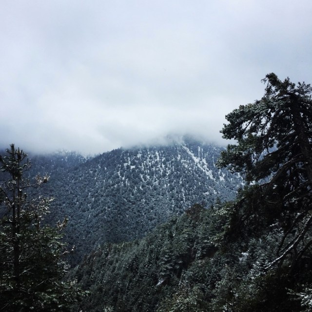
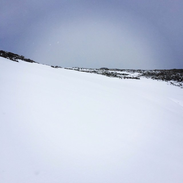
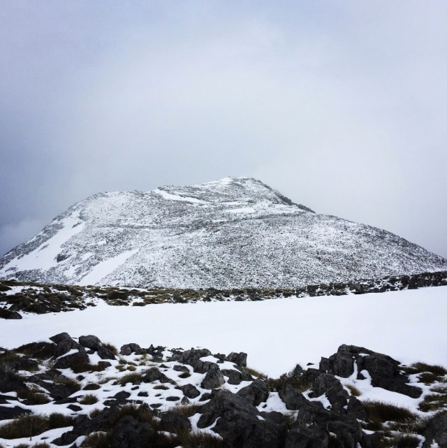
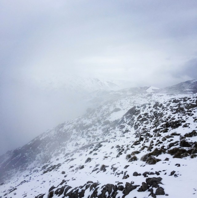
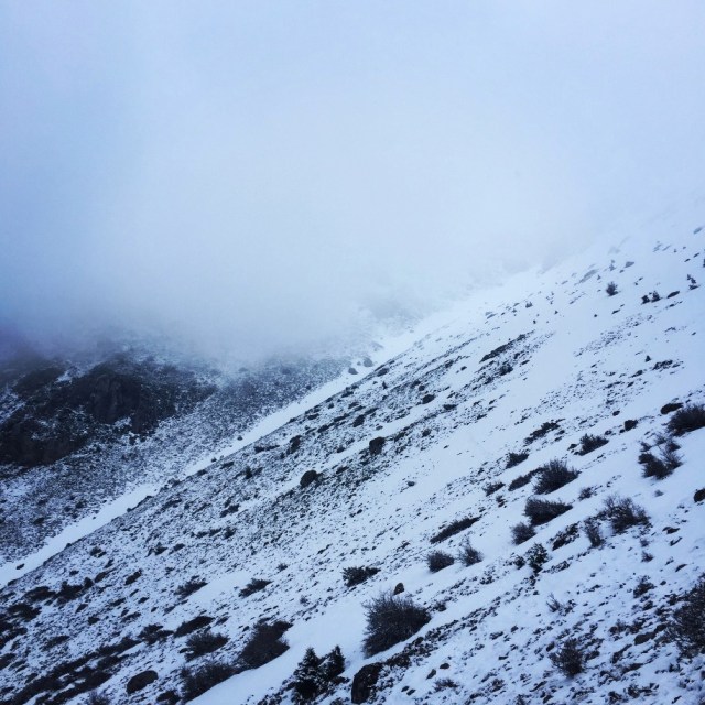
After that point, we had to go off trail, through the forest and from 1.375 meters we have climbed up to 1.985 meters. It was a very nice and relatively easy route, though due to snowfall and fog we were not able to enjoy the surrounding peaks. We left on our right side the Koutsiferi peak (1.830 meters above sea level) and we have reached the alpine plateau at about 1.985 m. Once we have reached this point, we moved east towards the peak of Chioni and Dousias peak (2.086 m).
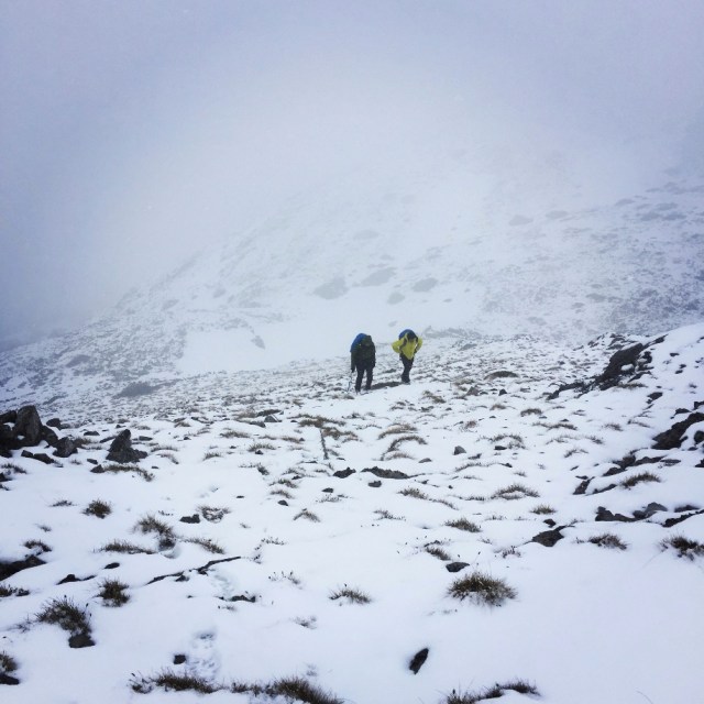
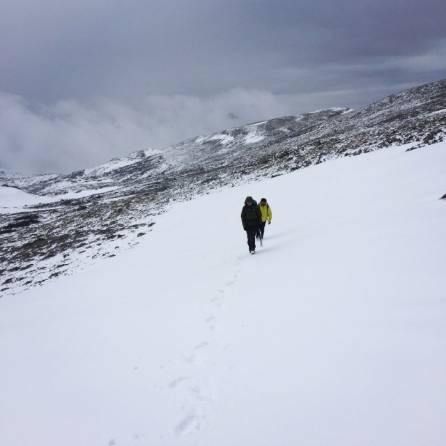
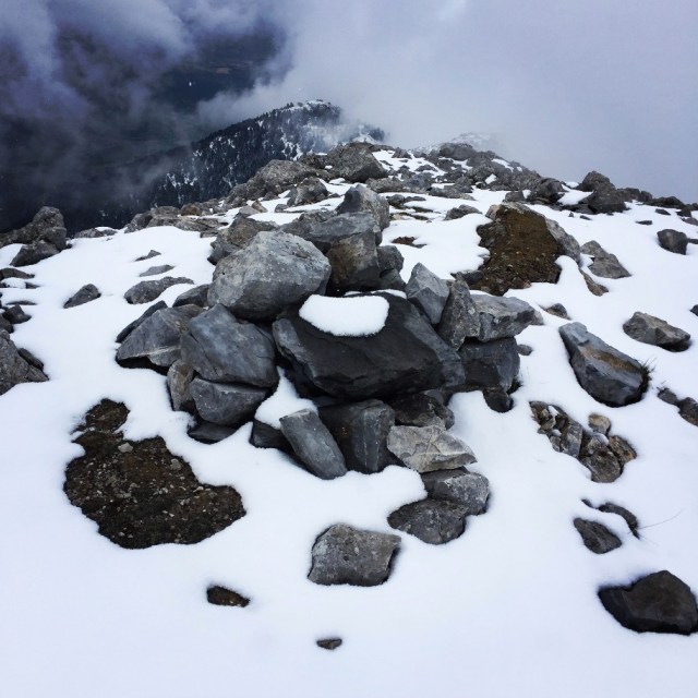
After 5 hours of hiking, creek-crossing, bushwalking and climbing, we have finally reached the Dousias Peak. Due to closed weather we did not have clear views, but nevertheless we enjoyed being there at the top. There we 5 minutes of rest, drunk some water and we soon started our descent because it was already very late.
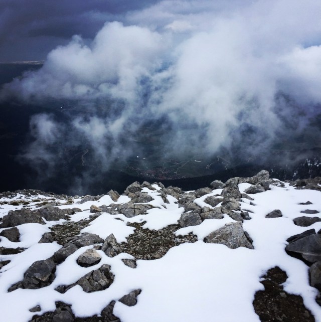

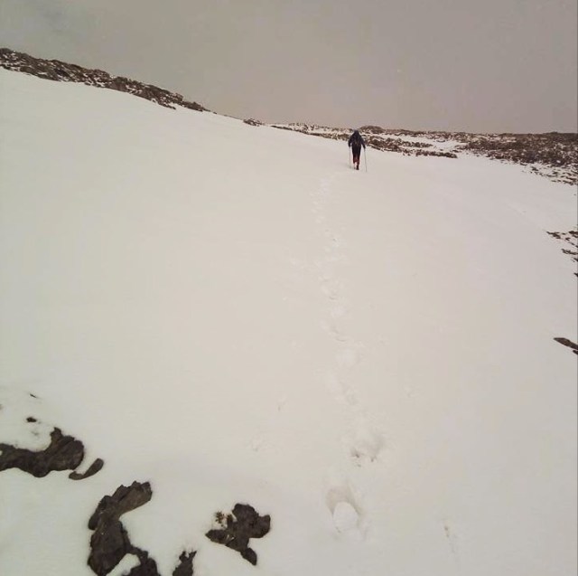
It was 17.00 when we reached the top and the weather was closed. In addition, we had to move towards our starting point through an unknown and off trail path. During our descent we have passed from Tsoumas peak and we descended via a very steep couloir of that peak. Once we left the alpine level we went on an extreme steep downhill within the forest till the point we have reached the Flabouritsa creek. By that time it was already dark and we needed to ascent (once again) towards the Ziria Ski Center. This ascent was done in the dark, with our headlamps and within the trees and bushes. Finally, and after 10 hours of a tiring but lovely day on the mountain we reached our camp.

Bellow the entire route we have done.


Pingback: Mount Kyllini (Ziria) Spring Ascent with Snow – Olympus Mountaineering
Pingback: Midnight ascent on Mount Pentelia (Dourdouvana) – Olympus Mountaineering
Pingback: Scrambling in Artemisio Mountain (Artemisio Arete) – Olympus Mountaineering
Pingback: Aroania (Chelmos) Winter Mountaineering Ascent – Olympus Mountaineering
Pingback: Hiking and Scrambling on Oligyrtos’ peak Chionotripa – Olympus Mountaineering
Pingback: Traverse of Arête of Chelmos/Aroania Mountain Pt. 01 | Lake Doxa – Karavi – Nisi – Madero – Olympus Mountaineering
Pingback: Traverse of Arête of Chelmos/Aroania Mountain Pt. 02 | Gardiki – Arête – Neraidalono – Kalavryta Ski Centre – Olympus Mountaineering