One of the hikes that had been on our bucket list since the very beginning of our travels in Bulgaria was without a doubt the legendary Seven Rila Lakes hike. These glacier-carved lakes, scattered like a string of pearls in the heart of Rila Mountain, are not just a natural wonder, they are a symbol of Bulgarian nature, spirituality, and alpine beauty.
After exploring Pirin and Rhodope, it was finally time to lace up our boots and head to Rila National Park. The Seven Lakes hike promised everything we love in a trail: alpine meadows, crystal-clear waters, rugged mountain scenery, and the chance to experience one of the most iconic landscapes in the Balkans.
▶ Listen to this Post Now
How to Reach the Rila Lakes Ski Lift
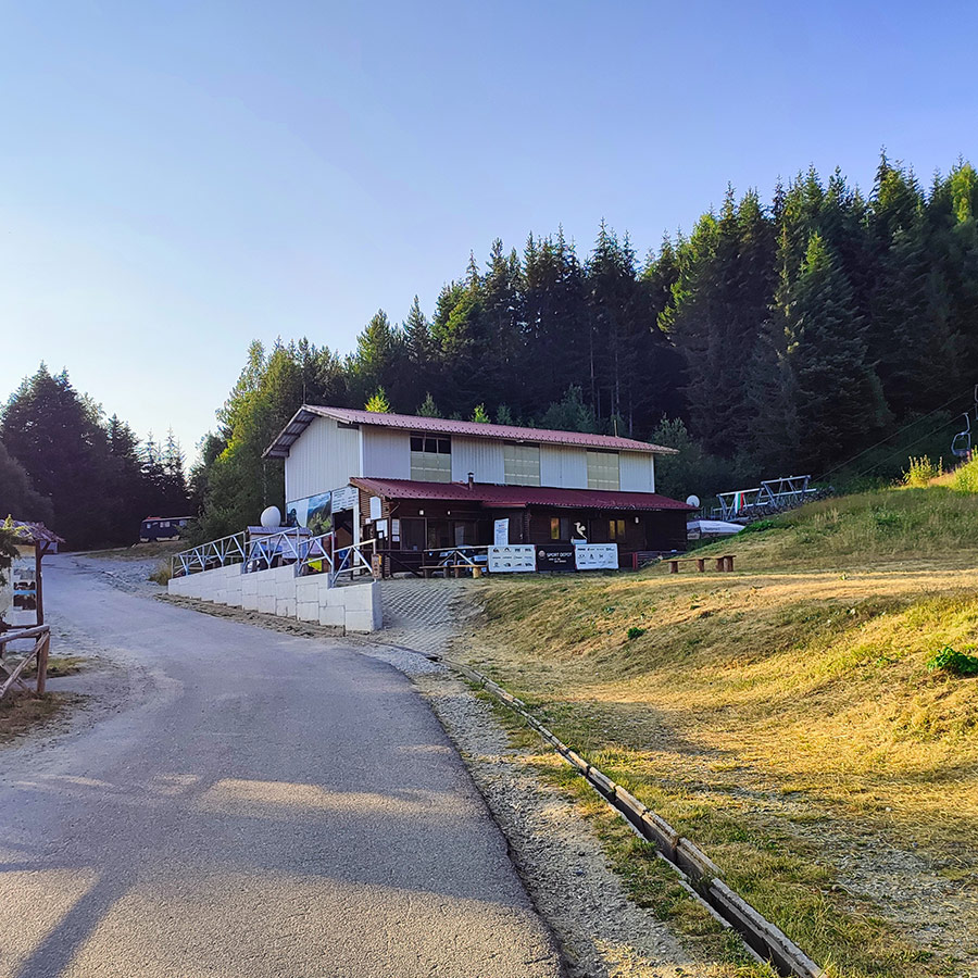
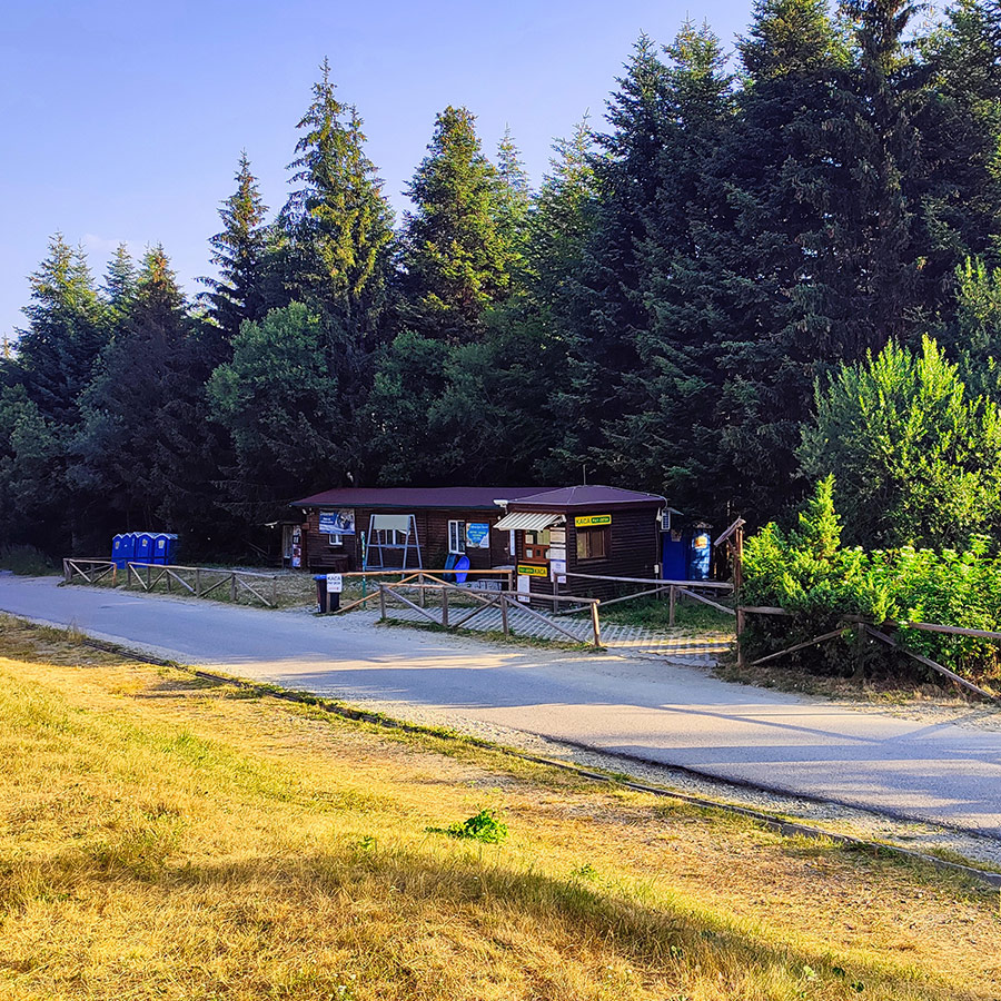
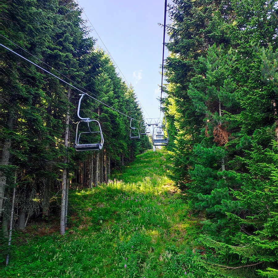
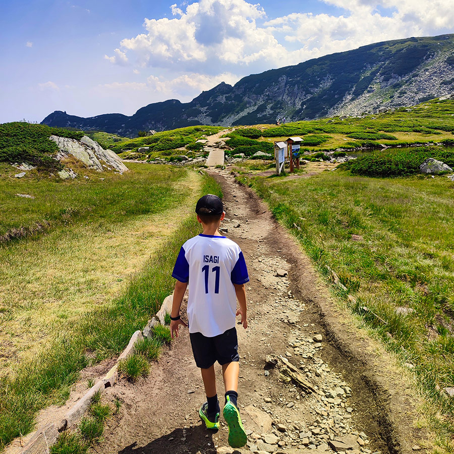
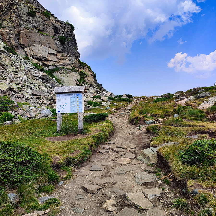
The trail to the Seven Lakes starts from Panichishte — a small mountain resort area above Sapareva Banya. The main access point is the Rila Lakes chairlift, which brings hikers from the base station (around 1,570 m) up to the mountain ridge (around 2,100 m).
- By car: From Sofia, it’s roughly 1h 45min drive (95 km). You pass through Dupnitsa and Sapareva Banya before climbing to Panichishte. There is a fee to enter the Rila National Park (4 BGN / person).
Tip: Arrive early! In summer and weekends, the line for the lift can be very long.
How to Book, Pay and Take the Ski Lift
The Rila Lakes chairlift is a two-seater lift that operates year-round, weather permitting. Tickets can be purchased directly at the cash desk at the base station.
- Return ticket: 30 BGN
- Operating hours: usually 08:30 – 18:30 (last ride down around 17:30)
- Payment: cash only
The ride itself is an adventure of 25 minutes floating above pine forest, meadows, and streams, with the majestic Rila range opening up as you gain altitude. By the time you step off at the upper station, you are already in a completely different world.
Explore all outdoor activities in a convenient list view here
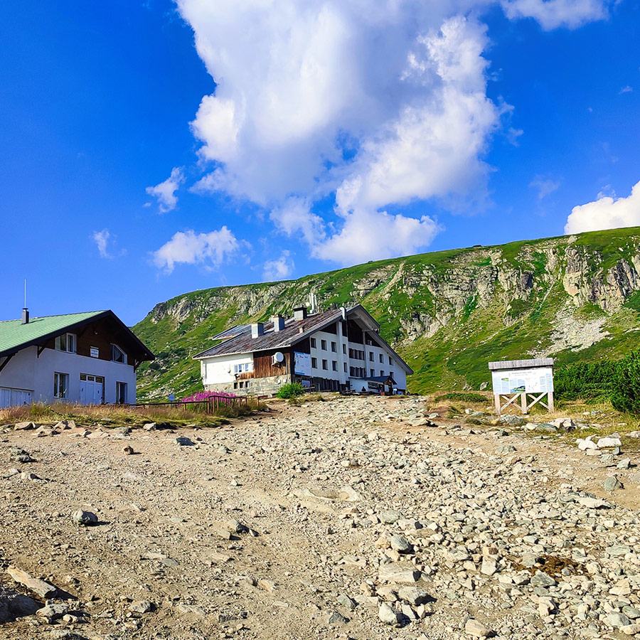
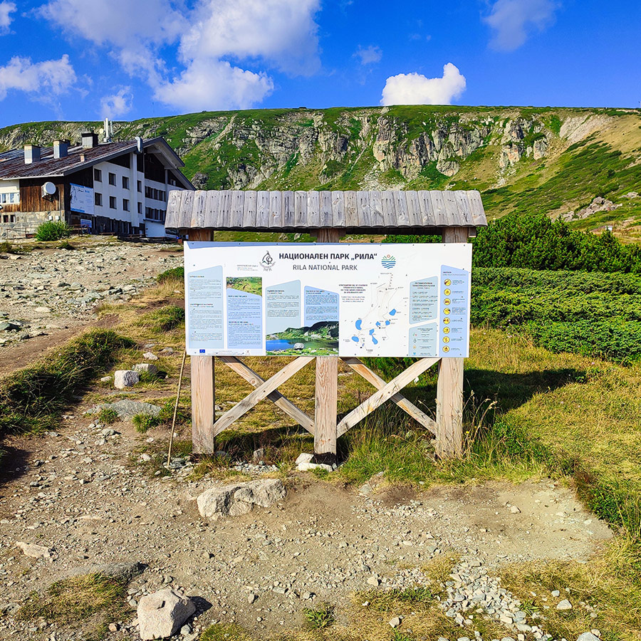
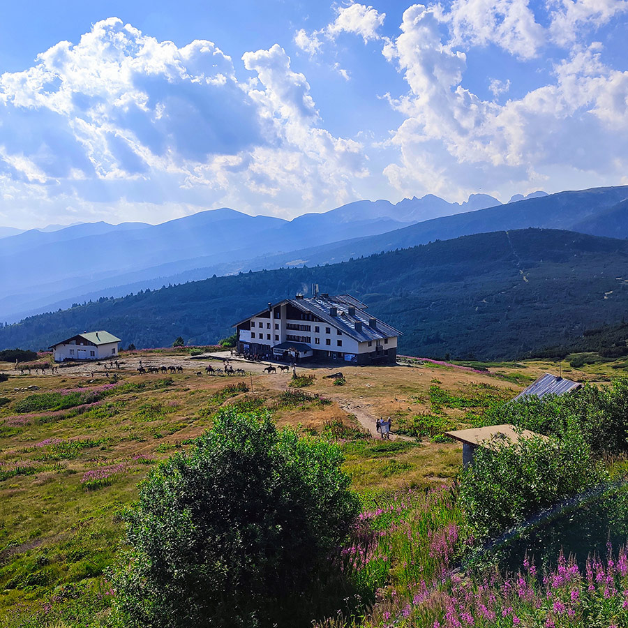
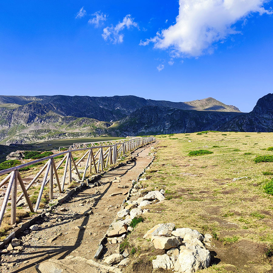
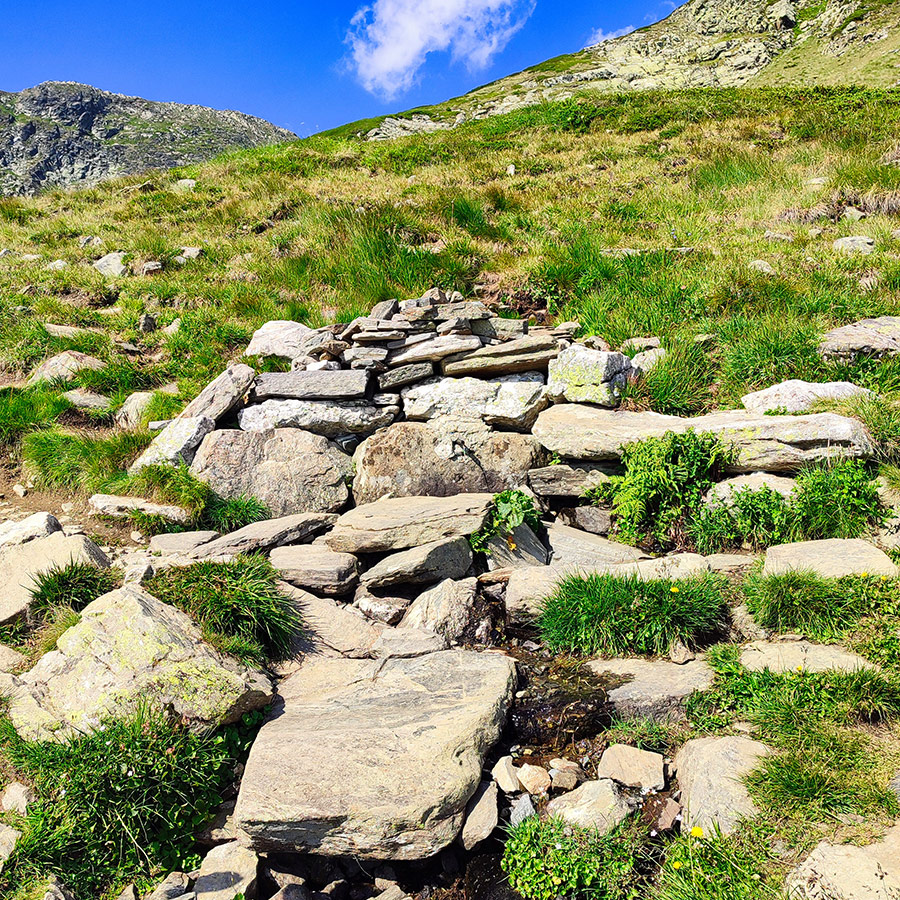
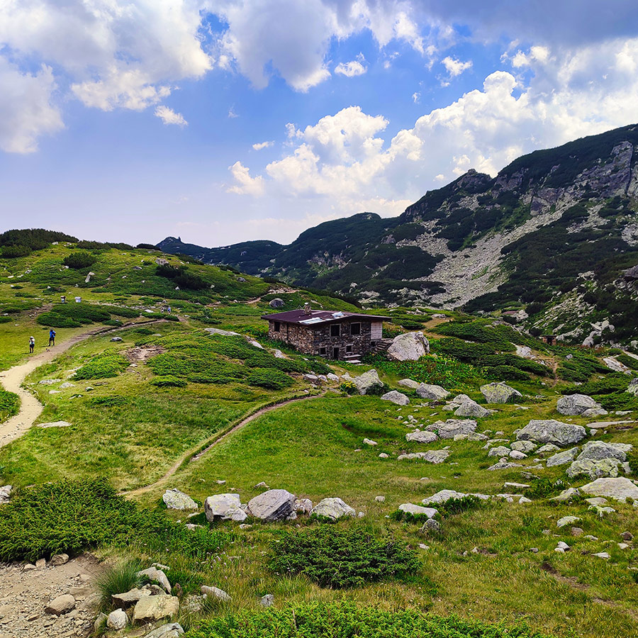
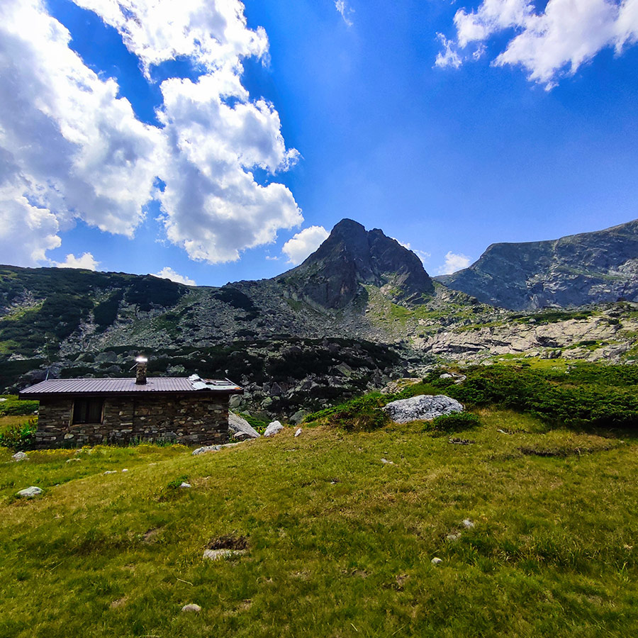
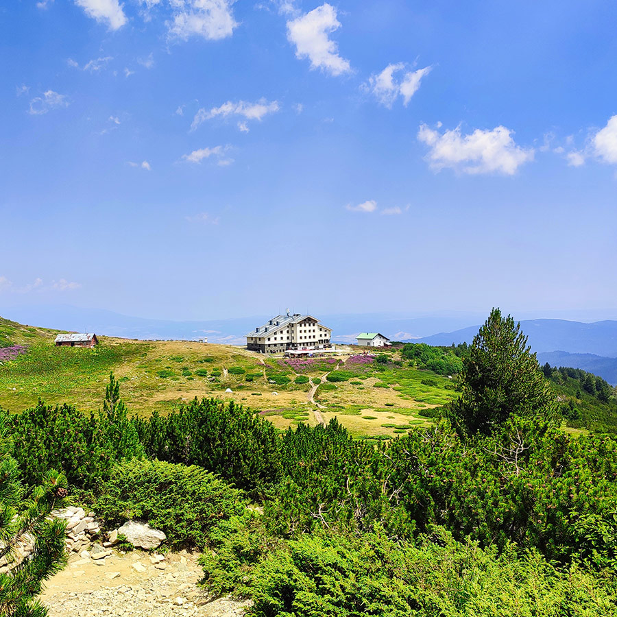
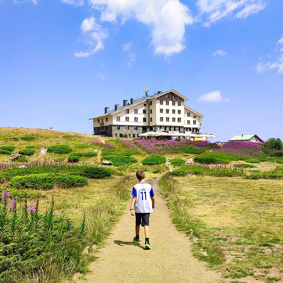
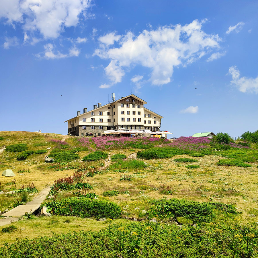
Arriving at the Mountain Hut
The upper lift station brings you near the Rila Lakes Hut (2,150 m). This is the main base for hikers. The hut offers:
- Simple food (soups, tea, grilled meat, pancakes)
- Drinks and snacks
- Basic accommodation (for those who wish to stay overnight)
- Restrooms and water refill
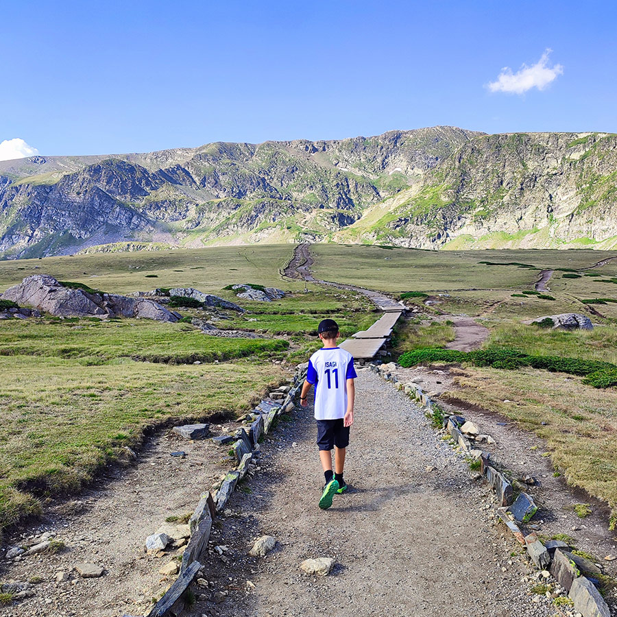
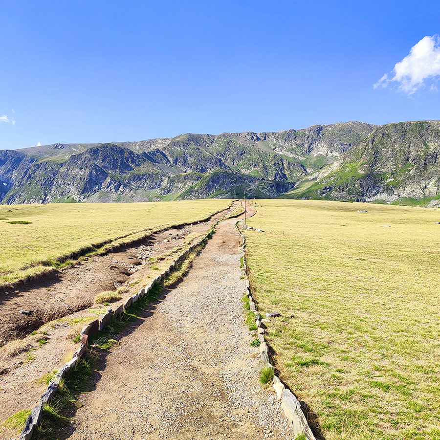
This is a great place to pause, adjust your gear, and prepare for the hike ahead. Most people start the Seven Lakes loop directly from here.
Discover More Outdoor Adventures in Bulgaria
- Hiking to Goritsa Waterfall (Ovcharchenski Vodopad) – Rila Mountain, Bulgaria (family friendly)
- Hiking to Saint Nicholas Waterfall – A Family Friendly Adventure Near Bansko, Bulgaria
- Hiking to Baykusheva Mura – Discovering Pirin’s Ancient Pine Giant – Bulgaria (family friendly)
- Hiking the Banderishki Lakes: From Vihren Mountain Hut to Fish Banderishko and Frog Lake
- Wild Camping in Pirin Mountain – Banderitsa Camping, Bulgaria
- Hiking to Dabitsata Waterfall – Belasitsa Mountains – Bulgaria (family friendly)
- Relaxing and Wild Camping at Belasitsa Hut – Belasitsa Mountains – Bulgaria (family friendly)
- Hiking to Klyuch Falls – A Family Friendly Adventure in Bulgaria’s Belasitsa Mountains (Ключки водопади)
- Hiking in Yavornitsa Waterfall – Belasitsa Mountains – Bulgaria Яворнишки водопад (family friendly)
- Hiking in Kamena Waterfall – Belasitsa Mountains – Bulgaria Камешнишки водопад (family friendly)
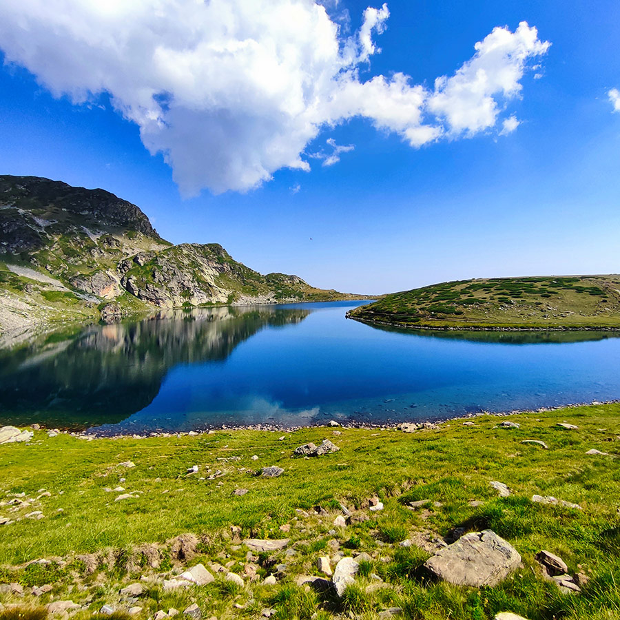
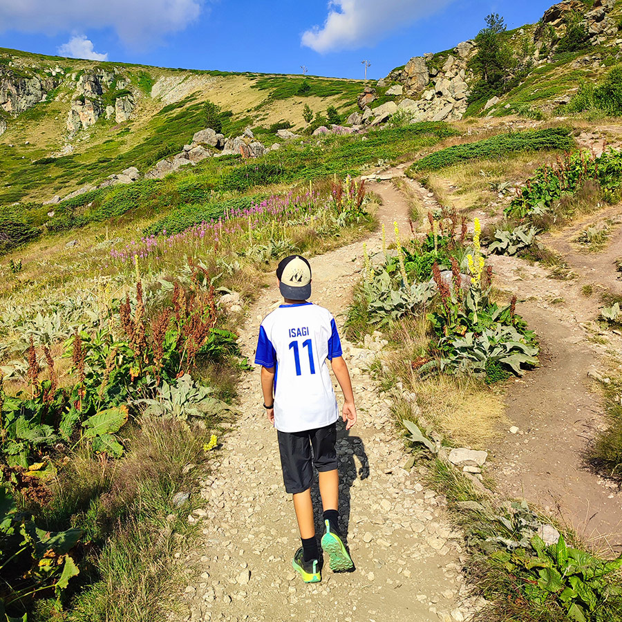
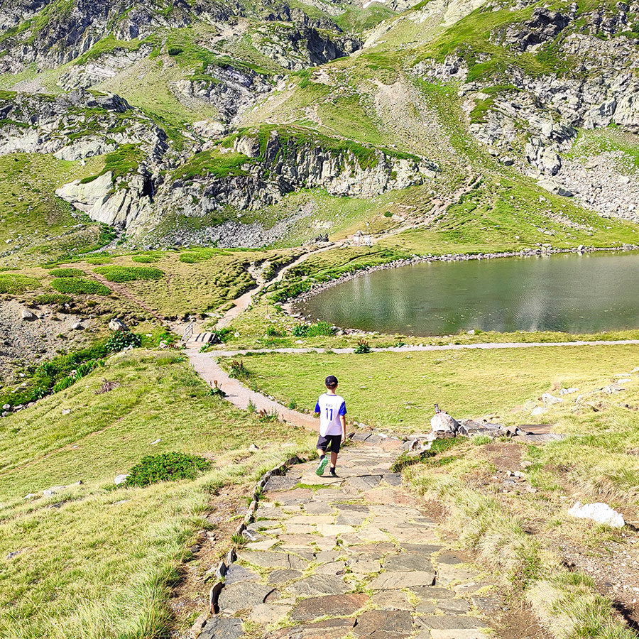
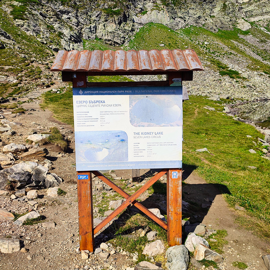
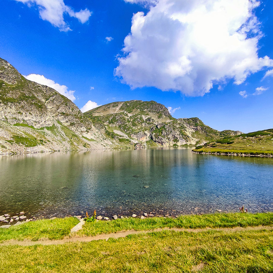
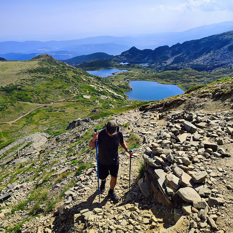
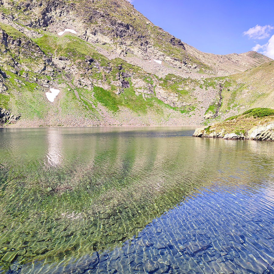
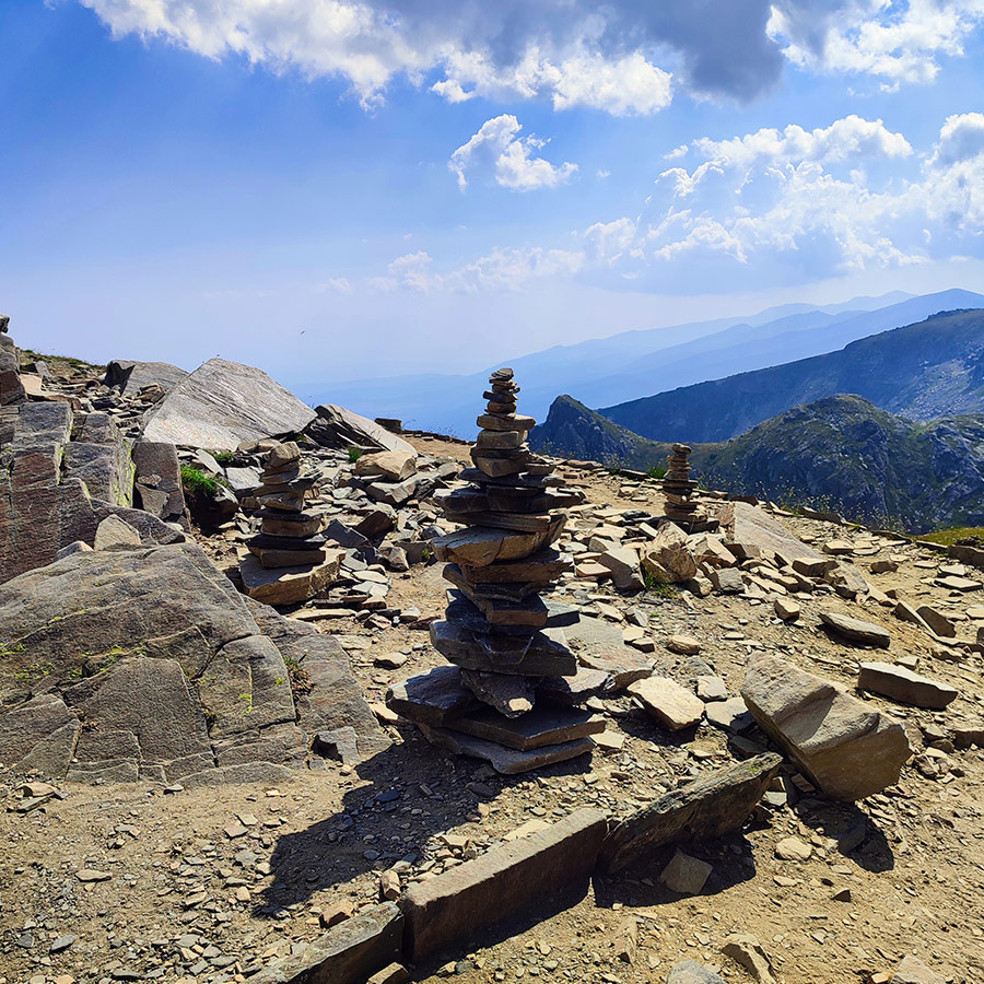
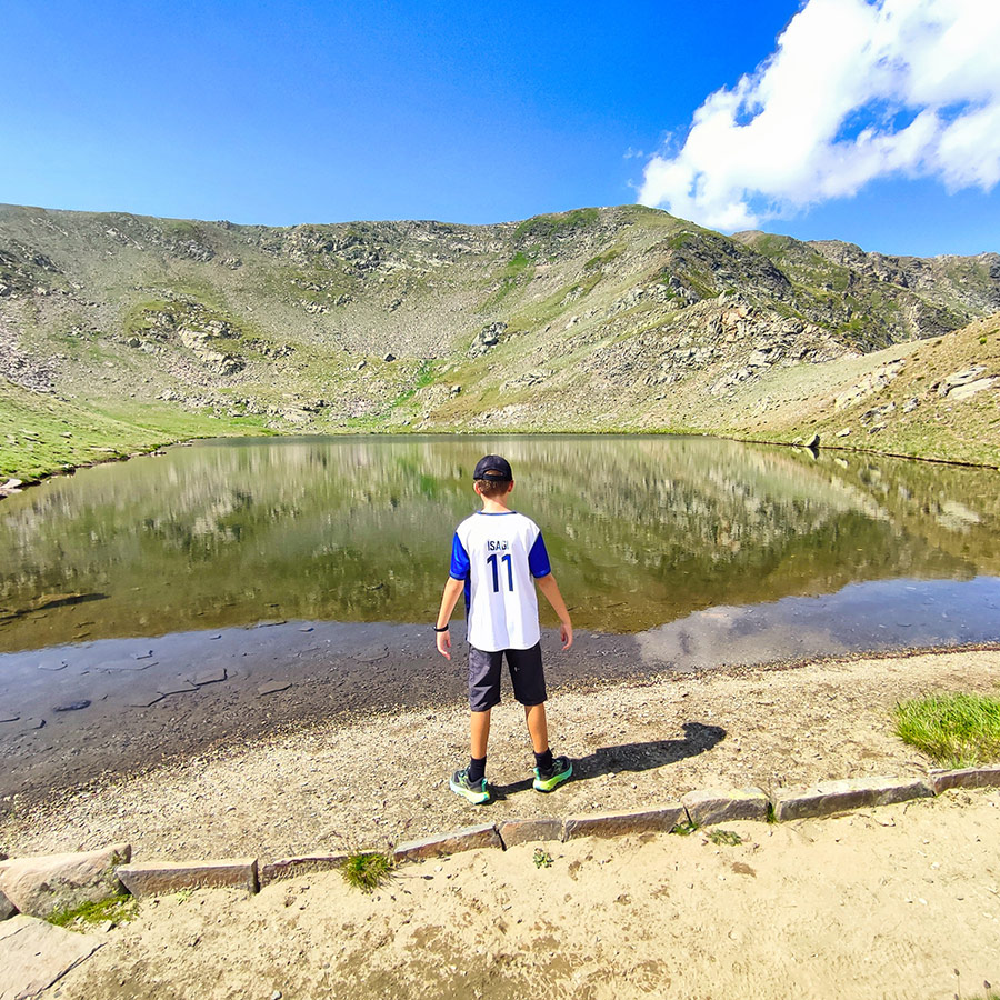
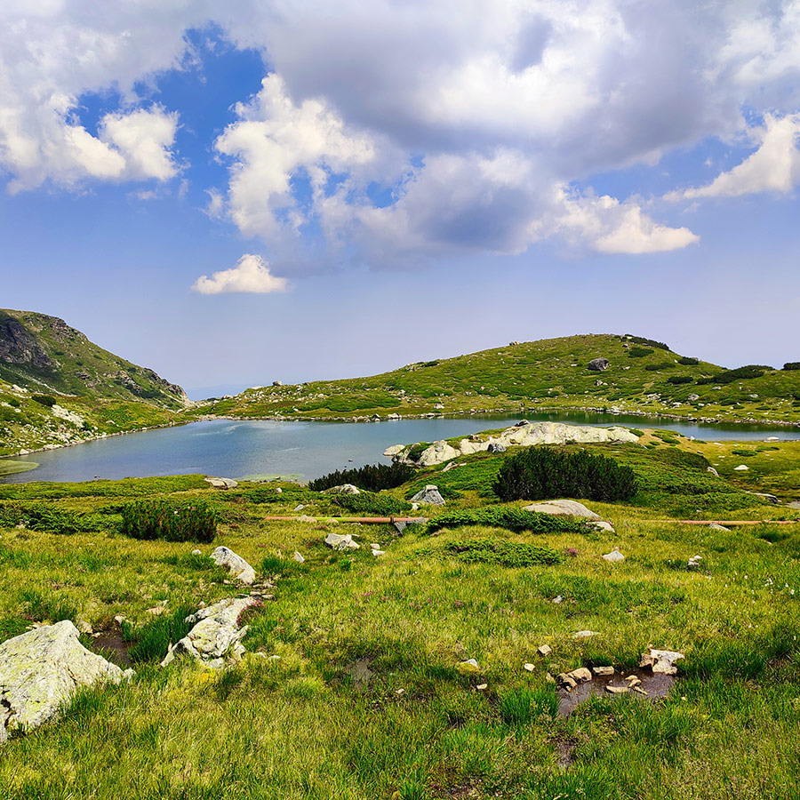
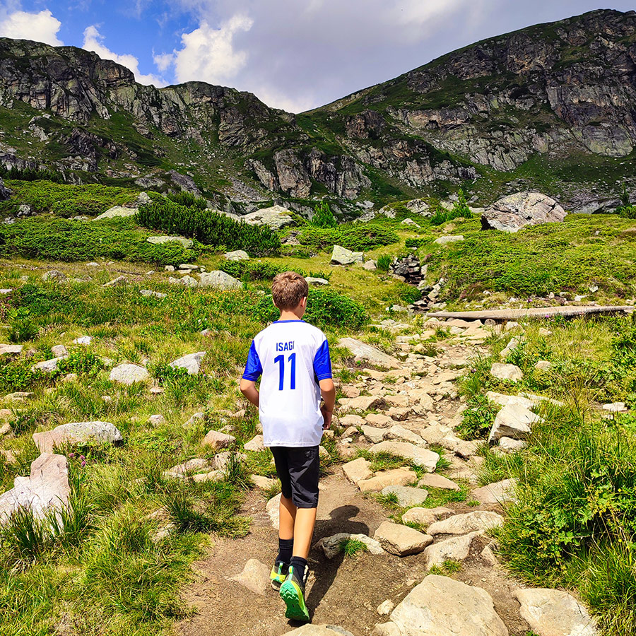
Hiking to the First Lake – The Kidney Lake (Babreka)
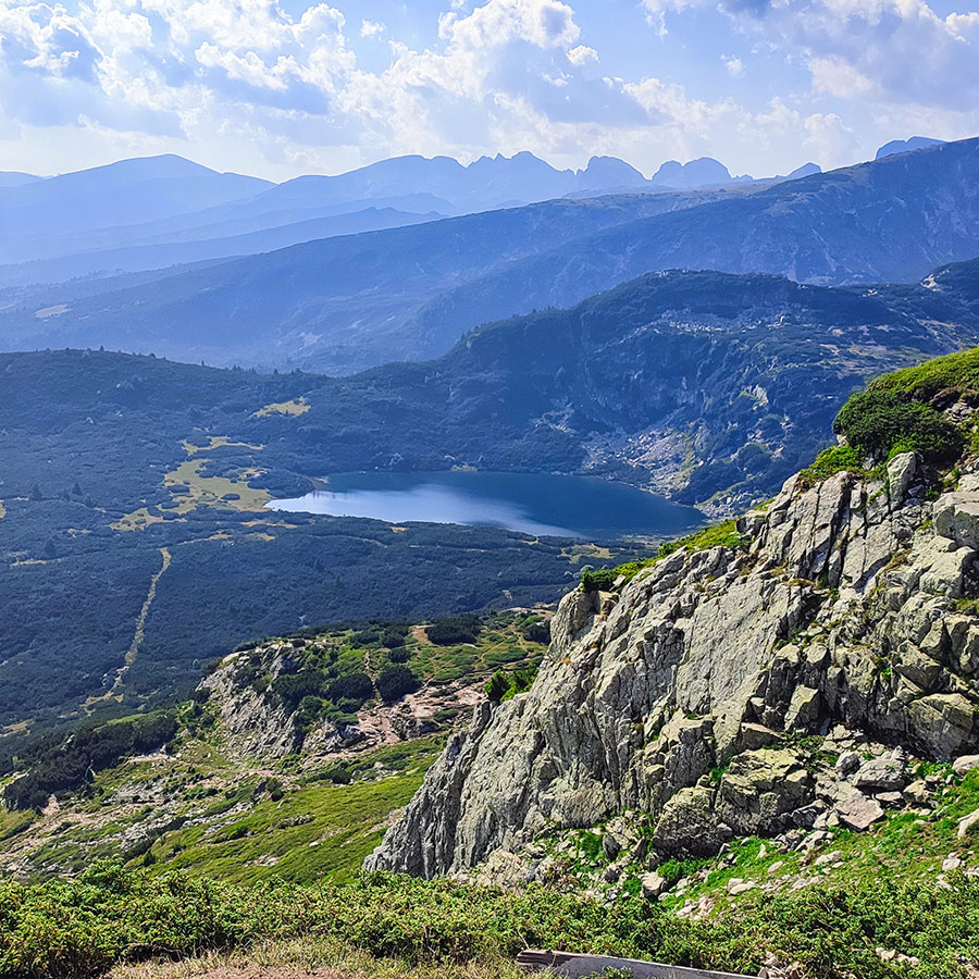
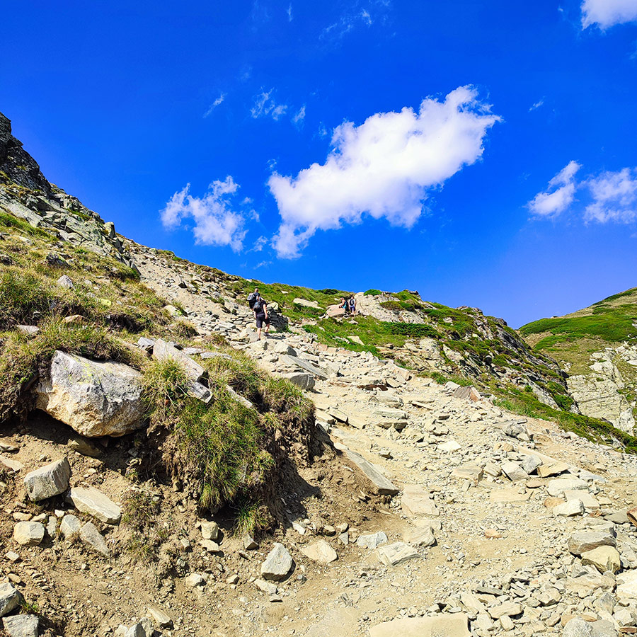
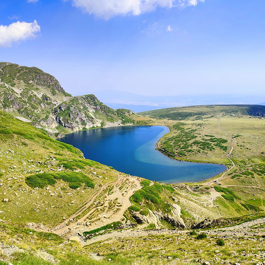
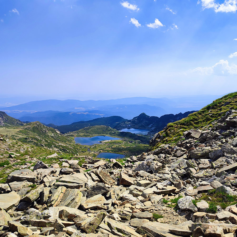
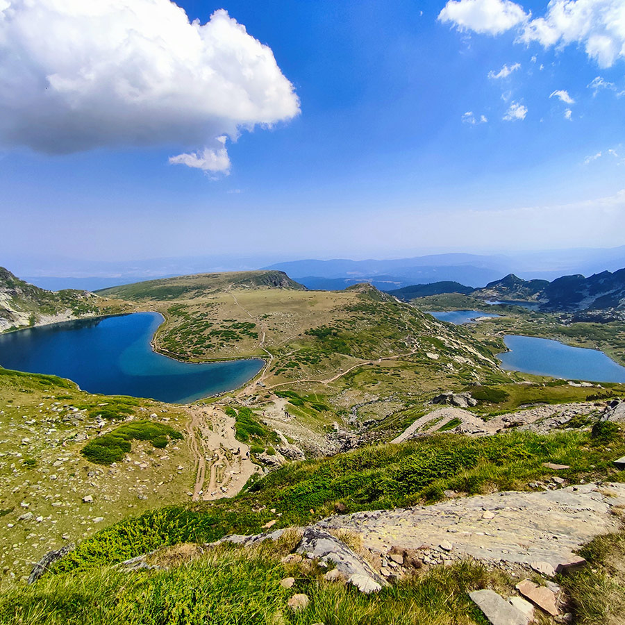
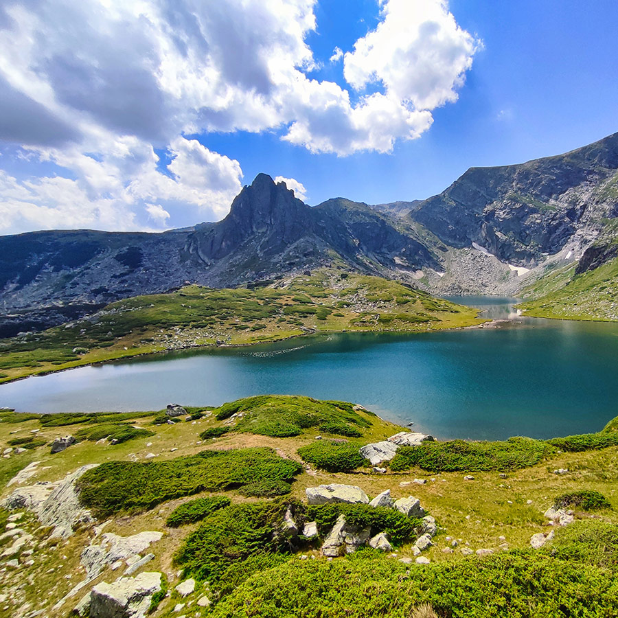
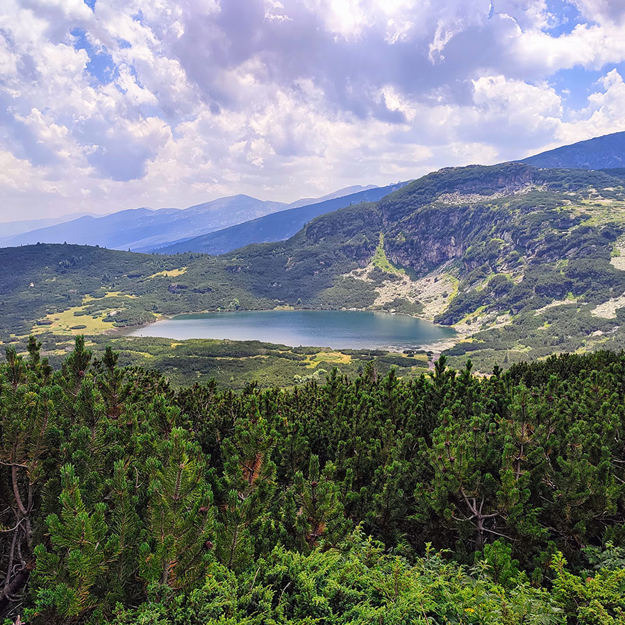
From the Rila Lakes Hut, the trail immediately begins to climb across wide alpine meadows. Within 30–40 minutes, you reach the first lake of this route the legendary Kidney Lake (Babreka) at 2,282 m. Shaped like a perfect horseshoe, the Kidney is perhaps the most iconic of all the Seven Lakes and is instantly recognizable from postcards and guidebooks.
Standing at its shore, you are dwarfed by the steep cliffs rising sharply behind the lake. The amphitheater-like setting makes the water shimmer in deep turquoise, changing shades as the sun moves overhead. On a clear day, you’ll see the surrounding ridges perfectly reflected on the surface, making this one of the most photogenic spots in Rila.
Many hikers pause here for their first rest, as the atmosphere feels both powerful and serene. If you climb a little above the lake, you get panoramic views down to the lower lakes a preview of the journey you will complete later in the day. For us, beginning the hike here set the tone immediately: we were in for a dramatic and unforgettable mountain adventure.
Support the journey — buy me a coffee
I share these articles and the climbing guidebooks because I love the outdoors, and they’ll always be free. If they’ve helped you, help me keep them coming. Click the button to support my work.

Subscribe & Stay Informed
Enter your email address to follow this blog and receive notifications of new posts by email
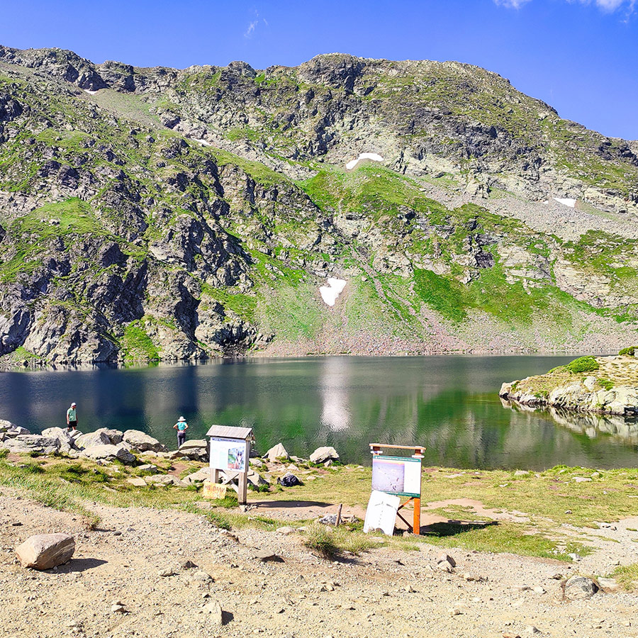
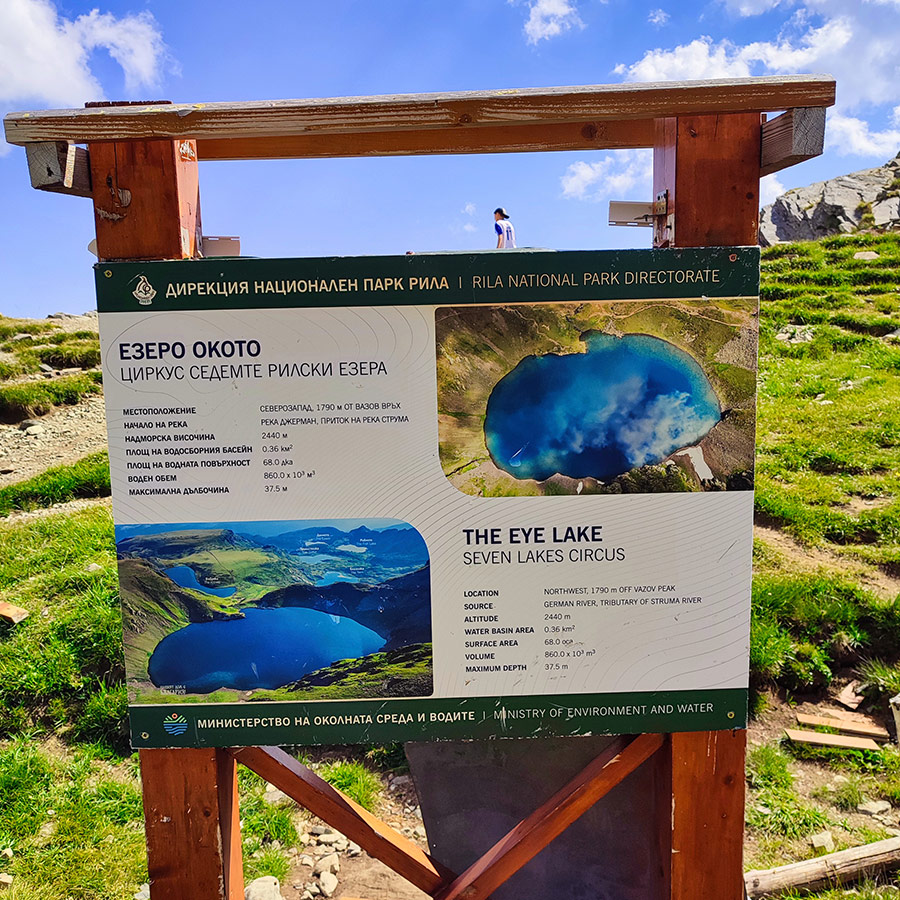
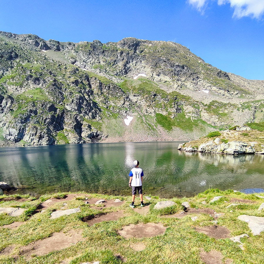
Hiking to the Second Lake – The Eye Lake (Okoto)ро)
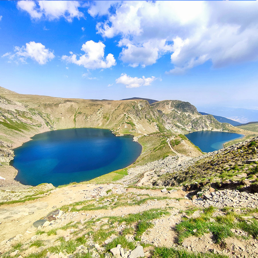
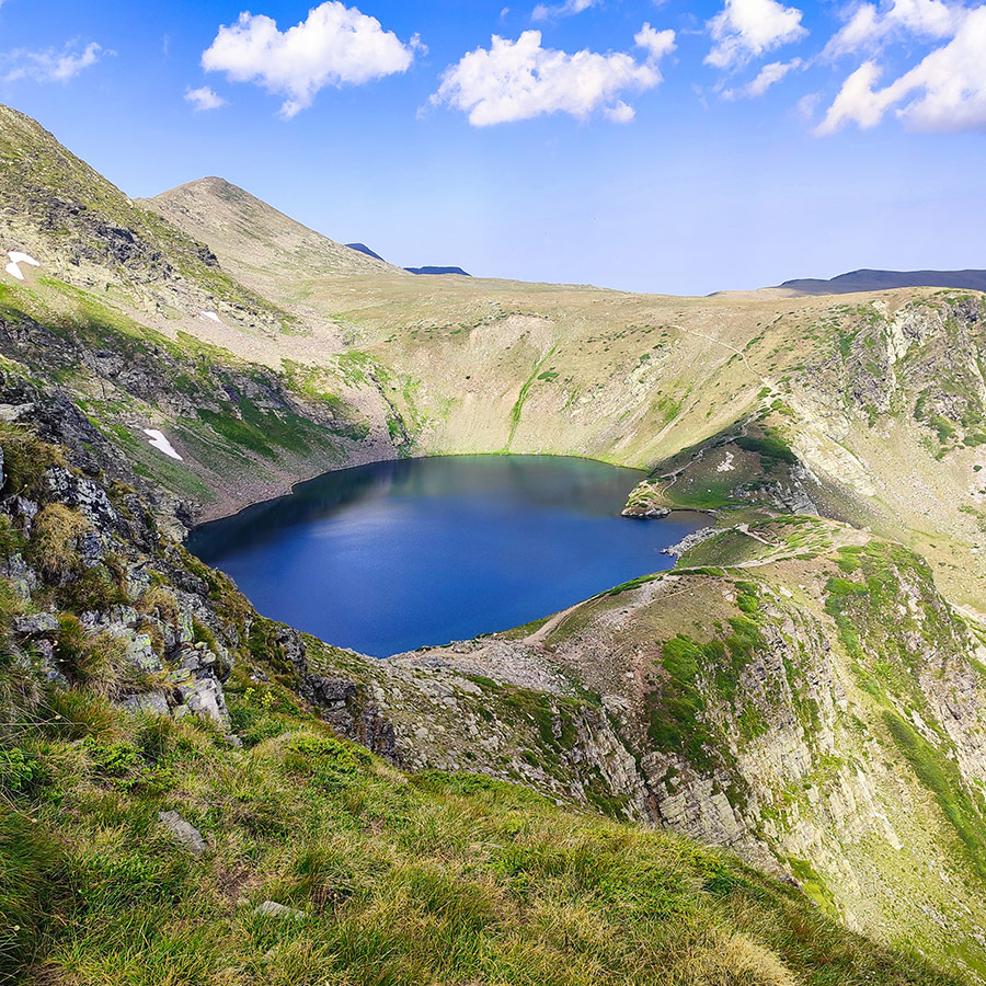
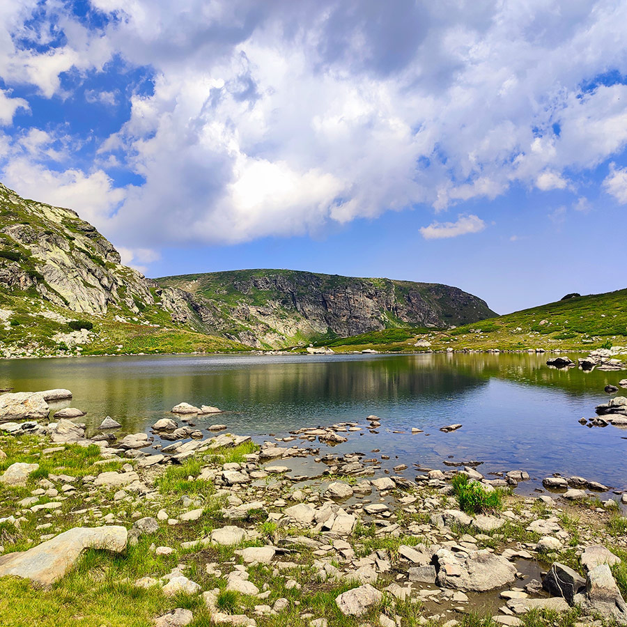
From the Kidney Lake, the path climbs more steeply on a rocky trail. After about 20 minutes, you arrive at the Eye Lake (Okoto), sitting at 2,440 m. This is the deepest of all seven, plunging to 37.5 m, and its nearly perfect oval shape gives it the look of a giant, dark eye gazing up toward the sky.
The Eye Lake is striking in its simplicity. Its surface is often glassy and still, reflecting only the cliffs above. On bright days, the water glows in an intense dark blue, while in cloudy weather it takes on a mysterious, almost black tone. The lake is famous for its clarity, some say you can peer down into its depths and see details not visible anywhere else.
The area around the Eye Lake feels wilder, with rocky slopes and sparse vegetation. The higher altitude brings cooler winds, and even in summer you may need an extra layer. This is the point where the hike begins to feel more alpine, preparing you for the final climb to the Tear Lake.
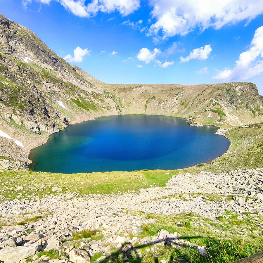
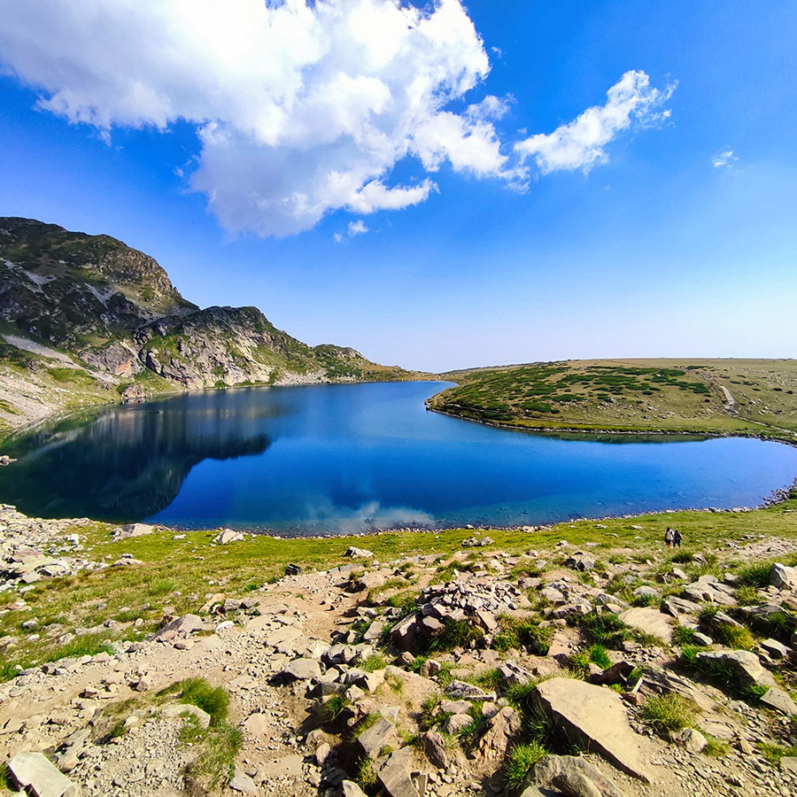
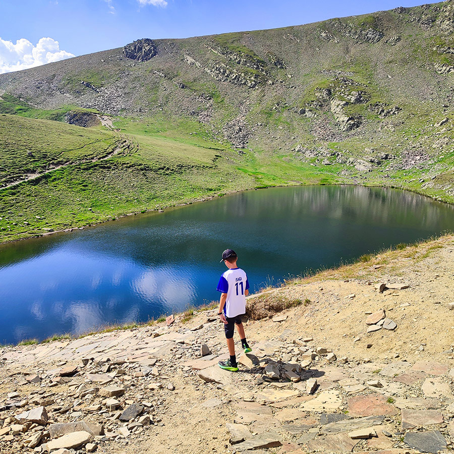
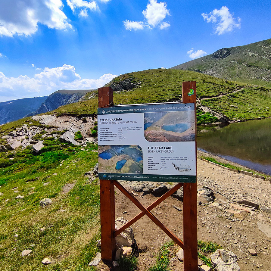
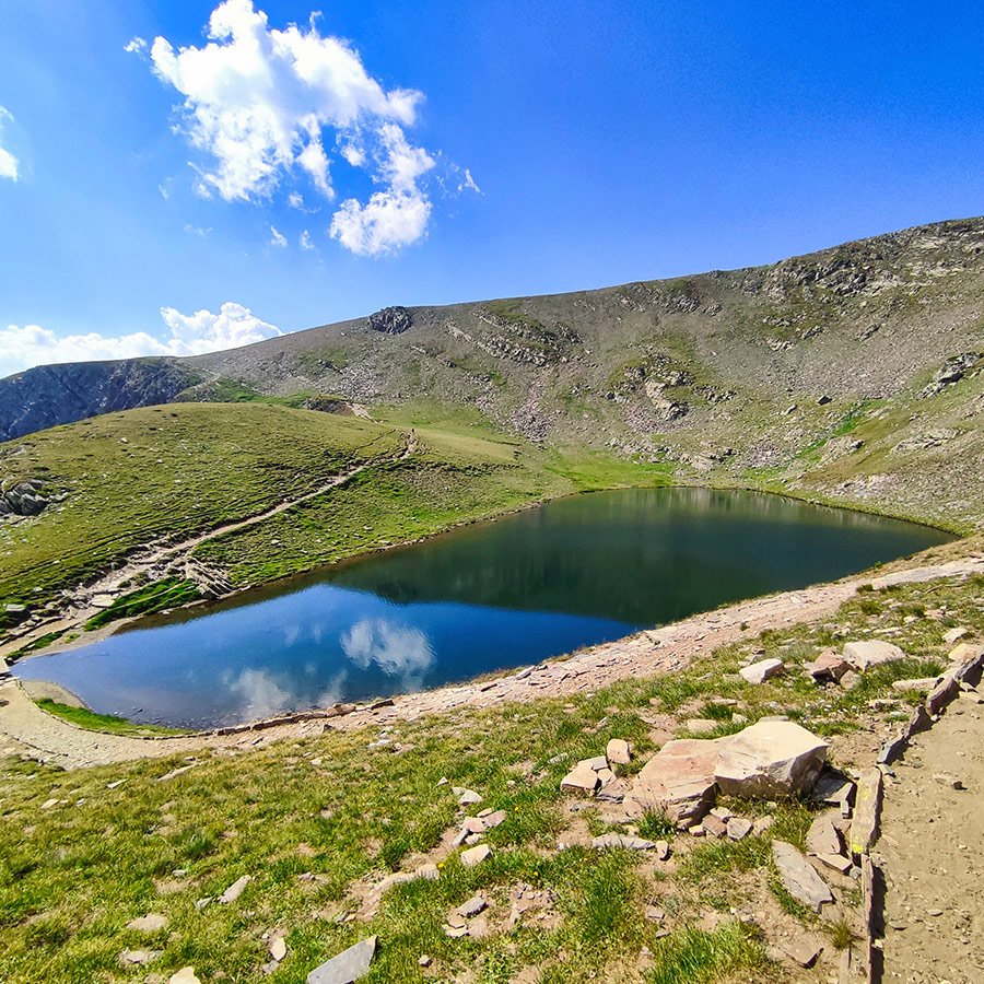
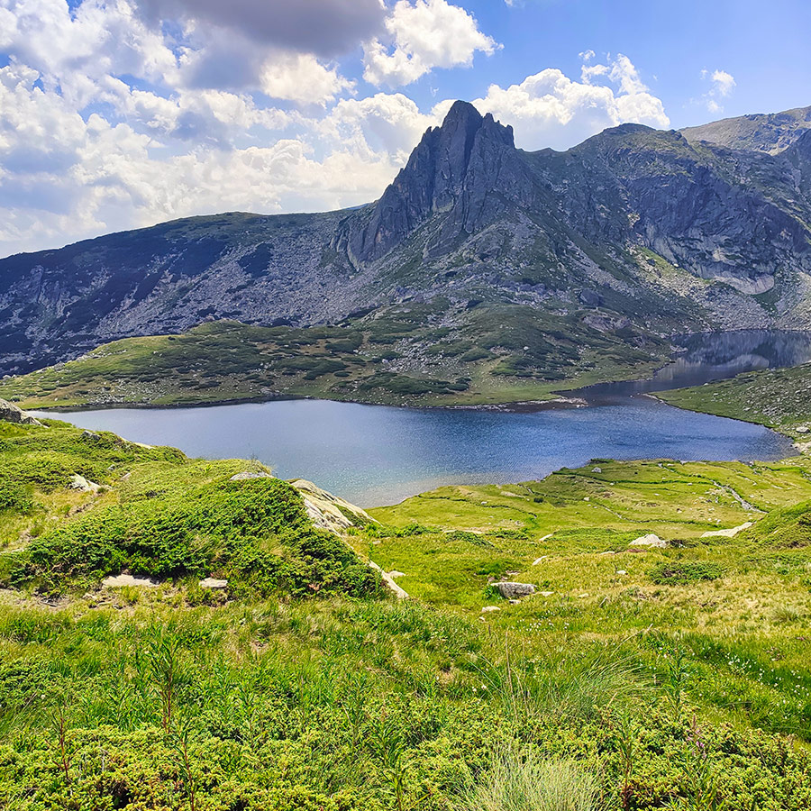
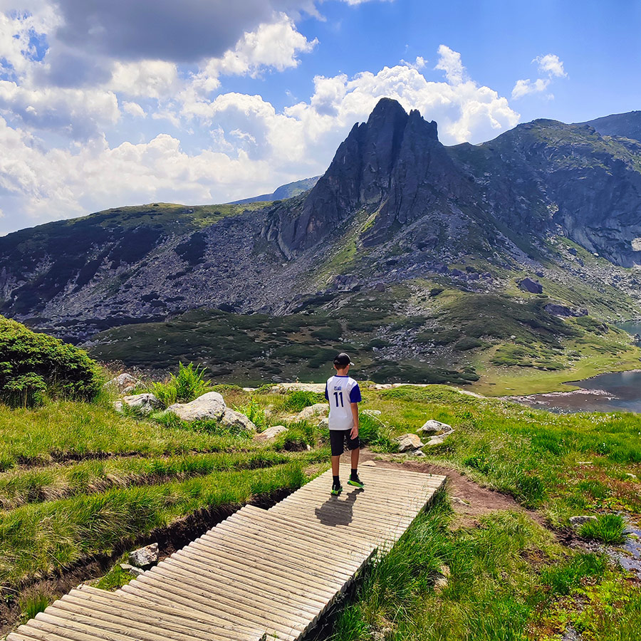
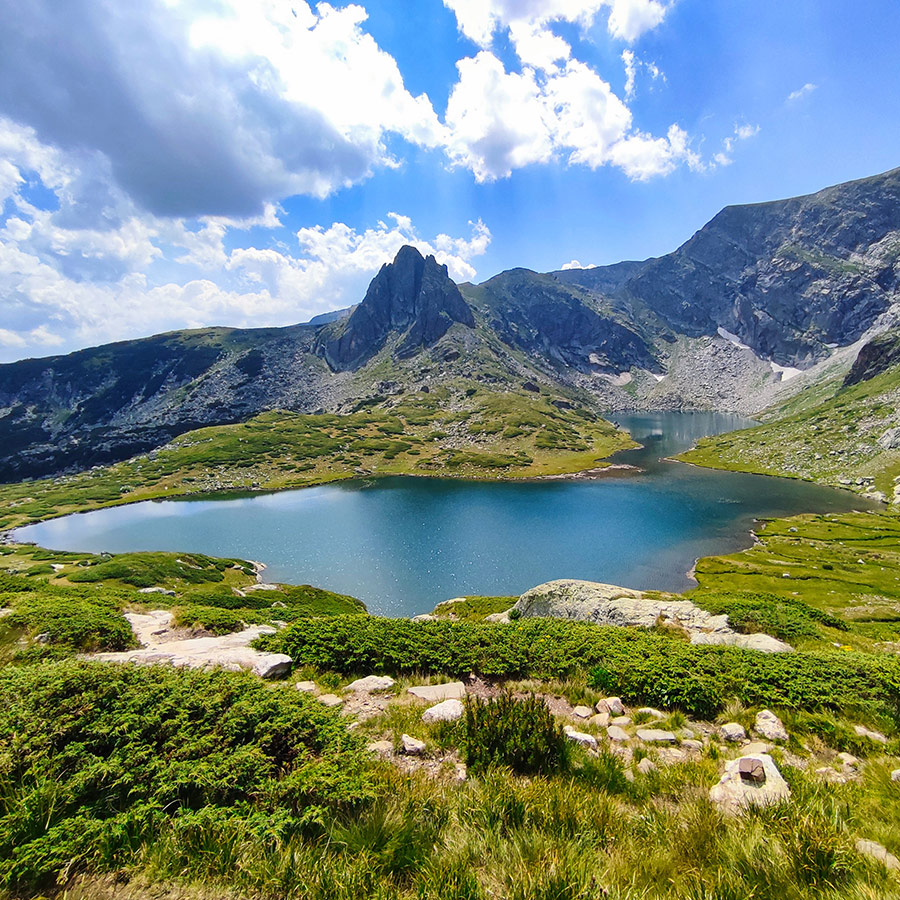
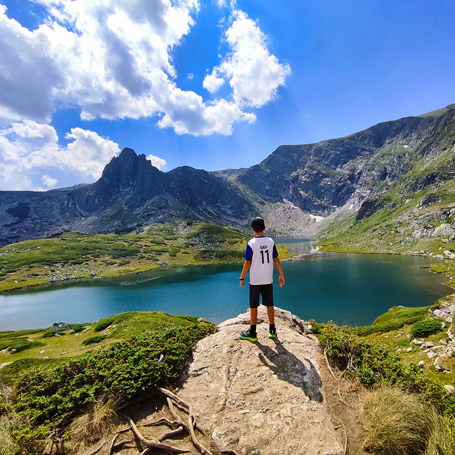
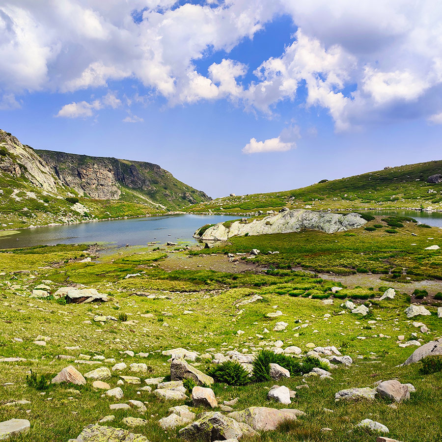
Hiking to the Third Lake – The Tear Lake (Salzata)
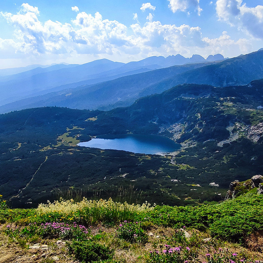
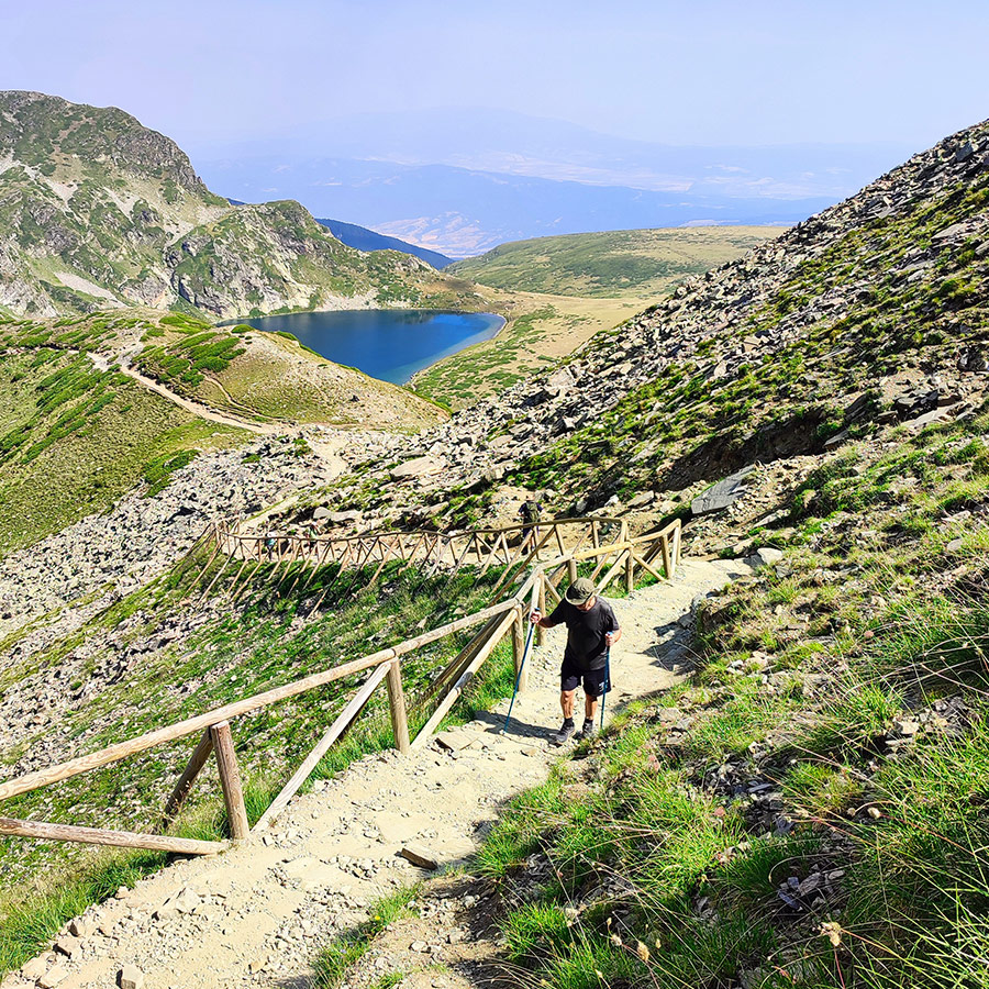
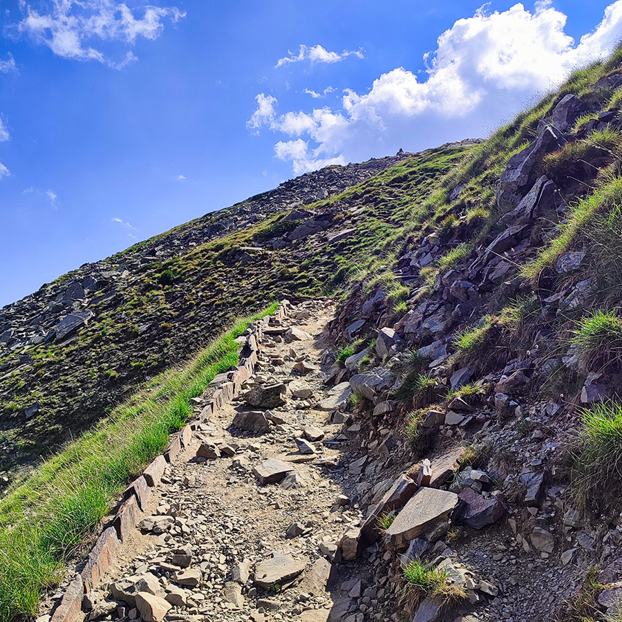
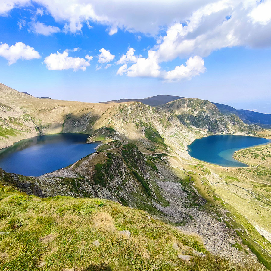
The most demanding section of the ascent leads you from the Eye Lake to the Tear Lake (Salzata), the highest of the seven at 2,535 m. It usually takes around 15-20 minutes to reach it, with the path zig-zagging across loose rocks and alpine terrain.
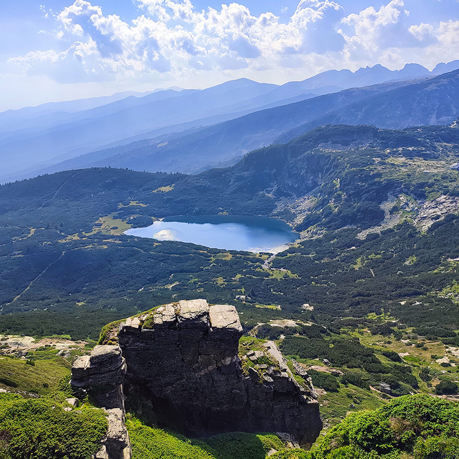
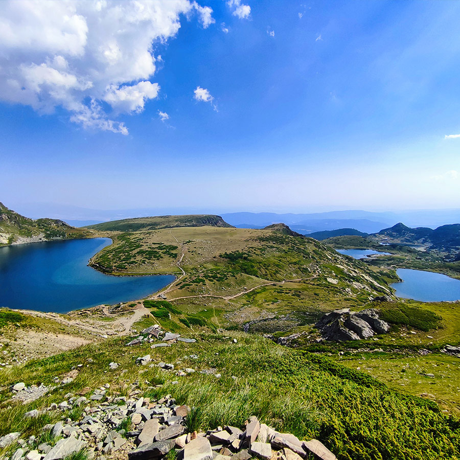
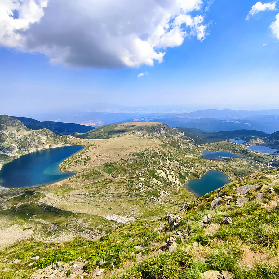
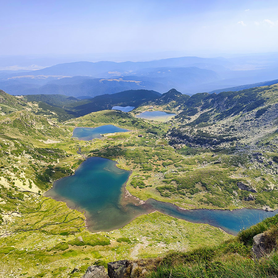
Arriving at the Tear is a moment of awe. The lake’s crystal-clear water lives up to its name, transparent, pure, and delicate, like a teardrop resting in the mountains. But what makes the Tear unforgettable is the view: from here you can see all of the Seven Lakes spread out below you in a breathtaking panorama. On a clear day, you may even see beyond Rila, with Pirin, Vitosha, and the Rhodope Mountains visible on the horizon.
For many, this is the emotional high point of the hike. Bulgarians consider the Tear symbolic of spiritual clarity, and it is also a sacred place for the White Brotherhood, who gather here each August for their rituals. Whether you come for the spiritual significance or the raw natural beauty, standing by the Tear Lake is a moment you won’t easily forget.
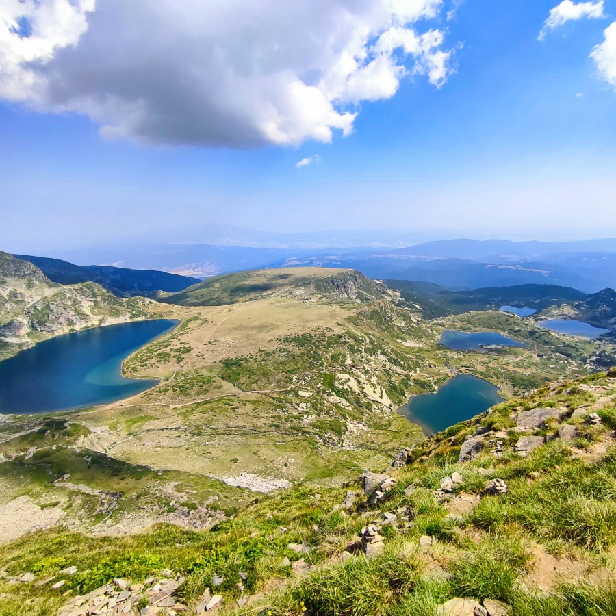
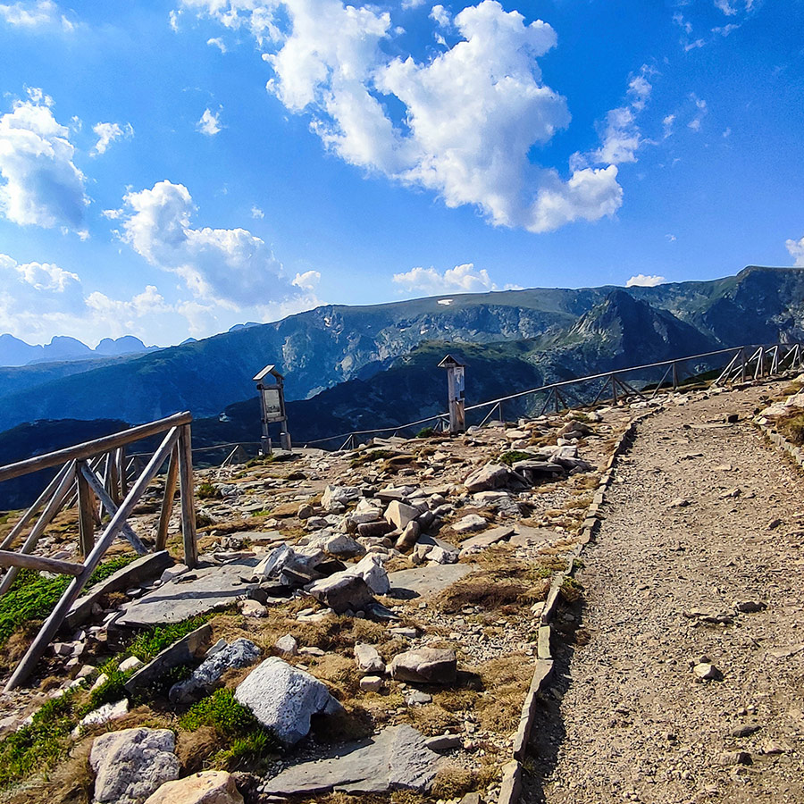
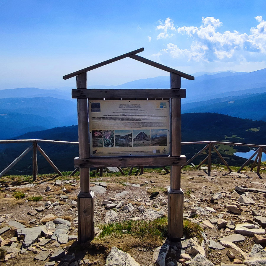
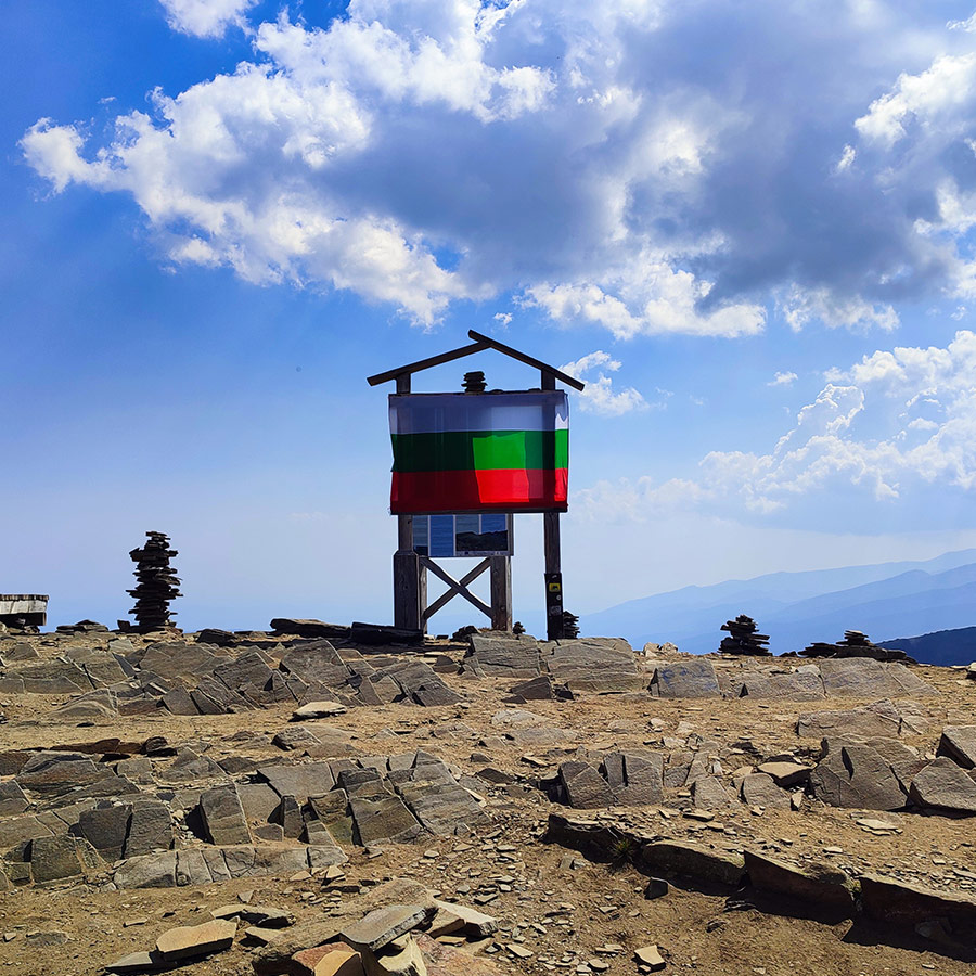
View from the Top
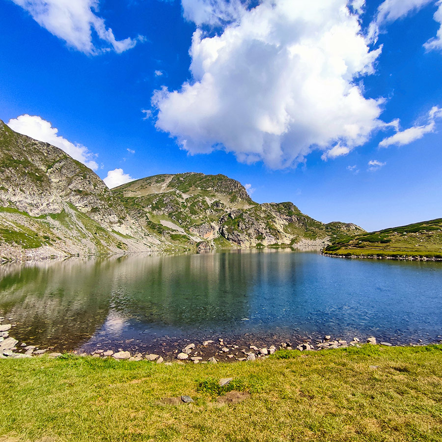
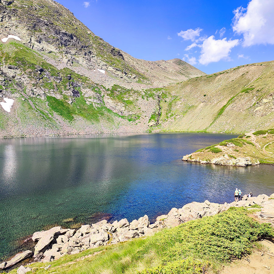
Returning to the Kidney Lake
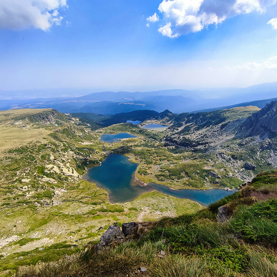
From the Tear Lake, the trail descends past the Eye and returns to the Kidney Lake. Approaching it from above gives you an entirely new perspective, the full horseshoe curve and its deep, vivid color stand out against the rolling alpine meadows below.
This is the perfect spot to take another break, as it’s not only one of the most photogenic but also one of the most central points in the entire cirque. From here, the descent continues toward the lower lakes, with the trail offering magnificent views back up toward the higher peaks.
Many hikers linger here to enjoy a snack or simply stretch out in the grass. The lake’s amphitheater shape makes it feel like you’re sitting in nature’s grand stadium, with the sky above and the still waters at your feet.
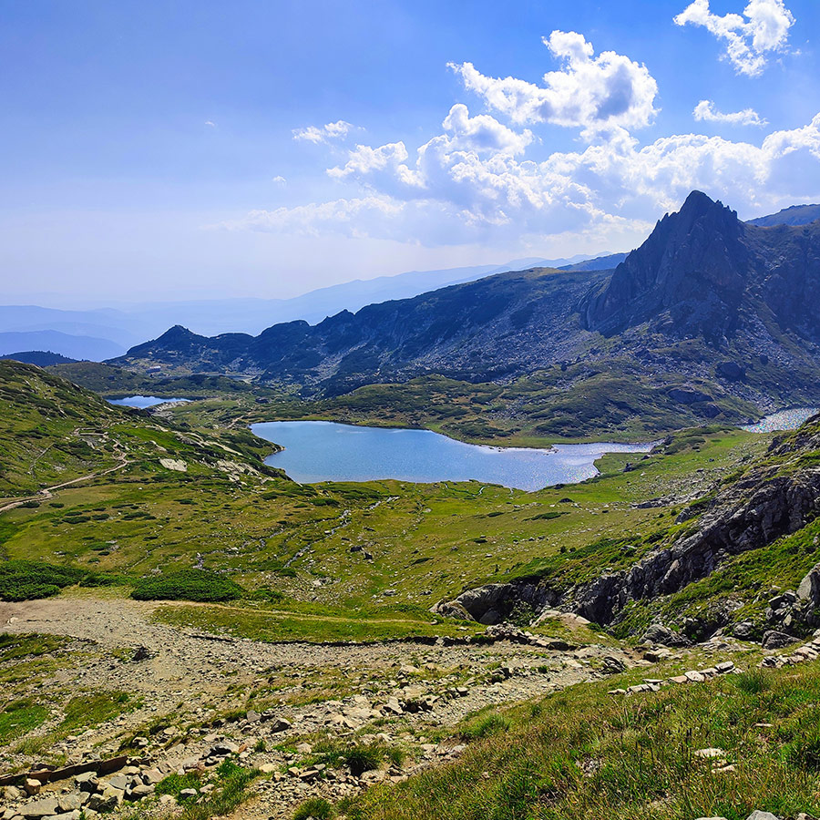
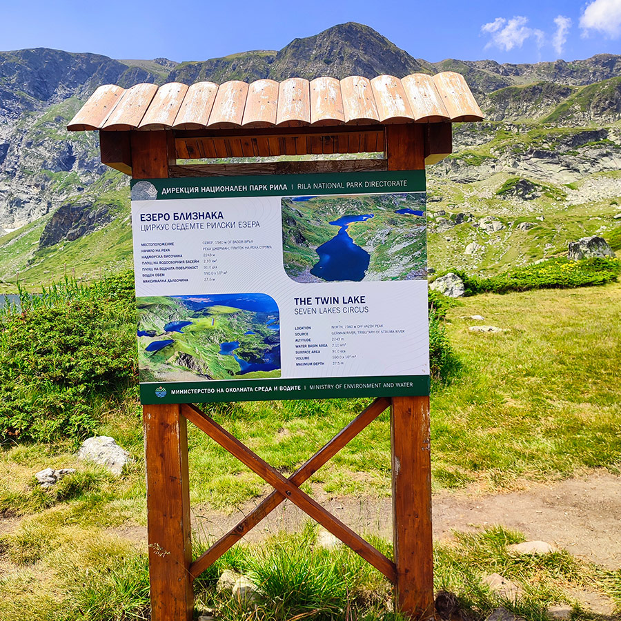
Hiking to the Fourth Lake – The Twin Lake (Bliznaka)
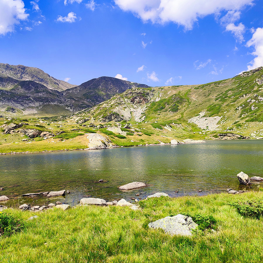
Leaving the Kidney behind, the trail gently descends into the central basin of the cirque. After 20–25 minutes you arrive at the Twin Lake (Bliznaka), which lies at 2,243 m. This is the largest lake by volume, its two connected basins giving it the distinctive “twin” appearance when viewed from above.
The Twin Lake has an open, expansive feel, with grassy shores and wide views in all directions. It’s often where hikers spread out for lunch, as there’s plenty of space to relax. The reflections here are stunning, especially in the afternoon when the surrounding ridges and the Kidney Lake above create perfect mirror images on the water’s surface.
Because of its central location, the Twin is often seen as the heart of the Seven Lakes. You’re surrounded by peaks, ridges, and other lakes, making this a place where the scale and harmony of Rila’s landscape truly sink in.
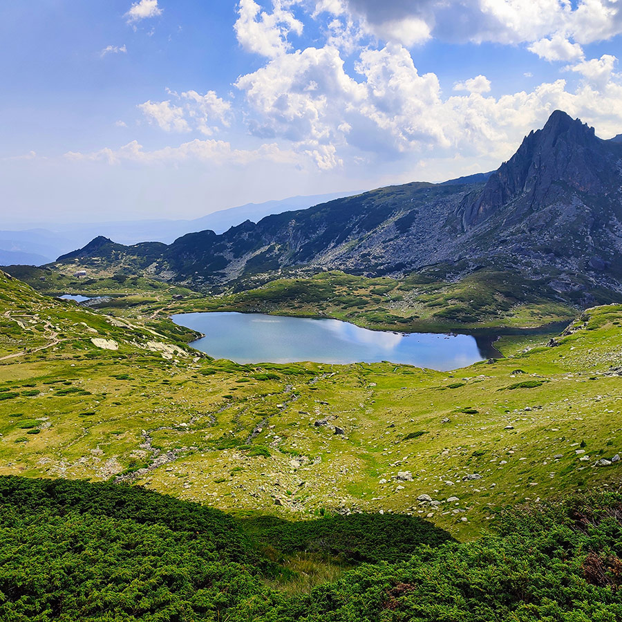
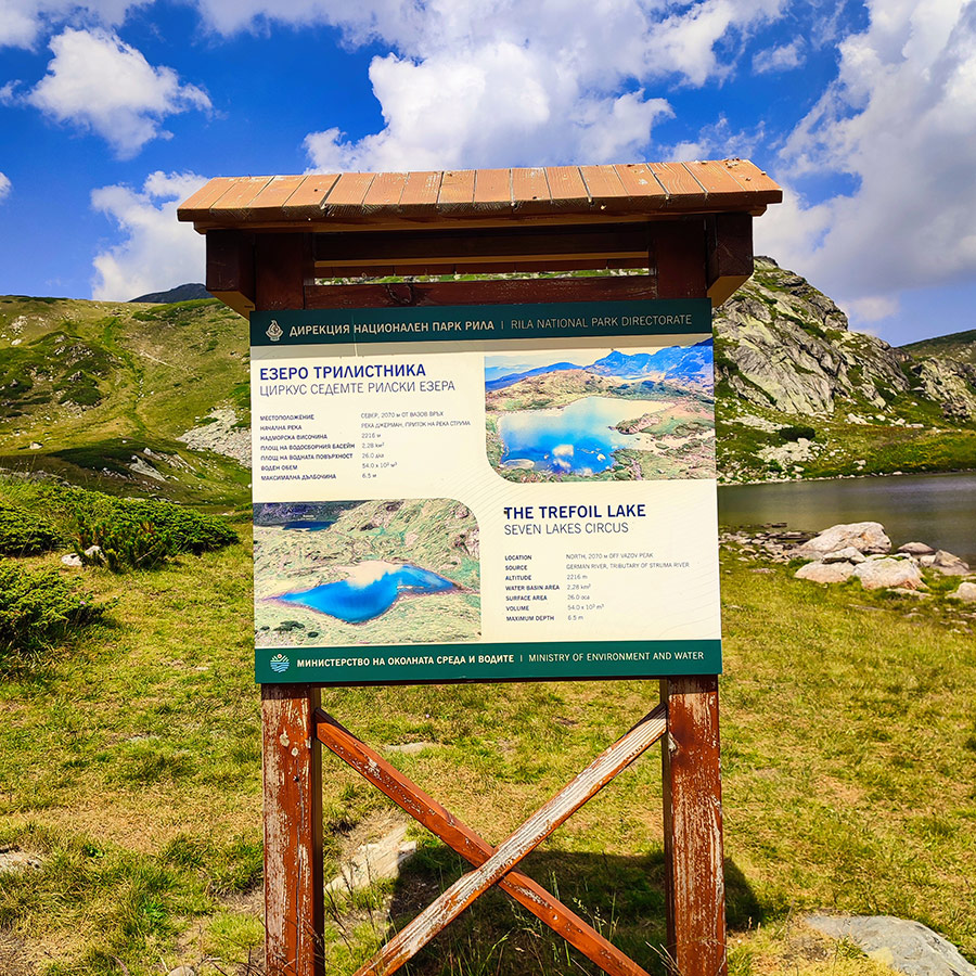
Hiking to the Fifth Lake – The Trefoil Lake (Trilistnika)
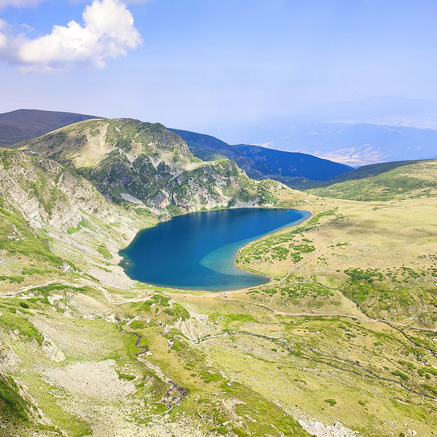
From the Twin Lake, the path leads gently downhill toward the Trefoil Lake (Trilistnika) at 2,216 m. Named after its three-lobed shape, the Trefoil has a distinctive outline best appreciated from higher above.
The lake is smaller and quieter than the Twin, but it has a unique charm. Surrounded by alpine meadows, it’s an excellent place to spot wildflowers in summer or even wildlife grazing nearby. The shallow edges give the water a lighter, more turquoise shade compared to the deeper lakes above.
The Trefoil is also one of the sites where the White Brotherhood gathers for their annual Paneurhythmy dance. On such days, the lakeside transforms into a living stage of movement and music, with people dressed in white moving rhythmically in circles. Even outside those occasions, the lake holds a peaceful energy that invites you to slow down and reflect. In fact, the day we hiked that route, we had the chance to see the White Brotherhood dancing and enjoying the morning sun.
The Universal White Brotherhood, a spiritual movement founded in Bulgaria by Peter Deunov, is known for its annual gathering at the Seven Rila Lakes, where followers perform the Paneurhythmy, a cosmic dance. The “trefoil” likely refers to the Trefoil Lake (also known as Balder-Daru Lake), one of the Seven Rila Lakes, which holds significance within the movement.
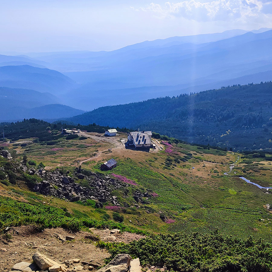
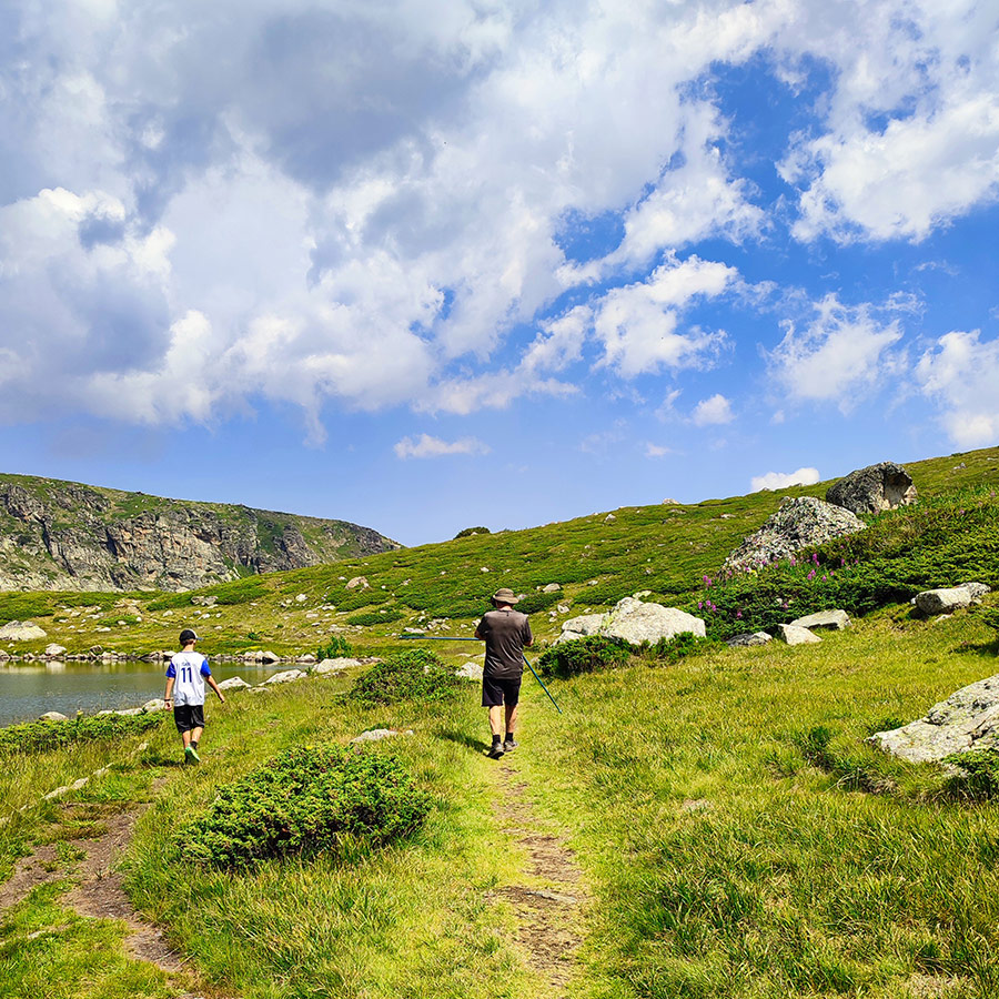
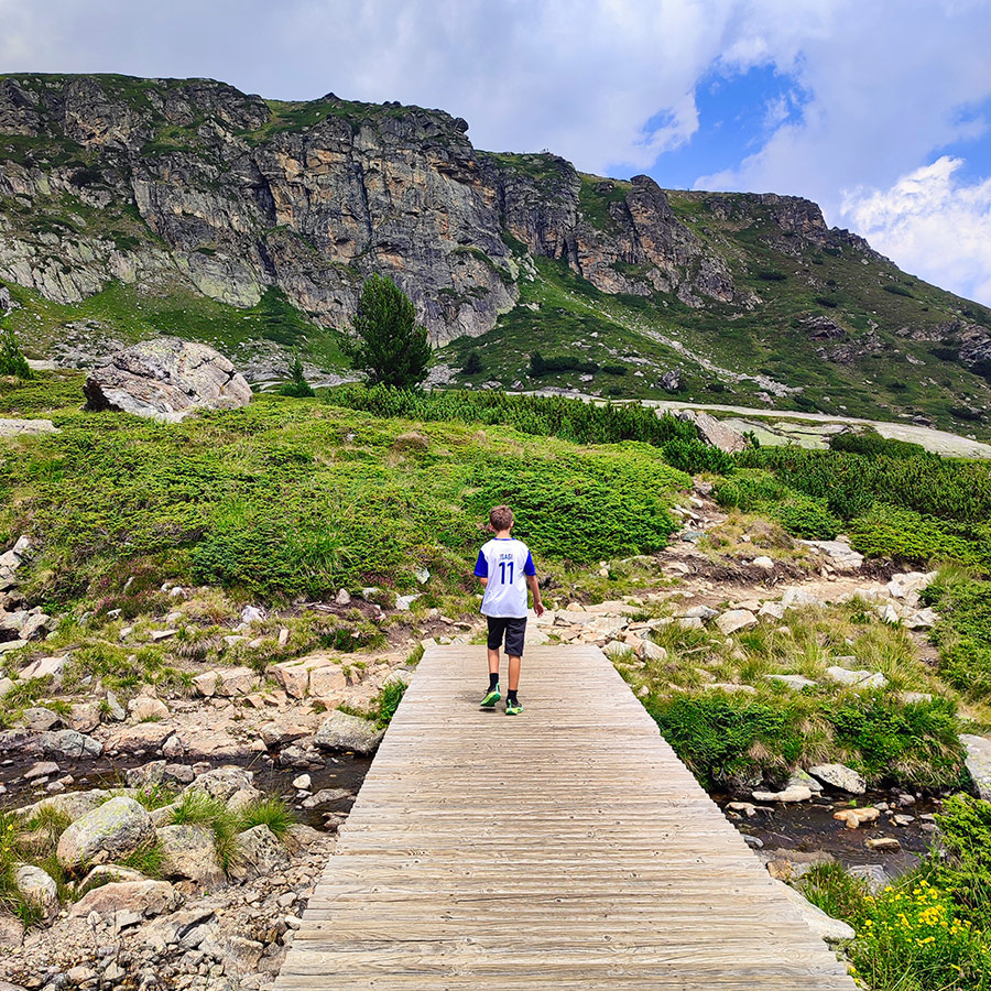
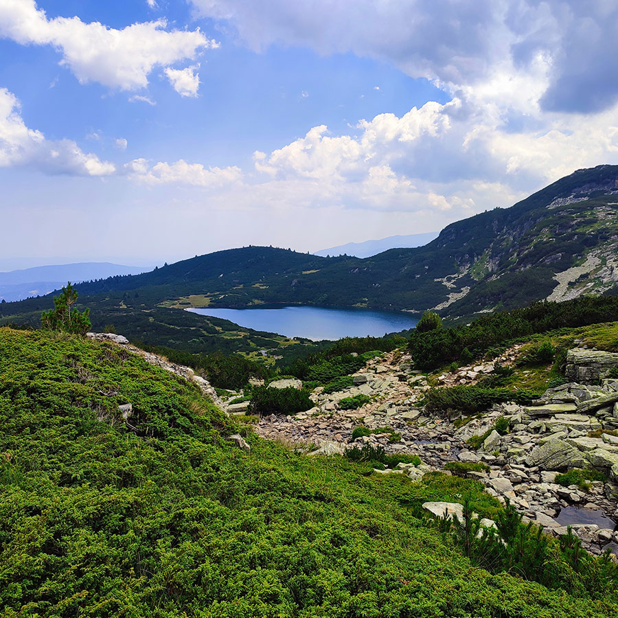
Hiking to the Sixth & Seventh Lakes – The Fish Lake (Ribnoto) and The Lower Lake (Dolnoto)
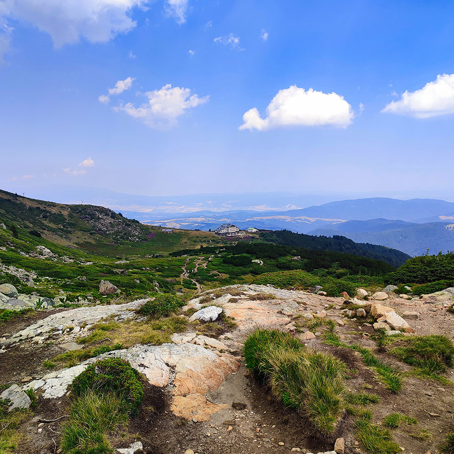
The descent continues steadily as you pass into gentler terrain. Soon, you arrive at the Fish Lake (Ribnoto) at 2,184 m, the largest by surface area. This lake is home to the Rila Lakes Hut, making it one of the busiest points on the trail. It’s an excellent place to grab food or drinks, refill water, or simply take a rest before finishing the hike. The wide expanse of the Fish Lake provides great reflections of the cliffs above, especially during golden hour.
Finally, you continue down to the Lower Lake (Dolnoto) at 2,095 m, the last of the chain. While less dramatic than the higher lakes, it has a quiet beauty and often lies shrouded in mist. Its position at the very bottom of the cirque makes it symbolic — the final step of the Seven Lakes journey, and a reminder of the high alpine world you’ve just traversed.
Many hikers don’t spend long at the Lower Lake, as it lies close to the main return route toward the hut and ski lift. But it’s worth pausing here for a moment of closure. From its shore, looking back up at the chain of lakes and peaks, you realize just how vast and varied this landscape is.
Return to Rila Lakes Mountain Hut
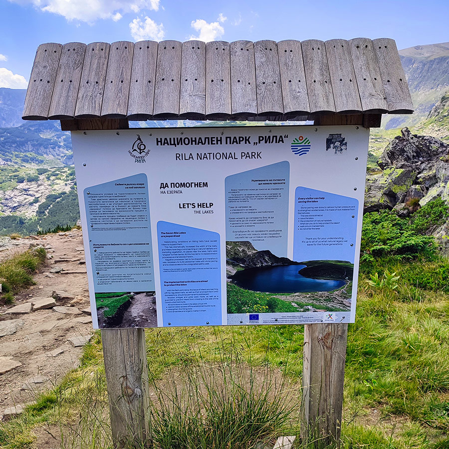
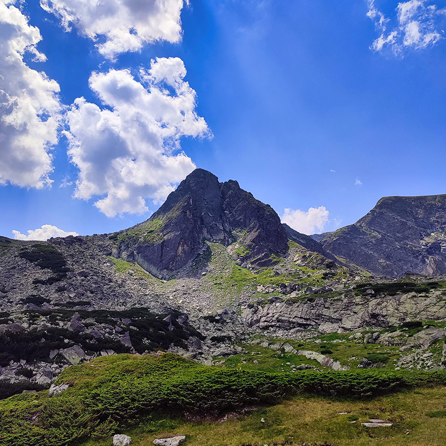
About Rila Mountain and Its Alpine Zone
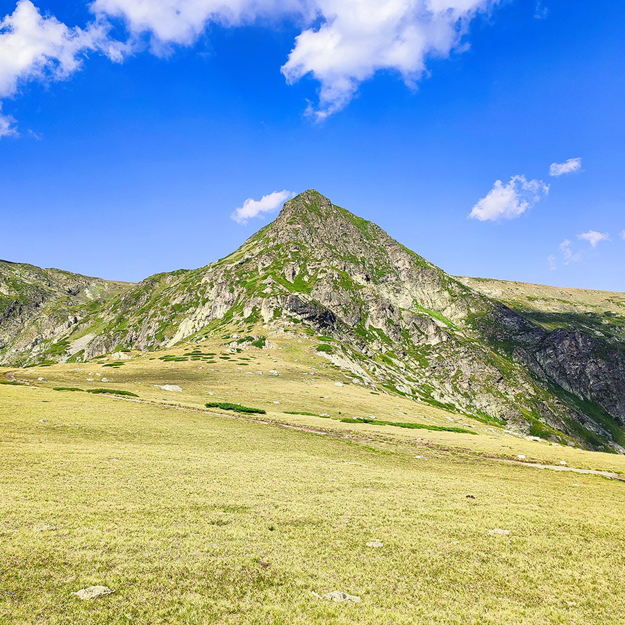
Rila Mountain is the highest mountain range in Bulgaria and on the entire Balkan Peninsula, crowned by Musala Peak at 2,925 meters. Its name is believed to come from the Thracian word roula, meaning “well-watered mountain,” a fitting description for a massif that feeds some of the Balkans’ largest rivers, including the Iskar, Struma, and Mesta. With more than 200 glacial lakes scattered across its slopes, Rila is not only a national treasure but also one of Europe’s most impressive mountain landscapes.
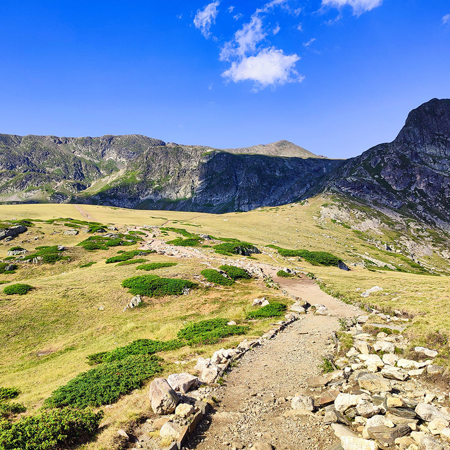
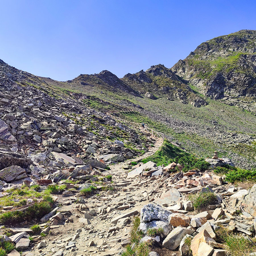
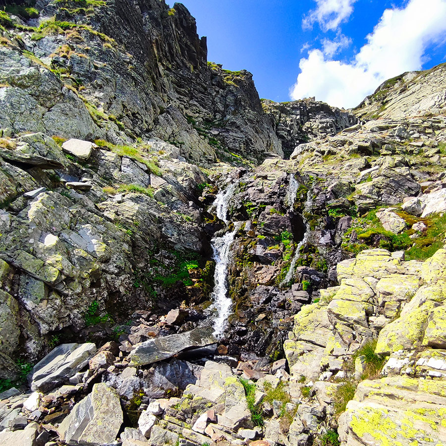
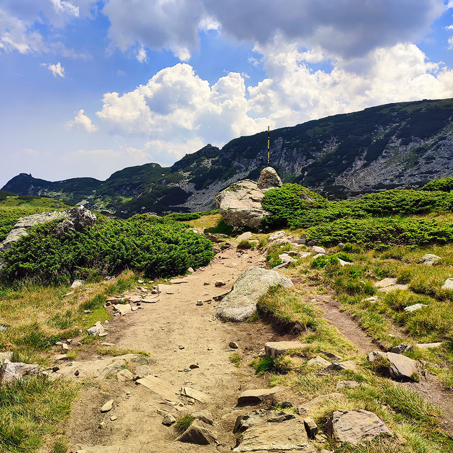
The alpine zone of Rila begins above 2,000 meters, where dense forests give way to open meadows, rocky ridges, and high plateaus. This is where the Seven Rila Lakes are found, a glacial amphitheater carved thousands of years ago by ice, wind, and water. The alpine terrain is dramatic yet inviting, with jagged peaks softened by grassy ridges, making it accessible to hikers of different levels. During summer, the meadows bloom with alpine flowers, while in winter the zone is often buried under meters of snow, creating a completely different, but equally stunning, environment.
One of the most remarkable features of Rila’s alpine zone is its sense of vastness. Standing at the edge of a lake or climbing up to a ridge, you often feel suspended between earth and sky, surrounded by endless horizons. The clear, thin air and wide-open spaces offer a rare feeling of freedom. Wildlife thrives here too: marmots, chamois, and golden eagles are not uncommon sights. The alpine zone of Rila is more than a hiking destination, it is a living, breathing ecosystem, shaped by the harsh beauty of altitude, and one of the finest examples of high-mountain landscapes in the Balkans.
Details of the hike
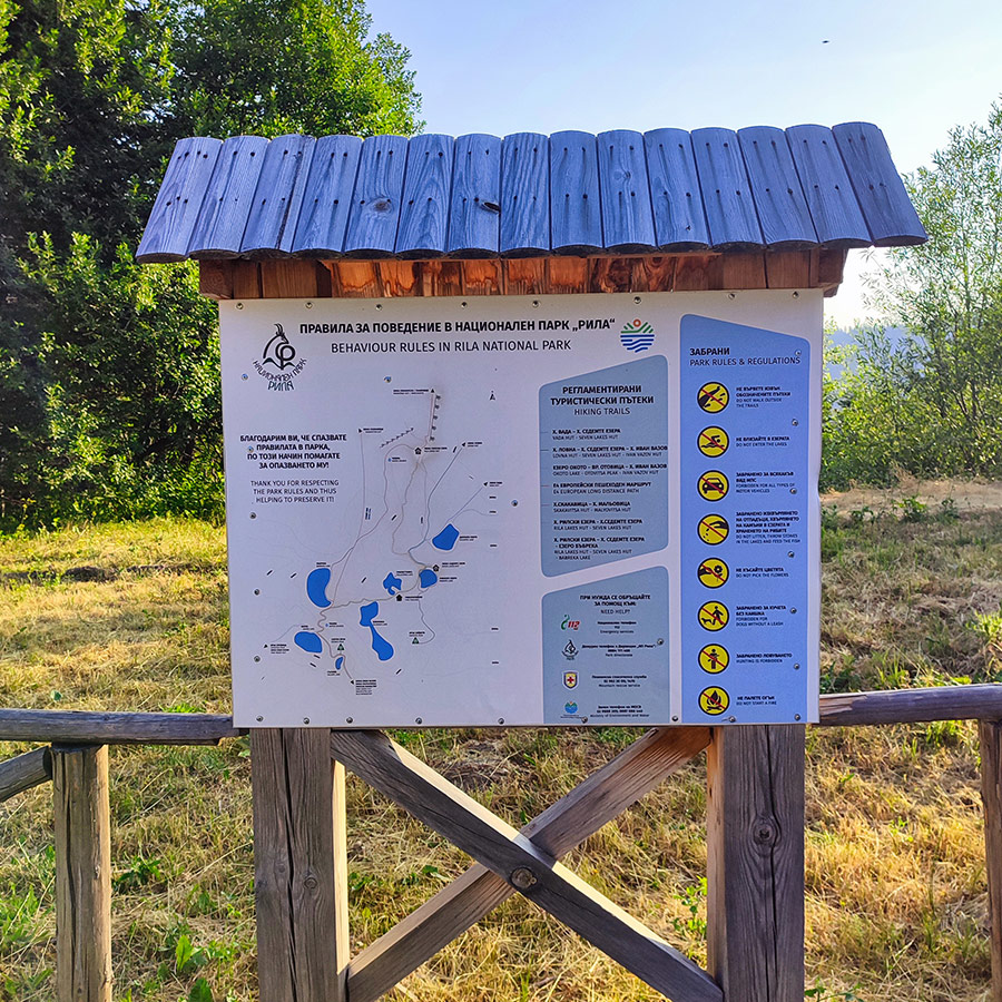
- Location: Rila Mountain
- Trail Signs: Yes
- Maximum Elevation: 2.549 m.
- Minimum Elevation: 2.013 m
- Total Distance: 8.2 km
- Hiking time: 3 hour 30 minutes
- Difficulty: Medium (family friendly)
- When to Hike: All year round (Winter time needs winter gear)
Support the journey — buy me a coffee
I share these articles and the climbing guidebooks because I love the outdoors, and they’ll always be free. If they’ve helped you, help me keep them coming. Click the button to support my work.
Before you leave this blog check out the following map
Below: This map marks all the mountaineering adventures that have been featured on Olympus Mountaineering so far, including several Sport climbing crags – Select full screen to expand, zoom in for more detail, or click on a marker for a link to the post.

This area looks so beautiful to explore!
LikeLiked by 1 person
It is indeed a stunning location. This hike is not difficult, so I highly recommend it to everyone. Furthermore, Rila Mountain offers many more scenic spots, hiking opportunities, and outdoor activities.
Thank you for your comment
LikeLiked by 1 person
Beautiful place! And there are some nice (and big) crags in the area too by the looks of it!
LikeLiked by 1 person
Generally, Rila offers several climbing crags and numerous traditional and mountaineering routes; however, on this occasion, I did not climb. I was there solely for hiking and exploring the natural beauty of Bulgaria.
LikeLiked by 1 person
Beautiful!
LikeLiked by 1 person
Pingback: Hiking the Beli Iskar Eco-Trail – Rila Mountain, Bulgaria (family friendly) – Olympus Mountaineering
Pingback: From Waterfalls to Alpine Lakes: An Expedition Through Bulgaria’s Belasitsa, Pirin & Rila Mountains – Olympus Mountaineering