It’s almost Christmas time and also the end of one more exciting mountaineering year here in Greece. This past year, we have been to many different mountain peaks and mountain range, but one of the few that we have never visited before, were Athamanika or Tzoumerka Mountains.
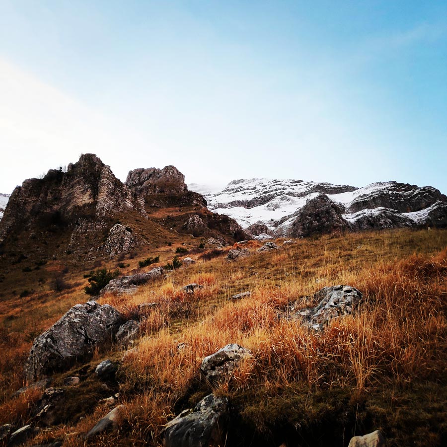
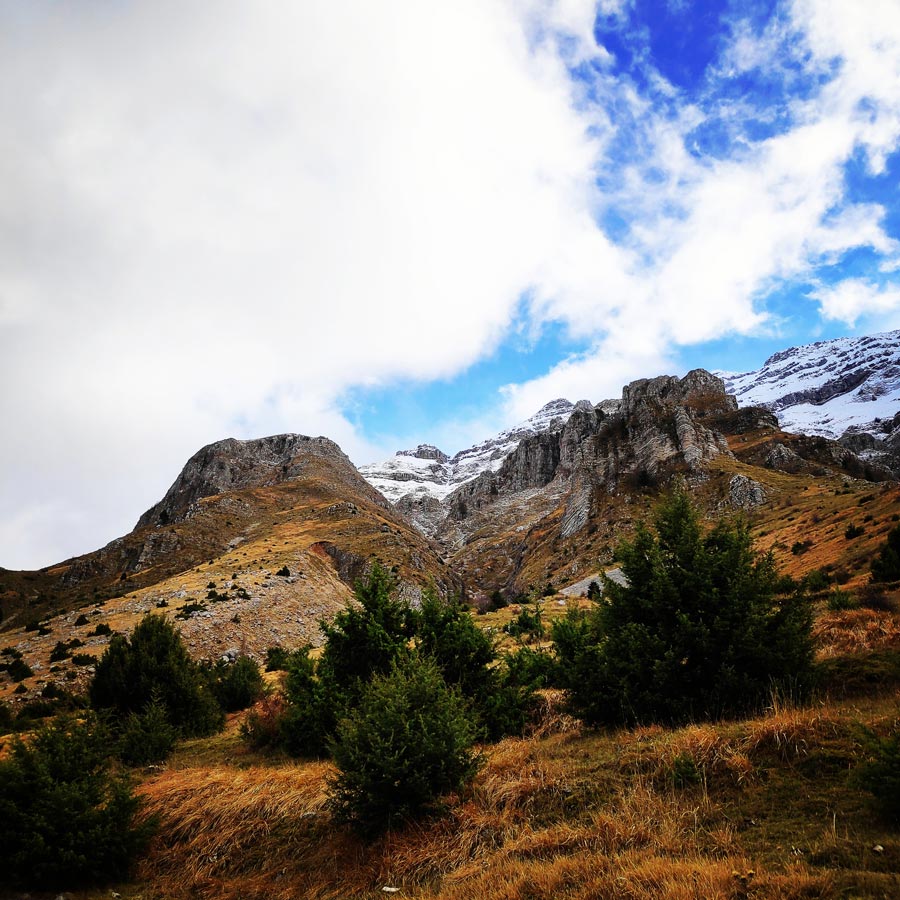
Athamanika mountains, also known as Tzoumerka, are part of Pindos mountain range located at the boundaries of the regions of Thessaly and Epirus. Both the physical landscape and the traditional settlements set Athamanika mountains as one of the most popular tourist destinations in Greece.

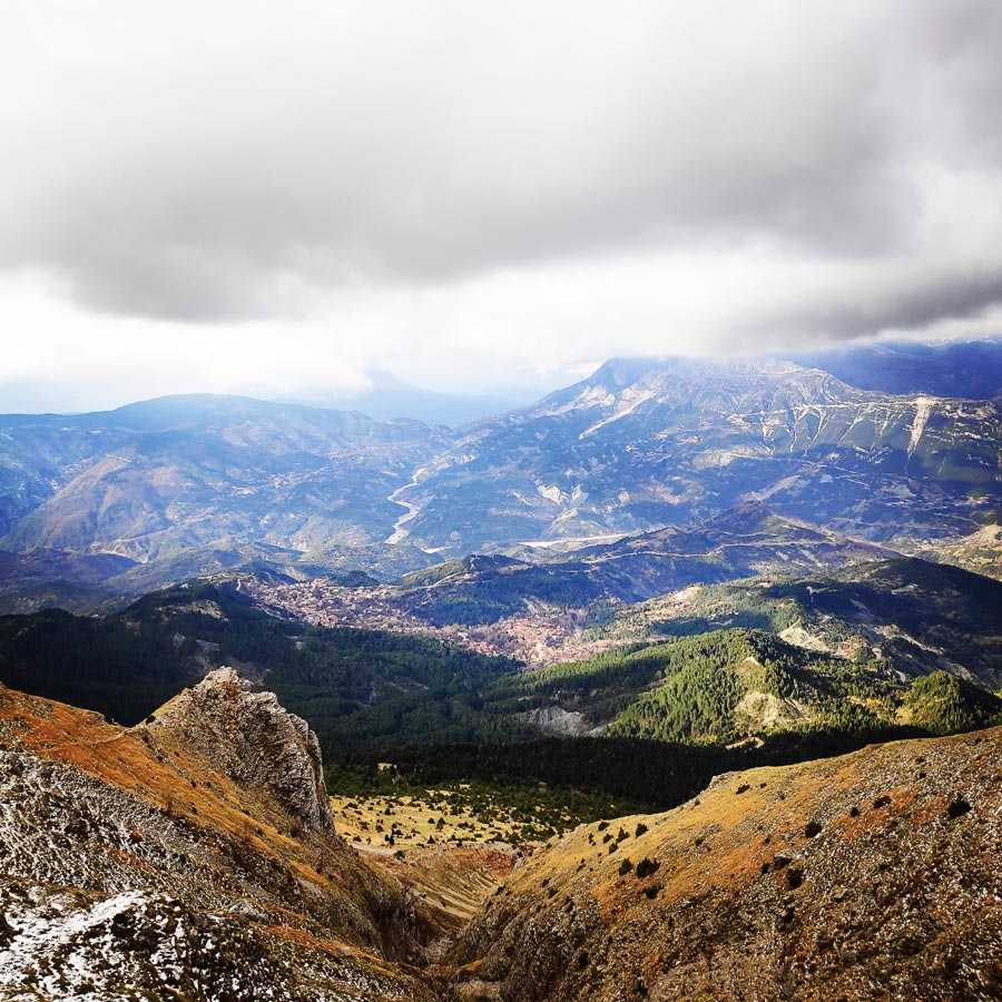
Athamanika mountains rise in-between the boundaries of the counties of Arta, Ioannina and Trikala. At the West the mountains are bounded by Aracthos river and at the East by Acheloos river. Geomorphologically, the region is divided into 2 sections: the northern section, belongs to Ioannina prefecture and hosts the highest peak (2469 meters) and the southern part belongs mainly to the prefecture of Arta.
Geologically, Athamanika Mountains are consisted mainly of limestones and flysch formations. This alternation of rocks combined with intense rainfall has resulted the development of an extensive groundwater with a presence of springs in many places. The most famous water spring is “Agathi“, near the village of Melisourgoi.
Support the journey — buy me a coffee
I share these articles and the climbing guidebooks because I love the outdoors, and they’ll always be free. If they’ve helped you, help me keep them coming. Click the button to support my work.

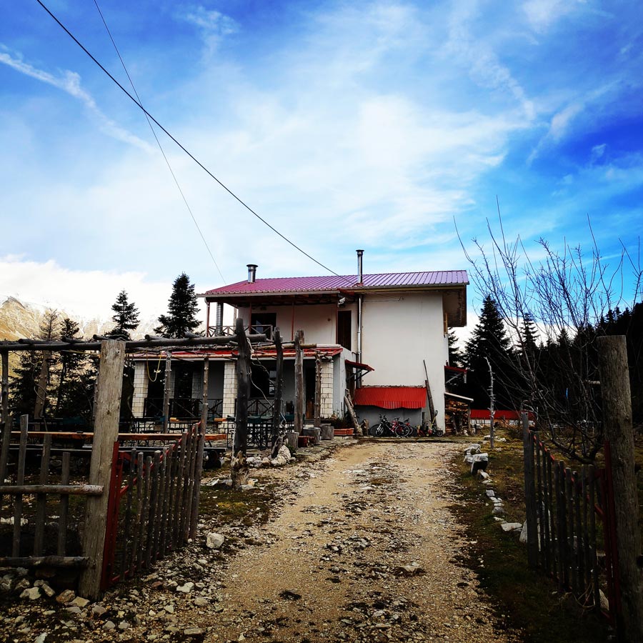
Pramanta Refuge – Strogoula Peak
At an altitude of 1.300 m (4.265 ft), in the “Isioma” plateau on the slopes of Tzoumerka Mountain, the Pramanta Mountain Refuge restarted its operation on 28 October 2006 under new administration! Babis and Pola, together with their two wonderful and kind kids, provided us excellent service and great company during our stay there.
There are two 8-bed rooms and one 10-bed room, totalling 26 beds, a fully functional kitchen, dining tables, a living room and a fireplace. It operates round the year, every day, should no emergencies occur (we’re humans!). The whole “Isioma” plateau is there for games, camping, football, excursions even a little theatre! (mountain theatre).
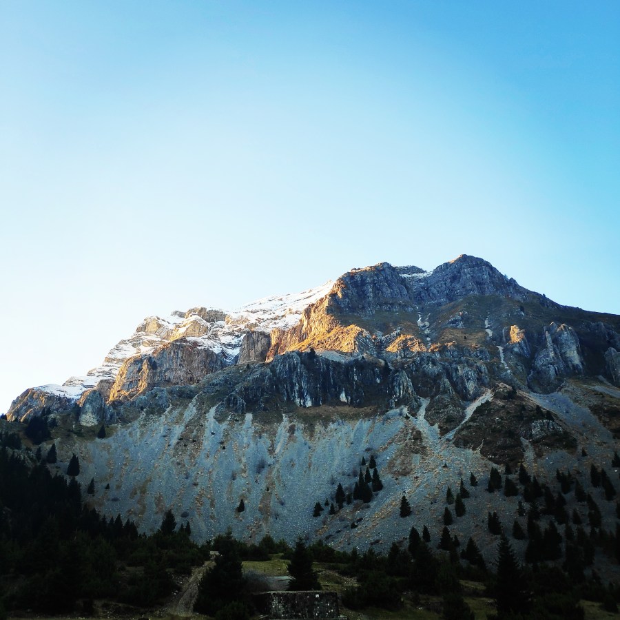
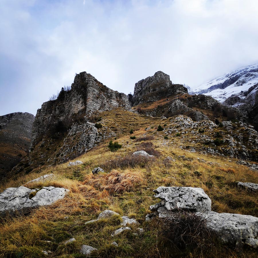
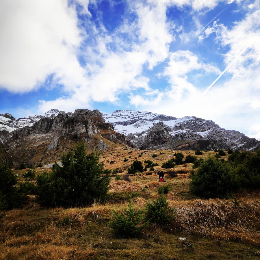
In the summer we offer coffee and deserts outside in the sunshine, under the umbrellas. One can enjoy the view towards every direction, Mitsikeli, Vikos, Gamila, Peristeri, Baros, Kakarditsa, all the villages but, above all, the impressive Strogoula Peak.


Check out more FREE Guidebooks
Download now for free! Explore breathtaking landscapes and conquer thrilling heights with our collection of guidebooks and topos.
Don’t miss out on this opportunity to elevate your outdoor adventures. Click, download, and let the exploration begin!
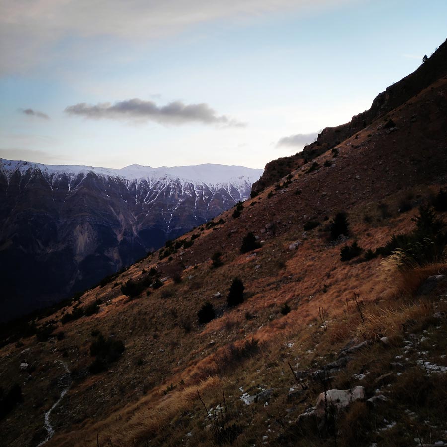
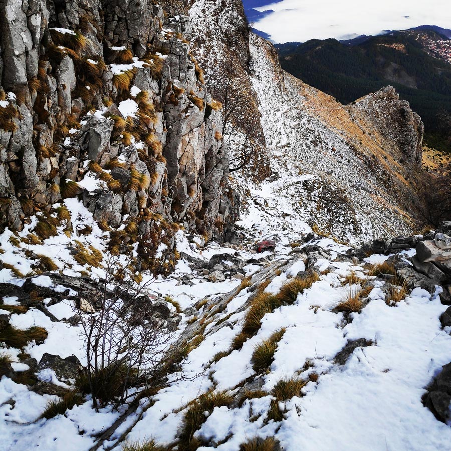
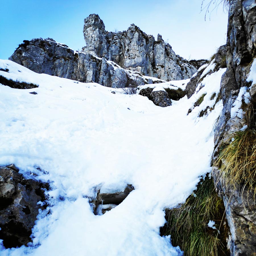
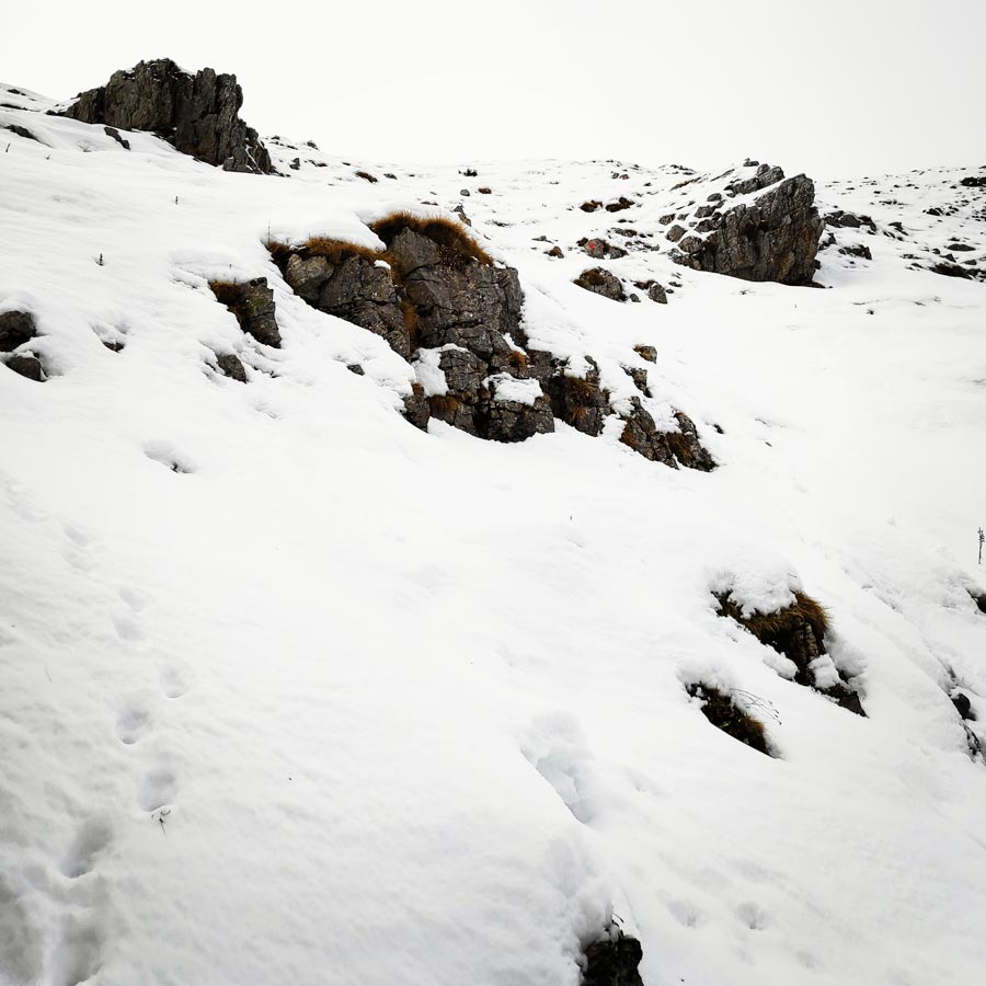
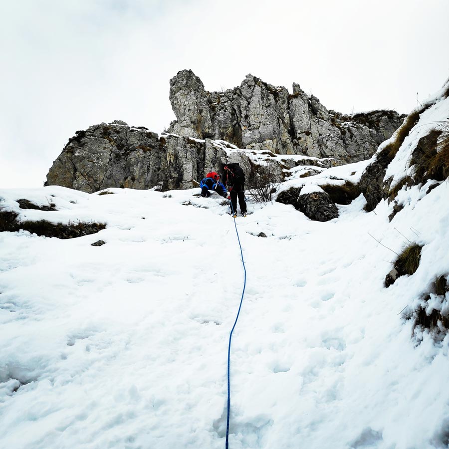
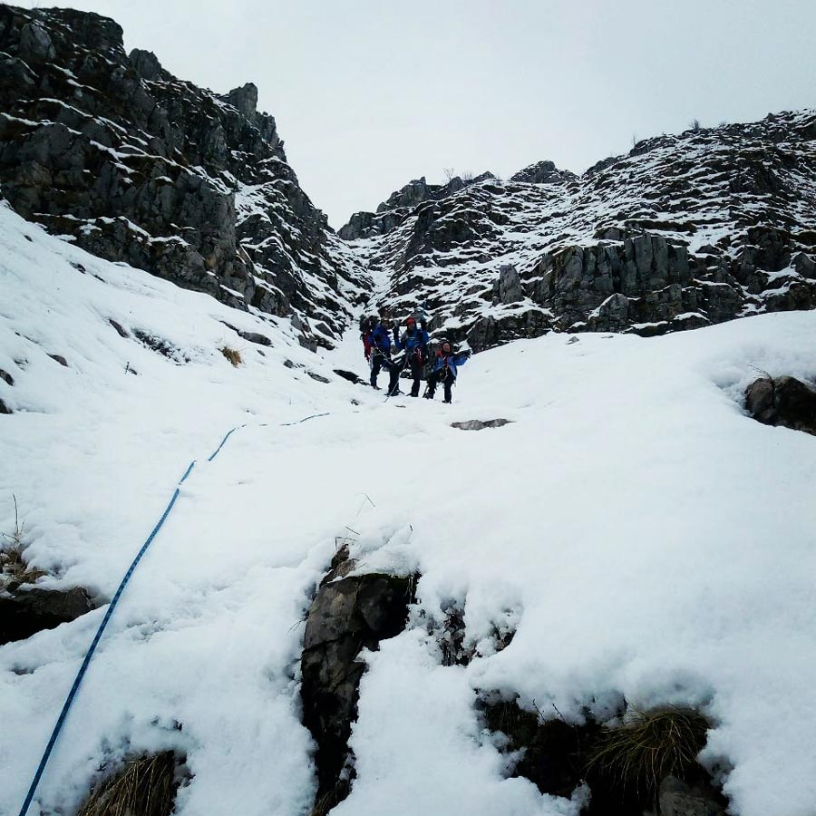
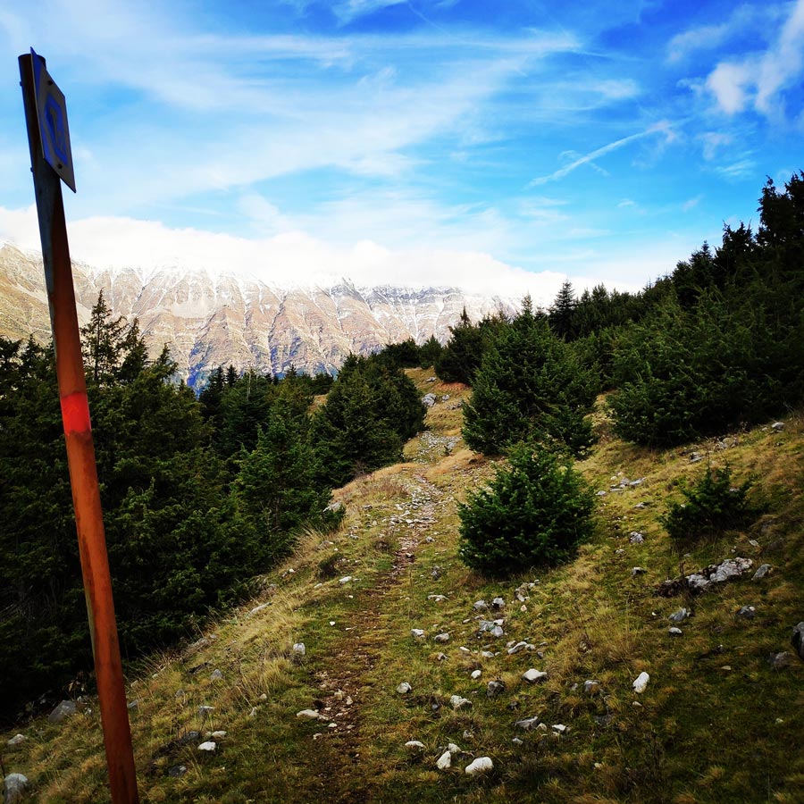
We have been hiking uphill for about 45 minutes till the point we first stepped on snow. The altitude was about 1.600 meters above sea level and due to low temperatures we needed to step on our crampons soon. Also, the ice axes took the place of the walking sticks and we were ready to move ahead in order to find the beginning of “Agrofylakas” couloir.
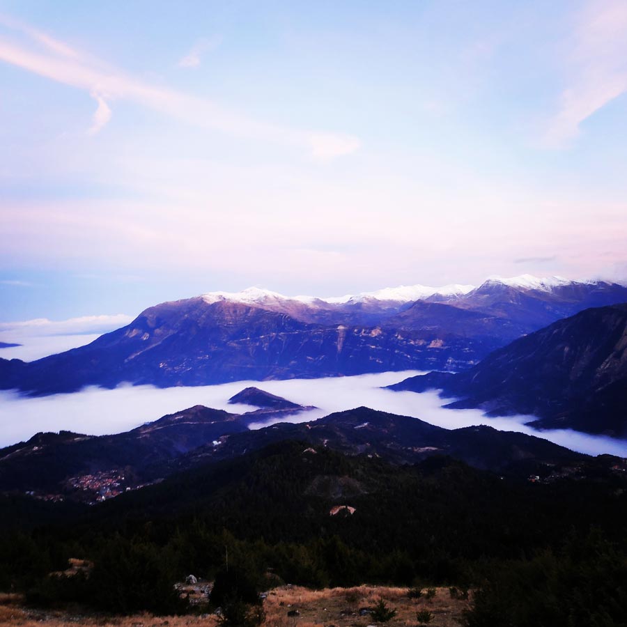
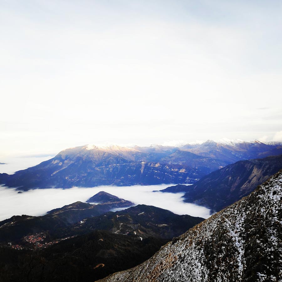
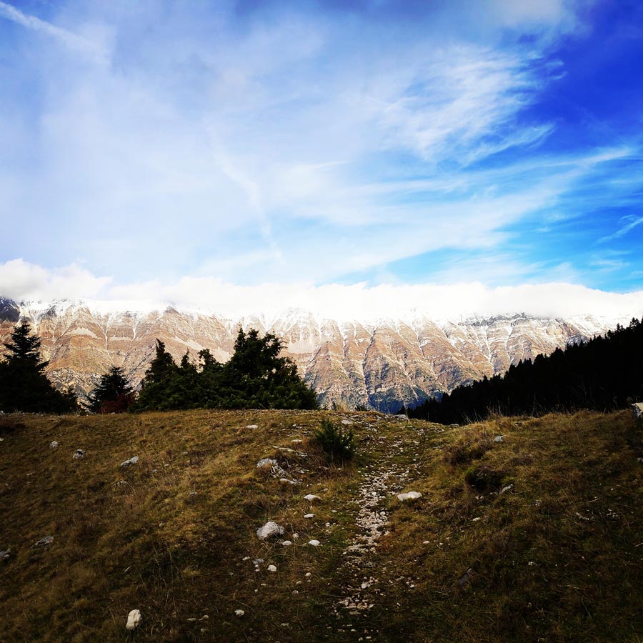
The views from that altitude were really nice and we were able to enjoy several neighbouring peaks such as Kakarditsa, Astraka, Gamila, Lakmos and many others.
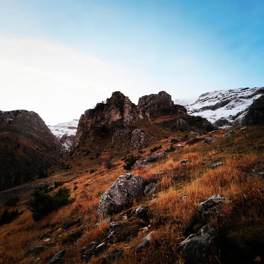
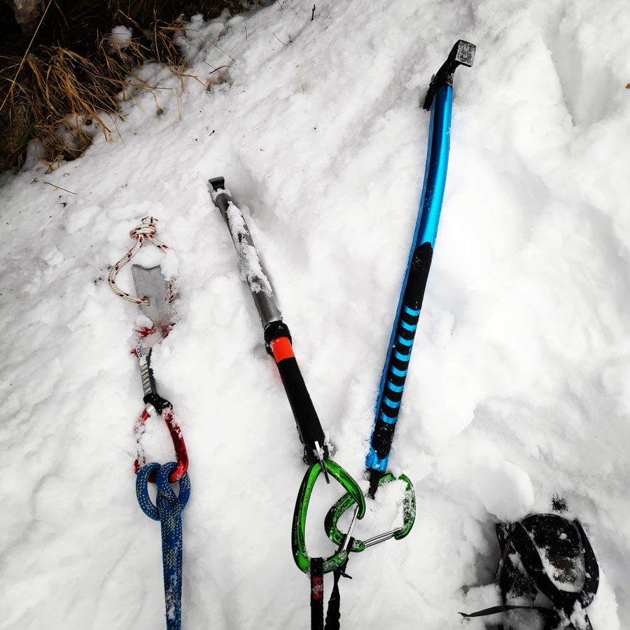
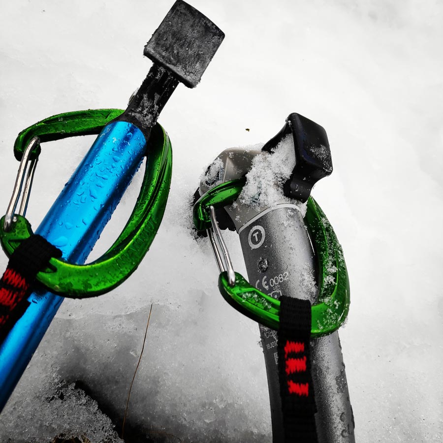
At an altitude of about 1.700 meters, we located the Agrofylakas couloir and on the base of the couloir we had a rather long break in order to get our gear ready for the climb of the couloir. Some of the gear I have used of this climb was the following:
- The North Face Verbera Mountaineering boots
- Lowe Alpine Mountain Attack 35-45
- Rock Empire Machki Crampons
- Mammut Wall Rider Helmet
- Petzl Altitude Harness
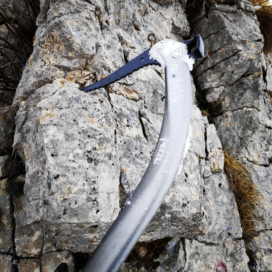
- Salewa Tec X Ice Axe
- Petzl Quark Ice Axe
- Wild Country Rocks Nuts
- Olympus Snow Picket
- Cumulus Incredilite Endurance
- Simond 2-in-1 Mountaineering Gloves
- Petzl Reverso
- Garmin Dakota 20
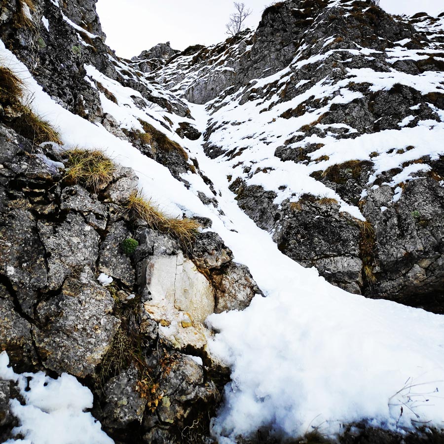
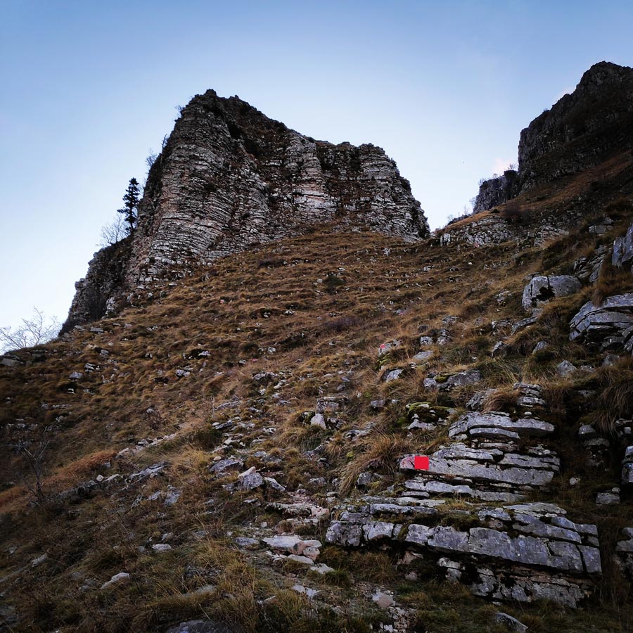
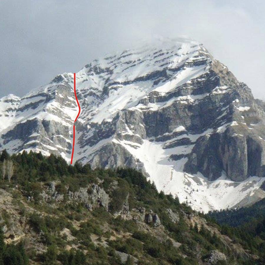
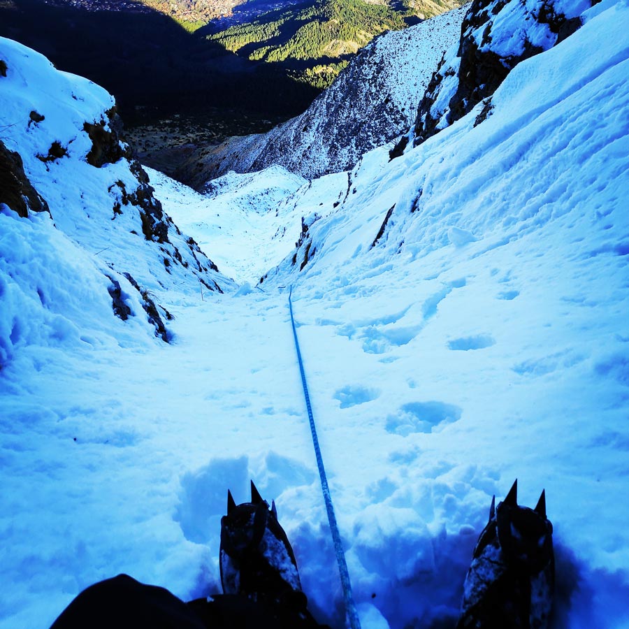
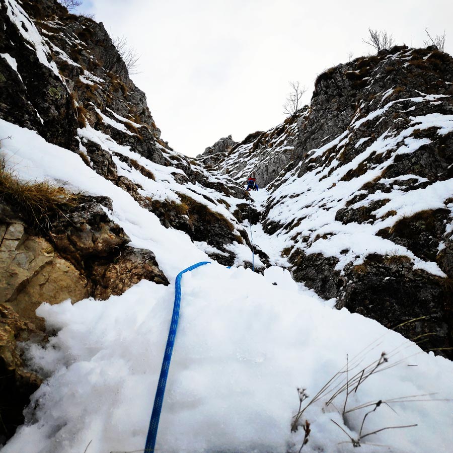
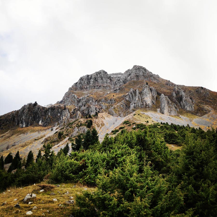
Agrofylakas Couloir
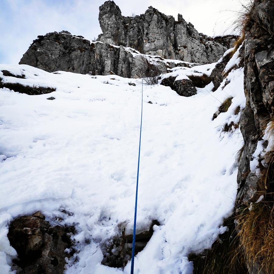
Agrofylakas’ couloir (55° (70°), 500m.) was first discovered and ascent by P. Sotiropoulos – A. Karras and M. Vasiliou – S. Koukoumpi on 27/4/1986.
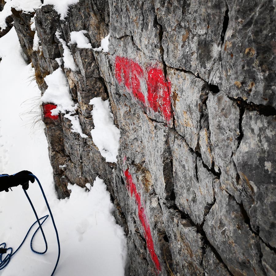
Agrofylakas’ couloir is the central couloir that is seen from Pramanta looking out over the northwest cliff of Strogoula.
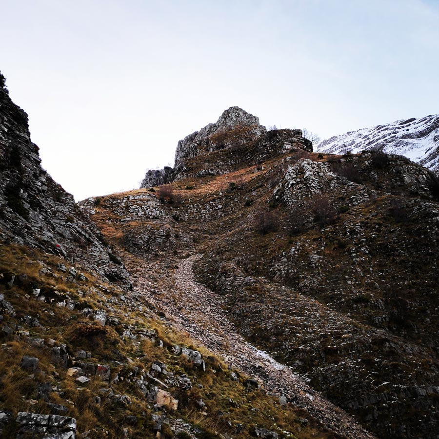
The route is a deep hook that ends 100m before the top in rock passes, where the toughest part (M2 or 70 °). If the snow cover is great then things are easier. After the exit of the cabin there is still 100m of walking to the top.
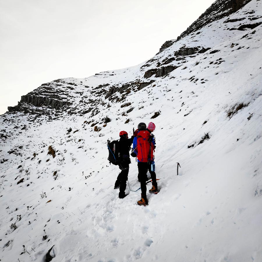
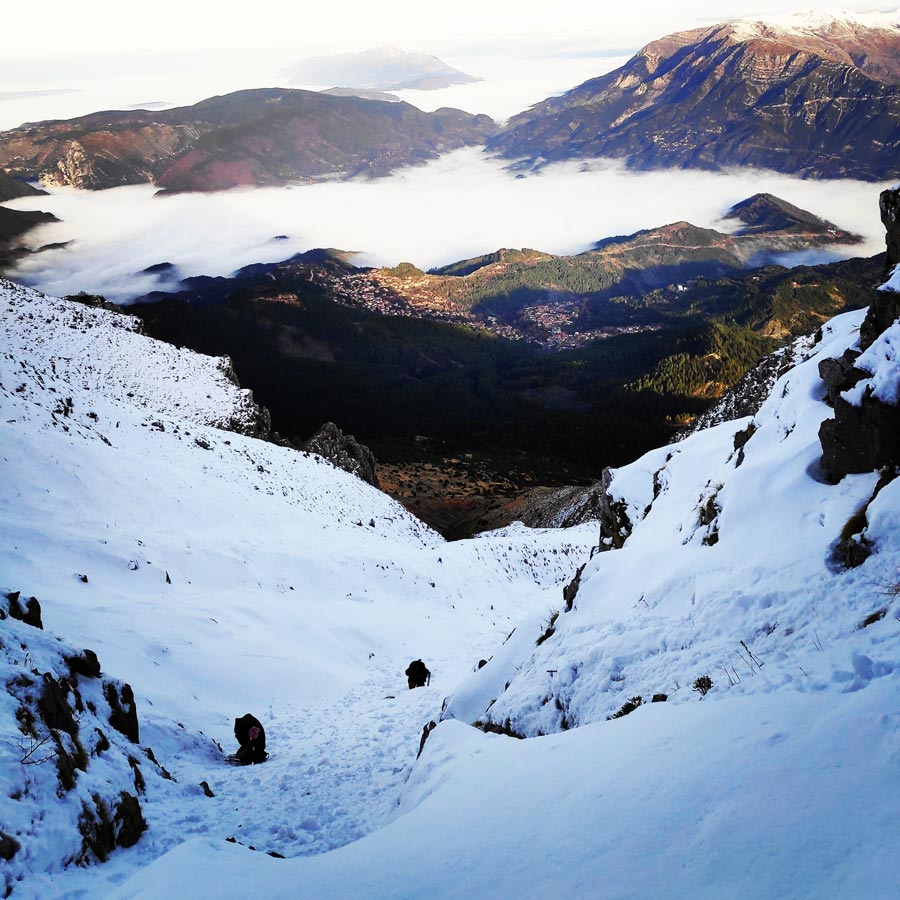
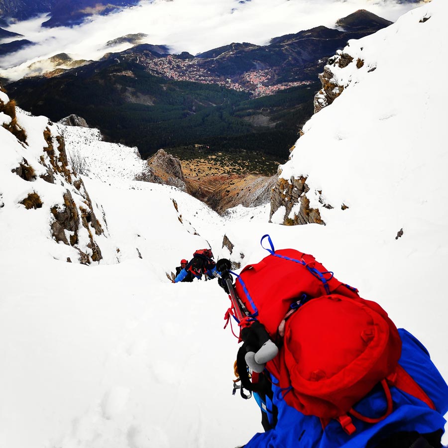
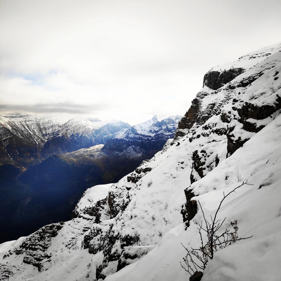
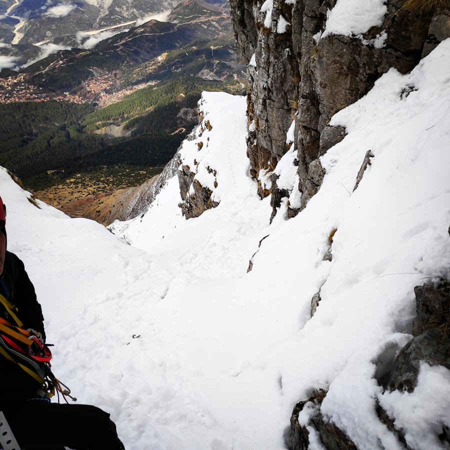
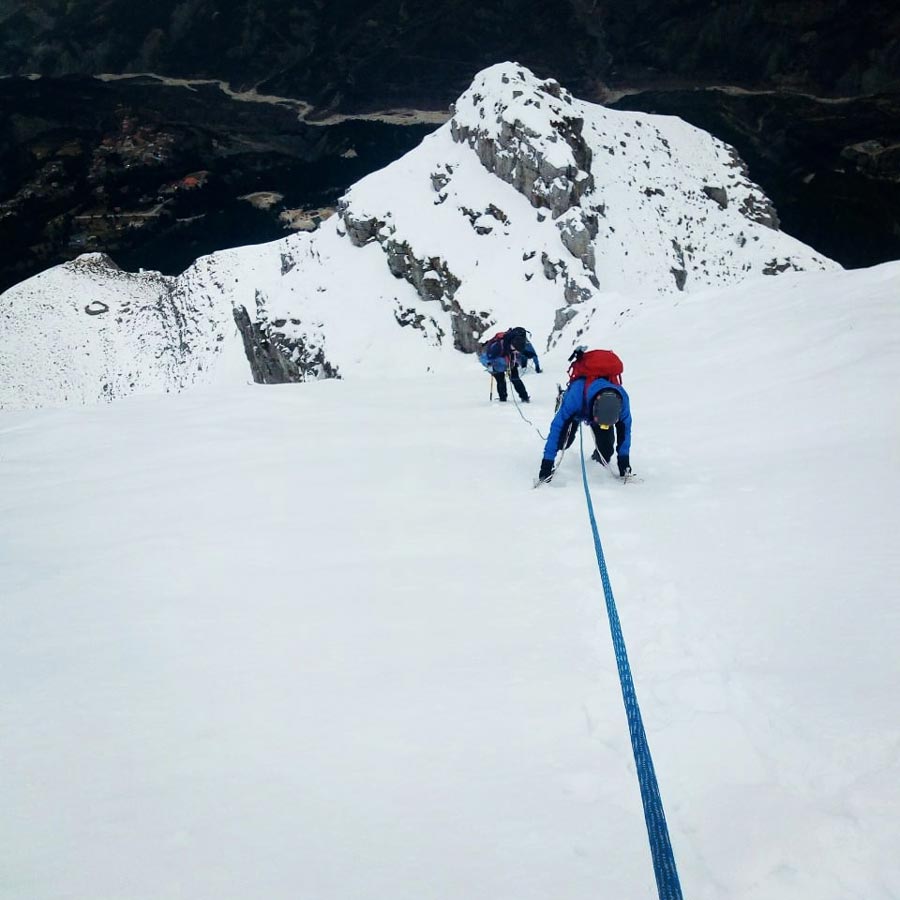
The Agrofylakas couloir line is a beautiful line that leads you almost at the top of Strogoula peak (2.1720). The snow conditions on that day were almost ideal, which means that there was very low avalanche danger and although there was not ice, the quality of the snow was néve type.
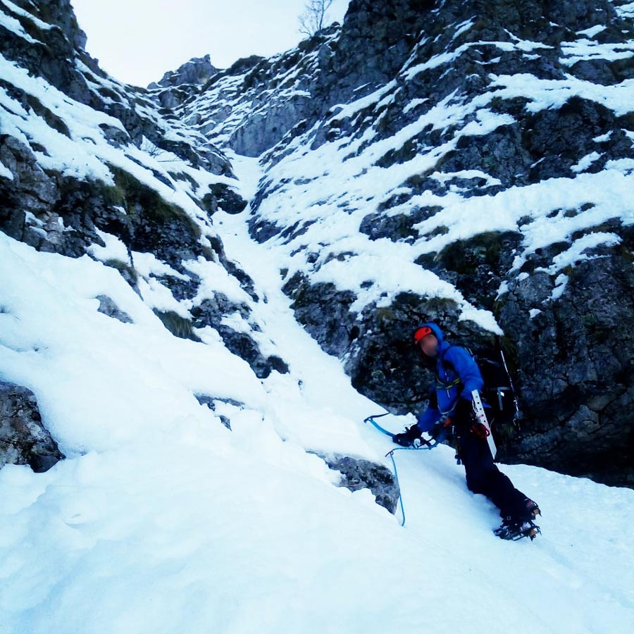
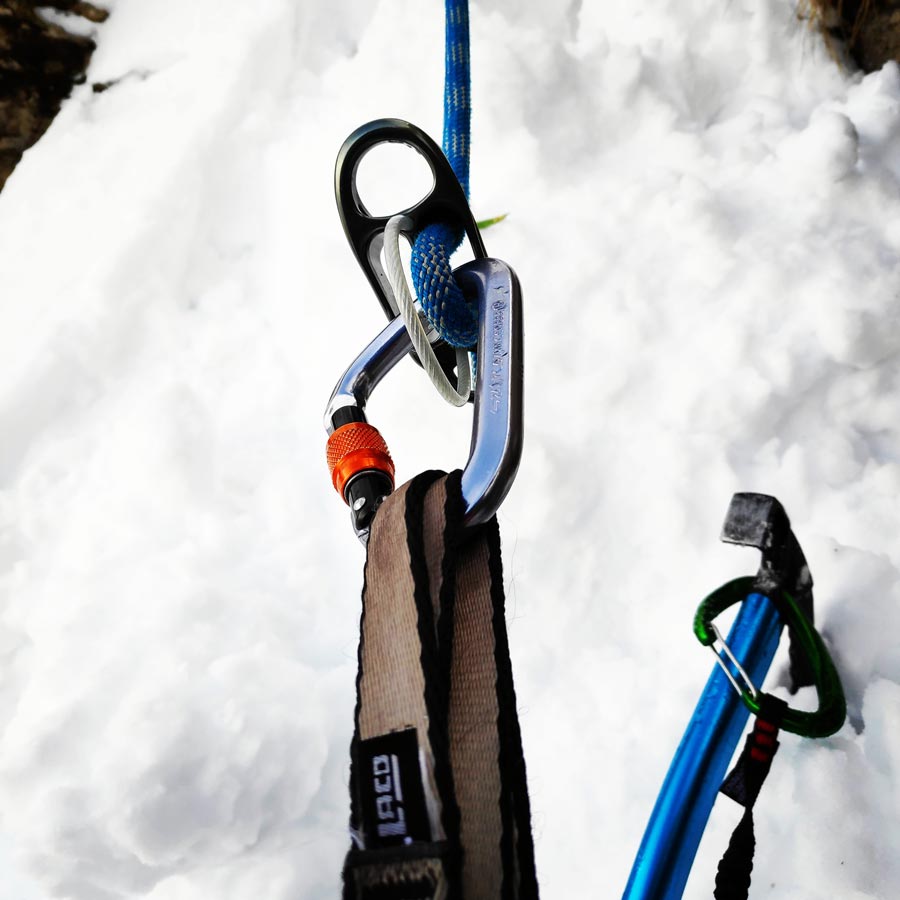
Prior of starting the beautiful 500 meter climb, we doubled checked all our gear and safety equipment. I lead the climb and while climbing I was feeling very good and strong. For safety reasons, the first snow picket was placed about 10 meters from the first belay because just after was the first of the two difficult passages (M2 70°).
About 50 meters higher I created a safe natural belay with snow pickets and I was belaying my fellow climbers.


Explore all outdoor activities in a convenient list view here
I particularly enjoyed the climb and it was easier that I was expecting. Also, weather and snow conditions were almost ideal and that made the entire route very enjoyable.
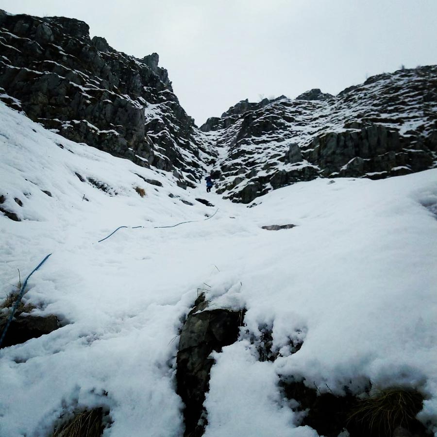
At the end of the couloir, we could also see the trail signs that lead to the peak of Strogoula, but our goal was to climb the couloir and not really to reach the 2.122 meters.
Another thing I particularly enjoyed during my climbs was my new ice axe, the Petzl Quark 2018. The quark together with the Salewa Tec X ice axe performed great on snow and rock. Really great tools both.
It was about noon and having reached our goal to climb the couloir of Agrofylakas, we had a short break and just after that we started to down climb. The first pitch was done via abseil and the rest of the pitches were simple down climbed.
Finally, we have reached the refuge of Pramanta around 15.30 in the afternoon were we enjoyed a warm greek shepherd’s mountain tea.
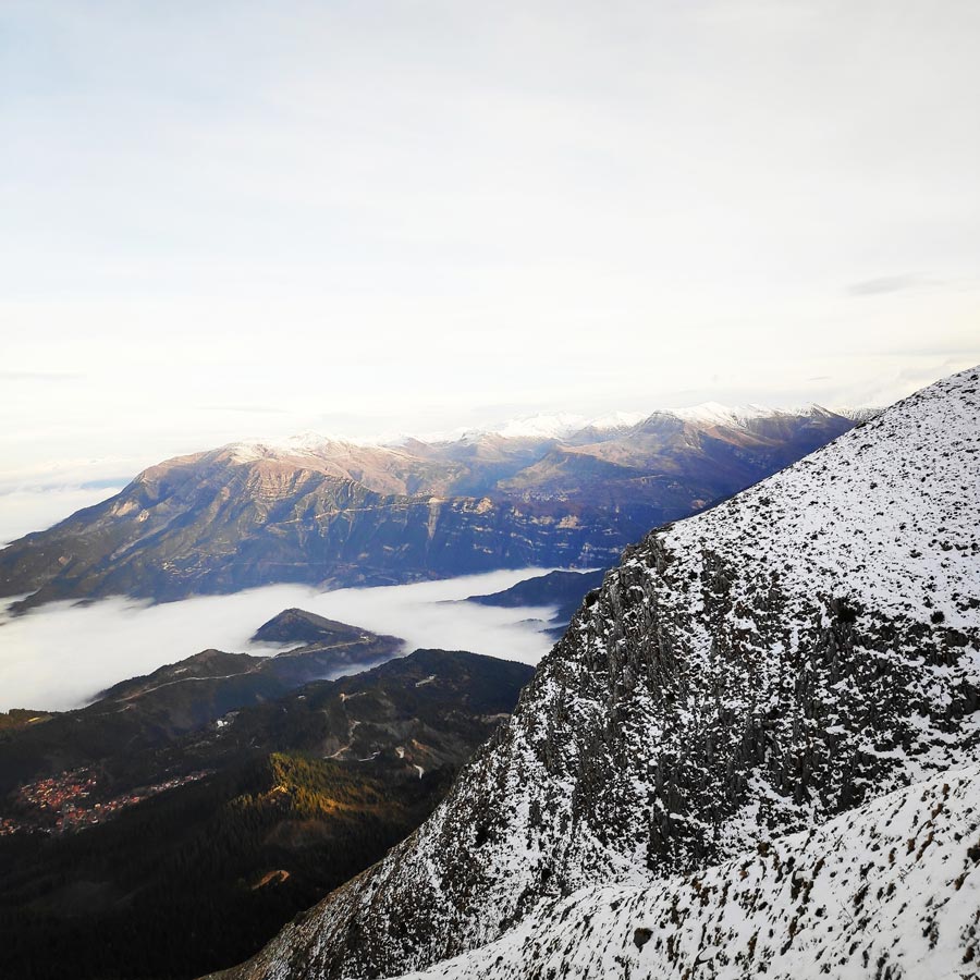
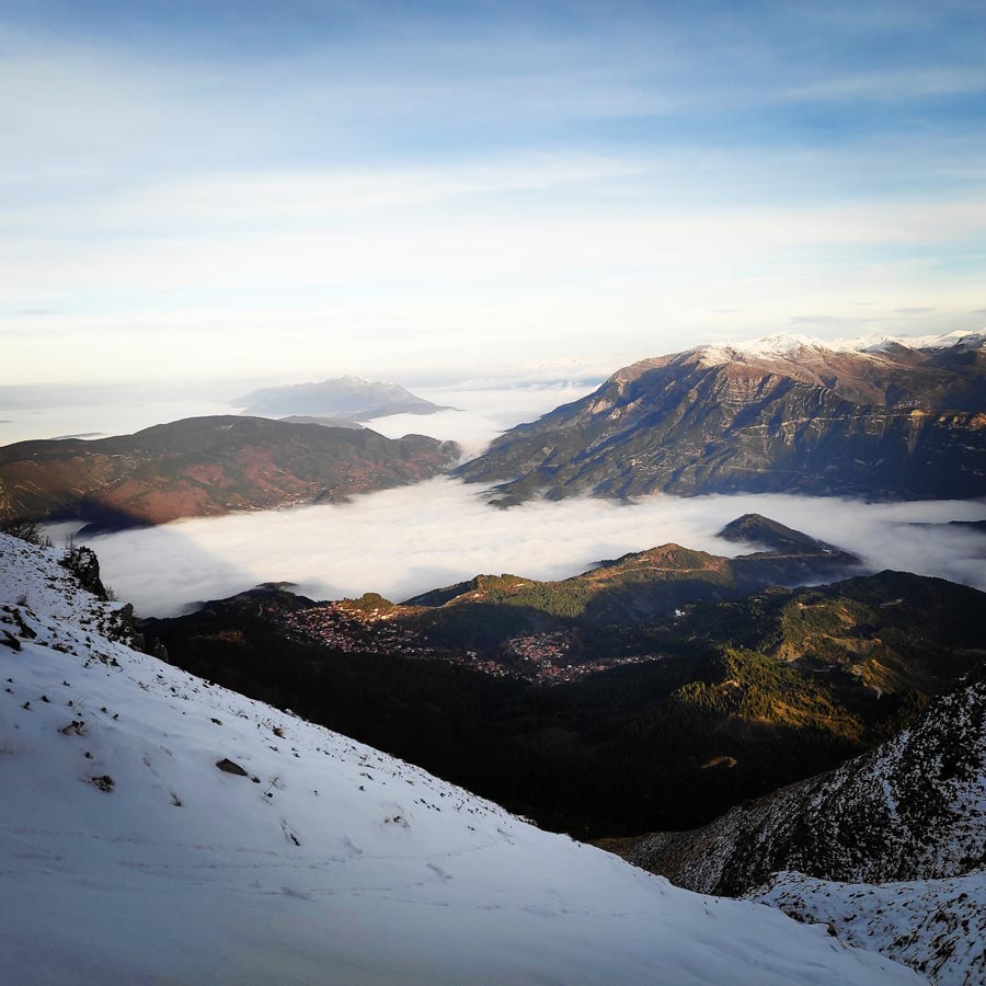
It was a really nice climb and I really enjoyed the views towards the north, east, west and south of Greece.
Most of all, I personally enjoyed that we climbed up and down the mountain in full safety and without running any risk. The essence of mountaineering after all, is to enjoy your climb and return home sound and safe.

Details of the Climb:
- Location: Athamanika (Tzoumerka) Mountains Strogoula Peak
- Starting Point: Pramanta Mountain Refuge
- Goal: Agrofylakas Couloir (Strogoula Peak)
- Ending Point: Pramanta Mountain Refuge
- Trail Signs: Well signed path
- Minimum Elevation: 1.300 m
- Maximum Elevation: 2.112 m.
- Total Distance: 8.5 km
- Difficulty: Difficult
- When to Hike: Winter with appropriate winter mountaineering gear
- Water Features: None
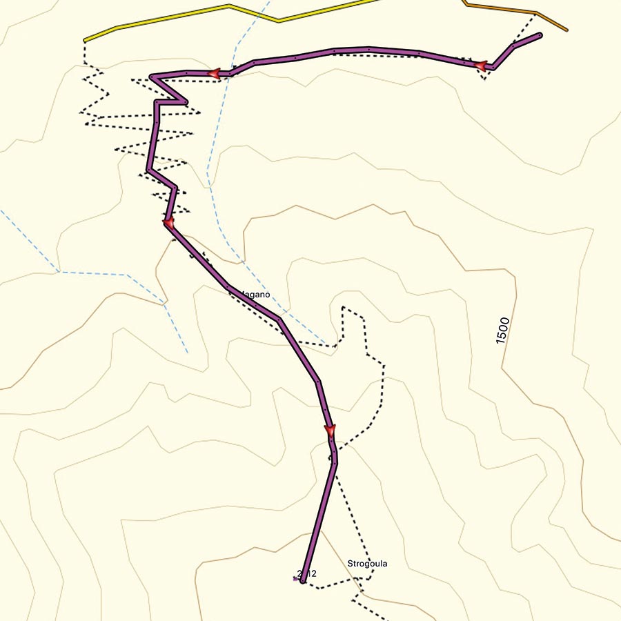
Bellow you can see the route we have followed on a map:
Subscribe & Stay Informed
Enter your email address to follow this blog and receive notifications of new posts by email
History of Athamanika Mountains
According to historical data, the first inhabitants were the Athamanes. Their civilization flourished in the 3rd century BC. The alternative name of the mountains (Tzoumerka) is much more modern and it is of Slavic origin, like many toponyms of the prefecture of Epirus.
In the Ottoman period the development of trade routes that were crossing Pindus gave impetus to a network of settlements that flourished continuously. The most significant of them were Pramanta, Agnanta, Melissourgoi, Theodoriana, Vourgareli, Kalarites, Sirako etc. In modern history, the intense urbanization has led to decline several settlements. A few of them were completely abandoned. Almost every village of Athamanika mountains is characterized by the famous Epirus architecture.
See more hiking/mountaineering routes around this area:
- Winter Mountaineering Lakmos/Peristeri
- Verliga Alpine Lake
- Alpine Dragon Lake
- Astraka Peak
- Gamila Peak
- Syrrako – Kallarites
Before you leave this blog check out the following map
Below: This map marks all the mountaineering adventures that have been featured on Olympus Mountaineering so far, including several Sport climbing crags – Select full screen to expand, zoom in for more detail, or click on a marker for a link to the post.

Pingback: Hiking in Tzoumerka (Athamanika) – Pramanta Refuge – Waterfall Kefalovriso – Olympus Mountaineering
Pingback: Hiking in Tzoumerka (Athamanika) – Skala Stamati – Katafidi – Olympus Mountaineering
Pingback: Hiking in Gyftokambos and Sarakatsani huts – Zagori – North Pindos – Olympus Mountaineering
Pingback: Hiking in Tzoumerka (Athamanika) – Melissourgoi – Kryoneri Waterfall – Melissourgoi (family friendly) – Olympus Mountaineering