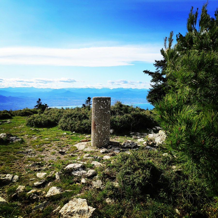
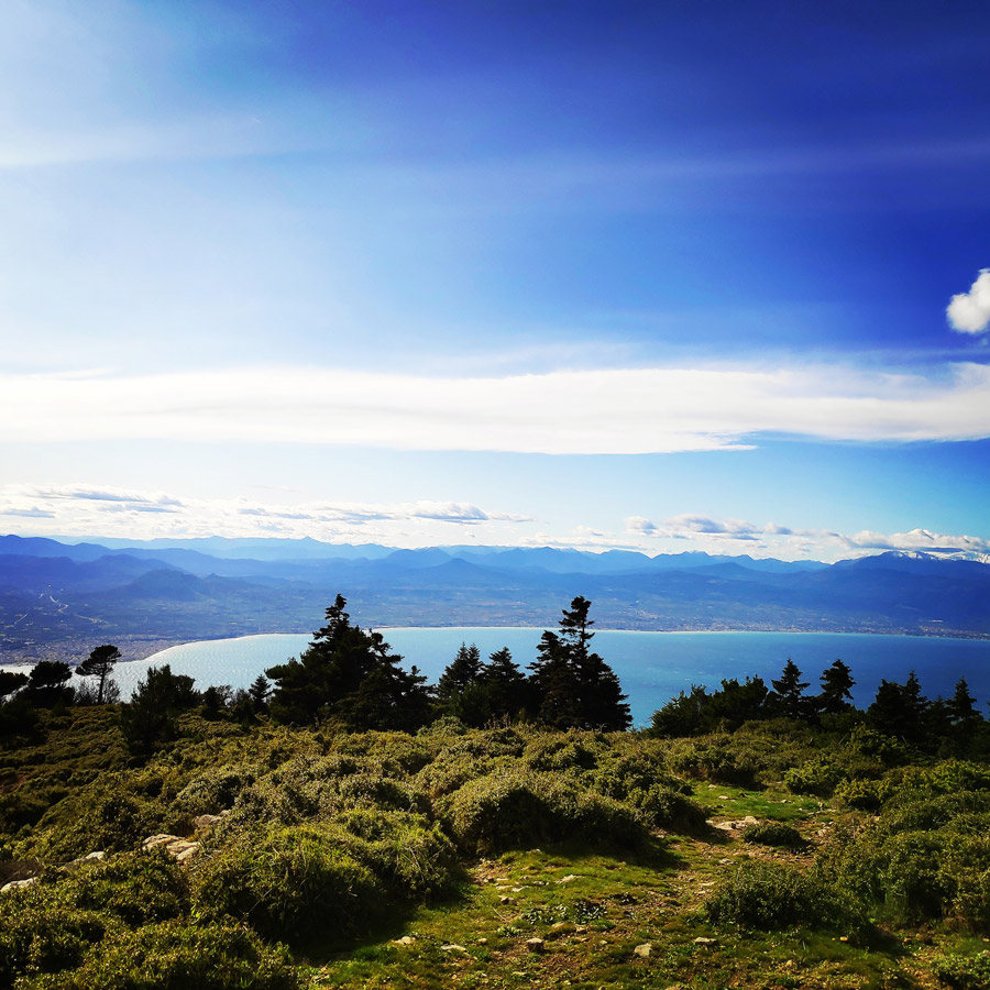
Mount Geraneia is a mountain range in Corinthia and West Attica, Greece. Its highest point is the peak Makryplagi, elevation 1,351 m. It covers the northern part of the isthmus between the Gulf of Corinth and the Saronic Gulf. It spans 5–10 km from north to south and 30 km from east to west.
The geography of Geraneia includes forests in the south, the west and the northern part at an elevation of under 900 to 1,000 m. Barren land is in the central part. The grasslands and some bushes lies to the northwest. Farmlands and some barren land lies to the south.
The name of the mountain dates back to ancient times. During the Peloponnesian War, the Corinthians and their allies occupied the heights of Geraneia and marched to Megara with a large force.
We have been on this mountain peak several other times, but it is always nice to return due to the easy approach and great terrain for trail running.
See previous ascents on Geraneia mountain here:
- Spring Training on Geraneia mountain
- Summer in Geraneia mountain
- Geraneia Mountains & Sanctuary of Hera
Support the journey — buy me a coffee
I share these articles and the climbing guidebooks because I love the outdoors, and they’ll always be free. If they’ve helped you, help me keep them coming. Click the button to support my work.

Pissia Village Pintiza Peak
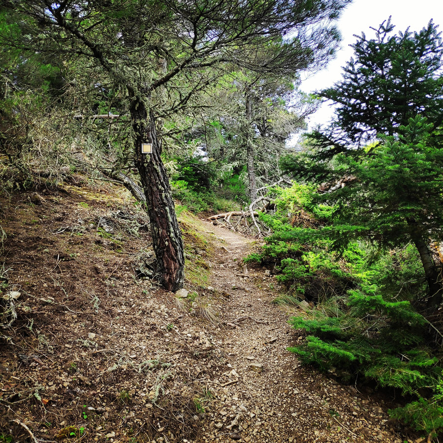
Our starting point was the small mountainous village, Pissia. We parked the car in the central square of the village and we followed the road towards the “Platanos” tavern. Just before “Platanos”, there is a sign from where the path initiates. The path is well signed (Black with Yellow). The first part of the path is within the trees. It is quite steep and requires a well trained body.


Check out more FREE Guidebooks
Download now for free! Explore breathtaking landscapes and conquer thrilling heights with our collection of guidebooks and topos.
Don’t miss out on this opportunity to elevate your outdoor adventures. Click, download, and let the exploration begin!
About Pissia Village
Pisia is a village and a community in northeastern Corinthia, Greece. Part of the municipality Loutraki-Perachora-Agioi Theodoroi, it is situated south of the Alkyonides Gulf. The community consists of the villages Pisia, Agia Sotira, Vamvakes, Mavrolimni and Schinos.
Until the early 1970s there were only olive plantations but during the 1990s there was rapid development and many visitors came to the area. Helping make this possible was the then newly laid asphalt road. It is now a popular weekend destination for the citizens of Athens. There are two beaches, one sandy with tavernas on the shore and one pebbly with little or no shops nearby. It is still relatively undeveloped and retains a relaxed and laid back atmosphere. Many Athenians bought land years ago and built weekend retreats for themselves and their families to escape Athens in the hot summer.


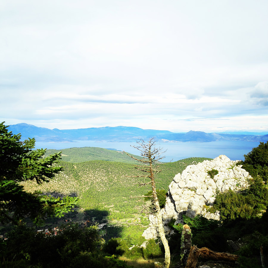
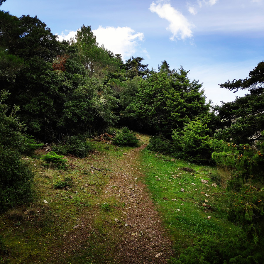


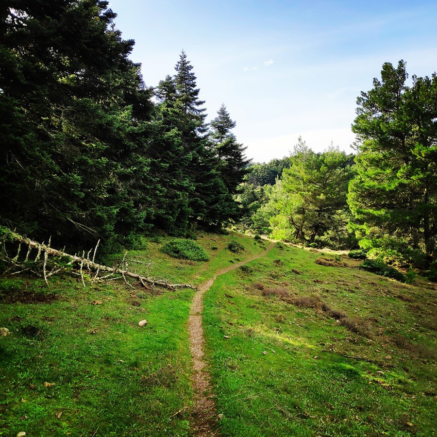


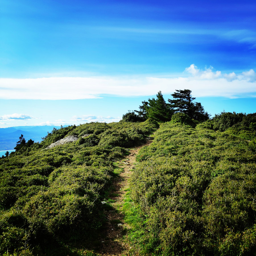


Geraneia Mountains are surrounded by the Saronic Gulf, the Corinthian Gulf and the Alkyonis Gulf. It is covered with pine trees whereas the higher zone is covered by Greek firs. The shrubby vegetation is rich and 950 species and subspecies of plants have been recorded, many of them are rare or endemic to Greece or Attica, like the endangered local endemic Centaurea attica ssp. megarensis, the population of which is small and scattered. The area is part of the European Network of Protected Areas (Natura 2000).
Subscribe & Stay Informed
Enter your email address to follow this blog and receive notifications of new posts by email
Pintiza Peak
- Patapiou Monastery to Pintiza (3.2km and 540m vertical)
- Pisia to Pintiza (2.8km and 450m vertical)
- Trailhead 3 to Pintiza (3.6km and 350m vertical)


See previous ascents on Geraneia mountain here:
- Spring Training on Geraneia mountain
- Summer in Geraneia mountain
- Geraneia Mountains & Sanctuary of Hera
Before you leave this blog check out the following map
Below: This map marks all the mountaineering adventures that have been featured on Olympus Mountaineering so far, including several Sport climbing crags – Select full screen to expand, zoom in for more detail, or click on a marker for a link to the post.

Pingback: Tsirio To Proto | Trad Multipitch Climbing on Mount Onia (Oneia) | V 170 m. – Olympus Mountaineering