The previous couple of months I was extremely busy and therefore, besides some rock climbing I was not able to dedicate enough time to new mountaineering adventures.
Though, in my calendar, I had booked a specific date that the Mountaineering Club of Athens (EOS Athinon) would organise the famous long Traverse Arête of Chelmos (Aroania)
Aroania, also known as Helmos or Chelmos, is a mountain range in Achaea, Peloponnese, Greece. At 2,355 m elevation, Aroania is the third highest mountain of the Peloponnese, after Taygetus and Kyllini, and the highest in Achaea. The largest town near the mountain is Kalavryta. The municipal unit Aroania took its name from the mountain.
Aroania is situated in southeastern Achaea, near the border with Corinthia. The slightly higher Kyllini mountain is about 15 km to its east, separated from Aroania by the valley of the river Olvios. The mountain Erymanthos is about 30 km to the west, across the valley of the river Vouraikos. The rivers Krios, Krathis and Vouraikos drain the mountain towards the Gulf of Corinth in the north. The river Aroanios drains the mountain towards the southwest, to the Ionian Sea.
See more Winter Mountaineering ascents in the Peloponnese region here:
- Winter Mountaineering climb on Nisi peak (Arête of Chelmos)
- Mount Kyllini (Ziria) Winter Ascent
- Small Mount Kyllini Ziria
- Mount Oligyrtos
- Taygetos Winter Mountaineering ascent
- Aroania Mountain Winter Mountaineering Ascent
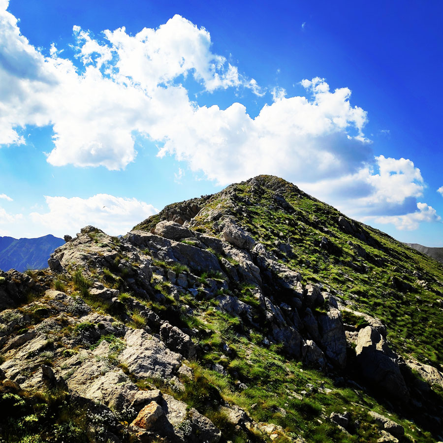
About the long Traverse “Arête of Chelmos”
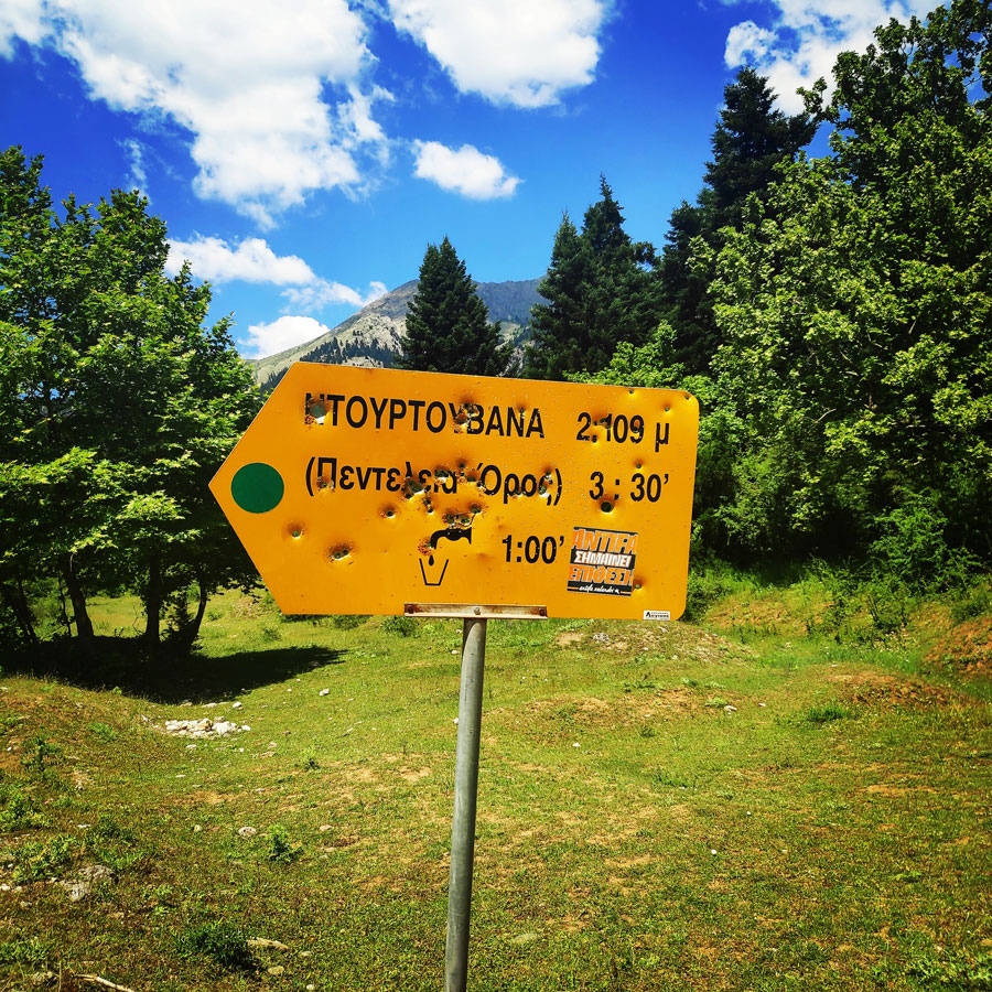
The southern ridge of Aroania, so called as “Arête of Chelmos“, extends from the col of the hunter at the base of Mount Penteleia (dourdouvana) to Neraidalono opposite the legendary Neraidorachi which is one of the most beautiful faces that one can encounter in Greece. The first attempts in the region date back to 1958 by G. Michailidis and D. Liago.
The route covers an altitude difference of 800m, it is alpine and is several kilometers long. The difficulty of the entire alpine climb is about III+, depending the actual circumstances, and the general difficulty of climbing is AD +. This means that the traverse of “Arête of Chelmos” is fairly hard, with rock climbing up to UIAA grade III+, belayed climbing in addition to a large amount of exposed but easier terrain. Significant objective hazard.
Explore all outdoor activities in a convenient list view here
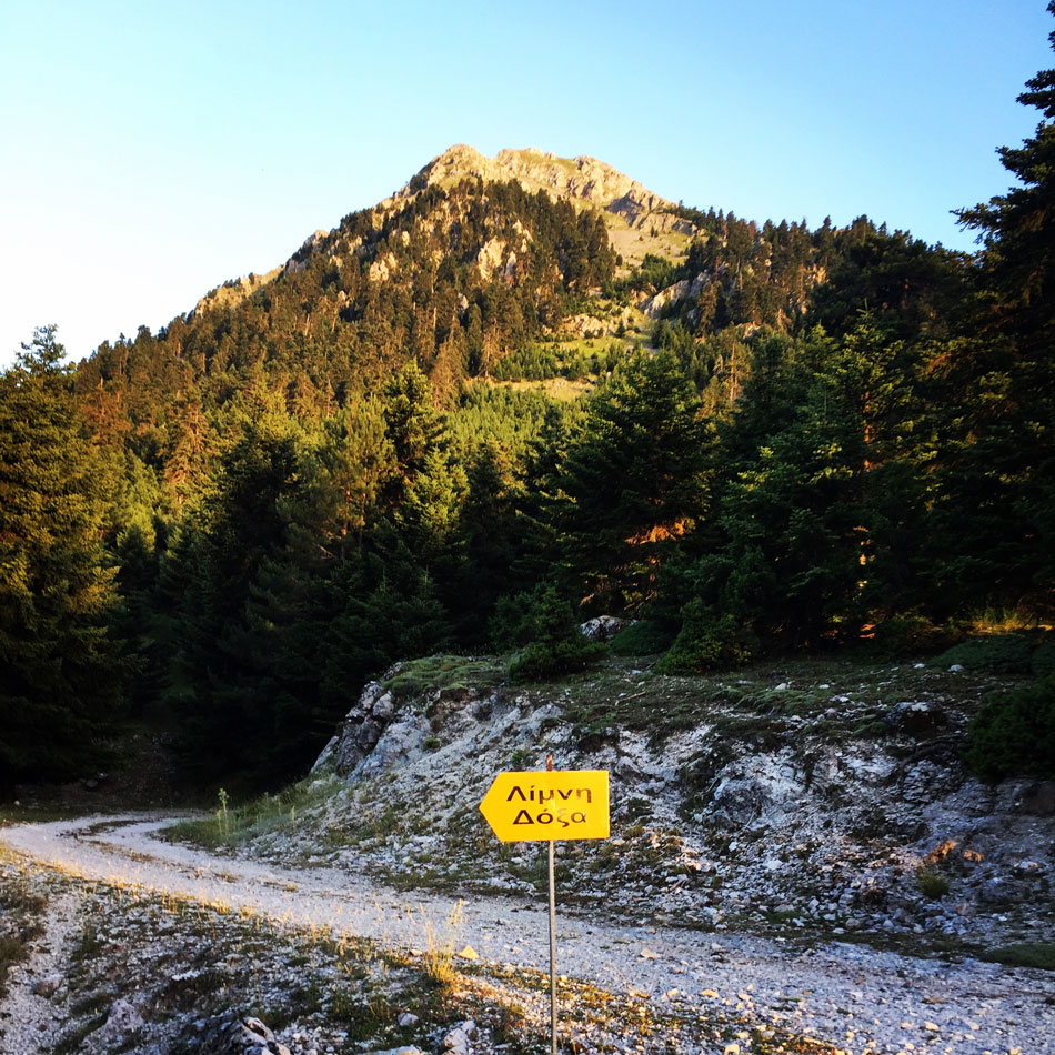
Lake Doxa – Hunter’s Col
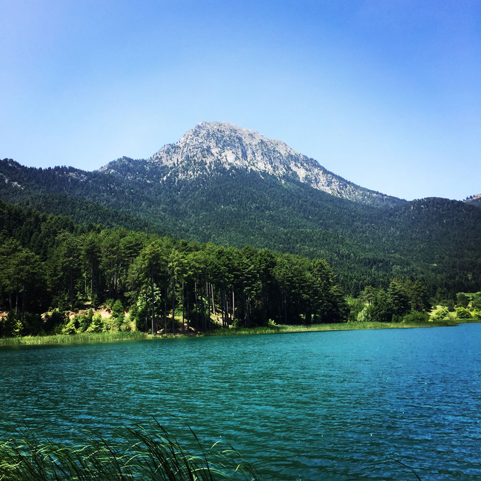
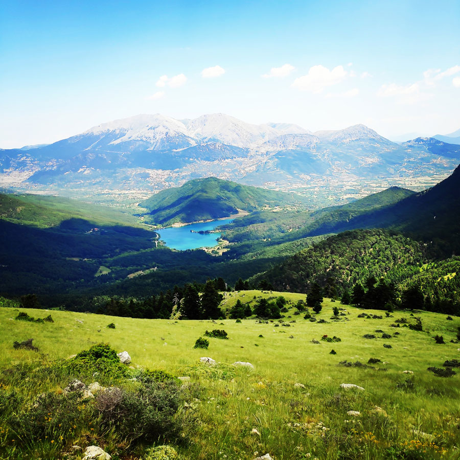
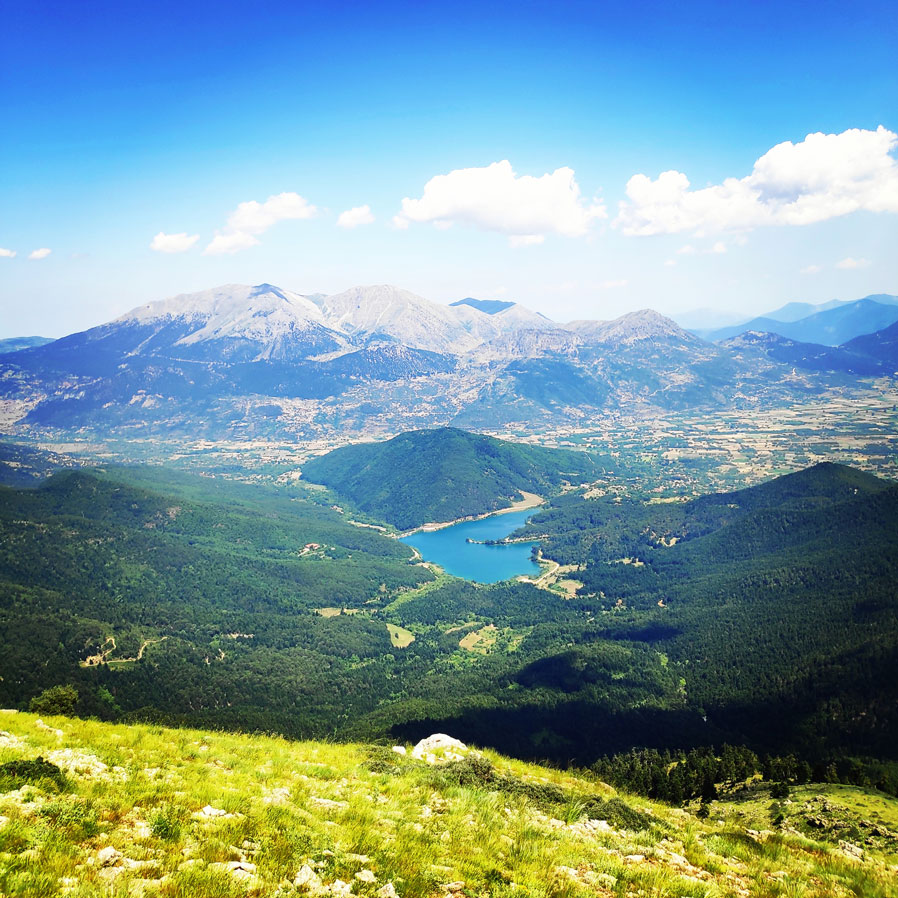
Although the official route of “Arête of Chelmos” starts from “Hunter’s Col“, as first step we need to reach that point via an easy one hour hike that has as starting point the beautiful lake doxa. Lake Doxa, the “emerald” of mountainous Corinthia, is situated at an altitude of 900 m (2,953 ft). At first we follow the dirt road and then ascent via a firs slope, along a well signed path, having an impressive view of the emerald lake below us.
The trail is very well signed and the actual hking time between Lake Doxa and Hunter’s Col is about an hour.


Check out more FREE Guidebooks
Download now for free! Explore breathtaking landscapes and conquer thrilling heights with our collection of guidebooks and topos.
Don’t miss out on this opportunity to elevate your outdoor adventures. Click, download, and let the exploration begin!
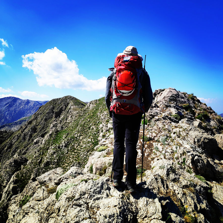
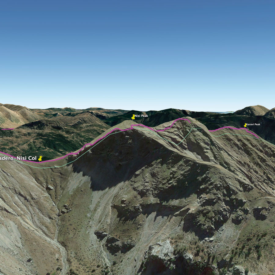
Hunter’s Col – Karavi Peak – Nisi Peak
As soon we reached Hunter’s col, we have had our first short break in order to have a refreshment and a snack. The weather was really hot and very sunny and therefore it was very important to keep our bodies hydrated though out the entire route.
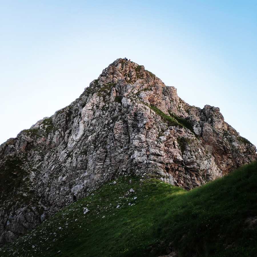
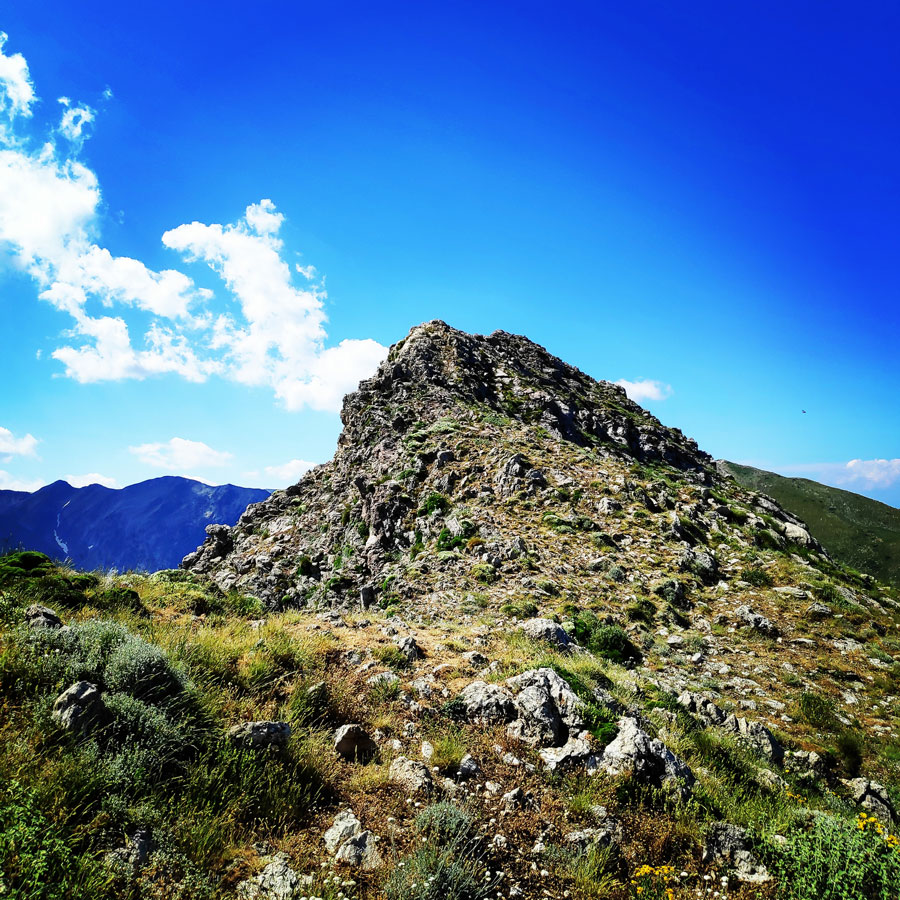
After this short break, we followed a dirt road for about 100 meters and then we entered the trail that leads to the first of the many peaks of “Arête of Chelmos“, Karavi Peak (1.983 m.)
All of this section is visible from the beginning and consists of successive small towers that are joined together by a several cols. In fact, we are dealing with a continuous upswing on the ridge. The technical difficulty initially is not problematic with passages of II degree (UIAA) and progressively difficult.
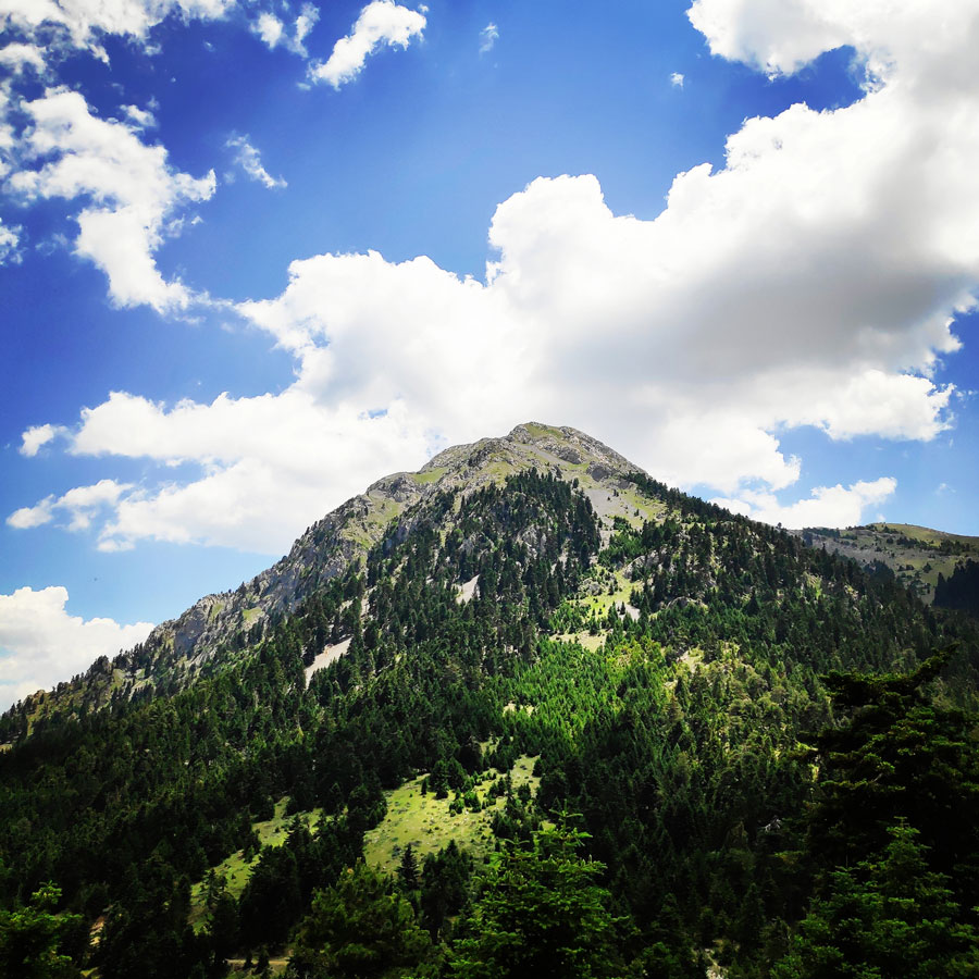
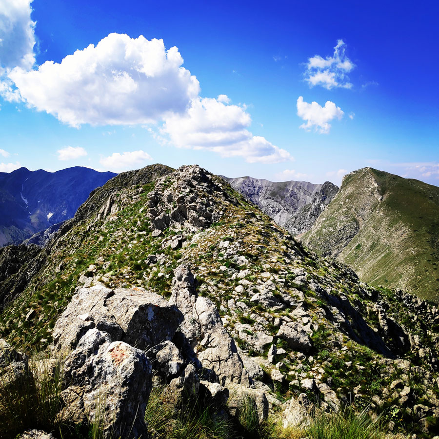
During this part of the ascent, we had an amazing view and we were able to enjoy Mount Kyllini, Small Mount Kyllini, Dourdouvana & Triantafylia, Oligyrtos and of course the magnificent Lake Doxa.


The uphill hike towards Karavi peak, is very easy, though there is a rather high altitude difference and especially under the hot sun got us very sweaty and tired. Therefore, once we have reached Karavi peak, it was a great point to have a bit of water and a snack in order to proceed for the second peak, the Nisi Peak.
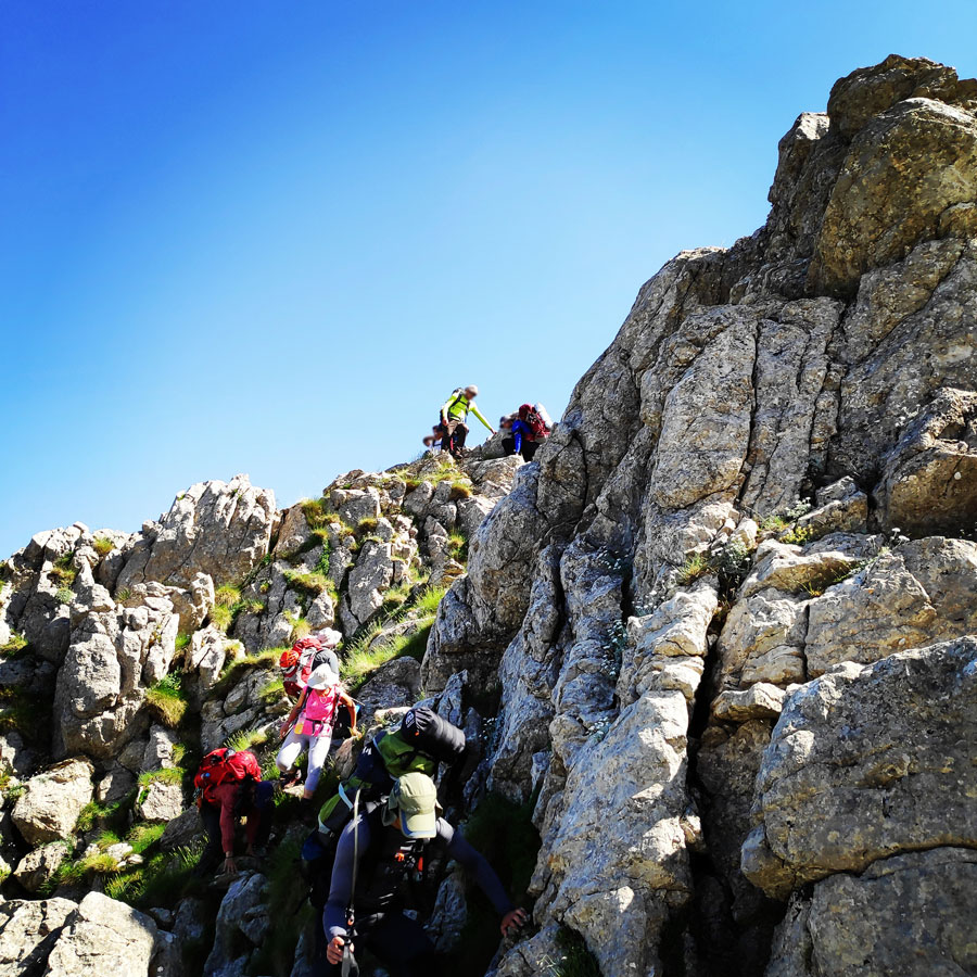
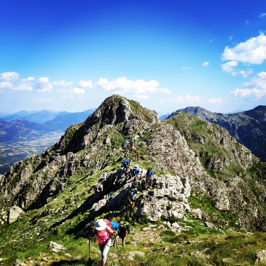
After that short break, we carried on towards Nisi Peak, though from that point and on the simple uphill hike was over and we had to move very carefully on the various exposed scrambling points of this ridge.


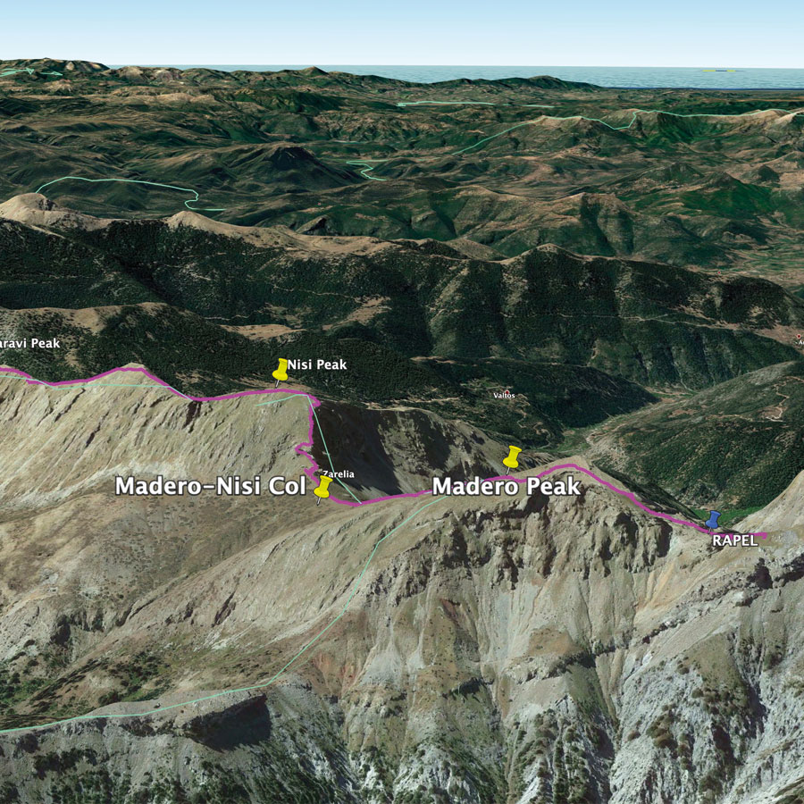
Nisi Peak – Madero Peak
Nisi is the first high peak of the Arête of Chelmos” route and the highest point is at 2.042 meters above sea level. It has a very steep ridgeline and there are 2 main ways in order to reach the peak. The first option is to hike up from Lake Doxa towards the “hunter’s col“.
We reached Nisi peak, according to our schedule and therefore we decided to have another short break for some more water. During the summer months, mountaineering activities in Greece can be a bit heavy due to hot weather and lack of water.
From Nisi peak, we had to down climb about 200 meters in order to reach the Madero-Nisi col. As soon we have reached the Madero-Nisi col, we had to go uphill again so we could reach Madero Peak which is 2.100 meters above sea level.
This section was rather easy without any technical challenge.


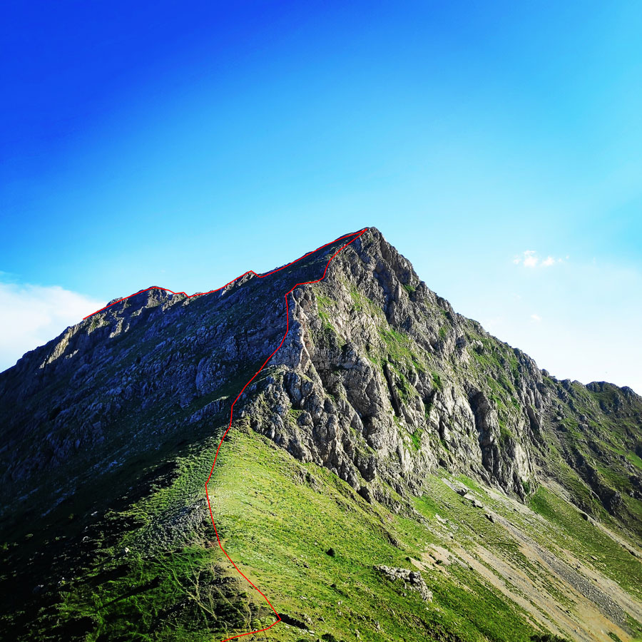


Madero Peak – 1st Rappel – Gardiki/Madero Col
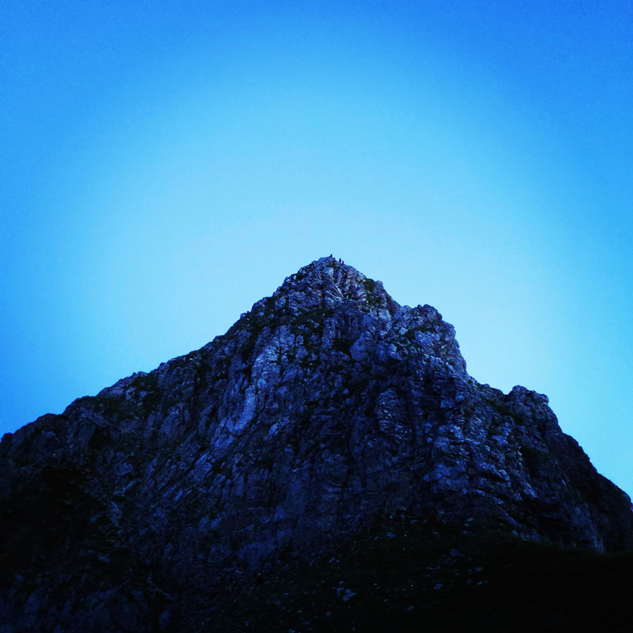
It was about 19.30 when we reached the peak of Madero (2.100 m.) and we still had to rappel down from Madero peak down to a col that connects Madero and Gardiki peaks.
This is the first real challenging part of the entire climb, but if done with all safety, then is not difficult.
For this abseil, we had dedicated gear, and of course each one of us had the necessary knowledge in order to perform 2 continuous abseils of a total 110 meters in safety.
As first step, we have checked where we should create a strong anchor point from where we would rappel down the entire peak. Once we have fixed the belay point, one by one rappeled down. Though, it was inevitable that some of our team members had to rappel in the darkness. Nevertheless, it was very nice experience for every one.


Support the journey — buy me a coffee
I share these articles and the climbing guidebooks because I love the outdoors, and they’ll always be free. If they’ve helped you, help me keep them coming. Click the button to support my work.

Thanks to great cooperation and technical knowledge, all of us abseiled with safety.
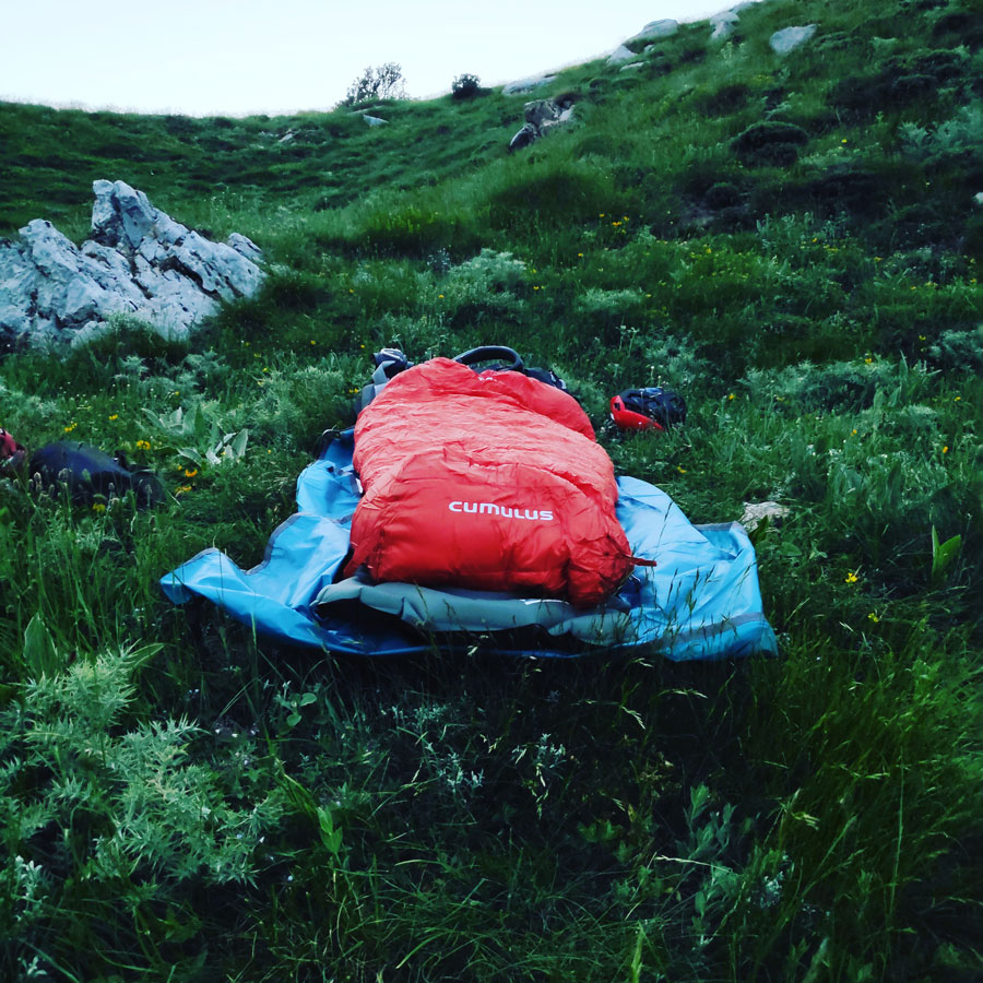
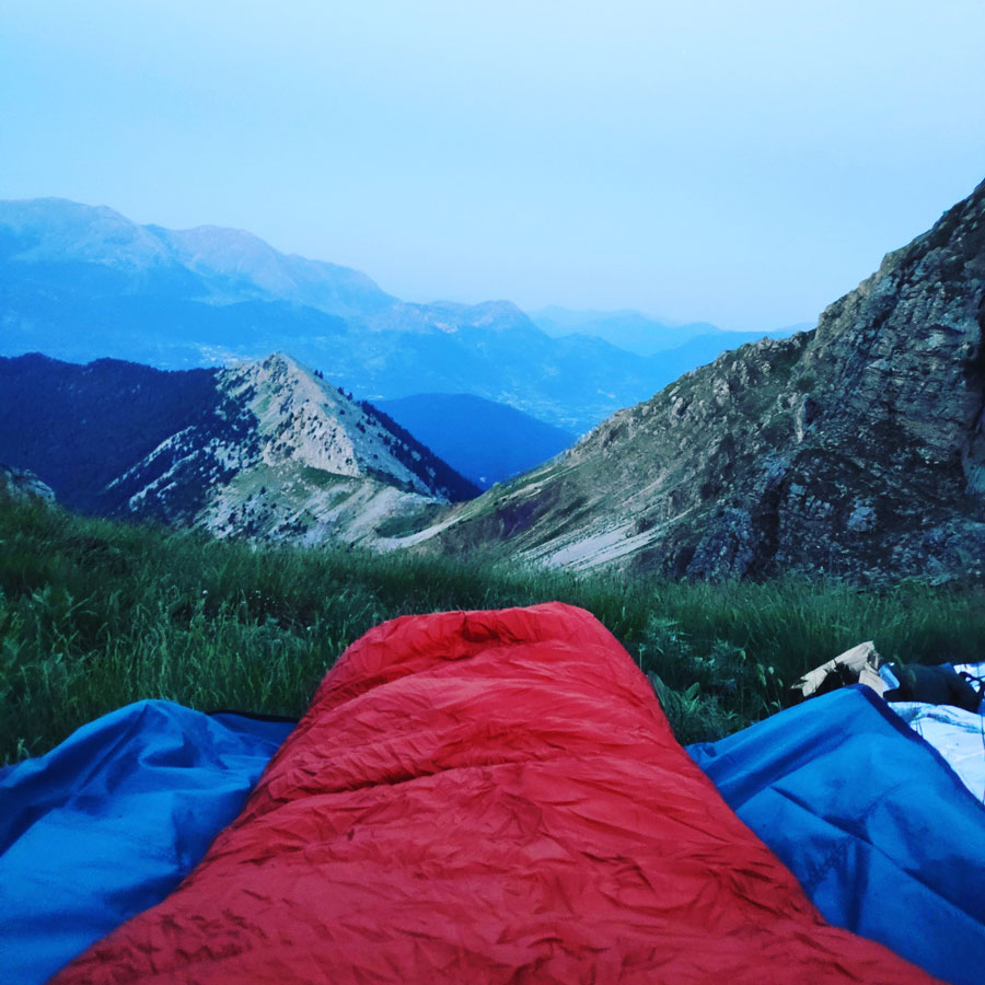
On that col, we also had the chance to sleep in our sleeping bags and bivy sacks for this first night. We were all rather tired and therefore we had some food, some water and we soon went to sleep because the day after would be even more demanding.
For my sleep, I used the following gear:
- Cumulus Panyam 600 Sleeping Bag
- Klymit Static V Insulated Ultralight Sleeping pad
- footprint of Sierra Designs Lightning 2 tent
Details of the Climb and Hike:
- Location: Aroania / Chelmos
- Starting Point: Lake Doxa
- Trail Signs: Enough trail signs
- Minimum Elevation: 900 m
- Maximum Elevation: 2.100 m.
- Elevation Gain: 1.200 m.
- Total Distance: 5.3 km
- Difficulty: Difficult
- Water Features: No (Necessary to have at least 4 lt. of water
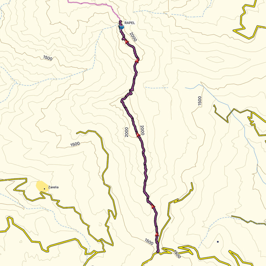
Bellow you can see the route we have followed on a map and on 3D:

Subscribe & Stay Informed
Enter your email address to follow this blog and receive notifications of new posts by email
This post was the entire first day of the long traverse of the Arête of Chelmos.
In the coming days, it will be published the second part with many more photos and even more detailed description of all technical and exposed passages of this great alpine route.
See more Winter Mountaineering ascents in the Peloponnese region here:
- Winter Mountaineering climb on Nisi peak (Arête of Chelmos)
- Mount Kyllini (Ziria) Winter Ascent
- Small Mount Kyllini Ziria
- Mount Oligyrtos
- Taygetos Winter Mountaineering ascent
- Aroania Mountain Winter Mountaineering Ascent
Before you leave this blog check out the following map
Below: This map marks all the mountaineering adventures that have been featured on Olympus Mountaineering so far, including several Sport climbing crags – Select full screen to expand, zoom in for more detail, or click on a marker for a link to the post.

Very cool trip!
LikeLike
Indeed, it was a great alpine weekend trip.
In the coming days I’ll post the second part where with many more photos of the exposed alpine climb.
Thanks for reading and for your kind comment
LikeLike
Pingback: Traverse of Arête of Chelmos/Aroania Mountain Pt. 02 | Gardiki – Arête – Neraidalono – Kalavryta Ski Centre – Olympus Mountaineering
Pingback: A mixed climbing attempt on Profitis Elias 2.257 | Mount Kyllini (Ziria) – Olympus Mountaineering
Pingback: Alpine Climb in Gerontovrachos – Parnassos – Olympus Mountaineering
Pingback: Wild Camping in Lake Doxa (family friendly) – Olympus Mountaineering
Pingback: Immerse in Greek Mountain Beauty: 10 Hiking Routes That Ignite the Spirit of Adventure – Olympus Mountaineering