Having completed one of the most exciting trekking trips in Tymfi, we decided to explore a bit further the area and specifically the Zagori villages.
Zagori, is a region and a municipality in the Pindus mountains in Epirus, in northwestern Greece. The seat of the municipality is the village Asprangeloi. It has an area of some 1,000 square kilometers and contains 46 villages known as Zagori villages (or Zagorochoria or Zagorohoria), and is in the shape of an upturned equilateral triangle. Ioannina, the provincial capital, is at the southern point of the triangle, while the south-western side is formed by Mount Mitsikeli (1,810m). The Aoos river running north of Mt Tymfi forms the northern boundary, while the south-eastern side runs along the Varda river to Mount Mavrovouni (2,100m) near Metsovo.

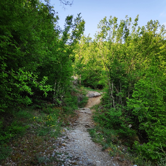
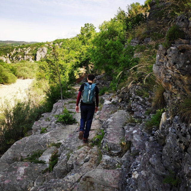
In Zagori area, there are plenty of easy hikes that are addressed for beginners or even for families. Having just completed a 30+ km Thru-Hike in the northern part of Mt. Tymfi, we decided to do something easier and a bit more “touristic”, but at the same time nice, interesting and exciting. Our aim was to follow a well signed and established trail that starts from the village Kipi, go to four old stone bridges and via Koukouli village ends up again to Kipi. This means an 8.6 km of easy hike with plenty of nature and local attractions.
Zagori Bridges
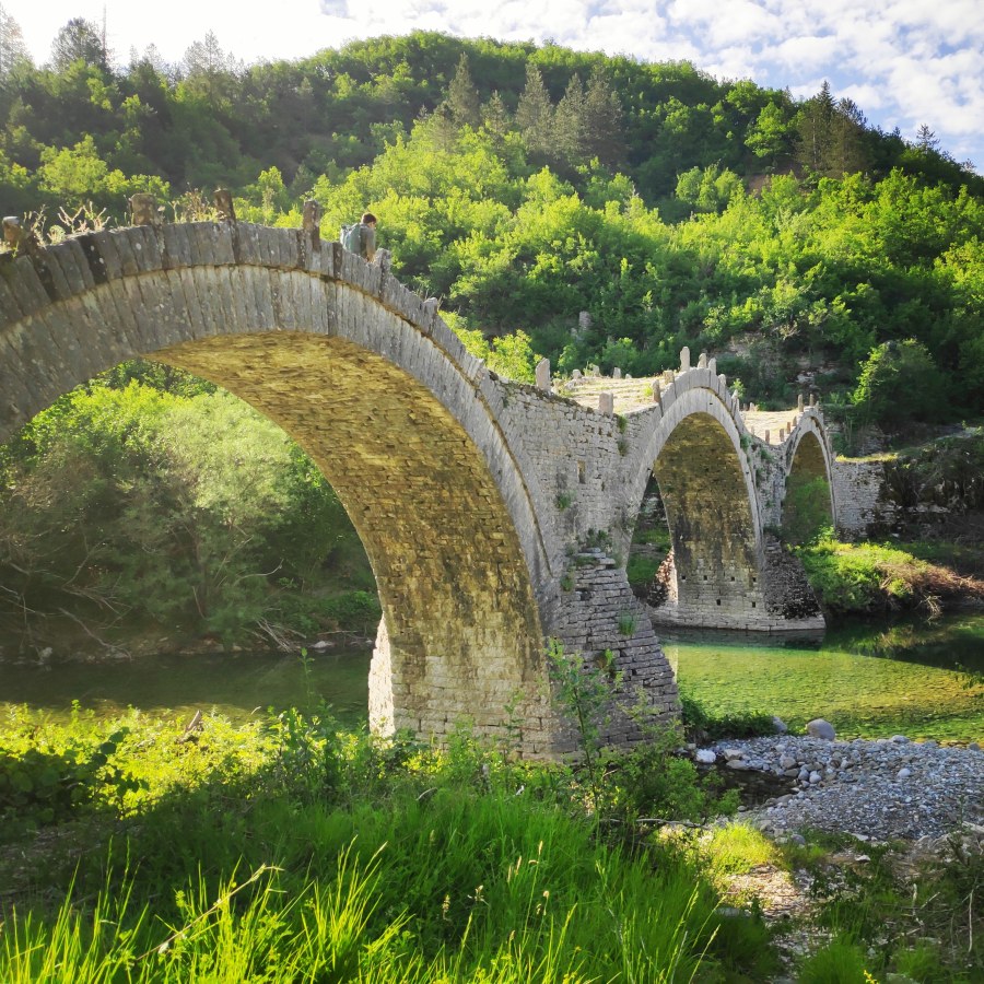
More than 160 arched bridges were built in the greater area of Zagori, many of which still stand helping travellers to cross the numerous rivers and streams of the region. They were mostly built during the 18th and 19th centuries by local master craftsmen using local stone. These bridges usually have one to three arches called “kamares“ in Greek. One of the most iconic is the three arched bridge of Plakidas, also known as Kalogeriko, near the village of Kipi (Κἠποι).
Kalogeriko (or Plakida) Bridge
Kalogeriko Bridge or Plakidas Bridge is a three-stringers bridge, that was built in 1814. Kalogeriko-Plakidas Bridge located nearby Kipi and Koukouli villages in central Zagoria. Kalogeriko Bridge is one of the few three-stringers bridges in this area. It named after the abbot of Kipi’s monastery. The bridge characteristics due its cogged ledges and the harmonious line over the stringers. These making the moving across it, flowing and harmonic.
Initially, the bridge was a wooden one, but, by sponsoring of Serafeim, the abbot of Kipi’s monastery, it was replaced with stones made one, sometime after 1865. It was named then as “Bridge of Plakidas” after the engineer Alexis Plakidas, who renew the bridge structure. There is a plate attached, details some facts about it. The bridge was in use of the locals from the two villages, and was the main transportation way for rural goods.


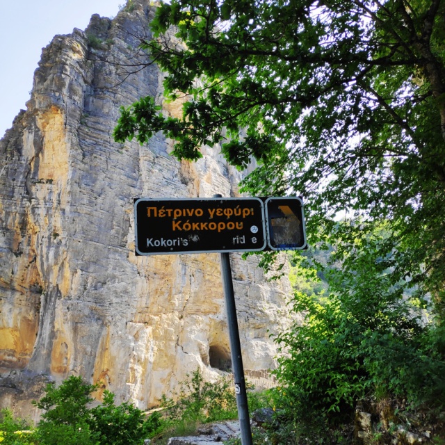
Kokori’s Bridge
Bridge of Kokkori is a stone bridge with a unique arch, located on the main road leading to the villages of Koukouli, Dilofo and Kipoi, in Central Zagoria. It was first built in 1750 by Noutsos Kontodimos and named after him. The Kokkori Bridge had been repaired several times, and almost was rebuilt from scratch. Many people donates to the bridge maintains, however the miller, Grigoris Kokkoris financed it most. Therefore, the bridge was renamed to: Kokkori Bridge. The bridge is preserved in a very good condition, there is no way you won’t admire it.


Misios Bridge
Bridge of Misios is a beautiful one-stringer bridge, Bridge of Misios was built in 1748 by Alexis Misios and named after its builder. From the bridge, there is an old cobbled road named “Skala Vitsa”, which is leads to villages Vitsa and Koukouli in Central Zagori. You will admire the magical views over the Vikos Gorge, from the top of its. Standing there overt its arch, you will forget all, become peaceful, and understand the supremacy of nature!


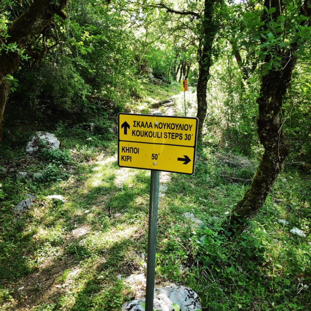
Koukouli Steps and Koukouli Village
The village takes its name from the Greek word of silkworm cocoon; silk production in the wider region of Zagori was popular during the past centuries.
The village appears to be founded somewhere in the 13th century. It was included in the treaty signed between the villages of Zagori (there were 14 at the time) and the Ottomans at 1430, which marked the beginning of Ottoman rule in the region. The villages of Zagori formed an autonomous federation for the next centuries. The privileges which were granted to the federation of Zagori and which are due, in the biggest part, to the influence of notable Zagorians over the Sublime Porte, were preserved until 1868. According to these privileges, Zagori was autonomous and self-governed under the surveillance of the Vekili of Zagori.
Many inhabitants during the 18th century became merchants, traveled abroad and made huge profits. The Plakidas family was one of those that made a fortune. Alexios Plakidas, a local benefactor, donated huge amounts of money for the village and the Zagori region.


Zagori Houses
Houses until the 18th century were simple rectangular dwellings, often with only a ground floor and with ancillary areas in the basement used as stables. Indeed, this appears to be the style of construction of the dwellings in the excavated Molossian site near Vitsa. Houses are built of local stone and have a roof made of stone tiles (either of limestone or sandstone) which are held together without cement, only by the weight of the tiles above them. The stone roof therefore requires continual upkeep, subjected as it is to heavy snowfalls during the winter months.
That older type was developed through the 18–19th centuries into more complex styles all the way to the multi-storied manors of the wealthier families of the late 18th century. Many houses are fronted by a walled courtyard or garden. The courtyard gate is an edifice in itself, covered by a stone roof and connecting the house to the rest of the village. In addition to the house, there are ancillary buildings, usually a “mageirio” (kitchen), an external toilet at the furthest corner from the kitchen, and stables. The main house is built with walls up to a meter thick that may have an internal sand compartment for insulation against the cold. The house entrance opens into the foyer called “hagiati” which leads to adjoining rooms called “ondas” or “mantzato”. The hagiati originally was and sometimes still is a partially open area in front of the house. The name is probably derived from the Persian word Hayāt, a style of Persian garden with pavilions or other edifices. The mantzato is the main room for the winter months with a fireplace, a “tavla” (table) and seating areas that can be used as beds, called “basia”. Opposite the fireplace there is a walled closet called “mesantra”. As an aid to its function, the mantzato often has a location in the south of the house.
A usually wooden staircase leads from the hagiati to the upper floor landing called “krevatta”. This is a space between the bedrooms. In rare cases, the krevatta opens into a small balcony covered by a wooden roof. “Glavané” is a small entrance to the attic. The basement of the house contains cellars and other storage areas that may be used as additional quarters for animals.
Few of the old manors survive, most having fallen victim to disrepair. In those that survive, the ondas room is the most spacious, has a large fireplace and may have floral frescoes. It was used for the reception of guests.


Details of the Hike:
- Location: Zagori Villages
- Starting Point: Kipi (Zagori)
- Ending Point: Kipi (Zagori)
- Trail Signs: Signed path
- Maximum Elevation: 892 m.
- Minimum Elevation: 714 m
- Total Distance: 8.6 km
- Hiking time: 3 hours (with easy pace – including the breaks)
- Difficulty: Easy
- When to Hike: Any time of the year
- Water Features: three
Bellow you can see the route we have followed on a map and on 3D:


Should you wish to see more nice hikes in the area, feel free to check out the following links:
- Konitsa – Moni Stomiou – Sadi Migas
- Sadi Migas – Karteros Pass – Astraka Refuge
- Astraka Refuge – Davalista – Konitsa
- Kapesovo – Mezaria Gorge – Vikos Canyon – Mikro Papingo
- Thru-Hike Part 2 – ASTRAKA REFUGE – ASTRAKA PEAK
- Thru-Hike Part 3 – Dragon Lake (Drakolimni)
- Thru-Hike Part 4 – GAMILA – STOMA – MEGAS LAKOS -TSEPELOVO – KAPESOVO
Below: This map marks all the mountaineering adventures that have been featured on Olympus Mountaineering so far, including several Sport climbing crags – Select full screen to expand, zoom in for more detail, or click on a marker for a link to the post.

Πανέμορφα! So beautiful! Another one added to my to-do list!
LikeLike
Thank you for your comment Natacha, and excellent choice to add this hike to your list.
Of course, besides hiking, in the area you can also enjoy some delicious local recipes.
LikeLike
This looks like another fabulous area to go hiking. I love all the various arches and bridges.
LikeLike
All stone bridges were really nice and the entire Zagori region perfect for some days of nice outdoor activities.
Thanks for reading this post
LikeLiked by 1 person
Fascinating bridges. Great post!
LikeLike
Thank you for your comment Par and glad to know you liked this post.
LikeLike
The bridges are incredible! Beautiful area with a cool history
LikeLike
Indeed a great area, full of history and local traditions.
LikeLiked by 1 person
What amazing stone bridges. I love that you can hike to them.
LikeLike
It was an excellent hike. Thanks for reading and for your comment.
LikeLike
Wow. Beautiful! Loved the stone-bridges pics, great captures!
LikeLike
Thank you. The stone bridges in reality are much more impressive.
LikeLiked by 1 person
I am really enjoying your hiking in Greece posts. Like many people, the first thing that comes to mind when I think of your country are all those beautiful islands, followed by the world-class historic sites. I’m glad to learn about the lovely countryside and hiking opportunities. The bridges are so charming. I’m curious: does this area get many international travellers? Would I get by knowing zero Greek?
LikeLike
I am very pleased to know you enjoy all the hiking posts here.
Like you, most people have in their mind that Greece is mostly islands, historical monumets, blue skies and sandy beaches.
In contrary, Greece is a rather mountainous country and certain areas still quite pure and “virgin”.
In the area of Zagori, there are many tourists and therefore you can easily get access to all kind of services you might wish. Pretty much every local business will be able to help you in English, so should you visit once the area, I am sure you will find your way without any issues.
Thank you for reading this post and your overall support to the Olympus Mountaineering blog.
LikeLiked by 1 person
Wow! Those bridges are gorgeous. Great photos. It looks like a delightful place to hike. Thanks for the tour. –Curt
LikeLike
Thank you for the comment Curt! I highly appreciate it, and my pleasure for the “tour”.
LikeLiked by 1 person
Pingback: Hiking to Balta di Stringa Waterfall – Iliochori – Zagori (Tymfi) – Olympus Mountaineering
Pingback: Hiking in Zagori – Villages and Stone Bridges – Greece (family friendly) — Olympus Mountaineering – The Bridgehunter's Chronicles
thank you so much for this information!
I will be in that area in 3 weeks and definitely I will do this nice trail.
How exactly I know the exact starting/ending points and routes I should take? Not very clear from the map how to start and where to go
LikeLike
Hi Deivis,
Thank you for your message and pleased to know you like all the info of this post.
Answering to your question, I would suggest you download the GPX file provided via the Gmap on this post.
Should you not be able to get the GPX file directly from the map, feel free to get in touch via the contact page and I will happily try to provide you more info.
Again, thank you for your comment and enjoy your time in Greece.
LikeLike
Pingback: A Family Adventure in Greece: Top 10 Hiking Routes for Nature-Loving Families – Olympus Mountaineering